Browse Listings in America
Carte du Continent de l\' Amerique Nord.
A map of North America.
Place & Date: Paris, 1821
Selling price: $250
Sold in 2013
Carte Physique et Politique de l'Amérique Septentrionale. . .
Huge map of North America and the Caribbean showing the political divisions and colonial possessions with a color key at bottom. Brué prepared the maps for Louis de Onis...
Place & Date: Paris, 1821
Selling price: $500
Sold in 2016
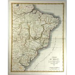
Carte du Bresil, Dressee pouo L'Intelligence de L'histoire Generale des Voyages de Labarpe.
A striking lithograph map of Brazil and the surrounding countries. One of the original maps that show the findings resulting from the voyages of Labarre.
Place & Date: Paris, 1821
Selling price: $100
Sold in 2017
Carte du Perou Dressee pouo L'intelligence de L'histoire generale des Voyages de Labarpe.
A striking lithograph map of Peru and the surrounding countries. One of the original maps that shows the findings resulting from the voyages of Labarpe.
Place & Date: Paris , 1821
Selling price: $30
Sold in 2017
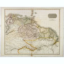
Caraccas and Guiana.
An attractive and detailed map of Venezuela and Guiana, extending Martinique in the north as far south northern Brazil, westwards to Lake Maracaibo across to the Atlantic...
Place & Date: Edinburgh, 1821
Selling price: $80
Sold in 2017
Peru, Chili and La Plata.
This is a beautiful 1817 Thomson map of Peru, Chile and Argentina. It covers Bolivia, Paraguay, Uruguay and parts of Peru, Chile, Argentina and Brazil.The map identifies ...
Place & Date: Edinburgh, 1821
Selling price: $100
Sold in 2016
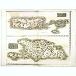
Porto Rico and Virgin Isles / Haiti, Hispaniola...
A map of three interesting West Indian Islands by the Edinburg cartographer John Thomson. Lightly hand colored. Relief shown by hachures.John Thomson was one of the leadi...
Place & Date: Edinburgh, 1821
Selling price: $100
Sold in 2016
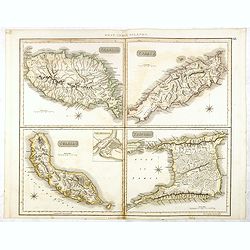
Grenada / Tobago / Curaçao / Trinidad.
A delightfully detailed map of four West Indian islands by John Thomson. The map displays excellent detail concerning each of the islands, including an inset plan of Fort...
Place & Date: Edenburgh, 1821
Selling price: $150
Sold in 2016
Spanish North America.
The excellent map by the Scottish engraver John Thomson, depicts Mexico from the Yucatan northwards to what would eventually become the Republic of Texas, and the Louisia...
Place & Date: Edinburgh, 1821
Selling price: $500
Sold in 2016
Southern Provinces of the United States.
A very finely engraved and detailed map of United State, that Includes the states and territories east of the Mississippi River to the Atlantic and as far north as Lake E...
Place & Date: Edinburgh, 1821
Selling price: $220
Sold in 2018
Carte de L'Amerique Septentrionale. . .
An uncommon map of North America, published shortly after the Louisiana Purchase, and the first publication of Lewis & Clark's official report.What makes this map imp...
Place & Date: Paris, 1821
Selling price: $130
Sold in 2017
Plan du Port de Ste. Helene a la cote des Patagons levee en 1794. . . [together with] Plan des Port de Melo dans la Partie N. du Golfe de St. George...
Two engraved charts. Relief shown hachures, soundings in brasses françaises. Includes "Vue de l'Entree du Port de Ste. Helene ..." Scales of maps (ca. 1:23,500...
Place & Date: Paris, after 1821
Selling price: $50
Sold in 2018
Plan du de la rade et du Barachois des Isles St. Pierre et Miquelon Levé en 1818.
Engraved of Saint Pierre and Miquelon, a self-governing territorial overseas collectivity of France, situated in the north-western Atlantic Ocean near the Newfoundland a...
Place & Date: Paris, 1821
Selling price: $50
Sold in 2018
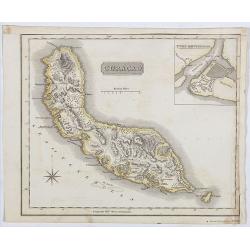
Curaçao.
A delightfully detailed map the West Indian island Curaçao by John Thomson. The map displays excellent detail concerning, including an inset plan of Fort Amsterdam in Cu...
Place & Date: Edenburgh, 1821
Selling price: $150
Sold in 2019
L'America Settentrionale.
Upper part of a two-sheet Italian map depicting North America. A massive Luigiana runs through the center of the United States, overlapping with a large Missouri Territor...
Place & Date: Roma, 1821
Selling price: $200
Sold in 2020
Guadaloupe / Marie Galante / Antigua.
A very finely engraved and detailed map, of both French and English islands in the West Indies. The map is mostly of Guadeloupe, with inset maps of Marie Galante and Anti...
Place & Date: Edinburgh, 1821
Selling price: $60
Sold in 2021
United States of America Compiled from the latest and best..
An uncommon and important map by the well recognized American cartographer John Melish, engraved by Samuel Harrison. Melish was the first American publisher to issue excl...
Place & Date: Philadelphia, 1822
Selling price: $1300
Sold
Map of the United States with contiguous British & Spanish Possessions.
.. compiled from the latest & best authorities by John Melish. Engraved by J. Vallance and [H.S.] Tanner. Entered according to Act of Congress the 16.th day of June 1...
Place & Date: Philadelphia, 1822
Selling price: $30025
Sold
Geographical, statistical, and historical map of the district of Columbia.
Includes a detailed plan of Washington DC, Georgetown and Alexandria and a number of roads and rivers in the District. Muds Tavern is shown just outside the District on t...
Place & Date: Philadelphia, 1822
Selling price: $375
Sold in 2010
Plan de la Baie Saint George Situe a la CoteOccidental de Terre-Neuve, Leve en 1820. . .
Fine of the interior of St. George's Bay near the present-day towns of Stephenville and Saint George's on the Southwest coast of Newfoundland. Relief shown by hachures. ...
Place & Date: Paris, 1822
Selling price: $120
Sold in 2016
United States of America.
An uncommon and important map by the well recognized American cartographer John Melish. Shows both the newly formed state of Missouri and the massive Missouri Territory.M...
Place & Date: Philadelphia, H.C. Carey & I. Lea, 1822
Selling price: $1100
Sold in 2019
Plan de l'Embouchure de la Rivière de Cayenne et des Mouillages extérieures. . .
Early chart of coast offshore to Cayenne.
Place & Date: Paris, ca.1822
Selling price: $45
Sold in 2018
United States.
A small map of the east and south east of the United States. From Louisiana , up to the 'Northwest Territory' and across to New England and down to Florida. There is an i...
Place & Date: London, 1822
Selling price: $29
Sold in 2019
Plan de l'Embouchure de la Rivière de Cayenne et des Mouillages extérieures. . .
Early chart of coast offshore to Cayenne. Prepared by C.L. Grassier and engraved by Ambroise Tardieu and P.J. Besançon. Detailed chart published by Dépôt Générale de...
Place & Date: Paris, ca.1822
Selling price: $55
Sold in 2020
Geographical, Statistical, and Historical Map of Colombia.
One of the first separate maps of the newly independent Colombia and Venezuela, which was still steeped in Revolution under the irrepressible work of Simon Bolivar. The m...
Place & Date: Philadelphia, 1822
Selling price: $80
Sold in 2020
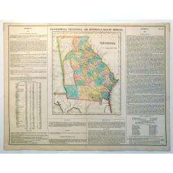
Geographical, Statistical and Historical Map of Georgia
Nice example of this fine map of Georgia, from the 1827 edition of Carey & Lea's Geographical, Statistical and Historical Atlas of America, with two columns of conte...
Place & Date: Philadelphia, 1822
Selling price: $220
Sold in 2023
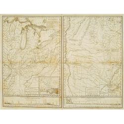
Country drained by the Mississippi Eastern Section. (with) Country of the Mississippi.
Rare map in two sheets stretching from Mississippi to Lake Superior. An inset box at top right includes a series of explanations to the symbols on the map. From: "Ac...
Place & Date: Philadelphia, 1823
Selling price: $1275
Sold
L'america meridionale.
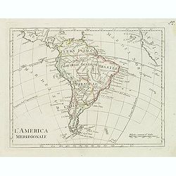
Charming map of South America from the rare atlas Atlante Tascabile o sia Serie di Num. XXI Cartine Geografiche nelle quali si rappresenta in ristretto lo Stato Attuale d...
Place & Date: Rome, 1823
Selling price: $150
Sold
Carta esférica del Rio de la Plata en la América del Sur, Levantada por Don Andres Oyarvide. . .
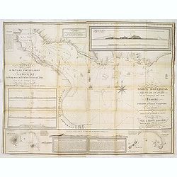
Stunning chart of the Rio de la Plata with Buenos Aires, Montevideo, Maldonado, etc. prepared by Benito Aizpurúa. The map has several insets including "Puerto de Mo...
Place & Date: Buenos Aires, ca.1823
Selling price: $1900
Sold in 2013
Map of North & South Carolina by H.S. Tanner.
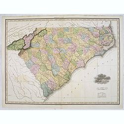
Uncommon and important map of North and South Carolina by H.S. Tanner and published in his "New American Atlas" from 1823. Henry Schenck Tanner (1786-1858) was ...
Place & Date: Philadelphia, Henry Tanner, 1823
Selling price: $2250
Sold in 2014
An Outline to shew the Connected Discoveries of Captains Ross, Parry & Franklin in the years 1818, 19, 20 and 21.
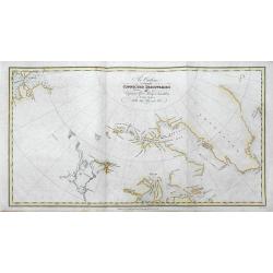
A rare first edition of this highly interesting map of early Arctic exploration. It shows the latest coast lines in the polar areas of Canada and Greenland. Two areas sho...
Place & Date: London, 1823
Selling price: $55
Sold in 2016
Route of the Expedition from Isle à la Crosse to Fort Providence in 1819 & 20.
A rare first edition of this chart illustrating John Franklin's (1786-1847) first Arctic land expedition (Coppermine Expedition) fromÎle-à-la-Crosse in Saskatchewan to ...
Place & Date: London, 1823
Selling price: $185
Sold in 2016
A Chart of the Discoveries & Route of the Northern Land Expedition under the command of Captain Franklin, R.N. in the Years 1820 & 21...
A fantastic map showing John Franklin's expedition from Great Slave Lake to the Coronation Gulf (Nunavut) with incredible detail. It shows Fort Providence, Fort Enterpris...
Place & Date: London, 1823
Selling price: $245
Sold in 2016
Route of the Expedition from York Factory to Cumberland House and the Summer & Winter Tracks from thence to Isle a La Crosse, in 1819 & 1820.
A rare first edition of this chart illustrating John Franklin's (1786-1847) first Arctic land expedition (Coppermine Expedition) from Île-à-la-Crosse in Saskatchewan to...
Place & Date: London, 1823
Selling price: $45
Sold in 2016
Route of the Expedition from Isle de la Crosse to Fort Providencein 1819 & 20.
A scarce chart of John Franklin's first Arctic land expedition from Ile a la Crosse in what is now Saskatchewan to Fort Providence on northern Great Slave Lake in what is...
Place & Date: London, ca. 1823
Selling price: $30
Sold in 2017
Amérique septentrionale.
A fine map of North America published by the well-known Paris publisher of maps, globes and atlases.The map includes "Mormonfort" next to Lac Salé. Mormons arr...
Place & Date: Paris, 1824
Selling price: $120
Sold in 2023
Map of the Country Embracing the Route of the Expedition of 1823 commanded by Major SH Long.
Folding map originating from the rare book "Narrative of an Expedition to the Source of St. Peter's River : Lake Winnepeek, Lake of the Woods, &c., &c. Perfo...
Place & Date: H.C.Carey and E. Lea, 1824
Selling price: $310
Sold in 2008
Freistaat von Nordamerica. . .
Scarce and unusual German map featuring primarily topography. Twenty-nine states and territories are outlined and named in a panel at bottom. A huge Louisiana stretches t...
Place & Date: Berlin, 1824
Selling price: $200
Sold in 2016
Carte de la partie septentrionale du Nouveau Monde..
Detailed map of Canada and Alaska. Prepared by L.Vivien and engraved in steel by Giraldon-Bovinet. Published by Menard and Desenne, rue Git-le-Ceur 8, Paris.
Place & Date: Paris, 1825
Selling price: $85
Sold in 2011
OHIO (Geographisch - statistische und historische Charte de Staates Ohio)
From the rare German edition of Carey and Lea?s, A Complete Historical, Chronological, and Geographical American Atlas, an early and impressive map of Ohio bordered with ...
Place & Date: London and Weimar, 1825
Selling price: $290
Sold
Carte Géographique .. du Maryland.
"Detailed map of Maryland. From J.A. Buchon, ""Atlas Gégraphique Statistique, historique et chronologique des deux Ameriques et des isles adjacentes; trad...
Place & Date: Paris 1825
Selling price: $200
Sold
Peru.
This is the map of Peru is from a plano edition of the very scarce German edition of Carey & Lea's "A Complete Historical, Chronological, and Geographical Americ...
Place & Date: Weimar, 1822-1825
Selling price: $100
Sold
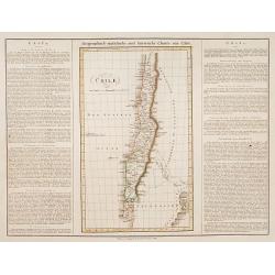
Chili.
This is the map of Chilli is from a plano edition of the very scarce German edition of Carey & Lea's "A Complete Historical, Chronological, and Geographical Amer...
Place & Date: Weimar, 1822-1825
Selling price: $100
Sold
Massachusetts.
This is the map of Massachusetts is from a plano edition of the very scarce German edition of Carey & Lea's "A Complete Historical, Chronological, and Geographic...
Place & Date: Weimar, 1822-1825
Selling price: $90
Sold
Carta del Oceano Atlantico Setentrional, con las Derrotas que siguió Dn. Cristobal Colon ..
Map of the North Atlantic Ocean, illustrating Christopher Columbus' routes to the New World in 1492, 1495, 1498, 1502.POublished by the "Deposito Hidrografico" ...
Place & Date: Madrid 1825
Selling price: $110
Sold
Carte Générale des Etats Unis de L''Amérique Septentrionale..
Detailed map of the United States. Prepared by L.Vivien and engraved in steel by Giraldon-Bovinet.Published by Menard and Desenne, rue Git-le-Ceur 8, Paris.
Place & Date: Paris, 1825
Selling price: $250
Sold in 2015
Carte Géographique [. . .] Connecticut.
Detailed map of Connecticut. From J.A. Buchon, Atlas Gégraphique Statistique, historique et chronologique des deux Amériques et des isles adjacentes, traduit de l'atlas...
Place & Date: Paris, 1825
Selling price: $200
Sold in 2015
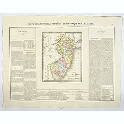
Carte Geographique, Statistique et Historique Du New-Jersey.
Very detailed map from Buchon's french edition of Carey & Lea's American Atlas. The map is surrounded with lengthy text, dates, and tables. Includes information about...
Place & Date: Paris, 1825
Selling price: $75
Sold in 2020
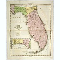
Map of Florida by H.S. Tanner. Improved to 1825
A very fine example of the revised 1825 issue of Henry Schenk Tanner's important map of Florida, with significant changes to the mapping. The second edition of the map sh...
Place & Date: Philadelphia, Henry Tanner, 1825
Selling price: $1800
Sold in 2014
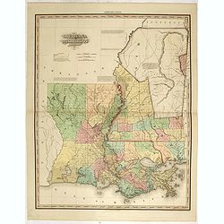
Louisiana and Mississippi by H.S. Tanner. Improved to 1825
A very fine example of the revised 1825 issue of Henry Schenk Tanner's important map of Louisiana and Mississippi. "Improved to 1825" has been added to the titl...
Place & Date: Philadelphia, Henry Tanner, 1825
Selling price: $1750
Sold in 2015
Atlas Gégraphique Statistique, historique et chronologique des deux Ameriques et des isles adjacentes; traduit de l'atlas exécuté en Amerique d'aprés Lesage, avec des nombreuses corrections et augmentations
Atlas Gégraphique Statistique, historique et chronologique des deux Ameriques et des isles adjacentes... was an elegant Parisian publication of the Carey & Lea atla...
Place & Date: Paris, 1825
Selling price: $1600
Sold in 2019
Vue d'une distillerie sur l'Ìle Guam.
Rare and beautiful view of a distillery on Guam Island. By Chasselat after Pellion, engraved by Pomel. Published in the important Voyage autour du monde under the command...
Place & Date: Paris, 1825
Selling price: $100
Sold in 2016
Femme de l'Ile Guam: Josephe Cortez.
Rare and beautiful image of a woman from Guam. Located in the western Pacific Ocean, Guam is one of five American territories with an established civilian government. By...
Place & Date: Paris, 1825
Selling price: $100
Sold in 2018
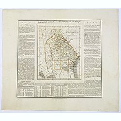
Geographisch-Statistische und Historische Charte von Georgia.
A nice map of the southern US state of Georgia, from the German version of Carey and Lea's English language atlas. This atlas was issued in six editions, from 1822-1827, ...
Place & Date: Weimar, 1825
Selling price: $205
Sold in 2017
Carte Générale des Etats Unis de L'Amérique Septentrionale. . .
A highly interesting map of much of today's USA, the Bahamas, and parts of Canada. The map features the 54° 40' or Fight border with the huge Northwest region extending ...
Place & Date: Paris, 1825
Selling price: $95
Sold in 2018
North America [2 maps].
A differing pair of North American maps, both published in 1820s, one in London, the other in Edinburgh. The map published by Constable, after Arrowsmith shows N. America...
Place & Date: London, Edinburgh 1820 -1825
Selling price: $150
Sold in 2020
Carte Géographique, Statistique et Historique L'Amerique Septentrionale.
A lovely detailed map of North America, from Buchon's, Atlas Gégraphique Statistique, historique et chronologique des deux Ameriques et des isles adjacentes: traduit de ...
Place & Date: Paris, 1825
Selling price: $50
Sold in 2019
Etats-Unis d'Amerique.
A nicely detailed map of the U.S.A., showing the various states with their political borders, in fine original colors. This interesting map shows the Oregon Territory, th...
Place & Date: Paris, 1825
Selling price: $105
Sold in 2019
Carte de l'Adjonction Progressive des divers Etats au Territoire et a l'Union Constitutionnelle des Etats-Unis de l'Amerique du Nord. 1825.
An interesting map of the United States from Buchon's Atlas Gégraphique Statistique, historique et chronologique des deux Ameriques et des isles adjacentes, traduit de l...
Place & Date: Paris, 1825
Selling price: $60
Sold in 2019
Carte Geographique, Statistique et Historique du Maine.
A finely engraved early map of the state of Maine, U.S.A., hand colored by counties. It includes roads, towns, rivers, and lakes and there are key note flags for 10 Maine...
Place & Date: Paris, 1825
Selling price: $45
Sold in 2022
Carte Geographique, Statistique et Historique du New Hampshire.
A detailed map of New Hampshire, from Buchon's Atlas Gégraphique Statistique, historique et chronologique des deux Ameriques et des isles adjacentes, traduit de l'atlas ...
Place & Date: Paris, 1825
Selling price: $50
Sold in 2019
Carte Géographique, Statistique et Historique du New-Jersey.
A detailed map of New Jersey, from Buchon's Atlas Gégraphique Statistique, historique et chronologique des deux Amériques et des isles adjacentes: traduit de l'atlas ex...
Place & Date: Paris, 1825
Selling price: $50
Sold in 2019
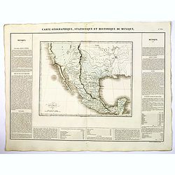
Carte Geographique, Statistique ey Historique du Mexique.
A lovely, detailed map of Mexico, from Buchon's, Atlas Gégraphique Statistique, historique et chronologique des deux Ameriques et des isles adjacentes traduit de l'atlas...
Place & Date: Paris, 1825
Selling price: $135
Sold in 2019
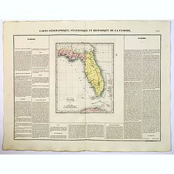
Carte Geographique, Statistique ey Historique de la Floride.
A lovely, detailed map of Florida, from Buchon's, Atlas Gégraphique Statistique, historique et chronologique des deux Ameriques et des isles adjacentes traduit de l'atla...
Place & Date: Paris, 1825
Selling price: $150
Sold in 2022
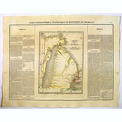
Carte Geographique, Statistique et Historique de Michigan.
A nice detailed map of Michigan, from Buchon's Atlas Gégraphique Statistique, historique et chronologique des deux Ameriques et des isles adjacentes traduit de l'atlas e...
Place & Date: Paris, 1825
Selling price: $100
Sold in 2019
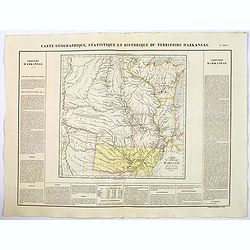
Carte Geographique, Statistique et Historique du Territoire d'Arkansas.
A nice detailed map of the Territory of Arkansas, from Buchon's Atlas Gégraphique Statistique, historique et chronologique des deux Ameriques et des isles adjacentes tra...
Place & Date: Paris, 1825
Selling price: $70
Sold in 2019
Carte Geographique, Statistique et Historique du Territoire Missouri.
A nice detailed map of the state of Missouri, from Buchon's Atlas Gégraphique Statistique, historique et chronologique des deux Ameriques et des isles adjacentes traduit...
Place & Date: Paris, 1825
Selling price: $50
Sold in 2019
Carte Geographique, Statistique et Historique de Illinois.
A nice detailed map of the state of Illinois, from Buchon's Atlas Gégraphique Statistique, historique et chronologique des deux Ameriques et des isles adjacentes traduit...
Place & Date: Paris, 1825
Selling price: $55
Sold in 2019
Carte Geographique, Statistique et Historique de L'Indiana.
A nice detailed map of the state of Indiana from Buchon's Atlas Gégraphique Statistique, historique et chronologique des deux Ameriques et des isles adjacentes traduit d...
Place & Date: Paris, 1825
Selling price: $50
Sold in 2019
Carte Geographique, Statistique et Historique de Louisiane.
A nice detailed map of the state of Louisiana from Buchon's Atlas Gégraphique Statistique, historique et chronologique des deux Ameriques et des isles adjacentes traduit...
Place & Date: Paris, 1825
Selling price: $100
Sold in 2022
Carte Geographique, Statistique et Historique de d'Alabama.
A nice detailed map of the state of Alabama from Buchon's Atlas Gégraphique Statistique, historique et chronologique des deux Ameriques et des isles adjacentes traduit d...
Place & Date: Paris, 1825
Selling price: $85
Sold in 2019
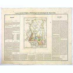
Carte Geographique, Statistique et Historique de Mississipi.
A nice detailed map of the state of Mississippi from Buchon's Atlas Gégraphique Statistique, historique et chronologique des deux Ameriques et des isles adjacentes tradu...
Place & Date: Paris, 1825
Selling price: $75
Sold in 2020
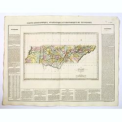
Carte Geographique, Statistique et Historique du Tennessee.
A nice detailed map of the state of Tennessee from Buchon's Atlas Gégraphique Statistique, historique et chronologique des deux Ameriques et des isles adjacentes traduit...
Place & Date: Paris, 1825
Selling price: $60
Sold in 2019
Carte Geographique, Statistique et Historique du Kentucky.
A nice detailed map of the state of Kentucky from Buchon's Atlas Gégraphique Statistique, historique et chronologique des deux Ameriques et des isles adjacentes traduit ...
Place & Date: Paris, 1825
Selling price: $50
Sold in 2021
Carte Geographique, Statistique et Historique de L'Ohio.
A nice detailed map of the state of Ohio from Buchon's Atlas Gégraphique Statistique, historique et chronologique des deux Ameriques et des isles adjacentes traduit de l...
Place & Date: Paris, 1825
Selling price: $50
Sold in 2022
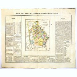
Carte Geographique, Statistique et Historique de la Georgie.
A nice detailed map of the state of Georgia from Buchon's Atlas Gégraphique Statistique, historique et chronologique des deux Ameriques et des isles adjacentes traduit d...
Place & Date: Paris, 1825
Selling price: $100
Sold in 2022
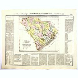
Carte Geographique, Statistique et Historique de la Caroline du Sud.
A nice detailed map of the state of South Carolina from Buchon's Atlas Gégraphique Statistique, historique et chronologique des deux Ameriques et des isles adjacentes tr...
Place & Date: Paris, 1825
Selling price: $80
Sold in 2019
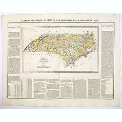
Carte Geographique, Statistique et Historique de la Caroline du Nord.
A nice detailed map of the state of North Carolina from Buchon's Atlas Gégraphique Statistique, historique et chronologique des deux Ameriques et des isles adjacentes tr...
Place & Date: Paris, 1825
Selling price: $80
Sold in 2019
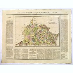
Carte Geographique, Statistique et Historique de la Virginie.
A nice detailed map of the state of Virginia from Buchon's Atlas Gégraphique Statistique, historique et chronologique des deux Ameriques et des isles adjacentes traduit ...
Place & Date: Paris, 1825
Selling price: $70
Sold in 2020
Carte Geographique, Statistique et Historique de Cuba.
A nice detailed map of the island of Cuba, from Buchon's Atlas Gégraphique Statistique, historique et chronologique des deux Ameriques et des isles adjacentes traduit de...
Place & Date: Paris, 1825
Selling price: $60
Sold in 2019






![Plan du Port de Ste. Helene a la cote des Patagons levee en 1794. . . [together with] Plan des Port de Melo dans la Partie N. du Golfe de St. George...](/uploads/cache/39153-250x250.jpg)












![Carte Géographique [. . .] Connecticut.](/uploads/cache/14220-250x250.jpg)





![North America [2 maps].](/uploads/cache/42445-250x250.jpg)


