Browse Listings in America
Carte des deux Florides et de la Louisiane inférieure : dressee pour les voyages de Mr. Robin dans les annees 1802, 1803, 1804, 1805 et 1806. . .
Very detailed map by J.B. Poirson, which shows all of Florida and Georgia, Louisiana north to Arkansas with the Ozarks clearly delineated, and east Texas with its rivers ...
Place & Date: Paris, F. Buisson,1807
Selling price: $550
Sold in 2010
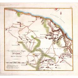
Investissment et Attaque D'York, dans la Virginie.
Engraved fold-out map from the French edition of John Marshall's "Life of George Washington". This historical map depicts Yorktown (the final engagement) and it...
Place & Date: Paris, 1807
Selling price: $29
Sold in 2016
Partie Septentrionale du New-Jersey, et Positions des Armées Américaine et Britannique Après le Passage de la Rivière du Nord, en 1776
Striking and highly detailed Revolutionary War period rare copper engraved map illustrating the military operations of the American Revolution in northern New Jersey duri...
Place & Date: Paris, 1807
Selling price: $96
Sold in 2014
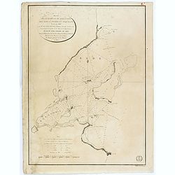
Partie de l'etat de Rhode-Island, et position des armees Americaine et Britannique au Siege de Newport. . .29 Aout 1778.
A nice example of this Revolutionary War battle map showing the siege of Newport on August 29, 1778. It shows the harbour, islands, and opposing encampments. The map acco...
Place & Date: Paris, 1807
Selling price: $44
Sold in 2019
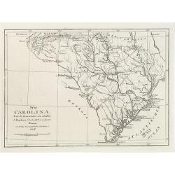
Süd Carolina. Nach des Gouverneurs von Carolina J. Dalton Charte (1803) reducirt. . .
Interesting map of South Carolina and its cartographic source, based on Governor Drayton's map of South Carolina of 1803. The map provides lots of details with many place...
Place & Date: Weimar, Geographisches Institute, 1808
Selling price: $300
Sold in 2018
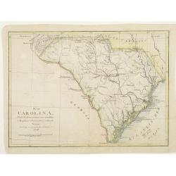
Süd Carolina. Nach des Gouverneurs von Carolina..
Map of South Carolina. Copied after a map by J.Drayton.
Place & Date: Weimar, 1808
Selling price: $340
Sold
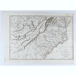
Carte des Etats du centre, de L'Quest et du Sud des Etats-Unis.
Detailed map of the East Coast of America, taken from "Voyage à l'Ouest des Monts Alléghanys, dans les Etats de l'Ohio, du Kentucky et du Tennessée, et retour à ...
Place & Date: Paris, Dentu, 1808
Selling price: $400
Sold in 2015
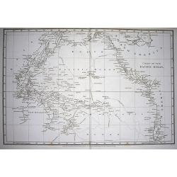
Chart of the Pacific Ocean.
Very interesting map of the Pacific Ocean. Shows the tracks and dates of Captain Cook's voyages! (and also Clarke and Furneaux). Shows Australia with unfinished coast li...
Place & Date: London, 1808
Selling price: $210
Sold in 2009
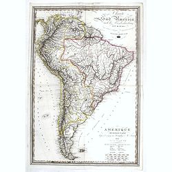
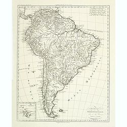
Amérique méridionale. . .
Detailed map of South of America. Includes a cartouche for the Galapagos island.Jean Baptiste Poirson (1760-1831) was a French geographer and engineer.
Place & Date: Paris, 1808
Selling price: $30
Sold in 2011
Amérique Septentrionale.
A charming map of North America. Very detailed. Published by Alexandre Emile Lapie, in his atlas Universel. Engraved by Tardieu.
Place & Date: Paris 1809
Selling price: $140
Sold
Amerique Septentrionale. . .
Detailed map of the United States and Canada giving good detail along the east coast and the Lakes. Including Port St.Francois, Monterey, Pte. De Pins, Pt.Estero, Pte de ...
Place & Date: Paris, 1809
Selling price: $120
Sold in 2011
AMERIQUE SEPTENTRIONALE.
A detailed map of North America, issued shortly before the publication of the official account of Lewis & Clark's expedition to the Pacific Ocean. The map shows a ver...
Place & Date: Paris, 1809
Selling price: $110
Sold in 2019
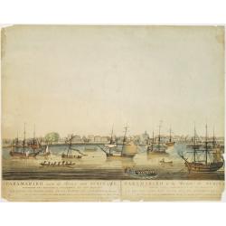
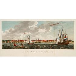
Vue de la Rade et de la Ville de Paramaribo.
A very decorative panoramic view of the town with a large Dutch vessel in the foreground.
Place & Date: Paris 1810
Selling price: $280
Sold
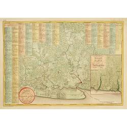
Kaart van het bebouwde gedeelte van Suriname.
With inset map of general Suriname. Scarce map covering the area of Paramaribo. 751 Plantation identified to key panels at top and left of the sheet.
Place & Date: Amsterdam, 1810
Selling price: $750
Sold in 2013
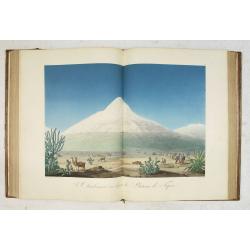
Vues des Cordillères et Monuments des Peuples Indigènes de l Amérique. . .
The book describes the travels of Alexander Humbolt together with the botanist Aime Bonpland in 1799 via Tenerife to Venezuela, through the Orinoco area and through Colom...
Place & Date: Paris, [de l'imprimerie de J.H. Stône] chez F. Schoell, 1810
Selling price: $30000
Sold
Map of the Mississippi River from its source to the mouth of the Missouri..
Very rare map, one of the first maps of the Mississippi River with its tributaries, giving latitude and longitude markings along the way. Prepared during Zebulon Montgome...
Place & Date: Baltimore 1811
Selling price: $1650
Sold
Map of the interior of Louisiana with part of New Mexico..
Engraved by Haase. A mile stone map of the internal part of Louisiana, including the Mississippi in the East and the Mountains of Mexico in the West: with a part of New M...
Place & Date: London 1811
Selling price: $725
Sold
Paraguay, Chili, Terre Magellan. . .
An antique copper engraved map, published 1795, in Paris for the "Nouvel Atlas Portatif..." by Robert de Vaugondy & Charles Francois Delamarche.
Place & Date: Paris, ca. 1811
Selling price: $80
Sold in 2016
West Indies & East Indies (2 Maps)
Two separate maps published by Cadell & Davies in London in 1811. One is of the West Indies, and the other is of the East Indies. They were by John Pinkerton and are ...
Place & Date: London, 1811
Selling price: $10
Sold in 2016
North America & South America (2 Maps)
Two separate maps published by Cadell & Davies in London in 1811. One is of North America, and the other is of South America. They are by John Pinkerton and from his ...
Place & Date: London, 1811
Selling price: $30
Sold in 2016
Amérique septentrionale.
A fine map of North America published by the well-known Paris publisher of maps, globes and atlases C.F. Delamarche.
Place & Date: Paris, 1811
Selling price: $50
Sold in 2017
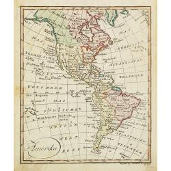
Amerika.
Nice small map of America published by Johannes Walch in his rare Allgemeiner Atlas Nach den bewährsten Hülfsmitteln und astronomischen Ortsbestimungen…, edition of 1...
Place & Date: Augsburg, 1812
Selling price: $85
Sold in 2022
[No Tittle] Map of the west of world.
Nice small map of the continent of America by Johannes Walch in his rare Allgemeiner Atlas Nach den bewährsten Hülfsmitteln und astronomischen Ortsbestimungen…, editi...
Place & Date: Augsburg, 1812
Selling price: $120
Sold in 2015
Die Vereinigten Staaten von Nordamerika nach Arrowsmith und Lewis Karten vom Jahre 1795 und 1796. . .
A uncommon map of the United States, according to the title based on the maps by Arrowsmith and Lewis published in 1795 and 1796. Roads and Indian tribes are noted, in ad...
Place & Date: Nuremberg, 1812
Selling price: $850
Sold in 2016
Westindien.
A scarce map of South America and Caribbean. Published in “Allgemeiner Atlas” by Johann Walch (1757-1824). He was a cartographer and map publisher active in Augsburg,...
Place & Date: Augsburg, 1812
Selling price: $17
Sold in 2018
ETATS UNIS ET GRANDES ANTILLES.
An attractive map of the United States and West Indies with decorative cartouche, from 'Atlas Supplementaire du Precis de la Geographie Universalle de M. Malte-Brun by La...
Place & Date: Paris, 1812
Selling price: $41
Sold in 2019
General View of Quebec.
A delightful early 19th century view of Quebec City in Canada, engravrd by George Cooke and published in London. Quebec City's strategic location on the St. Lawrence Rive...
Place & Date: London, 1812
Selling price: $55
Sold in 2021
[Official US Government Document.]
An official US government printed document, completed in manuscript. An attractive copper engraved broadside, signed by President James Madison, appointing Daniel Chandle...
Place & Date: Washington D.C., 1812
Selling price: $1550
Sold in 2022
A Map exhibiting the frontiers of Canada and the United States, intended to illustrate the operations of the British & American armies
A scarce map issued during the War of 1812. Large inset lower right, "A sketch of the coast of North America; from the River St. Lawrence, to Chesapeake Bay." S...
Place & Date: London, 1813
Selling price: $4800
Sold in 2015
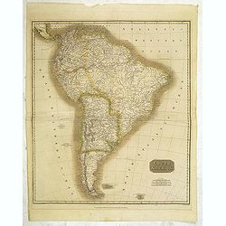
South America.
Map of South America by the Edinburg cartographer John Tomson. Hand colored. Relief shown by hachures.John Thomson was one of the leading masters of the Edinburgh school ...
Place & Date: Edinburgh, London, 1814
Selling price: $65
Sold in 2012
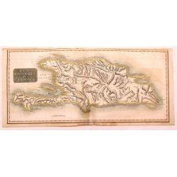
Haiti, Hispaniola or St. Domingo.
Fine Thomson map of Haiti or th island of St. Domingo. Originally paired with the map of Porto Rico, this map has been professionally split into two maps.
Place & Date: Edinburgh, 1814
Selling price: $15
Sold in 2015
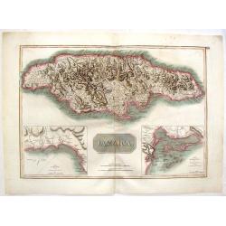
Jamaica.
Large map of the island with insets of 'The Harbour of Bluefields' and 'The Harbours of Kingston and Port Royal'. This map was based on Jefferys' map of 1775. The map is ...
Place & Date: London, 1814
Selling price: $38
Sold in 2017
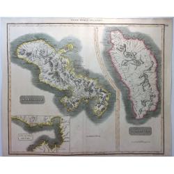
West India Islands - Martinico & Dominica.
A fine example of John Thomson's 1814 map of the West Indian islands of Dominica and Martinique. The map offers detail including individual buildings, villages, hospitals...
Place & Date: Edinbourgh, 1814
Selling price: $20
Sold in 2021
Charte von den Inseln Trinidad, Tabago und Margaretha, dem Busen von Paria, und einem Theile von Cumana.
This uncommon chart incorporates the area from the island of Margarita, off the coast of Venezuela, to Tobago. It includes a portion of the of the Venezuelan coastline an...
Place & Date: Weimar, 1814
Selling price: $135
Sold in 2020
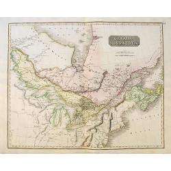
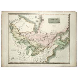
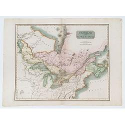
Canada and Nova Scotia.
A large map of Upper and Lower Canada, New Brunswick and Nova Scotia, centered on the Great Lakes, extending to Hudson Bay in the north, and Philadelphia in the south. In...
Place & Date: Edinburgh, ca.1815
Selling price: $140
Sold in 2019
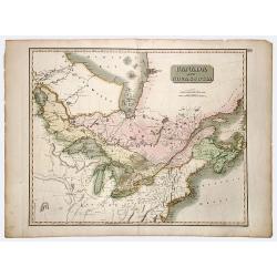
CANADA and NOVA SCOTIA.
A beautiful map, centered on the Great Lakes, with many names and geographical details. Nice treatment of the River system which connects Lake Winnepeg with Hudson's Bay ...
Place & Date: Edinburgh, 1815
Selling price: $120
Sold in 2022
CANADA and NOVA SCOTIA.
A beautiful map, centered on the Great Lakes, with many names and geographical details. Nice treatment of the River system which connects Lake Winnepeg with Hudson's Bay ...
Place & Date: Edinburgh, 1815
Selling price: $130
Sold in 2020
Martinico & Dominica.
Two superb maps on one sheet, of two Carribean Islands. 'Martinico' is Martinique (French) and Dominica (English). Below the Martinique map, there is an inset map of the...
Place & Date: Liverpool, 1815
Selling price: $17
Sold in 2021
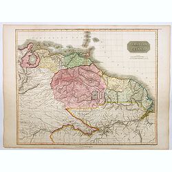
Caraccas and Guiana.
An attractive and very detailed map of Venezuela and Guiana, extending from Martinique in the north as far south northern Brazil, westwards to Lake Maracaibo across to th...
Place & Date: Edinburgh, 1815
Selling price: $45
Sold in 2023
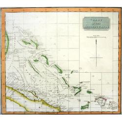
CHART OF THE BAHAMA ISLANDS
Rare chart of the Bahamas, includgin part of Cuba and the Turks & Caicos. Excellent detail with depth soundings and shipping channels indicated. On of the best maps a...
Place & Date: Edinburgh, 1816
Selling price: $220
Sold
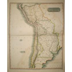
Peru, Chili and La Plata.
The Peru, Chile, and Argentina (La Plata, not including Magellanica), from Thomson's New General Atlas.
Place & Date: Edinburgh, 1816
Selling price: $200
Sold in 2009
Peru, Chili and La Plata.
A handsome map of part of South America including Peru, Chile and La Plata (which currently includes most of Paraquay, Uruguay and Bolivia and North Argentina. John Thom...
Place & Date: Edinbourgh, 1816
Selling price: $90
Sold in 2015
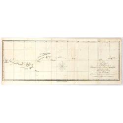
Chart ... Shewing the Course Taken by The Rurick in April, 1816
From the book “A voyage of discovery, into the South Sea and Beering's straits, for the purpose of exploring a north-east passage, undertaken in the years 1815-1818, at...
Place & Date: London, 1816
Selling price: $15
Sold in 2018
United States of America, Exhibiting the Seat of War on the Canadian Frontier from 1812 to 1815.
Edward Baines' 1816 map of the 'United States of America, Exhibiting the Seat of War on the Canadian Frontier from 1812 to 1815' A scarce of the US, published after the W...
Place & Date: Leeds, 1816
Selling price: $215
Sold in 2021
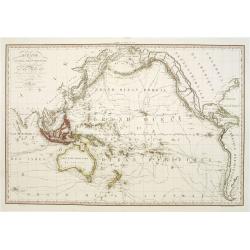
Océanie ou Australasie et Polynésie..
Engraved by Blondeau, who was engraver for the King of France.Rare and detailed map of the Pacific, giving good detail on Australia, New Zealand and Americas west coast. ...
Place & Date: Paris 1817
Selling price: $450
Sold
Paramaribo aan de Rivier van Suriname.
Very rare and decorative panoramic view of the city of Paramaribo as seen from the river. The best 19th century view of Paramaribo. The houses shown are typical Dutch in ...
Place & Date: Amsterdam 1817
Selling price: $1000
Sold
Northern Provinces of the United States.
Somewhat later but very finely engraved and detailed map of the United States.
Place & Date: Edinburgh, 1817
Selling price: $450
Sold in 2008
Nothern Provinces of the United States
Somewhat later but very finely engraved and detailed map of eastern part of the United States. Including the states and territories of New England, New York, Pennsylvania...
Place & Date: Edinburgh, 1817
Selling price: $111
Sold in 2013
Southern Provinces of the United States
Somewhat later but very finely engraved and detailed map of the United States. Including the states and territories east of the Mississippi River to the Atlantic and as f...
Place & Date: Edinburgh, 1817
Selling price: $250
Sold in 2013
Jamaica.
Fine hand-colored map featuring the island of Jamaica. Inserts of the Harbour of Bluefields and The Harbours of Kingston & Port Royal. From Thomson's "New Genera...
Place & Date: Edinburgh, 1817
Selling price: $26
Sold in 2016
America.
Fine hand-colored, engraved map of North & South America including parts of Europe, Africa and the South Pacific. Includes several geographical mistakes such as Green...
Place & Date: Edinbourgh, 1817
Selling price: $199
Sold in 2015
West Indies Islands - Guadeloupe, Mariegalante & Antigua.
A fine Thomson map of the West Indies islands of Guadeloupe, Mariegalante and Antigua. The map is simple, clean and elegant. John Thomson (1777-c1840), was a Scottish ca...
Place & Date: Edinburgh, 1817
Selling price: $115
Sold in 2015
West India Islands - Martinico & Dominica.
Two maps of West India Islands including Martinico and Dominica. Features an inset of cul de Sac Royal (Modern day Fort-de France). Issued in Thomson's "NEW GENERAL ...
Place & Date: Edinburgh, 1817
Selling price: $131
Sold in 2015
Amérique ou Nouveau Continent Dressée Sur les Nouvelles Relations Découvertes et Observations, par J.B. Nolin. . .
Uncommon map of the Western hemisphere prepared by J.B.Nolin and improved by L.Denis. In the bottom an inset map of continuation of Americas west coast indicating a North...
Place & Date: Paris, (1777) 1817
Selling price: $1000
Sold in 2015
Plan of the City of New York. New-York, Oct. 1817.
Plan de New-York engraved by W. Hooker for "Blunt's Strangers Guide", covering New-York covering Manhattan below 30th Street. Shows some existing and proposed s...
Place & Date: New-York, Oct. 1817
Selling price: $725
Sold in 2014
Peru, Chili and La Plata.
A fine 1817 Thomson map of Peru, Chile and Argentina. It also covers parts of Bolivia, Paraguay, Uruguay and Brazil. The map identifies towns, rivers, mountains, indigeno...
Place & Date: Edinbourgh, 1817
Selling price: $17
Sold in 2021
Canada and Nova Scotia.
Engraved by Dassauville. Original hand-color. Issued in the 1817 edition of Thomson's 'New General Atlas'.
Place & Date: Edinburgh: John Thomson. 1817
Selling price: $270
Sold in 2023
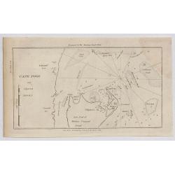
Cape Poge.
A small sea chart showing the eastern portion of Martha's Vineyard. Cape Poge Lighthouse can be seen at the northeast tip of Chapaquedick Island. This map was published ...
Place & Date: New York, 1817
Selling price: $30
Sold in 2020
Little Egg Harbour.
A small sea chart showing Little Egg Harbour east of Tucker's Island.
Place & Date: New York, 1817
Selling price: $12
Sold in 2020
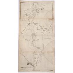
Staten Island.
A small sea chart showing Staten Island, Long Island Bluff and Sandy Hook. This map was published in the “American Coast Pilot”, a detailed guide to harbours, capes a...
Place & Date: New York, 1817
Selling price: $75
Sold in 2020
West India Islands.
Map of four islands in the Caribbean: Grenada. Tobago. Trinidad. Curacao (with) Fort Amsterdam.Title above: 'West India Islands'. At bottom centre: 'Drawn & engraved ...
Place & Date: Edinburgh, London, Dublin, 1816/1817
Selling price: $120
Sold in 2022
Carte réduite de l'océan Atlantique méridional. . .
Map showing the southern part of South America and Africa, including the Falkland islands. Issued by "Depot Général de la Marine", the official French Governm...
Place & Date: Paris, 1818
Selling price: $100
Sold in 2011
A View of West-Point on the River Hudson, With the Steam-Boat, invented by M. Fulton, going up from New-York to Albany.
A lithographic incunabula showing a view of West-Point on the River Hudson, with the Steam-Boat, invented by M. Fulton, going up from New-York to Albany. Lithograph after...
Place & Date: Dijon, 1818
Selling price: $4500
Sold in 2016
Proof state without title. (A View of West-Point on the River Hudson, With the Steam-Boat, invented by M. Fulton, going up from New-York to Albany.)
A lithographic incunabula showing a view of West-Point on the River Hudson, with the Steam-Boat, invented by M. Fulton, going up from New-York to Albany. Lithograph after...
Place & Date: Dijon, 1818
Selling price: $2500
Sold in 2016
Amerique Meridionale d'apres le voyage au Paraguay de M. Azara.
A large uncommon folding map of South America, with both German and French titles and explanations, by Jospeh Dirwald, published in Vienna in 1818. The map is probably ba...
Place & Date: Vienna, 1818
Selling price: $200
Sold in 2017
Charte von der Nordwestkuste Americas Nach Vancouver.
An anonymous 1818 'Charte von der Nordwestkuste Americas nach Vancouver'. This map of the Pacific coast stretches from present-day San Francisco north to Anchorage, in Al...
Place & Date: Prague, 1818
Selling price: $70
Sold in 2017
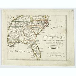
I Stati Uniti nell' America Settentrionale.
Only one sheet of four.The south eastern section of Bartolomeo Borghi's scarce 4 sheet map of the United States. From east of the Mississippi River. From: Kentucky and so...
Place & Date: Firenze, 1818
Selling price: $85
Sold in 2019
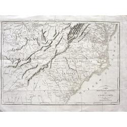
Carta delle provincie meridionali degli Stati - Uniti
Interesting map from the Italian translation of Francois La Rochefoucauld-Liancourt's famous travel guide for the United States. Showing the Carolinas, Georgia, Tennessee...
Place & Date: Italy, 1819
Selling price: $200
Sold in 2008
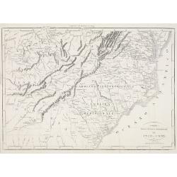
Carta delle provincie meridionali degli Stati - Uniti.
An interesting map from the Italian translation of Francois La Rochefoucauld-Liancourt's famous travel guide for the United States.Showing the Carolinas, Georgia, Tenness...
Place & Date: Italy, 1819
Selling price: $120
Sold in 2023
Plan de la Rade et du Barachois..
Sea of Rade de Saint-Denis le Barachois on the island La Réunion. Relief shown by hachures. Depths shown by soundings. Below engraved seal of Depot General de la Marine...
Place & Date: Paris, 1819
Selling price: $50
Sold in 2018
Carta delle provincie meridionali degli Stati-Uniti.
An Italian map of the south eastern United States from Botta's Storia della Guerra dell' Independenza degli Stati Uniti d'America, which was based upon Francois la Rochef...
Place & Date: Milan, ca 1819
Selling price: $100
Sold in 2020
LIMA, por el Lado del este.
Very fine view of Lima, engraved by T.Sutherland. The engraving was made after a design of Paroissein.Showing the Rímac River and is the most important source of potable...
Place & Date: London, 1820
Selling price: $100
Sold in 2008
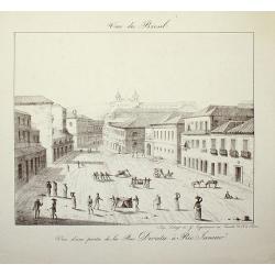
Vue du Bresil - Vue d'une partie de la Rue Direita à Rio-Janeiro
Place & Date: Paris, c. 1820
Selling price: $120
Sold in 2008
Partie septentrionale de l'Océan Pacifique ou l'on marqué les découvertes et les routes de M.rs de la Pérouse et Cook.
Detailed and rare map of the northern part of the Pacific with the Gulf of Alaska, British Columbia, south to St.Francisco and the east coast of Asia from Tartary to Kore...
Place & Date: Paris, 1820
Selling price: $150
Sold in 2011
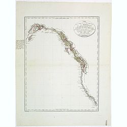
Carte de la partie de la cote nord-ouest de l'Amerique. Reconnue pendant les Etes de 1792, 1793 et 1794 depuis 29054' de latitude nord et 244033' de. . .
Detailed and rare map of the Gulf of Alaska, British Columbia, south to St.Francisco.Prepared by Edward Roberts after information by George Vancouver. Engraved by Tardieu...
Place & Date: Paris, 1820
Selling price: $150
Sold in 2011
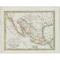
Messico Nuova Spagna.
Rare map of Mexico and Texas. Engraved by Pasquali.
Place & Date: Italy, c.1820
Selling price: $100
Sold in 2023
United States and additions, 1820
In this map showing the United States from coast to coast, John Thomson offers significant detail with rivers, mountains and Indian villages. Transmississippi West is tru...
Place & Date: Edinburgh, 1820
Selling price: $700
Sold in 2013
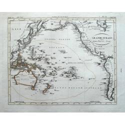
Grande Oceano ouvero Quinta Parte del Mondo.
Curious engraved map of the Pacific ocean. Extends from China to the Hudson Bay. With an interesting depiction of Australia and numerous islands in the Pacific including ...
Place & Date: Milan, ca. 1820
Selling price: $85
Sold in 2014
George Washington.
Rare lithographed portrait of George Washington, by an unknown artist; published by William Smith, 702 So. Third St, Philadelphia.Surrounded by scroll work.
Place & Date: Philadelphia, c1820
Selling price: $100
Sold in 2016
Map of the Route of Columbus, on arriving among the Bahama Islands.
An interesting map of the route Christopher Columbus took when he arrived in the Bahamas. Map extent includes Jamaica, most of Cuba, Saint Domingo, The Caycos Islands, th...
Place & Date: Philadelphia, 1820
Selling price: $75
Sold in 2018








![[No Tittle] Map of the west of world.](/uploads/cache/29384-250x250.jpg)


![[Official US Government Document.]](/uploads/cache/48156-250x250.jpg)

