Browse Listings in America
Carte particulaire de la Côte du Nord-Ouest de l\'Amerique, 3e Feuille.
Jean François Galoup, Comte de la Pérouse (1741-88), outstanding French explorer and hydrographer. Voyage autour du Monde?Atlas', 1797.A large chart from La Pérouse's ...
Place & Date: Paris, 1797
Selling price: $225
Sold in 2009
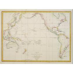
Carte du Grand Ocean ou Mer du Sud. Voyage de Decouvertes la Bousole et l'Astrolabe.
Jean François Galoup, Comte de la Pérouse (1741-88), outstanding French explorer and hydrographer.Important map of the Pacific, illustrating the voyages made by La Pero...
Place & Date: Paris, 1797
Selling price: $1000
Sold in 2011
Gli Stati Uniti Dell' America...sesto foglio...parte della Carolina...Terra Nuova...S.Lorenzo
This unusual chart centers on a large inset map of the Gulf of Saint Lawrence and Newfoundland. Outside of the inset it shows the coast of Carolina with the city of Charl...
Place & Date: Rome 1797
Selling price: $250
Sold
Carte particulaiere de la Côte du Nord-Ouest de l\'Amerique, 2e Feuille.
Jean François Galoup, Comte de la Pérouse (1741-88), outstanding French explorer and hydrographer. ' Voyage autour du Monde?Atlas', 1797.A large detailed chart from La ...
Place & Date: Paris, 1797
Selling price: $225
Sold in 2009
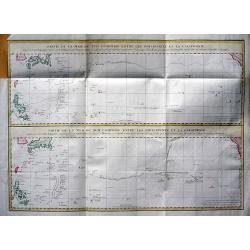
Partie de la Mer du Sud comprise entre les Philippines et la Californie d\'apres de Carte Espagnole trouvee sur le Galion pris par l\'Amiral Anson en 1743, qui represente l\'etat des connaissances a cette epoque, et les routes que suivaient ordinairement
Two large sea charts on one sheet. Each from the Philippines to California; one of the route of the Spanish galleons from Manilla to Acapulco with recent discoveries, and...
Place & Date: Paris, 1797
Selling price: $150
Sold in 2009
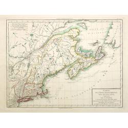
Carte de la partie septentrionale des Estats Unis. . .
An attractive map of North Americas east coast north of Long Island. Including St.Laurence River as far south as Lake Ontario.Engraved by André and P.F.Tardieu.
Place & Date: Paris c.1797
Selling price: $250
Sold in 2015
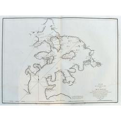
Plan du Port De St. Diego en Californie. . . 1782 [with] Plan Du Port et du Departement de San Blas . . . 1777.
Two engraved maps on one page of the harbors of San Diego (ca. 1:100,000) in California and St. Blas (ca. 1:105,000) in Mexico . Depths by soundings. Engraved by L. Auber...
Place & Date: Paris, 1797
Selling price: $300
Sold in 2014
Plan du Port De St. François Situé sur la côte de la CALIFORNIE Septentrionale . . . (San Francisco Bay)
The earliest obtainable printed map of San Francisco Bay, from the La Perouse's Voyages. Depths by soundings. Engraved by L. Aubert. The map includes 21 place names, incl...
Place & Date: Paris, 1797
Selling price: $475
Sold in 2014
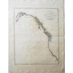
Carte particulaire de la Côte du Nord-Ouest de l'Amerique, 3e Feuille.
Jean François Galoup, Comte de la Pérouse (1741-88), outstanding French explorer and hydrographer. ' Voyage autour du Monde…Atlas', 1797.A large chart from La Pérous...
Place & Date: Paris, 1797
Selling price: $220
Sold in 2016
Plan de l'Entrée du Port de Bucarelli sur la cote du Nord-Ouest de l'Amerique.
The Port Bucarelli is a harbour in Alaska, discovered in 1775 by two Spaniards, La Quadra & Maurelle, at Latitude 55N the furthest north that Spanish explorers got.Th...
Place & Date: Paris, 1797
Selling price: $35
Sold in 2017
Carte Particuliere de la Cote du Nord-Ouest de l'Amerique reconnue par les Fregates Francaises la Boussole et l' Astrolabe en 1786 1e. Feuille.
Attractive chart of the Alaskan coast from Mount St.Elie south to Bay de ClonardThis chart was engraved by Bouclet for La Pérouse's 'Voyage autour du Monde'.Jean Francoi...
Place & Date: Paris, 1797
Selling price: $36
Sold in 2018
Plan de l'Entree du Port de Bucarelli sur la Cote du Nord-Ouest de l'Amerique, par 55°15' de Latitude Nord et 136°15' de Longitude a l'Ouest de Paris . . .
Attractive chart of Bucareli Bay which is part of the Alexander Achipelago in the southeastern portion of AlaskaThis chart was engraved by Bouclet for La Pérouse's 'Voya...
Place & Date: Paris, 1797
Selling price: $34
Sold in 2018
Carte Des Cotes De L'Amérique Et De L'Asie depuis la Californie jusqu'à Macao...1786 et 1787...
A large map showing La Perouse's expedition in the northern Pacific. Extends from Baja California to Alaska, and the east coast of Asia from Tartary to Canton, including ...
Place & Date: Paris, 1797
Selling price: $220
Sold in 2017
Carte Particuliere de la Cote du Nord-Ouest de l'Amerique reconnue par les Fregates Francaises la Boussole et l' Astrolabe en 1786 1e. Feuille.
An attractive chart of the Alaskan coast from Mount St. Elie, south to Bay de Clonard.This chart was engraved by Bouclet for La Pérouse's 'Voyage autour du Monde'.Jean F...
Place & Date: Paris, 1797
Selling price: $12
Sold in 2020
Partie de l'Amerique Septentrionale qui comprend Le Cours de l'Ohio, La Nlle Angleterre, la Nlle York, le New Jersey, La Pensylvanie, le Maryland La Virginie, La Caroline
A copperplate border colored map or the eastern United States, with inlet titled "Supplement pour la Caroline". First issued in 1755 ,here later state without d...
Place & Date: Paris 1797
Selling price: $250
Sold in 2019
Partie de L'Amerique Septent. Qui comprend La Nouvelle France ou le Canada.
A decorative and highly detailed map of New England and part of Canada, extending east to Newfoundland, with a large inset map of the Great Lakes.One of the best large fo...
Place & Date: Paris, 1797
Selling price: $180
Sold in 2019
Plan de l'Entree du Port de Bucarelli sur la Cote du Nord-Ouest de l'Amérique. . .
A large chart of Bucareli Bay which is part of the Alexander Archipelago in the southeastern portion of Alaska. Highly detailed with coasts, islands, small rocks, and dep...
Place & Date: Paris, ca.1797
Selling price: $110
Sold in 2020
A plain map of America, according to the method of the Abbe Gaultier by Mr. Wauthier, his pupil. 1797.
Engraved map. Hand colored. Outline map showing boundaries and unnamed rivers, mountains, cities, etc. Prime meridian: Ferro.
Place & Date: Philadelphia, 1797
Selling price: $50
Sold in 2020
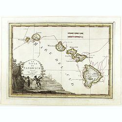
Le Isole di Sandwich delineate sulle osservazioni del Cap Cook.
FIRST EDITION on laid paper. Cassini’s splendid map depicts Sandwich islands, old name for Hawaii islands, at the end of the eighteenth century. The splendid cartouche ...
Place & Date: Rome, 1798
Plan du Port des Français sur la cote des Français ...
"Chart of the entrance of ""Bassin de L'Quest"", visited on July 2nd 1786 by La Perouse. On many 18th century maps we find a depiction of Mer de ...
Place & Date: Paris 1798
Selling price: $650
Sold
Le Isole Azoridi delineate fulle ultime Osservazioni
Rare Italian map of the Azores. Large scale and very detailed with much of topographical information. Big and decorative title cartouche illustrating a native hunting sce...
Place & Date: Rome, 1798
Selling price: $300
Sold
Carte générale et Politique de l'Amérique.
Copper-engraved map, hand-colored in outline. Well-engraved and attractive map of North and South America, from the French Atlas National, dated An VI, No. 155 in upper l...
Place & Date: Paris, 1798
Selling price: $190
Sold in 2014
Plan du Port des Français sur la cote du nord ouest. . .
Chart of the entrance of Bassin de L'Quest , visited on July 2nd 1786 by La Perouse. On many 18th century maps we find a depiction of Mer de L'Quest or Sea of the West a ...
Place & Date: Paris, 1798
Selling price: $60
Sold in 2018
Maine entworfen von D.F. Sotzmann. Hamburg bey Carl Ernst Bohn 1798 . . . NO.VII
Extremely rare map of Maine prepared by Daniel Friedrich Sotzmann for Christopher Ebeling's "Erdbeschreibung von Amerika", a project ended after only ten maps o...
Place & Date: Hamburg, Carl Ernst Bohn, 1798
Selling price: $4600
Sold in 2016
Carte de L'Amerique ..
Fine detailed map of America, with inset map of the Northern regions, including Alaska. Prepared by J.B.Poirson and Herison. Upper left hand corner 2 blocks listing the f...
Place & Date: Paris, 1798
Selling price: $300
Sold in 2022
Carte dés Carolines Méridionale et septrionale La Georgie, la Floride.. Le pays des Cherokées ..
Fine map of Florida, Carolinas and Georgia. From : Voyage dans les parties sud de l'Amérique septentrionale, savoir : les Carolines septentrionale et méridionale, la G�...
Place & Date: Paris 1799
Selling price: $650
Sold
Le Paraguay.
Nice small map covering the basin drained by the main tributaries of the Río de la Plata (the Uruguay and Paraná, and the important Paraná...
Place & Date: Paris, 1799
Selling price: $80
Sold in 2009
Rhode Island.
This small but striking map of Rhode Island is from Payne's Geography, published by John Low. Counties, roads, ponds, rivers, swamps, and towns and cities are shown. Unen...
Place & Date: New York, 1799
Selling price: $85
Sold in 2017
Carte des États-Unis, Provinces Méridionales.
The map shows portions of Kentucky, Virginia, Tennessee, Georgia, North Carolina, South Carolina, a strip of land between Tennessee and Georgia as 'United States Territor...
Place & Date: Paris, 1799
Selling price: $125
Sold in 2022
Karte von .. Norstwestlichen Kuste America.
A very nice map centered on Northwest coast of America, including the city of Vancouver. On the lower left corner, an inset map (285x208 cm) of Japan, Taiwan and Chinese ...
Place & Date: Berlin 1800
Selling price: $510
Sold
Part of the United States of North America.
Fine map of the eastern part of the United States, with in lower right an inset of South Carolina. An entirely new engraving, closely copied from the 1798 English edition...
Place & Date: Berlin 1800
Selling price: $250
Sold
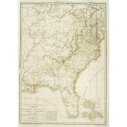
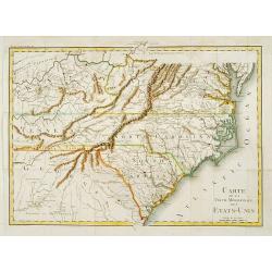
Carte de la partie méridionale des Etats-Unis.
Detailed map of North and South Carolina, Kentucky, Tennessee and Virginia. A separate publication of Pierre François Tardieu.With in lower left corner the address: Grav...
Place & Date: Paris 1800
Selling price: $550
Sold
Karte von einem theil der Nord westlichen Küste von America..
A very nice map centered on Northwest coast of America, including the city of Vancouver. On the lower left corner, an inset map (285x208 cm) of Japan, Taiwan and Chinese ...
Place & Date: Berlin 1800
Selling price: $350
Sold
Carte des cotes du Golfe du Mexique..
Detailed and important early chart of the Gulf Coast and Florida and dated 1800. From Neptune des cotes occidentales d'Amerique sur le Grand Ocean, an extensive atlas of ...
Place & Date: Paris 1800
Selling price: $1750
Sold
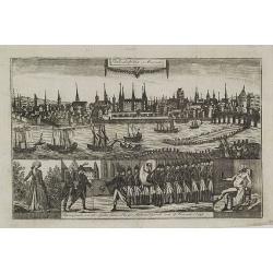
Philadelphia in Amerika. / Bonaparte an der spitze seiner Pariser National Garde am 8 Novemb. 1799
Copper engraving with four scenes on one sheet. In upper part a view of Philadelphia. Published in "Allgemeine Welt-Chronik oder neue und wichtige Zeit-Geschichte al...
Place & Date: Zittau, 1798-1800
Selling price: $1200
Sold
Il Canada le Colonie Inglesi con Luigiana e Florida . . .
Map of East coast of America including the Great Lakes. Fine title cartouche lower right hand corner. From Zatta's Atlante Novissimo.
Place & Date: Venise, 1800
Selling price: $240
Sold in 2010
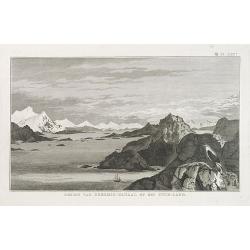
GEZIGT VAN KERSMIS-KANAAL OP HET VUUR-LAND . Pl. LXX*.
A landscape and sea coast view of mountains and a ship in the Strait of Magellan. From a Dutch edition of James Cook.
Place & Date: Amsterdam, ca. 1800
Selling price: $45
Sold in 2010
Die Stadt Carthagena in West Indien.
Panoramic view of the town of Cartagena in present-day Colombia, with a variety of boats and ships who dominate the foreground with the town and its surroundings depicted...
Place & Date: Zittau, 1798 - 1800
Selling price: $525
Sold in 2013
Theil der Vereinigten Staten von Nord America.
Detailed map of eastern part of the United States. In lower right hand corner inset map of Georgia, North and South Carolina.Showing routes of Mr. Weld.
Place & Date: Germany, c.1800
Selling price: $900
Sold in 2012
Amerique Septentrionale.
Interesting map of North America, where the Mississippi River serves as the western boundary of the United States, with the western frontier under Spanish rule. Several s...
Place & Date: Paris, c1800
Selling price: $130
Sold in 2014
Captain Cook's Inboorlingen en Verblijfplaatsen Van Oonalashka.
A view from the Dutch edition of Cook's voyages featuring native Americans in the village of Oonalashka.
Place & Date: Amsterdam, 1800
Selling price: $41
Sold in 2016
North America.
John Arrowsmith's map of North America at the turn of the nineteenth century. It shows very little exploration west of the Mississippi River, and 'Louisiana' stretches fr...
Place & Date: London, ca. 1800
Selling price: $45
Sold in 2017
A Map of the Island of St. Domingo.
An important map of the Caribbean island of St. Domingo (Santo Domingo), or Hispaniola, prepared by Bryan Edwards and published by Englishman John Stockdale in 1800. This...
Place & Date: London, 1800
Selling price: $85
Sold in 2018
Carte d'Amérique, Dressée pour Instruction. . .
Dezauche's revision of the De l'Isle/Buache map of North and South America which first came out in 1722. This is rare 1800 issue. The map reflects the political changes i...
Place & Date: Paris, 1800
Selling price: $350
Sold in 2019
America Settentrionale.
An interesting rare copper engraved map of North America by an unknown cartographer in about 1800. Text in Italian. The cartouche is quite plain but it does have minimal ...
Place & Date: Spain, ca 1800
Selling price: $95
Sold in 2020
Il Canada le Colonie Inglesi con Luigiana e Florida. . .
A splendid map of the east coast of America including the Great Lakes. With a decorative and fine title cartouche lower right hand corner, and mileage scales. From Zatta'...
Place & Date: Venice, 1800
Selling price: $350
Sold in 2020
Carte de la partie méridionale des Etats-Unis.
Detailed 1801 map of North and South Carolina, Kentucky, Tennessee and Virginia. A separate publication of Pierre François Tardieu.With in lower left corner the address:...
Place & Date: Paris, 1801
Selling price: $200
Sold in 2022
Carte Reduite d’une partie du Vieux Canal de Bahama...
This large highly detailed chart of the northern coastline of Cuba and part of the Bahamas was published under the auspices of the Contra-Amiral Decres Ministre de la Mar...
Place & Date: Paris, 1801
Selling price: $300
Sold in 2023
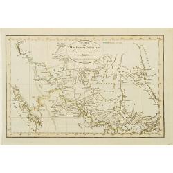
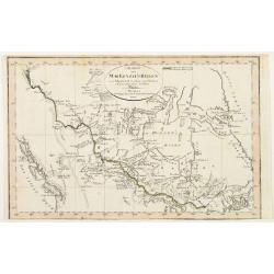
Charte von Mackenzie's Reisen von Montreal zu dem nördlichen Eis..
A detailed map north of Vancouver, Lake Michigan and New York. Showing the land discovered by Mackenzie during his travels to Montreal, Fort Chipewyan and North Regions i...
Place & Date: Weimar 1802
Selling price: $205
Sold
Charte von Mackenzie's Reisen von Montreal zu dem nördlichen Eis..
A detailed map north of Vancouver, Lake Michigan and New York. Showing the land discovered by Mackenzie during his travels to Montreal, Fort Chipewyan and North Regions i...
Place & Date: Weimar 1802
Selling price: $160
Sold
A Map Exhibiting all the New Discoveries in the Interior Parts of North America...
Published between 1795 and 1824, Aaron Arrowsmith's map of North America, is perhaps the single most important maps of North America after the American Revolution. It rep...
Place & Date: London, 1802
Selling price: $1400
Sold in 2020
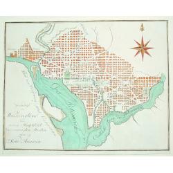
Grundrifs von Washington der nuen Hauptstadt ver vereinigten Staaten von Nord America
An extremely rare and desirable early plan of Washington DC. Of German origin, the map was published during Thomas Jefferson's first term as U.S. President. The work iden...
Place & Date: Heidelberg, c. 1803
Selling price: $800
Sold
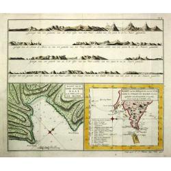
Kaart van de Good Success Baai in de Straat van le Maire. / Kaart van het Z.O.gedeelte van het Vuurland de Straat Le Maire en een gedeelte van Staaten-Land 1769.
Captain James Cook (1728-79), explorer, circumnavigator and hydrographer. Three voyages, 1768-71, 1772-75 and 1776-79. From 1778 on printed editions of ' Captain Cook's T...
Place & Date: Leiden, 1795-1803
Selling price: $95
Sold in 2018
Amérique Septentrionale an XI 1803.
Curious map of North America taken from "Boussole des speculateurs". According to the title, an uncommon encyclopedical work should be useful for investors and ...
Place & Date: Paris, 1803
Selling price: $160
Sold in 2012
Gli Stati Uniti dell'America.
A rare map of the United States of America, from "Nuova geografia universale antica e moderna cosmografica, fisica, topografica, di commercio e d'industria politica,...
Place & Date: Rome, Vincenzo Poggioli, 1803
Selling price: $200
Sold in 2020
ETATS UNIS DE L' AMERIQUE.
A scarce early, original outline colored map of the United States, showing 17 organised states. Georgia still extends to the Mississippi River, shortly before the organis...
Place & Date: Paris, 1803
Selling price: $40
Sold in 2019
Carte des Etats du centre, de L'Quest et du Sud des Etats-Unis.
Detailed map of the East Coast of America. Engraved by S.Glot.
Place & Date: Paris, ca. 1804
Selling price: $200
Sold
Charte von dem Meer von Kamtschatka mit Capt. Jos. Billings und Mart. Sauers Reise Routen..
Uncommon map of the west coast of America showing the tracks of Billings and Sauers.Prepared by Ferd Götze.
Place & Date: Weimar 1804
Selling price: $80
Sold
[no title] Map of the United States and southern Canada.
This untitled map of the United States and southern Canada bears the imprimatur Smith & Jones Sculp. 13 Pleasant Row Pentonville (McCorkle #799.8). It is from an Engl...
Place & Date: London, R.Philips, 1804
Selling price: $1000
Sold in 2020
Carte de la Partie de la Cote Nord-Ouest de l'Amerique Reconnue pendant les Etes de 1792, 1793 et 1794 . .
A Cartographic Landmark -- George Vancouver's Map of the West Coast of North America. The first broadly accurate sea chart of the Pacific Coast of North America, by the g...
Place & Date: Paris , 1804
Selling price: $200
Sold in 2021
Neue Charte von dem Mittleren Westlichen .. Nord Amerika..
A very nice map centered on north America, including part of Florida, north and south Carolina, Pennsylvania, etc. Title cartouche on the lower right corner.
Place & Date: Weimar 1805
Selling price: $410
Sold
Neue Charte von den Mittleren, Westlichen und Südlichen Ländern der Nord-Americanischen Freistaaten..
A detailed and rare map covering good part of the central and eastern American States.
Place & Date: Weimar 1805
Selling price: $220
Sold
[Early folding promotial fan with map of Martin La Bastide and his project to join the Pacific Ocean and the Atlantic Ocean.]
The fan is decorated on one side with an engraved map showing Central America and Lake Nicaragua. In the upper part is a long text on the work of Martin La Bastide and hi...
Place & Date: France, ca. 1805
Selling price: $12800
Sold in 2020
Charte von Jamaica In Kirchspiele eingetheilt und mit den Poststrassen.
General map of Jamaica, shows the postal roads, churches, towns, harbours, rivers, mountains and many other details. One of the earliest obtainable maps of Jamaica to loc...
Place & Date: Weimar, 1805
Selling price: $50
Sold in 2020
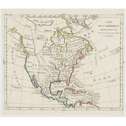
Carte de l'Amérique Septentrionale Divisée en ses principaux Etats.
Map of North and Central America. From Atlas de la Géographie de toutes les parties du monde .. Ouvrage destiné pour l'education, et nécessaire aux négocians, aux voy...
Place & Date: Paris, Prudhomme, Levrault, Debray, 1806
Selling price: $48
Sold in 2023
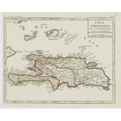
L'Isle St. Domingue Divisée en 5 Département.
Map of the island of Hispaniola, from Atlas de la Géographie de toutes les parties du monde .. Ouvrage destiné pour l'education, et nécessaire aux négocians, aux voya...
Place & Date: Paris, Prudhomme, Levrault, Debray, 1806
Selling price: $17
Sold in 2022
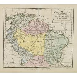
Terre-Ferme, Perou, Brésil, Pays de l'Amazone.
Map of northern half of South America, with Peru, Venezuela, Guyane and Brazil. By C. F. Delamarche, successor of Robert de Vaugondy, Geographer. Uncommon later edition, ...
Place & Date: Paris, ca.1806
Selling price: $85
Sold in 2013
Canada, Louisiane, États-Unis.
Although dated 1794/95 [l'An 3e.], the map is a copy of an earlier map which appeared in Robert de Vaugondy''s 1778 atlas. Two maps on one sheet. The map of the western p...
Place & Date: Paris, 1794 - 1806
Selling price: $210
Sold in 2016
L'Amérique.
Although dated 1794/95 [l'An 3e.], the map is a copy of an earlier map which appeared in Robert de Vaugondy's 1778 atlas. Map of North and South America. By C. F. Delamar...
Place & Date: Paris, 1794 - 1806
Selling price: $180
Sold
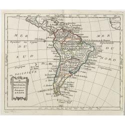
L'Amérique Méridionale . . .
Map of the South American continent, from Atlas moderne portatif composé de vingt-huit cartes sur toutes les parties du globe terrestre .. A l'usage des Colléges, des P...
Place & Date: Paris, Prudhomme, Levrault, Debray, 1806
Selling price: $80
Sold in 2019
Homme & Femme Ottawas.
Hand-colored mezzotints of Native Americans engraved by Félix Mixelle and Lachaussée Jeune after Jacques Grasset de Saint-Sauveur.
Place & Date: Paris,1801-1806
Selling price: $30
Sold in 2011
Homme & Femme Iroquoia.
Hand-colored mezzotints of Native Americans engraved by Félix Mixelle and Lachaussée Jeune after Jacques Grasset de Saint-Sauveur.
Place & Date: Paris,1801-1806
Selling price: $50
Sold in 2011
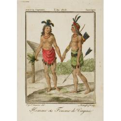
Homme et Femme de Virginie.
Hand-colored mezzotints of Native Americans engraved by Félix Mixelle and Lachaussée Jeune after Jacques Grasset de Saint-Sauveur.
Place & Date: Paris,1801-1806
Selling price: $40
Sold in 2011
Homme & Femme de Népissens.
Hand-colored mezzotints of Native Americans engraved by Félix Mixelle and Lachaussée Jeune after Jacques Grasset de Saint-Sauveur.
Place & Date: Paris,1801-1806
Selling price: $50
Sold in 2011
Carte générale de l'Océan Atlantique ou occidental, Dresse au depot general des Cartes Plans et Journaux/de la Marine/en 1786
Seventh edition of this magnificent sea chart of the Atlantic Ocean, covered in rhumb lines. Map flanked with extensive lists of tides, ‘Tables des Latitudes and Longit...
Place & Date: Paris, 1806
Selling price: $500
Sold in 2022
A NEW MAP OF AMERICA
John Cary’s important and very detailed 1806 Map of the Western Hemisphere. Prepared in 1805 by John Cary for issue in his magnificent 1808 New Universal Atlas. Alask...
Place & Date: London, 1806
Selling price: $140
Sold in 2011
Isle de la Jamaïque.
Map of Jamaica, from Atlas de la Géographie de toutes les parties du monde.. Ouvrage destiné pour l'education, et nécessaire aux négocians, aux voyageurs, aux fonctio...
Place & Date: Paris, Prudhomme, Levrault, Debray, 1806
Selling price: $25
Sold in 2016
(St. Kitts) Appointment of Charles Andrew Mills as the Aid-de-Camp. . .
Unique and rare document: Describes the appointment of Charles Andrew Mills as the Aid-de-Camp (ADC and government representative) of the Caribbean island of St. Christ...
Place & Date: Antigua, 1806
Selling price: $340
Sold in 2016
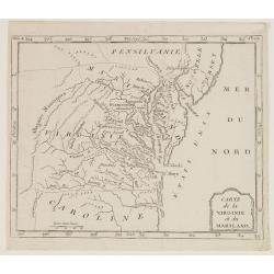
Carte de la Virginie et du Mariland.
Map centered on Chesapeake Bay and its hinterland, from Atlas de la Géographie de toutes les parties du monde.. Ouvrage destiné pour l'education, et nécessaire aux né...
Place & Date: Paris, Prudhomme, Levrault, Debray, 1806
Selling price: $120
Sold in 2017
Carte Des Isles De Saint Pierre Et Miquelon..
A well engraved and highly detailed chart showing the islands Miquelon and St. Pierre with superb detail of the islands, soundings and anchorages. The chart is embellishe...
Place & Date: Paris 1763-1807
Selling price: $500
Sold



![Plan du Port De St. Diego en Californie. . . 1782 [with] Plan Du Port et du Departement de San Blas . . . 1777.](/uploads/cache/34838-250x250.jpg)















![[no title] Map of the United States and southern Canada.](/uploads/cache/44308-250x250.jpg)


![[Early folding promotial fan with map of Martin La Bastide and his project to join the Pacific Ocean and the Atlantic Ocean.]](/uploads/cache/44026-250x250.jpg)

