Browse Listings in America
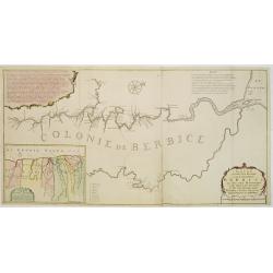
Nieuwe..kaart van de colonie Berbice..
Re-issue of his map from 1740, without the printed list of owners, with a large added contemp. hand-colored cartouche Relaas van de rebellie, ontstaan op de plantagien in...
Place & Date: Amsterdam 1765
Selling price: $500
Sold
De Stad en Haven van Porto-Bello.
Izaak Tirion (d. 1769) Amsterdam publisher. His ' Nieuwe en beknopte handatlas' saw 6 editions between before 1740 and after 1784. Also ' Tegenwoordige staat van alle vol...
Place & Date: Amsterdam, 1765
Selling price: $80
Sold
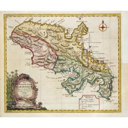
Het Westindische Eiland Marteneque.
Izaak Tirion (d. 1769) Amsterdam publisher. His ' Nieuwe en beknopte handatlas' saw 6 editions between before 1740 and after 1784. Also ' Tegenwoordige staat van alle vol...
Place & Date: Amsterdam, 1765
Selling price: $180
Sold in 2010
An exact Plan of the City, Fortifications & Harbour of Havana in the Island of Cuba.
John Hinton (fl.1745, d. 1781), London-based publisher, Universal Magazin 1747-1781. A plan of the town of Havana and direct vincinity. With an inset depicting Cuba. From...
Place & Date: London, Newgate Street, 1752-1765
Selling price: $300
Sold in 2008
Kaart van de landengte van Panama.
Map of the Isthmus showing towns such as Panama, Chargres and Porto-Bello,&c., roads and villages of the time.
Place & Date: Amsterdam, 1765
Selling price: $40
Sold in 2008
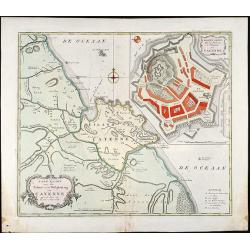
Land-Kaart van het Eiland en de Volkplanting van Cayenne aan de Kust van Zuid-Amerika
Attractive engraved map of French Guyana by I. Tirion. Showing the coast of French Guyana with a plan of Cayenne and the fortifications. With two cartouches and a compass...
Place & Date: Amsterdam, 1765
Selling price: $110
Sold in 2009
[Six engraved gores for a 20cm diameter terrestrial globe, showing the western hemisphere]
Six engraved globe gores for a 20cm diameter terrestrial globe, published by Peter Anich (1723-1766), a Tyrolean shepherd who became an eminent geographer and maker of ma...
Place & Date: Vienna, 1765
Selling price: $1550
Sold in 2009
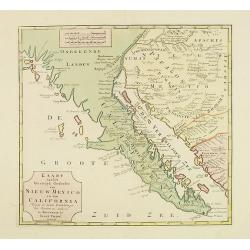
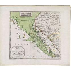
Kaart van het Westelyk Gedeelte van Nieuw Mexico en van California. . . MDCCLXV ..
A detailed map of the Baja California and Sonora, bounded on the north by the Colorado and Gila Rivers and approximately Mozatlan in the south, thus including parts of mo...
Place & Date: Amsterdam, 1765
Selling price: $600
Sold in 2012
Plan de la Ville de Paita dans le Roiaume de Santa Fe.
Plan of the Peruvian city of Paita on the Santa Fe coast. The original map was produced by Captain George Anson during his voyage around the world. Jacob Van Der Schley...
Place & Date: Amsterdam, 1765
Selling price: $37
Sold in 2013
Carte Reduite du Detroit de Davids...
Highly interesting large-scale sea chart of the Davis Strait, which was created for whaling ships, and illustrates the importance of offshore activities in the region. Or...
Place & Date: Paris, 1765
Selling price: $199
Sold in 2018
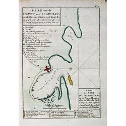
Plan van de haven van Acapulco.
A map of the fort and town of Acapulco. From a Dutch edition of Anson's Voyage around the World.2.
Place & Date: Amsterdam, 1765
Selling price: $45
Sold in 2016
Kaart van het Westelyk gedeelte van Nieuw Mexico en van California
A detailed map of the Baja California and Sonora, bounded on the north by the Colorado and Gila Rivers and approximately Mozatlan in the south, thus including parts of mo...
Place & Date: Amsterdam, 1765
Selling price: $280
Sold in 2014
A New & Accurate Map of North America, Including the British Acquisitions gain'd By the late War. 1763
Scarce map of the eastern part of North America from James Bay to the Gulf of Mexico in the year 1763. It shows boundaries, colonies, towns, cities, forts, and Indian tri...
Place & Date: London, ca. 1765
Selling price: $295
Sold in 2016
Kaart van het Westelyk Gedeelte van Nieuw Mexico en van California. . . MDCCLXV ..
A detailed map of the Baja California and Sonora, bounded on the north by the Colorado and Gila Rivers and approximately Mozatlan in the south, thus including parts of mo...
Place & Date: Amsterdam, 1765
Selling price: $500
Sold in 2020
Grondvlakte van Nieuw Orleans de Hoofdstad van Louisiana. / De uitloop van de Rivier Missisippi./ De Oostelijke ingang van de Missisippi. . .
A sought-after, beautiful, decorative sheet that shows three maps arranged around a significant compass rose. This work represents Tirion's version of a first executed ma...
Place & Date: Amsterdam, 1765
Selling price: $600
Sold in 2017
De Stad, Reede, Haven en Rivier van Chagres in de Spaansche Westindien.
A map of the town of Chagres and its direct vicinity. The Chagres River in central Panama is the largest in the Panama Canal's watershed.It was published in “Tegenwoord...
Place & Date: Amsterdam, 1765
Selling price: $120
Sold in 2017
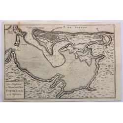
De Hoofdstad en Haven Van't Eiland Porto Rico, in de Westindien.
A detailed plan of San Juan Harbour in Puerto Rico, which appeared in Tirion's “Hedendaagsch Historie of Tegenwordige Staat van Amerika”.The map includes a detailed p...
Place & Date: Amsterdam, 1765
Selling price: $250
Sold in 2023
Kaart van geheel GUAJANA of de WILDEN-KUST, en die der Spaansche Westindien [and] Het Eiland KURASSAU. [and] KAART van de Volkplanting aan DEMERARY en RIO D'ESSEQUEBO.
A scarce hand-colored map made from four maps together on one sheet, showing the Dutch colonies on the north coast of South America, including Curaçao and Willemstad. Wh...
Place & Date: Amsterdam, 1765
Selling price: $355
Sold in 2019
Carte de L'Ile de Terre-Neuve. Dressee d'apres les Plans Anglois de James Cook et Michael Lane. . .
A fine early sea chart of the Newfoundland and Labrador based upon early 18th century works , published by the French Hydrographical Department. This chart was produced b...
Place & Date: Paris, 1765
Selling price: $350
Sold in 2020
A Plan of the City and Harbour of Havanna, Capital of the Island of Cuba.
A lovely small town plan of the Cuban capital city of Havana, probably published by Baldwin for the "London Magazine" in the mid 1760s. The plan highlights the ...
Place & Date: London, ca 1765
Selling price: $65
Sold in 2020
L' Amerique.
Louis Brion de la Tour (1756-1823), ' Atlas Géneral, Civil et Ecclésiastique', 1766, ' Atlas Général', 1790-98. Louis Charles Desnos (fl.1750-70), Le Rouge's 'Atlas N...
Place & Date: Paris, 1766
Selling price: $210
Sold
Carte Réduite de L'Ocean Septentrional compris entre l'Asie et l'Amerique.. (1766)
Large and detailed chart prepared by N.Bellin of east coast of Asia and western America, including Alaska, California, and Great Lakes region in the typical Bellin format...
Place & Date: Paris 1766
Selling price: $1150
Sold
Carte Réduite de L'Ocean Septentrional. . .
A first state, with no page number, price or Depot de la Marine stamp engraved anywhere. Large and detailed map prepared by Bellin of east coast of Asia and western Ameri...
Place & Date: Paris 1766
Selling price: $1000
Sold
Carte Reduite de l'Ocean Occidental.
Superb sea chart of the Atlantic Ocean by Jacques Nicolas Bellin (1703-1772) the Royal Hydrographer and head of the Depot de la Marine, in Paris.The chart is filled with ...
Place & Date: Paris 1766
Selling price: $100
Sold
[North America].
Two sheets (nos 1 & 3) of a larger 4 sheet wall map of North America, published by Postlethwayt, from his "Dictionary of Trade and Commerce".The work is bas...
Place & Date: [London], ca. 1766
Selling price: $40
Sold in 2017
Carte Reduite de l'Ocean Occidental. . .
An attractive mid eighteenth century sea chart published in Paris by Jacques Nicolas Bellin. The chart shows from the north of South America, northwards to the Caribbean,...
Place & Date: Paris, ca 1766
Selling price: $625
Sold in 2020
Carte Reduite de l' OCEAN OCCIDENTAL Contenant Partie des Costes d' Europe et d' Afrique... M DCCLXVI.
An decorative maritime chart, by the one of the greatest French hydrographers of the 18th century. In the context of the war at the end of the 18th century, and of the ri...
Place & Date: Paris, 1766
Selling price: $875
Sold in 2019
TO S,,r George Pocock KNIGHT of the BATH and Admiral of the Blue Squadron of His Majesty’s Fleet, on the EXPEDITION against the Havannah in 1762, / This PERSPECTIVE VIEW of the Harbour, with the LAND to the West, the MORO CASTLE to
A large, rare view of the British fleet entering the harbor of Havana to take possession of the town, 16 August 1762. Seven Years War (1756-63). Engraved after paintings ...
Place & Date: London, 1766
Selling price: $650
Sold in 2021
The Coast of New Found Land From Salmon Cove to Cape Bonavista. . . [together with] The Coast of New Found Land from Cape-Raze to Cape St-Francis.
Two charts showing the coast of New Found Land from Salmon Cove to Cape Bonavista and from Cape-Raze to Cape St-Francis. With inset chart of Trinity HarborGrierson publis...
Place & Date: Dublin, 1767
Carte Nouvelle d'Amerique..
Fine map of north and south America, engraved by J.E.T. Vallet and prepared by M.A.Moithey. In western part of North America a large "Mer de L' Quest" or Sea of...
Place & Date: Paris 1767
Selling price: $450
Sold
A Plan of the City of Philadelphia, with the Country Adjacent.
Early small plan of Philadelphia, published in "The World displayed; or, a curious collection of voyages and travels...". Quite detailed with roads and houses...
Place & Date: London, 1767
Selling price: $100
Sold in 2010
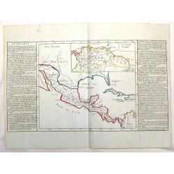
Du Mexique.
Interesting map of the lakes, rivers and mountains of Mexico. With inset of "LA TERRE FIRME". The history of the region is featured to the sides. Published by M...
Place & Date: Paris, 1767
Selling price: $52
Sold in 2015
A Large Draught of New England New York and Long Island.
Two charts on one sheet showing the New England coast. The chart displayed here focuses on the New England coast from the Hudson River to the Penobscot River.Grierson pub...
Place & Date: Dublin, 1767
Selling price: $3300
Sold in 2017
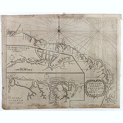
A Draught of the Coast of GUIANA From the River Oronoque To the River Amazones.
Rare chart with the coastline of the Guyana's with small insets of two charts of The River Oronoque from the entrance to St. Thomas's and The River of Surinam. Compass po...
Place & Date: Dublin, 1767
Selling price: $300
Sold in 2017
North America.
A nice general map of North America, published in London during the latter half of the eighteenth century. It mentions many Native American Indian Tribes, shows 'New Albi...
Place & Date: London, 1767
Selling price: $70
Sold in 2019
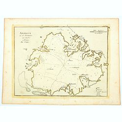
Antigue une des Antilles aux Anglois.
A map of Antigua in the Caribbean published in Paris by Jean Baptist Crepy in the mid eighteenth century. The map shows roads criss-crossing the island, with parishes, vi...
Place & Date: Paris, 1767
Selling price: $40
Sold in 2023
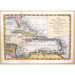
The West Indies Exhibiting the English French Spanish Dutch & Danish Settlements with the Adjacent Parts of North & South America from the Best Authorities
This is a fine map of the Caribbean showing the colonial holdings of Britain, France, Spain, the Netherlands and Denmark after the Treaty of Peace in 1783, by way of a k...
Place & Date: London, 1768
Selling price: $101
Sold in 2016
Grondvlakte van Nieuw Orleans, de Hoosdstad van Louisiana / De Uitloop van de Rivier Missisippi / De oostelyke Ingang van de Missisippi, met een Plan van het Fort, 't Welk het Kanaal Beheerscht
A sought-after, beautiful, decorative sheet that shows three maps arranged around a significant compass rose. This work represents Tirion's version of a map that was firs...
Place & Date: Amsterdam, ca. 1769
Selling price: $750
Sold
Guayana, Terre Ferme, Isles Antilles et N.lle Espagne.
Louis Brion de la Tour (1756-1823), ' Atlas Géneral, Civil et Ecclésiastique', 1766, ' Atlas Général', 1790-98. Louis Charles Desnos (fl.1750-70), Le Rouge's 'Atlas N...
Place & Date: Paris, 1769
Selling price: $300
Sold
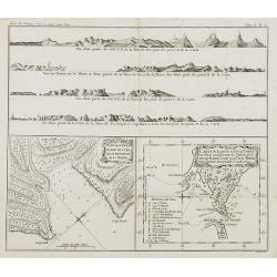
Plan de la Baye du Bon succès dans le détroit de le Maire. / Carte de la partie S. E. de la Terre de Feu. . . / 4 profils figurant la Terre de feu. Tome II Pl. 6.
Charts of the Detroit of Le Maire and of Tierra del Fuego in Spanish for "Land of Fire" situated on the southernmost tip of the South American mainland by the S...
Place & Date: Paris, 1769
Selling price: $70
Sold in 2008
Carte Nouvel le D'Amerique pour les..
Fine detailed and uncommon map of America. This map is most notable for it's depiction of Mer de L'Ouest or "Sea of the West": a great sea, easily the size of t...
Place & Date: Paris, 1769
Selling price: $650
Sold in 2010
Grondvlakte van Nieuw Orleans, de Hoosdstad van Louisiana / De Uitloop van de Rivier Missisippi / De oostelyke Ingang van de Missisippi, met een Plan van het Fort, 't Welk het Kanaal Beheerscht
A sought-after, beautiful, decorative sheet that shows three maps arranged around a large compass rose. This work represents Tirion's version of a first executed map by D...
Place & Date: Amsterdam, ca. 1769
Selling price: $460
Sold in 2015
Nieuwe kaart van Kanada . . .
Nice map of the Bay of Hudson, In Labrador a small inset of Nova Scotia. The map is dated 1769. All text is in Dutch. The map shows the region shortly after the conclusio...
Place & Date: Amsterdam, 1769
Selling price: $475
Sold in 2016
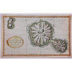
Chart of the Island Otaheite by Capt'n Cook.
Cook's mission on his First Voyage to the South Seas was to observe the passage of Venus across the Sun in 1769, at the request of the Royal Society. In the three months ...
Place & Date: London, 1769
Selling price: $40
Sold in 2018
Nieuwe Kaart van Kanada, De Landen aan de Hudson's-Baay en de Noordwestelyke deelen van Noord-Amerika. . .
A decorative, interesting map of Canada and the Upper Midwest. It is centered on the Great Lakes and Hudson's Bay and was published by Issak Tirion. The map depicts the r...
Place & Date: Amsterdam, 1769
Selling price: $150
Sold in 2022
Carte des Nouvelles découvertes. . .
This map is most notable for it's depiction of "Mer de L'Ouest" or "Sea of the West", a great sea, easily the size of the Mediterranean, to flow from ...
Place & Date: Paris, 1770
Selling price: $200
Sold in 2022
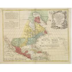
America Septentrionalis, Concinnata juxta Observationes..
This exemplar represents Lotter?s version of Delisle?s foundation map of North America, published in 1700. The Great Lakes are actually based on the Coronelli model, whic...
Place & Date: Augsburg, ca. 1770
Selling price: $1100
Sold
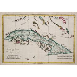
L' Isle de Cuba.
Rigobert Bonne (1727-1795), French cartographer. His maps are found in a.o. Atlas Moderne (1762), Raynal's Histoire Philos. du Commerce des Indes (1774) and Atlas Encyclo...
Place & Date: Paris, c. 1770
Selling price: $110
Sold
Carte de la Partie Meridionale de l\'Amerique Meridionale.
A coastal chart of southern South America showing the route of the Centurion from the Island of St. Catherine (Brazil) to the Island of Juan Fernandez (in the Pacific).
Place & Date: Paris c.1770
Selling price: $120
Sold
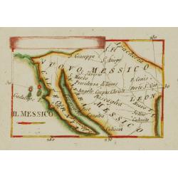
Il Messico.
Uncommon map of Mexico and Baya California.
Place & Date: Italy ca.1770
Selling price: $260
Sold
Supplément pour les Isles Antilles.
Rigobert Bonne (1727-1795), French cartographer. His maps are found in a.o. Atlas Moderne (1762), Raynal's Histoire Philos. du Commerce des Indes (1774) and Atlas Encyclo...
Place & Date: Paris, c. 1770
Selling price: $125
Sold
America Septentrionalis, Concinnata juxta Observationes..
This exemplar represents Lotter's version of Delisle's foundation map of North America, published in 1700. The Great Lakes are actually based on the Coronelli model, whic...
Place & Date: Augsburg, ca. 1770
Selling price: $650
Sold in 2011
Amérique Septentrionale.
25Rigobert Bonne (1727-1795), French cartographer. His maps are found in a.o. Atlas Moderne (1762), Raynal's Histoire Philos. du Commerce des Indes (1774) and Atlas Encyc...
Place & Date: Paris, c. 1770
Selling price: $170
Sold
Les Isles Antiles et le Golfe du Méxique / Les Bermudes.
Rigobert Bonne (1727-1795), French cartographer. His maps are found in a.o. Atlas Moderne (1762), Raynal's Histoire Philos. du Commerce des Indes (1774) and Atlas Encyclo...
Place & Date: Paris, c. 1770
Selling price: $200
Sold
Amérique Méridionale.
Rigobert Bonne (1727-1795), French cartographer. His maps are found in a.o. Atlas Moderne (1762), Raynal's Histoire Philos. du Commerce des Indes (1774) and Atlas Encyclo...
Place & Date: Paris, c. 1770
Selling price: $60
Sold
Nieuwe Kaart van het Westelykste Deel der Weereld.
Izaak Tirion (d. 1769) Amsterdam publisher. His ' Nieuwe en beknopte handatlas' saw 6 editions between before 1740 and after 1784. Also ' Tegenwoordige staat van alle vol...
Place & Date: Amsterdam, c. 1770
Selling price: $400
Sold
Untitled [Nordlicher Theil des Grossen Süd Meers].
Uncommon map illustrating the Californian and some of the Mexican Pacific shores. With notations in German. In the upper central part some marks are visible due to cracks...
Place & Date: Germany, 1750 - 1770
Selling price: $80
Sold
Untitled [Nordlicher Theil des Grossen Süd Meers].
Uncommon map illustrating the Californian and some of the Mexican Pacific shores. With notations in German. In the upper central part some marks are visible due to cracks...
Place & Date: Germany, 1750 - 1770
Selling price: $220
Sold
Karte von der Insel Montreal..
A rare issue of a plan of Montreal, published by G.Raspe in \"Schau Plats Des Gegenwaertigen Kriegs ...\". The title, at top left, credits Bellin.
Place & Date: Nürnberg, 1770
Selling price: $400
Sold in 2008
Grund Riss der Americanischen Insuln Cape Breton, St. Iean und Anticosti im Flusse S. Laurencii..
Map representing the eastern part of Nova Scotia, namely Cape Breton and Prince Edward Islands. With an inset map of Anticosti Island on top.
Place & Date: Nurnberg, 1770
Selling price: $235
Sold in 2023
Extrémité Méridionale de l'Amerique.
Rigobert Bonne (1727-1795), French cartographer. His maps are found in a.o. Atlas Moderne (1762), Raynal's Histoire Philos. du Commerce des Indes (1774) and Atlas Encyclo...
Place & Date: Paris, c.1770
Selling price: $115
Sold in 2008
Détroit de Magellan, avec les Plans des principaux ports, Bayes etc. de ce Détroit.
Rigobert Bonne (1727-1795), French cartographer. His maps are found in a.o. Atlas Moderne (1762), Raynal's Histoire Philos. du Commerce des Indes (1774) and Atlas Encyclo...
Place & Date: Paris, c.1770
Selling price: $130
Sold
America Meridionalis Concinnata juxta Observationes Dnn Acad
colored copper engraving showing South America. After a map of De l'Isle.
Place & Date: Augsburg, 1770
Selling price: $280
Sold in 2009
L\'Amérique.
A nice map of America.
Place & Date: Paris, ca.1770
Selling price: $70
Sold in 2011
N. America.
Uncommon map of North America, with unfinished coast north of California. Shows "Quivira" and "The supposed Str. of Annian". Locates Indian tribes.
Place & Date: London, ca. 1770
Selling price: $170
Sold in 2014
S. America.
Uncommon map of South America. With many details and place names. With small specks of land "Terra Australis", "Port discover'd by Sir Francis Drake",...
Place & Date: London, ca. 1770
Selling price: $20
Sold in 2014
North America Drawn & Engraved from the best Maps & Charts.
Important early hand-colored, copper engraved map of the British Colonies and the whole of North America, shortly after the conclusion of the French & Indian War and ...
Place & Date: London, 1770
Selling price: $200
Sold in 2015
America Septentrionalis, Concinnata juxta Observationes..
This exemplar represents Lotter's version of Delisle's foundation map of North America, published in 1700. The Great Lakes are actually based on the Coronelli model, whic...
Place & Date: Augsburg, ca. 1770
Selling price: $525
Sold in 2018
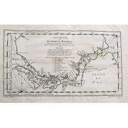
Carte Reduite Du Détroit de Magellan...
Bellin's important and interesting map of the Straits of Magellan and parts of Tierra del Fuego. Extends from Cap des Vierges to Cap de la Victoire. Indicating many bays,...
Place & Date: Paris, ca. 1770
Selling price: $50
Sold in 2017
Carte de la Californie et des Pays Nord-Ouest..
From Diderot's Encyclopedia. The main map shows California and the north west coast as depicted in a four-sheet map of America, published by Claes Jansz Visscher in 1612:...
Place & Date: Paris, 1770
Selling price: $140
Sold in 2020
Hemisphere Occidental.
This is a most informative map of the Western Hemisphere by Brion de la Tour, dating to 1786. It covers the entire hemisphere in generous detail, covering North America a...
Place & Date: Paris, ca 1770
Selling price: $110
Sold in 2019
Vue de la Rue grande vers l'Eglise du Sud des Presbiteriennes a Boston. [Vue de Boston].
A "vue d'optique" or perspective view. These popular engravings were published in Europe during the last half of the 18th century. They were meant to be seen th...
Place & Date: Augsburg, 1770
Selling price: $225
Sold in 2019
[Lot of 9 maps and prints]. Kaart van Brasil en de Aller-heiligen Baay waar aan de Hoofdstad legt van Brazil.
[Lot of 9 maps and prints of Brasil].- Kaart van de Aller-heiligen Baay waar aan de Hoofdstad legt van Brazil. - Carte du Bresil Prem. Partie- Suite du Bresil- Suite du ...
Place & Date: Amsterdam, ca 1770
Selling price: $150
Sold in 2023
Partie de la carte du Captaine Cluny..
From Diderot's Encyclopaedia . Based on Captain Cluny's map of 1769 published in London in American Traveller .
Place & Date: Paris 1771
Selling price: $430
Sold
Carte du Paraguay et des Pays voisin.
Jaques Nicolas Bellin (1702-720) was the most important French hydrographer of the 18th century. Sea-atlas 'Hydrographique Français' , 1756-65, atlas to accompany Prévo...
Place & Date: Amsterdam, 1771
Selling price: $110
Sold
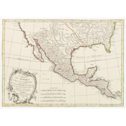
Carte du Mexique ou de la Nlle. Espagne Contenant aussi le Nouveau Mexique, la Californie, avec une Partie des Pays adjacents..
Attractive map covering the region from the Chesapeake Bay through California with Mexico and Central America.Excellent detail, particularly of the Jesuit missions in Mex...
Place & Date: Paris, 1771
Selling price: $250
Sold in 2022
An exact chart of the River St. Laurence, from Fort Frontenac to the Island of Anticosti, shewing the soundings, rocks, shoals &c.
Published in "A General Atlas", with dedication to Jn. Montague, Earl of Sandwich. Dated 1771. This is the fourth state of five. With five insets. A chart of th...
Place & Date: London, Robert Sayer, 1771
Selling price: $900
Sold in 2013
The British Troops entering the Breach of the Moro Castle Engraved for Mountagues History of England.
The scene "CUBA: BATTLE OF HAVANA", British troops entering the breach in the fortress, Morro Castle, during the Battle of Havana, in the July of 1762. Engraved...
Place & Date: London, 1771
Selling price: $60
Sold in 2017
Carte De La Terre Ferme, de la Guyane, et du Pays des Amazones...
Fine map of the northern part of South America, including Aruba, Bonaire, Curacao, Trinidad, Columbia, Peru, Venezuela, Ecuador, Guyana, and the northern part of Brazil. ...
Place & Date: Paris, 1771
Selling price: $75
Sold in 2018
CARTE REDUITE DES ISLES MALOUINES OU .. ISLES DE FALKLAND 1771
Large-scale nautical chart of the Falkland islands with rhumb lines, soundings and anchorages, detailed chart with depth soundings and the tracks of recent French and Eng...
Place & Date: Paris, 1771
Selling price: $250
Sold in 2021



![[Six engraved gores for a 20cm diameter terrestrial globe, showing the western hemisphere]](/uploads/cache/27976-250x250.jpg)




![Kaart van geheel GUAJANA of de WILDEN-KUST, en die der Spaansche Westindien [and] Het Eiland KURASSAU. [and] KAART van de Volkplanting aan DEMERARY en RIO D'ESSEQUEBO.](/uploads/cache/82588-250x250.jpg)


![[North America].](/uploads/cache/39534-250x250.jpg)


![The Coast of New Found Land From Salmon Cove to Cape Bonavista. . . [together with] The Coast of New Found Land from Cape-Raze to Cape St-Francis.](/uploads/cache/40658-250x250.jpg)














![Untitled [Nordlicher Theil des Grossen Süd Meers].](/uploads/cache/23671-250x250.jpg)
![Untitled [Nordlicher Theil des Grossen Süd Meers].](/uploads/cache/24713-250x250.jpg)






![Vue de la Rue grande vers l'Eglise du Sud des Presbiteriennes a Boston. [Vue de Boston].](/uploads/cache/43546-250x250.jpg)
![[Lot of 9 maps and prints]. Kaart van Brasil en de Aller-heiligen Baay waar aan de Hoofdstad legt van Brazil.](/uploads/cache/19736-250x250.jpg)


