Browse Listings in America
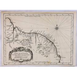
Carte de la Guyane.
A map of the Guyanas - present day Guyana, Suriname and French Guiana, including Paramaribo and Cayenne. The map features a decorative rococo style title cartouche. By Be...
Place & Date: Paris, 1757
Selling price: $17
Sold in 2018
Carte de la Caroline et Georgie.
A pleasant map depicting the eastern coast of the United States from Savannah (GA) to Edenton (NC) as well as the inland corresponding to today Carolinas. Includes part o...
Place & Date: Paris, 1757
Selling price: $85
Sold in 2019
Carte de la Virginie, de la Baye Chesapeack, et Pays Voisins.
An attractive and detailed map of the Chesapeake, Virginia, Maryland, Delaware, just before the settlement between Penn and Lord Baltimore, with Delaware properly shown a...
Place & Date: Paris, 1757
Selling price: $135
Sold in 2019
Carte du Cours du Fleuve de St. Laurent Depuis son Embouchure Jusqu'au Dessus de Quebec.
A detailed regional map of Canada, extending from Anticosti Island to just west of Quebec, centred on the St. Laurence River. From Abbe Prevost's "Histoire Generale...
Place & Date: Paris, 1757
Selling price: $26
Sold in 2021
Suite du Cours du Fleuve de St. Laurent Depuis Quebec Jusqu'a au Lac Ontario.
A detailed map of the region between Lake Ontario and the St. Lawrence River to Quebec. The map extends to Lake Champlain and Lake George, as well as Lake Nepissing with...
Place & Date: Paris, 1757
Selling price: $135
Sold in 2019
Carte de la Virginie, de la Baye Chesapeack, et Pays Voisins.
An attractive and detailed map of the Chesapeake, Virginia, Maryland, Delaware, just before the settlement between Penn and Lord Baltimore, with Delaware properly shown a...
Place & Date: Paris, 1757
Selling price: $150
Sold in 2020
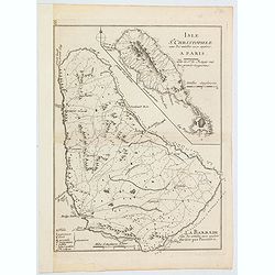
Isle St. Christophle. . ../ La Barbade. . .
Two maps on one sheet: top - St.Christopher and bottom - Barbados. George Louis Le Rouge was active from 1740 until 1780 as a publisher, and was appointed engineer for th...
Place & Date: Paris, 1757
Selling price: $15
Sold in 2020
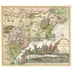
Recens Edita totius Belgii, in America
Arguably one of the most recognizable maps of the Northeastern American colonies this fifth state example of Novi Belgii by Tobias Conrad Lotter series does not disappoin...
Place & Date: Augsburg, Germany 1757
Selling price: $2300
Sold in 2023
Carte Réduite De L'Isle De Saint Christophe..
A well engraved and highly detailed large-scale map of St. Kitts, with highly detailed topography , many place names, and a beautiful title cartouche. At the upper right ...
Place & Date: Paris, 1758
Selling price: $750
Sold in 2018
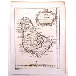
Carte de L'Isle de la Barbade Dressee au depost des cartes et plans de la marine..
This large scale coastal chart of Barbados, with hand-coloring, large decorative cartouche. Bellin (1703-1772) began working for the newly established Dépôt des Cartes ...
Place & Date: Paris 1758
Selling price: $150
Sold
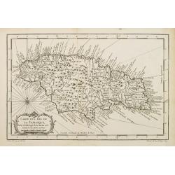
Carte de l?Isle de La Jamaique.
Jaques Nicolas Bellin (1702-720) was the most important French hydrographer of the 18th century. Sea-atlas 'Hydrographique Français' , 1756-65, atlas to accompany Prévo...
Place & Date: Paris, 1758
Selling price: $120
Sold
Carte de L'Isle de La Jamaique..
A good engraved map of the island with rococo title cartouche lower left.
Place & Date: Paris, 1758
Selling price: $150
Sold in 2017
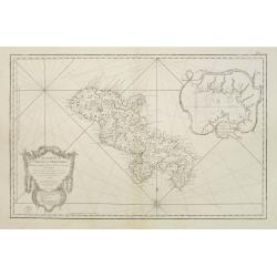
Carte Réduite de l'Isle de la Martinique Dresée au Dépost des Cartes et Journaux de la Marine Pour le Service des Vaisseaux du Roy. Par ordre de M. de Moras Ministre et Secretaire d'Etat ayant le Département de la Marine.
This handsome large scale chart shows parishes, towns, plantations, windmills, roads anchorages and a few soundings. The inset shows a close up of the town and harbor of ...
Place & Date: Paris 1758
Selling price: $250
Sold
Carte de L'Isle de La Jamaique..
A good engraved map of the island Jamaica with rococo title cartouche lower left. From l'Histoire générale des voyages .
Place & Date: Paris 1758
Selling price: $50
Sold
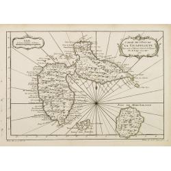
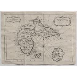
Carte de L'Isle de la Guadeloupe.
A good engraved map of Guadeloupe. The geographical features are typical with somewhat exaggerated bays and inlets. From l'Histoire générale des voyages .
Place & Date: Paris 1758
Selling price: $30
Sold
Carte de l?Isle de La Jamaique.
Jaques Nicolas Bellin (1702-720) was the most important French hydrographer of the 18th century. Sea-atlas 'Hydrographique Français' , 1756-65, atlas to accompany Prévo...
Place & Date: Paris, 1758
Selling price: $140
Sold
Karte von Luisiana, dem Laufe des Mississipi und den benachbarten Laendern. . .
A scarce German text edition of de l'Isles map, covering all the known United States, from the Rio del Norte (extending north almost to the Missouri headwaters) to the Gr...
Place & Date: Leipzig, 1744 - 1758
Selling price: $1200
Sold in 2011
Karte von der Bay Chesapeack und den benachbarten Landen
Bellin\'s important and interesting map of the Chesapeake Bay, with excellent detail on New Jersey, Maryland, Virginia, and Pennsylvania. Indicating many cities and vill...
Place & Date: Paris, c.1758
Selling price: $275
Sold in 2008
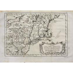
Karte von Neu England Neu Yorck und Pensilvanien.
Bellin's important and interesting map of the North-East U.S. German Edition published in "Historie der Reisen." Very detailed, showing many cities and villages...
Place & Date: Paris, c1758
Selling price: $220
Sold in 2008
Carte de l''Amérique Méridionale..
A good engraved map of South America with rococo title cartouche lower right. From l'Histoire générale des voyages .
Place & Date: Paris, 1758
Selling price: $60
Sold in 2015
A DRAUGHT OF VIRGINA from the Capes to York in York River and to Kuiquotan or Hamton in James River.
A large fragment of this significant chart. Shows the cities of Norfolk and Hamton, many bays, islands, and depth soundings.Includes the large title cartouche, a compass ...
Place & Date: London,Mount & Page, c1758
Selling price: $310
Sold in 2010
Carte de L'isle de la Barbade.
One of the finest early maps or charts of Barbados. The island is divided into parishes and details cities & towns, mountains, forests, anchorages, shoals, rocks, etc...
Place & Date: Paris, 1758
Selling price: $95
Sold in 2017
Carte de l'Isle de la Barbade dressee au Depost des Cartes et Plans de la Marine...
Bellin's famous large scale map of Barbados - one of the best antique maps of the island, with many details such as parishes, villages, churches, streets, anchorages, sho...
Place & Date: Paris, 1758
Selling price: $150
Sold in 2016
Karte von dem laufe des Flusses St. Laurenz von seiner Mündung an bis über Quebec. . .1757. [together with] Fernerer Lauf des Flusses St. Laurentz. . .
Two maps of the entrance of the St. Laurence river up beyond Quebec. With a second map from Quebec to Lake Ontario.From a German edition of the ' Histoire. des Voyages'. ...
Place & Date: Augsburg, 1758
Selling price: $75
Sold in 2018
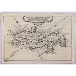
Carte de l'Isle de la Martinique.
A well engraved map of Martinique. The geographical features are typical, with somewhat exaggerated bays and inlets. From the l'Histoire Générale des Voyages. It featur...
Place & Date: Paris, 1758
Selling price: $20
Sold in 2018
Vue de L'isle de Juan Fernandes. . .
A striking map of Juan Fernandez Island also known as Mas a Tierra. It is west of San Antonio, Chile in the South Pacific. It is thought to have inspired Robinson Crusoe....
Place & Date: Paris, 1758
Selling price: $35
Sold in 2020
Carte de L'Isle de Saint Domingue.
A fine 1758 Bellin map of the Dominican Republic and Haiti. Taken from a later edition of Abbe A.F. Prevost d'Exiles's "Histoire generale des voyages". It featu...
Place & Date: Paris, 1758
Selling price: $43
Sold in 2020
Carte de L'Isle de la Guadaloupe.
A fine 1758 Bellin map of Guadeloupe. Taken from a later edition of Abbe A.F. Prevost d'Exiles's "Histoire generale des voyages". It features a decorative flora...
Place & Date: Paris, 1758
Selling price: $50
Sold in 2020
Carte de l'Isle de la Barbade.
A large engraved nautical chart,also showing the division of the Parishes, towns and fortifications. An exceptional onboard document of this rare and fabulous maritime at...
Place & Date: Paris, 1758
Selling price: $200
Sold in 2020
ANTIGUA, - Carte reduite de l'isle d'Antigue ; dressée au Dépost des cartes, plans et journaux de la marine : pour le service des vaisseaux du roy. . .
A very rare and large nautical map of the island of Antigua, by Bellin, at Dépost des cartes, plans et journaux de la marine. Relief shown pictorially. Depths by soundin...
Place & Date: Paris, 1758
Selling price: $290
Sold in 2022
Grundriss von der Stadt Buenos-Ayres.
The early layout of the town of Buenos Aires is shown in block formation, with a few of the important buildings named, these include: the Governor's Residence, the City H...
Place & Date: Leipzig, 1758
Selling price: $75
Sold in 2023
Carte réduite de l'isle d'Antigue
Large and detailed chart of Antigua. One of the best 18th Century maps of the island. Shows villages, windmills, hills, streets, Parishes, bays, anchorages, depth soundin...
Place & Date: Paris, 1758
Selling price: $100
Sold in 2022
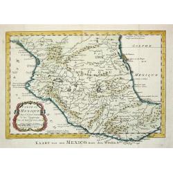
Carte de Mexique, 1754.
Jaques Nicolas Bellin (1702-720) was the most important French hydrographer of the 18th century. Sea-atlas 'Hydrographique Français' , 1756-65, atlas to accompany Prévo...
Place & Date: Amsterdam, 1759
Selling price: $95
Sold
Carte de Isthme de Panama et des Provinces de Veragua, Terre Ferme, et Darien.
Jaques Nicolas Bellin (1702-720) was the most important French hydrographer of the 18th century. Sea-atlas 'Hydrographique Français' , 1756-65, atlas to accompany Prévo...
Place & Date: Amsterdam, 1759
Selling price: $100
Sold in 2018
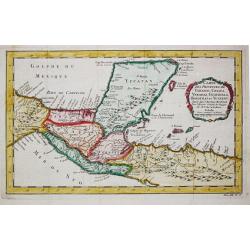
Carte des provinces des Tabasco, Chiapa, Verapaz, Guatamala, Honduras et Yucatan.
Jaques Nicolas Bellin (1702-720) was the most important French hydrographer of the 18th century. Sea-atlas 'Hydrographique Français' , 1756-65, atlas to accompany Prévo...
Place & Date: Amsterdam, 1759
Selling price: $120
Sold
Guadeloupe, one of the Caribee Islands in the West Indies from the latest Discovery.
Guadeloupe, one of the Caribee Islands in the West Indies from the latest Discovery. By John Hinton. Published in London March 1759, in "The Universal Magazine of Kn...
Place & Date: London 1759
Selling price: $60
Sold in 2015
Nova Tabula Americae.
A rare map of the Americas showing California as an island, published by Georg Christoph Kilian. Map gives some very good detail, however, Brazil is still distorted, Cali...
Place & Date: Augsburg, 1759
Selling price: $120
Sold in 2019
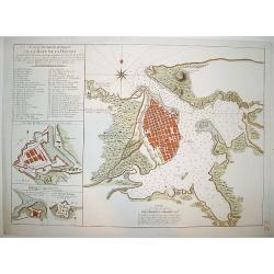
Carte Hydrographique de la Baye de la Havane
A beautifully engraved and detailed chart of the bay of Havana and plan of the city itself. Includes three inset plans of Havana's principal fortifications and a 45 point...
Place & Date: Paris, ca 1760
Selling price: $1000
Sold
Pensylvania, Nova Jersey et Nova York..
One of the few maps to concentrate on this area and one of the most bizarre maps of North America ever published. It was based on a very rare map by Lewis Evans published...
Place & Date: Augsburg c.1760
Selling price: $2225
Sold
Amérique Septentrionale divisée en ses principales..
A finely engraved map of North America, prepared by J.B.Nolin. The map is most notable for it's depiction of Mer de L'Quest or Sea of the West, a great sea, easily the si...
Place & Date: Paris c.1760
Selling price: $325
Sold
Eine neue karte von den Gegenden 1746 und 1747 eine Nord-Westliche Durchfahrt..
Uncommon map of Hudson, Great Lakes and northern Atlantic, showing the tracks of Captain Heinrich Ellis from London to the Hudson.
Place & Date: Germany 1760
Selling price: $260
Sold
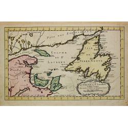
Carte du Golphe de St. Laurent et Pays Voisins.
Jaques Nicolas Bellin (1702-720) was the most important French hydrographer of the 18th century. Sea-atlas 'Hydrographique Français' , 1756-65, atlas to accompany Prévo...
Place & Date: Paris, c. 1760
Selling price: $100
Sold
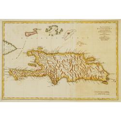
The island of Hispaniola called by the French St.Domingo..
The much contested island of Hispaniola at the height of the French side's prosperity, from Jeffery's The Natural and Civil History of the French Dominions in North and S...
Place & Date: London 1760
Selling price: $250
Sold
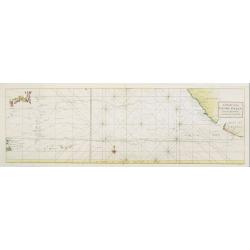
A Chart of the PACIFIC OCEAN..
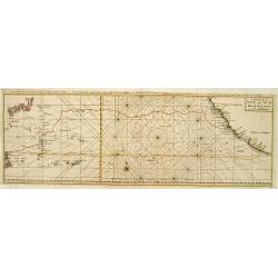
Showing in the left southern coastline of Japan and eastern coastline of Philippines. To the right Americas West Coast from Acapulco up to Los Farollones. Showing tracks ...
Place & Date: London, 1760
Selling price: $425
Sold in 2010
Carte de la Mer du Sud ou Mer Pacifique..
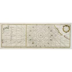
Showing in the left southern coastline of Japan and eastern coastline of Philippines. To the right Americas West Coast from Acapulco up to Los Farollones. Showing tracks ...
Place & Date: France c.1760
Selling price: $180
Sold
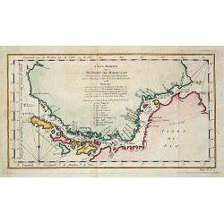
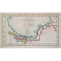
Carte réduite du Détroit de Magellan
Jaques Nicolas Bellin (1702-720) was the most important French hydrographer of the 18th century. Sea-atlas 'Hydrographique Français' , 1756-65, atlas to accompany Prévo...
Place & Date: Amsterdam, c. 1760
Selling price: $150
Sold
Carte de l'Isle de la Grenade..
This chart shows the island Grenada. It contains an inset coastal profile and numerous rhumb linesJacques Nicolas Bellin (1703-1772) was one of the most important and pro...
Place & Date: Paris 1760
Selling price: $185
Sold
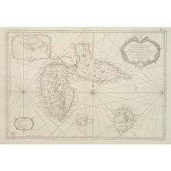
Carte Reduite des Isles de la Guadeloupe Marie Galante et les Saintes..
Superb large-scale sea chart with great detail of parishes, forts, towns, settlements, anchorages and topography. Includes Guadeloupe, Isles de Saintes and Marie Galante ...
Place & Date: Paris 1760
Selling price: $200
Sold in 2008
Carte de la Mer du Sud ou Mer Pacifique..
Showing in the left southern coastline of Japan and eastern coastline of Philippines. To the right Americas West Coast from Acapulco up to Los Farollones.Showing tracks o...
Place & Date: France c.1760
Selling price: $100
Sold
Carte réduite du Détroit de Magellan.
Jaques Nicolas Bellin (1702-720) was the most important French hydrographer of the 18th century. Sea-atlas 'Hydrographique Français' , 1756-65, atlas to accompany Prévo...
Place & Date: Paris, c. 1760
Selling price: $80
Sold
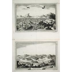
Ancien Mexico / Nouveau Mexico.
2 views of Mexico city, as in the times of the conquestedores and as in the 18th century.
Place & Date: Paris, c. 1760
Selling price: $200
Sold
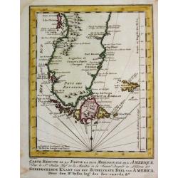
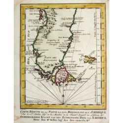
Carte Réduite de la Partie la plus Meridionale de l'Amerique.
Jaques Nicolas Bellin (1702-720) was the most important French hydrographer of the 18th century. Sea-atlas 'Hydrographique Français' , 1756-65, atlas to accompany Prévo...
Place & Date: Amsterdam, c. 1760
Selling price: $130
Sold
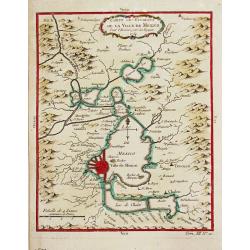
Carte des Environs de la Ville de Mexico, 1754.
Jaques Nicolas Bellin (1702-720) was the most important French hydrographer of the 18th century. Sea-atlas 'Hydrographique Français' , 1756-65, atlas to accompany Prévo...
Place & Date: Paris, c, 1760
Selling price: $75
Sold
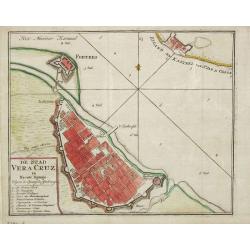
De Stad Vera Cruz in Nieuw Spanje.
Izaak Tirion (d. 1769) Amsterdam publisher. His "Nieuwe en beknopte handatlas" saw 6 editions between before 1740 and after 1784. Also "Tegenwoordige staat...
Place & Date: Amsterdam, c. 1760
Selling price: $70
Sold in 2014
Carte de l' Ocean Meridional, 1746.
Jaques Nicolas Bellin (1702-720) was the most important French hydrographer of the 18th century. Sea-atlas 'Hydrographique Français' , 1756-65, atlas to accompany Prévo...
Place & Date: Amsterdam, c. 1760
Selling price: $175
Sold
Carte de la Baye de Hudson.
Jaques Nicolas Bellin (1702-720) was the most important French hydrographer of the 18th century. Sea-atlas 'Hydrographique Français' , 1756-65, atlas to accompany Prévo...
Place & Date: Paris, c. 1760
Selling price: $90
Sold in 2019
Carte Réduite de la Partie la plus Meridionale de l'Amerique.
Jaques Nicolas Bellin (1702-720) was the most important French hydrographer of the 18th century. Sea-atlas 'Hydrographique Français' , 1756-65, atlas to accompany Prévo...
Place & Date: Amsterdam, c. 1760
Selling price: $65
Sold in 2008
Amerique Meridionale.
Jaques Nicolas Bellin (1702-720) was the most important French hydrographer of the 18th century. Sea-atlas 'Hydrographique Français' , 1756-65, atlas to accompany Prévo...
Place & Date: Paris, c. 1760
Selling price: $85
Sold in 2008
Carte du Golphe de St. Laurent et Pays Voisins.
Jaques Nicolas Bellin (1702-720) was the most important French hydrographer of the 18th century. Sea-atlas 'Hydrographique Français' , 1756-65, atlas to accompany Prévo...
Place & Date: Paris, c. 1760
Selling price: $135
Sold in 2008
Carte réduite du Détroit de Magellan
Jaques Nicolas Bellin (1702-720) was the most important French hydrographer of the 18th century. Sea-atlas ''Hydrographique Français'' , 1756-65, atlas to accompany Pré...
Place & Date: Amsterdam, c. 1760
Selling price: $125
Sold in 2008
Portrait of Johan Maurits van Nassau, governor of the Dutch colony in Brazil in the early 17th century.
Published by Isaac Tirion, Amsterdam ca. 1760, as part of a series of prints of historical figures.
Place & Date: Amsterdam, c.1760
Selling price: $75
Sold in 2008
NEW YORK AND PENSILVANIA
Charming little map of the Great Lakes, showing also Maryland, New York, and Pennsylvania. From the Atlas Minimus Illustratus. Includes Philadelphia, Ft. du Quesne, Kuski...
Place & Date: London, c.1760
Selling price: $110
Sold in 2009
Portrait of Johan Maurits van Nassau, governor of the Dutch colony in Brazil in the early 17th century.
Published by Isaac Tirion, Amsterdam ca. 1760, as part of a series of prints of historical figures.
Place & Date: Amsterdam, ca. 1760
Selling price: $50
Sold in 2009
L'Amérique septentrionale et Meridionale divisée en ses principales parties . . .
Unrecorded state of this fine map of the western hemisphere with inset maps of Martinique and Santa Domingo. To the right a text column showing the regional division of t...
Place & Date: Paris, 1760
Selling price: $600
Sold in 2015
Paraquariae Provinciae Soc. Jesu cum adiacentib. novissima descriptio. . .
Uncommon large map of the Paraguay provinces ruled by the Jesuits from Atlantic to Pacific ocean, including most of Peru, Bolivia, Brazil, Uruguay, Argentina and Chile, w...
Place & Date: Venice, 1760
Selling price: $900
Sold in 2012
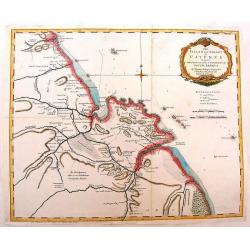
The Island & Colony of Cayenne Subject to the French, on the Continent of South America.
Scarce map of French Guiana was created by Thomas Jefferys (1695-1771) in 1760. He was geographer to his Royal Highness, the Price of Wales and was one of the most prolif...
Place & Date: London, 1760
Selling price: $46
Sold in 2014
An Accurate Map of South America Drawn from the Sieur Robert.
Detailed map of South America by George Rollos. From Vaugondy's map. Decorated with a fancy Rococo cartouche.
Place & Date: Paris, c1760
Selling price: $22
Sold in 2013
America Septentrionalis concinnata . . .
After the foundation map by de L'Isle published in 1700: which was the first map to reconnect California to the mainland and shows good detail for the Great Lakes and Hud...
Place & Date: Augsburg, 1760
Selling price: $600
Sold
L'Amerique divisée en ses principaux Etats.
A large uncommon map published by Lattré. This map is most notable for it's depiction of Mer ou Baye de L'Quest or Sea of the West. A great sea, easily the size of the M...
Place & Date: Paris, c 1760
Selling price: $170
Sold in 2014
Carolina By H. Moll, Geographer.
A detailed map that includes the Limit of King Charles ye II Granted to ye Present Proprietors of Carolina in 1663, the south bounds of Carolina (well into Florida), note...
Place & Date: London, c 1760
Selling price: $301
Sold in 2013
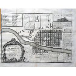
Plan de la ville de Santiago. . .
Early plan of Santiago de Chile, showing the squarish arranged streets, the Río Mapocho and its canals. A key identifies 23 churches and 5 important places on the map.
Place & Date: Paris, c1760
Selling price: $50
Sold in 2013
Representation du Cours Ordinaire des Vents de Traverse Qui Regnent le Long des Cotes dans la Mer Atlantique & celle des Indes.
This map shows the prevailing winds in the North Atlantic and Indian Oceans. Published in "Histoire Generale des Voyages". The engraver was Cosmant. Jacques N...
Place & Date: Paris, 1760
Selling price: $49
Sold in 2019
Carte réduite du Détroit de Magellan
Jaques Nicolas Bellin (1702-720) was the most important French hydrographer of the 18th century. Sea-atlas 'Hydrographique Français' , 1756-65, atlas to accompany Prévo...
Place & Date: Amsterdam, c. 1760
Selling price: $100
Sold in 2020
Mappa Geographica Americae Septentrionalis ad Emendatiora Exemplaria adhuc Edita . . .
Printed from 4 plates and showing the northern half continent with the Caribbean. Copper engraved map with original outline color, printed from 4 plates, after Leonhard E...
Place & Date: Berlin c. 1760
Selling price: $800
Sold in 2014
America Septentrionalis concinnata...
A copperplate colored map of the north east America, that shows California as an island, after the foundation map by de L'Isle published in 1700, which was the first map ...
Place & Date: Augsburg, 1760
Selling price: $500
Sold in 2017
America septentrionalis oder Mitternachtiger theil von America bestehend in Neu Brittania, Canada, Neu Engeland, Neu Schotland, Neu Jorck, Pensylvania, Carolina, Florida, Georgien. . .
A rare German map of the East Coast of North America. Shows the British Colonies at the end of the Franco-Indian War, and extends from Newfoundland until Florida, and wes...
Place & Date: Augsburg, ca 1760
Selling price: $220
Sold in 2018
Carte Reduite Du Détroit de Magellan. . .
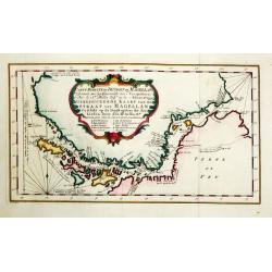
Bellin's important and interesting map of the Straits of Magellan and parts of Tierra del Fuego, dated 1753. It extends from Cap des Vierges to Cap de la Victoire, and in...
Place & Date: Paris, ca. 1760
Selling price: $50
Sold in 2021
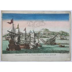
Vue perspective de la Ville de St. Francois de campeche dans l'Amerique Septentrionalle.
An optica print with a view on the city of Campeche, Yucatan, Mexico, several ships in the foreground. Published by Jean-François Daumont, Paris, ca. 1760.
Place & Date: Paris, ca. 1760
Selling price: $210
Sold in 2020
Carte Reduite de L'Isle de Cube [Cuba]. Dressee au Depoit des Cartes et Plans de la Marine. . .
A well engraved and highly detailed nautical chart of Cuba. It shows soundings, anchorage's, channels, shoals, navigational sightings. Also shows small parts of Florida a...
Place & Date: Paris, 1760
Selling price: $700
Sold in 2021
[A lot of 5 map of Guyana.] Land-kaart van Cayenne.
An attractive map of the island and settlement of Cayenne, with an inset picturing a plan of the town and fort of Cayenne. Izaak Tirion (d. 1769) Amsterdam publisher. H...
Place & Date: Amsterdam, c. 1760
Selling price: $275
Sold in 2022









![Karte von dem laufe des Flusses St. Laurenz von seiner Mündung an bis über Quebec. . .1757. [together with] Fernerer Lauf des Flusses St. Laurentz. . .](/uploads/cache/39140-250x250.jpg)






















![Carte Reduite de L'Isle de Cube [Cuba]. Dressee au Depoit des Cartes et Plans de la Marine. . .](/uploads/cache/84494-250x250.jpg)
![[A lot of 5 map of Guyana.] Land-kaart van Cayenne.](/uploads/cache/20452-250x250.jpg)