Browse Listings in America
Partie de l\'Amerique septentrionale.. le cours de L\'Ohio..
From the Atlas Universel , a detailed map extending the length of the east coast from Penobscot Bay to Cape Fear and, in an inset, from Cape Fear to Fort St.Georges. This...
Place & Date: Paris, 1755
Selling price: $1100
Sold in 2008
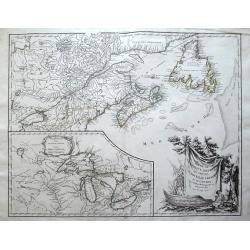
Partie de l'Amerique Septent. .
A fine copy of this map of New Foundland, Nova Scotia and the course of the St.Lawrence to Lake Ontario. An inset shows Bellini's famous and important map of the Great La...
Place & Date: Paris, 1755
Selling price: $950
Sold in 2014
Carte de la Riviere de la Plata.
Jaques Nicolas Bellin (1702-720) was the most important French hydrographer of the 18th century. Sea-atlas 'Hydrographique Français' , 1756-65, atlas to accompany Prévo...
Place & Date: Paris, c. 1755
Selling price: $100
Sold
Carte de l?Isle de St. Christofle.
Jaques Nicolas Bellin (1702-720) was the most important French hydrographer of the 18th century. Sea-atlas 'Hydrographique Français' , 1756-65, atlas to accompany Prévo...
Place & Date: Paris, c.1755
Selling price: $85
Sold
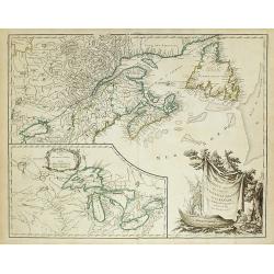
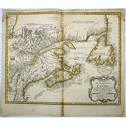
Partie de l'Amerique Septent? qui comprend la Nouvelle France ou le Canada..
Robert de Vaugondy's superb map of French Canada with an inset on the lower left of the still not completely defined Great Lakes.The highly decorative title cartouche fea...
Place & Date: Paris 1755
Selling price: $800
Sold
Carte du Pérou.
Jaques Nicolas Bellin (1702-720) was the most important French hydrographer of the 18th century. Sea-atlas 'Hydrographique Français' , 1756-65, atlas to accompany Prévo...
Place & Date: Paris, c. 1755
Selling price: $80
Sold
Carte de la Riviere de la Plata.
Jaques Nicolas Bellin (1702-720) was the most important French hydrographer of the 18th century. Sea-atlas 'Hydrographique Français' , 1756-65, atlas to accompany Prévo...
Place & Date: Paris, c. 1755
Selling price: $120
Sold
Nieuwe kaart van de Grootbrittannische volkplantingen ..
A wonderful map of the situation in North America at the beginning of the French & Indian War. By the middle of the eighteenth century, the French, who claimed the en...
Place & Date: Amsterdam 1755
Selling price: $700
Sold
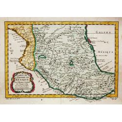
Carte de l'Empire de Mexique, 1754.
Jaques Nicolas Bellin (1702-720) was the most important French hydrographer of the 18th century. Sea-atlas 'Hydrographique Français' , 1756-65, atlas to accompany Prévo...
Place & Date: Paris, c. 1755
Selling price: $80
Sold in 2020
Carte Réduite des Isles Açores Pour servir aux Vaisseaux du Roy..
A well engraved and highly detailed chart. It shows soundings, anchorage's, channels, shoals, navigational sightings. Engraved by Petit, engraver for the Depot Générale...
Place & Date: Paris, 1755
Selling price: $650
Sold in 2020
Nouvelle Ecosse ou Partie Orientale du Canada ...
A Parisian edition of Thomas Jeffery's map of Nova Scotia and Cape Britain. At the time of publication, 1755, Great Britain and France were in dispute over their boundary...
Place & Date: Paris, 1755
Selling price: $500
Sold in 2014
Partie de l\'Amerique Septent? Qui comprend la Nouvelle France ou le Canada ?
Robert de Vaugondy's superb map of French Canada with an inset on the lower left of the still not completely defined Great Lakes.The highly decorative title cartouche fea...
Place & Date: Paris, 1755
Selling price: $600
Sold in 2009
Partie de l\'Amerique Septent? Qui comprend la Nouvelle France ou le Canada ?
Robert de Vaugondy's superb map of French Canada with an inset on the lower left of the still not completely defined Great Lakes.The highly decorative title cartouche fea...
Place & Date: Paris, 1755
Selling price: $380
Sold in 2010
Carte des possessions Angloises et Françoises du continent de l'Amerique Septentrionale. / Kaart van de Engelsche en Fransche bezittingen . . .
A great French and Indian War map, with the states of Florida, Georgia, North and South Carolina, Virginia, Pennsylvania, Maryland, Jersey, New York, Connecticut, Massach...
Place & Date: Amsterdam, 1755
Selling price: $1500
Sold in 2019
L'Isthme de l'Acadie Baye du Beaubassin en Anglois Shegnekto. Environs du Fort Beausejour.
Important and very rare map describing the first battle of the French and Indian War in Canada in 1755The copper engraved map published by G. L. le Rouge in 1755 showing ...
Place & Date: Paris, 1755
Selling price: $3000
Sold in 2011
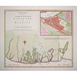
Landkaart van den Volkplantingen Surianme en Berbice.
Beautifully delineated map of Suriname identifying major plantations, waterways and towns. There is a plan of the capital, Paramaribo, in the upper right and corner with ...
Place & Date: Amsterdam, ca. 1755
Selling price: $180
Sold in 2011
Partie Orientale du Canada. . .
A Parisian edition of Thomas Jeffery's map of Nova Scotia and Cape Britain. At the time of publication, 1755, Great Britain and France were in dispute over their boundary...
Place & Date: Paris, 1755
Selling price: $500
Sold in 2012
Partie de l'Amerique Septent? qui comprend la Nouvelle France ou le Canada. . .
Robert de Vaugondy's superb map of French Canada with an inset on the lower left of the still not completely defined Great Lakes.The highly decorative title cartouche fea...
Place & Date: Paris, 1755
Selling price: $250
Sold in 2012
Canada Louisiane et Terres Angloises.
The northwest sheet of a four-sheet map featuring the Great Lakes and upper Mississippi River. Large, decorative cartouche designed by Gravelot. The map was based in part...
Place & Date: Paris, 1755
Selling price: $300
Sold in 2012
Partie de l\'Amerique septent? Qui comprend la nouvelle France. . .
A fine copy of this map of New Foundland, Nova Scotia and the course of the St. Lawrence to Lake Ontario in a fourth state.An inset shows Bellini's famous and important m...
Place & Date: Paris, 1755
Selling price: $255
Sold in 2013
Partie de l'Amerique Septent? qui comprend la Nouvelle France ou le Canada...
Vaugondy's important map of French Canada with a large inset of the Great Lakes.Decorated with a large title cartouche features the title draped over a canoe and a beaver...
Place & Date: Paris, 1755
Selling price: $300
Sold in 2014
Partie Occidentale de la Nouvelle France ou des Canada.
A fine large-scale map derived from Bellin's landmark map of the Great Lakes which first appeared in Charlevoix's Histoire in 1744. The chart incorporates the work of Sie...
Place & Date: Nuremberg, 1755
Selling price: $1500
Sold in 2015
Partie Occidentale de la Nouvelle France ou de Canada.
An important and influential map of the Great Lakes region during the time of French colonial occupation. This map was originally engraved by Jacques Bellin in 1745, howe...
Place & Date: Nuremberg, 1755
Selling price: $550
Sold in 2017
Partie orientale de la Nouvelle France ou du Canada.
This is a finely engraved map which embraces Eastern Canada and Northern New England, and is focused on the River and Gulf of St. Lawrence, then the gateway to French Nor...
Place & Date: Nuremberg, 1755
Selling price: $220
Sold in 2018
A Map of the British and French Settlements in North America.
An interesting and informative map highlighting (in green) the areas of dispute between England and France and the beginning of the French & Indian War. Explanatory n...
Place & Date: London, 1755
Selling price: $60
Sold in 2016
Partie Orientale de la Nouvelle France ou du Canada...
Homann Heirs issue of Bellin's important map of the French explorations in eastern Canada around the River and Gulf of St. Lawrence. Map extends from Newfoundland to Lake...
Place & Date: Nuremberg, 1755
Selling price: $305
Sold in 2017
A Map of the British and French Settlements in North America.
This is the first map illustrating the French - British conflict in North America. It was issued just before the French and Indian War was officially. It illustrates by h...
Place & Date: London, 1755
Selling price: $165
Sold in 2017
Carte De La Virginie Et Du Maryland Dressee sur la grande carte Angloise de Mrs. Josue Fry et Pierre Jefferson (First State, with Lord Fairfax Line Shown), 1755
A copperplate border-colored map of Virginia and Maryland. A striking example of the single sheet version of the seminal Fry-Jefferson map, engraved by Elisabeth Haussard...
Place & Date: Paris, 1755
Selling price: $2000
Sold in 2017
Karte von den Kusten des Franzosischen Florida.
A nice, uncommon map of French Florida, covering South Carolina, Georgia and Florida, from the German edition of Charlevoix's History of New France.The map extent is fro...
Place & Date: Paris, 1744-1755
Selling price: $36
Sold in 2019
Carolinae[,] Floridae nec non Insularum Bahamensium cum partibus adjacendibus delineatio ad Exemplar Londinense in lucem edita a Ioh. Michael Seligmann[,] Norimbergae Ao. 1755
The first and only continental edition of one of the finest and most important maps of southeastern North America – Catesby's Map of Carolina, Florida, and the Bahama I...
Place & Date: Nuremberg, 1755
Selling price: $1900
Sold in 2020
A Map of the British and French Settlements in North America.
An interesting and informative map highlighting the dispute (the shaded areas) between England and France at the beginning of the French & Indian War. Explanatory not...
Place & Date: London, 1755
Selling price: $215
Sold in 2019
Carte D'Une Partie de L' AMERIQUE SEPTENTRIONALE.
A fine example of this highly detailed set of maps illustrating the British Colonies in North America at the conclusion of the American Revolution, published by Soules in...
Place & Date: Paris, ca 1755
Selling price: $800
Sold in 2019
A NEW CHART of the Vast ATLANTIC OCEAN, Exhibiting The SEAT of WAR, both in EUROPE and AMERICA. [Popple]
A scarce map of the Atlantic with Sailing Routes To New York & Boston. A fine example of Emmanuel Bowen's fascinating broadside map of the Atlantic, which includes a ...
Place & Date: London, 1755
Selling price: $425
Sold in 2019
Canada Louisiane et Terres Angloises.
The two northern sheets of a four-sheet map featuring the Great Lakes, the upper Mississippi River and the Atlantic coast region. Large, decorative cartouche designed by ...
Place & Date: Paris, 1755
Selling price: $550
Sold in 2020
Partie Occidentale de la NOUVELLE FRANCE ou du CANADA.
A fine large-scale map derived from Bellin's landmark map of the Great Lakes which first appeared in Charlevoix's Histoire in 1744. However, Homann's publication is more ...
Place & Date: Nuremberg, 1755
Selling price: $1000
Sold in 2020
CARTE DE L'AMERIQUE SEPTENTRIONALE, Depuis le 28 Degre...[Sea of the West]
A large and rare map that covers nearly all of North America, especially the USA. An important map of North America, with interesting geographical features: * Incorperati...
Place & Date: Paris, 1755
Selling price: $1500
Sold in 2021
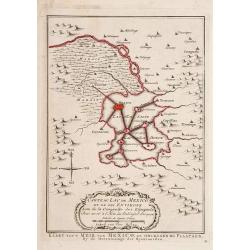
Carte du Lac de Mexico et de ses Environs.
"Uncommon edition of this accurate map showing Mexico City and surrounding areas, the ranges and villages of numerous Indian tribes are shown.From Atlas Portatif pou...
Place & Date: Amsterdam 1756
Selling price: $100
Sold
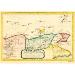
Carte des Provinces des Caracas, Comana et Paria.
Jaques Nicolas Bellin (1702-720) was the most important French hydrographer of the 18th century. Sea-atlas "Hydrographique Français", 1756-65, atlas to accompa...
Place & Date: Paris, c. 1756
Selling price: $140
Sold in 2009
Isle de St. Domingue.
Fine map of Haiti and the Dominican Republic. Striking map of the island with detailed rendering of roads and topography. George Louis Le Rouge was active from 1740- till...
Place & Date: Paris 1756
Selling price: $70
Sold
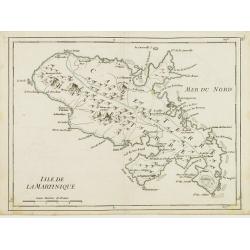
Isle de la Martinique.
Detailed map on the island of Martinique in the Caribbean. Villages, forts, mountains and bays all around the island are named. George Louis Le Rouge was active from 1740...
Place & Date: Paris 1756
Selling price: $65
Sold
La Jamaique.. La Bermude..
Two maps on one sheet, Jamaica above Bermuda. Jamaica is engraved to show the plantations, denoting those growing sugar, cotton, cacao, and indigo. The map of Bermuda inc...
Place & Date: Paris 1756
Selling price: $155
Sold
Carte des Provinces des Caracas, Comana et Paria.
Jaques Nicolas Bellin (1702-720) was the most important French hydrographer of the 18th century. Sea-atlas 'Hydrographique Français' , 1756-65, atlas to accompany Prévo...
Place & Date: Paris, c. 1756
Selling price: $100
Sold in 2009
Karte von dem Ostlichen-Stucke von Neu Frankreich oder Canada..
The German edition after Bellin's map that served as the basis for numerous maps to follow. Includes eastern Canada and Newfoundland including Nova Scotia (Arcadia) and P...
Place & Date: Leipzig 1756
Selling price: $390
Sold
Karte von den Küsten des Französischen Florida..
An attractive map of the coast from Cape Fear, North Carolina, to St. Augustine, Florida. This is a German adaptation of a Bellin map, identifying rivers and major towns....
Place & Date: Leipzig 1756
Selling price: $130
Sold
Amerique Septentrionale avec les Routes, Distances en miles, Limites et Etablissements François et Anglois Par le Docteur Mitchel Traduit de 'Anglois..
First French edition of the famous John Mitchell map of the British and French Dominions in North America. Includes the word Limites in the title rather than Villages whi...
Place & Date: Paris 1756
Selling price: $10500
Sold
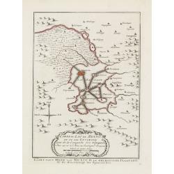
Carte du Lac de Mexico et de ses Environs.
Uncommon edition of this accurate map showing Mexico City and surrounding areas, the ranges and villages of numerous Indian tribes are shown.FromAtlas Portatif pour servi...
Place & Date: Amsterdam, 1756
Selling price: $160
Sold
Carte des Provinces de Tierra Firme Darien Cartagene ..
Uncommon edition of this accurate map showing covering Panama and Colombia, the ranges and villages of numerous Indian tribes are shown.FromAtlas Portatif pour servir a l...
Place & Date: Amsterdam, 1756
Selling price: $150
Sold in 2008
Suite de Perou Audience de Charcas.
Uncommon edition of this accurate map showing the southern Peruvian coast, the ranges and villages of numerous Indian tribes are shown.FromAtlas Portatif pour servir a l'...
Place & Date: Amsterdam, 1756
Selling price: $50
Sold in 2020
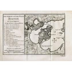
Grundriss von der Stadt Boston und ihren Gegenden
Rare German edition of this detailed plan of the city of Boston with its harbour and surrounding area. Indicates principal buildings such as the various forts and their a...
Place & Date: Paris, c1756
Selling price: $280
Sold in 2008
Baye et Port de Boston. Tire des Manuscrits de M. le Chevalier de la Rigaudiere Lieutenant de Vaissau du Roy . A Paris par le Rouge. Rue des Augustins
Unrecorded and exceptional rare chart of the Bay around Boston during the French & Indian WarAn unrecorded sea chart of Boston by G. L. le Rouge during the French &am...
Place & Date: Paris, 1756
Selling price: $7100
Sold in 2010
Carte des Possessions Françoises et Angloises dans le Canada et partie de la Lousiane. . .
First state, separately published. This map was published in 1756 to provide information on the French-Indian wars.
Place & Date: Paris, 1756
Selling price: $950
Sold in 2013
A Map of the Isthmus of Darien and Bay of Panama.
A fine little map featuring the Isthmus of Darien and Bay of Panama. Crrently, the country of Panama and the Panama Canal are located in this Isthmus. Block cartouche. T...
Place & Date: London, 1756
Selling price: $100
Sold in 2013
Carte des Possessions Françoises et Angloises dans le Canada et Partie de la Louisiana. . .
First state of this separately published map of the European Colonies in the New World east of the Mississippi River. This map was published in 1756 to provide informatio...
Place & Date: Paris, 1756
Selling price: $1000
Sold in 2021
Partie Orientale de la Nouvelle France ou du Canada. . .
A remarkably detailed map of North Eastern Canada, including Nova Scotia, Newfoundland and Labrador. The vertical projection shows the St. Lawrence River running nearly n...
Place & Date: Augsburg, 1756
Selling price: $700
Sold in 2021
Carte de la Caroline et Georgie..
Jaques Nicolaas Bellin (1703-1772) was one of the most important and proficient French cartographers of the mid-eighteenth century. He was appointed the first Ingenieur H...
Place & Date: Paris 1757
Selling price: $260
Sold
L'Amerique Meridionale Dressée sur les Observations
Detailed map of South America prepared by De L'Isle, with fine title cartouche.
Place & Date: Amsterdam 1757
Selling price: $320
Sold
Carte de la Californie, Levée par la Société des Jesuites..
Uncommon updated version of Father Kino's epoch-making map of 1705 which was finally to decide De L'Isle as to California being a peninsula and, through him, to influence...
Place & Date: Paris, after 1757
Selling price: $300
Sold
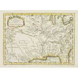
Carte de la Louisiane et pays Voisins.
Accurate map showing the lower Mississippi River and surrounding areas, the ranges and villages of numerous Indian tribes are shown.Jacques Nicolas Bellin (1703-1772) was...
Place & Date: Paris, 1757
Selling price: $400
Sold in 2011
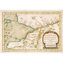
Suite du Cours du Fleuve de St.Laurent depuis Quebec jusqu' au Lac Ontario.
A map of Prevost's 'Hist. des Voyages', depicting the cours of the St. Lawrence river from lake Onario to Quebec.Jaques Nicolaas Bellin (1703-1772) was one of the most im...
Place & Date: Paris, 1757
Selling price: $350
Sold
Carte de la Baye de Hudson..
Jacques Nicholas Bellin (1703-1772) was one of the most important and proficient French cartographers of the mid-eighteenth century. He was appointed the first Ingenieur ...
Place & Date: Paris, 1757
Selling price: $240
Sold
Suite du Cours du Fleuve de St.Laurent..Ontario.
A map of Prevost's 'Hist. des Voyages', depicting the course of the St. Lawrence river from lake Ontario to Quebec.Jacques Nicolas Bellin (1703-1772) was one of the most ...
Place & Date: Paris 1757
Selling price: $100
Sold
Carte du Cours du Fleuve de St.Laurent..Quebec.
A map of Prevost's 'Hist. des Voyages', depicting the course of the St. Lawrence river from Quebec to the Atlantic.Jacques Nicolas Bellin (1703-1772) was one of the most ...
Place & Date: Paris 1757
Selling price: $180
Sold
Carte du Golphe de St.Laurent et Pays Voisins..
Accurate map depicting the gulf of St. Lawrence and the surrounding area, included the isle of Newfoundland.Jacques Nicolaas Bellin (1703-1772) was one of the most import...
Place & Date: Paris 1757
Selling price: $80
Sold
Carte de la Louisiane et pays Voisins.
Accurate map showing the lower Mississippi River and surrounding areas, the ranges and villages of numerous Indian tribes are shown.Jacques Nicolaas Bellin (1703-1772) wa...
Place & Date: Paris 1757
Selling price: $170
Sold
Carte de la Caroline et Georgie..
Accurate map depicting the eastern coast of the United States from Savannah to Edenton as well as the inland corresponding to today Carolinas. Includes part of Georgia.Ja...
Place & Date: Paris 1757
Selling price: $100
Sold
Carte Des Parties Du Nord-Ouest De L'Amerique Suivant les Voyages de Middleton et d Ellis..
Very nicely engraved chart that covers most of Hudson's Bay. Locates Fort Prince of Wales and Fort York, the Ottawa Islands (here the Bakers Dozen), the track of Henry El...
Place & Date: Paris 1757
Selling price: $80
Sold
Carte de l' Accadie et Pais Voisins..
First state of this nice map with a decorative rococo-style cartouche. It shows in good detail Prince Edward Island, here called Isle Saint Jean, and covers all of Nova S...
Place & Date: Paris 1757
Selling price: $80
Sold
Carte de la Nouvelle Angleterre, Nouvelle Yorck et Pensilvanie..
Lovely map of the northeast, fully engraved with mountains. The colonies are shown confined east of the Appalachian Mountains, with the "Nations Iroquoises" wes...
Place & Date: Paris 1757
Selling price: $150
Sold
Carte Des Lacs Du Canada Pour sevir a l'Histoire Generale des Voyages.
Showing the all the Great Lakes in the traditional Bellin configuration. Jacques Nicolas Bellin (1703-1772) was one of the most important and proficient French cartograph...
Place & Date: Paris, 1757
Selling price: $300
Sold in 2011
Carte de la Baye de Chesapeack et Pays Voisins. . .
Very attractive map showing both Chesapeake and Delaware Bays and the coast of New Jersey, Maryland and Virginia down to Cape Charles and Cape Henry. Including Philadelph...
Place & Date: Paris, 1757
Selling price: $350
Sold
Plan de la Nouvelle Orleans. . .
An important transitional and very detailed early map of New Orleans, copied after the original manuscript town-plan of the city drafted by Le Blond de la Tour in 1722. I...
Place & Date: Paris, 1757
Selling price: $400
Sold in 2009
Carte du Cours du Fleuve de St.Laurent ? Quebec.
A folding map of Prevost's 'Hist. des Voyages', depicting the course of the St. Lawrence river from Quebec to the Atlantic.Jacques Nicolas Bellin (1703-1772) was one of t...
Place & Date: Paris, 1757
Selling price: $80
Sold in 2009
Carte de l' Accadie et Pais Voisins . . .
A nice folding map with a decorative rococo-style cartouche. It shows in good detail Prince Edward Island, here called Isle Saint-Jean, and covers all of Nova Scotia incl...
Place & Date: Paris, 1757
Selling price: $30
Sold in 2011
Carte du Golphe de St.Laurent et Pays Voisins ?
Accurate map depicting the gulf of St. Lawrence and the surrounding area, included the isle of Newfoundland.Jacques Nicolaas Bellin (1703-1772) was one of the most import...
Place & Date: Paris, 1757
Selling price: $70
Sold in 2009
Carta de la Mar del Sur, ò Mar pacifico, entre el Equador, y 39½ de latitud Septentrional hallada por el Almirante Jorge Anson en el Galion de Philipinas, que apresò.
Scarce map of the west coast of America, covering part of Mexico and California, copied from Anson's chart of 1748. Reaches as far north as Punta de los Reyes and Los Far...
Place & Date: Madrid, 1757
Selling price: $500
Sold in 2013
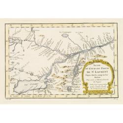
Suite du Cours du Fleuve de St.Laurent depuis Quebec jusqu' au Lac Ontario.
A map of Prevost's 'Hist. des Voyages', depicting the course of the St. Lawrence river from lake Ontario to Quebec.Jacques Nicolaas Bellin (1703-1772) was one of the most...
Place & Date: Paris, 1757
Selling price: $200
Sold in 2013
Carte de la Baye de Chesapeack et Pays Voisins. . .
Very attractive map showing both Chesapeake and Delaware Bays and the coast of New Jersey, Maryland and Virginia down to Cape Charles and Cape Henry. Including Philadelph...
Place & Date: Paris, 1757
Selling price: $290
Sold in 2018
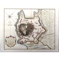
La ville de Cayenne de Stad Cayenne.
A fine city plan of the town of Cayenne in French Guyana in South America by J.N. Bellin, and engraved by J. Van Der Schley in 1757. From "Histoire Generale des Voya...
Place & Date: Paris, 1757
Selling price: $20
Sold in 2016
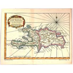
Carte de L'Isle de Saint Dominique.
A fine map of the island of Saint Dominique or Santo Domingo or Hispaniola, divided by the countries of Haiti and Dominican Republic. From the atlas “Histoire Generale ...
Place & Date: Paris, 1757
Selling price: $19
Sold in 2018
Carte de la Caroline et Georgie..
Common map depicting the eastern coast of the United States from Savannah to Edenton as well as the inland corresponding to today Carolinas. Includes part of Georgia.Jacq...
Place & Date: Paris, 1757
Selling price: $70
Sold in 2017












![Carolinae[,] Floridae nec non Insularum Bahamensium cum partibus adjacendibus delineatio ad Exemplar Londinense in lucem edita a Ioh. Michael Seligmann[,] Norimbergae Ao. 1755](/uploads/cache/82109-250x250.jpg)


![A NEW CHART of the Vast ATLANTIC OCEAN, Exhibiting The SEAT of WAR, both in EUROPE and AMERICA. [Popple]](/uploads/cache/83196-250x250.jpg)


![CARTE DE L'AMERIQUE SEPTENTRIONALE, Depuis le 28 Degre...[Sea of the West]](/uploads/cache/85714-250x250.jpg)
