Browse Listings in America
Praefecturae Paranambucae pars Borealis..
Among the most picturesque of all early maps of the Brazilian coastline covering the capitanias of Pernambuca and I. Tamarica. The upper part is embellished with are rema...
Place & Date: Amsterdam, 1740
Selling price: $1850
Sold in 2013
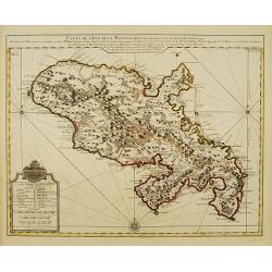
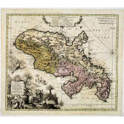
Representation la plus nouvelle et exacte De L'Ile Martinique, la premiere des Iles Del' Amerique Antilles Nommees Barlovento, Aux depens...
Fine map of Martinique with an extremely decorative cartouche that depicts the native islanders meeting and trading with Europeans. Engraved by Albrecht Carl Seutter (172...
Place & Date: Augsburg, c. 1740
Selling price: $600
Sold
L\'Amerique, Meridionale et Septentrionale.
Fine map of the Western hemisphere showing California with indented northern coast: Agubela de Cato to north. Includes partial outline on Nouvelle Zeelande. Engraved by C...
Place & Date: Paris, 1740
Selling price: $615
Sold in 2013
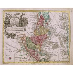
Nova Orbis Sive America Septentrionalis.
Oddly shaped, early 18th century German map of North America, with California as an island. Decorative cartouche with native Americans and birds.
Place & Date: Augsburg, c1740
Selling price: $450
Sold in 2014
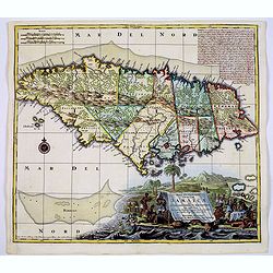
Nova Designatis Insulae Jamaicae.
In a large, uncolored, very decorative cartouche the production of sugar is illustrated.
Place & Date: Augsburg, 1740
Selling price: $210
Sold in 2014
Kaart...Guajana of de Wilden Kust...Westindien...
Tirion's excellent map of the northern coast of Venezuela, Columbia and parts of northern Guyana.Lovely small inset map of the Dutch colony of Curacao, together with a fu...
Place & Date: Amsterdam, 1740
Selling price: $150
Sold in 2016
Nova Designatis Insulae Jamaicae.
An attractive map with a large, uncolored, very decorative cartouche, where the production of sugar is beautifully illustrated. The island is divided up into 13 distinct ...
Place & Date: Augsburg, 1740
Selling price: $300
Sold in 2019
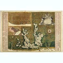
Grondvlakte van Nieuw Orleans, de Hoofdstad van Louisiana [with] De Uitloop vande Rivier Missisippi [and] De Oostelyke ingang van de Missisippi met een Plan van het Fort .
A sought after, highly attractive, decorative sheet that shows three maps arranged around a large compass rose. This work represents Tirion's version of a map that was fi...
Place & Date: Amsterdam, 1740
Selling price: $875
Sold in 2017
Nova Designatis Insulae Jamaicae ex Antillanis Americae Septentrion. . .
The Caribbean island of Jamaica is shown divided into its various precincts, and there is a large, beautiful title cartouche that shows natives harvesting the various pro...
Place & Date: Augsburg, 1740
Selling price: $300
Sold in 2017
Aussicht der Insel Juan Fernandes/Aussicht von Cumberland Bay.
2 views on one sheet; with decorative views of the coast of Chile by the Admiral of the Fleet George Anson (1697 -1762), who was a Royal Navy officer.
Place & Date: London, ca. 1740
Selling price: $100
Sold in 2018
Carta geographica della florida nelp americ settentrionale.
Map taken from "Atlante Novissimo", published by Giambattista Albrizzi around 1740. Based on Delisle, the map covers the region from Filadelfia south to the Bah...
Place & Date: Venise, 1740
Selling price: $750
Sold in 2018
A New Map or Chart of The Western or Atlantic Ocean with Part of Europe, Africa & America: Shewing the Course of the Galleons. . .
An attractive chart of the Atlantic Ocean with large decorative cartouche, from 'The Gentleman's Magazine: and Historical Chronicle', by Sylvanus Urban, printed by Edward...
Place & Date: London, 1740
Selling price: $95
Sold in 2019
Algemene kaart van Suriname Algemeene kaart van de Colonie of Provintie van Suriname : met de rivieren, districten, ontdekkingen door militaire togten. . .
Uncommon large scale map of of Suriname, indicating the different plantations and their owners. Consists of two glued-together sheets. Completed with funding by the Direc...
Place & Date: Amsterdam, 1740
Selling price: $5500
Sold in 2023
AMERICA SETTENTRIONAL di N. Sanson (California Island)
Very rare old outline color example of Nicolas Sanson's map of North America. California is depicted as an island; McLaughlin notes: "California with indented northe...
Place & Date: NAPLES, ca 1740
Selling price: $190
Sold in 2020
Totius AMERICAE Septentrionalis et Meridionalis novissima represestatio quam ex fingulis. . .
A richly ornamented map of North and South America. Title cartouche bottom left is copied from De Fer's map of 1699 and the cartouche containing text (top left) is based ...
Place & Date: Nuremberg, 1740
Selling price: $600
Sold in 2020
L'Amerique, Meridionale et Septentrionale. Dressee selon les dernieres relations et suivant les nouvelles decouvertes dont les points principaux sont placez sur les observations de Mrs. de l'Academie Royale des Sciences. . .
A rare later issue of this map of the Americas, with decorative cartouches for the title, dedication and scale. Engraved by Inselin for the 'Atlas Curieux', California is...
Place & Date: Paris, 1740
Selling price: $450
Sold in 2021
Virginia Marylandia et Carolina. . .
An very attractive and detailed map, covering the coastline from Long Island in the north to just south of Cape Feare in Carolina, with the large fictitious Apalache Lacu...
Place & Date: Augsburg, 1740
Selling price: $800
Sold in 2023
A new map of Virginia and Maryland.
Detailed folding map of the Chesapeake Bay region, showing towns, rivers, inlets, shoals, Islands, and other details. Predates the resolution of the Dispute between the P...
Place & Date: London 1741
Selling price: $460
Sold
Novus Orbis potius Altera Continens Sive Atlantis Insula . . .
This is a very unusual map of the Americas, noted in the cartouche to illustrate the mythical island of Atlantis. The Great Lakes are shown but are still very misshapen a...
Place & Date: Paris, 1741
Selling price: $325
Sold in 2011
America Aurea Pars Altera Mundi.
Extremely rare and gorgeous map of America, seldom offered on an auction. California is taken from the second Sanson map published by the Valk family, with rugged coastli...
Place & Date: Amsterdam, 1741
Selling price: $850
Sold in 2014
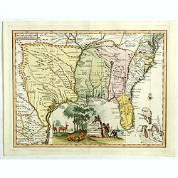
[Gulf of Mexico showing entire Texas coast, and extending east to Florida]
Untitled sheets from Ottens’ important 6-sheet wall map: "Grand Théâtre de la Guerre en Amérique suivant les plus nouvelles observations des Espagnols, Anglois,...
Place & Date: Amsterdam, 1741
Selling price: $2100
Sold in 2016
Nouvelle Carte Particuliere de l'Amerique ou sont Exactement Marquees les Iles de Bermude, la Iamaique, Saint Domingue, les Antilles la Terre Ferme. . .
The two lower maps, with their own border title, of the four-sheet Dutch edition of Popple's monumental map of North America.It covers the region from Bermuda through the...
Place & Date: Amsterdam, 1741
Selling price: $2750
Sold
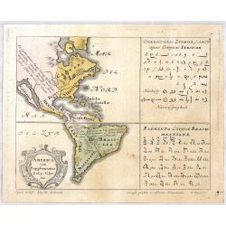
AMERICA cum Supplementis Poly Glottis.
A rare separate thematic map of AMERICA from the set of 4 maps of the continents, identifying the distribution of languages of the world from "Synopsis Universae Phi...
Place & Date: Nurenberg, 1741
Selling price: $380
Sold in 2020
Virginia, Maryland, Pennsilvania, East & West New Jarsey.
Important early English Chart of the Chesapeake and Delaware Bay region, based on a map by Augustine Hermann.Originally issued by John Thornton and William Fisher in 1689...
Place & Date: London, ca 1742
Selling price: $4700
Sold in 2013
[7 sheets] A Map of the British Empire in America with the French Spanish and Dutch Possessions adjacent thereto by Henry Popple.
Seven map sheets, uncut, the first six with colored borders and outline coloring, each approximately 515 x 498 images (550 x 664 mm). Including the preliminary key map, f...
Place & Date: Amsterdam, 1742
Selling price: $10250
Sold in 2017
CARTA GEOGRAFICA DEL CANADA. NELI: AMERICA SETTENTRIONALE.
A striking hand-colored map of the Great Lakes, Canada and northeastern US, based upon Guillaume De L'Isle's map of 1703, which was then one of the most accurate and up t...
Place & Date: Venice, 1742
Selling price: $725
Sold in 2019
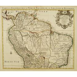
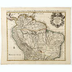
Tabula geographica Peruae Brasiliae & Amazonum Regionis.
Covens & Mortier's large size detailed map of the northern part of South America, after Guillaume De L'Isle, 1721-1742.Full title on the map: 'Tabula geographica Peru...
Place & Date: Amsterdam, 1721-1742
Selling price: $250
Sold in 2020
Nieuwe en Naaukeurige Paskaart van Het Eyland Hispaniola of St. Domingo met alle desselfs Havenen, Dieptens en Ankergronden, als meede de door passeeringe tusche de Caiques en andere Eylanden. ..
Fine Sea Chart of Puerto Rico and Hispaniola, published by Johannes Van Keulen II. A rare map since these larger sized sheets were never published in atlases but were ra...
Place & Date: 1742
Selling price: $2450
Sold in 2022
A Prospect of Carthagena, Taken from Madre de la Popa.
Very rare view of Cartagena de IndiasThis English copper engraved view of Cartagena in Colombia was drawn by an unidentified J. Norden and engraved by William Henry Toms,...
Place & Date: London, 1743
Selling price: $2400
Sold in 2010
Carte de la partie Orientale de la nouvelle France ou du ..
Nicolas Bellin's landmark map of maritime Canada in a first appearance: Charlevoix's Histoire.. in 1744.Later he used the map as a basis for his equivalent maps of 1745 a...
Place & Date: Paris 1744
Selling price: $490
Sold
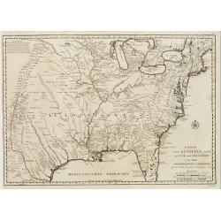
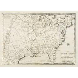
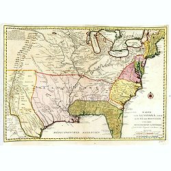
Karte von Luisiana, dem Laufe des Mississipi und den benachb
A rare German text edition of de l'Isles map of the Gulf region of the Mississippi. The European colonies and possessions along the Atlantic and Gulf coasts share importa...
Place & Date: Paris 1744
Selling price: $650
Sold
Plan du Port Royal dans l'Acadie, Appelé Aujourd' par les Anglois Annapolis Royal.
This chart shows the territories of Port Royal in Acadia.Depths shown by soundings.From Bellin's Histoire et Description Generale de la Nouvelle France Charlevoix.Tome I ...
Place & Date: Paris, 1744
Selling price: $120
Sold
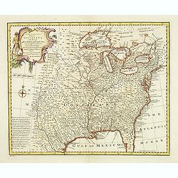
A new & accurate map of Louisiana, with part of Florida. . .
An English view of North America compiled from available French maps, especially those of Bellin used in Charlevoix's History of New Franc. English cartographers had litt...
Place & Date: London, 1744
Selling price: $800
Sold in 2020
Carte des Embouchures du Mississipi.
This is a lovely chart of the mouth of the mighty Mississippi River, and her delta, as it empties into the Gulf of Mexico, about 75 miles south east of New Orleans. The c...
Place & Date: Paris, ca 1744
Selling price: $75
Sold in 2020
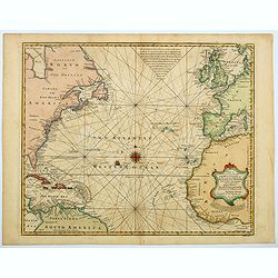
A New and Accurate Chart of the Western or Atlantic Ocean. . .
A map that is typical of the sort published by Emanuel Bowen. This chart of the Western or Atlantic Ocean contains numerous annotations, which lend a fascination and char...
Place & Date: London, 1744
Selling price: $200
Sold in 2023
Carte de la Terre Ferme du Perou, du Bresil et du Pays des Amazones.
Large, graphic map of the northern part of South America. It is filled with place names and notations speculating about the Indian tribes and the tributaries to the Amazo...
Place & Date: Amsterdam c. 1745
Selling price: $330
Sold
Carte de L' Isle de la Martinique Colonie Francoise de l'une des Isles Antilles de l'Amerique..
A very well executed plan of the island after Delisle. Excellent detail throughout includes realistic depictions of bays, mountains, islets, lagoons, forests, etc., which...
Place & Date: Amsterdam c. 1745
Selling price: $330
Sold
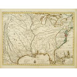
Carte de la Louisiane et du Cours du Mississipi Dressée sur un grand nombre de Memoires..
Covens & Mortier's issue of Delisle's influential map of the French possession of Louisiana. Updated to include New Orleans. When originally published in 1718, it was...
Place & Date: Amsterdam c. 1745
Selling price: $2000
Sold
Plan du Port de la Ville et des Forteresses de Carthagène..
Highly decorative plan of the bay and fortifications of Cartagena in Colombia during the siege by the British fleet. Table of explanations in French and Dutch below. Nort...
Place & Date: Amsterdam c. 1745
Selling price: $600
Sold
A new map of North America according to the newest observations..
A very fine map of North America, including the West Indies and northern South America.With Straits of Anian and Mozeemlek to north and Gulf of California to east., the B...
Place & Date: London 1745
Selling price: $300
Sold
Carte de la Louisiane et du Cours du Mississipi Dressée sur un grand nombre de Memoires..
Covens & Mortier's issue of Delisle's influential map of the French possession of Louisiana. Updated to include New Orleans.When originally published in 1718, it was ...
Place & Date: Amsterdam c. 1745
Selling price: $1850
Sold
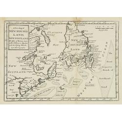
A new map of New Foundland, New Scotland. The Isles of Breton, Antocoste, St. Johns. . .
Fine map shows Newfoundland with the neighboring 'Cap Breton' and 'New Arcadia'. Hermann Moll's map provided a fair amount of information on place names, mostly along the...
Place & Date: London, 1745
Selling price: $90
Sold in 2008
Carte d' Amerique Dressee pour l'Usage Du Roy. . .
Detailed copper-engraved map of Northern and Central America. Shows North America with colonial divisions and a wide open Northwest. The English settlements are confined ...
Place & Date: Amsterdam c. 1745
Selling price: $1400
Sold in 2018
Carte du Canada ou de la Nouvelle France et des Decouvertes qui y ont ete faites..
Highly detailed copper-engraved map of Canada and the Great Lakes providing the most accurate rendering of the Great Lakes of the time, with the lakes fully enclosed and ...
Place & Date: Amsterdam c. 1745
Selling price: $750
Sold in 2019
Carte du Canada ou de la Nouvelle France et des Decouvertes qui y ont ete faites..
Highly detailed copper-engraved map of Canada and the Great Lakes providing the most accurate rendering of the Great Lakes of the time, with the lakes fully enclosed and ...
Place & Date: Amsterdam c. 1745
Selling price: $500
Sold in 2018
Carte de la Terre Ferme du Perou, du Bresil et du Pays des Amazones.
Large, graphic map of the northern part of South America. It is filled with place names and notations speculating about the Indian tribes and the tributaries to the Amazo...
Place & Date: Amsterdam c. 1745
Selling price: $380
Sold in 2020
Carte du Canada ou de la Nouvelle France et des Decouvertes qui y ont ete faites . . .
Highly detailed copper-engraved map of Canada and the Great Lakes providing the most accurate rendering of the Great Lakes of the time, with the lakes fully enclosed and ...
Place & Date: Amsterdam c. 1745
Selling price: $700
Sold in 2019
Carte d'Amerique . . .
First issued by De L'Isle in 1722. This is the seventh state of the map, unchanged geographically from the original, but with Philippe Buache's imprint at bottom right. T...
Place & Date: Paris, 1745
Selling price: $480
Sold in 2021
DOMINIA ANGLORUM in praecupuis Insulis AMERICAE ut sunt Insula S. CHRISTOPHORI, ANTEGOA, IAMAICA, BARBADOS, Insulae BERMUDES vel SOMMERS.
Set of 5 maps on a single sheet, outlined hand-colored, showing St. Kitts, Antigua, Bermuda, Barbados, and Jamaica, each in excellent detail with names and descriptions. ...
Place & Date: Nuremberg, 1745
Selling price: $160
Sold in 2020
Carte de la Louisiane et du cours du Mississipi . . .
Covens & Mortier's issue of Delisle's influential map of the French possession of Louisiana. Updated to include New Orleans.When originally published in 1718, it was ...
Place & Date: Amsterdam, 1745
Selling price: $1800
Sold in 2020
Carte De L'Ocean Occidental Dreessée pour Servir a l'Histoire Generale des voyages..
Attractive chart of the Atlantic, north of the equator, delineated with rhumb lines and a large 32-point compass rose.A good portion of each of the continents is shown wi...
Place & Date: Paris 1746
Selling price: $100
Sold
Americae Mappa Generalis
An updated map of the western hemisphere by the Homann Heirs. The map shows the continent on the eve of the conflicts that would soon erupt and change the political face ...
Place & Date: Nuremberg, ca. 1746
Selling price: $850
Sold
L'Amerique Septentrionale.
Interesting map of North America. In north eastern part of North America some interesting lakes and rivers are drawn, with a note: Terres vues par Tchirikow en 1741 . Tch...
Place & Date: Paris, 1746
Selling price: $150
Sold in 2017
Karte von Luisiana, dem Laufe des Mississipi und den Benachbarten Laendern.
A rare German text edition of de l\'Isle\'s map of North America, focusing on the Mississippi and covering all the known United States, from the Rio del Norte (extending ...
Place & Date: Leipzig, Arkstee & Merkus, 1746
Selling price: $350
Sold in 2008
Karte von Luisiana, dem Laufe des Mississipi und den Benachbarten Laendern.
A rare German text edition of de l'Isle's map of North America, focusing on the Mississippi and covering all the known United States, from the Rio del Norte (extending no...
Place & Date: Leipzig, Arkstee & Merkus, 1746
Selling price: $960
Sold in 2015
Amérique Septentrionale.
2 x 2 joined sheets.
Place & Date: Paris, 1746
Selling price: $750
Sold in 2009
Carte de l'Océan Occidental Dressée pour servir à l'Histoire Générale des Voyageurs. (together with) A new map of the West Indies.
Attractive chart of the Atlantic, north of the equator, delineated with rhumb lines and a large 32-point compass rose.A good portion of each of the continents is shown wi...
Place & Date: Paris, 1746
Selling price: $131
Sold in 2014
Americae Mappa generalis Secundum legimitas projectionis Stereiographiae regulas. . . MDCCXXXXVI
Johann Baptist Homann's well-engraved second map of America has a large decorative cartouche. Detailed map of the western hemisphere.The interior of North America has new...
Place & Date: Nuremberg, 1746
Selling price: $986
Sold in 2013
Carte de l'Ocean Occidental Dressee pour Servir a l'Histoire Generale des Voyages.
Bellin's superb North Atlantic sea chart. Shows the east coast of North America, the north coast of South America, the West Indies, Western Europe and West Africa. With t...
Place & Date: Paris, 1746
Selling price: $60
Sold in 2013
Cataracte de Niagara.
Copper engraving of Niagara Falls from Prevost's "Histoire Generale des Voyages". Jacques Nicolas Bellin (1703 – 1772) was a French hydrographer and geograph...
Place & Date: Paris, 1746
Selling price: $91
Sold in 2015
Karte von Luisiana, dem Laufe des Mississipi und den Benachbarten Laendern.
A rare German text edition of de l'Isle's map of North America, focusing on the Mississippi and covering all the known United States, from the Rio del Norte (extending no...
Place & Date: Leipzig, Arkstee & Merkus, 1746
Selling price: $1000
Sold in 2019
Americae Mappa generalis...
Important map of the Americas with contemporary hand color. Shows a partially unexplored Northwest. Locates Quivira, Tecas (Texas), and many native Indian areas. Indicate...
Place & Date: Nuremberg, 1746
Selling price: $325
Sold in 2018
Isle de la Martinique.
An antique copperplate map featuring the French island of Martinique. In 1692, Charles de La Roche-Courbon, Count of Blénac, the Governor and Lieutenant General of the F...
Place & Date: Paris, 1746
Selling price: $41
Sold in 2021
Amerique Septentrionale Publiee sous les Auspices de Monseigneur le Duc d'Orleans Premier Prince du Sang. . .
A large map of North America and the West Indies that was one of the best French maps of North America prior to the French & Indian War. This map provides good inform...
Place & Date: Paris, 1746
Selling price: $1100
Sold in 2019
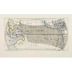
Répresentation du Cours ordinaire des Vents de Traverse qui regnent sur les Côtes dans la grande Mer Du Sud.
Sea chart of tides wind currents, centred on the equatorial regions of the South Pacific, from South America to Indochina. Published by Bellin in the Histoire Generale de...
Place & Date: Paris, 1747
Selling price: $80
Sold
Particular Draughts and Plans of Some of the Principal Towns and Harbours Belonging to the English, French, and Spaniards, in America and West Indies
An unusual copper engraving by E. Bowen from 'A Complete System of Geography'. Featuring 13 small maps of colonial towns and sea ports of North America and the West Indie...
Place & Date: London, 1747
Selling price: $500
Sold in 2010
A New and Accurate Map of Virginia & Maryland. Laid Down from Surveys and Regulated by Astronl. Observatns
Scarce map of the Chesapeake region by Bowen from 'A Complete System of Geography'. Based on Hermann's map of 1673 and Popple's map of 1733. Showing numerous early towns ...
Place & Date: London, 1747
Selling price: $750
Sold in 2010
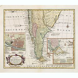
A New and Accurate Map of Chili, Terra Magellanica, Terra del Fuego &c
Bowen's map of the southern part of South America from 'A Complete System of Geography'. With one title cartouche and a compass rose. With two inset maps, one of Santiago...
Place & Date: London, 1747
Selling price: $375
Sold in 2010
A New & Accurate Map of Louisiana, with Part of Florida and Canada, and the Adjacent Countries
Remarkable map of the British, Spanish & French Colonies in North America on the eve of the French & Indian War by E. Bowen from 'A Complete System of Geography'....
Place & Date: London, 1747
Selling price: $1000
Sold in 2011
A New and Accurate Map of New Jersey, Pensilvania, New York and New England with the Adjacent Countries
A scarce map of New Jersey, New York, Pennsylvania, Maine, New Hampshire and Connecticut by E. Bowen from 'A Complete System of Geography'. Covering the area from the Che...
Place & Date: London, 1747
Selling price: $1100
Sold in 2011
A New & Accurate Map of the Provinces of North & South Carolina Georgia &c
Bowen's map of the Carolinas and Georgia from 'A Complete System of Geography'. Showing the area from the mouth of the Chesapeake Bay to St. Augustine and from Louisiana ...
Place & Date: London, 1747
Selling price: $900
Sold in 2012
An Accurate Map of the West Indies
Bowen's map of the West Indies from 'A Complete System of Geography'. Showing the area from Long Island in the north to the delta of the Orinoco in the south. Decorated w...
Place & Date: London, 1747
Selling price: $300
Sold in 2011
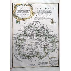
A New and Accurate Map of the Island of Antigua or Antego...
Highly attractive map of Antigua. Very detailed map with many place names, streets, etc. With text describing the island and a legend explaining symbols to churches, for...
Place & Date: London, 1747
Selling price: $130
Sold in 2012
A new and accurate map of New Jersey, Pensilvania, New York and New England with the Adjacent Countries. . .
A scarce map of New Jersey, New York, Pennsylvania, Maine, New Hampshire and Connecticut. Canada extends south to the Pennsylvania border. Published by E. Bowen from &quo...
Place & Date: London, 1747
Selling price: $850
Sold in 2018
A New and Accurate Map of Virginia & Maryland. Laid Down from Surveys and Regulated by Astronl. Observatns
Uncommon map of the Chesapeake region, including only a thin strip of southern Pennsylvania, which is named but with nothing identified. Published by Bowen from 'A Comple...
Place & Date: London, c.1747
Selling price: $1100
Sold in 2016
A new & accurate map of.. North & South Carolina, Georgia &c. c. Drawn from late Surveys and regulated by Astron.
An excellent early engraving of the American Southeast from the mouth of the Chesapeake to Northern Florida. Georgia occupies a very small area next to a large Florida. N...
Place & Date: London, 1747
Selling price: $1100
Sold in 2015
A New and Accurate Map of Chili, Terra Magellanica, Terra del Fuego &c. . .
Bowen's map of the southern part of South America from 'A Complete System of Geography'. With one title cartouche and a compass rose. With two inset maps, one of Santiago...
Place & Date: London, 1747
Selling price: $550
Sold in 2016
A new and accurate map of Chili, Terra Magellanica, Terra del Fuego &c. Laid down according to the latest improvements and regulated by astronl. observatns. By Eman: Bowen.
Full Title as it appears on the map, A new and accurate map of Chili, Terra Magellanica, Terra del Fuego &c. Laid down according to the latest improvements and regula...
Place & Date: London, 1747
Selling price: $300
Sold in 2014
Francis Drake.
Fine hand-colored copperplate engraving featuring Francis Drake, the famous pirate. From "Heads of Illustrius Persons of Great Britain" by Thomas Birch. Engrave...
Place & Date: London, 1747
Selling price: $200
Sold in 2013
A New and Accurate Map of Virginia & Maryland.
Scarce map of the Chesapeake region by Bowen.
Place & Date: London, c.1747
Selling price: $300
Sold in 2019




![Grondvlakte van Nieuw Orleans, de Hoofdstad van Louisiana [with] De Uitloop vande Rivier Missisippi [and] De Oostelyke ingang van de Missisippi met een Plan van het Fort .](/uploads/cache/39133-250x250.jpg)




![[Gulf of Mexico showing entire Texas coast, and extending east to Florida]](/uploads/cache/37159-250x250.jpg)


![[7 sheets] A Map of the British Empire in America with the French Spanish and Dutch Possessions adjacent thereto by Henry Popple.](/uploads/cache/38145-250x250.jpg)


