Browse Listings in America
Novum Amsterodamum..
A good example of one of the earliest available views of New York. Set in a border with two other prints. To the right a couple from the New England area. In the bottom a...
Place & Date: Leiden 1729
Selling price: $700
Sold
Partie Meridionale de la Virginie et la .. Floride dans L'Amerique septentrionale ..
A scarce and attractive map of the American colonies stretching from Chesapeake Bay through the Carolinas.Geographically based on the Montanus map, which was in turn base...
Place & Date: Amsterdam 1729
Selling price: $700
Sold
Nieu Amsterdam al. New York.
Originally engraved by Carolus Allard's for his Orbis Habitablis the print shows two locals and a distance view of lower Manhattan.From Galerie Agréable du Monde, a sixt...
Place & Date: Leiden 1729
Selling price: $1525
Sold
Partie Meridionale de la Virginie et la .. Floride dans L'Amerique septentrionale ..
Pierre van der AA used the old copper plate of Meurs and re-did the engraving, changed the large pictorial cartouche, a new scale of German and French leagues is provided...
Place & Date: Amsterdam 1729
Selling price: $750
Sold
Land en volk-ondekking in't noorder gedeelte van America door P.Marquette en Joliet.
Interesting map of the Mississippi delta. East to the top. According to the title the information is after P.Marquette and Joliet.This example is unusual in having the ad...
Place & Date: Amsterdam 1729
Selling price: $625
Sold
La Floride, suivant les nouvelles observations?
This splendid map of the southern United States was based on Delisle's influential Carte du Mexique de la Floride.. of 1703. The map is filled with details of early colon...
Place & Date: Amsterdam 1729
Selling price: $500
Sold
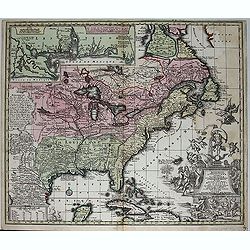
L'Amerique Septentrionale suivant les nouvelles observations ..
Splendid map of North America.These separately engraved border frames appear much more uncommon than the standard edition without border frames. From Galerie Agréable du...
Place & Date: Amsterdam 1729
Selling price: $850
Sold
Nouvelle Hollande (a present NOUVELLE-YORK)..
A charming map from the famous Jansson-Visscher series of maps covering the east coast from the Chesapeake Bay to Maine. The map has a particularly large title piece show...
Place & Date: Leiden 1729
Selling price: $1300
Sold
Novum Amsterodamum..
A good example of one of the earliest available views of New York. Set in a border with two other prints. To the right a couple from the New England area. In the bottom a...
Place & Date: Leiden 1729
Selling price: $600
Sold
Land en volk-ondekking in't noorder gedeelte van America door P.Marquette en Joliet.
Interesting map of the Mississippi delta. East to the top. According to the title the information is after P.Marquette and Joliet.This example is unusual in having the ad...
Place & Date: Amsterdam 1729
Selling price: $950
Sold
Nouvelle Hollande (a present NOUVELLE-YORK)..
A charming map from the famous Jansson-Visscher series of maps covering the east coast from the Chesapeake Bay to Maine. The map has a particularly large title piece show...
Place & Date: Leiden 1729
Selling price: $1650
Sold
Virginia and Maryland.
Title: 'VIRGINIA AND MARYLAND by H. Moll Geographer' from 'Atlas minor: or a new and curious set of sixty-two maps...' A charming map in Molls unique style.
Place & Date: London, 1729
Selling price: $400
Sold in 2015
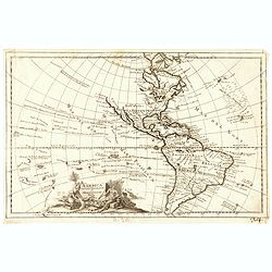
Amerique Septentrionale.
An interesting map of North America, from “METHODE POUR ETUDIER L’HISTOIRE” by L’Abbe Lenglet du Fresnoy, published in Paris in 1729. The map is quite rare, and i...
Place & Date: Paris, 1729
Selling price: $425
Sold in 2017
Amerique Meridionale.
A striking map of South America from the “METHODE POUR ETUDIER L’HISTOIRE” by L’Abbe Lenglet du Fresnoy, published in Paris in 1729. The map is quite rare, and is...
Place & Date: Paris, 1729
Selling price: $125
Sold in 2020
America aucta delineatio.
A very decorative map from a rare atlas by A.F. Zurner. The map shows a very unusual shape of California (depicted as an island) and the marvelous "Terra Iesso"...
Place & Date: Nuremberg, 1729
Selling price: $160
Sold in 2018
Carte des Isles d? Acores.
An uncommon and highly attractive map of the Azores. It contains much detail, with inset maps of Porto de Santa Cruz along with the town of Angra, located on the island o...
Place & Date: Amsterdam, 1730
Selling price: $630
Sold
Hemisphere Septentrional pour voir plus.. les Terres..
The Covens & Mortier edition of this highly important map of the Northern Hemisphere. This work is the first to correctly place the west coast of North America by mov...
Place & Date: Amsterdam, ca. 1730
Selling price: $300
Sold
Novus Orbis sive America Meridionalis et Septentrionalis..
A finely engraved and decorative mid-18th century map published in Augsburg, Germany. This map shows the state of early exploration with some of the explorer's routes in ...
Place & Date: Augsburg c. 1730
Selling price: $1675
Sold
Accurata delineatio....Gallice Louisiane ol. Cauad' et Floridae
Full title: Accurata delineatio celeberrimae Regionis Ludovicianae vel Gallice Louisiane ol. Cauad' et Floridae adpellatione in Septemtrionali America. A beautiful map of...
Place & Date: Germany, 1730
Selling price: $2600
Sold
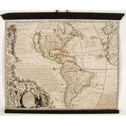
Carte de l'Amerique.
A very nice map centered on the American continent. Title cartouche on the upper left-hand corner. Includes also a lettered key legend on the lower part of the map.
Place & Date: Paris, ca. 1730
Selling price: $250
Sold in 2017
Insulae Bermudes in suas Tribus divisae...
Copper-engraved map of Bermuda most probably from a larger Homann composite sheet showing also other islands. Shows the island in good detail, naming towns and villages, ...
Place & Date: Nuremberg, c1730
Selling price: $15
Sold in 2011
Descripcion de la provincia de Chile.
Map of the Chile. Cartographic elements include topographical details and location of some rivers and settlements. The map was copied from the manuscript map of Juan Lóp...
Place & Date: Madrid, 1730
Selling price: $425
Sold in 2012
Descripcion de las Yndias des Norte. 2.
Rare map of the Americas, one of the very few Spanish printed maps of America, first published in the 1601 first edition of Herrera's Historia General, the present map ap...
Place & Date: Madrid, 1726, 1728, 1730
Selling price: $525
Sold in 2012
Canada ou Nouvelle France..
Beautifully engraved map of northeastern North American and the Great Lakes region based on Delisle's important map of 1703. The Great Lakes are reasonably well delineate...
Place & Date: Amsterdam, 1730
Selling price: $425
Sold in 2012
Nova Anglia Septentrionali Americae implantata Anglorumque coloniis florentissima ... Ioh. Baptista Homann Sac. Caes Maj ... Cum Privilegio ... .
This attractive map shows all of "Nova Anglia" (New England), most of "Nieuw Nederland" (present day New York), "Western and Eastern New Jarsey&...
Place & Date: Nurnberg, c.1730
Selling price: $750
Sold in 2013
Carte de la Louisiane et du cours du Mississipi.
Shows Indian villages, "nations derangees, nations detruites," the route of de Soto, Moscoso, Cavelier, Tonty and Denis, etc. Relief shown pictorially. Covers a...
Place & Date: Amsterdam, 1730
Selling price: $1100
Sold in 2014
Carte des Isles d'Acores.
Uncommon and detailed map of the Azores.
Place & Date: Amsterdam, 1730
Selling price: $220
Sold in 2015
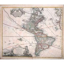
Totius Americae Septentrionalis et Meridionalis
A very decorative, richly decorated map of North and South America. The title cartouche on the bottom left is copied from De Fer's map of 1699, while the cartouche contai...
Place & Date: Nuremberg, ca. 1730
Selling price: $450
Sold in 2016
Carte du Canada ou de la Nouvelle France. . .
First issued by Guillaume Delisle in 1703, this important, detailed map provides the most accurate rendering of the Great Lakes of the time, with the lakes fully enclosed...
Place & Date: Amsterdam, c.1730
Selling price: $1300
Sold in 2019
Recentissima Novi Orbis, Sive Americae Septentrionalis et Meridionalis Tabula.
Attractive map of the Americas features a beautiful rich decorative title cartouche showing an Amazonian queen surrounded by riches, a sugar cane field and exotic animals...
Place & Date: Amsterdam, ca 1730
Selling price: $1100
Sold in 2020
America Septentrionalis et Meridionalis Nova.
Map of the American continent. Including the voyages of Columbus, Magellan, Le Mair, Schouten, Dampier, van Noordt.
Place & Date: Leiden, ca. 1730
Selling price: $220
Sold in 2021
L'AMERIQUE Meridionale et Septentrionale Dressée sur les Nou
Map surrounded by portraits of the New World explorers and those on either side are illuminated with charming illustrations of the signs of the zodiac.Geographically, the...
Place & Date: Paris, 1731
Selling price: $2400
Sold
Delineatis Pennsylvaniae et Caesereae nov. Occidebt seu West Niersey in America.
An extremely rare map of Pensylvania and New Jersey engraved by Jonas Silfverlong. Published in a publication by Tobias Biorck titled Dissertatio Gradualis, de Plantation...
Place & Date: Upsula 1731
Selling price: $4500
Sold
L\'AMERIQUE Meridionale et Septentrionale Dressée sur?
Map surrounded by portraits of the New World explorers and those on either side are illuminated with charming illustrations of the signs of the zodiac.Geographically, the...
Place & Date: Paris, 1731
Selling price: $2000
Sold in 2009
The Isle of California, New Mexico, Louisiane, The River Misisipi and the Lakes of Canada.
Printed in London, 1732. From Herman Moll's "A System of Geography." A scarce and remarkable map of California.California is as an island, with over a dozen pla...
Place & Date: London, 1732
Selling price: $400
Sold in 2014
Typus Geographicus Chili Paraguay Freti Magellanici &c ?
An attractive map with much information and engraved notes. With inset map of the Strait of Magellan.
Place & Date: Nuremberg, 1733
Selling price: $280
Sold in 2010
Tabula Americae Specialis Geographica Regni Peru, Brasiliae, Terra Firmae & Reg: Amazonum, Secundum relationes de Herrera . . . [together with]
A good and clean copy of Homann's map of the northern part of South America. The map is on the Valley of the Amazon and delineates the Amazon and its labyrinth of tributa...
Place & Date: Nuremberg, 1733
Selling price: $325
Sold in 2016
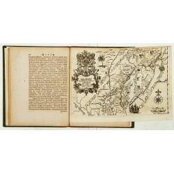
[JESUIT PARAGUAY], - PARAQUARIA in qua R.R. P.P Soc. Jesu suas Missiones promovere, 1733
This map depicts the Jesuit missions in Paraguay and Uruguay with parts of Brazil, Bolivia, Argentina and Chile. The Parana and Paraguay Rivers are well defined, with the...
Place & Date: Vienna, 1733
Selling price: $100
Sold in 2022
Tabula Americae Specialis Geographica Regni Peru, Brasiliae, Terra Firmae & Reg: Amazonum, Secundum relationes de Herrera. . .
A good and clean copy of the top half of Homann's map of the northern part of South America. The map is on the Valley of the Amazon and delineates the Amazon and its laby...
Place & Date: Nuremberg, 1733
Selling price: $120
Sold in 2017
A Map of the British Empire in America (Southeastern Section of Popple Map Sheet 10)
>A Map of the British Empire in America with the French, Spanish and the Dutch Settlements adjacent thereto. Henry Popple's Map of the British Empire in America ma...
Place & Date: London, 1733
Selling price: $1450
Sold in 2023
V. Haupt Karte America oder West Indien oder Die Neue Welt.
A rare map of America prepared by Anselm Desing (1699-1772) for "Historica auxilia". Printed by Christian Holstat Sulzbach for the publisher Johann Gastl.
Place & Date: Regensburg, Johann Gastl, 1733 - 1734
Selling price: $200
Sold in 2014
Carte de la Louisiane et du Cours du Mississipi.
Carte de la Louisiane et du Cours du Mississipi." From Jean Frederic Bernard's Recueil de Voiages au Nord. Amsterdam: J.F. Bernard, 1734.This is a reduced-size editi...
Place & Date: Paris, 1734
Selling price: $800
Sold in 2016
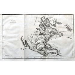
Amerique Septentrionale
A scarce copper engraving of colonial North America. The map shows the area from Greenland until the northern part of South America. Extends until California, but with la...
Place & Date: Paris, 1734
Selling price: $80
Sold in 2021
Amérique les Francois possedent en cette partie le Canada..
Very rare separately published map of America, showing California as an island. California's insularity indefinite: Cape Blanc de S.Sebastien is labelled at its north end...
Place & Date: Paris 1735
Selling price: $2200
Sold
Sheet 8 of 20: The harbour of Placentia./ The harbour of Anapolis Royal./ Boston Harbor.
One sheet of H.Popple's twenty-sheet survey of North America, in a first stae, the first large-scale map of the British colonies in America. Shows part of the Grand Fishi...
Place & Date: London 1733-1735
Selling price: $775
Sold
Sheet 6 of 20: The Great Lakes and New Jersey.
One sheet of H.Popple's twenty-sheet survey of North America, in a first state, the first large-scale map of the British colonies in America. Featuring the Great Lakes in...
Place & Date: London 1733-1735
Selling price: $1625
Sold
Sheet 5 of 20: The Mississippi River system and its tributaries.
One sheet of H.Popple's twenty-sheet survey of North America, in a first stae, the first large-scale map of the British colonies in America. Featuring the Great Lakes in ...
Place & Date: London 1733-1735
Selling price: $500
Sold
One sheet of 20: The coast from NovaScotia to Cape Cod and Nantucket.
One sheet of H.Popple's twenty-sheet survey of North America, in a first stae, the first large-scale map of the British colonies in America. Featuring the coast from Nova...
Place & Date: London 1733-1735
Selling price: $1800
Sold
Carte du Paraguai, du Chili, du Detroit de Magellan &c..
Large, finely engraved map of the southern part of South America with great topographical detail and notations throughout.The tracks of several explorations are noted in ...
Place & Date: Amsterdam 1720-1735
Selling price: $300
Sold in 2008
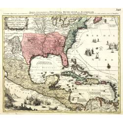
Mappa Geographica Regionem Mexicanam et Floridam.
It covers Central America with the Caribbean and the eastern part of the United States to the Great Lakes and New Mexico. In the lower-left is a beautiful picture of a na...
Place & Date: Augsburg, 1735
Selling price: $1100
Sold in 2013
Accurata delineatio celeberrimae reg. Ludovicianae. . .
Includes the area from the Great Lakes to the Caribbean, in the center of the map the basin of the river Mississippi. In an inset part of Louisiana. With a very elaborate...
Place & Date: Augsburg, 1735
Selling price: $1900
Sold in 2010
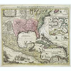
Mappa Geographica Regionem Mexicanam et Floridam.
Covers Central America with the Caribbean and the eastern part of the United States to the Great Lakes and New Mexico. In lower left a beautiful picture of a naval battle...
Place & Date: Augsburg, 1735
Selling price: $850
Sold in 2012
Accurata delineatio celeberrimae reg. Ludovicianae. . .
Includes the area from the Great Lakes to the Caribbean, in the center of the map the basin of the river Mississippi. In an inset part of Louisiana. With a very elaborate...
Place & Date: Augsburg, 1735
Selling price: $2300
Sold
Accurata delineatio celeberrimae reg. Ludovicianae. . .
Includes the area from the Great Lakes to the Caribbean, in the center of the map the basin of the river Mississippi. In an inset part of Louisiana. With a very elaborate...
Place & Date: Augsburg, 1735
Selling price: $1300
Sold in 2012
La Floride, suivant les Nouvelles Observations...
Fantastic map based on Delisle's important map of the southern United States of America, stretching from what is now Texas to Florida, and as far north as Tennessee and V...
Place & Date: Amsterdam, 1735
Selling price: $550
Sold in 2014
Plan de la Ville de Carthagene des Indes.
Nice map of the city of Cartegena and Magna Island in Columbia. It has a decorative title cartouche and the key places are identified in the index to the right.
Place & Date: Paris, 1735
Selling price: $135
Sold in 2015
Plan de la Ville de Carthagene des Indes.
Striking and highly detailed Bellin's copper engraved areal plan of Cartagena and Cartagena Bay, mapped by Antonio de Ulloa en 1735.The full color map presents a key list...
Place & Date: Paris, 1735
Selling price: $130
Sold in 2015
A Map of the Coast of New England from Staten Island to the island of Breton. . .
From the first marine atlas produced in the colonies was drawn by Captain Cyprian Southack (1662-1745). He is of great importance in North American cartography Of the fir...
Place & Date: London, ca. 1735
Selling price: $1400
Sold in 2017
Amerique.
A rare map of the western hemisphere, including portraits of explorers, such as Jacques Marquette, Louis Joliet, and Robert Cavelier de La Salle. Coats of arms present in...
Place & Date: Paris, 1735
Selling price: $1300
Sold in 2020
Map of South America, according to the Newest and most exact observations. . .
From 'The World described'. The elaborate cartouche designed by Bernard Lens and engraved by George Vertue is balanced by a large (8 x 10) inset view of Potosi with a not...
Place & Date: London, 1736
Selling price: $1000
Sold in 2015
The Island of Jamaica Divided into its Principal Parishes with the Roads & c.
The Island of Jamaica Divided into its Principal Parishes with the Roads & c. by Herman Moll. A highly detailed map of the island engraved with mountains, roads, town...
Place & Date: London, 1736
Selling price: $125
Sold in 2016
To the right honourable Charles Earl of Sunderland and Beron Spencer of Wormleighton. . . This map of South America. . .
Map of South America including part of Central America. Cartographic elements include lines of latitude and longitude, compass rose, indication of wind directions, locati...
Place & Date: London, 1726-1736
Selling price: $600
Sold in 2015
Partie la plus Meridionale de L'Amerique..
Striking map of the southern tip of south America: Prepared by Nicolas de Fer and published by Danet. Engraved by De Rochefort (signed lower right). The map shows the maj...
Place & Date: Paris, Danet, 1737
Selling price: $375
Sold in 2022
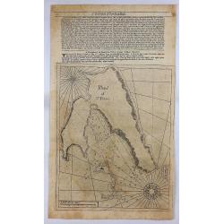
Island of St. Peters.
An early nautical chart of the island of St Pierre, included in the territory of Saint Pierre and Miquelon, by Mount and Page in London in 1737. Relief shown by hachures,...
Place & Date: London, 1737
Selling price: $40
Sold in 2018
A Map of the British Empire in America with the French Spanish and Hollandish Possessions adjacent thereto by Henry Popple.
This is the one-sheet key map from the Dutch edition. 22 insets and views of various harbors and sights. This example is the rare FIRST state of the edition published by ...
Place & Date: Amsterdam, 1737
Selling price: $2000
Sold in 2020
Carte du Canada Dediée a Son Altesse. . .
Uncommon map of America's east coast, including the Great Lakes and north eastern part of Canada. From: Le Beau, Avantures du Sr. C.Le Beau.More about Mapping of Canada [...
Place & Date: Amsterdam, 1738
Selling price: $435
Sold in 2020
To his Excellency Alured Popple Esq. Governour of Bermuda, or the Summer Islands. This Map.
Important and exceptional rare sea chart of the Bermuda IslandsClement Lempriere's chart of Bermuda, published in 1738, was the next major advance after Arent Roggeveen c...
Place & Date: London, 1738
Selling price: $11250
Sold in 2010
Carte d\'Amerique dressée par l\'usage du Roy..
Fine map prepared by G.d'Isle depicting North and south America, the west coast taken north to Cap Mendocin and Cap Blanc with a note Entrée decouverte par Martin d'Agui...
Place & Date: Amsterdam, 1739
Selling price: $355
Sold in 2013
A map of the County of Savannah.
Rare map, published in the 1730s and 1740s in Halle, Germany by Samuel Urlsperger in his Ausfuhrliche Nachricht von den Saltzburgischen Emigranten..Why the map is entitle...
Place & Date: Halle 1730- 1740
Selling price: $5000
Sold
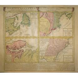
Dominia Anglorum in America Septentrionali/ Sie Gros-Brittanische Colonie Lænder in Nord-America. . .
Four maps on one sheet (Virginia und Maryland; Carolina nebsteinem Theil von Florida; New Engelland, New York, New Yersey und Pensilvania; and New Foundland, od. Terra No...
Place & Date: Nuremberg, 1740
Selling price: $600
Sold in 2015
Virginia Marylandia et Carolina.
An attractive and detailed map, covering the coastline from Long Island in the north to just south of Cape Feare in Carolina, with the large fictitious Apalache Lacus in ...
Place & Date: Augsburg 1740
Selling price: $1400
Sold
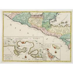
Central America, with inset maps of Acapulco and Vera-Cruz.
RARE map of Mexico and Guatemala, with insets of Acapulco and Veracruz. One sheet from a set of six offered by the Ottens firm in 1739 or shortly thereafter and relate to...
Place & Date: Amsterdam, 1740
Selling price: $600
Sold in 2021
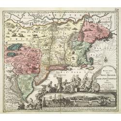
Recens edita totius Novi Belgii in America Septentrionali.
This most spectacular map, the last engraved in the sequence of maps based on the Janssonius' map of the area, shows a multitude of animals and birds and features a view ...
Place & Date: Augsburg, ca. 1730-1740
Selling price: $4700
Sold
[Five maps on one sheet] Dominia Anglorum in praecipuis Insulis Americae ut sunt Insula S. Christopheri, Antegoa, Iamaica, Barbados nec non Insula Bermudes vel Sommers . . .
Interesting set of 5 maps on a single sheet, showing Jamaica, Bermuda, Antigua, Barbados and St. Kitts. With a large decorative title cartouche. Each map is very detailed...
Place & Date: Nuremberg, 1740
Selling price: $500
Sold in 2008
Virginia Marylandia et Carolina.
An attractive and detailed map, covering the coastline from Long Island in the north to just south of Cape Feare in Carolina, with the large fictitious Apalache Lacus in ...
Place & Date: Augsburg, 1740
Selling price: $2400
Sold
Dominia Anglorum in America Septentrionali.
Four maps on one sheet (New Foundland/ New England/ Virginia and Carolina/Florida) based on J.B.Homann\'s map, showing British possessions in North America. At bottom of ...
Place & Date: Nuremberg 1740
Selling price: $690
Sold in 2009
Mappa Geographica complectens..
Decorative map depicting the region of Central America. View of Mexico.
Place & Date: Nuremberg, 1740
Selling price: $550
Sold in 2009
Recens edita totius Novi Belgii in America Septentrionali.
This most spectacular map, based on the Janssonius' map of the area. A wonderful cartouche adjacent to the title shows a long line of gods and natives bringing forth gift...
Place & Date: Augsburg, 1730-1740
Selling price: $4400
Sold in 2011
Recens edita totius Novi Belgii in America Septentrionali.
This most spectacular map, based on the Janssonius' map of the area. A wonderful cartouche adjacent to the title shows a long line of gods and natives bringing forth gift...
Place & Date: Augsburg, ca. 1730 - 1740
Selling price: $4700
Sold in 2013
Praefecturae de Paraiba, et Rio Grande.
Superb map of the Brazilian coastline including the capitanias of Paraiba and Rio Grande. The map was drawn after actual surveys by Georg Markgraf, Elias Herckmanns and o...
Place & Date: Amsterdam, 1740
Selling price: $1850
Sold in 2013









![Tabula Americae Specialis Geographica Regni Peru, Brasiliae, Terra Firmae & Reg: Amazonum, Secundum relationes de Herrera . . . [together with]](/uploads/cache/37397-250x250.jpg)
![[JESUIT PARAGUAY], - PARAQUARIA in qua R.R. P.P Soc. Jesu suas Missiones promovere, 1733](/uploads/cache/98366-250x250.jpg)












![[Five maps on one sheet] Dominia Anglorum in praecipuis Insulis Americae ut sunt Insula S. Christopheri, Antegoa, Iamaica, Barbados nec non Insula Bermudes vel Sommers . . .](/uploads/cache/25265-250x250.jpg)

