Browse Listings in America
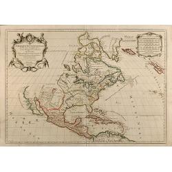
L' AMERIQUE MERIDIONALE ET SEPTENTRIONALE.
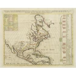
A striking example of N. De Fer's desirable map of the Americas. In North America, California is shown as an Island with coastal names. An early Great Lakes configuration...
Place & Date: Paris, 1717
Selling price: $350
Sold in 2019
Pas kaart Van Rio Oronoque Golfo de Paria met d'Eylanden Trinidad, Tabago, Granada, Granadillos, en Bequia ...
Double page chart of the mouth of the Orinoco and the adjacent Venezuelan coastline orientated with north to the right edge. The islands of Trinidad, Tobago and Grenada s...
Place & Date: Amsterdam, Gerard van Keulen 1717
Selling price: $551
Sold in 2020
Pas Kaart Van de Noord Kust van Espaniola met d'Eylanden door Benoorden
Double page chart showing the north coast of Hispaniola with the adjacent islands of the Turks and Caicos. Inset charts of the island of Tortue and the bay of Gonaives. T...
Place & Date: Amsterdam: [Gerard van Keulen 1717
Selling price: $590
Sold in 2020
Pas - Kaart Vande Zee Kusten inde Boght van Niew Engeland tusschen de Staaten Hoek en C. de Sable ...
Double page chart of the coastline and waters of New England from Cape Cod through to southern Nova Scotia. The chart with rhumb lines, compass roses and a ship illustrat...
Place & Date: Amsterdam, Gerard van Keulen 1717
Selling price: $2150
Sold in 2020
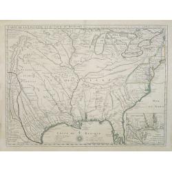
Carte de la Louisiane et du cours du Mississipi.
First issue, first state (New Orleans not yet located) of “the first detailed map of the Gulf region and the Mississippi, [and] the first printed map to show Texas”(T...
Place & Date: Paris 1718
Selling price: $9000
Sold
Carte qui contient la maniere.. Niagara..
A series of 12 engravings together with descriptive text, derived from the works of Lahontan and Hennepin.They illustrate the methods of the Indians hunting buffalo and s...
Place & Date: The Hague 1718
Selling price: $575
Sold
Partie Meridionale de La Riviere de Missisipi..
The printed version of the most important map of the Mississippi Valley and Gulf of Mexico, prepared in manuscript by De L'Isle (Carte des Environs du Mississippi, 1701) ...
Place & Date: Paris, 1718
Selling price: $8400
Sold in 2013
Carte de la Louisiane et du cours du Mississipi.
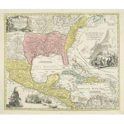
First issue, second state. First map to name New Orleans. This map is known for its detailed depiction of the states adjacent to the Gulf of Mexico region and the Mississ...
Place & Date: Paris, 1718
Selling price: $11600
Sold in 2008
Carte du Mexique et de la Floride des Terres Angloises et des Isles Antilles du Cours et des Environs de la Riviere de Mississipi ... Par Guillaume Del\'Isle Geographe de l\'Academie Royale des Scieces.
Rare first edition, second state of the first printed map to accurately depict the course and mouth of the Mississippi River. De L\'Isle\'s Carte du Mexique is drawn from...
Place & Date: Paris, 1703 / 1708-1718
Selling price: $1850
Sold in 2009
Carte de la Louisiane et du cours du Mississipi.
First issue, first state. New Orleans not yet listed!. This map is known for its detailed depiction of the states adjacent to the Gulf of Mexico region and the Mississipp...
Place & Date: Paris, 1718
Selling price: $15000
Sold
Carte de la Louisiane et du cours du Mississipi.
First issue, first state. New Orleans not yet listed!. This map is known for its detailed depiction of the states adjacent to the Gulf of Mexico region and the Mississipp...
Place & Date: Paris, Juin 1718
Selling price: $6000
Sold in 2018
L'Amerique Septentrionale qui fait partie des Indes Occidentales..
A handsome miniature-map showing California as an island after Sanson. Sanson's details are generally followed.The British colonies are shown confined east of the Appalac...
Place & Date: Paris, 1719
Selling price: $410
Sold in 2017
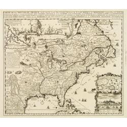
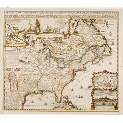
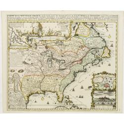
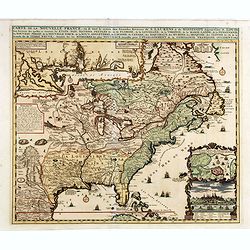
Carte de la Nouvelle France, ou se voi le cours. . .
Derived from de Fer's 1718 map, from west of the Mississippi it contains a mass of inland detail with notes and vignettes of the indigenous peoples and fauna of North Ame...
Place & Date: Amsterdam, 1719
Selling price: $2000
Sold
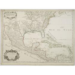
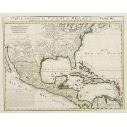
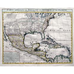
Carte contenant le Royaume du Mexique et la Floride.
This is a derivative of Delisle's landmark map of the southern part of North America. The detailed map shows many English settlements along the East Coast and carefully n...
Place & Date: Amsterdam, 1719
Selling price: $500
Sold in 2019
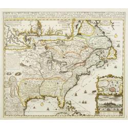
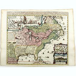
Carte de la Nouvelle France, ou se voi le cours..
Derived from de Fer's 1718 map, from west of the Mississippi it contains a mass of inland detail with notes and vignettes of the indigenous peoples and fauna of North Ame...
Place & Date: Amsterdam 1719
Selling price: $950
Sold
Carte de la Mer du Nord.
Fine map of the Atlantic Ocean. An extremely rare edition of the De Fer map. With 3 inset maps. Lower right Cape of Good Hope, upper right Gibraltar, and in upper center ...
Place & Date: Paris 1719
Selling price: $2100
Sold
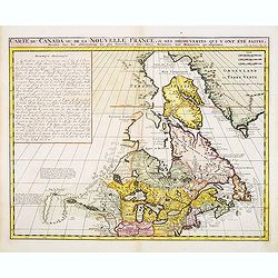
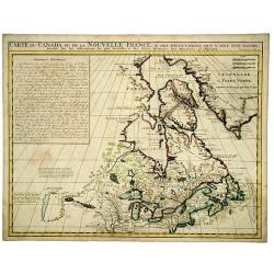
Carte du Canada ou de la Nouvelle France ..
Chatelain's map of Canada follows in its rendering of the Great Lakes closely the de l'Isle model of 1703 but from an entirely new plate with a large panel of text in pla...
Place & Date: Amsterdam 1719
Selling price: $400
Sold
Carte contenant le Royaume du Mexique et la Floride.
ñ This is a derivative of Delisle's landmark map of the southern part of North America. The detailed map shows many English settlements along the East Coast and carefull...
Place & Date: Amsterdam, 1719
Selling price: $750
Sold
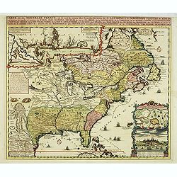
Carte de la Nouvelle France, ou se voi le cours..
Derived from de Fer's 1718 map, from west of the Mississippi it contains a mass of inland detail with notes and vignettes of the indigenous peoples and fauna of North Ame...
Place & Date: Amsterdam 1719
Selling price: $2000
Sold
L' Amerique Meridionale qui fait l' autre Partie des Indes Occidentales, Dressée tres Exactement Suivant les Observations..
Charming small map of the South American continent with good detail. Decorated with a title cartouche with two natives in the Atlantic and a sea battle being waged in the...
Place & Date: Paris 1719
Selling price: $300
Sold
Carte particuliere du Fleuve Saint Louis..
The map covers the area of South Hudson Bay and concentrates on the great lakes. Based on the 1703 map by Lahontan.The St. Laurent is shown running into the Great Lakes f...
Place & Date: Amsterdam, 1719
Selling price: $830
Sold
Carte contenant le Royaume du Mexique et la Floride.
This is a derivative of Delisle's landmark map of the southern part of North America.The detailed map shows many English settlements along the East Coast and carefully no...
Place & Date: Amsterdam, 1719
Selling price: $850
Sold
Carte de la Nouvelle France, ou se voi le cours..
Derived from de Fer\'s 1718 map, from west of the Mississippi it contains a mass of inland detail with notes and vignettes of the indigenous peoples and fauna of North Am...
Place & Date: Amsterdam, 1719
Selling price: $2500
Sold in 2009
Amerique Septentrionale divisee en ses Principales Parties
Attractive map of North America. By Jaillot and Sanson. California between island and peninsula. Pacific Northwest is unexplored. Old outline color.
Place & Date: 1719
Selling price: $1000
Sold in 2010
Carte contenant le royaume du Mexique et la Floride.
From Chatelains Atlas Historique. Based upon De L'Isle's landmark map of the region.
Place & Date: Amsterdam, 1719
Selling price: $600
Sold in 2009
LE PEROU Dans l'Amérique Méridionale ?
Map of Peru including parts of present-day Ecuador, Bolivia, and Brazil. Cartographic elements include location of native American settlements, rivers, lakes, and wetland...
Place & Date: Paris, 1719
Selling price: $475
Sold in 2009
A New & Exact Map of the Coast, Countries and Islands within ye Limits of ye South Sea Company from ye River Aranoca to Terra del Fuego and from thence through ye South Sea, to ye North Part of California &c. . . . (Galapagos Islands!)
Very decorative map of the whole of South America extending north as far as the island California and Florida. Numerous insets including Acapulco, the Galapagos Islands, ...
Place & Date: London, 1719
Selling price: $2000
Sold in 2019
Carte de la Nouvelle Franc, ou se voi le cours des grandes rivieres. . .
Derived from de Fer's 1718 map, from west of the Mississippi it contains a mass of inland detail with notes and vignettes of the indigenous peoples and fauna of North Ame...
Place & Date: Amsterdam, 1719
Selling price: $1750
Sold in 2017
Carte de la Nouvelle Franc où se voit le cours des Grandes Rivières de St Laurens et de Mississipi Aujourd'hui St Louis . . .
Derived from de Fer's 1718 map, from west of the Mississippi it contains a mass of inland detail with notes and vignettes of the indigenous peoples and fauna of North Ame...
Place & Date: Amsterdam, 1719
Selling price: $1500
Sold in 2012
Carte du Canada ou de la Nouvelle France, & des Découvertes qui y ont été faites..
Chatelain's map of Canada follows in its rendering of the Great Lakes closely the de l'Isle model of 1703 but from an entirely new plate with a large panel of text in pla...
Place & Date: Amsterdam, 1719
Selling price: $210
Sold in 2014
Carte du Canada ou de la Nouvelle France, & des Découvertes qui y ont été faites..
Chatelain's map of Canada follows in its rendering of the Great Lakes closely the de l'Isle model of 1703 but from an entirely new plate with a large panel of text in pla...
Place & Date: Amsterdam, 1719
Selling price: $425
Sold in 2013
Carte de la Nouvelle France, où se voit le cours des Grandes Rivières de S. Laurens & de Mississipi
An intricate map of eastern North America was copied from De Fer and designed to show the courses of the St. Laurence and the Mississippi rivers. One inset charts the mou...
Place & Date: Amsterdam, 1719
Selling price: $1500
Sold in 2013
L'Amerique Septentrionale qui fait partie des Indes Occidentales..
A handsome miniature-map showing California as an island after Sanson. Sanson's details are generally followed.The British colonies are shown confined east of the Appalac...
Place & Date: Paris, 1719
Selling price: $400
Sold in 2014
L' Amerique Meridionale qui fait l' autre Partie des Indes Occidentales, Dressée tres Exactement Suivant les Observations..
Charming small map of the South American continent with good detail. Decorated with a title cartouche with two natives in the Atlantic and a sea battle being waged in the...
Place & Date: Paris, 1719
Selling price: $300
Sold
Carte De La Nouvelle France, ou se voit le cours des Grandes Rivieres de. S. Laurens & de Mississipi Aujour d'hui S. Louis, Aux Environs des-quelles se trouvent les Etats, Pais, Nations, Peuples &c. de la Floride, de la Louisiane, de la Virginie, de la M
Nice original old color rare single sheet map of the inhabited parts of North America. This map is based on the 4-sheet map by Nicholas De Fer which appeared in 1718.This...
Place & Date: Paris, 1719
Selling price: $990
Sold in 2016
Carte de la Nouvelle France, ou se voi le cours..
Derived from de Fer's 1718 map, from west of the Mississippi it contains a mass of inland detail with notes and vignettes of the indigenous peoples and fauna of North Ame...
Place & Date: Amsterdam, 1719
Selling price: $2000
Sold
Carte de la Nouvelle France, ou se voi le cours..
Derived from de Fer's 1718 map, from west of the Mississippi it contains a mass of inland detail with notes and vignettes of the indigenous peoples and fauna of North Ame...
Place & Date: Amsterdam, 1719
Selling price: $1250
Sold in 2022
Le Bresil, dont les côtes sont divisées en capitaineries Dressé sur les dernières rélation. . .
Uncommon issue of this fine map of Brazil prepared by Nicolas de Fer, issued by Guillaume Danet.Originally published in atlas Atlas Curieux by N. de Fer in 1700-05, at hi...
Place & Date: Paris, 1719
Selling price: $350
Sold in 2017
Carte de la Nouvelle France, ou se voi le cours. . .
Derived from de Fer's 1718 map, from west of the Mississippi it contains a mass of inland detail with notes and vignettes of the indigenous peoples and fauna of North Ame...
Place & Date: Amsterdam, 1719
Selling price: $1400
Sold in 2019
Carte contenant le Royaume du Mexique et la Floride. . .
A double-page engraved map of Texas, Florida, the Gulf Coast, and Central America, based on Guillaume De L'Isle's important Carte du Mexique. It shows parts of the Great ...
Place & Date: Amsterdam, 1719
Selling price: $400
Sold in 2019
CARTE du CANADA ou de la NOUVELLE FRANCE, & Des decouvertes qui y ont ete faites. . .
Henri Chatelain's map of Canada follows in its rendering of the Great Lakes closely the de l'Isle model of 1703, but from an entirely new plate with a large panel of text...
Place & Date: Amsterdam, 1719
Selling price: $400
Sold in 2020
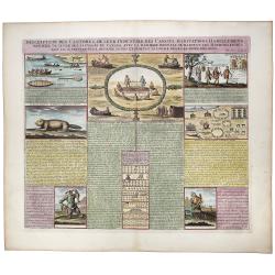
Inscription des Castors & De Leur Industrie des Canots Habitations Habillemens, maniere de vivre des sauvages du Canada. . .
A very unique sheet of various engravings concerning Native American customs and indigenous animals in North America. Includes a large view of an American buffalo and a g...
Place & Date: Paris, ca 1719
Selling price: $130
Sold in 2020
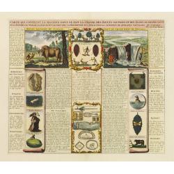
Carte Qui Contient la Mantere don't se Fait La Chasse des Boeufs Sauvages et des Elans, Le Grand Saut de la riviere de Niagar a la danse du Calumet. . .[NIAGARA FALLS..]
A beautiful colored chart showing the Natives of Canada. A very unique sheet of various engravings concerning Native American customs and indigenous animals in North Amer...
Place & Date: Paris, 1719
Selling price: $150
Sold in 2020
L'Amerique Septentrionale qui fait partie des Indes Occidentales . . . [California island]
A fine example of the 1719 Chiquet's map of North America, with the accompanied related engraved French text sheet entitled "Description Abregé de l'Amerique Septen...
Place & Date: Paris, 1719
Selling price: $300
Sold in 2021
Le Golfe de Panama &cc.Cartagene,..
An impressive large sheet chart of Panama and part of the Colombia coast up to Santa Nevada de Santa Marta. In top left corner, detailed inset map (190x460mm) of Sambalas...
Place & Date: Amsterdam 1720
Selling price: $1200
Sold
Amplissimae Regionis Mississipi,.. Provinciae Ludovicianae
Attractive map of present-day U.S. from Nouveau Mexico to the Atlantic, centring on the French province of Louisiana, with the English colonies and Spanish Florida indica...
Place & Date: Nuremberg 1720
Selling price: $1575
Sold
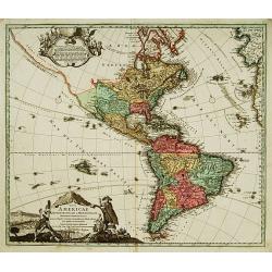
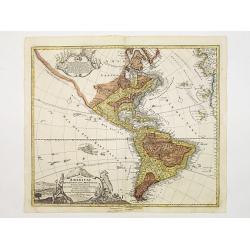
Totius Americae Septentrionalis et Meridionalis.
Richly ornamented map of North and South America. Title cartouche bottom left is copied from De Fer's map of 1699 and cartouche containing text (top left) is based on De ...
Place & Date: Nuremberg 1720
Selling price: $700
Sold
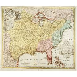
Nova Anglia Septentrionali Americae implantata . . .
German interest in North America was high during the first half of the eighteenth century when Johann Baptiste Homann was the leading German cartographer. During this per...
Place & Date: Nurnberg, 1720
Selling price: $1050
Sold in 2022
L'Amérique Méridionale..
Fine and uncommon map of south America. Very decorative title cartouche on the lower left corner. The map is printed within a large, elaborately engraved mock-frame borde...
Place & Date: Leiden 1720
Selling price: $270
Sold
Indiarum Occidentalium Tractus Littoralis cum Insulis..
One of the most splendidly engraved Dutch charts of the Caribbean with two decorative cartouches, one of which illustrates Native American cannibals preparing a meal. Inc...
Place & Date: Amsterdam 1720
Selling price: $3000
Sold
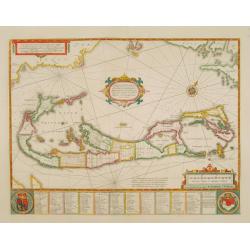
Mappa Aestivarum Insularum, alias Barmudas..
The map is the rare re-issue of the Blaeu's copperplate of 1630. The map includes the arms of Bermuda and England, and lists proprietors of the various tribes into which ...
Place & Date: Amsterdam 1720
Selling price: $1850
Sold
Amplissimae Regionis Mississipi,.. Provinciae Ludovicianae.
Attractive map of present-day U.S. from Nouveau Mexico to the Atlantic, centring on the French province of Louisiana, with the English colonies and Spanish Florida indica...
Place & Date: Nuremberg 1720
Selling price: $2500
Sold
Koning en Koningin van de Mississippi.
An Indian couple of the Mississippi area. From a book satirizing the disastrous Mississippi scheme (1718-1720) of the French Compagnie d'Occident and the speculation of i...
Place & Date: Amsterdam, 1720
Selling price: $100
Sold in 2013
Pasquins windkaart op de windnegotie van 't Iaar 1720
Pasquin's wind card on the wind trade of the year 1720. Set of 52 illustrated playing-cards with human figures and a little explanation under each one. Interesting is the...
Place & Date: Amsterdam 1720
Selling price: $1150
Sold
Amplissimae Regionis Mississipi,.. Provinciae Ludovicianae..
Attractive map of present-day U.S. from Nouveau Mexico to the Atlantic, centering on the French province of Louisiana, with the English colonies and Spanish Florida indic...
Place & Date: Nuremberg 1720
Selling price: $2150
Sold
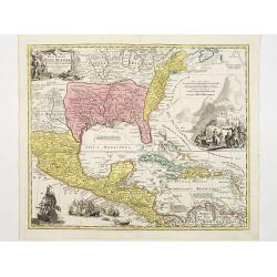
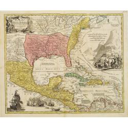
Regni Mexicani seu Novae Hispaniae, Floridae, Novae ..
The map shows the eastern sea board of America, the West Indies and the various estates and countries that border the Gulf of Mexico, with decorative -uncolored- cartouch...
Place & Date: Nuremberg 1720
Selling price: $1200
Sold
Totius Americae Septentrionalis et Meridionalis..
Richly ornamented map of North and South America. Title cartouche bottom left is copied from De Fer's map of 1699 and cartouche containing text (top left) is based on De ...
Place & Date: Nuremberg 1720
Selling price: $700
Sold
America tam Septentrionalis quam Meridionalis..
An uncommon map of the Americas with two superb pictorial (uncolored) cartouches. Engraved by A.F. Zurner and based largely on Visscher and Sanson. California is shown as...
Place & Date: Amsterdam 1720
Selling price: $1500
Sold
Carte de la Nouvelle France, ou se voit le cours des Grandes Rivieres de S. Laurens & de Mississipi..
Derived from de Fer's 1718 map, from west of the Mississippi it contains a mass of inland detail with notes and vignettes of the indigenous peoples and fauna of North Ame...
Place & Date: Amsterdam 1720
Selling price: $1700
Sold
Regni Mexicani seu Novae Hispaniae, Floridae, Novae ..
The map shows the eastern sea board of America, the West Indies and the various estates and countries that border the Gulf of Mexico, with decorative -uncolored- cartouch...
Place & Date: Nuremberg 1720
Selling price: $1900
Sold
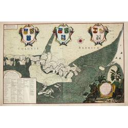
Platte Grond van Rio de Berbice.
Jan Daniel Knapp?s large-scale map of the Dutch plantations along the river Berbice in present day Guyana. The map shows the division of property and plantations and the ...
Place & Date: Amsterdam, 1720
Selling price: $1400
Sold
Nova Anglia Septentrionali Americae implantata ..
German interest in North America was high during the first half of the eighteenth century when Johan Baptiste Homann was the leading German cartographer. During this peri...
Place & Date: Nuremberg 1720
Selling price: $1700
Sold
Nouvelle Carte de l' Amerique Septentrionale Dressee sur les plus Nouvelles Observations de Messieurs de l' Academie..
Great map of North America with well developed cartography in the Great Lakes and Mississippi River.It includes all of Central America and the West Indies. The English se...
Place & Date: Amsterdam 1720
Selling price: $600
Sold
Nouvelle Carte de l' Amerique Septentrionale Dressee sur les plus Nouvelles Observations de Messieurs de l' Academie..
Great map of North America with well developed cartography in the Great Lakes and Mississippi River.It includes all of Central America and the West Indies. The English se...
Place & Date: Amsterdam 1720
Selling price: $525
Sold
Amplissimae Regionis Mississipi,.. Provinciae Ludovicianae..
Attractive map of present-day U.S. from Nouveau Mexico to the Atlantic, centering on the French province of Louisiana, with the English colonies and Spanish Florida indic...
Place & Date: Nuremberg 1720
Selling price: $2500
Sold
Nieuwe Wassende graadige Pas-kaart van de kust van Guinea en Brasilia..
Engraved by I.van Anse. A very representative example of a Dutch chart of the Atlantic.The chart shows the western coast of Africa but the information provided in the map...
Place & Date: Amsterdam c.1720
Selling price: $2450
Sold
America tam Septentrionalis quam Meridionalis..
An uncommon map of the Americas with two superb pictorial (uncolored) cartouches. Engraved by A.F. Zürner and based largely on Visscher and Sanson. California is shown a...
Place & Date: Amsterdam, 1720
Selling price: $1800
Sold in 2020
Carte de l'Isle de Saint Domingue Dressée en 1722 pour l'usa
Map of the island Hispaniola, now Haiti and the Dominican Republic. Embellished with a charming title cartouche and two compass roses. Shows the south easternmost part of...
Place & Date: Amsterdam, 1720
Selling price: $300
Sold in 2008
Regni Mexicani seu Novae Hispaniae, Floridae, Novae ..
The map shows the eastern sea board of America, the West Indies and the various estates and countries that border the Gulf of Mexico, with decorative cartouches. The map ...
Place & Date: Nuremberg 1720
Selling price: $1600
Sold in 2009
Amplissimae Regionis Mississipi,.. Provinciae Ludovicianae..
Attractive map of present-day U.S. from Nouveau Mexico to the Atlantic, centering on the French province of Louisiana, with the English colonies and Spanish Florida indic...
Place & Date: Nuremberg 1720
Selling price: $2530
Sold in 2009
Insulae Americanae Nempe: Cuba, Hispaniola, Iamaica, Pto Rico, Lucania, Antillae vulgo Caribe, Barlo-et Sotto-Vento Etc. . . .
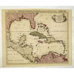
A rare re-issue of the plate by Danckerts. The West Indies with the gulf of Mexico and Florida. The map shows prominently in the centre Cuba, Haiti, the Bahamas and Flori...
Place & Date: Amsterdam, 1720
Selling price: $1500
Sold in 2009
Amplissimae Regionis Mississipi,.. Provinciae Ludovicianae. . .
Attractive map of present-day U.S. from Nouveau Mexico to the Atlantic, centering on the French province of Louisiana, with the English colonies and Spanish Florida indic...
Place & Date: Nuremberg, 1720
Selling price: $2200
Sold in 2019
Regni Mexicani seu Novae Hispaniae, Floridae, Novae . . .
The map shows the eastern sea board of America, the West Indies and the various estates and countries that border the Gulf of Mexico, with decorative -uncolored- cartouch...
Place & Date: Nuremberg, 1720
Selling price: $1750
Sold in 2019
De inbeelding heersseres van't rookverkopers-gild, maald Mississippi hier 't geen Vrankryks schat verspild.
Decorative print published in : Het groote tafereel der dwaasheid : vertoonende de opkomst, voortgang en ondergang der actie, bubbel en windnegotie, in Vrankryk, Engeland...
Place & Date: Amsterdam, 1720
Selling price: $160
Sold in 2010
Nouvelle Carte de l\' Amerique Septentrionale Dressee sur les plus Nouvelles Observations de Messieurs de l\' Academie. . .
Great map of North America with well developed cartography in the Great Lakes and Mississippi River.It includes all of Central America and the West Indies. The English se...
Place & Date: Amsterdam, 1720
Selling price: $210
Sold in 2011
Stoel des Oorlogs in America Waar in Vertoont Werden Alle Desself Voornaamste Eylande . . .
Large impressive map of the West Indies with the Gulf of Mexico and Florida. The map shows prominently in the center Cuba, Haiti, the Bahamas and Florida, which is here m...
Place & Date: Amsterdam, c. 1720
Selling price: $450
Sold in 2014
Carte de la Louisiane et du Cours du Mississipi Dressée sur un grand nombre de Memoires.
Anonymous map copied from the important de L'Isle map. The map shows "Natichitoches, éstablissemt. François fait en 1717 par Mr. De Bienville" and routes of e...
Place & Date: Paris, c. 1720
Selling price: $500
Sold in 2012
A new map of the English Empire in America. . .
This fine English map of eastern North America including Canada engraved by John Harris and first published by Robert Morden. John Senex acquired and made minor alteratio...
Place & Date: London, 1720
Selling price: $1400
Sold in 2013
A new map of New France containing Canada, Louisiana &c. in N.th America. . .
A fine map of Canada, Great Lakes and most of South east New Foundland. For this edition the London meridian is used with Deg.West from London and Deg.East from London en...
Place & Date: London, c. 1720
Selling price: $255
Sold in 2013
Insulae Americanae Nempe: Cuba, Hispaniola, Iamaica, Pto Rico, Lucania, Antillae vulgo Caribe, Barlo-et Sotto-Vento Etc. . . .
A rare re-issue of the plate by Danckerts. The West Indies with the gulf of Mexico and Florida. The map shows prominently in the center Cuba, Haiti, the Bahamas and Flori...
Place & Date: Amsterdam, 1720
Selling price: $700
Sold in 2013

















![Carte Qui Contient la Mantere don't se Fait La Chasse des Boeufs Sauvages et des Elans, Le Grand Saut de la riviere de Niagar a la danse du Calumet. . .[NIAGARA FALLS..]](/uploads/cache/83653-250x250.jpg)
![L'Amerique Septentrionale qui fait partie des Indes Occidentales . . . [California island]](/uploads/cache/85233-250x250.jpg)

