Browse Listings in America
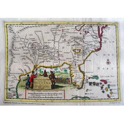
Le Canada, ou Nouvelle France la Florida, la Virginie, ? Misispi
Fine map of the eastern coast of North America. Engraved by Herman van Loon, a Dutch engraver active in Amsterdam, after 1686 in Paris. ¤
Place & Date: Paris, 1705
Selling price: $800
Sold in 2009
Le Chili et Les Provinces qui Composent Celle de Rio De La Plata avec Les Terres Magellanique. . .
Somewhat uncommon map of the southern part of South America, showing excellent detail along the River Plate and the Pacific Coast to the Andes mountains. Two globes and a...
Place & Date: Paris, 1705
Selling price: $170
Sold in 2011
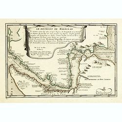
Le Detroit De Magellan . . . Se trouve . . . Il fut decouvert par Ferdinand . . .
Somewhat uncommon map of the Straits of Magellan, showing soundings, place names and other details in the passage through the Strait. Engraved by the master engraver Inse...
Place & Date: Paris, 1705
Selling price: $140
Sold in 2011
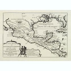
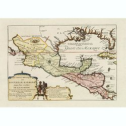
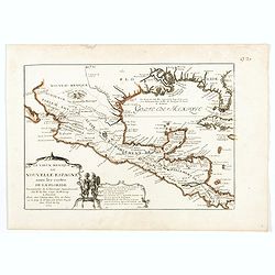
Le vieux Mexique ou nouvelle Espagne. . .
Detailed and important map of Mexico and Central America. The 'Atlas Curieux' was published in parts at first, and then as a complete entity in 1705.
Place & Date: Paris, 1705
Selling price: $160
Sold in 2011
Carte du gouvernement de l'Amerique.
A double page map including a fine map of America, with California as an island with indented northern coastline. Lots of text and four insets of four governments of the ...
Place & Date: Amsterdam, 1705
Selling price: $100
Sold in 2011
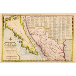
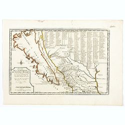
Cette Carte de Californie et du Nouveau Mexique.
A most important map, identifying by numerical code some 314 places in New Mexico, and showing in detail California as an island, although based on Sanson's monumental ma...
Place & Date: Paris, 1705
Selling price: $1200
Sold
Le Detroit De Magellan Se trouve . . . Il fut decouvert par Ferdinand Magellan. . .
Somewhat uncommon map of the Straits of Magellan, showing soundings, place names and other details in the passage through the Strait. Engraved by the master engraver Inse...
Place & Date: Paris, 1705
Selling price: $220
Sold in 2012
Le vieux Mexique ou nouvelle Espagne. . .
Detailed and important map of Mexico and Central America. The 'Atlas Curieux' was published in parts at first, and then as a complete entity in 1705.
Place & Date: Paris, 1705
Selling price: $275
Sold in 2015
Nouvelle Carte de l\' Amerique Septentrionale dressee sur les plus Nouvelles Observations de Messieurs de l\' Academie des Sciences et des Meilleurs Geographes avec des tables tres instructives et curieuses de la division de tous les Etats.
From: Atlas Historique. A fine folio map with California as an island. All five of the Great Lakes are present; but Lake Erie is unnamed. The Ohio River is shown, but unn...
Place & Date: Amsterdam, 1705
Selling price: $250
Sold in 2014
Le Detroit De Magellan . . . Se trouve . . . Il fut decouvert par Ferdinand . . .
Somewhat uncommon map of the Straits of Magellan, showing soundings, place names and other details in the passage through the Strait. Engraved by the master engraver Inse...
Place & Date: Paris, 1705
Selling price: $200
Sold in 2017
Cette Carte de Californie et du Nouveau Mexique.
A most important map, identifying by numerical code some 314 places in New Mexico, and showing in detail California as an island, although based on Sanson's monumental ma...
Place & Date: Paris, 1705
Selling price: $750
Sold in 2015
Sasquesahanok, Village palissade en Virginie, partie de l'Amerique/ Temple ou est l'Idole de Vens, adoree en Virginie/ Habillemens des Hommes et Femmes de Virginie
Copper engraving of Native Americans of Virginia by John Harris, from the: 'Navigantium atque Itinerantium Bibliotheca'; or, 'A Compleat Collection of Voyages and Travels...
Place & Date: London, 1705
Selling price: $210
Sold in 2015
Les Isles De L'Amerique Connues Sous le Nom D'Antilles, ou Sont les Isles de Cuba, St. Domingue et Jamaique, les Lucayes, les Caribes, et celles du Vent.
A detailed copper engraved map of the West Indies, from Florida and the Bahamas until Venezuela and Trinidad. With many place names, islands, bays, and several notes on t...
Place & Date: Paris, 1705
Selling price: $135
Sold in 2017
Cette Carte de Californie et du Nouveau Mexique.
A most important map, identifying by numerical code some 314 places in New Mexico, and showing in detail California as an island, although based on Sanson's monumental ma...
Place & Date: Paris, 1705
Selling price: $750
Sold in 2019
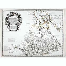
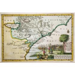
Le Canada, ou Nouvelle France la Florida, la Virginie, Pensilvanie . . .
Fine map is showing the east coast of the United States from the Caribbean up to Newfoundland, with the western border just beyond the Mississippi.The course of the Missi...
Place & Date: Paris, 1705
Selling price: $600
Sold in 2019
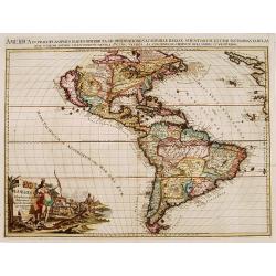
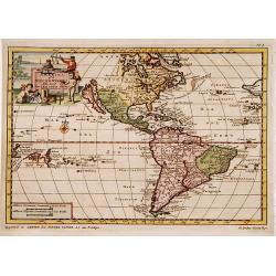
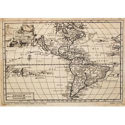
L'Amerique, Meridionale et Septentrionale.
Fine map of the Western hemisphere showing California with indented northern coast: Agubela de Cato to north. Includes partial outline of New Zealand. Interesting Great L...
Place & Date: Paris, 1705
Selling price: $425
Sold in 2021
Cette Carte de Californie et du Nouveau Mexique . . .
A most important map, identifying by numerical code some 314 places in New Mexico, and showing in detail California as an island, although based on Sanson's monumental ma...
Place & Date: Paris, 1705
Selling price: $750
Sold in 2020
Le Vieux Mexique ou Nouvelle Espagne . . .
Attractive map covering the Gulf of Mexico through Central America also including parts of Cuba and Jamaica. It extends through Mexico to show the southern tip of Baja Ca...
Place & Date: Paris, 1705
Selling price: $500
Sold in 2022
Le Canada, ou Nouvelle France la Florida, la Virginie, Pensilvanie . . .
Fine map is showing the east coast of the United States from the Caribbean up to Newfoundland, with the western border just beyond the Mississippi.The course of the Missi...
Place & Date: Paris, 1705
Selling price: $600
Sold in 2020
L'AMERIQUE, Meridionale et Septenstrionale.[California island]
A fine map of the Western hemisphere showing California as an island with indented northern coast: Agubela de Cato to north. Includes partial outline of New Zealand. Inte...
Place & Date: Paris, 1705
Selling price: $400
Sold in 2020
Le Canada, ou Nouvelle France la Florida, la Virginie, Pensilvanie . . .
A fine map is showing the east coast of the United States from the Gulf of Mexico and the Caribbean up to Newfoundland, with the western border just beyond the Mississipp...
Place & Date: Paris, 1705
Selling price: $555
Sold in 2021
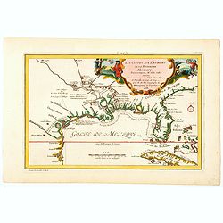
Les Costes aux Environs de la Riviere de Misisipi.
An historically important map of Florida and the Gulf Coast circa 1700 showing especially the estuary of the Mississippi in some detail, more or less correctly located.Th...
Place & Date: Paris, 1705
Selling price: $600
Sold in 2021
Partie Meridionale de la Virginie et la .. Floride..
Uncommon map of Virginia and the Carolinas.
Place & Date: Amsterdam 1706
Selling price: $1500
Sold
Canada ou Nouvelle France..
Uncommon map of Canada, including Great Lakes and East Coast down to Philadelphia. The map is printed within a large, elaborately engraved mock-frame border, which was pr...
Place & Date: Amsterdam 1706
Selling price: $1100
Sold
America, of Nieuw-Ontdekte Wereld, tot de Beschryving van Joseph d\'Acosta afgebakend.
Pieter van der Aa was a prolific publisher. He published a.o. ' Naauwkeurge versameling der gedenkwaardigste zee- en land-reysen', a series of accounts of voyages (1706-0...
Place & Date: Leiden, 1706
Selling price: $625
Sold in 2010
Canada ou Nouvelle France..
Uncommon map of Canada, including Great Lakes and East Coast down to Philadelphia.
Place & Date: Amsterdam, 1706
Selling price: $600
Sold in 2008
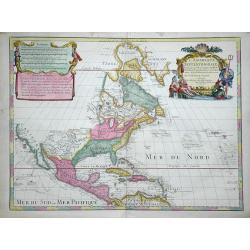
L'AMERIQUE SEPTENTRIONALE.[California island]
A map of North and Central America showing California as a hugh island stretching as far north as Alaska with indented coastline, and with the place names of: R'Estiete, ...
Place & Date: Amsterdam, 1706
Selling price: $200
Sold in 2021
Amerika of de Nieuwe Weereld.
A fine detailed map centred on the American continent. With charming pictorial title piece on the upper left-hand corner.Although not renowned for the originality of his ...
Place & Date: Leiden 1707
Selling price: $340
Sold
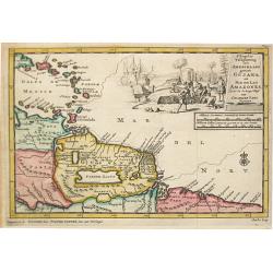
d' Engleze Volksplanting in' t Amerikaans Gewest Gujana en Rio de Las Amazones. Door de Scheeps-Togt van Charles Leig Begonnen.
Pieter van der Aa was a prolific publisher. He published a.o. ' Naaukeurige versameling der gedenkwaardigste zee- en land-reysen', a series of accounts of voyages (1706-0...
Place & Date: Leiden, 1707
Selling price: $200
Sold
Brasilaanze Scheepvaard door Johan Lerius Gedaan uit Vrankryk in' t Jaar 1556.
Pieter van der Aa was a prolific publisher. He published a.o. ' Naaukeurige versameling der gedenkwaardigste zee- en land-reysen', a series of accounts of voyages (1706-0...
Place & Date: Leiden, 1707
Selling price: $250
Sold
Amerika of de Nieuwe Wereld.
Pieter van der Aa was a prolific publisher. He published a.o. ' Naauwkeurge versameling der gedenkwaardigste zee- en land-reysen', a series of accounts of voyages (1706-0...
Place & Date: Leiden, 1707
Selling price: $550
Sold
Nieuw Engeland in Twee Scheepstogten door Kaptein Johan Smith in de Jaren 1614 en 1615 Bestevend.
Pieter van der Aa was a prolific publisher. He published a.o. ' Naaukeurige versameling der gedenkwaardigste zee- en land-reysen', a series of accounts of voyages (1706-0...
Place & Date: Leiden, 1707
Selling price: $700
Sold
' T noorder Deel van Amerika.
Pieter van der Aa was a prolific publisher. He published a.o. ' Naauwkeurge versameling der gedenkwaardigste zee- en land-reysen', a series of accounts of voyages (1706-0...
Place & Date: Leiden, 1707
Selling price: $700
Sold
Hispaniola.
A map of the island of Hispaniola with an attractive cartouche. Pieter van der Aa was a prolific publisher. He published a.o. "Naauwkeurge versameling der gedenkwaar...
Place & Date: Leiden, 1707
Selling price: $80
Sold in 2020
't Noorder Gedeelte van Virginie door Bartholomeus Gosnol en Martin Pringe uyt England bevaaren
Pieter van der Aa was a prolific publisher. He published a.o. ' Naaukeurige versameling der gedenkwaardigste zee- en land-reysen', a series of accounts of voyages (1706-0...
Place & Date: Leiden, 1707
Selling price: $400
Sold in 2018
Zee en Land-Togten der Franszen Gedaan na, en in' t Americaans Gewest van Florida door Ioh. Pontius Ontdekt.
Pieter van der Aa was a prolific publisher. He published a.o. ' Naaukeurige versameling der gedenkwaardigste zee- en land-reysen', a series of accounts of voyages (1706-0...
Place & Date: Leiden, 1707
Selling price: $850
Sold
De Straat van Magellaen Sedert deszelfgs eerste ondekker, F. Magellaen Ao 1520 meermaal bevaren.
Pieter van der Aa was a prolific publisher. He published a.o. ' Naaukeurige versameling der gedenkwaardigste zee- en land-reysen', a series of accounts of voyages (1706-0...
Place & Date: Leiden, 1707
Selling price: $325
Sold in 2008
Jomathan Dickensons Ramspoedige Reystogt van Jamaika na Pensylvania Nagespond
A scarce Van Der Aa map of Florida and the Carolinas unusually oriented to the east and covering the Great Lakes to Jamaica. A very crisp copy in bright example.
Place & Date: Leiden, 1707
Selling price: $325
Sold in 2016
T Amerikaans Gewest van Florida Door Ferdinand de Soto.
A scarce early 18th century Van Der Aa map of Florida with enormous boundaries covering all of southeastern America from Texas to Lake Erie. A decorative cartouche shows ...
Place & Date: Leiden, 1707
Selling price: $320
Sold in 2017
America of Nieuw Ontekte Weereld tot de Beschryving Joseph D'Acosta afgebakend
An interesting 1707 Van Der Aa map of the Western Hemisphere showing one open-ended Great Lake, a misshapen Hudson Bay, California as an island, spurious North American m...
Place & Date: Leiden, 1707
Selling price: $250
Sold in 2017
A. Knivets zeldzame Reystogt door de Straat Magellaan na de Zuyd Zee tot aan zijn Vlugt in Angola achtervolgt. 3262 / H. Benzös scheeps-togt uit Italien over Spanje na de Westindize Eylanden, en Kusten van' t Zuider America. 3285
Together 2 map of the Americas. Published by Pieter van der Aa who was a prolific publisher. He published a.o. ' Naaukeurige versameling der gedenkwaardigste zee- en land...
Place & Date: Leiden, 1707
Selling price: $200
Sold in 2021
Zee en Land-Togten der Franszen Gedaan na, en in' t Americaans Gewest van Florida door Ioh. Pontius Ontdekt.
An antique map of Georgia and the North and South Carolina. Pieter van der Aa was a prolific publisher. He published a.o. 'Naaukeurige versameling der gedenkwaardigste ze...
Place & Date: Leiden, 1707
Selling price: $220
Sold in 2021
Land en Volk-ontdekkingen in' t Noorder gedeelte van America door P. Marquette en Joliet gedaan in' t Jaar 1673.
An important map of the Mississippi river area, illustrating the voyage of Marquette and Joliet made in 1673. Embellished with a large and decorative title-cartouche, sho...
Place & Date: Leiden, 1707
Selling price: $600
Sold in 2021
[Lot of 10 (2x maps / 8x views of Guyana)] d' Engleze Volksplanting in' t Amerikaans Gewest Gujana en Rio de Las Amazones. Door de Scheeps-Togt van Charles Leig Begonnen.
[Lot of 10 (2x maps / 8x views of Guyana]- d'Engelze Volkplanting in't Amerikaans gewest Gujana en Rio de las Amazones. circa 1700 - Land-Kaart van het Eiland en de Vo...
Place & Date: Leiden, 1706-1707
Selling price: $144
Sold in 2023
Carolina. / A map of.. Bermudos.
Two maps on one folding sheet. To the left a map of the Carolinas and to the right a map of Bermuda.This map by Herman Moll was published in the first edition of John Old...
Place & Date: London 1708
Selling price: $520
Sold
L'Amerique Septentrionale.
Uncommon issue of this decorative map of North America, covering Central America, showing east coast, California, Canada, Caribbean and northern part of South America. Sh...
Place & Date: Amsterdam / Paris 1708
Selling price: $1150
Sold
L'AMERIQUE SEPTENTRIONALE Dressée sur les Observations de Mr
One of the most influential maps of North America, laying the groundwork for much of the cartography of the 18th century. This is an early re-issue of De l'Isle's landmar...
Place & Date: Paris, 1700 -1708
Selling price: $400
Sold in 2012
America Aurea Pars Altera Mundi
This ornamental map of the Americas depicts California as an island with a northern coastline indented by two bays on the second Sanson model. California is separated fro...
Place & Date: Amsterdam, 1708
Selling price: $850
Sold in 2012
L'Amerique Septentrionale. Dressée sur les Observations de Mrs. de l'Academie Royale des Sciences...
Attractive example of De L'Isle's very important map of North America, the first map to show California as a peninsula again. Further it has a better and a more accurate ...
Place & Date: Paris, c1708
Selling price: $1300
Sold in 2016
[Lot of 3 maps of America] AMERICA.
An excellent small map of the American continent by Herman Moll, 1709. Showing California as an island. 265 x 200mm.- South America, small map engraved for Walkers Geogra...
Place & Date: London, 1709
Selling price: $32
Sold in 2022
Pas-kaart van de Zee Kusten van Carthagena Tierra Firma, Costa Rica, ende Honduras…
A nautical showing the Caribbean coast, with Panama, Northern Colombia, Costa Rica to Cartagena. Includes four insets: Port of Carthagena; S. Barnardo Islands; port of No...
Place & Date: Amsterdam, J. van Keulen, 1697-1709
Selling price: $325
Sold in 2023
North America corrected from the observations communicated to the Royal Society of London, and the Royal Academy at Paris...
Monumental and important large wall map of the Eastern part of North America with the United States, Central America, and the West Indies. Centered on the great lakes.1st...
Place & Date: London, c 1710
Selling price: $1300
Sold in 2008
Nova Anglia Septentrionali Americae implantata ..
German interest in North America was high during the first half of the eighteenth century when Johan Baptiste Homann was the leading German cartographer. During this peri...
Place & Date: Nuremberg, c.1710
Selling price: $800
Sold in 2011
Novi Orbis sive Totius Americae cum adiacentibus Insulis. . .
A nice map of the Americas, supplemented by a splendidly decorative title cartouche in the lower left corner of the map. It features native Indians and a Westerner smokin...
Place & Date: Nuremberg, 1710
Selling price: $160
Sold in 2017
L'Amerique, Dressee sur les Observations de Mrs. de l'Academie Royale des Sciences, et suivant les Memoires les moins suspects.
A nice, scarce map depicting the American continent with the known towns, rivers and lakes. It shows the mythical 'Terre de Jesso', Tierra del Fuego is depicted as an isl...
Place & Date: Paris, 1710
Selling price: $150
Sold in 2018
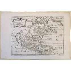
Amerique Septentrionale.
Early and interesting map of North America with large blank parts and California as an island. Names a large Floride. Rey Coromedo Nouveau in todays Arizona, and Coste de...
Place & Date: Paris, ca. 1710
Selling price: $155
Sold in 2019
Amerique meridionale.
A small map of South America with an interestingly shaped of coast line. It shows a few dates and fictional islands. A large "Terres Inconnues" is shown in the ...
Place & Date: Paris, ca 1710
Selling price: $38
Sold in 2019
SOUTH AMERICA. Corrected from the Observations comunicated to the Royal Societys of London & Paris.
A lovely extra large map of South America, dedicated by Senex to the famous Astronomer and Mnathematician Edmund Halley LLD Savilian Professor of Geometery in Oxford and ...
Place & Date: London, 1710
Selling price: $450
Sold in 2022
H. Benzos Scheep-togt uit Italie over Spanje na de Westindize Eylanden, en Kusten van't Zuider America.
A delightful map of the Atlantic Ocean highlighting the route of explorer Hieronymus Benzon, who travelled from Spain to the Americas, and back to Italy between 1541-56. ...
Place & Date: Leiden, ca 1710
Selling price: $150
Sold in 2020
A Map of Peru and the West Part of the Country of the Amazones.
A map showing a good proportion of the west coast of South America, covering Peru, Chile, Western Brazil and Quito (Equador). Many coastal settlements and towns are engra...
Place & Date: London, 1711
Selling price: $60
Sold in 2019
Die vornehmste Eigenthums Herren und Befitzer von Carolina..
Complete title in cartouche lower right : Die vornehmste / Eigenthums Herren und Besitzer / von / CAROLINA. / Lord CRAVEN. / Hertzog von BEAVFORT. / Lord CARTERET. / ASHL...
Place & Date: Hamburg, 1712
Selling price: $1040
Sold
Die vornehmste Eigenthums Herren und Befitzer von Carolina..
Complete title in cartouche lower right : Die vornehmste / Eigenthums Herren und Besitzer / von / CAROLINA. / Lord CRAVEN. / Hertzog von BEAVFORT. / Lord CARTERET. / ASHL...
Place & Date: Hamburg, 1712
Selling price: $1200
Sold in 2009
Carte du Canada ou de la Nouvelle France.
Fourth state of the map of Canada published by Delisle with the imprint "sur le Quai de l’Horloge a l’Aigle d’Or avec Privilege pour 20 ans, 1703". Beneat...
Place & Date: Paris, 1703/1708-1712
Selling price: $800
Sold in 2020
L'Amérique selon les nouvelles..
Rare. Van der Aa's lavish engraving makes his maps among the most prized of the early eighteenth century. This is one of the most attractive and superbly engraved of all ...
Place & Date: Leiden 1713
Selling price: $4500
Sold
L'Amerique Selon les nouvelles Observations de Messrs de l'Academie des Scineces etc.
Scarce map. Pieter van der Aa's lavish engraving makes his maps among the most prized of the early eighteenth century. This is one of the most attractive and superbly eng...
Place & Date: Leiden, 1713
Selling price: $2000
Sold in 2020
Nouvelle Carte de Geographie de la Partie Meridionale de l'Amerique Suivant les Plus Nouvelles Observations
A striking large map of South America, with information about various discoveries, expeditions, and colonies. In the Pacific, the routes of Magellan, Schouten & Le Ma...
Place & Date: Paris, 1713
Selling price: $130
Sold in 2016
L'Amerique Selon les nouvelles observations de Messrs. de l'Academie des Sciences.
A striking large format map of America, published in Leiden by Pierre van der Aa, in 1713. The map features California as an Island and a projection of the Mississippi pu...
Place & Date: Leiden, 1713
Selling price: $1080
Sold in 2023
America in Praecipuas Ipsius Partes Distributa ad Observationes. . . 1713.
A large impressive map of the Americas, Western Hemisphere. Full title above: 'America in praecipuas ipsius partes distributa ad observationes Academiae regiae scientiaru...
Place & Date: Leiden, 1713
Selling price: $1750
Sold in 2020
America Aurea pars altera mundi.
California is copied from second Sanson map, with rugged coastline throughout, and with Fretum Anianiand Terra Esonis to northwest.Place names along California coast, but...
Place & Date: Amsterdam c. 1714
Selling price: $1225
Sold
Les Provinces de Rio de la Plata.
Extremely rare map of the region including the Paraguay River basin and the Peru-Chilean coast with Lake Titicaca. The Rio de la Plata is boldly shown with many large isl...
Place & Date: Leiden 1714
Selling price: $450
Sold
Virginia Marylandia et Carolina in America Septentrionali Britannorum industria excultae. . .
Homann's important map intended to attract German emigration to America. It extends from New York City and Long Island south until present day Georgia, and as far west as...
Place & Date: Nuremberg, ca 1714
Selling price: $610
Sold in 2019
Nouvelle Carte de L' Amerique.
A decorative early 18th century map with California as an island. Full title and impressum in a cartouche top left: 'Nouvelle Carte de L' Amerique, avec tous ses Royaumes...
Place & Date: Leiden, 1714
Selling price: $1000
Sold in 2020
Terra Neuf, en de Custen van Nieu Vranckryck, Nieu Engeland, Nieu Nederland, Nieu Andalusia, Guiana en Venezuela
L. Renard's edition of Frederick de Wit's magnificent Atlantic chart oriented to the East. From the 1715 edition of "Atlas de la Navigation et du Commerce". A f...
Place & Date: Amsterdam, 1715
Selling price: $1700
Sold in 2012
Amerique Septentrionale.
Interesting 1715 quarto-size copy of Sanson's important map of North America, typically found in editions of L'Amerique published from 1656 to 1683. This copy from Chemer...
Place & Date: Utrecht, 1715
Selling price: $400
Sold in 2015
L'Ile De Terre Neuve Et Le Golfe De Scint Laurent Selon Les Meilleurs Memoires.
A well engraved chart that details the sea around the outlet of the St. Laurence River and the Gulf of St. Lawrence, Newfoundland, Canada. Made by J.F. Bernard, and publi...
Place & Date: Amsterdam, 1715
Selling price: $90
Sold in 2019
Descriptions des Plantes, Arbres, Animaux & Poissons des Iles Antilles.
An interesting sheet with eight detailed views illustrating fauna and flora on the Antillean islands, and how the slaves make sugar, with descriptive French text, from Ch...
Place & Date: Amsterdam, 1715
Selling price: $170
Sold in 2020
NOVA ANGLIA Septentrionali Americae impantata Anglorumique coloniis florentissima. Geographice exhibita a Ioh. Baptista Homann...
An early map of the Northeast North America, extending north to include Maine and the St. Lawrence and south to include virtually all of New Jersey.In the early 18th cent...
Place & Date: Nurmberg, 1716
Selling price: $600
Sold in 2017
A New Map of the Island of Jamaica.
Finely engraved map of Jamaica showing towns, churches, sugar works, cotton works, indico works and cacao works. Rich nomenclature illustrating the coast.Adorned with a c...
Place & Date: London 1717
Selling price: $180
Sold
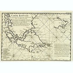
Carte réduite de l'extrémité de l'Amérique méridionale dans la partie du Sud . . .
Map of the southern extremities prepared by the French military engineer, mathematician, spy, and explorer Amédée-François Frezier (1682-1773).He is best remembered fo...
Place & Date: Amsterdam, Pierre Humbert, 1717
Selling price: $180
Sold in 2012
Cours du Fleuve Maragon Autrement du de Amazones. . .
This was the first close to correct chart of the Maranon territory. The map shows all of northern South America, and locates Lima and Cusco. With a decorative title carto...
Place & Date: London, 1717
Selling price: $150
Sold in 2018








![L'AMERIQUE, Meridionale et Septenstrionale.[California island]](/uploads/cache/83556-250x250.jpg)



![L'AMERIQUE SEPTENTRIONALE.[California island]](/uploads/cache/85225-250x250.jpg)







![[Lot of 10 (2x maps / 8x views of Guyana)] d' Engleze Volksplanting in' t Amerikaans Gewest Gujana en Rio de Las Amazones. Door de Scheeps-Togt van Charles Leig Begonnen.](/uploads/cache/IMG_2322-250x250.jpg)


![[Lot of 3 maps of America] AMERICA.](/uploads/cache/48389-250x250.jpg)


