Browse Listings in America
Amerique Meridionale, Par P. Du Val . . .
Map of the Southern Hemisphere showing South America, New Zealand, the southern coasts of Australia, and route of Le Maire across the Pacific. Published by P. Du-Val betw...
Place & Date: Paris, 1676
Selling price: $550
Sold
A Map of Jamaica & Barbados.
A Map of Jamaica and Barbados on one sheet,both with elaborate strapwork cartouches and mileage scales, compass roses and numerous rhumb lines. This is one of the new map...
Place & Date: London, 1676
Selling price: $750
Sold in 2012
A Map of Jamaica & Barbados.
A Map of Jamaica and Barbados on one sheet, both with elaborate strapwork cartouches and mileage scales, compass roses and numerous rhumb lines. This is one of the new ma...
Place & Date: London, 1676
Selling price: $750
Sold in 2013
Aestivarum Insularum alias Bermudas...
This beautiful map was compiled in 1622 by Richard Norwood. It’s the first English printed map published in an atlas to show Bermuda divided into Tribes and Shares. The...
Place & Date: London, 1676
Selling price: $700
Sold in 2016
Carte de La Virginie.
Uncommon miniature map of Virginia from Pierre Duval's La Geographie Universeille dated 1676. It depicts the now defeated Swedish colony, and the inactive French claim of...
Place & Date: Paris, 1676
Selling price: $240
Sold
Magellanique.
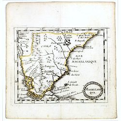
Uncommon miniature map of Magellan strait and the southern tip of Latin America from Pierre Duval's La Geographie Universeille. Ferdinand Magellan sailed through the stra...
Place & Date: Paris, 1676
Selling price: $100
Sold in 2016
MAGELLAN STRAIT, TERRA DEL FUOGO [without title].
An extremely rare variant of the map of the Magellan Strait and Tierra del Fuego. Here erased are the jagged oceans and no text is printed on the verso. From the updated ...
Place & Date: Amsterdam, 1676
Selling price: $475
Sold in 2021
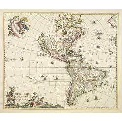
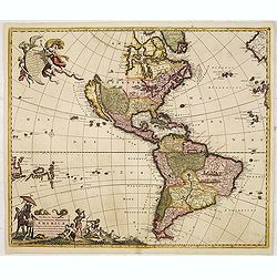
Novissima et Accuratissima Totius Americae Descriptio.
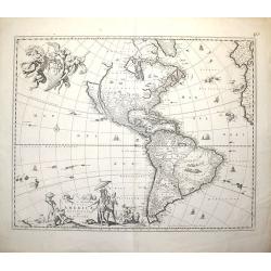
Second state of Visscher's map of the Americas, this decorative map greatly influenced the cartography of the Americas both geographically and artistically.Although it di...
Place & Date: Amsterdam 1677
Selling price: $2100
Sold
Atlantis Insula, a Nicoloa Sanson.
Nicolas Sanson's map of the Americas, published by his son Guillaume. In the Pacific the discoveries of Abel Tasman, Tasmania and New Zealand are depicted.California show...
Place & Date: Paris, c.1677
Selling price: $475
Sold in 2020
Novissima et Accuratissima Totius Americae Descriptio per N. Visscher
Second state, with the privilege in lower part. Insular California.A map of importance...it became the standard representation of North America for a number of years and ...
Place & Date: Amsterdam, c.1677
Selling price: $2000
Sold in 2008
L'America Meridionale Nuovamente corretta et accresciuta . . .
Giacomo Giovanni Rossi's map of South America, based upon Sanson's map, but with revised Italian nomenclature. From his 'Mercurio Geografico'. The engraver was Giorgio Wi...
Place & Date: Rome, 1677
Selling price: $350
Sold in 2012
Le Canada faict par le St. de Champlain..
The fourth printed state of Champlain's 1616 plate of Canada. According to Wroth, Du Val somehow came into possession of the Champlain plate, printed a proof state, then ...
Place & Date: Paris, 1677
Selling price: $3700
Sold in 2012
Novissima et Accuratissima Totius Americae Descriptio.
Second state of Visscher's map of the Americas, this decorative map greatly influenced the cartography of the Americas both geographically and artistically.Although it di...
Place & Date: Amsterdam, 1677
Selling price: $800
Sold in 2013
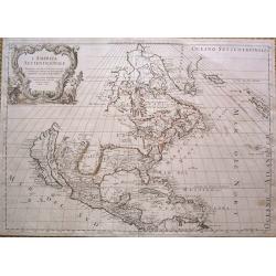
L'America Settentrionale.
Full title: 'L' America Settentrionale. Nuouamente corretta, et accresciuta secondo le relationi piu moderne, da GVGLIELMO SANSONE Geografe di S M Chrisftianis. E data in...
Place & Date: Rome, 1677
Selling price: $1700
Sold in 2015
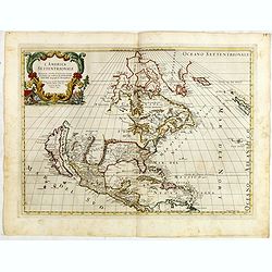
L' America Settentrionale. Nuouamente corretta, et accresciuta secondo le relationi piu moderne, da GVGLIELMO SANSONE. . .
Rossi's map of North America, based upon Sanson's seminal map, but with revised Italian nomenclature. Includes a detailed California as an Island on Sanson's model, and e...
Place & Date: Rome, 1677
Selling price: $1000
Sold in 2015
Le Canada faict par le St. De Champlain. . .
This is the sixth and final printed state of Champlain’s 1616 plate of Canada issued by Pierre Du Val. The original 1616 Champlain map was never published, and only one...
Place & Date: Paris, 1677
Selling price: $6200
Sold in 2016
Florida.
Uncommon derivate of this miniature map of Louisiana and Florida. Similar to the map in Pierre Duval's La Geographie Universeille, which was derived from La Floride , 165...
Place & Date: Nuremberg 1678
Selling price: $655
Sold
Virginia.
Uncommon derivate of this miniature map of Virginia, earlier published in Pierre Duval's La Geographie Universeille. It depicts the now defeated Swedish colony, and the i...
Place & Date: Nuremberg 1678
Selling price: $750
Sold
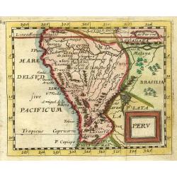
Peru.
"Nice miniature map covering the region from the Equator to the Tropic of Capricorn. At upper right corner in Brazil 'Lac Parime"" with the golden city 'Ma...
Place & Date: Paris 1679
Selling price: $120
Sold
Mexico sive N. Hispania.
Miniature map of Mexico and Central America including Cuba. Pierre Duval was Nicolas Sanson's nephew and pupil. He published a wide range of atlases and individual maps i...
Place & Date: Nuremberg, 1679
Selling price: $100
Sold
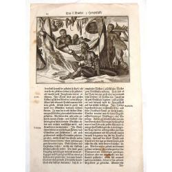
Florida (Two Copper Engravings)
Two Very interesting hand-colored copper engravings featuring Native American in Florida. One is titled ""Native Americans Walk Through Forest" and the oth...
Place & Date: Amsterdam, 1679
Selling price: $80
Sold in 2013
Kaert van Groen-Land [Map of Greenland]
A very rare map of the Northern Atlantic Ocean, showing the North American coast, Greenland, Scotland and the coast of Norway. In the Atlantic are Iceland and the mythica...
Place & Date: Nuremberg or Netherlands, after 1679
Selling price: $650
Sold in 2023
Novissima et Accuratissima Totius Americae descriptio..
One of the classic Dutch maps of the Americas and one of the most often copied.On either side of the map are tables listing the Cities, keyed to the map. Lower right hand...
Place & Date: Amsterdam 1680
Selling price: $1760
Sold
Nova et Accurata Brasiliae totius tabula.
The map Nova Brasiliae Typus was published by Willem Blaeu in his atlas Appendix in 1630. In 1642 a new, updated map Nova et Accurata Brasiliae with a much more detailed ...
Place & Date: Amsterdam 1680
Selling price: $950
Sold
Magnum Mare del Zur.
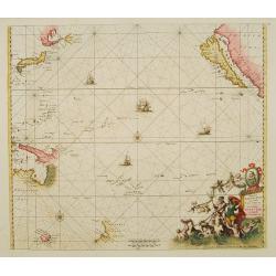
Based on Goos' 1666 chart, California depicted with an indented northern coastline following the second Sanson model. Tasmania, NW Australia and Carpentaria appear, as do...
Place & Date: Amsterdam 1680
Selling price: $2900
Sold
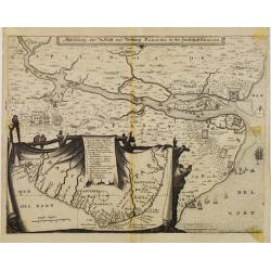
Abbildung der Statt und Vestung Parayba in der Landschaft Brasilia.
Detailed map of the region of Paraiba and the defending forts at the mouth of the River Paraiba.The map illustrates the Dutch incursion into the Portuguese territory and ...
Place & Date: Frankfurt, 1680
Selling price: $200
Sold in 2013
Novissima et Accuratissima Totius Americae descriptio..
One of the classic Dutch maps of the Americas and one of the most often copied.Lower right hand corner F. de Wit excudit. Several editions would appear through the end of...
Place & Date: Amsterdam 1680
Selling price: $850
Sold
Mappa Aestivarum Insularum alias Barmudas..
A very decorative map. The large title cartouche shows Neptune with mermaids and a sea-monster.The map includes the arms of England and Bermuda, and lists proprietors of ...
Place & Date: Amsterdam, 1680
Selling price: $1250
Sold in 2008
Tractus Australior Americae Meridionalis a Rio de la Plata per Fretum Magellanicaum ad Toraltum . . .
A decorative chart of the southern coast of Chile and Argentina from Toral to Rio del Plata. A large vignette battle scene occupies the South Atlantic and the title is se...
Place & Date: Amsterdam, 1680
Selling price: $900
Sold in 2009
Abbildung der Statt und Vestung Parayba in der Landschaft Brasilia.
In lower part map inset of general map of Brazil.
Place & Date: Frankfurt, 1680
Selling price: $200
Sold in 2008
Mappa Aestivarum Insularum alias Barmudas. . .
A very decorative map. The large title cartouche shows Neptune with mermaids and a sea-monster.The map includes the arms of England and Bermuda, and lists proprietors of ...
Place & Date: Amsterdam, 1680
Selling price: $1200
Sold
Insulae Americanae in Oceano ...
A beautiful map that includes the American Southeast, part of Mexico, Central America, and the northern part of South America.
Place & Date: Amsterdam, 1680
Selling price: $1100
Sold in 2014
Novissima et Accuratissima Totius Americae descriptio.
Visscher's map of the Americas, this decorative map greatly influenced the cartography of the Americas both geographically and artistically.Although it did not provide mu...
Place & Date: Amsterdam, 1658 - 1680
Selling price: $1100
Sold in 2010
Novissima et Accuratissima Totius Americae descriptio..
One of the classic Dutch maps of the Americas and one of the most often copied. Lower right hand corner F. de Wit excudit.Several editions would appear through the end of...
Place & Date: Amsterdam, 1680
Selling price: $1200
Sold in 2013
Novissima et Accuratissima Septentrionalis ac Meridionalis Americae...
An attractive, original color map of North and South America.The map was originally based on the Visscher map of 1670 of the Americas. What is especially interesting abo...
Place & Date: Amsterdam, (1670) 1680
Selling price: $999
Sold in 2014
Septemtrionaliora Americae a Groenlandia, per Freta Davidis, et Hudson, ad Terram Novam - De Noordelyckste Zee kusten van America van Groenland door de Straet Davis ende Straet Hudson tot Terra Neuf
De Wit's fine of Hudson Bay and Arctic Canada. This includes Hudson Bay and Strait, Baffin Bay and extends to include the western coast of Greenland. The chart shows a s...
Place & Date: Amsterdam, 1680
Selling price: $850
Sold in 2014
Septemtrionaliora Americae & Groenlandia, per Freta Davidis.
Chart of Hudson Bay and Arctic Canada, from Wit's Orbis Maritimus ofte Zee Atlas, published in 1680 in Amsterdam. The chart shows some of the earliest, tentative mapping ...
Place & Date: Amsterdam, 1680
Selling price: $500
Sold in 2012
Pascaert van Brasil-Littora Brasiliae.
Sea chart of the South American coastline from Guyana to Rio de la Plata. East to the top. Embellished with two compass roses and 5 sailing vessels.Oriented with north to...
Place & Date: Amsterdam, 1680
Selling price: $900
Sold
Paskaert waer in de graden.. custen van Africa en America..
Very fine , showing the points where the Dutch West India Company sailed: including Ireland, Portugal, Morocco, east coast of Africa, the Canary Islands, the Azores, Braz...
Place & Date: Amsterdam, 1680
Selling price: $2900
Sold in 2013
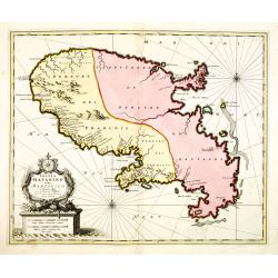
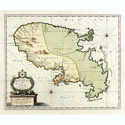
Insula Matanino vulgo Martanico in lucem edita / per Nicolaum Visscher cum Priviliegio Ordin: General Belgii Faederati.
Uncommon map, showing the portion of the island which had been taken from the Caribs up to that time. In lower left corner a title cartouche with fruit, tobacco, sugar.
Place & Date: Amsterdam, ca. 1680
Selling price: $900
Sold
Abbildung der Statt und Vestung Parayba in der Landschaft Brasilia.
Detailed map of the region of Paraiba and the defending forts at the mouth of the River Paraiba.The map illustrates the Dutch incursion into the Portuguese territory and ...
Place & Date: Frankfurt, 1680
Selling price: $300
Sold in 2015
West-Indische Paskaert waer in de graden der breedde over weder zijden vande middellijn wassende so vergrooten dat die geproportioneert sijn tegen hunne nevenstaende graden de lengde.
This is the second state of Goos' version of the West Indische Paskaert, published by Johannes Van Keulen, first published circa 1680.This second state was issued both as...
Place & Date: Amsterdam, 1680
Selling price: $14000
Sold in 2017
LA FLORIDE
Map of Florida, from the atlas L'Amérique en plusieurs cartes, et en divers traittés de Géographie, et d'Histoire.Nicolas Sanson was to bring about the rise of French ...
Place & Date: Paris 1680
Selling price: $475
Sold in 2019
Insula Matanino vulgo Martanico in lucem edita / per Nicolaum Visscher cum Priviliegio Ordin: General Belgii Faederati.
Uncommon map, showing the portion of the island which had been taken from the Caribs up to that time. In lower left corner a title cartouche with fruit, tobacco, sugar.
Place & Date: Amsterdam, ca. 1680
Selling price: $800
Sold in 2019
Pas-kaart van .. Brazilia tusschen I.S.Catharina en..
Johannes Van Keulen's superb chart of the entrance of the Rio de la Plata, including inset chart with the town of Boinos Aires. Published in his Zee-Atlas of 1681 and for...
Place & Date: Amsterdam 1681
Selling price: $1465
Sold
American Family at Rest.
Interesting map of a Native American family at rest. It gives an indication of dress, foods and customs. Olfert Dapper (1635 – 1689) was a Dutch physician and writer....
Place & Date: Amsterdam, 1681
Selling price: $20
Sold in 2015
Virginia.
Uncommon map of Virginia, printed by A. Godbid and J. Playford, for R. Scott. Included in "New systeme of the mathematicks: containing . . . II. Practical geometry. ...
Place & Date: London, 1681
Selling price: $1800
Sold
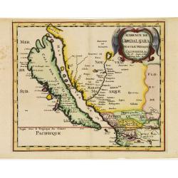
Audience de Guadalajara nouveau Mexique, Californie. &c.
From Sanson's Geographia Exactissima. A finely re-engraved Amsterdam version of Sanson's map of California and New Mexico, first published in 1657, which was the earliest...
Place & Date: Amsterdam 1682
Selling price: $1200
Sold
Insulae Americanae in Oceano Septentrionali ac Regiones Adiacentes.
A beautiful map that includes the American Southeast, part of Mexico, Central America, and the northern part of South America. Two cartouches with cherubs and mermaids de...
Place & Date: Amsterdam, 1682
Selling price: $700
Sold in 2009
P.les du Chile.
A charming copper engraving depicting a town surrounded by a luxuriant landscape on the background and a couple of indigenous on the foreground.From the French text editi...
Place & Date: Paris, 1683
Selling price: $40
Sold in 2011
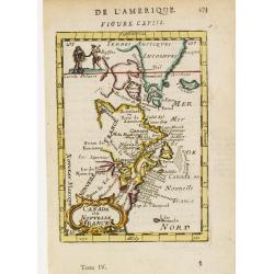
Canada ou Nouvelle France.
A strange early depiction of the Eastern Seaboard, from Terres Arctiques Incognues to Virginie, including also an outline of the Great Lakes. Native Indians appear at the...
Place & Date: Paris 1683
Selling price: $95
Sold
Floride.
Includes much of the Southern States.By Allain Manneson Mallet (1630-1706), a well travelled military engineer and geographer who worked in 17th century France under King...
Place & Date: Paris 1683
Selling price: $125
Sold
Mexique ou Nouvelle Espagne.
A charming late 17th century French map of North America, showing California to 30 degrees North and labelled I. Calfornie.
Place & Date: Paris 1683
Selling price: $95
Sold
Is. De Cuba et de Jamaica.
A charming late 17th century French map of Cuba and Jamaica.By Allain Manneson Mallet (1630-1706), a well travelled military engineer and geographer who worked in 17th ce...
Place & Date: Paris 1683
Selling price: $105
Sold
Amerique Septentrionale.
A charming late 17th century French map of North America, showing California to 40 degrees North and labelled I.Calfornie.
Place & Date: Paris 1683
Selling price: $110
Sold
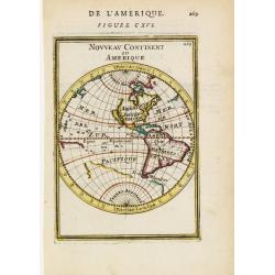
Nouveau Continent ou Amerique.
Attractive map of the western globe showing the American continent and large part of the Pacific ocean. It outlines the coasts of Australia and Antarctica according to th...
Place & Date: Paris 1683
Selling price: $75
Sold
St. Augus. De Floride.
Handsome view of the St. Augustine on the coast of Florida.From the French text edition of Description d'Univers, 1683. by Allain Manneson Mallet (1630-1706), a well trav...
Place & Date: Paris 1683
Selling price: $55
Sold
Royaume des Amazones.
Peculiar copper engraving showing a small map of the northern part of South America. The map is held by 2 native people with a verdant landscape on the background.From th...
Place & Date: Paris 1683
Selling price: $45
Sold
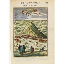
Montagne de Potosi.
Charming view of the silver-bearing Potosi mountain, in today Bolivia.From the French text edition of Description d'Univers, 1683. by Allain Manneson Mallet (1630-1706), ...
Place & Date: Paris 1683
Selling price: $40
Sold
P.les de la Floride.
Attractive copper engraving, depicting a couple of native people of Florida.From the French text edition of Description d'Univers, 1683. by Allain Manneson Mallet (1630-1...
Place & Date: Paris 1683
Selling price: $50
Sold
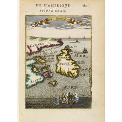
Isle de Terre Neuve.
Charming map centred on the island of Newfoundland, covering also the land around the St. Lawrence Gulf. Embellished with 6 sailing ships and hills in the Labrador area.F...
Place & Date: Paris 1683
Selling price: $78
Sold
Mexique.
Charming bird's-eye view of a Mexico City, with title garland on top.From the French text edition of Description d'Univers, 1683. by Allain Manneson Mallet (1630-1706), a...
Place & Date: Paris 1683
Selling price: $50
Sold
Havana.
Handsome view of the Havana harbour, assaulted by several vessels. Title garland on top.From the French text edition of Description d'Univers, 1683. by Allain Manneson Ma...
Place & Date: Paris 1683
Selling price: $50
Sold
Le plan de.. La Ville de San Domingo où de St. Dominique..
Charming bird's-eye view of Santo Domingo. With vessels approaching the shore and entering the harbour.From the French text edition of Description d'Univers, 1683. by All...
Place & Date: Paris 1683
Selling price: $40
Sold
I.d\'Hispaniola et Pto Rico.
Peculiar map showing the islands of Hispaniola and Puerto Rico. The map is inserted in a prospective view of the Caribbean Sea, where some vessels are involved in a naval...
Place & Date: Paris 1683
Selling price: $45
Sold
Isles Lucayes.
Peculiar map showing the Bahamas. The map is inserted in a prospective view of the Caribbean Sea, where some vessels are involved in a naval combat. Part of Cuba and Flor...
Place & Date: Paris 1683
Selling price: $75
Sold
Amerique Meridionale.
Map of South America, embellished with scenes of local customs inland, 5 vessels and a title cartouche.From the French text edition of Description d'Univers, 1683. by All...
Place & Date: Paris 1683
Selling price: $110
Sold
Païs qui sont aux Environs de la Riviere de la Plata et du Païs des Patagons.
Map of South America, centred on the basin drained by the main tributaries of the Río de la Plata. Embellished by many vessels and a decorative title cartouche surrounde...
Place & Date: Paris 1683
Selling price: $50
Sold
Perou.
Interesting map of Peru with the capital, Lima, in the centre.From the French text edition of Description d'Univers, 1683. by Allain Manneson Mallet (1630-1706), a well t...
Place & Date: Paris 1683
Selling price: $40
Sold
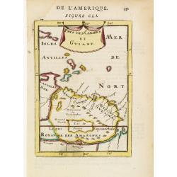
Pays des Caribes et Guiane.
Interesting map depicting the north coast of South America between the Orinoco and the Amazonas rivers, appreciatively corresponding to the Guianas. From the French text ...
Place & Date: Paris 1683
Selling price: $60
Sold in 2008
Bresil.
Interesting early map of Brazil. The wild inland as for example the later state of Mato grosso were still unexplored. The eastern border of Brazil is called Terre Inconnu...
Place & Date: Paris 1683
Selling price: $55
Sold
Royaume de Chili.
Interesting early map of Chile. The name Patagons is present on the southern border. The mountain range of the Andes is shown pictorially.From the French text edition of ...
Place & Date: Paris 1683
Selling price: $50
Sold
Dt de Magellan.
Interesting map depicting the area around the Magellan's Strait: the south most tip of South America and the Tierra del Fuego island. The map is inserted in a perspective...
Place & Date: Paris 1683
Selling price: $75
Sold
Cusco.
Charming view of the Peruvian town of Cuzco. From the French text edition of Description d'Univers, 1683. by Allain Manneson Mallet (1630-1706), a well travelled military...
Place & Date: Paris 1683
Selling price: $40
Sold
Carthagene.
Charming view of Cartagena in the Bolivar region, Colombia. Depicted with many vessels entering the harbour.From the French text edition of Description d'Univers, 1683. b...
Place & Date: Paris 1683
Selling price: $50
Sold
F. Lovys.
Bird's-eye view of Fort Louis on the island of Cayenne, besieged by fighting ships.From the French text edition of Description d'Univers, 1683. by Allain Manneson Mallet ...
Place & Date: Paris 1683
Selling price: $40
Sold
Isles Açores.
Charming map of the Azores inserted in a perspective view of the Atlantic ocean and embellished with fighting ships just off shores.From the French text edition of Descri...
Place & Date: Paris 1683
Selling price: $40
Sold
Isle de Cayenne.
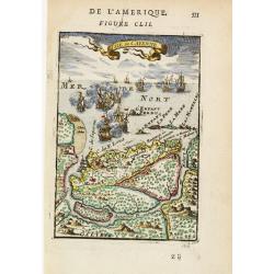
Dramatic view of the island of Cayenne, off French Guyana, showing Fort Louis and a fierce sea battle being waged just off shore.From the French text edition of Descripti...
Place & Date: Paris 1683
Selling price: $60
Sold in 2008
Callao.
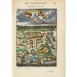
Bird's-eye view of the fortified sea town of Callao, besieged by fighting ships.From the French text edition of Description d'Univers, 1683. by Allain Manneson Mallet (16...
Place & Date: Paris 1683
Selling price: $40
Sold
I. de Guanahani ou de St. Salvador.
Charming map of the Guanahani Island, inserted in a perspective view of the Atlantic ocean and embellished with vessels approaching the shores.From the French text editio...
Place & Date: Paris 1683
Selling price: $50
Sold


![MAGELLAN STRAIT, TERRA DEL FUOGO [without title].](/uploads/cache/85229-250x250.jpg)








![Kaert van Groen-Land [Map of Greenland]](/uploads/cache/48503-250x250.jpg)


