Browse Listings in America
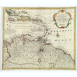
A New and Accurate Map of Terra Firma and the Caribbe Islands.
This is Emmanuel Bowen's attractive, decorative map of the Caribbean Islands, extending from eastern Cuba and Jamaica to Trinidad, and northern South America (Columbia, V...
Place & Date: London, ca 1747
Selling price: $130
Sold in 2018
Zuyd America. L'Amerique Meridionale.
An unusual map of South America in an early shape and with two mythological lakes. The track of Jacques Le Maire is shown in the Pacific. Above the title cartouche, nativ...
Place & Date: Amsterdam, 1747
Selling price: $21
Sold in 2018
A New and Accurate Map of Paraguay, Rio De La Plata, Tucumania Guaria &c. . .
A fine and decorative map of south central South America from Bowens Atlas "A Complete System of Geography". With a cartouche illustrating natives and European ...
Place & Date: London, ca 1747
Selling price: $124
Sold in 2019
A New and Accurate Map of Virginia & Maryland. Laid Down from Surveys and Regulated by Astronl. Observatns
Scarce map of the Chesapeake region by Bowen from 'A Complete System of Geography'. Based on Hermann's map of 1673 and Popple's map of 1733. Showing numerous early towns ...
Place & Date: London, c.1747
Selling price: $600
Sold in 2020
A New and Accurate Map of N. Jersey, Pensilvania, New York. . .
A scarce map of New Jersey, New York, Pennsylvania, Maine, New Hampshire and Connecticut. Canada extends south to the Pennsylvania border. Published by E. Bowen from A Co...
Place & Date: London, 1747
Selling price: $240
Sold in 2021
A new and accurate map of Chili, Terra Magellanica. . .
A delightful map of the southern part of South America from A Complete System of Geography. With one title cartouche and a compass rose. With two inset plans, a beautiful...
Place & Date: London, 1747
Selling price: $110
Sold in 2021
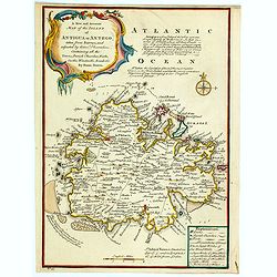
A New and Accurate Map of the Island of Antigua or Antego. . .
Bowen's maps of Antigua from A Complete System of Geography.. Decorated with a compass rose and a title cartouche. With extensive details and interesting annotations abou...
Place & Date: London, 1747
Selling price: $110
Sold in 2023
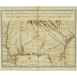
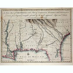
A New Map of Georgia with Part of Carolina, Florida and Loisiana..
Scarce and important early map of colonial Georgia. The map covers from Charles Town to the Mississippi River and extends into Florida to C. Canaveral. The coastal settle...
Place & Date: London c.1748
Selling price: $2525
Sold
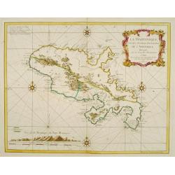
La Martinique une des Antilles Françoises de L'Amerique..
Fine map of Martinique. George Louis Le Rouge was active from 1740- till 1780 as a publisher, and was appointed engineer for the King of France.
Place & Date: Paris 1748
Selling price: $400
Sold
A New and Accurate Map of America..
An attractive map showing the full expanse of America. With decorative title cartouche featuring several Indians, one of whom casually rests his feet on an alligator.Alas...
Place & Date: London ca 1744 - 1748
Selling price: $300
Sold
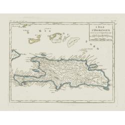
L'Isle St. Domingue.
Nice small map of Hispaniola. Including the Caicos Islands and the Great Inagua. From Atlas Portatif Universel, by Robert de Vaugondy.Page 535 and 95 outside border top r...
Place & Date: Paris, later than 1748
Selling price: $60
Sold in 2012
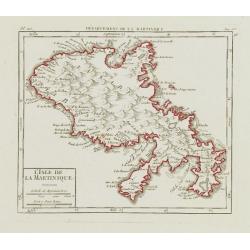
L\'Isle de la Martinique.
Nice small map of Martinique. From Atlas Portatif Universel, by Robert de Vaugondy.Page 563 and 96 outside border top right. To the left Pl. 110.Mary Sponberg Pedley does...
Place & Date: Paris, later than 1748
Selling price: $130
Sold in 2008
Nouvelle Angleterre N.lle York N.lle Jersey Pensilvanie Mariland et Virginie.
Charming small map showing the eastern States between New England and Carolina, including part of the Great Lakes area.Number 98 outside border top right. Mary Sponberg P...
Place & Date: Paris, 1748
Selling price: $250
Sold in 2008
Partie Septentrionale du Perou. . .
Detailed small map encompassing the Ecuadorian seacoasts and the Peruvian shores as far as Lima.In the hinterland the first stretch of the River Amazon. From Atlas Portat...
Place & Date: Paris, later than 1748
Selling price: $60
Sold in 2018
Partie Méridionale du Perou.
Detailed small map encompassing southern Peru, Bolivia and part of Chile. Centered on the lake Titicaca. Including the Atacama desert.From Atlas Portatif Universel, by Ro...
Place & Date: Paris, later than 1748
Selling price: $50
Sold in 2017
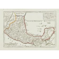
Partie du Mexique ou de la Nouv.lle Espagne où se trouve l'Audience du Mexique.
Nice small map showing the southern part of Mexico, from Guadalajara to the Yucatán Peninsula.From Atlas Portatif Universel, by Robert de Vaugondy. Page 90 outside borde...
Place & Date: Paris, later than 1748
Selling price: $210
Sold
A New Map of Georgia with Part of Carolina, Florida and Loisiana. . .
Scarce and important early map of colonial Georgia. The map covers from Charles Town to the Mississippi River and extends into Florida to C. Canaveral. The coastal settle...
Place & Date: London c.1748
Selling price: $1001
Sold in 2014
A Plan of the East End of the Island of Quibo.
A map showing the shoreline around Port de Dames indicating soft sand and mud, salt lagoons, fresh water, and fisherman's huts. Also marked are the islands of Quiveta and...
Place & Date: London, 1748
Selling price: $55
Sold in 2015
Amérique Meridionale..
Uncommon map of South America in 3 sheets.
Place & Date: Paris, 1748
Selling price: $400
Sold in 2016
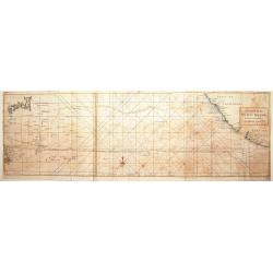
A Chart of the Pacific Ocean from the Equinoctial to the Latitude of 39 1/2d No.
This is a rare nautical chart of part of the Pacific Ocean displaying the routes of Spanish galleons between Acapulco and the Philippines. The tracks of the Spanish Nostr...
Place & Date: London, 1748
Selling price: $95
Sold in 2017
Amérique Meridionale. . .
Uncommon wall map of South America published by d''Anville and engraved by the master Guilluime Delahaye. Prepared by de la Condamine.
Place & Date: Paris, 1748
Selling price: $500
Sold in 2018
Les Isles Antilles.
Pleasing example of De Vaugondy's scarce map of the Caribbean. Note how Florida looked in the upper left corner. The map appeared in Vaugondy's "Atlas Portatif.&quo...
Place & Date: Paris, 1748
Selling price: $113
Sold in 2023
A Chart of the Southern Part of America, with the track of the Centurion. . .
A chart of the southern part of South America with the track of the Centurion from the Island of St Catherine to the Island of Juan Fernandes in which is inserted the var...
Place & Date: London, 1748
Selling price: $20
Sold in 2020
A NEW and Accurate Map of the North Pole, with all the Countries hitherto Discovered. . .
A spectacular Arctic and sub-Arctic map, showing excellent detail around Hudson Bay area, Greenland, Spitzbergen & the Northeast Coast of Europe & Asia. It depict...
Place & Date: London, 1748
Selling price: $300
Sold in 2021
Cours du Mississipi et La Louisiane. . .
Fine map depicting Mississippi delta and Great Lakes in upper right hand corner, from Atlas Portatif, Universel Et Militaire , first published in 1749.Map dated 1749.
Place & Date: Paris, 1749
Selling price: $250
Sold in 2021
Partie du Mexique ou de la Nouv.le Espagne ouse trouve..
Fine miniature map of California Peninsular, Mexico till the Gulf of Mexico. Found in his Atlas Portatif, universel et militaire, 1749-1799.
Place & Date: Paris 1749
Selling price: $300
Sold
Carte de la partie meridionale avec la route du Centurion, depuis l'Isle Ste. Catherine..
This fine chart shows the route of Capt. George Anson's ship The Centurion down the east coast of South America from St. Catherine's Island off the coast of Brazil, down ...
Place & Date: Amsterdam 1749
Selling price: $150
Sold
Kaart van het Zuidelykste Gedeelte van Zuider Amerika.. - Carte de la Partie Meridionale de l'Amerique Meridionale..
This fine chart shows the route of Capt. George Anson's ship "The Centurion" down the east coast of South America from St. Catherine's Island off the coast of B...
Place & Date: Amsterdam, ca 1749
Selling price: $120
Sold in 2012
Partie du Canada où se trouvent le Fleuve St. Laurent et la Nouvelle Ecosse.
Nice small map of Canada which shows the last stretch of the Saint Lawrence River, passing Quebec City before draining into the Gulf of Saint Lawrence.Tom 2. Page 184 out...
Place & Date: Paris, later than 1749
Selling price: $200
Sold
L'Acadie.
Nice small map of Nova Scotia. From Atlas Portatif Universel, by Robert de Vaugondy.Number 100 outside border top right. Mary Sponberg Pedley does not mention a state wit...
Place & Date: Paris, later than 1749
Selling price: $210
Sold
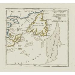
Golfe de St. Laurent, Isle et Bancs de Terre Neuve.
Nice small map showing the Gulf of Saint Lawrence as well as the islands of Newfoundland, Cape Breton and Prince Edward.Number 101 outside border top right. Mary Sponberg...
Place & Date: Paris, later than 1749
Selling price: $155
Sold in 2010
Isle Royale.
Nice small map of Cape Breton Island. From Atlas Portatif Universel, by Robert de Vaugondy.Number 102 outside border top right. Mary Sponberg Pedley does not mention a st...
Place & Date: Paris, later than 1749
Selling price: $200
Sold in 2010
Isle de Terre-Neuve.
Nice small map of Newfoundland. Showing good detail along the coasts. The inland is left blank except for a writing which says that the interior of the Island is complete...
Place & Date: Paris, later than 1749
Selling price: $80
Sold in 2015
Bayes d'Hudson et de Baffins, et Terre de Labrador.
Very attractive, small map focusing on Labrador, Baffin Bay, Hudson Bay and Greenland.The latter is represented with the three island configuration that began with Sanson...
Place & Date: Paris, later than 1749
Selling price: $100
Sold in 2018
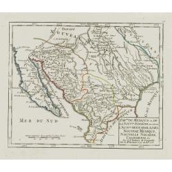
Partie du Mexique où de la Nouv.le Espagne.. Californie &c.
Nice small map showing the northern part of Mexico, from Lower California to Guadalajara.Pedley, Bel et utile, map 461, not mentioning this state.Number 91 outside border...
Place & Date: Paris, later than 1749
Selling price: $240
Sold
Les Lacs du Canada et Nouvelle Angleterre.
Charming small map showing the Great Lakes region from Superior to Ontario and including the northern part of Pennsylvania below Lake Erie, although the state is not name...
Place & Date: Paris, later than 1749
Selling price: $230
Sold
Cours du Mississipi et la Louisiane.
Nice small map showing the course of the Mississippi River, from Minnesota to the Gulf of Mexico.Number 92 outside border top right. Mary Sponberg Pedley does not mention...
Place & Date: Paris, later than 1749
Selling price: $95
Sold in 2022
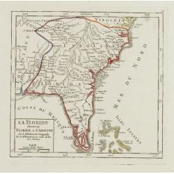
La Floride divisee en Floride et Caroline.
Nice small map representing the southeastern part of the United States, centred on Florida. It shows the Bahamas at the bottom.Number 93 outside border top right. Mary Sp...
Place & Date: Paris, later than 1749
Selling price: $260
Sold
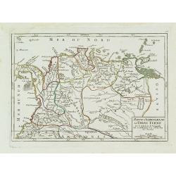
Partie Occidentale de la Terre Ferme.
Small detailed map showing the nor westernmost tip South America. Centered on Venezuela. From Atlas Portatif Universel, by Robert de Vaugondy.Page 106 outside border top ...
Place & Date: Paris, later than 1749
Selling price: $80
Sold in 2011
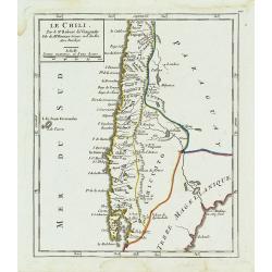
Le Chili.
Deatailed small map showing most part of Chile. Centered on Santiago. From Atlas Portatif Universel, by Robert de Vaugondy. 110 outside border top right. Mary Sponberg Pe...
Place & Date: Paris, later than 1749
Selling price: $65
Sold in 2014
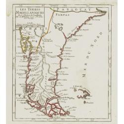
Les Terres Magéllaniques.
Nice small map of the southernmost tip of South America. The Falkland Islands have only partial coastlines.From Atlas Portatif Universel, by Robert de Vaugondy. 111 outsi...
Place & Date: Paris, later than 1749
Selling price: $160
Sold in 2009
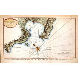
Plan du Havre de Chequetan ou Seguataneo.
Fine hand-colored map of present day Zihuatanejo, Mexico. It comes from a Dutch edition of Anson's "VOYAGE AROUND THE WORLD". The compass rose is striking.
Place & Date: Amsterdam, 1749
Selling price: $20
Sold in 2016
Plan de la Ville de Buenos Ayres.
The early layout of the town of Buenos Aires is shown in blocks, with a few of the important buildings named. Rococo title cartouche at lower left.Jacques Nicolaas Bellin...
Place & Date: Paris, 1749
Selling price: $250
Sold in 2016
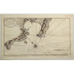
Plan of Havre de Chequetan ou Seguataneo. . .
A fine map of present day Zihuatanejo, Mexico. It comes from a Dutch edition of Anson's "VOYAGE AROUND THE WORLD". The compass rose is striking. It features a d...
Place & Date: London, ca 1749
Selling price: $22
Sold in 2019
Tierra del Fuogo.
An attractive map centred on the extreme part of South America, including the Horn Cape.
Place & Date: Venice 1750
Selling price: $200
Sold
A chart of the Pacific Ocean from the Equinoctial to the ..
Chart detailing the route of Spanish galleons between the Philippines and Acapulco. The tracks of British Navy Commodore George Anson and Spanish Nostra Seigniora de Caba...
Place & Date: London 1750
Selling price: $150
Sold
CALIFORNIA per P.Ferdinandum Con sak S.I. et alias.
Map of Mexico and the peninsular of California. Underneath the print a note about the region. Lower left a monogram E.V. of the engraver.
Place & Date: c. 1750
Selling price: $180
Sold
Amerique meridionale pour servir à l'Histore Generale des Voyages.
Bellin's distinctive map of the continent, from Prevost d'Exiles' influential travel book, Histoire Générale des Voyages, features a charming decorative cartouche.
Place & Date: Paris 1750
Selling price: $50
Sold
Amèrique Méridionale divisée en ses Grandes Régions et Possessions.
Uncommon map of South America after J.B.Nolin for Introduction à l'Histoire Universelle du Baron de Puffendorf.
Place & Date: Paris c.1750
Selling price: $90
Sold
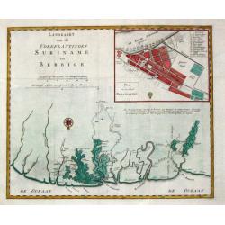
Landkaart van de volkplantingen Suriname en Berbice.
Izaak Tirion (d. 1769) Amsterdam publisher. His ' Nieuwe en beknopte handatlas' saw 6 editions between before 1740 and after 1784. Also ' Tegenwoordige staat van alle vol...
Place & Date: Amsterdam. C. 1750
Selling price: $300
Sold
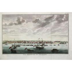
Vuë perspective de Paramaribo.
Attractive view of Paramaribo as seen from the sea, with in the front ships on the roads, to the right fort Zeelandia.
Place & Date: Amsterdam, c. 1750
Selling price: $235
Sold
L'Isle de Cuba.
Detailed map of Cuba. Finely engraved with many soundings on banks. Numerous coastal place names. Several tracks noted. The Florida keys and the Bahamas are included.Jacq...
Place & Date: Paris, 1750
Selling price: $110
Sold
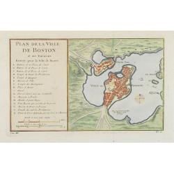
Plan de la Ville de Boston.
One of the earliest obtainable town plans of Boston and Charlestown, with an extensive index of 16 specific sites at left, each located on the map. Shows Boston 13 years ...
Place & Date: Paris, 1750
Selling price: $375
Sold in 2008
L'AMERIQUE SEPTENTRIONALE Dressée sur les Relations les plus modernes des Voyageurs. . .
Scarce first edition of De Vaugondy's large map of North America. The Coast of California still includes Nlle. Albion, Quiviera and the entrance discovered by Martin d'Au...
Place & Date: Paris, 1750
Selling price: $850
Sold in 2016
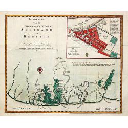
Landkaart van de volkplantingen Suriname en Berbice.
Izaak Tirion (d. 1769) Amsterdam publisher. His '' Nieuwe en beknopte handatlas'' saw 6 editions between before 1740 and after 1784. Also '' Tegenwoordige staat van alle ...
Place & Date: Amsterdam. C. 1750
Selling price: $250
Sold in 2009
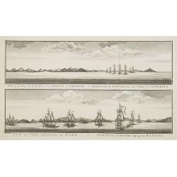
Vue de la Pointe du Nord-Est de l'Isle Sainte Catherine / Gezigt van de Noord-Oost Punt van 't Eiland S. Catharina.
From a Dutch edition of a voyage account. Large size (41 x 27 cm). Showing two views of the Island S. Catharina near Brazil, with ships.
Place & Date: Amsterdam, c. 1750
Selling price: $210
Sold in 2008
Karte von Hudsons Meerenge und Meer Busen.
Map of the Hudson Bay.
Place & Date: Goettingen : A. Vandenhoeck, 1750
Selling price: $75
Sold in 2023
Vue de Salem. (reversed
A so-called optical print. A lively scene from the harbour of Salem with many people loading a vessel. Engraver: Balthazar Frederic Leizelt.
Place & Date: Augsburg 1750
Selling price: $200
Sold in 2008
L'AMERIQUE SEPTENTRIONALE Dressée sur les Relations les plus modernes des Voyageurs. . .
Scarce first edition of De Vaugondy's large map of North America. The Coast of California still includes Nlle. Albion, Quiviera and the entrance discovered by Martin d'Au...
Place & Date: Paris, 1750
Selling price: $425
Sold in 2008
Plan de la Ville de Boston et ses Environs.
One of the earliest obtainable town town-plan of Boston and Charlestown, with an extensive index of 16 specific sites at left, each located on the map. Shows Boston 13 ye...
Place & Date: Paris, 1750
Selling price: $400
Sold in 2015
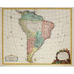
Amérique Méridionale, dressée, sur les Mémoires les plus récents . . .
South America, dated 1750, providing a clear summary of European knowledge at the time. From the Atlas Universel.
Place & Date: Paris, 1750
Selling price: $275
Sold in 2010
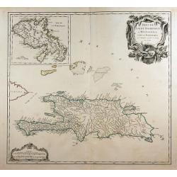
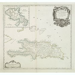
Isles de Saint Domingue ou Hispaniola, ...
A large map of Santo Domingo, with an inset showing the island of Martinique.
Place & Date: Paris, 1750
Selling price: $150
Sold in 2011
Vuë de Salem. (reversed) Salem - eine stadt in Engelländischen America, in der Grafschafft Essex, ... Salem - une ville de l'Amerique Angloise dans le Comte d'Essex, ... / gravé par Balth. Frederic Leizelt..
A so-called optical print. A lively and harbor scene of Salem, Massachusetts, with many people loading a vessel. Engraved by Balthazar Frederic Leizelt.This view is said...
Place & Date: Augsburg, c. 1750
Selling price: $400
Sold
Accurata delineatio Regionis Ludovicianae.
Map of the eastern part of North America focusing on the Mississippi River and the Graet Lakes. Copper engraving with original wash color by M. Rhein, published by Matth�...
Place & Date: Augsburg, c. 1745/1750
Selling price: $1150
Sold
Belgii Pars Septentrionalis Communi Nomine vulgo Hollandia ... / Batavorum Coloniae Occidential Indiis Septentrionalis Americae implantate / India Orientalis Batavorum Commerciis, Potentia & Coloniis celeberrima. / Batavia / Niew Amsterdam.
Original old colored map of the Netherlands by JB Homann. Large inset maps of the Northeastern US from the Chesapeake to Massachusetts and Southeast Asia and additional v...
Place & Date: Nuremberg, c.1750
Selling price: $700
Sold in 2011
Isles de Saint Domingue ou Hispaniola, et de la Martinique.
A large map of Santo Domingo, with an inset showing the island of Martinique from his "Atlas Universel".Gilles Robert de Vaugondy (1688–1766), also known as L...
Place & Date: Paris, 1750
Selling price: $55
Sold in 2011
A map of Chili. Patagonia. Part of La Plata & C.
Detailed map showing the southern most part of South America's coastlines, including details of the Falkland Islands.
Place & Date: London, c.1750
Selling price: $140
Sold in 2012
Accurata delineatio celeberrimae Regionis Ludovicianae ...
Includes the area from the Great Lakes to the Caribbean, and the basin of the river Mississippi in the centre of the map. Part of Louisiana in the top left inset. A very ...
Place & Date: Augsburg, 1750
Selling price: $1900
Sold in 2013
L\'AMERIQUE SEPTENTRIONALE Dressée sur les Relations les plus modernes des Voyageurs. . .
North America with inset of the Northwest including Nouvelle Albion, Strait of Anian, and other various fantastic possibilities of a Northwest Passage (Partie Nord-Ouest ...
Place & Date: Paris, 1750
Selling price: $400
Sold in 2013
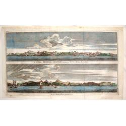
Vue de L'entree de Chequetan ou Seguataneo & Vue de L'Entree du Port d'Acapulco.
Two Mexican coastal views including Zihuatanejo at the top and Acapulco on the bottom vue. From Anson's "Voyage Autour de Monde".George Anson, 1st Baron Anson, ...
Place & Date: Paris, 1750
Selling price: $46
Sold in 2015
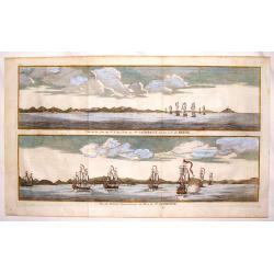
Vue de la Cote du N.E. de L'Isle de Ste. Catherine Sur la Cote du Bresil & Vue de L'Entre Septentionale du Port de Ste. Catherine
Two copper engraved views of the Port of Ste. Catherine off the coast of Bresil. Each shows seven two and three masted ships. George Anson, 1st Baron Anson, PC, FRS, RN ...
Place & Date: Paris, 1750
Selling price: $79
Sold in 2015
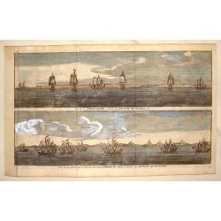
Cap de la Vierge Marie a L'Entre du Detroit de Magellan & Vue d'Une Partie de la Cote du N.E. de la Terre de Fue a L'Entree du Detroit de la Maire
Hand colored views of two costal areas of Magellan Straight off the coast of Terre del Fuega. Each view has seven two and three masted ship. George Anson, 1st Baron Anso...
Place & Date: Paris, 1750
Selling price: $110
Sold in 2013
Salem - Eine stadt in Engelländischen America, in der Grafschafft Essex, ... Salem - Une ville de l'Amerique Angloise dans le Comte d'Essex. . .
A so-called optical print. A lively town-view and harbor scene of Salem, Massachusetts, with many people loading a vessel. Engraved by Balthazar Frederic Leizelt.This vie...
Place & Date: Augsburg, 1750
Selling price: $300
Sold in 2015
Representation du feu terrible à nouvelle york.
So-called optical print of New York, showing several buildings along street engulfed in flames during fire on September 19, 1776, citizens being beaten by Redcoats, and l...
Place & Date: Augsburg, c. 1750
Selling price: $400
Sold in 2013
Neu Yorck - Na Nouvelle York.
A so-called optical print engraved by B.F. Leizelt, with underneath captions in German and French. Below the image, Augsburg, "au Negoce commun de l'Academie Imperia...
Place & Date: Augsburg, ca. 1750
Selling price: $450
Sold in 2013
Plan de la Ville de Buenos Ayres.
The early layout of the town of Buenos Aires is shown in blocks, with a few of the important buildings named. Rococo title cartouche at lower left.Jacques Nicolaas Bellin...
Place & Date: Paris, 1750
Selling price: $200
Sold in 2014
Plan de la Ville de Boston et ses Environs.
One of the earliest obtainable town plans of Boston and Charlestown, with an extensive index of 16 specific sites at left, each located on the map. Shows Boston 13 years ...
Place & Date: Paris, 1750
Selling price: $400
Sold in 2014
Portus Pulchri in Isthmo Panamensi / Scenographia Portus Pulchri
The birds-eye town-plan of Portobelo with title above, and a text panel "Dieser Grund Riss von dem Hafen, der Stadt u. den Forten von Porto belo ..." Below a sc...
Place & Date: Nuremberg, c. 1750
Selling price: $400
Sold in 2015
Mappa Geographica Complectens I. Indiae Occidentalis Partem Mediam Circum Isthmum Panamensem. . . [With insets of St. Augstine, Florida, Mexico City, Panama, etc.]
Six varying sized insets depict the West Indies: Panama, Saint Augustine, Vera Cruz, Santo Domingo, and a birds-eye view of Mexico City. The primary, largest inset map ha...
Place & Date: Nuremberg, 1750
Selling price: $200
Sold in 2016
Isles de Saint Domingue ou Hispaniola, et de la Martinique.
This is a fine map of Hispaniola or Santo Domingo (modern day Haiti and the Dominican Republic) by Robert de Vaugondy. It includes the tip of Cuba and the Inagua Islands ...
Place & Date: Paris, 1750
Selling price: $75
Sold in 2020

























![Mappa Geographica Complectens I. Indiae Occidentalis Partem Mediam Circum Isthmum Panamensem. . . [With insets of St. Augstine, Florida, Mexico City, Panama, etc.]](/uploads/cache/37359-250x250.jpg)
