Browse Listings in Africa > Central Africa
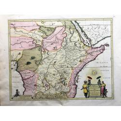
Aethiopia Superior vel Interior; vulgo Abissinorum. 

An attractive map of the Eastern African and the fictitious kingdom of 'Prester John'. The map shows a major section of central and eastern Africa including Mozambique no...
Place & Date: Amsterdam, 1638
Selling price: $200
Sold in 2019
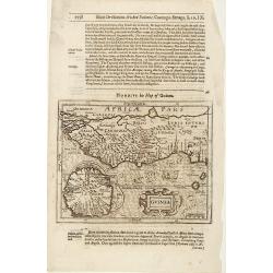
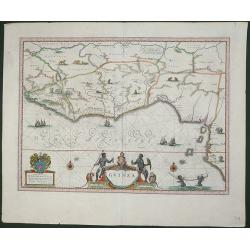
Guinea.
A detailed and decorative map of Guinea, showing the length of a coast important to African-European trade, including the slave trade. Embellished with numerous animals i...
Place & Date: Amsterdam, 1638
Selling price: $200
Sold in 2019
Aethiopia Superior vel Interior vulgo Abissinorum.
An attractive map of the Eastern African and the fictitious kingdom of Prester John. The map shows a major section of central and eastern Africa including Mozambique nort...
Place & Date: Amsterdam 1640
Selling price: $480
Sold
Guinea.
An attractive map covered with intersecting rhumb lines and decorated with monkeys, lions, elephants and native figures. With a dedication to Dr. Nicolas Tulp.
Place & Date: Amsterdam 1640
Selling price: $480
Sold
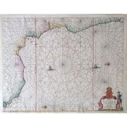
Guinea.
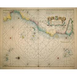
One of the most beautiful and graphic maps to be found, covering the east coast of Africa from Sierrra Leone to Gabon. The interior is decorated with many wild animals, s...
Place & Date: Amsterdam, ca. 1640
Selling price: $525
Sold in 2008
Aethiopia Superior vel Interior vulgo Abissinorum.
An attractive map of the Eastern African and the fictitious kingdom of Prester John. The map shows a major section of central and eastern Africa including Mozambique nort...
Place & Date: Amsterdam, 1640
Selling price: $250
Sold in 2009
Abissinorum sive Pretiosi Ioannis Imperiu
Hand colored map of Central Africa by G. Mercator. With two beautiful colored cartouche and one inset map of the Congo. Showing the Kingdom of Prester John in central Afr...
Place & Date: Amsterdam, 1640
Selling price: $700
Sold in 2013
Aethiopia Superior vel Interior vulgo Abissinorum.
An attractive map of the Eastern African and the fictitious kingdom of Prester John. The map shows a major section of central and eastern Africa including Mozambique nort...
Place & Date: Amsterdam, ca 1640
Selling price: $400
Sold in 2022
Aethiopia Superior vel Interior vulgo Abissinorum...
Offered is a large, decorative, attractive map of Eastern African and the fictitious kingdom of Prester John. The map shows a major section of central and eastern Africa,...
Place & Date: Amsterdam, 1640
Selling price: $300
Sold in 2023
Guinea.
colorful cartouche on the lower border. Two natives sit at the sides of the title, above which is a scroll with flowers and fruit and, in the center, a very human-looking...
Place & Date: Amsterdam, 1644
Selling price: $200
Sold in 2008
Guinea.
colorful cartouche on the lower border. Two natives sit at the sides of the title, above which is a scroll with flowers and fruit and, in the center, a very human-looking...
Place & Date: Amsterdam, ca. 1644
Selling price: $100
Sold in 2018
Guinea.
Samuel Purchas' edition of the Mercator/Hondius "Atlas Minor". Map of Guinea published in his famous collection of voyages "His Pilgrimes". With descr...
Place & Date: London 1645
Selling price: $80
Sold
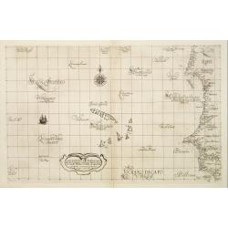
Carta Particolare della Barberia Australe che comincia con il capo Matas è Finiscie con ilc Himilas con l'Isole di capo Verde.
First state of Dudley?s magnificent chart showing the west coast of Africa including the Cape Verde Islands. Include a sailing ship, notes on prevailing winds and current...
Place & Date: Florence 1645
Selling price: $550
Sold
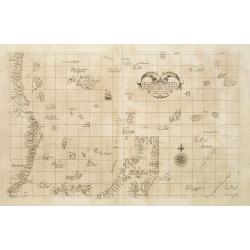
Carta Particolare della parte Tramontana dell Isola di San Lorenzo con la costa diripetto sino à Monbazza con l'Isole è Seccagne int.. Carta XIII I.
First state of Dudley?s magnificent chart showing the east coast of Africa including the northern half of Madagascar. Include a sailing ship, compass card, notes on preva...
Place & Date: Florence 1645
Selling price: $700
Sold
Carta Particolare del mare di Etthiopia con l'Idola di S:Elena è parte della Costa .. Carta VIIII.
First state of Dudley's magnificent showing the west coast of Africa. Include sailing ships, compass card, notes on prevailing winds and currents and more stylized calli...
Place & Date: Florence, 1645
Selling price: $850
Sold in 2008
Carta Particolare che commincia con il fiu me Iuntas nella Guinea è finisce con il capo di S.Dara è con l'Isola d'S:Thmaso. . Carta VI.
First state of Dudley?s magnificent chart showing the coast of New Guinea. Include a sailing ship, compass card, notes on prevailing winds and currents and more stylized ...
Place & Date: Florence 1645
Selling price: $800
Sold
Carta Particolare che comincia con l'Isola di S:Tomaso o Tome è d S. Clara è finisce con il c: d' Aldeas .. Carta VII.
Dudley?s magnificent chart shows the Gulf of Guinea with the Island São Tomé. One of the smaller scale, more specific (?Carta Particolare?) maps and include sailing shi...
Place & Date: Florence 1645
Selling price: $450
Sold
Carta Particolare che comincia con l'Isola di S:Tomaso o Tome è d S. Clara è finisce con il c: d' Aldeas .. Carta VII.
Dudley?s magnificent chart shows the Gulf of Guinea. One of the smaller scale, more specific (?Carta Particolare?) maps and include sailing ships, notes on prevailing win...
Place & Date: Florence 1645
Selling price: $650
Sold
Occidentalior Tractus Indiarum Orientalium à Promotorio Bonae Spei ad C. Comorin.
Rare sea chart by Ottens of showing the coastlines of the Arabian peninsula and Africa up to Cape Town, with a splendid cartouche of royal figures and animals.
Place & Date: Amsterdam, 1645
Selling price: $1050
Sold in 2009
Guinea.
An attractive map covering the coast from Sierra Leone to Gabon, filled with intersecting rhumb lines and decorated with monkeys, lions, elephants, sea monsters, and two ...
Place & Date: Amsterdam, c.1645
Selling price: $300
Sold in 2012
Carta particolare che comincia con il c.apo Aldea e Finisce con il capo Degortam.
Dudley’s magnificent chart shows the south west coast of Africa..Engraved by Lucini.Sir Robert Dudley's Dell'Arcano del Mare is the earliest printed sea atlas to cover ...
Place & Date: Florence, 1645
Selling price: $400
Sold in 2014
Carta particolare che comincia con il c.apo Aldea e Finisce con il capo Degortam.
Dudley’s magnificent shows the south west coast of Africa. A first edition without the privilege..Engraved by Lucini.Sir Robert Dudley's Dell'Arcano del Mare is the ea...
Place & Date: Florence, 1645
Selling price: $600
Sold in 2015
Carta Particolare che commincia con il capo Aldea è Finisce?
Engraved by Lucini.Sir Robert Dudley's Dell'Arcano del Mare is the earliest printed sea atlas to cover the entire world, and the first made by an Englishman, and the firs...
Place & Date: Florence 1646
Selling price: $305
Sold in 2010
Carta particolare che mostra il Capo buona Speranza con il mare....
The rare first state in a beautiful example.
Place & Date: Florence, 1646
Selling price: $850
Sold
Aethiopia superior vel interior.
An attractive map of the Eastern African and the fictitious kingdom of Prester John. The map shows a major section of central and eastern Africa including Mozambique nort...
Place & Date: Amsterdam, 1639-1649
Selling price: $195
Sold in 2014
Regna Congo et Angola
A superb delineation of the Congo and Angola as known in the 17th century. Portions of Gabon and Sao Tome are also depicted. Key ports and interior towns are identified a...
Place & Date: Amsterdam, ca. 1650
Selling price: $200
Sold in 2010
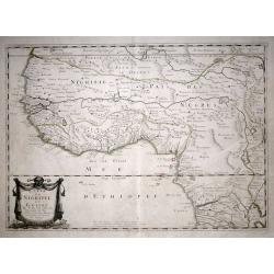
Carte De Nigritie Et Guinee.
Copper engraving map of Nigeria and Guinea, Western Africa, from Mauritania to Zaire. The map has an attractive water mark and a Decorative title cartouche. A highly deta...
Place & Date: Paris, 1653
Selling price: $280
Sold in 2015
Pascaerte van Guinea, en Angola, van R de Gambia tot Cabo de Bona Esperanca.
A sea chart of the Gulf of Guinea, with the neighbouring countries, it shows the coasts and all places. In the sea some boats for decoration and the islands of Fernando, ...
Place & Date: Amsterdam, 1654
Selling price: $300
Sold in 2017
Guinea.
An attractive map covered with intersecting rhumb lines and decorated with monkeys, lions, elephants and native figures. With a dedication to Amsterdam anatomist and phys...
Place & Date: Amsterdam, 1658
Selling price: $450
Sold in 2013
Aethiopia Superior vel Interior vulgo Abissinorum.
An attractive map of the Eastern African and the fictitious kingdom of Prester John. The map shows a major section of central and eastern Africa including Mozambique nort...
Place & Date: Amsterdam, 1658
Selling price: $900
Sold in 2010
Guinea
Very attractive map of Guinea and Benin. Various animals and ships are shown.Dutch text on verso.
Place & Date: Amsterdam, 1660
Selling price: $220
Sold in 2013
Carte particolare che comincia con l'Isole di S. Tomasso e Tome e c. d' S. Clara e finisce con il. c. d' Aldeas.
Chart of Gabon, Congo, Zaire and Angola] Carte particolare che comincia con l'Isole di S. Tomasso e Tome e c. d' S. Clara e finisce con il. c. d' Aldeas. Description: Rob...
Place & Date: Florence, 1661
Selling price: $500
Sold in 2019
Guinee. (13).
Scarce map of Guinea published by Antoine de Fer in 1661 or 1662 in "Cartes de géographie revues et augmentées". With number 13 in lower right bottom of the m...
Place & Date: Paris, Antoine de Fer, 1657 but 1661 or 1662
Selling price: $220
Sold in 2020
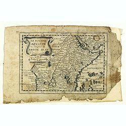
Le royaume d'Abyssinie ou l'Empire du Prete Iean. (14).
Scarce map of Abyssinia and Ethiopia published by Antoine de Fer in 1661 or 1662 in "Cartes de géographie revues et augmentées". With number 14 in lower right...
Place & Date: Paris, Antoine de Fer, 1657 but 1661 or 1662
Selling price: $40
Sold in 2020
Nigritarum regio.
Blaeu's map of a part of West Africa, from Tropic of Cancer southward including the Senegal River to Angola. The map includes decorative title and scale statement cartouc...
Place & Date: Amsterdam, 1662
Selling price: $120
Sold in 2020
Del Mina. St. Iago [with] Carmantyn [with] Cabo Verde ofte t. Eijlant Goeree.
Thee engravings on one sheet. View of Elmina, Cormante and the island of Goeree as happened July 1665. Above: the Dutch fleet under Admiral Michiel de Ruyter with three c...
Place & Date: Amsterdam, 1665
Selling price: $45
Sold in 2023
Pas-Caart van Guinea en de Custen daer aen gelegen Van Cabo verde tot Cabo de Bona Esperanca
Beautiful seachart of the southwest coast of Africa by P. Goos from the famous sea atlas "De Zee-Atlas ofte Water-Weereld". Showing the coatlines of Guinea, Sie...
Place & Date: Amsterdam, 1666
Selling price: $800
Sold in 2008
Pascaerte van 't Westelyckste Deel van Oost Indien, van Cabo de Bona Esperanca tot C.Comorin..
An eye-catching of the western part of the Indian Ocean and its adjacent coasts of East Africa, Arabia with the Red Sea and the Arabian Gulf, Iran, Pakistan and western ...
Place & Date: Amsterdam, 1666
Selling price: $2500
Sold in 2009
Pas-Caart van Guinea en de Custen daer aen gelegen Van Cabo verde tot Cabo de Bona Esperanca.
A rare sea chart of the southwest coast of Africa from the Guinea Coast down to the Cape of Good Hope, covering Guinea, Sierra Leone, Liberia, the Ivory Coast, Ghana, Nig...
Place & Date: Amsterdam, 1666
Selling price: $280
Sold in 2016
L'Afrique ou Libie ulterieur ou font le Saara ou desert. . .
Map of Guinea coast prepared by N.Sanson and published by Pierre Mariette.Published in an early edition of the small Sanson atlas L'Europe Dediée a Monseigneur . . . Le ...
Place & Date: Paris, P. Mariette, 1667
Selling price: $100
Sold in 2008
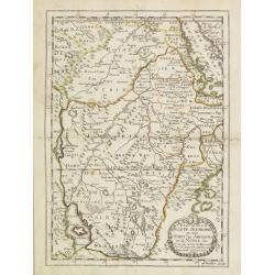
Partie de la Haute Aethiopie. . .
Map of Ethiopia prepared by N.Sanson and published by Pierre Mariette.Published in an early edition of the small Sanson atlas L'Europe Dediée a Monseigneur . . . Le Tell...
Place & Date: Paris, P. Mariette, 1667
Selling price: $210
Sold in 2008
Isle du Cap Verd Coste, et pays des Negres. . .
Depicting the West Coast of North Africa and also showing the Cape Verde Islands prepared by N.Sanson and published by Pierre Mariette.Published in an early edition of th...
Place & Date: Paris, P. Mariette, 1667
Selling price: $100
Sold in 2008
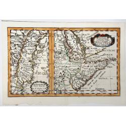
Le Zanguebar Partie du Zanguebar ou sont les Costes d'AJAN et d'ABEX.
Two maps on one sheet showing the coasts of East Africa. The left hand map shows the Zanzibar coast, the right hand map shows the coast north from Zanzibar, round the Hor...
Place & Date: Paris, P. Mariette, 1667
Selling price: $170
Sold in 2008
Royaume de Congo & c. . .
Decorative map of the Congo on Africa's west coast.An attractive miniature map prepared by N.Sanson and published by Pierre Mariette.Published in an early edition of the ...
Place & Date: Paris, P. Mariette, 1667
Selling price: $120
Sold
Le Royaume Abyssin ou l'Empire du Presteiean.
Rare map of Central Africa with Ethiopia, published by Jollain in 1667. Published in "Trésor Des Cartes Geographiques Des Principaux Estats de Lunivers".This a...
Place & Date: Paris, 1667
Selling price: $50
Sold in 2021
Guinee. (inset) I. S. Thomas.
Rare map of Guinea with inset of I. S. Thomas, published by Jollain in 1667. Published in "Trésor Des Cartes Geographiques Des Principaux Estats de Lunivers".T...
Place & Date: Paris, 1667
Selling price: $120
Sold in 2021
Partie du ZANGUEBAR ou Sont les Costes d'AJAN et d' ABEX &c.
Two, maps on one sheet showing the coasts of East Africa. The left hand map shows the Zanzibar coast, the right hand map shows the coast north from Zanzibar, round the Ho...
Place & Date: Paris, P. Mariette, 1667
Selling price: $50
Sold in 2019
[Lot of 10 maps / prints of the South Atlantic Ocean islands] CAPEVERDIAN ISLANDS / Insulae Promontorii Viridis.
A map of the Capeverdian islands, embellished with two large and attractive cartouches. With lot of 9 maps / prints of the South Atlantic Ocean islands.
Place & Date: Amsterdam, 1668
Selling price: $200
Sold in 2022
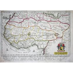
Africa or Libia Ulteriour Where are the Countries of Saara Desert...
Rare map of Western Africa after Sanson. Detailed early Geography with numerous errors of the time. Important mapping of the Canary Islands. The map shows an unusual amou...
Place & Date: London 1669
Selling price: $450
Sold
AFRICA or LIBIA ULTERIOUR Where are the COUNTRIES OF SAARA DESERT the COUNTRIE of NEGROES and GUINE.
A map of Western Africa after Sanson. Detailed early geography with numerous errors typical of the time. Important mapping of the Canary Islands. The map shows an unusual...
Place & Date: London, 1669
Selling price: $300
Sold in 2019
Insulae de Cabo Verde olim Hesperides sive .. Zoute Eylanden.
A beautiful sea chart of these important islands. The map is a re-issue of the map by J.Janssonius. Beautifully embellished with rhumb lines, compass rose and cartouche.
Place & Date: Amsterdam 1670
Selling price: $240
Sold
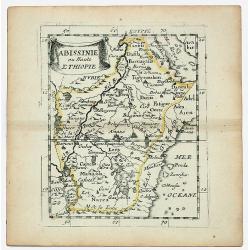
ABISSINIE ou Haute ETHIOPIE.
Nubie old, outlined colored historical miniature map of Abyssinie in north Ethiopia. The map is copperplate engraved with hand coloring and in very good condition and pu...
Place & Date: Paris 1670
Selling price: $27
Sold in 2020
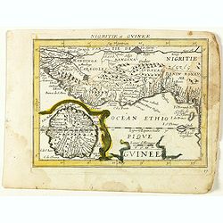
NIGRITIE. Par P. Du VAL Geogr du Roy.
Miniature map of west coast of Africa, showin Guinee, Sahara desert, Congo, Niger, etc.
Place & Date: Paris, c 1670
Selling price: $22
Sold in 2020
Costes de Guinée avec les Royaumes qui y sont connus des Européens, au-dedans des terres, selonn les relations les plus nouvelles . . .
Uncommon map of the Guinea, with fine title cartouche upper right . Dated 1671 and without the inset map added in 1677.
Place & Date: Paris, 1671
Selling price: $450
Sold
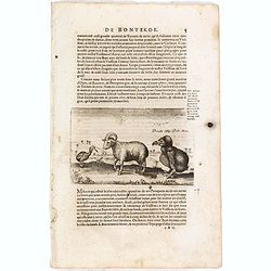
Dronte, autrement appellé par les Hollandois Dod-aers.
An early text engraving of a Dodo who Willem Ysbrandtszoon Bontekoe claimed to have seen on Réunion and published from 1672 onwards in "Relations de Divers Voyages ...
Place & Date: Paris, 1672
Selling price: $160
Sold in 2015
Dronte Alijs Dod-Aers.
An early text engraving of a Dodo who Willem Ysbrandtszoon Bontekoe claimed to have seen on Réunion and published from 1672 onwards in "Relations de Divers Voyages ...
Place & Date: Paris, 1672
Selling price: $30
Sold in 2015
Joao Teixeira Cosographo de sua Magestade.
An early issue of this important map of the Indian Ocean was prepared by Joao Teixeira, a well-known and respected Portuguese chart maker. He produced this wonderful sea ...
Place & Date: Paris ca. 1672
Selling price: $2200
Sold in 2017
Tractus Littorales Guineae a Promontorio Verde. . .
The West coast of Africa from Mauritania up to Angola. Classic sea of Dutch school with excellent baroque embellishment. In top center a very decorative title cartouche.
Place & Date: Amsterdam, 1675
Selling price: $260
Sold in 2014
Zanguebar.
Uncommon miniature map of East Africa including Northern tip of Madagascar, from Pierre Duval's La Geographie Universeille. Following his Cartes de geographie in 1657, Pi...
Place & Date: Paris, 1676
Selling price: $30
Sold in 2008
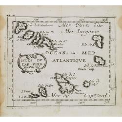
Isles du Cap Verd.
Uncommon miniature map of Cape Verde Islands from Pierre Duval's La Geographie Universeille dated 1676. Following his Cartes de geographie in 1657, Pierre Duval published...
Place & Date: Paris, 1676
Selling price: $30
Sold in 2008
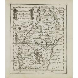
Abissinie ou Haute Ethiopie.
Uncommon miniature map of Ethiopia from Pierre Duval's La Geographie Universeille dated 1676. Following his Cartes de geographie in 1657, Pierre Duval published this smal...
Place & Date: Paris, 1676
Selling price: $25
Sold in 2008
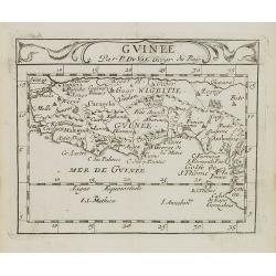
Guinee.
Uncommon miniature map of Guinea and Africa's Gold coast from Pierre Duval's La Geographie Universeille dated 1676. Following his Cartes de geographie in 1657, Pierre Duv...
Place & Date: Paris, 1676
Selling price: $40
Sold in 2009
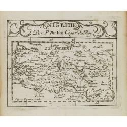
Nigritie.
Uncommon miniature map of Guinea and Africa's Gold Coast, from Pierre Duval's La Geographie Universeille dated 1676. Following his Cartes de geographie in 1657, Pierre Du...
Place & Date: Paris, 1676
Selling price: $75
Sold in 2009
Le Biledulgerid ou Numidie et le Zaara autrement le Desert.
Uncommon miniature map of Sahara Dessert and Algeria, from Pierre Duval's La Geographie Universeille dated 1676. Following his Cartes de geographie in 1657, Pierre Duval ...
Place & Date: Paris, 1676
Selling price: $20
Sold in 2009
Guinee en de omliggende Landen.
A map of the lands along the Gulf of Guinea.
Place & Date: Utrecht, 1680
Selling price: $45
Sold in 2022
Nigritarum regnum.
Rare and beautiful map of the West coast of Africa with a dedication to Otto Schwerin of Brandenburg. The signature reads Apud Heredes Joannis Janssonii Only a small numb...
Place & Date: Amsterdam, 1680
Selling price: $900
Sold in 2010
Pascaert vande Bocht van Benin..
Uncommon chart showing the coast of Nigeria from Accra (Ghana) till Douala in Cameroon.
Place & Date: Amsterdam, 1680
Selling price: $220
Sold in 2016
Nieuwe Paskaert, van de Kust van Genehoa als Mede een Gedeelte van Gambia, Beginnende an C. Blanco tot C. Verde…
This sea chart covers the western coast of Africa from Cape Blanco (Ras Nouadhibou) to Cape Verde. The chart depicts the interior course of both the Gambia and Casamance ...
Place & Date: Amsterdam, ca.1681
Selling price: $190
Sold in 2023
De cust van Barbaria
A sea chart depicting the west coast of Africa.Doncker ran a flourishing business in Amsterdam as a bookseller and publisher of sea atlases and textbooks on navigation. D...
Place & Date: Amsterdam, 1682
Selling price: $325
Sold in 2010
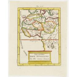
Ancienne Libye Interieure. . .
A charming map of the inland part of Libya with a colorful architectural title cartouche.German title in curtain draped at top. No text on verso.From the German text edit...
Place & Date: Frankfurt, 1684
Selling price: $65
Sold in 2012
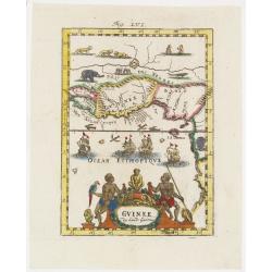
Guinee . . .
A charming map of Guinee with hand painted borderlines and a colorful ornamental title cartouche of two male figures , one holding a parrot, the other a spear that are su...
Place & Date: Frankfurt, 1684
Selling price: $120
Sold in 2008
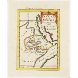
Empire des Abyssins. . .
A charming map of he Abyssinian Empire referred to as Nubia with a colorful title banner.German title in curtain draped at top. No text on verso.From the German text edit...
Place & Date: Frankfurt, 1684
Selling price: $40
Sold in 2012
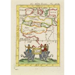
Zaara le Desert . . .
A charming map of the northwestern part of Africa with colored borderlines and a beautiful colorful title banner upheld by two male figures seated on two elephants, one h...
Place & Date: Frankfurt, 1684
Selling price: $60
Sold in 2008
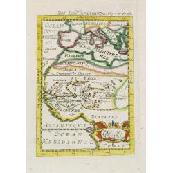
Pays des negres. . .
A charming map of western Africa with colored borderlines and scale in addition to a colorful ornamental title cartouche in lower right corner.German title in curtain dra...
Place & Date: Frankfurt, 1684
Selling price: $60
Sold in 2008
I. Goree [Ialoffes Royaume]
A charming map featuring a bird's eye view of Island of Goree with hills, dwellings and trees on the island, four ships at sea heading towards the island, and coastal Ara...
Place & Date: Franckfurt, 1684
Selling price: $65
Sold in 2008
Isle de Zocotora [Die Insel Zocotora]
A charming map featuring a bird's eye view of Socotra with hills, dwellings and trees on the island, two naval battles with cannons firing at sea, and coastal Arabia and ...
Place & Date: Frankfurt, 1684
Selling price: $60
Sold in 2008
Nieuwe Paskaert, Van de Kust Van Genehoa als Medeen gedeelte van Gambia, beginnende an C. Blanco tot C. Verde, Met al syn diep ten end droogten, dus Ver Naeukeurig op gestelt.
Nice chart, showing the coast of Africa, from Cabo Blanco till Cabo Verde (Dakar) and Gambia River. The Dutch firm and printing house van Keulen was one of the most impor...
Place & Date: Amsterdam, 1684
Selling price: $350
Sold in 2009
The city of Loango from Dapper.
Copper engraved page view of Loango from Olfert Dapper. The view shows the city of Loango capital of the kingdom of the same name which lay in what is now the Republic of...
Place & Date: Amsterdam, 1686
Selling price: $15
Sold in 2019
Isola della Guinea. / Isola Gore.
Fine map of Guinea, from Isolario Dell'Atlante Vento.On verso a map of the island Goeree (130x172mm).
Place & Date: Venice 1690
Selling price: $140
Sold
Bocche del Fiume Negro et Isole di Capo Verde..
This is a splendid map of the northwestern coast of Africa and the Cape Verde Islands.The map provides details of the various Portuguese discoveries in the region in the ...
Place & Date: Venice 1690
Selling price: $200
Sold in 2008















![Del Mina. St. Iago [with] Carmantyn [with] Cabo Verde ofte t. Eijlant Goeree.](/uploads/cache/48507-250x250.jpg)





![[Lot of 10 maps / prints of the South Atlantic Ocean islands] CAPEVERDIAN ISLANDS / Insulae Promontorii Viridis.](/uploads/cache/18308-(1)-250x250.jpg)








![I. Goree [Ialoffes Royaume]](/uploads/cache/25317-250x250.jpg)
![Isle de Zocotora [Die Insel Zocotora]](/uploads/cache/25316-250x250.jpg)
