Browse Listings in Africa
L'Afrique.
An attractive map. The large cartouche is decorated by scenes of ostrich and crocodile hunting and elephants.
Place & Date: Leiden 1729
Selling price: $110
Sold
Africa vetus . . .
A rare issue of this map by Weigels, usually seen with a different cartouche showing disks (coins) instead of the one shown here. A person is skinning an ox on a rock, wh...
Place & Date: Nurnberg, 1729
Selling price: $110
Sold in 2008
Ile de S. Laurens, ou Madagascar, située dans L'Ocean Ethiopien, sur les Côtes de L'Afrique.
Detailed map of Madagascar and Réunion. Published by Pieter van der Aa in "Galérie agréable du monde", completed in 1729. The Galerie was a sixty-six volume ...
Place & Date: Leiden, 1729
Selling price: $300
Sold in 2013
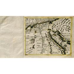
Carte Generale de L'Egypte.
A striking map of Egypt. It is from METHODE POUR ETUDIER L’HISTOIRE by L’Abbe Lenglet du Fresnoy, published in Paris in 1729. The map is quite rare and is not now, no...
Place & Date: Paris, 1729
Selling price: $25
Sold in 2020
Carte De L'Africa.
A striking map of Africa with Madagascar from the “METHODE POUR ETUDIER L’HISTOIRE” by L’Abbe Lenglet du Fresnoy, published in Paris in 1729. The map is quite rar...
Place & Date: Paris, 1729
Selling price: $125
Sold in 2018
L' AFRIQUE. Selon les Autheurs les plus Modernes.
A beautiful map of Africa with african kingdom's emblems on the sides. Published by Jeanne de la Feuille in Amsterdam. Published in; "les tablettes Guerrieres ou Car...
Place & Date: Amsterdam, 1729
Selling price: $90
Sold in 2019
Carte de l'Afrique.
A striking map of Africa with Madagascar from the “METHODE POUR ETUDIER L’HISTOIRE” by L’Abbe Lenglet du Fresnoy, published in Paris in 1729. The map is quite rar...
Place & Date: Paris, 1729
Selling price: $170
Sold in 2020
L'Afrique Dressee sur les Observations de Ms. de l'Academie Royale des Sciences?.
Guillaume de l'Isle's (1675-1726) well deserved reputation as one of the foremost geographers of the 18th century meant that his maps were influential for many years afte...
Place & Date: Amsterdam ca. 1730
Selling price: $800
Sold
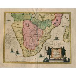
Aethiopia inferior vel exterior ...
Blaeu's landmark map of Southern Africa, here in the final De Wit edition of 1695 published by Covens and Mortier ca. 1730. Blank on verso. This final print saw an almost...
Place & Date: Amsterdam, 1730
Selling price: $600
Sold in 2008
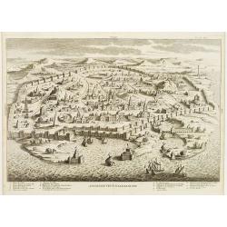
Ancienne Veue D'Alexandrie.
Highly decorative bird's-eye view of Alexandria, taken from "Dictionnaire Historique et critique de la Bible" by Abbé Calmet.It illustrates a detailed plan of ...
Place & Date: Paris, 1722 - 1730
Selling price: $80
Sold in 2009
Algercum ?
One of Seutter's most decorative prospects, with a sea battle in the foreground.
Place & Date: Augsburg, c.1730
Selling price: $430
Sold in 2010
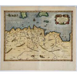
Tab. II Africae, complectens Africam. . .
From the last edition of Mercator’s Ptolemaeic Atlas by Georgius Hornius, with the Mediterranean labeled ‘Aphricum Pelagus’, the land mass with mountain ridges and ...
Place & Date: Amsterdam, 1578, but 1730
Selling price: $180
Sold in 2019
Deserta Aegypti Thebaidies Arabiae Syriae etc. ubi accurate notata sunt loca inhabitata per Sanctos Patres Anachoreatas.
Original engraved map of Egypt, Northern Arabia, the Holy Land, Syria and Cyprus, with original hand coloring. Verso blank. An attractive map of Egypt, northern Arabia, t...
Place & Date: Augsburg, 1730
Selling price: $160
Sold in 2020
The Apparel of the Hottentot Men - The Apparel of the Hottentot Women.
An early 1731 engraving depicting the apparel of the Hottentot people of South Africa.James Mynde Engraver, working in City of London on general plates. He had a large st...
Place & Date: London, 1731
Selling price: $30
Sold in 2012
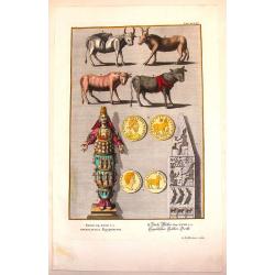
Egyptian Antiquities.
Interesting hand-colored copperplate print featuring items of Egyptian antiquities. Engraved by G.D. Heuman. Johannes Jacob Scheuchzer (1672-1733) is known as the the fo...
Place & Date: Augsberg, 1731
Selling price: $21
Sold in 2015
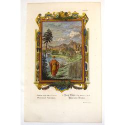
Pharaoh's Dream.
Ornate hand-colored copper engraved print featuring Pharaoh's dream. Behind him is a fictitious Egyptian city of his dream. The engraver was M. Tyroff.Johannes Jacob Sche...
Place & Date: Augsburg, 1731
Selling price: $17
Sold in 2016
The Present State of the Cape of Good-Hope: or a Particular Account of the Several Nations of the Hottentots...
One of the most important early accounts of South Africa and the Cape of Good Hope! “It contains the earliest list of South African animals … a full account of the go...
Place & Date: London, 1731
Selling price: $800
Sold in 2019
Africa Interior.
Christoph Cellarius (1638-1707). Geographia Antiqua, 1686
Place & Date: Leipzig, Gledisch, 1732
Selling price: $70
Sold in 2019
Wahrhaffte Abbildung der Barbarischen Vestung Oran
Hand colored copper engraving from Chr. Gephart by Homann Heirs, showing coast outline of Algeria (province Oran) and some sailing ships.
Place & Date: Nuremberg, 1732
Selling price: $250
Sold in 2008
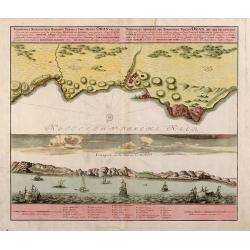
Topographica Repraesentatio Barbarici Portus et Urbis Munitae Oran / Wahrhaffte Abbildung der Barbarischen Vestung Oran
Original old colored copper engraved map from Chr. Gephart by Homann Heirs published 1732 in Nuremberg. Showing the coast outline of Algeria (province Oran) on the upper ...
Place & Date: Nuremberg, 1732
Selling price: $160
Sold in 2013
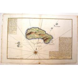
Plan de L'Isle Galita
Beautifully engraved map of the Island of Galite, north of Tunisia. Decorated with a large compass rose. Little is known about Jacques Ayrouard and he only published thi...
Place & Date: Paris, 1732
Selling price: $51
Sold in 2014
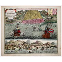
ALGERUM munita Metropolis REGNI ALGERIANI in littore Africano Barbariae in monte delici Amphitheatri instar quadrata forma... SEDES EST BASSAE TURCICI... (ALGIERS)
An impressive, originally colored sheet with two views of the town of Alger. A bird-eye view of the town and its harbor with two large galleons and a panoramic view, from...
Place & Date: Ausburg 1732
Selling price: $420
Sold in 2021
L'Afrique Dressée Sur les Relations et nouvelles decouvertes . . .
Decorative map of Africa with a large allegorical cartouche featuring a female Europe and a male Africa, both holding manacles, representing the valuable slaves trade...
Place & Date: Paris, 1732
Selling price: $400
Sold in 2022
Royaume de Maroc divise en sept Provinces..
Attractive map of Morocco prepared by Daniel de La Feuille (1702) and published in the rare first edition of "Kleyne en Beknopte Atlas, of Tooneel des Oorlogs in Eur...
Place & Date: Amsterdam 1735
Selling price: $20
Sold
Carte générale de l'Afrique contenant les principaux états dressée sur les nouvelles observations?
Charles Inselin (or Inslin) was an engraver for important map publishers such as Delisle, de Fer and Jaillot in Paris during the first half of the 18th century. His map ...
Place & Date: Paris, 1735
Selling price: $1500
Sold
Royaume de Maroc divise en sept Provinces..
Attractive map of Morocco prepared by Daniel de La Feuille (1702) and published in the rare first edition of ,Kleyne en Beknopte Atlas, of Tooneel des Oorlogs in Europa.....
Place & Date: Amsterdam 1735
Selling price: $55
Sold
AFRICA Secundum legitimas Projectionis Stereographiae regulas . . Leonis Africani. . .à IOH. MATTHIA HASIO. . .
A large, nice copper engraved map of Africa, and Madagascar, with Arabia, dated 1737, by Jean-Baptiste HOMANN (1664-1724) & Johann Mathias Hass, edited by Homann Heir...
Place & Date: Nuremberg, ca 1737
Selling price: $500
Sold in 2018
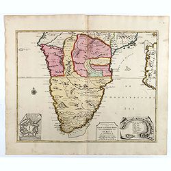
Nieuwe caarte van Kaap de Goede Hoop en't zuyderdeel van Africa. . .
Uncommon map of Africa, south of the Equator, with insets of the Dutch fort at the Cape of Good Hope and Table Bay.Joachim Ottens (1663 - 1719) and his sons Renier and Jo...
Place & Date: Amsterdam, 1737
Selling price: $900
Sold in 2017
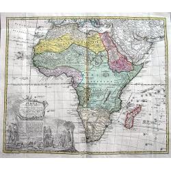
Africa secundum legitimas Projectionis...
Decorative map of Africa, with a large title cartouche featuring the Dutch at the Cape of Good Hope, Table Mountain, elephants, lions and snakes. Homann focuses on the kn...
Place & Date: Nuremberg, ca. 1737
Selling price: $210
Sold in 2018
Africa Secundum legitimas Projectionis Sterographicae regulas. . .
Johann Matthias Haas's revision J.B. Homann's 1715 map of Africa, augmented to include important cartographic developments as recorded by Guillaume Delisle and D'Anville....
Place & Date: Nuremberg, ca 1737
Selling price: $300
Sold in 2019
Aegyptus Antiqua.
A rare map of Egypt by Franz Wagner (historian and Jesuit), from "Einleitung in die alte und neuere Geographia". Published and printed by Leopold Hoedl and Fran...
Place & Date: Vienna, ca. 1737
Selling price: $140
Sold in 2019
A New Map of Africk Shewing its Present General Divisions Cheif Cities or Towns, Rivers, Mountains &c.
Decorative colored map of the African continent. From "A New Sett of Maps both of Antient and Present Geography" by Edward Wells an English clergyman, teacher ...
Place & Date: London, 1738
Selling price: $900
Sold in 2012
AFRICAE emenduta Descriptio.
Map of Africa. With a cartouche on the down left corner. Engraved by Gottfried Haupt. Published in "Der Seinen zu erziehen habenden Jungen Cavalier in der Profan- un...
Place & Date: Augsburg, 1738
Selling price: $120
Sold in 2019
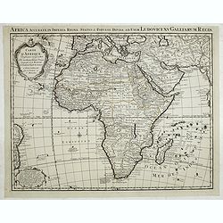
Carte d'Afrique dressée par l'usage du Roy. . .
Fine map prepared by G.d'Isle depicting the African continent.The re-engraved Amsterdam edition, of this fine map of Africa prepared by Guillaume delisle.The cartography ...
Place & Date: Amsterdam, 1739
Selling price: $300
Sold in 2014
Coste Occidentale D'Afrique Depuis le XIe. Degre De Latitude Meridional
Detailed map featuring the southwest coast of Africa from “Cap de Bonne Esperance” (Cape of Good Hope), “Hottentots” (modern South Africa) in the south to “St. ...
Place & Date: Paris, 1739
Selling price: $15
Sold in 2016
Africae.
A very nice map of the African continent with an adorned title cartouche. From Francisco Giustiniani for El Atlas abreviado o el nuevo compendio de la Geografia universal...
Place & Date: Leon de Francia (Lyon), Jaime Certa, 1739
Selling price: $220
Sold in 2021
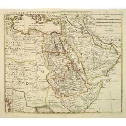
Carte de L\'Egypte de la Nubie de L\'Abissinie. . .
Prepared by G.de l'Isle. Uncommon issue by Hendrik de Leth. Very detailed map of northeastern Africa, the Red Sea and the Arabian peninsula shows the political divisions ...
Place & Date: Amsterdam, 1740
Selling price: $245
Sold in 2012
Carta Generale Dell' Africa.
From an Italian edition of "Atlante Novissimo". Published by Albrizzi. With a vignette cartouche in upper right showing a crocodile hunt.
Place & Date: Venice, ca 1740
Selling price: $250
Sold in 2008
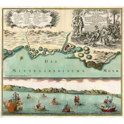
Oran Munita Urbs et Comodus Porta in Ora Maritima Barbariae.
Map of the vicinity of Oran with panoramic view from the sea below.
Place & Date: Augsburg, 1740
Selling price: $300
Sold in 2010
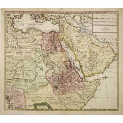
Carte de L'Egypte de la Nubie de L'Abissinie. . .
Prepared by G.de l'Isle. Uncommon issue by Hendrik de Leth. Very detailed map of northeastern Africa, the Red Sea and the Arabian peninsula shows the political divisions ...
Place & Date: Amsterdam, 1740
Selling price: $100
Sold in 2010
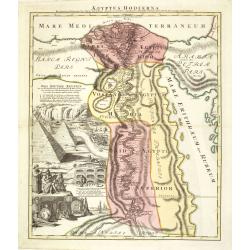
Aegyptus Hodierna. . .
Scarce. A splendid map of ancient Egypt. West is at the top and the Nile bisects Egypt. A small inset shows the region around Alexandria to good detail. With the Red Sea ...
Place & Date: Nurenberg, 1740
Selling price: $375
Sold in 2015
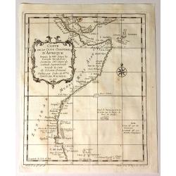
Carte de la Coste Orientale D'Afrique.
Fine detailed map from the Saudi Arabia (Mekka) coast til the Tanzanian coast. From Prevost's "L'HISTOIRE GENERALE DES VOYAGES".
Place & Date: Paris, 1740
Selling price: $65
Sold in 2017
Carte de la Coste Orientale D'Afrique Depuis le XIIIe Degree de Latitude Meridionale
Attractive map of the East Coast of Africa from Dahlak Island in the Red Sea to the Comoro Islands. Produced by Jacques Nicolas Bellin (1703-1772). It features a decora...
Place & Date: Paris, 1740
Selling price: $15
Sold in 2015
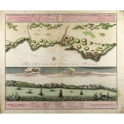
Oran Munita Urbs et Comodus Port in Ora Maritima.
A beautiful map depicting the plan, and the panorama, of the coast of Oran, Algeria with many boats in the foreground. In opulent original period colors. The legend is in...
Place & Date: Augsburg, 1740
Selling price: $300
Sold in 2016
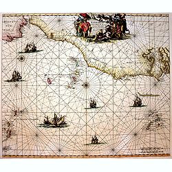
Barbariae et Guineae Maritimi a Freto Gibralta ad Fluvium Gambiae cum Insulis Salsis Flandricis et Canaricis.
Very decorative sea chart of North-West Africa. Including Canary Islands and Cape Verde Islands.The chart appeared De Wit's sea atlas, the "Orbis Maritimus". Th...
Place & Date: Amsterdam, 1740
Selling price: $450
Sold in 2017
[2 Maps] Coste Occidentale d'Afrique, Depuis le Xie. Degre. . . / Carte de la Coste Orientale d'Afrique, depuis le Cap de Bonne Esperance. . .
The first map is a detailed map featuring the southwest coast of Africa from “Cap de Bonne Esperance” (Cape of Good Hope), “Hottentots” (modern South Africa) in t...
Place & Date: Paris, ca 1740
Selling price: $80
Sold in 2018
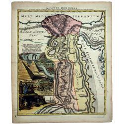
AEGYPTUS HODIERNA.
A scarce and splendid map of ancient Egypt. West is at the top and the Nile bisects Egypt. A small inset shows the region around Alexandria to good detail. With the Red S...
Place & Date: Nurenberg, 1740
Selling price: $300
Sold in 2020
[Lot of 10 maps] In Notitiam Eclesiasticam Africae Tabula Geogrphica.
Very decorative copper engraved map of the northern coast of Africa, Spain, Italy and the western part of the Mediterranean with the islands of Sardinia, Corsica, Major...
Place & Date: Paris, c. 1740
Selling price: $220
Sold in 2022
Deserta Aegypti Thebaidis, Arabiae, Syriae etc.
An attractive map of Egypt, northern Arabia, the Holy Land, Syria and Cyprus. From Seutter's "Atlas Novus". Map shows many physical features, biblical scenes, s...
Place & Date: Augsburg, 1741
Selling price: $160
Sold in 2017
AFRICA Poly Glotta Scribendi Modos Gentium. . .
A rare separate thematic map of AFRICA from the set of 4 maps of the continents, identifying the distribution of languages of the world from "Synopsis Universae Phil...
Place & Date: Nurenberg, 1741
Selling price: $351
Sold in 2019
Alexandria antiqua juxta mentem . . .
Manuscript hand colored map of the ancient city of Alexandria, probably carried out by P.N. Bonamy. With an inset map. The book "Description of the City of Alexa...
Place & Date: Paris, 1741
Selling price: $300
Sold in 2023
Nieuwe Kaart van Afrika.
An uncommon map of Africa.
Place & Date: Amsterdam/ Deventer, 1742
Selling price: $140
Sold
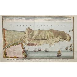
Plan of the fortifications of Gibraltar, exactly taken on the Spot in the Year 1738.
A map showing Gibraltar in Spain with decorative ships in the foreground. It is very likely that the author of this map was Nicholas Tindall: as Chaplain to an English Fl...
Place & Date: London ca. 1742
Selling price: $170
Sold in 2018
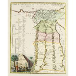
Veteris Aegypti Tabula ex variis auctoribus decerpta..
A very fine map centered on Egypt. Includes also a list of the provinces on the left side. Published by Joseph-Nicolas De l' Isle (or Delisle) (1688-1768), astronomer, ge...
Place & Date: Paris 1743
Selling price: $755
Sold
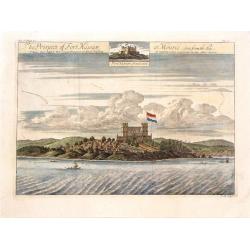
The Prospect of Fort Nassaw at Mouree, Seen from the Sea.
A fine copper engraved print featuring a scene of Fort Nassaw in Guinea. From John Barbot's "A Description of Nort and South Guinea" published in London in 1744...
Place & Date: London, 1744
Selling price: $125
Sold in 2015
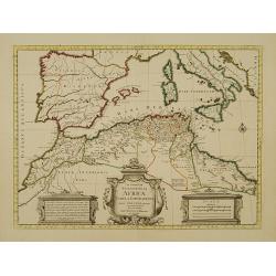
In Notitiam Ecclesiasticam Africae Tabula Geographica.
Very decorative copper-engraved map of the northern coast of Africa, Spain, Italy and the Mediterranean with the islands of Sardinia, Corsica, Majorca, Minorca etc. Sicil...
Place & Date: Amsterdam, c. 1745
Selling price: $350
Sold in 2008
Carte d'Afrique Dressée pour l'usage du Roy..
Detailed copper-engraved map covering the whole of Africa including southern Europe and the whole of the Middle East. Geographical knowledge in Africa was mostly garnered...
Place & Date: Amsterdam c. 1745
Selling price: $400
Sold
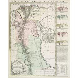
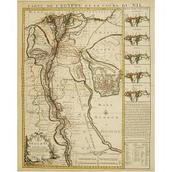
Carte de l'Egypte et le cours du Nil.
Large copper-engraved map illustrating the part of Egypt where the Nile River flows. 5 insets on left margin depicting the river outfall according to Herodotum, Strabonem...
Place & Date: Amsterdam c. 1745
Selling price: $950
Sold
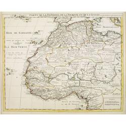
Carte de la Barbarie de la Nigritie et de la Guinée..
Richly engraved map of North and West Africa, based upon the earlier maps of De L'Isle. Richly annotated throughout and with excellent regional detail. It includes the Ca...
Place & Date: Amsterdam c. 1745
Selling price: $150
Sold
Carte d' Afrique Dressée pour l' usage du Roy?1722.
Guillaume de l' Isle (1675-1724), Royal Geographer, was the most influential French cartographer of the first quarter of the 18th century. ' Atlas de Géographie' (1700-1...
Place & Date: Paris, Ph.Buache, 1745
Selling price: $600
Sold in 2008
Carte de la Barbarie de la Nigritie et de la Guinée..
Richly engraved map of North and West Africa, based upon the earlier maps of De L'Isle. Richly annotated throughout and with excellent regional detail. It includes the Ca...
Place & Date: Amsterdam, c. 1745
Selling price: $110
Sold in 2022
Carte de La Barbarie de La Nigritie et de la Guinée.
Richly engraved map of North and West Africa, based upon the earlier maps of De L'Isle. Richly annotated throughout and with excellent regional detail. It includes the Ca...
Place & Date: Amsterdam, ca. 1745
Selling price: $101
Sold in 2014
[Lot of 10 maps of Guinea.] Tractus Littorales Guinea a promontorio Verde.
A fine chart, originally published by Frederick de Wit, corrected and re-issued by the Ottens brothers. A large, finely etched title-cartouche. The Guinea coast played an...
Place & Date: Amsterdam, 1745
Selling price: $170
Sold in 2022
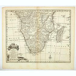
A New & Accurate Map of the Southern Parts of Africa containing Lower Guinea, Monoemugi. . .
A striking map of the Southern half of Africa and Madagascar, complete with a large decorative cartouche and compass rose. Tribal regions and Kingdoms named. Interesting ...
Place & Date: London, ca 1745
Selling price: $150
Sold in 2021
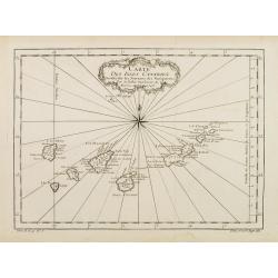
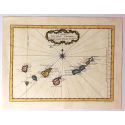
Carte des Isles Canaries..
A good engraved map of the Canary islands, with rococo title cartouche upper part. From l'Histoire générale des voyages .
Place & Date: Paris 1746
Selling price: $50
Sold
Carte de l'Egypte et le cours du Nil.
Large copper-engraved map illustrating the part of Egypt where the Nile River flows. Five insets on right margin depicting the river outfall according to Herodotum, Strab...
Place & Date: Amsterdam c. 1746
Selling price: $200
Sold in 2016
Carte Des Isles Canaries
Detailed map of the Canary Islands, with towns, ports, etc. Produced by Bellin, Ingenieur de la Marine, for Prevost d'Exiles important travel book, "L'Histoire Gener...
Place & Date: Paris, 1746
Selling price: $47
Sold in 2015
Partie de la Coste de Guinee, Depuis la Riviere de Sierra Leona Jusquan Cap das Palmas.
Detailed map of the Guinea coast in West Africa, from the Sierra Leone River to Cape Palmas on the southern coast of what is now Liberia, from the atlas of Prevost d'Exil...
Place & Date: Paris, 1746
Selling price: $25
Sold in 2017
Partie de la Coste de Guinee Depuis la Riviere de Sierre Leona Jusquau Cap das Palmas . . .
The coasts of present-day Sierre Leone and Liberia in Western Africa are shown on this map. All along the coasts are depth sounds. The map features an attractive title ca...
Place & Date: Paris, 1746
Selling price: $35
Sold in 2019
Suite de la Coste de Guinee Depuis le Cap de Palme Jusqu' au Cap des Trois Pointes...
Old map of the Ivory coast showing the kingdoms of the Côte d'Ivoire and Ghana in West Africa. From Antoine-François Prevost's L`Histoire Generale des Voyages. Feature...
Place & Date: Paris, 1746
Selling price: $12
Sold in 2019
A New and Accurate Map of Nubia....
Folding page map showing area from lower Egypt, through Sudan and Ethiopia and down to Somalia. The map also includes the Red Sea and what is now Yemen and South Arabia. ...
Place & Date: London 1747
Selling price: $100
Sold
Partie de la Coste de Guinee Depuis le Cap de Monte Jusqu'au Cap des Basses.
Fine little map engraved by Schley featuring the coast of Guinee in Western Africa. The insert is of the Sestos River. Pleasing floral, title cartouche. The map was publi...
Place & Date: Paris, 1747
Selling price: $125
Sold in 2015
A New and Accurate Map of Nubia & Abissinia, Together with All the Kingdoms Tributary there...
Showing the area from lower Egypt, through Sudan and Ethiopia and down to Somalia. The map also includes the Red Sea and what is now Yemen and South Arabia. Blank on vers...
Place & Date: London, 1747
Selling price: $250
Sold in 2013
Suite de la Coste de Guinnee Deouis la Riviere de Volta Jusqu'a Jakin.
Fine detailed map of the African Guinea coast, west of the Volta River. Featuring the kingdoms of Koto, de Popo, de Whidah and Ardra.Engraved by J. Schley from atlas of P...
Place & Date: Paris, 1747
Selling price: $119
Sold in 2015
Carte des Isles du Cap Verd.
Striking map of the Cape Verde Islands off the coast of Africa. Fancy cartouche and interesting, unique compass rose.By Bellin from the Abbe Prevost d'Exiles.
Place & Date: Paris, 1747
Selling price: $35
Sold in 2016
Carte du Cours des Rivieres de Faleme et Sanaga dans les Pays de Bambuc et Tamba Awra.
An interesting map of the Faleme and Sanaga Rivers in Camaroon in Africa. The map by Jacques Bellin has a decorative title cartouche.
Place & Date: Paris, 1747
Selling price: $27
Sold in 2016
Plan de L'Isle de Gore avec ses Fortifications.
Fine plans of Isle Gore, one of the main sites from which thousands of slaves were loaded on to ships bound for the New World. Engraved by J.V. Schley in 1747. From Abbe...
Place & Date: Paris, 1747
Selling price: $27
Sold in 2016
Coste de Guinee Depuis le Cap Apollonia Jusqu'a la Riviere de Volta ou La Coste d'Or.
Bellin's detailed map of the Guinea coast in west Africa, from Cape Appollonia to the mouth of the Volta River in what is now Ghana (the Gold Coast), from the atlas of Pr...
Place & Date: Paris, 1747
Selling price: $15
Sold in 2016
Partie de la Coste de Guinee Depuis le Cap de Monte Jusqu'au Cap des Basses;
A fine little map engraved by Schley featuring the coast of Guinee in Western Africa. The insert is of the Sestos River.With a pleasing floral, title cartouche. The map w...
Place & Date: Paris, 1747
Selling price: $50
Sold in 2019
L'Afrique Suivant les Dern.res Observations de Mr. Hass et des R.R.P.P. Jesuites.
A large map of the continent of Africa with a decorative title cartouche. Informational table upper left explaining the countries that comprise northern and southern Afri...
Place & Date: Paris, 1747
Selling price: $240
Sold in 2017




















![[2 Maps] Coste Occidentale d'Afrique, Depuis le Xie. Degre. . . / Carte de la Coste Orientale d'Afrique, depuis le Cap de Bonne Esperance. . .](/uploads/cache/42215-250x250.jpg)
![[Lot of 10 maps] In Notitiam Eclesiasticam Africae Tabula Geogrphica.](/uploads/cache/19552-250x250.jpg)






![[Lot of 10 maps of Guinea.] Tractus Littorales Guinea a promontorio Verde.](/uploads/cache/82292-250x250.jpg)
