Browse Listings in Africa
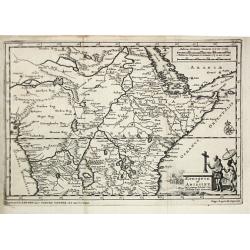
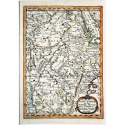
Partie de la HAUTE AETHIOPIE ou sont L'EMPIRE des ABISSINS et la NUBIE &c.
An excellent map of the Nile with its mythical sources. Shows the Nile River from Zaire Lake and Zaflant Lake, until Assuan / Aswan). Richly detailed with place names, hi...
Place & Date: Paris, ca 1700
Selling price: $91
Sold in 2019
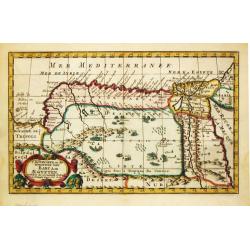
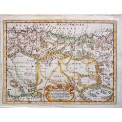
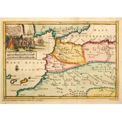
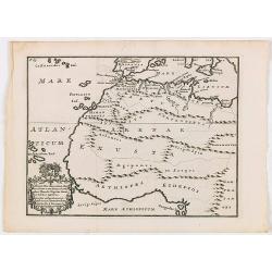
ROYAUME et Desert De BARCE, et L'AEGYPTE divisee en ses Principales Parties.
Very fine, decorative map of Egypt prepared by N.Sanson. Engraved by A.de Winter.
Place & Date: Paris, 1700
Selling price: $57
Sold in 2019
LA GUINEE et Pays circonvoisins.
Attractive copper engraved map of the Guinea coast including Guinea, Benin and Congo. Nicely detailed and decorated with a title cartouche that credits Gerard Mercator an...
Place & Date: Amsterdam 1700
Selling price: $55
Sold in 2019
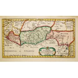
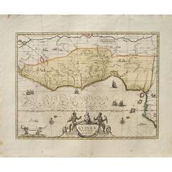
Guinea.
A decorative map of West Africa. The map includes numerous animals in the interior, sailing ships and an elegant cartouche. Published in Amsterdam by P. Schenk and G. Val...
Place & Date: Amsterdam, ca. 1700
Selling price: $199
Sold in 2019
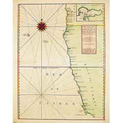
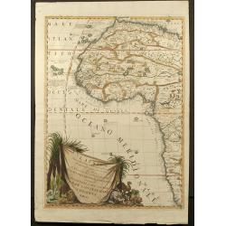
Carte Particuliere des Costes de l ' Afrique depuis Cabo Ledi jusques au Cap de Bone Esperance.
Carte Particuliere des Costes de l ' Afrique depuis Cabo Ledi jusques au Cap de Bone Esperance. Pieter Mortier (1661-1711), Amsterdam bookseller and printer of French des...
Place & Date: Amsterdam, 1700
Selling price: $400
Sold in 2020
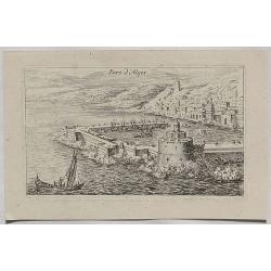
Port d'Alger.
A fine copper engraved city view of Algiers, in Algeria from about 1700.
Place & Date: Paris, ca 1700
Selling price: $75
Sold in 2020
Africae in Tabula Geographica Delineatio.
An attractive and detailed map of Africa, drawn by Zurner and published by Pieter Schenk. It's an updated version of the previous Schenk map, which was based on Visscher....
Place & Date: Amsterdam, ca 1700
Selling price: $450
Sold in 2020
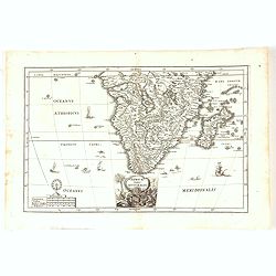
Africae Pars Australis.
Africa south of the equator. Beautiful cartouche with the title above in a scroll. Nice margins, excellent condition.
Place & Date: Munich, 1700
Selling price: $150
Sold in 2020
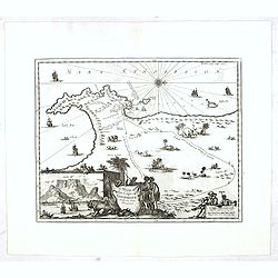
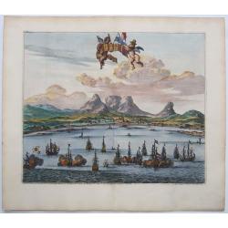
LE CAP DE BONNE ESPERANCE.
Probably the finest view of Cape Town. Beautifully engraved. A sea battle in the foreground with at least 15 galleons.With Tabletop mountain as the backdrop. Two putti ho...
Place & Date: Leiden, ca 1700
Selling price: $180
Sold in 2021
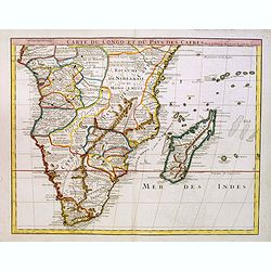
[Lot of 9 maps / prints of SOUTH AFRICA] Carte du Congo et du Pays des Cafres.
Guillaume de l 'Isle's influential map of South Africa. Guillaume de l' Isle (1675-1724), Royal Geographer, was the most influential cartographer of the first quarter of ...
Place & Date: Paris, c. 1700
Selling price: $230
Sold in 2022
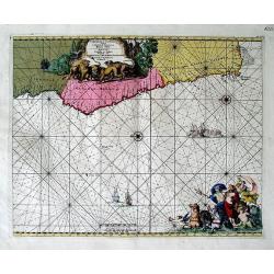
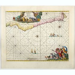
Cimbebas et Caffariae Littora a Catenbela ad Promontorium ..
A delightful Dutch sea chart that shows the coast of Angola, south-west Africa and South Africa up to Port Elizabeth. A truly classic sea chart of Dutch school with excel...
Place & Date: Amsterdam, 1700
Selling price: $180
Sold in 2023
L'Africa divisa nelle sue Parti secondo le piu moderne, relationis colle scoperte dell origine e corso del Niro
Famous two sheet Coronelli map of Africa. Second edition from 1701 which is unchanged since first edition in 1691. Many little elephants, lions and other animals filling ...
Place & Date: Venice, 1701
Selling price: $3001
Sold in 2008
Africa Selou les Autheurs les plus Modernes.
A rare map of Africa. Very decorative. It shows a quite up-to-date Africa flanked with armorial shields for major nations. The cartouche depicts natives smoking and tradi...
Place & Date: Paris, 1701
Selling price: $110
Sold in 2017
Congo, Angola, Cafres, Monoemugi, Monomotapa, Zanguebar & Madagascar.
The nice map that extends from Central Africa - Congo to Mombasa to the Cape of Good Hope. Herman Moll (fl.1678-1732). was a bookseller, geographer and engraver. A native...
Place & Date: London, ca 1701
Selling price: $95
Sold in 2019
Kabo de Bona Esperança.
Attractive view of the Good Hope Cape. A fleet of Dutch vessels is present on the foreground.
Place & Date: Amsterdam, 1702
Selling price: $550
Sold in 2008
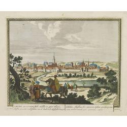
Salee, een vermaerde Koopstadt, en roofnest, gelegen aen de Atlantische of Spaense zee.
From Schenk's Hecatompolis sive Totius Terrarum Oppida Nobiliora Centrum.. , a collection of 100 views, dedicated to the 14-year old Prussian crown prince, the later king...
Place & Date: Amsterdam, 1702
Selling price: $100
Sold in 2009
Amara, een voorname stadt midden in opper Ethiopie, Abyssine genaamt, ..
From Schenk's Hecatompolis sive Totius Terrarum Oppida Nobiliora Centrum.. , a collection of 100 views, dedicated to the 14-year old Prussian crown prince, the later king...
Place & Date: Amsterdam, 1702
Selling price: $100
Sold in 2016
Cabo de Bona Esperanca / De Bay Van A de.S. Bras.
Uncommon small map of South Africa. From the French reissue of the account of early Dutch voyages first published in 1608 by Commelin. The French translation was carried ...
Place & Date: Amsterdam, E. Roger, 1702
Selling price: $150
Sold in 2012
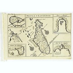
Insula S. Laurentii.
Map of Madagascar, with four inset maps. From the French reissue of the account of early Dutch voyages first published in 1608 by Commelin. The French translation was car...
Place & Date: Amsterdam, E. Roger, 1702
Selling price: $120
Sold in 2012
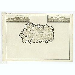
St Helene.
Uncommon small map of St. Helena, with two coastal profile inset maps.From the French reissue of the account of early Dutch voyages first published in 1608 by Commelin. T...
Place & Date: Amsterdam, E. Roger, 1702
Selling price: $80
Sold in 2012
Isle St. Maurice. Ins. cygnae a Lusit, a nostris Maurity nomine indigitata, sita ad 21um gradum ab Equinoctiali Meridiem versus inventa et detecta Decima-jctava die mensis septembris anno 1598.
A bay at ST. Mauritius, a small island located in the South-West Indian Ocean, off the east coast of Madagascar. Mauritius is well known for the Dodo, the extinct bird. T...
Place & Date: Amsterdam, E. Roger, 1702
Selling price: $80
Sold in 2021
C.D.Bona Esperance.
A rare view of a South African couple. In background Table Mountain.Engraved by A.Meijer for Carolus Allard's for his Orbis habitabilis oppida et vestitus. This rare work...
Place & Date: Amsterdam, inbetween 1683-1702
Selling price: $400
Sold in 2012
Egypten theilet sich.
Fantastic miniature map of Egypt, despite it size with many place names. Below the map it lists the areas and main cities. An increasingly rare map.
Place & Date: Ulm, 1702
Selling price: $75
Sold in 2017
Canary, Azores+Cape Verde Islands. -ARCHIPELAGUS ATLANTICUS, CUM SUIS INSULIS CANARIIS, HESPERIDIBUS [CAPE VERDE] ET AZORIBUS.
A very decorative map of Northwestern Africa and the Canary, Azores and Cape Verde Islands, with a large inset of Tenerife and Grand Canary Island. The richly decorated m...
Place & Date: Munich, 1702
Selling price: $300
Sold in 2021
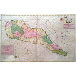
Insulae S. Thomae.
Uncommon map of the Island of St. Thomas located in the Atlantic Ocean near West Africa. From a travel book deScribing the early Dutch voyages by René Augustin Constanti...
Place & Date: Amsterdam, E. Roger, 1703
Selling price: $90
Sold in 2012
A mapp of the Cape of Goodhope with its true Situation.
Very fine decorative map of Cape of Good Hope. From the book "A Collection of Voyages and Travels" by J. Churchill and the map came from the part containing the...
Place & Date: London, Printed for A. and J. Churchill, 1703
Selling price: $400
Sold in 2016
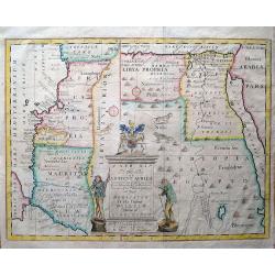
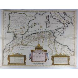
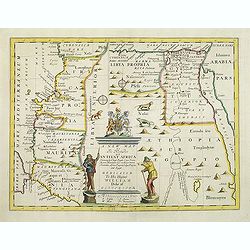
A new map of the north part of Antient Africa, shewing the chiefe people, cities, towns, rivers, and mountains in Mauritania, Numidia, Africa Propria, Libya Propria, and Egypt...
Ancient North Africa in two parts, the left portion shows Morocco to Cyrenaica (Libya), and is oriented to the east; the right portion from Cyrenaica to the Red Sea, orie...
Place & Date: London, c1704
Selling price: $120
Sold in 2013
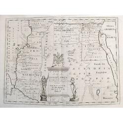
A new map of the north part of Ancient Africa, shewing the chiefe people, cities, towns, rivers, and mountains in Mauritania, Numidia, Africa Propria, Libya Propria, and Egypt...
Ancient North Africa in two parts, the left portion shows Morocco to Cyrenaica (Libya), and is oriented to the east; the right portion from Cyrenaica to the Red Sea, orie...
Place & Date: London, ca.1704
Selling price: $87
Sold in 2017
D' Eilanden van Capo Verde, de kust en 't landt der Negeren.
Nicolas Sanson (1600-67), ' father of the French cartography' and founder of the Sanson firm. Atlas ' Cartes générales de toutes les parties du Monde', 1658-70 and a po...
Place & Date: Amsterdam, F. Halma, 1705
Selling price: $95
Sold in 2009
T koninkryk en de Woestyne van Aegypten.
Nicolas Sanson (1600-67), ' father of the French cartography' and founder of the Sanson firm. Atlas ' Cartes générales de toutes les parties du Monde', 1658-70 and a po...
Place & Date: Amsterdam, F. Halma, 1705
Selling price: $85
Sold in 2016
' T Ryk van Fez verdeelt in zeven Landschappen
Nicolas Sanson (1600-67), ' father of the French cartography' and founder of the Sanson firm. Atlas ' Cartes générales de toutes les parties du Monde', 1658-70 and a po...
Place & Date: Amsterdam, F. Halma, 1705
Selling price: $100
Sold in 2009
Guinee.
Nicolas Sanson (1600-67), ' father of the French cartography' and founder of the Sanson firm. Atlas ' Cartes générales de toutes les parties du Monde', 1658-70 and a po...
Place & Date: Amsterdam, F.Halma, 1705
Selling price: $85
Sold
Egypten, verdeelt in zyne twaalf Cassilifen of Landvoogdyen.
An attractive map of Egypt from Nicolas Sanson's pocket atlas. Nicolas Sanson (1600-67), the father of the French cartography' and founder of the Sanson firm. Published a...
Place & Date: Amsterdam, F. Halma, 1705
Selling price: $75
Sold in 2019
T Koninkrijk van Congo.
Nicolas Sanson (1600-67), ' father of the French cartography' and founder of the Sanson firm. Atlas ' Cartes générales de toutes les parties du Monde', 1658-70 and a po...
Place & Date: Amsterdam, 1705
Selling price: $75
Sold in 2017
Guinee.
Nicolas Sanson (1600-67), ' father of the French cartography' and founder of the Sanson firm. Atlas ' Cartes générales de toutes les parties du Monde', 1658-70 and a po...
Place & Date: Amsterdam, F.Halma, 1705
Selling price: $85
Sold
L'Afrique Dressée sur les Relat. Et Suivant les Nouvelles decouvertes . . .
Map of Africa. Decorative dedication panel and title cartouche. From his "Atlas Curieux", published 1700-1705, in the rare early edition dated 1700.
Place & Date: Paris, 1700-1705
Selling price: $310
Sold in 2011
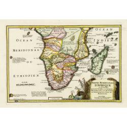
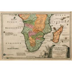
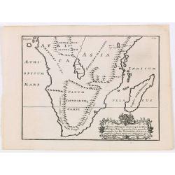
Partie méridionale d'Afrique où se trouvent la Basse Guinée, la Cafrerie, le Monomotapa, le Monoemugi, le Zanguebar et l'isle de Madagascar
The map includes Southern Africa and Madagascar. Engraved by C.Inselin.There is a small legend at the lower border describing the discovery of the Cape by Bartholomew Dia...
Place & Date: Paris, 1705
Selling price: $170
Sold in 2011
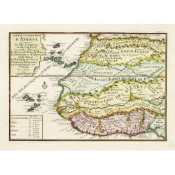
Partie occidentale d'Afrique ou se trouve les Isles Canaries. . .
The map includes Western Africa and the Canary Islands and Cape Verde. Engraved by C.Inselin. From his "Atlas Curieux", published 1700-1705.
Place & Date: Paris, 1705
Selling price: $105
Sold in 2011
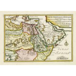
Partie Orientale d'Afrique ou se trouvent l'Egipte, La Nubie. . . L.Arabie . . . Et la Mer Rouge.
The map includes Northern Africa and the Arabian peninsular. Engraved by C.Inselin. Dated in the lower right corner. From his "Atlas Curieux", published 1700-17...
Place & Date: Paris, 1705
Selling price: $50
Sold in 2011
Gedeelte van Barbaryen, waar in legt 't Rijk van Algiers verdeelt in zyne Lanschappen.
Northern part of Algeria. Published by Frans Halma
Place & Date: Utrecht, F. Halma,1705
Selling price: $40
Sold in 2013
T Ryk van Fez verdeelt in zeven Landschappen, getrokken uit Sanutus enz.
Map of Fez in Morocco. Published by Frans Halma
Place & Date: Utrecht, F. Halma,1705
Selling price: $41
Sold in 2013
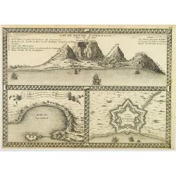
Cap de Bonne Esperance par N.de Fer.
In the upper part a view of the Table Mountain, in lower part Table Bay and the Dutch Castle at Cape of Good Hope.
Place & Date: Paris, 1705
Selling price: $450
Sold in 2008
Partie Meridionale d'Afrique ...
Map of southern Africa, engraved by C. Inselin, from De Fer's Atlas Curieux.
Place & Date: Paris, 1705
Selling price: $230
Sold in 2009
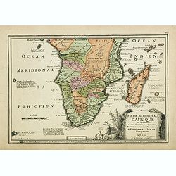
Partie méridionale d'Afrique où se trouvent la Basse Guinée, la Cafrerie, le Monomotapa, le Monoemugi, le Zanguebar et l'isle de Madagascar
The map includes Southern Africa and Madagascar. Engraved by C.Inselin.There is a small legend at the lower border describing the discovery of the Cape by Bartholomew Dia...
Place & Date: Paris, 1705
Selling price: $300
Sold in 2018
T Ryk van Fez verdeelt in zeven Landschappen
Nicolas Sanson (1600-67), ' father of the French cartography' and founder of the Sanson firm. Atlas ' Cartes générales de toutes les parties du Monde', 1658-70 and a po...
Place & Date: Amsterdam, F. Halma, 1705
Selling price: $50
Sold in 2018
L'Afrique dressée sur les dernieres Relations . . .
An interesting small map of Africa by Nicolas de Fer. From his rare "Petit et Nouveau Atlas". The first edition was published in 1697 and was republished in 170...
Place & Date: Paris, 1705
Selling price: $170
Sold in 2016
Aethiopie of Abissine. In 't gemeen 't Land van Preste Jan Genoemd.
Pieter van der Aa was a prolific publisher. He published a.o. ' Naauwkeurge versameling der gedenkwaardigste zee- en land-reysen', a series of accounts of voyages (1706-0...
Place & Date: Leiden, 1707
Selling price: $130
Sold
Africa.
Pieter van der Aa was a prolific publisher. He published a.o. ' Naaukeurige versameling der gedenkwaardigste zee- en land-reysen', a series of accounts of voyages (1706-0...
Place & Date: Leiden, 1707
Selling price: $235
Sold
Barbaryen.
Pieter van der Aa was a prolific publisher. He published a.o. ' Naaukeurige versameling der gedenkwaardigste zee- en land-reysen', a series of accounts of voyages (1706-0...
Place & Date: Leiden, 1707
Selling price: $125
Sold
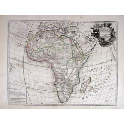
L' AFRIQUE, Dressée sur les Observations de Mrs. de l'Academie Royale des Sciences, et quelques autres, & sur les Memoi= res les plus recens.
This is a landmark map of Africa. This is the first map of Africa to show Africa without the two Nile River Ptolemaic-based source lakes. Delisle's last remaining majo...
Place & Date: Paris, 1700-1708
Selling price: $575
Sold in 2013
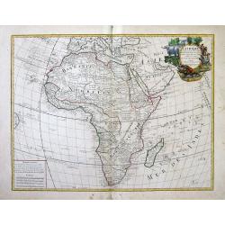
L\' AFRIQUE, Dressée sur les Observations de Mrs. de l\'Academie Royale des Sciences, et quelques autres, & sur les Memoi= res les plus recens.
This is a landmark map of Africa. This is the first map of Africa to show Africa without the two Nile River Ptolemaic-based source lakes. Delisle's last remaining major ...
Place & Date: Paris, (1700) 1708
Selling price: $325
Sold in 2013
Aethiopia Superior vel Interior vulgo Abissinorum.
An attractive map of the Eastern African and the fictitious kingdom of Prester John. The map shows a major section of central and eastern Africa including Mozambique nort...
Place & Date: Amsterdam, 1708
Selling price: $440
Sold in 2010
L\'Afrique dressée sur les observations de Mr de l\'académie Royale des Sciences. . .
Guillaume de l'Isle's (1675-1726) well deserved reputation as one of the foremost geographers of the 18th century meant that his maps were influential for many years afte...
Place & Date: Amsterdam, 1708
Selling price: $250
Sold in 2011
Carte du Congo et du Pays des Cafres..
Large map of the Southern part of Africa, including Madagascar An important map by one of France's most prolific map makers.The Delisle (de L'Isle) family followed the Sa...
Place & Date: Paris, 1708
Selling price: $180
Sold in 2017
Carte Particuliere Des Costes De L'Afrique Depuis C.Del Gado Jusques Rio Mocambo.
A fine sea chart of the coasts of Mozambique and Tanzania and the Comoro Islands. Full tile: 'Carte Particuliere Des Costes De L'Afrique Depuis C.Del Gado Jusques Rio Moc...
Place & Date: Amsterdam, 1693-1708
Selling price: $225
Sold in 2020
Representatio Totius Africae ...
This is Scherer's (1628-1704) famous but rather uncommon map showing the skeleton chopping down the tree. Based on his earlier map of the continent (see Norwich Map 62),...
Place & Date: Munich 1710
Selling price: $425
Sold
L'Afrique
Nicolas Bion (1652-1733) was a French mapmaker in Paris. In 1710 Bion's L'Usage des Globes Celestes et Terrestrees et des spheres was published, from which this map com...
Place & Date: Paris, 1710
Selling price: $200
Sold
Cimebebas et Caffariae Littora a Catenbela ad Promontorium Bonae Spei. Pascaerte... Gedruckt tot Amsterdam by L Renard.
A highly decorative of the southern and southwest coast of Africa including the Cape of Good Hope. A large title cartouche dominates the top of the chart. This cartouc...
Place & Date: Amsterdam, (c.1675) 1710
Selling price: $400
Sold in 2011
Carte particuliere de L´Isle Dauphine ou Madagascar et St Laurens.
A big, beautiful, brightly colored map of Madagascar, Comoros, I. De Bourbon, Santa Apolonia, I. Ioan de Lisboa and other islands. With an inset map of Baye St. Augustin....
Place & Date: Amsterdam, ca. 1710
Selling price: $300
Sold in 2017
Theatrum historicum ad Annum Christi Quadringentesimum...
Striking map of the world in two Hemispheres from the time of the Roman Empire. Dating from the 8th century, the Roman empire expanded to become one of the largest empi...
Place & Date: London, 1710
Selling price: $62
Sold in 2018
Carta dell Affrica in eisa dalli Fratelli Bordiga.
Decorative map of the African continent with Madagascar and the surrounding islands. Also the Arabia peninsular. Published by the Bordiga brothers of Milan.
Place & Date: Milan, ca. 1710
Selling price: $100
Sold in 2020
AFRICA Concinnata Secundum Observationes. . .
A rare issue by German the publisher Jeremia Wolff of de l’Isle’s map of Africa, which served as the model for European mapmakers, and was frequently copied throughou...
Place & Date: Augsburg, 1710
Selling price: $350
Sold in 2020
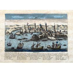
Tripoli.
A decorative view of Tripoli. With detailed sailing ships and buildings. Below the view with descriptive French text of the city and its (pirate) history. A 1-16 legend k...
Place & Date: Paris, ca 1710
Selling price: $110
Sold in 2020
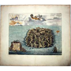
SAINT HELENA.
This fine hand colored original copper-plate engraved antique map of the Island of St Helena in the southern Atlantic, was published by Pieter Van der Aa. With cherubs, s...
Place & Date: Amsterdam, ca 1710
Selling price: $150
Sold in 2021
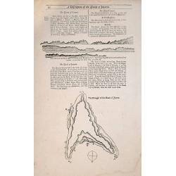
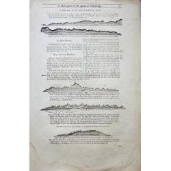
A Description of the Islands of Joanna (Anjouan).
A Description of the Islands of Joanna by Samuel Thornton. Small woodblock chart by Samuel Thornton of The Island of Joanna published in 1711 by John How and Samuel Thorn...
Place & Date: London, 1711
Selling price: $100
Sold in 2014
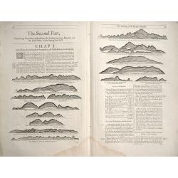
The Making of the Canary Islands.
The Making of the Canary Islands, a woodblock chart by Samuel Thornton showing the approaching coast lines of The Island of Madera, Gran Canaries and Island of Palma on t...
Place & Date: London, 1711
Selling price: $50
Sold in 2014
A Description of the Island of Mauritius - Don Mascarenhas Island.
No’s 23 – 24 A woodblock chart on a double sided sheet by Samuel Thornton showing the approaching coast line of Mauritius 23’ on the verso 24’ shows Don Mascarenh...
Place & Date: London 1711
Selling price: $80
Sold in 2015
CARTE Particuliere de L' EGYPTE, de la NUBIE, et de L' ABYYSSINIE.
Detailed map of Cyprus, Asia Minor, the Middle East and North Africa, colored by regions.
Place & Date: Amsterdam, 1711
Selling price: $120
Sold in 2020
Ultimae Aethiopum utrorumque in Asia Africaque Orae . . .
A uncommon map of South Africa after Pompus Mela, with Madagascar with a large cartouche lower left with dedication to Ric. Elsworth of Bickham.From "De situ orbis l...
Place & Date: London, Philipp Bishop, 1711
Selling price: $50
Sold in 2020
Africae fons illa, quae Mari Atlantico . . .
A uncommon map of West Africa with a large dedicational cartouche lower left corner.From "De situ orbis libri tres, ad omnium Angliae & Hiberniae codicum mss. fi...
Place & Date: London, 1711
Selling price: $50
Sold in 2020
A new map of the north of antient Africa. . .
Decorative map of the north part of Ancient Africa. East to the top.This decorative map was part of a set of 22 maps dedicated to William, Duke of Gloucester, who was the...
Place & Date: Oxford, 1712
Selling price: $110
Sold in 2011
AFRICA.
This the Raphael Savonarola printing of Giovanni Magini's modern map of Africa, from his edition of Claudius Ptolemy's Geographia. It is basically a slightly-reduced ve...
Place & Date: Padua, 1713
Selling price: $70
Sold in 2013
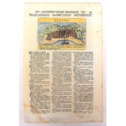
Quiloa
An uncommon, important map of Kilwa , an island off the coast of East Africa, in present day Tanzania. It is from Lazor A Varea's "Universus Terrarum Orbis". A ...
Place & Date: Padua, 1713
Selling price: $22
Sold in 2013
Quiloa.
A charming map of the island nation of Quiloa (Kilwa) off the coast of East Africa, in present day Tanzania near Zanzibar. An attractive small city view (after Valegio) ...
Place & Date: Padua, 1713
Selling price: $20
Sold in 2017
Quiloa (Kilwa - Tanzania)
A woodcut print of Quiloa (Kilwa) off the coast of Tanzania. An scarce small map of the island.
Place & Date: Padua, 1713
Selling price: $45
Sold in 2018
To the right...This Map of Africa.
A superb, beautifully engraved large-scale map of Africa, including 4 insets of ports, coast lines and estuaries across the continent.The work is highlighted by a magnifi...
Place & Date: London, 1716
Selling price: $4000
Sold
AFRIQVE Par le Sr. Sanson d'Abbeville Geographe du Roy
This map is often confused with the Nicolas Sanson map of Africa of 1656 (Betz #86). In Paris in 1716, a copy of the Sanson map appeared in Methode Pour Etudier La Geogr...
Place & Date: Paris, ca 1716
Selling price: $75
Sold in 2013
L'Afrique Dressée selon les derniners relat et suivant les nouvelles decouvertes...?
Striking copper plate engraved map of all of Africa from the 'Atlas Curieux' of Nicholas de Fer (1646-1720). Tooley p.45, plate 33, third state with the date 1717. Curiou...
Place & Date: Paris, 1717
Selling price: $400
Sold
L'Afrique Dressée selon les dernieres relat. et suivant . . .
Map of Africa. Decorative dedication panel and title cartouche.
Place & Date: Paris, 1717
Selling price: $200
Sold in 2009
Vue et description des Forts Que Les Hollandois, Anglois, et Danois ont sur la cote de Guinee.
Decorative, copperplate sheet with 12 vies of African Cities, from Chatelain's monumental 7 volume Atlas Historique.Includes a series of views showing Map shows on 12 vie...
Place & Date: Paris 1717
Selling price: $40
Sold in 2019



![[Lot of 9 maps / prints of SOUTH AFRICA] Carte du Congo et du Pays des Cafres.](/uploads/cache/19581-(1)-250x250.jpg)





![Canary, Azores+Cape Verde Islands. -ARCHIPELAGUS ATLANTICUS, CUM SUIS INSULIS CANARIIS, HESPERIDIBUS [CAPE VERDE] ET AZORIBUS.](/uploads/cache/85216-250x250.jpg)

