Tercia Etas Mundi. Foliu. XXVIII (with a view of the city of Lacedaemon or Sparta)
The Latin text page is illustrated with depictions of Kings, Noble men and women and scientists, including Atlas. RECTO : In the first panel, at the left, are some of the...
- $150 / ≈ €132
Place & Date: Nuremberg, 12 July 1493
[Euboe].
Woodcut Ptolemaic-style map by Sebastian Münster figuring Euboea Island, published in the edition of Strabo by Henri Petri in 1571."Strabonis rerum geographicarum&q...
- $100 / ≈ €88
Place & Date: Basle, Henri Petri, 1571
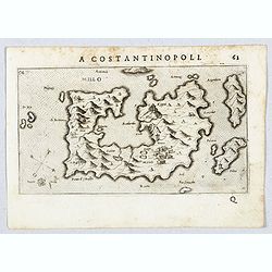
Millo.
Very rare view of Milos Island published in the first edition of "Viaggio da Venetia, a Costantinopoli. Per Mare, e per Terra, & infieme quello di Terra Santa. D...
- $450 / ≈ €396
Place & Date: Venice, Giacomo Franco, 1598
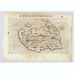
Murgo.
Very rare map of Amorgos published in the first edition of "Viaggio da Venetia, a Costantinopoli. Per Mare, e per Terra, & infieme quello di Terra Santa. Da Gios...
- $300 / ≈ €264
Place & Date: Venice, Giacomo Franco, 1598
[Map of Morea]
Very rare map of the island Morea published in the first edition of "Viaggio da Venetia, a Costantinopoli. Per Mare, e per Terra, & infieme quello di Terra Santa...
- $450 / ≈ €396
Place & Date: Venice, Giacomo Franco, 1598
[Map of Zakynthos or Zante]
Very rare map of Zakynthos or Zante, a Greek island in the Ionian Sea. It is the third largest of the Ionian Islands. Published in the first edition of "Viaggio da V...
- $450 / ≈ €396
Place & Date: Venice, Giacomo Franco, 1598
Zafalonia [Map of Kefalonia]
Very rare map of the island of Kefalonia published in the first edition of "Viaggio da Venetia, a Costantinopoli. Per Mare, e per Terra, & infieme quello di Terr...
- $450 / ≈ €396
Place & Date: Venice, Giacomo Franco, 1598
Rhodi.
A beautiful miniature map of the Greek island of Rhodes, published by Petrus Bertius in Amsterdam at the beginning of the seventeenth century.Engraved by Petrus Kaerius. ...
Place & Date: Amsterdam, 1606
Descriptio Peloponnesi.
A fine miniature map of the southern Greek provence of Morea, the middle ages term for the Peloponnese peninsular, published by Petrus Bertius in Amsterdam early in the s...
- $100 / ≈ €88
Place & Date: Amsterdam, 1606
Graecia.
Small map centered on Greece and the Aegean Sea, surrounded by text in Dutch.Nicolaes de Clerck (de Klerc) was active as engraver and publisher in Delft from 1599-1621.In...
- $100 / ≈ €88
Place & Date: Amsterdam, Cloppenburch, 1621
Morea olim Peloponnesus.
Gerard Mercator's map of the Greece's Peloponnesus peninsula called and labeled Morea. A few of the other smaller islands appear included the larger Cerigo (today's Cythe...
- $300 / ≈ €264
Place & Date: Amsterdam, 1630
Moree jadis Peloponese.
Rare map of Peloponnese, published by Jollain in 1667. Published in "Trésor Des Cartes Geographiques Des Principaux Estats de Lunivers".This atlas is based upo...
- $300 / ≈ €264
Place & Date: Paris, 1667
Candie.
Rare map of Crete with in top six small inset maps of Greek islands, published by Jollain in 1667. Published in "Trésor Des Cartes Geographiques Des Principaux Esta...
- $350 / ≈ €308
Place & Date: Paris, 1667
Insula Candia ejusque fortificatio.
An earlier and smaller version of De Wit's map of Candia. Richly engraved work, one of the most beautiful ever produced of Crete. There are insets of the fortifications a...
- $2500 / ≈ €2201
Place & Date: Nuremberg, 1680
Bartanico nel Arcipelago. (Bartanico)
Magnificent shipping scene offshore of Bartanico. Engraved by Lucas Vostermans II, who was born in 1624, in the same year when the family moved to England for six years. ...
- $125 / ≈ €110
Place & Date: Antwerp, c.1690
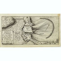
Piazza di Sta Maura esvoi Borghi Affediata dall Armi della. . .
Magnificent bird's eye- with the northern tip of the island of Santa Maura (today Lefkada). Situated very close to the mainland to which it is linked by a long strip of s...
Place & Date: Antwerp, c.1690
Camos nel Arcipelago. (Samos Island)
Magnificent shipping scene offshore of the island of Samos. Engraved by Lucas Vostermans II, who was born in 1624, in the same year when the family moved to England for s...
- $100 / ≈ €88
Place & Date: Antwerp, c.1690
Pelaguse nel Arcipelago. (Pegalos)
Magnificent shipping scene offshore of Pelagos. Engraved by Lucas Vostermans II, who was born in 1624, in the same year when the family moved to England for six years. He...
- $125 / ≈ €110
Place & Date: Antwerp, c.1690
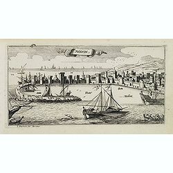
Modon. (Methoni)
Magnificent bird's eye-town-view of Methoni on Morée. Etched by Gaspar Bouttats (1640-1695).The Antwerp based publisher Jacques Peeters published ca. 1690 a series of pr...
- $150 / ≈ €132
Place & Date: Antwerp, c.1690
Graeciae Pars Septentrionalis..
Very decorative map illustrating the northern part of Greece and a small part of Turkey. Istanbul is represented on the right margin with its former names Byzantium and C...
Place & Date: Amsterdam, 1720
Peloponnesus Hodie Morea Ad Normam Veterum Et Recentiorum Mappa Accuratissime Adornata Aeri Incisa Et Venalis. . .
Decorative regional map of Morea and contiguous islands, with an ornate cartouche showing a lion bearing a sword defeating Turkish and other invaders.
- $450 / ≈ €396
Place & Date: Augsburg, 1740
Carte de la Grece dressée sur un grand nombre de memoires. . .
Detailed copper-engraved map of Greece with its neighboring countries, including southern Italy and part of Cyprus. Relief shown pictorially. With large decorative title ...
- $400 / ≈ €352
Place & Date: Amsterdam c. 1745
[59] Svr I. De Paros.
Charming chart of the harbour of the Greek island of Paros. Showing town and harbour plan, with soundings, anchorages, rocks, shoals, fortifications and lighthouses.Josep...
- $50 / ≈ €44
Place & Date: Marseille, 1764
[60] Porto de Ganea.
Charming chart of the harbour of the Greek town of Ganea. Showing town and harbour plan, with soundings, anchorages, rocks, shoals, fortifications and lighthouses.Joseph ...
Place & Date: Marseille, 1764
[56] I.Scio.
"Charming chart of the harbour of the Greek town of Chios. Showing town and harbour plan, with soundings, anchorages, rocks, shoals, fortifications and lighthouses.J...
- $80 / ≈ €70
Place & Date: Marseille, 1764
Graeciae pars septentrionalis. . .
Rare map of northern part of Greece and part of Turkey, prepared by Nolin and published by L.J. Mondhare for his Atlas Général a l'usage des colleges et maisons d'educa...
- $80 / ≈ €70
Place & Date: Paris, 1781
Graeciae Antiquae Specimen Geographicum..
A map of Greece in classical times, with an inset depicting northern Greece. Ornamental title cartouche in the lower left corner.Venetian edition of d'Anville's map, from...
- $250 / ≈ €220
Place & Date: Venice, 1776 - 1784
Turquie d'Europe . . .
Detailed map of Grrece, Marcedonia, Bulgaria, Servia, Roumania, prepared by A. H. Basset, rue Saint-Jacques, no. 64, Paris and published in Atlas classique et Universel d...
- $80 / ≈ €70
Place & Date: Paris, A.H. Basset, 1828
Greece and the Ionian Islands.
A large steel engraved map concentrating on Greece and the Ionian islands. Featured are Albania, Corfu, Macedonia, Central Greece and Morea., along with many small island...
Place & Date: London, 1839
Etat de la Grèce.
Finely engraved map of Greece prepared by A.H.Dufour and engraved by Giraldon-Bovinet. Published by Jules Renouard in his uncommon atlas "Le globe Atlas classique Un...
- $50 / ≈ €44
Place & Date: Paris, Jules Renouard, ca.1840
La Grecia Antica . . . / Atene e sue vicinanze . . .
Two rare maps, one of Greece map 175 x 240mm. and the other of Athens 140 x 240mm. with an inset map of Sparta.From l'Atlante Storico, Letterario, Biografico, Archeologic...
Place & Date: Venice, 1840
Provincia ecclesiastica di Naxos e delegazione aplica di Grecia. (Tav XCVII)
A large-format map of Naxos with it's dioceses. This Greek island in the South Aegean, is the largest of the Cyclades island group. The map is finely engraved and beautif...
- $250 / ≈ €220
Place & Date: Rome, 1858
Provincia ecclesiastica di Corfu nell isole Jonie. Tav. XCV.
A large-format map centered on Corfu with it's dioceses. The map is finely engraved and beautifully colored and was prepared by Girolamo Petri, a lawyer who served as a s...
- $450 / ≈ €396
Place & Date: Rome, Tipografia della Reverenda Camera Apostolica, 1858-1859
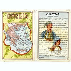
Grecia.
Unique manuscript map of Greece. Award-winning manuscript card, prepared by Antonio Raggio for the 11th Congreso de la Union Postal Universal (World Postal Congress) Expo...
- $250 / ≈ €220
Place & Date: Buenos Aires, 1939

![[Euboe].](/uploads/cache/41989-250x250.jpg)
![[Map of Morea]](/uploads/cache/45228-250x250.jpg)
![[Map of Zakynthos or Zante]](/uploads/cache/45226-250x250.jpg)
![Zafalonia [Map of Kefalonia]](/uploads/cache/45223-250x250.jpg)






![[59] Svr I. De Paros.](/uploads/cache/12831-250x250.jpg)
![[60] Porto de Ganea.](/uploads/cache/12832-250x250.jpg)
![[56] I.Scio.](/uploads/cache/12828-250x250.jpg)


