
Femina indica Orientalis - Indus Africanus - Singava vulgo dicta sive erratica femina Ori.
Beautiful engraving by Abraham de Bruyn showing inhabitants of Asian and African people with captions in Latin, French and German.Abraham de Bruyn, a Flemish engraver and...
Place & Date: Cologne, c.1577

Africa ex magnae Orbis Terrae Descriptione.
Very rare separately published "Lafreri" map of Africa. The title in typical Italian scrollwork surmounted by two Cupids in the lower Atlantic. A dedication to ...
- $6000 / ≈ €5283
Place & Date: Venice, ca. 1590

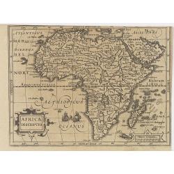
Africa.
A lovely miniature map of the continent of Africa, published by Petrus Bertius, in Amsterdam at the beginning of the seventeenth century. There is a small strap-work titl...
Place & Date: Amsterdam, 1606
Africae Descriptio.
Map of Africa from the first French-text edition of Jodocus Hondius' Atlas Minor.Shortly after the publication of the big folio-atlases the need was apparently felt for a...
Place & Date: Amsterdam, 1608

XII. Delineatio Venationum, quomodo Nimir um Omnis Generis feras capiant. (How the hunters catch animals: 1603-1604)
A: shows a leopard walking into a cage with a trap door. B: is an antelope, killed by natives, using ‘assagais’. C: shows rabbits being caught. They are frightened ou...
- $125 / ≈ €110
Place & Date: Frankfurt, 1609
Africa ex magna orbis terre descriptione Gerardi Mercator. . .
A classic map of Africa. The map first appeared in Gerard Mercator’s Atlas sive Cosmographicae..., published posthumously in 1595. As stated in the title, this map is b...
- $2200 / ≈ €1937
Place & Date: Duisburg and then Amsterdam, (1595) 1609 or 1619

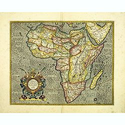
Africa ex magna orbis terre descriptione Gerardi Mercator. . .
Map of Africa. Much of the interior of Africa defers to the traditions of Ptolemy. The Nile river is shown with the two lakes and the Mountains of the Moon across souther...
Place & Date: Amsterdam, 1630
Selling price: $1500
Sold in 2015

L'Affrique En Plusieurs Cartes Nouvelles, et exactes, &c.
Edition illustrated with 18 maps in original outline colors dated 1656. No date and title page and maps not numbered (according to Pastoureau 1 C, maps are numbered).Nico...
Place & Date: Paris, l'Auteur, after 1662

Nouvelle description d'Afrique.
Rare map of Africa published by Jollain in 1667. Published in "Trésor Des Cartes Geographiques Des Principaux Estats de Lunivers".This atlas is based upon Bois...
- $250 / ≈ €220
Place & Date: Paris, 1667
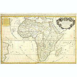
L'Afrique divisée suivant l'estendue de ses principales parties ou sont distingués les vns des autres . . .
A second state of this fine mile-stone map of Africa with a decorative title and scale cartouche. As the title indicates, this map is based on the geography of Guillaume ...
- $750 / ≈ €660
Place & Date: Paris, 1685
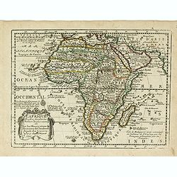
L' Afrique Dressee suivant les Auteurs les plus nouvea. . .
Charming map of the African continent with some interesting cartography and filled with notations.The Nile is correctly shown with its origins in Abyssinia. A large Lac d...
- $300 / ≈ €264
Place & Date: Paris, 1719

L'Afrique divisée en ses principaux etats par le Sr. Janvier Geographe.
A neatly engraved example of Jean Janvier's 1762 map of Africa. Covers the entire continent as well as the Island of Madagascar and adjacent parts of Persia and Arabia. D...
- $200 / ≈ €176
Place & Date: Paris, ca. 1765
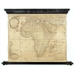
Carte D'Afrique Dressée pour l'usage du Roy. Par Guillaume Delisle, Premier Géographe de Sa Majesté, de l'Académie Royale des Sciences…
Curious late issue of De L'Isle's map of the African continent from 1722 map "Corrigée et Augmentée en 1781". - The decorative map shows the continent Africa ...
- $1250 / ≈ €1101
Place & Date: Paris, 1781

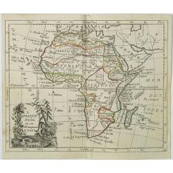
L'Afrique divisée en ses principaux Etats assujettie..
Excellent copper engraved map of the continent showing the extent of knowledge in the mid-18th century.While mostly accurate, it does have remnants of fantasy such as the...
- $400 / ≈ €352
Place & Date: Venice, 1776 - 1784

L'Africa divisa nelle sue principali parti…
Rare map of Africa. Published by Pazzini, Carli (1707-1769) and prepared by Bartolomeo Borghi (1750-1821). Features decorative title cartouche. Included in "Atlante ...
- $300 / ≈ €264
Place & Date: Siena, 1796
![[Lot of 3 maps] Le Coste Dell' Alta Guinea… [with] Carta del Basso Egitto [with] Le Coste di Barbaria.](/uploads/cache/48545-250x250.jpg)
[Lot of 3 maps] Le Coste Dell' Alta Guinea… [with] Carta del Basso Egitto [with] Le Coste di Barbaria.
A lot of three maps of nort and eastern Africa. Published by Pazzini, Carli (1707-1769) and prepared by Bartolomeo Borghi (1750-1821). Features decorative title cartouche...
- $300 / ≈ €264
Place & Date: Siena, 1796

L'Afrique Divisée en ses Principaux Etats.
Map of Africa, from Atlas de la Géographie de toutes les parties du monde.. Ouvrage destiné pour l'education, et nécessaire aux négocians, aux voyageurs, aux fonction...
Place & Date: Paris, Prudhomme, Levrault, Debray, 1806
L'Afrique . . .
Map of the African continent, from Atlas moderne portatif composé de vingt-huit cartes sur toutes les parties du globe terrestre .. A l'usage des Colléges, des Pensions...
- $200 / ≈ €176
Place & Date: Paris, Prudhomme, Levrault, Debray, 1806
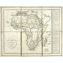
Carte générale de L'Afrique divisée en ses principaux états par Fx Delamarche. . .
Uncommon map of Africa prepared by Felix Delamarche, after R.de Vaugondy. The "Zahara ou Grand désert" and Congo and Zambia "Contrée tout-a-fait Inconnue...
- $300 / ≈ €264
Place & Date: Paris, 1820
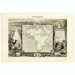
Afrique.
A decorative 19th century map of the continent colored to show the colonial possessions and major tribal kingdoms. The interior is mostly void of detail. The map is surro...
Place & Date: Paris, 1850
![[Title in Ottoman Turkish: SOUTHERN AFRICA].](/uploads/cache/44732-250x250.jpg)
[Title in Ottoman Turkish: SOUTHERN AFRICA].
A fine Ottoman map of Southern Africa from Ali Şeref Paşa’s rare "Yeñi coġrafya aṭlası", published by the press of Matbaa-i Amire, the successor of İb...
- $350 / ≈ €308
Place & Date: Beyazit, Istanbul: Matbaa-i Amire 1311 or 1895
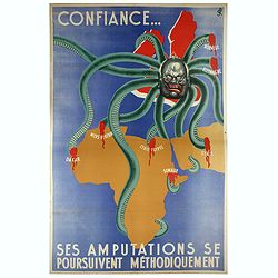
Confiance... Ses Amputations se Poursuivent Methodiquement.
Propaganda poster, produced under the NAZI collaborating Vichy French regime and designed to inspire revulsion and hatred of the English among the French, while frequentl...
Place & Date: Paris, ca. 1941