Browse Listings
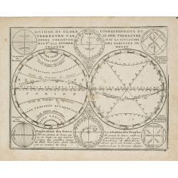
Division du Globe Terrestre par zones.. - Correspondance du Globe Terrestre avec la situation des habitants du monde.
A charming representation of various planetary models and systems according to the latest mathematical and scientific schemes of the day.From Le Nouveau et Curieux Atlas ...
Place & Date: Paris, 1719
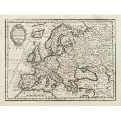
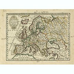
L' Europe Dressée sur les Observations de Mrs. de l' Academie Royale des Sciences..
Charming small map of Europe, including Iceland and the Mediterranean. Based on the geography of Guillaume Delisle.From Le Nouveau et Curieux Atlas Geographique et Histor...
Place & Date: Paris, 1719
L' Asie Dressée Selon les Observations de Mrs. De l' Academie Royale des Sciences..
Delightful little map of Asia that conforms to the standard French model of the period. Hokkaido is attached to the mainland and Terre de Iesso is off the coast partially...
- $300 / ≈ €281
Place & Date: Paris, 1719
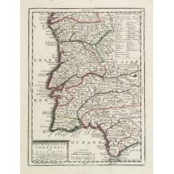
Les Royaumes de Portugal et d'Algarve..
Lovely small map of Portugal showing a panel in the upper right corner with a list of local rulers.From Le Nouveau et Curieux Atlas Geographique et Historique.. by Jacque...
Place & Date: Paris, 1719
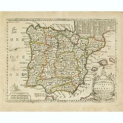
L'Espagne nominée Par les Anciens Grecs Iberia ou Hesperia..
Lovely small map of Spain with decorative title cartouche, vessels and a sea monster in the Atlantic Ocean.Presenting a panel in the upper right corner listing local rule...
Place & Date: Paris, 1719
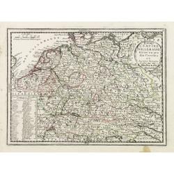
L'Empire D'Allemagne Divisé en ses dix Cercles et Autres Estats..
Map centered on Germany, including Switzerland, Austria, part of France, Northern Italy and Eastern Europe. With title cartouche and a panel in the lower left corner list...
- $60 / ≈ €56
Place & Date: Paris 1719
Nouvelle carte du royaume de Pologne, divisée selon..
Chatelain's map of Poland. The title is in two lines across the map. On bottom border appears an index to the map's contents. At the top of the map appear historical rema...
- $1100 / ≈ €1029
Place & Date: Amsterdam, 1719
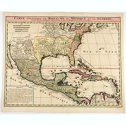
Carte contenant le Royaume du Mexique et la Floride.
This is a derivative of Delisle's landmark map of the southern part of North America.The detailed map shows many English settlements along the East Coast and carefully no...
- $1000 / ≈ €936
Place & Date: Amsterdam, 1719
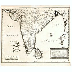
Carte du Golfe de Bengale, Mer de Indes, et Riviere du Gange, Avec les Pais et Iles d'alentour, Savoir les Cotes de Malabar, Cormandel, Ile de Ceylon, Les Maldives . . .
Detailed map of the Southern part of India with Ceylon. Good detail along the coasts of Malabar, Coromandel, the Maldives islands and the Kingdoms of Visipour, Golconda, ...
- $375 / ≈ €351
Place & Date: Leiden, 1719
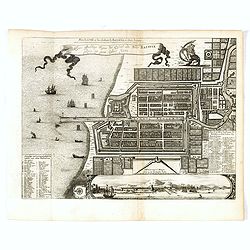
Waere affbeeldinge wegens het casteel ende stadt Batavia.
A good impression of Batavia's finely engraved and detailed plan, present-day Jakarta, the Dutch center of trading activities in the East Indies. Copied after Clement de ...
Place & Date: Leiden, 1719
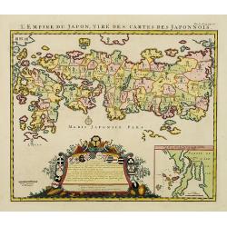
L'Empire du Japon, tire des cartes des Japonnois.
A good impression of this decorative map of Japan based on Reland's map of `1715, one of the earliest to use both Latin names and Japanese characters. With inset of the b...
Place & Date: Amsterdam, 1719
Plan de la Ville et du Chateau de Batavia en l'Isle de Java.
Detailed dual language plan of Batavia, the capital of the Dutch East Indies.Batavia, today’s Indonesian capital of Jakarta, was the center of Dutch economic activity i...
- $800 / ≈ €749
Place & Date: Paris, 1719
La Rade de Batavia . . .
Beautifully engraved map with elaborate cartouche of present-day Jakarta. From van der Aa's very rare work "La galerie agreable du Monde".
- $300 / ≈ €281
Place & Date: Leiden, 1719
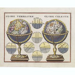
Globe Terrestre. / Globe Celeste.
A very decorative depiction of a terrestrial and celestial globe on a decorative base. The page is filled with seven diagrams.
- $175 / ≈ €164
Place & Date: Paris, 1719
Le Royaume de Norwege Divisé en ses cinq Principaux Gouvernements. . .
Lovely small map of Norway, with much of Sweden to the East, vessel and sea monsters in the Norwegian Sea.It shows a text table in the upper left corner containing the na...
- $100 / ≈ €94
Place & Date: Paris, 1719
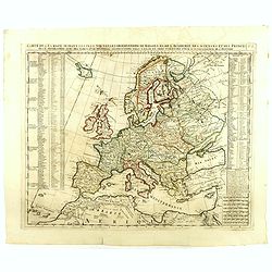
Carte De L'Europe Suivant Les Plus Nouvelles Observations De Messieurs De L'Academie Des Sciences . . .
Includes Iceland, and Russia in the north as well as the Black Sea and the northern tip of Africa in the south. Two tables, listing more than 175 countries along with the...
- $300 / ≈ €281
Place & Date: Amsterdam, 1719
Les Estats de la Couronne de Pologne.
Lovely small map of Poland with title cartouche and a panel in the upper right corner listing local rulers.From Le Nouveau et Curieux Atlas Geographique et Historique.. b...
- $200 / ≈ €187
Place & Date: Paris, 1719
[Lot of 6 plates] Carte de la Laponie Suedoise.
Chatelain's map of Lapland (170 x 205mm.) , with views of indigenous people and customs (including Reindeer!), etc.Together with 4 other engraved pages with views of indi...
- $300 / ≈ €281
Place & Date: Amsterdam, 1719
Terki, ville de la Circassie, dans l'Asie.
A very detailed panoramic view of Terki in the Caucasus, the capital of one of the most powerful Dagestani potentates of southeast Asia.Foreground filled with locals.
Place & Date: Leiden, c. 1719
La ville de Berbendt, en Perse.
Decorative view of Derbendt - Derbent, a city in the Republic of Dagestan, Russia, located on the Caspian Sea, north of the Azerbaijani border. It is the southernmost cit...
- $350 / ≈ €328
Place & Date: Leiden, 1719
Carte du Golfe de Bengale, mer des Indes et rivieres du Gange . . .
Detailed scare map of the Southern part of India with Ceylon. Good detail along the coasts of Malabar, Coromandel, the Maldives islands and the Kingdoms of Visipour, Golc...
Place & Date: Leide, 1719
Goa Indiae orientalis metropolis.
A fine example of a rare plan of this important Indian city and port, the focal point for Portuguese trading activity in southern Asia. Pictorial map by Pieter Boudewyn v...
- $450 / ≈ €421
Place & Date: Leiden, 1719
Genealogie des anciens empereurs Tartares,. . .
In lower part a map Russia including Tartary and Korea (158 x 290mm.), flanked by text in French. In top a family tree of the descendants of Genghis Khan.From Chatelain's...
- $75 / ≈ €70
Place & Date: Amsterdam, 1719
Ware affbeeldinge wegens het casteel ende stadt Batavia. . .
A reduced version of Clement de Jonghe (1650) plan of Jakarta from 1650. The town plan has a vignette at the bottom showing Jakarta from the sea with the volcanoes Mount ...
- $800 / ≈ €749
Place & Date: Leiden, 1719
Le Nouveau et Curieux Atlas Geographique et historique, ou Le Divertissement des Empereurs, Roys, et Princes. Tant dans la Guerre que dans la Paix. Dédié A Son A.R. Monseigneur le Duc d'Orléans Regent du Roîaume de France.
Charming world atlas with double hemisphere world and the North American map feature the Island of California. In Asia and the Pacific, Australia is incompletely mapped a...
Place & Date: Paris, 1719
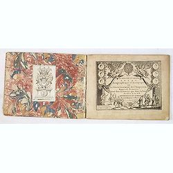
[Title page] Le nouveau et curieux Atlas Géographique et historique ou Le Divertissement des Empereurs, Roys, et Princes. Tant dans laz Guerre que dans la Paix. . .
Decorative title page. According to its title, this atlas was intended for the entertainment of emperors, kings, and princes!Together with 4 text pages.
- $120 / ≈ €112
Place & Date: Paris, 1719
L' Europe Dressée sur les Observations de Mrs. de l' Academie Royale des Sciences..
Charming small map of Europe, including Iceland and the Mediterranean. Based on the geography of Guillaume Delisle.From Le Nouveau et Curieux Atlas Geographique et Histor...
- $150 / ≈ €140
Place & Date: Paris, 1719
L'Empire D'Allemagne Divisé en ses dix Cercles et Autres Estats. . .
Map centered on Germany, including Poland, Switzerland, Austria, part of France, Northern Italy and Eastern Europe. With title cartouche and a panel in the lower left cor...
- $80 / ≈ €75
Place & Date: Paris, 1719
[Title page] Le nouveau et curieux Atlas Géographique et historique ou Le Divertissement des Empereurs, Roys, et Princes. Tant dans laz Guerre que dans la Paix.
Decorative title page. According to its title, this atlas was intended for the entertainment of emperors, kings, and princes!
Place & Date: Paris, 1719
L' Asie Dressée Selon les Observations de Mrs. De l' Academie Royale des Sciences..
Delightful little map of Asia that conforms to the standard French model of the period. Hokkaido is attached to the mainland and Terre de Iesso is off the coast partially...
- $400 / ≈ €374
Place & Date: Paris, 1719
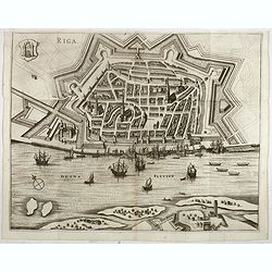
Riga.
Decorative view of Riga. This well executed engraving was published in 1729 and 1727 by Pieter van der AA, in Leiden in "Les Voyages tres-curieux et tres-renommez fa...
Place & Date: Leiden, 1719
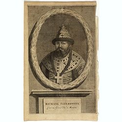
Michael Federowits . . .
Portrait of Tsar Michail Feodorovich (1596-1645). Engraving by Jacob Christopher Sartorius (1694-1737) engraver, active in Nuremberg. This well executed engraving was pub...
- $75 / ≈ €70
Place & Date: Leiden, 1719
La grande & belle ville de Kaschan, en Perse. (Kashan in Iran)
Decorative view of Kashan in Iran. The city has nowadays many tourist locations. This well executed engraving was published in 1729 and 1727 by Pieter van der AA, in Leid...
- $300 / ≈ €281
Place & Date: Leiden, 1719
Le Royaume de France..
Lovely small map of France with decorative title cartouche and a panel in the upper right corner listing local rulers.From Le Nouveau et Curieux Atlas Geographique et His...
- $75 / ≈ €70
Place & Date: Paris, 1719
Estats du Grand Duc de Moscovie ou de L'Empereur de la Russie Blanche. . .
Lovely small map of central Russia with decorative title cartouche and a panel in the lower left corner listing local rulers.From Le Nouveau et Curieux Atlas Geographique...
- $150 / ≈ €140
Place & Date: Paris, 1719
Saba, ville en Perse.
Decorative view of Saba, the main town of this kingdom in pre-Islamic southwestern Arabia. In the foreground camels and horses. This well executed engraving was published...
- $400 / ≈ €374
Place & Date: Leiden, 1719
Estats de L'empire du Grand Seigneur dit Sultan et Ottomans Empereur des Turcs. . .
The map shows the extent of the Ottoman Empire from the Balkans to Persia, including all of Arabia and North Africa (an inset map at the lower left shows the continuation...
- $250 / ≈ €234
Place & Date: Paris, 1719
L'Espagne nominée Par les Anciens Grecs Iberia ou Hesperia. . .
Lovely small map of Spain with decorative title cartouche, vessels and a sea monster in the Atlantic Ocean.Presenting a panel in the upper right corner listing local rule...
- $150 / ≈ €140
Place & Date: Paris, 1719
Nouvelle carte de geographie de .. Meridionale de l'Amerique
Chatelain's map of South America. The title is in two lines across the map. The tracks of Magellan, de la Maire, de Mendana, etc. are shown.On each side, borders appear a...
- $250 / ≈ €234
Place & Date: Amsterdam, 1719
Carte la plus nouvelle et plus exacte du royaume de Perse . . .
Decorative map of Persia. This well executed engraving was published in 1729 and 1727 by Pieter van der AA, in Leiden in "Les Voyages tres-curieux et tres-renommez f...
- $400 / ≈ €374
Place & Date: Leiden, 1719
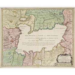
Nouvelle carte de la province de Kilan en Persie . . . (Iran]
Decorative map of southern part of the Caspian Sea in Northern Iran. This well executed engraving was published in 1729 and 1727 by Pieter van der AA, in Leiden in "...
- $300 / ≈ €281
Place & Date: Leiden, 1719
Astrakan, ville capitale du royaume du meme nom, en Moscovie. (Astrakhan)
Decorative view of Astrakhan. This well executed engraving was published in 1729 and 1727 by Pieter van der AA, in Leiden in "Les Voyages tres-curieux et tres-renomm...
- $300 / ≈ €281
Place & Date: Leiden, 1719
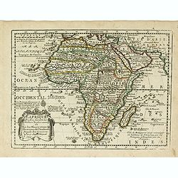
L' Afrique Dressee suivant les Auteurs les plus nouvea. . .
Charming map of the African continent with some interesting cartography and filled with notations.The Nile is correctly shown with its origins in Abyssinia. A large Lac d...
- $300 / ≈ €281
Place & Date: Paris, 1719
Elbing. (Elblag in Northern Poland)
Decorative view of the town of Elblag in Northern Poland. This well executed engraving was published in 1729 and 1727 by Pieter van der AA, in Leiden in "Les Voyages...
- $400 / ≈ €374
Place & Date: Leiden, 1719
La ville de Dantzic dans la Prusse Royale.
Decorative view of Danzig. This well executed engraving was published in 1719 by Pieter van der AA, in Leiden in "Les Voyages tres-curieux et tres-renommez faits en ...
- $400 / ≈ €374
Place & Date: Leiden, 1719
La Moscovie septentrionale . . .
Decorative view of area north of Moscow. This well-executed engraving was published in 1729 and 1727 by Pieter van der AA, in Leiden in "Les Voyages tres-curieux et ...
- $250 / ≈ €234
Place & Date: Leiden, 1719
La Moscovie meridionale . . .
Decorative map centred on Moscow. This well executed engraving was published in 1729 and 1727 by Pieter van der AA, in Leiden in "Les Voyages tres-curieux et tres-re...
- $300 / ≈ €281
Place & Date: Leiden, 1719
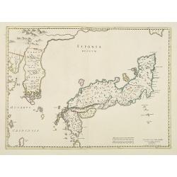
Japonia Regnum.
It is the first map to correctly show Korea as a peninsula. The rare Covens and Mortier issue of this important map of Japan and Korea, originally published by Blaeu. Thi...
Place & Date: Amsterdam, 1655 - 1720
Représentation du parlement d'Angleterre, les chambres assemblées . . .
Engraving showing the British Parliament and an assembly before the King of England. From Chatelain's Atlas Historique, 1732-1739. In upper right margin: 'Tom. 7. No 26.H...
- $80 / ≈ €75
Place & Date: Amsterdam, 1720
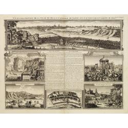
Vue et description de la Ville de Meaco Capitale du Japon. . .
Top part of the print shows the town of Meaco (Kyoto) at that time the capital of Japan, with a coach and horses in the foreground. Other parts show among other things th...
- $450 / ≈ €421
Place & Date: Amsterdam, 1720
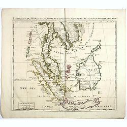
Le Royaume de Siam avec Les Royaumes Qui Luy sont Tributaries & c.
Influential map of Southeast Asia, including modern day Thailand, southern Vietnam, Cambodia, Malaysia, Singapore, Borneo, Sumatra and Java. Chatelain incorporated inform...
Place & Date: Amsterdam, c.1720
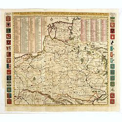
Carte De Pologne Avec La Chronologie Des Rois Et Des Ducs De Lithuanie, Ainsi Que Des Grands M. De L'Ordre Teutonique Les Evechez et Archeveches, et Les Armes Des Provinces . . .
Map of Poland with a key table to the towns, and 30 coats of arms on both sides, extending south the Black Sea. From Chatelain's monumental 7-volume "Atlas Historiqu...
- $1000 / ≈ €936
Place & Date: Amsterdam, 1720
Flessingue Ville de l'Ile de Walcheren. [Vlissingen]
A very RARE panoramic view of the city of Vlissingen. The plate is numbered in red pencil in the upper right corner.Engraved by Jean Crepy (the father), who was active as...
- $400 / ≈ €374
Place & Date: Paris, 1690-1720
Carte des Grisons et des Communautez qui Composent leurs Ligues, les Etats de St. Gal, Neuchastel, Geneve et Quelques Autres Etats Alliez des Suisse.
This finely engraved sheet provides the history of various cities and regions allied with Switzerland at the beginning of the eighteenth century. The top section of the s...
- $150 / ≈ €140
Place & Date: Amsterdam, 1720
Carte des Indes, de la Chine & des Isles de Sumatra, Java &c..
This fine and quite detailed general map extends from northern Japan to Timor and from India to New Guinea.There are very good details of towns and trade routes in modern...
- $750 / ≈ €702
Place & Date: Amsterdam, 1720
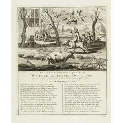
De kornet van vuil gewin of wortel en besse postiljon op zyn mager, doch niewlyks gemest varken uitschreewende de kompany is vol.
Page taken from "Het groote tafereel der dwaasheid : vertoonende de opkomst, voortgang en ondergang der actie, bubbel en windnegotie, in Vrankryk, Engeland, en de Ne...
Place & Date: Amsterdam, 1720
Prospect, Grundriss und Gegend der Polnischen vesten Reichs und Handels-Stadt Dantzig und ihrem Werder. . .
Striking example of Homann's map of Danzig (Gdansk) and neighboring regions and striking birds eye view, major port to the Baltic Ocean, which for centuries was an import...
- $550 / ≈ €515
Place & Date: Nuremberg, ca. 1720
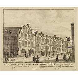
Het Oost Indisch Huys op de Suyd hock..
A decorative print of the East Indian House , the headquarters of the V.O.C., a place for meeting, trading and storage of spices and ship equipment.The maps and charts we...
Place & Date: Amsterdam, 1720
Carte ancienne et moderne de l'Irlande, avec quelques remarques sur son gouvernement . . .
Map of Ireland, based upon the ancient and modern cartographic information as of the beginning of the 18th Century. From Chatelain's monumental 7 volume "Atlas Histo...
- $200 / ≈ €187
Place & Date: Amsterdam, 1720
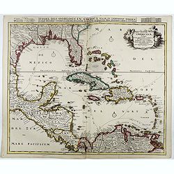
Stoel des Oorlogs in America Waar in Vertoont Werden Alle Desself Voornaamste Eylande . . .
Large impressive map of the West Indies with the Gulf of Mexico and Florida. The map shows prominently in the center Cuba, Haiti, the Bahamas and Florida, which is here m...
Place & Date: Amsterdam, c. 1720
Bronwater of geneesmiddel voor de zieke actionisten.
Springwater or potion for the sick shareholder, taken from Het groote tafereel der dwaasheid : vertoonende de opkomst, voortgang en ondergang der actie, bubbel en windneg...
Place & Date: Amsterdam, 1720
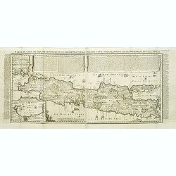
Carte de l'Ile de Java.
An inset plan of Batavia and clearly indicated rice fields, mountains, forests, towns in profile and even elephants suggest the wealth of detail found on this map. Modele...
Place & Date: Amsterdam, 1720
Harlekin en Bombario en den rouw.
Harlequin and Bombario in mourning, taken from Het groote tafereel der dwaasheid : vertoonende de opkomst, voortgang en ondergang der actie, bubbel en windnegotie, in Vra...
Place & Date: Amsterdam, 1720
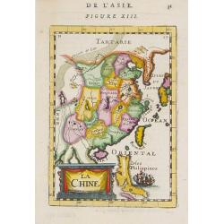
La Chine.
A charming small map of China, Taiwan, Philippines, Korea and Kyushu (Japan). By Allain Manneson Mallet (1630-1706), a well traveled military engineer and geographer who ...
- $300 / ≈ €281
Place & Date: Paris, 1720
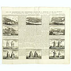
Vue et description des principales villes de l'Armenie et de la Georgie avec les habillements des femmes du pays, et ceux des prêtres et religieux armeniens. . .Tom: V N° 11 Pag: 28
View and description of the principal Armenian and Georgian cities with illustrations of Armenian women's garments as well as priests' and monks' clothing. The views are ...
Place & Date: Amsterdam, ca 1720
Costes de L'Afrique .. ..Cap de Bone Esperance..
In the upper right-hand corner inset map of Saldanha Bay. Numerous place names, soundings and sand banks are shown round the island and the regions are defined by origina...
- $500 / ≈ €468
Place & Date: Amsterdam, 1720
Vue et description de la Ville de Meaco Capitale du Japon. . .
The top part of the print shows a panoramic view of Meaco (Kyoto) at that time the capital of Japan, with a coach and horses in the foreground. Other parts show among oth...
- $750 / ≈ €702
Place & Date: Amsterdam, 1720
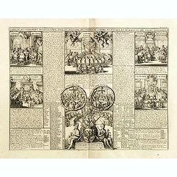
Carte du gouvernement ecclesiastique civil et militaire de l'Empire de l'ordre teutonique et de Malte et des villes anseatiques.
Interesting sheet with a detailed series of views showing the various councils of the Hanseatic League, including the councils of war, finance, state and the college of t...
- $75 / ≈ €70
Place & Date: Amsterdam, 1720
Tytel-print der actie-kraam of yoor-hof yan Quinquenpoix. . .
Page taken from "Het groote tafereel der dwaasheid : vertoonende de opkomst, voortgang en ondergang der actie, bubbel en windnegotie, in Vrankryk, Engeland, en de Ne...
- $100 / ≈ €94
Place & Date: Amsterdam, 1720
Rue Quinquempoix en l'année 1720. De regte afbeelding der wind negotie gehouden in de straat van Quinquempoix tot Parys.
A true picture of the wind trade of the rue Quinquempoix, Paris, in 1720, taken from "Het groote tafereel der dwaasheid : vertoonende de opkomst, voortgang en onderg...
- $275 / ≈ €257
Place & Date: Amsterdam, 1720
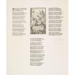
Spiegel der Reden Voor de Wanhopende Actionisten. [Mirror for the reason of the despairing stockbrokers. ]
Text page with copper engraving (150 x 100mm.) taken from Het groote tafereel der dwaasheid : vertoonende de opkomst, voortgang en ondergang der actie, bubbel en windnego...
Place & Date: Amsterdam, 1720
Carte des pavillons accompagnée d'observations pour en faire comprendre le blazon et les différentes devises aussy bien que d'une table alphabétique pour les trouver facilement.
A plate of 88 marine flags, including Malta, Turkey, Middelburg, Amsterdam, Portugal, Monaco, Tuscany, China, Nanking, the French Royal flag, the French admiralty flag an...
- $1200 / ≈ €1123
Place & Date: Amsterdam, 1720
Regnum Borussiae gloriosis auspiciis serenissimi et potentissimi princip. Friderici III primi Borussiae regis march. et elect. Brandenburg inauguratum die 18 Jan...1701.
Map covering the region along the Baltic Sea from Prussia to northern Poland, with the city of Kaliningrad (Königsberg), Danzig, and Heilsperg, etc. With a large title-c...
- $700 / ≈ €655
Place & Date: Nuremberg, 1720
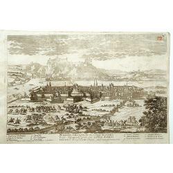
Namur.
A very RARE panoramic of the city of Namur, with a numbered legend in both lower corners.The plate is numbered in red pencil in upper right corner.Engraved by Pierre Avel...
- $150 / ≈ €140
Place & Date: Paris, 1690-1720
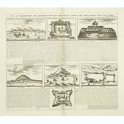
Vue et Description de Quelques-Uns des Principaux Forts des Hollandois dans les Indes .
Interesting sheet with seven detailed views illustrating the most important Dutch V.O.C. trading outposts and fortified colonial possessions in the East Indies, including...
Place & Date: Amsterdam, 1720
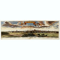
Norimberga.
A spectacular panoramic town-plan of Nuremberg, with legends numbered from 1-39 in German. With the title in a banderol.After a design by Friedrich Bernhard Werner (1690...
Place & Date: Augsburg, ca. 1720
Carte de l'Ile de Java. . .
An inset plan of Batavia and clearly indicated rice fields, mountains, forests, towns in profile, and even elephants, suggesting the wealth of detail found on this map. M...
Place & Date: Amsterdam, 1720
Carte du gouvernement ecclesiastique d'Angleterre . . .
Elegant engraving of the ecclesiastical government of England, with an engraving showing three images: in the centre, an ecclesiastical assembly (Convocation of the Clerg...
- $100 / ≈ €94
Place & Date: Amsterdam, 1720
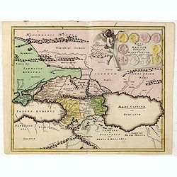
Asia intra Maeotim Pontum et Mare Caspium. . .
Striking map the Black Sea and Caspian Sea regions, featuring the geographical features known to the ancients and decorated with a vignette and 10 medallions.From "D...
- $195 / ≈ €182
Place & Date: Nuremberg, 1720
Nova ac verissima Maris Caspii ante hac maximam fere partem nobis incogniti, ac Regionum adiacentium : Delineatio Iussu Invictissimi Principis Petri Alexii Fil. Magni Russorum Imperatoris / immenso labore et maximis sumptibus facta, atque ex ...
Covers portions of Iran, Turkmenistan, Kazakhstan, Russia and Azerbaijan. Relief is shown pictorially. Depth is shown by soundings. Oriented with north to the left. Rare.
- $750 / ≈ €702
Place & Date: Amsterdam, 1720








![[Lot of 6 plates] Carte de la Laponie Suedoise.](/uploads/cache/36604-250x250.jpg)




![[Title page] Le nouveau et curieux Atlas Géographique et historique ou Le Divertissement des Empereurs, Roys, et Princes. Tant dans laz Guerre que dans la Paix. . .](/uploads/cache/34361-250x250.jpg)

![[Title page] Le nouveau et curieux Atlas Géographique et historique ou Le Divertissement des Empereurs, Roys, et Princes. Tant dans laz Guerre que dans la Paix.](/uploads/cache/17244-250x250.jpg)





![Nouvelle carte de la province de Kilan en Persie . . . (Iran]](/uploads/cache/39437-250x250.jpg)





![Flessingue Ville de l'Ile de Walcheren. [Vlissingen]](/uploads/cache/13105-250x250.jpg)







![Spiegel der Reden Voor de Wanhopende Actionisten. [Mirror for the reason of the despairing stockbrokers. ]](/uploads/cache/28094-250x250.jpg)


