Browse Listings
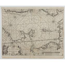
Pascaert van Engelant Van t'Voorlandt tot aen Blakeney waer in te sien is de mont vande Teemse.
Two charts on one sheet. One decorative sea chart of the southeast coast of England with an inset of the Thames till London, embellished with two title cartouches, a ship...
- $750 / ≈ €702
Place & Date: Amsterdam, 1666
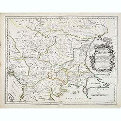
Illyricum Orientis In quo Partes II. Moesia et Thracia. Provinciae XI.
Attractive historical map of the area west of the Black Sea, today's Bulgaria, Rumania, etc. Based on the cartography of Nicolas Sanson and published by P.Mariette. With ...
- $400 / ≈ €374
Place & Date: Paris, 1666
Carte générale d'Alemagne divisée par les cercles ou provinces d'icelle.
Rare and detailed map of Germany, Poland and Austria, engraved by H. le Roy in 1643 or 1666 for Jacques L'Agniet. The publishing house Jollain bought the copper plate and...
- $300 / ≈ €281
Place & Date: Paris, 1666
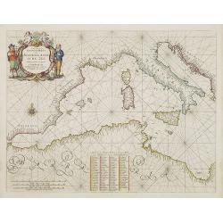
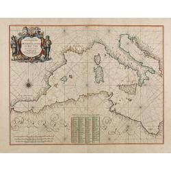
Pascaerte Van't Westelyckste der Middelandsche Zee. . .
An eye-catching chart of the western part of the Mediterranean Sea.Pieter Goos (ca. 1616-1675) was one of the most important cartographer, engraver, publisher and print s...
Place & Date: Amsterdam, 1666
De custen van Noorwegen, Finmarcken, Laplandt, Spitsbergen . . .
Two sea charts on one sheet showing Norway, Finland, Iceland, Spitsbergen and part of Scotland. The chart includes a detailed plan of the coastlines, soundings, anchorage...
Place & Date: Amsterdam, 1666
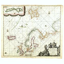
Pascarte van Europa Beginnende vande Canael tot aen Spitbergen, en van Ysland tot aen Nova Zemla . . .
An eye-catching chart of northern Europe with a coastline from northern Russia to the Dutch English Channel in the south. Good detail on Iceland. North to the top.In the ...
Place & Date: Amsterdam, after 1666
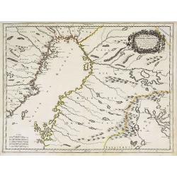
Cajanie, ou Bothnie Orientale Tirée de celles d'Andr Burae et de Isaac Massa. . .
Map of the Northern part of Gulf of Bothnia, today's border area between Sweden and Finland. The map derive from the work of the Swedish cartographer Andreas Bureus and I...
Place & Date: Paris, P.Mariette, 1666
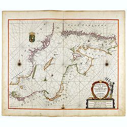
Pas-Caart van de Oost Zee verthooende alle de ghelegenheydt tusschen t Eylandt Rugen ende Wyborg. . .
An eye-catching chart of the Baltic Sea. Engraved by Gerard Coeck.Pieter Goos (ca. 1616-1675) was one of the most important cartographers, engravers, publishers and print...
- $1500 / ≈ €1404
Place & Date: Amsterdam, 1666
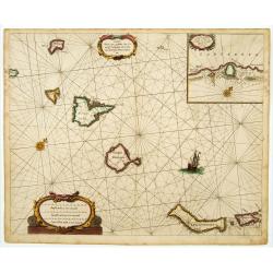
.Caarte voor een gedeelte der Canarise Eylanden als Canaria, Tenerifa, Forteventura, etc.
Very rare chart of the Canaries. Showing Palma, Ferro, Tenerife, Gran Canaria, Forteventura, Lancerota. In upper right hand corner inset of harbour of Lancerota.
- $1000 / ≈ €936
Place & Date: Amsterdam, 1666
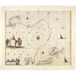
Noordoost Cust van Asia van Japan tot Nova Zemla.
An eye-catching chart of Japan, Hokkaido and the Islands to the North of Japan. In the lower left Korea and part of northern China. Korea has three names mentioned: "...
- $2000 / ≈ €1871
Place & Date: Amsterdam, 1666
De Cust van Barbaryen van out Mamora tot Capo Blanco..
Six charts on one sheet. The two upper charts covering an area from Cape Blanc to Casablanca. In lower part four insets with detailed charts of islands as Madera, Porto S...
Place & Date: Amsterdam, 1666
Noordoost Cust van Asia van Japan tot Nova Zembla.
Important for its early depiction of Hokkaido and the Islands to the North of Japan. Ships navigate the seas around the Siberian, Chinese and Japanese coast extending as ...
Place & Date: Amsterdam, 1666
.Pascaerte Van't Westelyckste der Middelandsche Zee. . .
An eye-catching chart of the western part of the Mediterranean Sea.Pieter Goos (ca. 1616-1675) was one of the most important cartographer, engraver, publisher and print s...
Place & Date: Amsterdam, 1666
Pascaerte van Groen-Landt, Yslandt, Straet Davids en Ian Mayen eylandt. . .
An eye-catching chart of the North Atlantic, showing prominent Greenland, Iceland, and parts of the North American continent. The map is decorated with a large figurative...
- $1000 / ≈ €936
Place & Date: Amsterdam, 1666
Partie de Lithuanie ou sont en partie les Palatinats de Minsk, et Mseislaw, we les Seign.Ries ou Terres de Rohaczow, Rzeczica, Zernobee, et partie des. . .
Fine map of Lithuania. This edition carries the publishers address "chez l'Autheur Avec privilege pour vingt ans 1666". Nicolas Sanson was to bring about the ri...
Place & Date: Paris, 1666
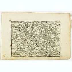
Partie de Lithuanie ou sont en partie les Palatinats de Wilna, et Troki, subdivisés en leurs Chastellenies et partie du Palatinat de Minsk.
Fine map of Lithuania. This edition carries the date 1665 and the publishers address "A Paris, chez Pierre Mariette, rue Saint Jacques a l'Esperance…"Nicolas ...
Place & Date: Paris, 1666
Noordoost Cust van Asia van Japan tot Nova Zemla.
An eye-catching chart of Hokkaido and the Islands to the North of Japan. Ships navigate the seas around the Siberian, Chinese and Japanese coasts extending as far west as...
- $2500 / ≈ €2339
Place & Date: Amsterdam, 1666
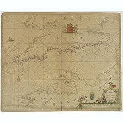
Het Canaal tusschen Engeland en Vranciick.
An eye-catching chart of the Channel.Pieter Goos (ca. 1616-1675) was one of the most important cartographers, engravers, publishers and print sellers of Amsterdam. His wi...
Place & Date: Amsterdam, after 1666
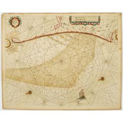
Cust van Hollant Tussen de Maes ende Texel.
Uncommon chart of the coast of Holland, including the southern tip of Texel. East at the top. Two fine compass cards, soundings and a large Bree Veerthien offshore.Piete...
Place & Date: Amsterdam, 1666
De Cust van Barbaria, Gualata, Arguyn, en Gene..heo, van Capo S.Vincente tot Capo Verde.
An eye-catching chart of the north western coast of Africa. Including Canary Islands, Cape Verde Islands and Azores.Pieter Goos (ca. 1616-1675) was one of the most import...
Place & Date: Amsterdam, 1666
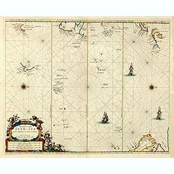
.Pascaerte Vande Zuyd-Zee tusschen California, en Ilhas de Ladrones. . .
A decorative and most interesting map - being one of the earliest of the Pacific to record the observations of Tasman's voyages. The northern part of the island of Califo...
Place & Date: Amsterdam, 1666
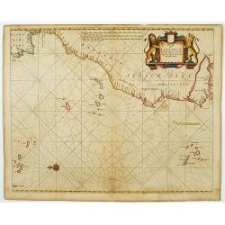
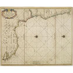
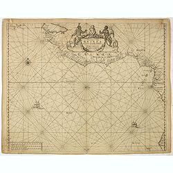
Pas-Caart van Guinea en den Custen daer aen gelegen Van C..
A decorative chart of the southwest coast of Africa, embellished with an elaborate, finely colored title-cartouche, and 2 compass-roses. Pieter Goos (ca. 1616-1675) was o...
Place & Date: Amsterdam, 1666
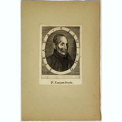
P. Famiano Strada.
Portrait of Famiano Strada, published in "Elogii D' Hvomini Letterati Scritti", by Lorenzo Crasso. Famiano Strada (1572–1649) was a Jesuit writer, who was bor...
- $120 / ≈ €112
Place & Date: Venice, 1666
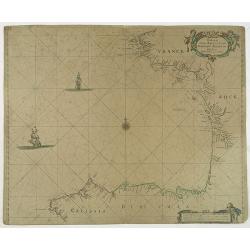
Paskaert vande Bocht van Vranckrijck Biscajen. . .
An eye-catching chart of the coast of Bretagne from Brest running south till the coast of Biscay in Northern Spain.Including the towns of Ferrol in the west, Gijon, Santa...
Place & Date: Amsterdam, after 1666
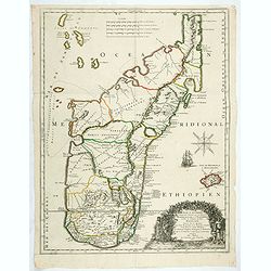
Isle D'Auphine, communement Nommée pae les Europeens Madagascar. . .
One of the most UpToDate maps of Madagascar, also showing the Comoros Islands in the North West and the Reunion Island in the South East.With decorative title cartouche r...
- $900 / ≈ €842
Place & Date: Paris, 1667
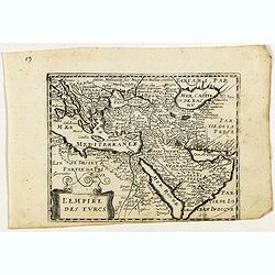
L'Empire des Turcs.
Rare map of the Turkish empire, published by Jollain in 1667. Published in "Trésor Des Cartes Geographiques Des Principaux Estats de Lunivers".Showing "&q...
Place & Date: Paris, 1667
Moree jadis Peloponese.
Rare map of Peloponnese, published by Jollain in 1667. Published in "Trésor Des Cartes Geographiques Des Principaux Estats de Lunivers".This atlas is based upo...
- $300 / ≈ €281
Place & Date: Paris, 1667
Asie.
Rare map of Asia, published by Jollain in 1667. The name of Korea placed in the sea in between Korea and Japan. In top right part of North America. Published in "Tr�...
- $400 / ≈ €374
Place & Date: Paris, 1667
Candie.
Rare map of Crete with in top six small inset maps of Greek islands, published by Jollain in 1667. Published in "Trésor Des Cartes Geographiques Des Principaux Esta...
- $350 / ≈ €328
Place & Date: Paris, 1667
Le grand Royaume du Sophi de Perse.
Rare map of Persia with present-day Iran and Iraq published by Jollain in 1667. Published in "Trésor Des Cartes Geographiques Des Principaux Estats de Lunivers"...
- $250 / ≈ €234
Place & Date: Paris, 1667
Moscovie avec ses confins.
Rare map of Russia, published by Jollain in 1667. Published in "Trésor Des Cartes Geographiques Des Principaux Estats de Lunivers".This atlas is based upon Boi...
- $450 / ≈ €421
Place & Date: Paris, 1667
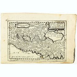
Terre Sainte jadis Terre Promise ou Palestine.
Rare map of the Holy Land published by Jollain in 1667. Published in "Trésor Des Cartes Geographiques Des Principaux Estats de Lunivers".This atlas is based up...
- $300 / ≈ €281
Place & Date: Paris, 1667
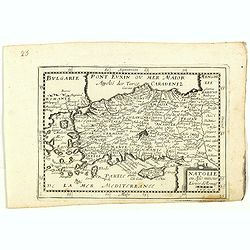
Natolie ou Asie mineur, Lieües d'Alemag.
Rare map of Turkey and Cyprus published by Jollain in 1667. Published in "Trésor Des Cartes Geographiques Des Principaux Estats de Lunivers".This atlas is base...
- $250 / ≈ €234
Place & Date: Paris, 1667
La Chine.
Rare map of China, Korea (as an island) and Japan, published by Jollain in 1667. In upper right corner part of North America. Published in "Trésor Des Cartes Geogra...
- $350 / ≈ €328
Place & Date: Paris, 1667
Hongrie.
Rare map of Hungary, published by Jollain in 1667. Published in "Trésor Des Cartes Geographiques Des Principaux Estats de Lunivers".This atlas is based upon Bo...
- $300 / ≈ €281
Place & Date: Paris, 1667
[Title page for ] Nuevo Atlas o Teatro De todo el Mundo . . . Otra parte del Tomo Primero.
Title page to the Spanish text edition : Nuevo Atlas o Teatro De todo el Mundo . . . Otra parte del Tomo Primero.Read more about decorative atlas title pages [+]
- $300 / ≈ €281
Place & Date: Amsterdam, 1667
Russie.
Rare map of Russia, published by Jollain in 1667. Published in "Trésor Des Cartes Geographiques Des Principaux Estats de Lunivers".This atlas is based upon Boi...
- $250 / ≈ €234
Place & Date: Paris, 1667
Angleterre Ecosse et Hibernie.
Rare map of the British islands, published by Jollain in 1667. Published in "Trésor Des Cartes Geographiques Des Principaux Estats de Lunivers".This atlas is b...
- $250 / ≈ €234
Place & Date: Paris, 1667
Norvege et Suede.
Rare map of Norway, Sweden and Finmark published by Jollain in 1667. Published in "Trésor Des Cartes Geographiques Des Principaux Estats de Lunivers".This atla...
- $250 / ≈ €234
Place & Date: Paris, 1667
Espagne.
Rare map of Spain and Portugal, published by Jollain in 1667. Published in "Trésor Des Cartes Geographiques Des Principaux Estats de Lunivers".This atlas is ba...
- $200 / ≈ €187
Place & Date: Paris, 1667
[Title page] Tables de la Géographie ancienne et nouvelle… De toutes les parties du monde …
Title page of "Tables de la Géographie ancienne et nouvelle… De toutes les parties du monde..."Read more about decorative atlas title pages [+]
- $350 / ≈ €328
Place & Date: Paris, 1667
France nouvellement descripte.
Rare map of France, published by Jollain in 1667. Published in "Trésor Des Cartes Geographiques Des Principaux Estats de Lunivers".This atlas is based upon Boi...
- $150 / ≈ €140
Place & Date: Paris, 1667
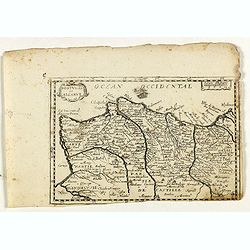
Portugal et Algarve.
Rare map of Portugal, published by Jollain in 1667. Published in "Trésor Des Cartes Geographiques Des Principaux Estats de Lunivers".This atlas is based upon B...
- $150 / ≈ €140
Place & Date: Paris, 1667
Le monde et sa disposition suivant Ptolomée.
The Christian Aristotelian cosmos. Ptolemy accepted the following order for celestial objects in the solar system: Earth (center), Moon, Mercury, Venus, Sun, Mars, Jupite...
- $150 / ≈ €140
Place & Date: Paris, 1667
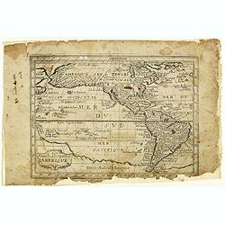
Nouvelle description de lamerique.
Jollain published this rare map of America in 1667. State 3, with the scale, erased, as it fictitious strait on the west coast of North America which Le Royaume de Quiuer...
- $450 / ≈ €421
Place & Date: Paris, 1667
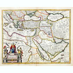
Turcicum Imperium. Concordia res parvæ crescunt discordia maximæ dilabuntur.
An impressive and attractive map with a particularly fine cartouche showing the Turkish Sultan on his throne and allegorical figures at either side brandishing weapons.Sa...
- $1100 / ≈ €1029
Place & Date: Amsterdam, 1667
Le Royaume de Fez.
Rare map of Morocco published by Jollain in 1667. Published in "Trésor Des Cartes Geographiques Des Principaux Estats de Lunivers".This atlas is based upon Boi...
- $150 / ≈ €140
Place & Date: Paris, 1667
Hollandiae pars septentrionalis, Vulgo Westvriesland..
Based on the work of B.F.van Berckenrode, this fine map, orientated west to the top of the sheet, includes Kennemerland and Hollands Noorderkwartier and is a reasonably u...
Place & Date: Amsterdam, ca. 1667
Le Royaume de Marroc.
Rare map of Morocco published by Jollain in 1667. Published in "Trésor Des Cartes Geographiques Des Principaux Estats de Lunivers".This atlas is based upon Boi...
- $100 / ≈ €94
Place & Date: Paris, 1667
Nouvelle description d'Afrique.
Rare map of Africa published by Jollain in 1667. Published in "Trésor Des Cartes Geographiques Des Principaux Estats de Lunivers".This atlas is based upon Bois...
- $250 / ≈ €234
Place & Date: Paris, 1667
Barbarie.
Rare map of the Barbary Coast of Africa published by Jollain in 1667. Published in "Trésor Des Cartes Geographiques Des Principaux Estats de Lunivers".This atl...
- $100 / ≈ €94
Place & Date: Paris, 1667
Tartarie.
Rare map of Tartary published by Jollain in 1667. In lower right corner Korea as a peninsular and part of America in upper right corner. Published in "Trésor Des Ca...
- $150 / ≈ €140
Place & Date: Paris, 1667
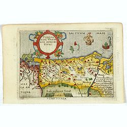
Pomeraniae Wandalice Regionis Tipus.
Miniature map of Pomerania embellished by rich cartouche, vessel and sea monsters in the Baltic. Abraham Ortelius (1527-1598) was a cartographer and publisher, who is bor...
- $250 / ≈ €234
Place & Date: Antwerp, 1667
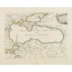
Mer Noire ou Mer Maievre, . . .
Map of the Black Sea prepared by N.Sanson and published by Pierre Mariette.Published in an early edition of the small Sanson atlas L'Europe Dediée a Monseigneur . . . Le...
Place & Date: Paris, P. Mariette, 1667
Espagne. . .
Map of Spain and Portugal prepared by N.Sanson and published by Pierre Mariette.Published in an early edition of the small Sanson atlas L'Europe Dediée a Monseigneur . ....
Place & Date: Paris, P. Mariette, 1667
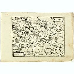
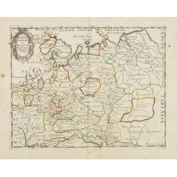
Russie Blanche ou Moscovie.
Map of the European part of Russia prepared by N.Sanson and published by Pierre Mariette.Published in an early edition of the small Sanson atlas L'Europe Dediée a Monsei...
Place & Date: Paris, P. Mariette, 1667
Royaume et desert de Barca, et Aegypte divisee. . .
Map of Egypt prepared by N.Sanson and published by Pierre Mariette.Published in an early edition of the small Sanson atlas L'Europe Dediée a Monseigneur . . . Le Tellier...
- $100 / ≈ €94
Place & Date: Paris, P. Mariette, 1667
Partie de la Barbarie ou sont les royaumes de Tunis et Tripoli. . .
Coastal map of Tunisia and Libya prepared by N.Sanson and published by Pierre Mariette.Published in an early edition of the small Sanson atlas L'Europe Dediée a Monseign...
- $750 / ≈ €702
Place & Date: Paris, P. Mariette, 1667
Partie de la Barbarie ou est le royaume d'Alger. . .
Coastal map of North Africa prepared by N.Sanson and published by Pierre Mariette.Published in an early edition of the small Sanson atlas L'Europe Dediée a Monseigneur ....
- $80 / ≈ €75
Place & Date: Paris, P. Mariette, 1667
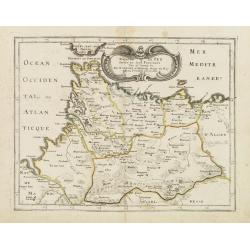
Royaume de Fez. . .
Map of Morocco prepared by N.Sanson and published by Pierre Mariette.Published in an early edition of the small Sanson atlas L'Europe Dediée a Monseigneur . . . Le Telli...
- $120 / ≈ €112
Place & Date: Paris, P. Mariette, 1667
Les Iles Molvcques, Celebes, Gilolo. . .
Map of the Indian Ocean Islands of the Moluccas Islands prepared by N.Sanson and published by Pierre Mariette.Published in an early edition of the small Sanson atlas L'Eu...
Place & Date: Paris, P. Mariette, 1667
Selling price: $150
Sold in 2009
Americque Septentrionale. . .
A general map of North America shows California as an island but with few names and a flat northern coastline. Prepared by N. Sanson and engraved by A.Peyrounin. A first ...
- $1000 / ≈ €936
Place & Date: Paris, P. Marriete, 1667
Carte du Comté de Flandre. . .
Decorative map of Flanders from Plans, et Profils des principales villes.. by Ch. De Beaulieu. Etched by mr. Romeijn de Hooghe.
- $80 / ≈ €75
Place & Date: Paris, 1668
Incliti Cantonis Friburgensis Tabula, autore Francisco Petro VON DER WEID. Senatore et Commissario generale Friburgi. anno Domini 1668.
Very rare 2-sheet map and the first map of the canton Fribourg (Freiburg) in a scale of Scale 1:120.000. South to the top.The area shown on the map encompasses the whole ...
- $7500 / ≈ €7018
Place & Date: Fribourg, 1668
(Title page) Plans et Profils des principales Villes des Duchez de Loraine et de Bar. . .
Decorative title page by Ch. De Beaulieu.
- $80 / ≈ €75
Place & Date: Paris, 1668
Impery sino Tartarici Supremus Monarcha.
Decorative costume plate showing Kam Hi son of the Shunzhi Emperor of China [1638 - 1661?], the second emperor of the Manchu Qing dynasty, who apparently supported the fo...
Place & Date: Amsterdam, 1668
Paskaart van Guinea van C.Verde tot R. deGalion.
Rare edition of Doncker's sea chart of Guinea coast. From an atlas printed in 1668, "l'Atlas de MER ou MONDE AQUATIQUE, Remontrant toutes lescôtes de la Mer…"...
- $1000 / ≈ €936
Place & Date: Amsterdam, 1660-1668
Pascaart van de zee-custenvan Angola, en Cimbedas van Rivier de Galion tot C. de Bona Esperanca.
Rare Doncker's sea chart of the West Coast of Africa, from Angola to the Cape of Good Hope, with a larger inset map of the area from St. Martin's Bay to the Cape of Good ...
Place & Date: Amsterdam, 1660-1668
[Title page] Les Plans et Profils des principales Villes et lieux considérables du Comté de Flandre. . .
Decorative title page from Plans, et Profils des principales villes.. by Ch. De Beaulieu. Etched by mr. Romeijn de Hooghe.
- $80 / ≈ €75
Place & Date: Paris, 1668
[Title page] Les Plans et Profils des principales Villes et lieux considérables Du Duché de Brabant. . .
Decorative title page from Plans, et Profils des principales villes.. by Ch. De Beaulieu. Etched by mr. Romeijn de Hooghe.
- $80 / ≈ €75
Place & Date: Paris, 1668
[Title page] Les Plans et Profils des principales Villes du Comté de Namur. . .
Decorative title page from Plans, et Profils des principales villes.. by Ch. De Beaulieu. Etched by mr. Romeijn de Hooghe.More about title pages [+]
- $80 / ≈ €75
Place & Date: Paris, 1668
Pascaart van de west cust van Engeland en Wales Van S. Davids Point tot de Moul van Dalway.
Rare Doncker's sea chart of the Irish Sea with the west Coast of England (Liverpool), the Island of Man and the western-most tip of Northern Ireland (Bangor) and Souther...
Place & Date: Amsterdam, 1660-1668
[Title page] Les Plans et Profils des principales Villes et lieux considérables du Comté de Haynaut. . .
Decorative title page from Plans, et Profils des principales villes.. by Ch. De Beaulieu. Etched by mr. Romeijn de Hooghe.
- $80 / ≈ €75
Place & Date: Paris, 1668
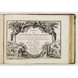
Diverses cartes et tables pour la géographie ancienne, pour la chronologie et pour les itinéraires et voyages modernes.
Edition without date. Variant edition containing three parts : "Cartes géographiques dressées pour bien entendre les Historiens… / La Chronologie en plusieurs Ta...
Place & Date: Paris, l'Auteur, no date ca.1669
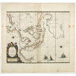
Paskaerte Zynde t'Oosterdeel Van Oost Indien, met alle de Eylanden daer ontrendt geleegen van C. Comorin tota aen Iapan.
An eye-catching chart of Pieter Goos' sea chart of Australia, Southeast Asia, China, Japan, Korea and India. The chart shows the regions from Cape Comorin (Southern India...
Place & Date: Amsterdam, 1669
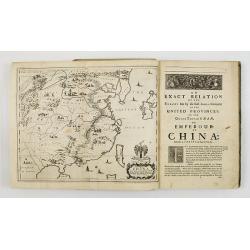
An embassy from the East-India Company of the United Provinces, to the Grand Tartar Cham, Emperor of China deliver'd by their excellencies, Peter de Goyer and Jacob de Keyzer, at his imperial city of Peking. . .
Very rare first English text edition of this most important and early resource on China and the Chinese. Three parts in one folio by John Macock for the author.Part I: An...
Place & Date: London : Printed by the Author at his house in White-Friers, 1669
Jerusalem comme elle estoit du temps que nostre Sauveur Jesus-Christ souffrit mort et passion pour nous.
Rare and decorative view imaginary plan of ancient Jerusalem and its suburbs published by Gérard Jollain after Christian van Adrichom (1533-1595) plan.The plan itself is...
- $3000 / ≈ €2807
Place & Date: Paris, ca.1670
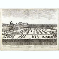
Comparse des Cinq Quadrilles dans l'Amphitheatre.
An early and intriguing engraving recording one of the most celebrated and spectacular festivals held at Paris by the young Louis XIV. The multi-day tournament took place...
Place & Date: Paris, imprimerie royale, 1670
Course de Baque et Disposition des Quadrilles, dans l'Amphiteatre seconde journée.
An early and intriguing engraving recording one of the most celebrated and spectacular festivals held at Paris by the young Louis XIV. The multi-day tournament took place...
Place & Date: Paris, imprimerie royale, 1670
L’Atlas de la Mer ou Monde aquaticque.
Original blind-stamped vellum binding ; attractive ORIGINAL HAND-COLOR in outline with cartouches, windroses and decoration in full orginal color ; internally some usual ...
- $75000 / ≈ €70179
Place & Date: Amsterdam, sur le Cay de Teexel, prez du Rams-Koy, au miroir de la Mer, 1670









![[Title page for ] Nuevo Atlas o Teatro De todo el Mundo . . . Otra parte del Tomo Primero.](/uploads/cache/47925-250x250.jpg)


![[Title page] Tables de la Géographie ancienne et nouvelle… De toutes les parties du monde …](/uploads/cache/47927-250x250.jpg)












![[Title page] Les Plans et Profils des principales Villes et lieux considérables du Comté de Flandre. . .](/uploads/cache/33218-250x250.jpg)
![[Title page] Les Plans et Profils des principales Villes et lieux considérables Du Duché de Brabant. . .](/uploads/cache/33214-250x250.jpg)
![[Title page] Les Plans et Profils des principales Villes du Comté de Namur. . .](/uploads/cache/33217-250x250.jpg)
![[Title page] Les Plans et Profils des principales Villes et lieux considérables du Comté de Haynaut. . .](/uploads/cache/33216-250x250.jpg)
