Browse Listings
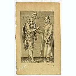
Torlaqui Religieux Turc. ( 25 )
Sought-after copper engraved plate taken from Laonikos Chalcocondyle’s "L'histoire de la décadence de l'empire grec et establissement de celuy des Turcs." by...
Place & Date: Paris, Mathieu Guillemot, 1650
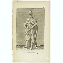
Religieux Turc. (26)
Sought-after copper engraved plate taken from Laonikos Chalcocondyle’s "L'histoire de la décadence de l'empire grec et establissement de celuy des Turcs." by...
Place & Date: Paris, Mathieu Guillemot, 1650
Esclave More. (38)
Sought-after copper engraved plate of a Moor slave from North Africa. Plate from Laonikos Chalcocondyle’s "L'histoire de la décadence de l'empire grec et establis...
- $75 / ≈ €70
Place & Date: Paris, Mathieu Guillemot, 1650
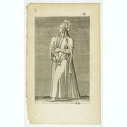
(Grand dame Turque. 45)
Sought-after copper engraved plate of a woman from Turkey. Plate from Laonikos Chalcocondyle’s "L'histoire de la décadence de l'empire grec et establissement de c...
Place & Date: Paris, Mathieu Guillemot, 1650
Gentille Femme Perotte Franque. (48)
Sought-after copper engraved plate of a woman from Pera, taken from Laonikos Chalcocondyle’s "L'histoire de la décadence de l'empire grec et establissement de cel...
- $100 / ≈ €94
Place & Date: Paris, Mathieu Guillemot, 1650
Femme de la Caramanie. (57)
Sought-after copper engraved plate taken from Laonikos Chalcocondyle’s "L'histoire de la décadence de l'empire grec et establissement de celuy des Turcs." by...
- $50 / ≈ €47
Place & Date: Paris, Mathieu Guillemot, 1650
Femme Persienne. (59)
Sought-after copper engraved plate of a woman from Persia. Plate from Laonikos Chalcocondyle’s "L'histoire de la décadence de l'empire grec et establissement de c...
Place & Date: Paris, Mathieu Guillemot, 1650
Russiae vulgo Moscovia pars australis. . .
Shows southern Russia from Crimea to 60 degrees north and from the Volga west to Smolensk. Centered on Moscow. Prepared by Isaac Massa, a Dutch mapmaker who traveled to R...
- $750 / ≈ €702
Place & Date: Amsterdam, 1650
Femme moresque de Tripoly en Barbarie. (60)
Sought-after copper engraved plate of a woman with child from Tripoli. Plate from Laonikos Chalcocondyle’s "L'histoire de la décadence de l'empire grec et establi...
- $45 / ≈ €42
Place & Date: Paris, Mathieu Guillemot, 1650
De la Ruine de l'Empire des Turcs Seconde figure / Epigramme de la Seconde figure. (81)
Sought-after copper engraved plate taken from Laonikos Chalcocondyle’s "L'histoire de la décadence de l'empire grec et establissement de celuy des Turcs", th...
- $50 / ≈ €47
Place & Date: Paris, Mathieu Guillemot, 1650
Fille Moresque esclave en Alger ville de Barbarie. (63)
Sought-after copper engraved plate of a young slave from Algeria. Plate from Laonikos Chalcocondyle’s "L'histoire de la décadence de l'empire grec et establisseme...
- $45 / ≈ €42
Place & Date: Paris, Mathieu Guillemot, 1650
De la Ruine de l'Empire des Turcs Première figure / Epigramme de la première figure. (79)
Sought-after copper engraved plate taken from Laonikos Chalcocondyle’s "L'histoire de la décadence de l'empire grec et establissement de celuy des Turcs", th...
- $50 / ≈ €47
Place & Date: Paris, Mathieu Guillemot, 1650
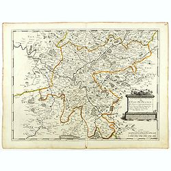
Gouvernement General de l'Ile de France. . .
Fine map of Isle de France, centered on ParisThis edition carries the date 1651. Engraved by Jean Sommer.Nicolas Sanson was to bring about the rise of French cartography,...
- $200 / ≈ €187
Place & Date: Paris, 1651
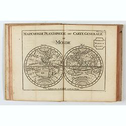
L'Hydrographie ..la Surface du Globe Terrestre.
An unusual double hemisphere hydrological map of the world - the earliest of the world prepared by the great French mapmaker Nicolas Sanson. Of particular interest is the...
- $750 / ≈ €702
Place & Date: Paris, 1652
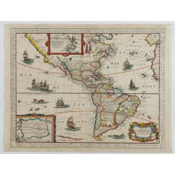
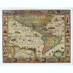
Americae Nova Descriptio.
Final state. According to Philip Burden, "this scarce map is America's first single-sheet map with decorative borders." A re-issue of the 1614 plate by Pieter v...
Place & Date: Amsterdam, 1652
Insulae Iavae Cum parte insularum Borneo Sumatrae..
An elegant sea chart of the island of Java with parts of Sumatra, Borneo and Bali. The map includes only coastal detail and shows the Dutch capital in the East Indies at ...
Place & Date: Amsterdam, 1652
[Rare map centered on the Arabian Peninsular and India reaching till Malysia.]
Early map of the Indian Ocean region, from the Eastern Mediterranean (Alexandria) to Malaysia and Sumatra. Shows The passage of Nimrod and The passage of Ophir en Hauilah...
- $750 / ≈ €702
Place & Date: London, John Saywell in 1652
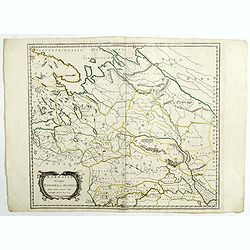
La Russie ou Moscovie.
Scarce map of Russia, centered on Moscow, the map covers much of central Europe, from the Baltic Sea east to the Caspian Sea and from the Arctic Ocean to the Black Sea.Fr...
- $300 / ≈ €281
Place & Date: Paris, 1653
L'Isle de Malte avec ses Voisines./ La Valete Forte..
Uncommon map Malta. Four maps on one sheet. With inset maps of Valletta.Like Sanson, Briet was born in Abbeville and became a Jesuit at age 18. His "Parallela Geogra...
- $300 / ≈ €281
Place & Date: Paris, 1653
Geographisches-Toneel, Of uitgezochte kaarten, Tot gemak der Officieren, Reisigers en Liefhebbers.
Pocket atlas, not in Koeman, but similar to Koeman III, p. 99 (Rat 1) of which our atlas is a later edition.Illustrated with 41 engraved maps, of which two are in origina...
- $2000 / ≈ €1871
Place & Date: Amsterdam, D. Weege, 1653
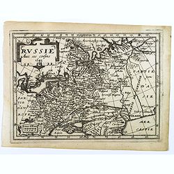
Russie avec ses confins...
A rare map published by Jean Boisseau (fl.1637-1658) French geographer, topographer, and genealogist in his Trésor des cartes géographiques. (The first true world atlas...
- $300 / ≈ €281
Place & Date: Paris, 1653
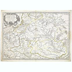
La grande Tartarie.
Map of Central Asia showing major cities, places and water bodies. Relief shown pictorially. Engraved by Anthony de Winter.
- $150 / ≈ €140
Place & Date: Amsterdam, Utrecht, ca. 1653
Le Royaume de Sicile.
Uncommon map Sicily and part of Palermo. Very good impression.Like Sanson, Briet was born in Abbeville and became a Jesuit at age 18. His "Parallela Geographiae Vete...
Place & Date: Paris, 1653
Nova Haec tabula Galliae. . .
Dated 1653. This handsome map of France is dedicated to Louis XIV, interesting in light of the nearly constant warfare between Louis and the Netherlands in the ensuing ye...
Place & Date: Amsterdam, 1653
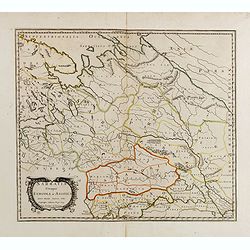
Sarmatia utraque europaea et asiatica. . .
Ancient map of the European part of Russia with the Ukraine. Dated 1654.Nicolas Sanson was to bring about the rise of French cartography, although the fierce competition ...
- $300 / ≈ €281
Place & Date: Paris, 1654
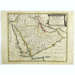
Carte des Trois Arabies. Tiree en Partie de l'Arabe de Nubie, en Partie de Divers autres Autheurs. . .
Rare map of the Arabian Peninsula, first published in 1654 and one of the first large maps focused specifically on the Arabian Peninsula. Sanson's map of the Arabian Peni...
Place & Date: Paris, 1654
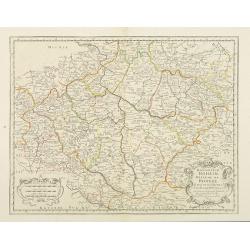
Konigreich Boheim. Royaume de Boheme. . .
Covering Czech Republic and centered on Prague. Nicolas Sanson was to bring about the rise of French cartography, although the fierce competition of the Dutch would last ...
- $300 / ≈ €281
Place & Date: Paris, 1654
Sarmatia utraque europaea et asiatica. . .
Ancient map of the European part of Russia with the Ukraine. Dated 1654.Nicolas Sanson was to bring about the rise of French cartography, although the fierce competition ...
- $200 / ≈ €187
Place & Date: Paris, 1654
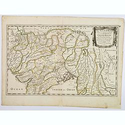
L'Inde deca et dela le Gange, ou est L'Empire du Grand Mogol. . .
An excellent mid 17th century map showing the area from Afghanistan and Pakistan in the west, and western China on the east, with most of India and extending north to the...
- $100 / ≈ €94
Place & Date: Paris, 1654
Oost Zee door Arnold Colom.
Large double-page engraved chart of the Baltic Sea including the coastlines of Finland, Estonia, Latvia, Lithuania, Poland, Denmark and Sweden with a decorative inset of ...
- $1500 / ≈ €1404
Place & Date: Amsterdam, c. 1654
Partie Meridionale De L'Inde En deux Presqu'Isles l'une deca et l'autre Gange . . . 1654
Sanson's important mid-seventeenth-century map of India and Southeast Asia. At a scale of about 1:9,000,000, it covers most of modern India, Bangladesh and Burma, the who...
- $600 / ≈ €561
Place & Date: Paris, 1654
Les Isles Philippines [on sheet with] Islas de los Ladrones ou Isle des Larrons.
Sanson's important mid-seventeenth-century map of the Philippines and tha Ladrones.It was first engraved by J. Somer for the elder Nicolas Sanson with a privilege for twe...
Place & Date: Amsterdam/Utrecht, 1654
HERTZOGTHUMB POMMERN DUCHE DE POMERANIE divise en ses Princip les Parties qui sont les Princip te de Rugue, Duche de Stettin, Pomeranie, Cassubie, et Wandalie . . .
Very fine map of the northern part of Poland. Nice details of forests, villages and rivers. Two nice uncolored cartouches.Nicolas Sanson was to bring about the rise of Fr...
- $300 / ≈ €281
Place & Date: Paris, 1654
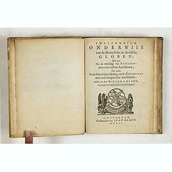
Tweevoudigh onderwiis van de Hemelsche en Aerdsche Globen; Het een Na de meyning van Ptolemeus met een vasten Aerdkloot...
Tweevoudigh onderwiis van de Hemelsche en Aerdsche Globen; Het een Na de meyning van Ptolemeus met een vasten Aerdkloot; Het ander Na de Natuerlijcke stelling van N. Cope...
Place & Date: Amsterdam, 1655
Vues du port de Llivourne. (set of 6 prints)
Sought-after complete suite of 6 engravings by S[tefano] Della Bella [1610-1664]. in a second state (of 2).Della Bella was born in Florence in 1610, and studied the art ...
Place & Date: 1654-1655
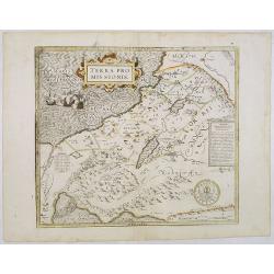
Terra Promissions.
A beautifully executed and very rare map of the Promised Land, divided into the 12 Tribes. The shore line runs in north-southwesterly direction from Sidon as far as Pelus...
Place & Date: Paris, c.1655
Japonia Regnum.
The first map to correctly show Korea as a peninsula. This was to remain the standard form of Japan until the eighteenth century and although replaced by the maps of Rela...
- $2000 / ≈ €1871
Place & Date: Amsterdam, 1655
(China Atlas) Novus Atlas Sinensis, A Matino Martinio... Seste Deel van de Nieuwe Atlas, oft Toonneel des Aerdrijck, Uytgegeven door Joan Blaeu.
Dutch text edition of the First European Atlas of China. 17 engraved maps in original hand-color, and engraved title pages in original hand-color, heightened in gold. [6]...
- $15000 / ≈ €14036
Place & Date: Amsterdam, 1655
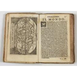
Theatro del Mondo di Abrahamo Ortelio..
Including maps of the world (Shirley, World 214): Europe; Asia; America (Burden, America 126, Marchetti 1598); Africa; England; Scotland; Ireland; Tercera; Spain (4); Por...
Place & Date: Venice, G. Turrini, 1655
Germano-Sarmatia in qua Populi maiores Venedi et Aetiaei Peucini et Bastarnae in minores Populos divisi ad hodiernam locorum et Regionum
Fine map of ancient Poland and the whole of Eastern Europe, showing part of the Baltic and Gulf of Riga, including the modern countries of Poland, Lithuania, Ukraine and ...
Place & Date: Paris, 1655
Selling price: $425
Sold in 2013
[Title page ] Topographia Galliae. . .
Title page from Casper Merian's Topographia Galliae...
- $50 / ≈ €47
Place & Date: Frankfurt, 1655
Japonia Regnum.
It is the first map to correctly show Korea as a peninsula.This was to remain the standard form of Japan until the eighteenth century and although replaced by the maps of...
- $2000 / ≈ €1871
Place & Date: Amsterdam, 1655
Haute Saxe.. Duche de Saxe... / Marquisat de Misnie..
Fine map of Saxony.This edition carries the date 1655. Engraved by R.Cordier Abbauil.Nicolas Sanson was to bring about the rise of French cartography, although the fierce...
- $100 / ≈ €94
Place & Date: Paris, 1655
[Title page] Cartes de geographie les plus nouvelles et les plus fideles, Avecque leurs divisions regulieres, par P. Du Val Géographe Ordinaire du Roy.
Title page from the atlas "Cartes de geographie les plus nouvelles et les plus fideles, Avecque leurs divisions regulieres" of Duval.In the top a crowned globe ...
- $400 / ≈ €374
Place & Date: Paris, after 1656
L'evesché d'Aire. . .
In center Adour (river), Aire-sur-l'Adour, with Aire and Dax in lower right corner. Janssonius does give credit to Pierre du Val. In lower left corner putti with grapes.D...
- $300 / ≈ €281
Place & Date: Amsterdam, 1656
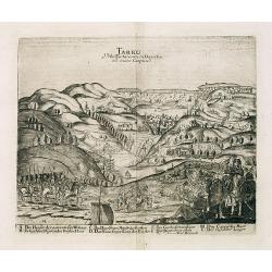
Tarku Urbs Tartaroum in Dagestan ad mare Caspium.
An early view of Tarku, in the Republic of Dagestan. From "Voyages en Moscovie, Tartarie et Perse, par Adam Olearius".Adam Olearius was a seventeenth-century G...
- $400 / ≈ €374
Place & Date: Paris, Abraham de Wicquefort , 1656
View of Derbendt an der Persischen Grentze.
An early view of Derbent, in the Republic of Dagestan. From "Voyages en Moscovie, Tartarie et Perse, par Adam Olearius".Adam Olearius was a seventeenth-century ...
- $400 / ≈ €374
Place & Date: Paris, Abraham de Wicquefort , 1656
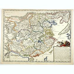
La Chine Royaume. . .
An important and attractive French map of the whole of China, the northern tip of the Philippines, with a strangely curved Korea and an under-sized Taiwan here called &qu...
- $2600 / ≈ €2433
Place & Date: Paris, 1656
La Chine Royaume. . .
An important and attractive French map of the whole of China, northern tip of the Philippines, with a strangely curved Korea and an under-sized Taiwan here called "Y...
Place & Date: Paris, 1656
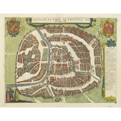
Moscovia urbs Metropolis totius Russiae Albae.
Detailed bird's-eye town-plan of Moscow from Janssonius' rare townbook. With a key (1-20) to important spots in town. The verso has French text and originates from Jansso...
Place & Date: Amsterdam, 1657
Carte generale de L'Empire d'Allemagne et pays circonvoisins. . .
Fine map of Germany, Low countries, Switzerland, Austria and Poland. The map was first published by Tavernier and later by Mariette. This edition carries the date 1642 an...
- $200 / ≈ €187
Place & Date: Paris, 1642/45-1657
[Title page] De insectis libri III, de serpentibus et draconibus libr II.
Title page from : Historiae Naturalis de Quadrupedibus libri.The re-edition of the edition of Frankfurt of 1650-53 illustrated with mirror imaged copper engravings after ...
Place & Date: Amsterdam, 1657
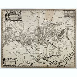
Typus Generalis Ukrainae sive Palatinatuum Podoliae, Kioviensis et Braczlaviensis terras nova delineatione exhibens. . .
A key map engraved by Johannes Janssonius in about 1656 and based on Guillaume La Vasseur de Beauplan's map of the region published in "Description d'Ukraine". ...
- $2000 / ≈ €1871
Place & Date: Amsterdam, ca. 1657
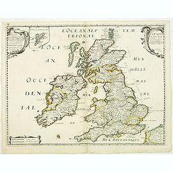
Carte Generale des Royaume d'Angleterre Escosse et Irlande Avecq les Isles circonvoisines Conues toutes soubs le nom de Britanniques / Nouvellement dressee et tiree de Cambdene Spede & autres Par N. Sanson geogr.e Ord.re du Roy
Fine map of the British Isles. The map was first published by Tavernier and later by Mariette. This edition carries the date 1640 and the address of Pierre Mariette: rue ...
- $350 / ≈ €328
Place & Date: Paris, 1640-1657
Dromedary.
Decorative and early copper engraving showing three dromedaries : Historiae Naturalis de Quadrupedibus libri.The re-edition of the edition of Frankfurt of 1650-53 illustr...
Place & Date: Amsterdam, 1657
Mexico, Regia et Celebris Hispaniae Novae Civitas ... [on sheet with] Cusco, Regni Peru in Novo Orbe Caput.
Two bird's-eye views on one sheet: Mexico and Cusco.Showing Mexico City and Cusco, the capital cities of the Aztecs and Incas, with the major buildings shown in profile w...
Place & Date: Amsterdam, 1657
(Title page) Topographia Galliae. . .
Title page from Casper Merian's Topographia Galliae... Read more about title pages [+]
- $35 / ≈ €33
Place & Date: Frankfurt, 1658
Carte de L'AMERIQUE Corrigeé et argumenteé….
Separately published map published in 1658 but based on Petrus Bertius map of 1624., this on its turn taken from Jodocus Hondius map of 1618. On the sides he lists the pr...
Place & Date: Paris, 1658
Turcicum Imperium.
A very handsome map with a particularly fine cartouche showing the Turkish Sultan on his throne and allegorical figures at either side brandishing weapons. At right is a ...
- $1500 / ≈ €1404
Place & Date: Amsterdam, 1658
Pascaerte van Brazil en Nieu Nederlandt van Cuorvo en Flores.
A rare chart of the Atlantic Ocean from the first edition of Hendrick Doncker's Zee-Atlas, of which no surviving example is known.Although the idea of its unusual coverag...
Place & Date: Amsterdam, 1658
Virginiae Partis Australis, et Floridae Partis Orientalis.
Blaeu based this map on the Mercator-Hondius of 1606. A number of geographical improvements, however were incorporated, although two large fictions lakes accompanied by e...
- $1500 / ≈ €1404
Place & Date: Amsterdam, 1658
Guiana sive Amazonum Regio.
A very decorative map of Suriname which extends from the Isla Margarita in the northwest to the coast of northern Brazil near Sao Luis east of the Amazon delta. The map l...
- $450 / ≈ €421
Place & Date: Amsterdam, 1658
Dioecesis Sarlatensis, Vernacule.. Sarlat.
Detailed map of the region south of the Dordogne River, depicting Bergerac, Saint Cyprien, Montignac, Sarlat, Villefranche, etc.Embellished with an impressive title carto...
- $200 / ≈ €187
Place & Date: Amsterdam, 1658
(Title page ) Topographia Galliae. . .
Title page from Casper Merian's Topographia Galliae...See other Title Pages [+]
- $30 / ≈ €28
Place & Date: Frankfurt, 1658
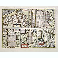
De Zype. / Purmer / Wormer/ Beemster / Waterland.
Five maps on one sheet. Showing the polders of De Zype, De Purmer, De Wormer, De Beemster and a map of Waterland, including de Bylmermeer and Monnekedam. Showing the Noor...
Place & Date: Amsterdam, 1652-1658
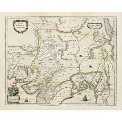
Magni Mogolis Imperium.
An attractive map of the northern part of India, Tibet, Iran to Burma. The travel route from Kabul to Surat is the most prominent feature of the map. Richly decorated wit...
- $650 / ≈ €608
Place & Date: Amsterdam, 1658
Brasilia.
A mint example of this map is by Krystof Arciszewski, a Polish general who worked for the Dutch West Indian Company. The map perpetuates various myths including the Parim...
- $1250 / ≈ €1170
Place & Date: Amsterdam, 1658
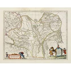
Tartaria sive Magni Chami imperium.
Detailed and decorative map of Tartary and Northern part of China, and the Chinese Great Wall is depicted. Including the Caspian Sea and the Volga River east as far as th...
- $575 / ≈ €538
Place & Date: Amsterdam, 1658
Turcicum Imperium.
A very handsome map with a particularly fine cartouche showing the Turkish Sultan on his throne and allegorical figures at either side brandishing weapons. At right is a ...
- $1100 / ≈ €1029
Place & Date: Amsterdam, 1658
Dicecese de Rheims, et le païs de Rethel. . .
Centered on Rheims. A very decorative map with beautiful cartouches of a province of France by one of the most famous map publishers.
- $300 / ≈ €281
Place & Date: Amsterdam, 1658
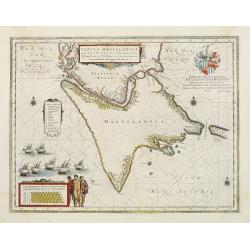
Tabula Magellanica.
A map with Willem Blaeu's signature, but published by his son Joan, of South America's extremity with the Strait of Magellan and Le Maire Strait.The coastlines are depict...
Place & Date: Amsterdam, 1658
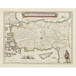
Natolia, quae olim Asia minor.
A finely designed map of Turkey and Cyprus from the great Blaeu family of Amsterdam. The decoration consist of a colored title cartouche, sea monsters, a naval engagement...
- $450 / ≈ €421
Place & Date: Amsterdam, 1658
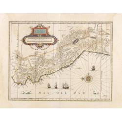
Peru.
Decorated with ships and monsters on the sea. Orientated with east at the top. Shows the Pacific coast of South America from Ecuador (at the left-hand side) as far south ...
- $400 / ≈ €374
Place & Date: Amsterdam, 1658
Insulae Americanae in Oceano Septentrionali cum Terris adiacentibus.
General map of the West Indies extending from Virginia to the mouth of the Orinoco, and destined to be copied in various shapes by many other publishers. Title cartouche ...
- $1500 / ≈ €1404
Place & Date: Amsterdam, 1658
Vera Delineatio Provinciae Fertilissimae Kilan olim Hyrcaniae ad Mare Caspium Sitae.
Uncommon map prepared by Adam Olearius showing the region of Azerbaijan and Iran. The map is oriented with north to the upper left corner and adorned with an attractive t...
- $400 / ≈ €374
Place & Date: Jean Dupuis in Paris, 1659
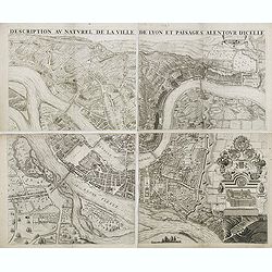
Description au naturel de la ville de Lyon et païsages alentour d'icelle.
PREMIERE EDITION. Plan de Lyon à « vol d’oiseau » commandé par le consulat, destiné à la diffusion et à la notoriété de la cité, mariant ainsi image de la vil...
Place & Date: Lyon, 1659
Amerique Meridionale. . . 1650.
First edition. A fine large map of South America, engraved by A.Peyrounin. The relatively unknown Amazon region is left without speculation. However, Sanson includes the ...
- $450 / ≈ €421
Place & Date: Paris, 1650-1659
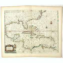
Pascaerte vande Caribische Eylanden, vande Barbados tot aende Bocht van Mexico ‘t Amsterdam By Hendrick Doncker. . .
First state. Rare. “This chart appeared in the first edition of Hendrick Doncker’s Zee-Atlas, of which no surviving example is known” -- Burden. This is an example ...
Place & Date: Amsterdam, 1659
India Orientalis Nova.
Charming uncommon miniature map showing the northern two-thirds of Australia pre-discoveries by Captain Cook, but showing discoveries by Abel Tasman in 1642. The map show...
- $750 / ≈ €702
Place & Date: Amsterdam, 1659
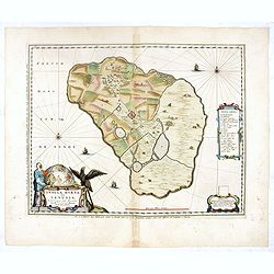
Insula Huaena sive Venusia a Guiljelmo Blaeu cum sub Tychone Astronomiae operam daret, delineata.
Decorative map of the island Hvan in the Danish Sound. In the center Tycho Brahe's famous observatory Uraniborg established in 1576, under the patronage of Frederick II, ...
Place & Date: Amsterdam, 1659








![[Rare map centered on the Arabian Peninsular and India reaching till Malysia.]](/uploads/cache/42886-250x250.jpg)





![Les Isles Philippines [on sheet with] Islas de los Ladrones ou Isle des Larrons.](/uploads/cache/42023-250x250.jpg)

-250x250.jpg)

![[Title page ] Topographia Galliae. . .](/uploads/cache/32226-250x250.jpg)


![[Title page] Cartes de geographie les plus nouvelles et les plus fideles, Avecque leurs divisions regulieres, par P. Du Val Géographe Ordinaire du Roy.](/uploads/cache/48000-250x250.jpg)




![[Title page] De insectis libri III, de serpentibus et draconibus libr II.](/uploads/cache/22364-250x250.jpg)

![Mexico, Regia et Celebris Hispaniae Novae Civitas ... [on sheet with] Cusco, Regni Peru in Novo Orbe Caput.](/uploads/cache/29013-250x250.jpg)

