Browse Listings in Europe > Scandinavia > Denmark
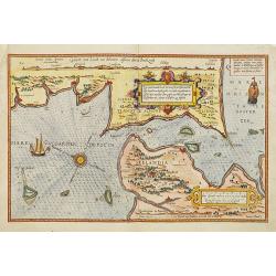
Zee caerte vande Sondt tvermaerste van Danemarcke . . .
A detailed chart of the coast of Denmark and its islands, Copenhagen in the center of the chart. West to the top. It is decorated by a title, scale and descriptive cartou...
Place & Date: Leiden, Plantijn, 1585
Abbildung der Stadt und Thumbs Havelberg, so von den Dennmarckischen verlassen und von den Keijs: eingenommen worden 1627”. Mindre fågelvy utan horisont med stridande trupper. . .
A separately published plan of the Danish town of Havelberg, with its siege of 1627. The copper engraved plan was also included in the work "Relationis Historicae S...
- $200 / ≈ €187
Place & Date: Frankfurt am Main, ca. 1620
Christianus III. D. G. Daniae Et Norwegiae Rex. Dux Hols. etc.
The engraving depicts a half length oval portrait of "Christianus III".Nicolaes de Clerck (de Klerc) was active as engraver and publisher in Delft from 1599-162...
- $20 / ≈ €19
Place & Date: Amsterdam, Cloppenburch, 1621
Fredericus II. D. G. Daniae Et Norvegiae Rex. Dux Holsatiae etc.
The engraving depicts a half length oval portrait of "Fredericus II".Nicolaes de Clerck (de Klerc) was active as engraver and publisher in Delft from 1599-1621....
- $20 / ≈ €19
Place & Date: Amsterdam, Cloppenburch, 1621
Fridericus I. D. G. Daniae Et Norvegiae Rex. etc.
The engraving depicts a half length oval portrait of "Fridericus I".Nicolaes de Clerck (de Klerc) was active as engraver and publisher in Delft from 1599-1621.I...
- $20 / ≈ €19
Place & Date: Amsterdam, Cloppenburch, 1621
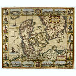
Daniae Regni Typum..
A first state. Very decorative "carte à figures"- map of Denmark with the signature of the engraver Abraham Goos. Printed on heavy paper, in spite of its repai...
Place & Date: Amsterdam, 1629
Fionia.
Early map, including Odense and the island Langeland .
- $200 / ≈ €187
Place & Date: Amsterdam 1630
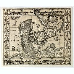
Daniae regni typum . . .
Second Edition, now for the first time with a date (1630), this rare map which - like that of Janssonius-Kaerius - is based on John Speed's map of 1626. The side borders ...
Place & Date: Amsterdam, 1630
Fionia.
Early map, including Odense and the island Langeland .
- $200 / ≈ €187
Place & Date: Amsterdam, 1630
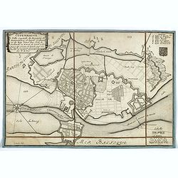
Copenhague ville capitale du royaume de Dannemarq et séjour ordinaire du Roy . . .
Separately published town-plan of Copenhagen, also published in de Fer's "Curious Atlas". Engraved by C.Inselin. Plan is dated 1700 in lower right corner. With ...
- $150 / ≈ €140
Place & Date: Paris, 1700
Le Royaume de Danemarc et les Etats.
Map centered on Sweden and North Germany.
Place & Date: Paris, 1724
Royaume de Danemarck. qui comprend le Nort-Jutland . . . Sélande, Laland.
Finely and crisply engraved map of Denmark. Venetian edition of Giles Didier Robert De Vaugondy's map from Atlas Universel printed in 1776-84. Ornamental title cartouche ...
- $100 / ≈ €94
Place & Date: Venice, 1776 - 1784
Pont de Knippelsbroe a Copenhague.
View of Knippelsbroe's bridge in Copenhagen. From "Voyage en Scandinavie, en Laponie, etc" - Atlas Pirtoresque (complément). Designed by A.Mayer.
- $150 / ≈ €140
Place & Date: Paris, ca 1834-1838


