Search Listings matching "blaeu" in Europe > France > France Provinces
Lotaringia Ducatus.
Small map of Lorraine, oriented with West on top and surrounded by text in Dutch. Nicolaes de Clerck (de Klerc) was active as an engraver and publisher in Delft from 1599...
- $75 / ≈ €70
Place & Date: Amsterdam, Cloppenburch, 1621
Picardia Regio Belgica.
Map of the northern region of Picardy. The region is well known due to the 4 major battles fought between France, Britain and Germany between 1915-18 during World War I. ...
- $400 / ≈ €374
Place & Date: Amsterdam, 1644
Veromanduorum.. Vermandois / Gouvernement de la Capelle.
A very decorative map with beautiful cartouches of a province of France by one of the most famous map publishers. Signed by Guilielmus Blaeu.From early on Willem Jansz. B...
- $150 / ≈ €140
Place & Date: Amsterdam, 1644
Le Gouvernement de l'Isle de France.
A very detailed map of Ile de France centered on Paris. Showing Beauvais, Compiègne, Noyon, Laon, Soisson, Vernon, Mante, Pontoise, Meaux, etc.Adorned with the royal arm...
- $300 / ≈ €281
Place & Date: Amsterdam, 1644
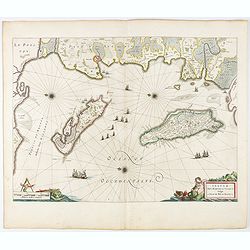
Insulae Divi Martini et Uliarus, vulgo L'Isle de Ré.. Oleron.
Map of Ré and Oléron islands. Depicting the west coast of France, showing La Rochelle. Several vessels and sailing ships dot the Atlantic ocean.Three windroses indicate...
- $950 / ≈ €889
Place & Date: Amsterdam, 1644
Britannia Ducatus. Duché de Bretaigne.
Map of Bretagne in France. From early on Willem Jansz. Blaeu aimed of publishing an atlas to compete with the Hondius-Jansson Atlas. By 1630, he had published at least 1...
- $800 / ≈ €749
Place & Date: Amsterdam, 1644
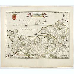
Normandia Ducatus.
Very detailed map of Normandy centered on Caen and Rouen. Also showing Cherbourg, Avranches, Bayeux, Cabourg, Honfleur, Le Havre, Etretat, Fecamp. St Malo and Mont Saint ...
- $500 / ≈ €468
Place & Date: Amsterdam, 1644
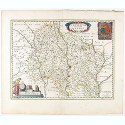
Cadurcium Vernaculé Querci.
Detailed map of a province of France by one of the most famous map publisher. Centered on Cahors.In the lower-left corner, a colored scale cartouche surmounted by a monke...
Place & Date: Amsterdam, 1644
Xaintonge et Angoumois.
This map features a portion of western coastal France, north of Bordeaux with Ile de Ré and Ile Oléron. Two large cartouches show cherubs with grapes and wheat, and tw...
- $500 / ≈ €468
Place & Date: Amsterdam, 1644
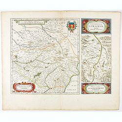
Lemovicum.. Lymosin. / Topographia Limaniae. . .
Two maps on one sheet. The author of the map of Lymosin was the French physician and cartographer Jean du Fayen. From early on Willem Jansz. Blaeu aimed of publishing an...
- $400 / ≈ €374
Place & Date: Amsterdam, 1644
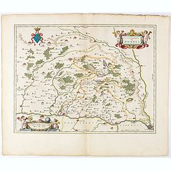
La Souverainete de Dombes.
A very decorative map with beautiful cartouches of a province of France by one of the most famous map publishers.Including Lyon in the lower right corner. From early on ...
- $400 / ≈ €374
Place & Date: Amsterdam, 1644
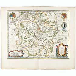
Territorium Metense. Auctore Ab. Fabert.. Le Pais Messin.
A very decorative map of part of Lorraine with beautiful cartouches. Orientated with West on top. Centered on Metz. From early on Willem Jansz. Blaeu aimed of publishing...
- $400 / ≈ €374
Place & Date: Amsterdam, 1644
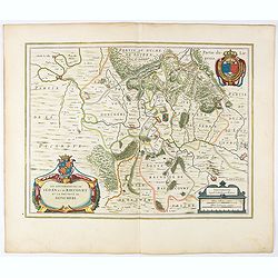
Les Souverainetez de Sedan et de Raucourt.. Doncheri.
A very decorative map with beautiful large cartouches of a province of France by one of the most famous map publishers. From early on Willem Jansz. Blaeu aimed of publis...
- $230 / ≈ €215
Place & Date: Amsterdam, 1644


