Browse Listings in Europe > Eastern Europe
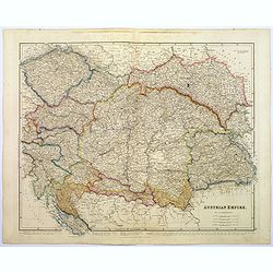
Austrian Empire.
A, large steel engraved map of the mighty Austrian Empire, covering Austria, Dalmatia, Styria, Slavonia, Hungary, Transylvania, Moravia and Bohemia. An enormous amount of...
Place & Date: London, 1839
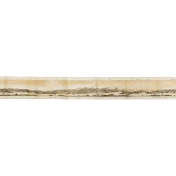
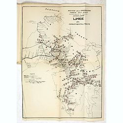
Panorama della Costa e delle Isole di Dalmazia nei viaggi dei piroscafi del Lloyd Austriaco.
On 20 August 1838 the Austrian Lloyd inaugurated a line service from Trieste to the Mouth of Cattaro. In order to illustrate the route, the Company asked the Trieste pain...
- $2500 / ≈ €2339
Place & Date: Trieste, Linassi, 1857
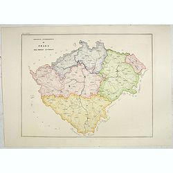
Provincia ecclesiastica di Praga nell' Impero Austriaco (Tav LXVIII)
A large-format map of Prague with its different dioceses. The map is finely engraved and beautifully colored and was prepared by Girolamo Petri, a lawyer who served as a ...
- $300 / ≈ €281
Place & Date: Rome, 1858
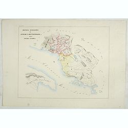
Provincia ecclesiastica di Antivari e arciv di durazzo nella Turchia Europae (Tav XCVII) ( Albania)
This large-format map of Albania with it's different dioceses. The map is finely engraved and beautifully colored and was prepared by Girolamo Petri, a lawyer who served ...
- $500 / ≈ €468
Place & Date: Rome, 1858
Provincie ecclesiastiche di Leopoli e Fogaras ed Altre Diocesi di Rito Greco (Tav LXXV)
This large-format Romania map is finely engraved and beautifully colored and was prepared by Girolamo Petri, a lawyer who served as a senior official within the Vatican�...
- $250 / ≈ €234
Place & Date: Rome, 1858
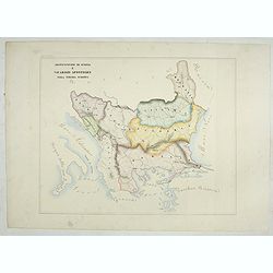
Arcivescovato di Scopia e vicariati Apostolici nella Turchia Europea. (Tav XCVIII)
This large-format map of Eastern Europe, including Bosnia, Herzegovina, Albania, Montenegro, Servia, Bulgaria, Romania and Molavia. The map is finely engraved and beautif...
- $600 / ≈ €561
Place & Date: Rome, 1858

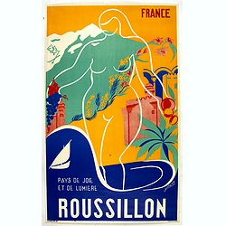
Hongarije.
Poster made for Hungarian Tourist association. The uncommon Dutch version of this fine poster to promote Hungary in the 1930's. Arisztid Uher was a graphic designer. He d...
Place & Date: Budapest, KLOSZ / Sohn., ca. 1930
![Environs de Raguse (Dubrovnik). Deuxième Feuille. Canal de Calamota (Kolocep).. [277]](/uploads/cache/23473-250x250.jpg)
Environs de Raguse (Dubrovnik). Deuxième Feuille. Canal de Calamota (Kolocep).. [277]
This large-scale coastal chart shows the stretch of the Dalmatian coast between Slano as far as the island of Kolocep, the southernmost inhabited island in Croatia. With ...
- $200 / ≈ €187
Place & Date: Paris [1877] corrected to 1932
![Mer Adriatique. Côte Orientale. De l'Ile Meleda à Antivari.. [3552]](/uploads/cache/23471-250x250.jpg)
Mer Adriatique. Côte Orientale. De l'Ile Meleda à Antivari.. [3552]
This large scale coastal chart shows the stretch of Dalmatian coast between the island Mljet in Croatia as far as Ulcinj (Montenegro). With latitude and longitude scales,...
- $200 / ≈ €187
Place & Date: Paris [1877] corrected to 1934
![Mer Adriatique. Partie Sud.. [3976]](/uploads/cache/23549-250x250.jpg)
Mer Adriatique. Partie Sud.. [3976]
This large scale coastal chart centered on the southern part of the Adriatic sea. Showing the Dalmatian coast between Split in Croatia as far as the northernmost tip of C...
- $200 / ≈ €187
Place & Date: Paris [1883] updated for 1935
MEMORANDUM Vlade Demokratske Federativne Jugoslavije po pitanju Juliske Krajine i drugih jugoslavenskih teritorija pod Italijom.
Memorandum of the government of the Democratic Federative Yugoslavia concerning the questions of the Jilian March and other Yugoslav territories under Italy.Julian March ...
- $300 / ≈ €281
Place & Date: London, 1946