Search Listings matching "blaeu" in Europe
Germania.
Second state of this rare "carte à figures"- map of Germany, The Netherlands, Poland and central Europe. Bordered on three sides with portraits and views. In t...
Place & Date: Amsterdam, 1607
Pascaarte van een deel der Oost Zee, tusschen Bornholm ende der Memel, vertonende de ware gelegentheijt der Zeecusten van Pruijssen. . .
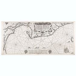
This very rare chart of the Northern Coast of Poland with Gdansk, appeared in the rare English edition of Willem Blaeu's 'Het Licht der Zeevaert', an atlas of sea charts ...
- $4000 / ≈ €3743
Place & Date: Amsterdam, 1608
Domus Hansae Teutonicae / Sacri Romani Imperii. (Antwerp townhall)
From Ludovico Guicciardini.'s description of the Netherlands "Beschrijvinghe van alle de Nederlanden anderssins ghenoemt Neder-Duytslandt", published by Willem ...
- $100 / ≈ €94
Place & Date: Amsterdam, 1612
Gallia. Nova Galliae descriptio . . .
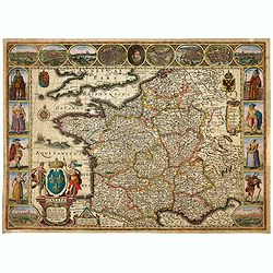
Very rare and early map of France with figures on three sides with views of cities, portraits (Henri IV and Marie de Medicis) and costumes. The map was directly influence...
Place & Date: Amsterdam, 1616
Gallia.
Small map of France, surrounded by text in Dutch. Nicolaes de Clerck (de Klerc) was active as engraver and publisher in Delft from 1599-1621.Included in the rare book : W...
- $70 / ≈ €66
Place & Date: Amsterdam, Cloppenburch, 1621
Hispania.
Small map of the Iberian peninsula with the Balearic Islands, surrounded by text in Dutch.Nicolaes de Clerck (de Klerc) was active as an engraver and publisher in Delft f...
- $100 / ≈ €94
Place & Date: Amsterdam, Cloppenburch, 1621
Lotaringia Ducatus.
Small map of Lorraine, oriented with West on top and surrounded by text in Dutch. Nicolaes de Clerck (de Klerc) was active as an engraver and publisher in Delft from 1599...
- $75 / ≈ €70
Place & Date: Amsterdam, Cloppenburch, 1621
Hungaria.
Small map of Hungary, surrounded by text in Dutch. Nicolaes de Clerck (de Klerc) was active as engraver and publisher in Delft from 1599-1621.Included in the rare book : ...
- $100 / ≈ €94
Place & Date: Amsterdam, Cloppenburch, 1621
Coloniensis Archiepisscopatus.
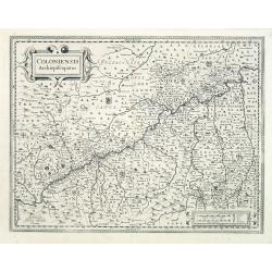
Extremely rare first edition of this beautiful map of Cologne and Dusseldorff.Jodocus Hondius Jr. planned to produce a new modern atlas less dependent on the Mercator pla...
Place & Date: Amsterdam, 1629
Monasteriensis Episcopatus.
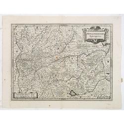
The extremely rare first edition of this beautiful map of Munster.Jodocus Hondius Jr. planned to produce a new modern atlas less dependent on the Mercator plates that his...
Place & Date: Amsterdam, 1629
Westphalia Ducatus.
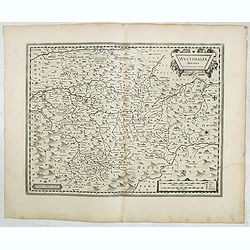
Extremely rare first edition of this beautiful map of Westphalia.Jodocus Hondius Jr. planned to produce a new modern atlas less dependent on the Mercator plates that his ...
Place & Date: Amsterdam, 1629
Sueviae Nova Tabula.
Extremely rare first edition of this beautiful map of Swaben, including Ulm, Augsburg, Stuttgart, Zurich, Lucerne and Lake Constance.Jodocus Hondius Jr. planned to produc...
Place & Date: Amsterdam, 1629
Alpinae seu Foederatae Rhaetiae . . .
Extremely rare first edition of this beautiful map of Graubünden Canton in Switzerland. Including Chur, Davos, St.Moritz, etc.Jodocus Hondius Jr. planned to produce a ne...
- $750 / ≈ €702
Place & Date: Amsterdam, 1629
Tabula Islandiae. . .
With a very decorative cartouche, and a very fine imprint. No text on verso; included in the rare "Appendix" of 1630. VERY RARE. This handsome map of Iceland wa...
- $1200 / ≈ €1123
Place & Date: Amsterdam, 1630
Meklenburg Ducatus.
Very detailed map of the northern part of Germany decorated with a coat of arms, a windrose and two saling ships.From the rare atlas Appendix, published in a very small n...
Place & Date: Amsterdam, 1629-1630
Oldenburg Comitatus
A map of the northern part of Germany centered on Oldenburg. Also showing Bremen. North to the right. The decoration consists with a windrose and a title cartouche surmou...
Place & Date: Amsterdam, 1629-1630
Tractus Danubii, Fluminis in Europa Maximi, A Fontibus, Per Germaniam. . .
This is Blaeu’s first map of the Danube and surrounding regions. The Danube River runs through the map from the top left with its headwaters in the German Black Forest ...
Place & Date: Amsterdam, 1634
Prussiae nova tabula.
The map features a bold title cartouche, a ship, compass rose and a sea monster in the Baltic Sea. As indicated in the title cartouche, the map was prepared by the German...
Place & Date: Amsterdam, 1634
Selling price: $80
Sold in 2015
Sardinia Insula.
FIRST EDITION, FIRST ISSUE OF THIS MAP. Map of the Italian island of Sardinia in a copper engraving on a sheet with letterpress with German text description of the island...
Place & Date: Amsterdam, 1634
Corsica.
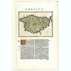
FIRST EDITION, FIRST ISSUE OF THIS MAP. Blaeu's map of the French island of Corsica. East on top. A detailed and well executed map.From an incomplete example of the 1634 ...
- $500 / ≈ €468
Place & Date: Amsterdam, 1634
Mantua ducatus.
Originally engraved for Jodocus Hondius II, at his death in August 1629 this map was, among 39 other copper plates, purchased by Willem Blaeu who deleted Hondius' name an...
- $300 / ≈ €281
Place & Date: Amsterdam, 1634
Novus XVII Inferioris Germaniae Provinciarum Typus.
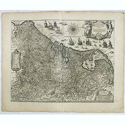
Willem Blaeu published this map in 1608 as a wall map with figured borders. When later, in 1630 he needed a general map of the Netherlands for his first atlas, the Append...
Place & Date: Amsterdam, 1634
Nassovia comitatus.
Elegantly engraved map of the region including Koblenz, Sigen and Dillenburg. The mountainous topography is graphically depicted and there is a coats of arms in the corne...
- $100 / ≈ €94
Place & Date: Amsterdam, 1634
Mansfeldia Comitatus. . .
FIRST EDITION, FIRST ISSUE OF THIS MAP. From the 1634 edition of Blaeu's Atlas Novus, the first edition of this work.Centered on Mansfeld and its surrounding region, this...
- $100 / ≈ €94
Place & Date: Amsterdam,1634
Hassia Landgraviatus.
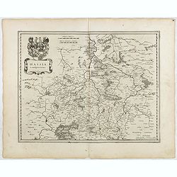
FIRST EDITION, FIRST ISSUE OF THIS MAP. From the 1634 edition of Blaeu's Atlas Novus, the first edition of this work.Important map of Hesse in Germany, centered on the to...
- $100 / ≈ €94
Place & Date: Amsterdam, 1634
Franconia vulgo Franckenlandt.
FIRST EDITION, FIRST ISSUE OF THIS MAP. From the 1634 edition of Blaeu's Atlas Novus, the first edition of this work.Map highlights all the major cities of this region li...
- $100 / ≈ €94
Place & Date: Amsterdam, 1634
Waldeck Comitatus.
FIRST EDITION, FIRST ISSUE OF THIS MAP. From the 1634 edition of Blaeu's Atlas Novus, the first edition of this work.Important early map of Waldeck. Attractive coat of ar...
- $100 / ≈ €94
Place & Date: Amsterdam, 1634
Westphalia Ducatus.
Originally engraved for Jodocus Hondius II, at his death in August 1629 this map was, among 39 other copper plates,purchased by Willem Blaeu who deleted Hondius' name and...
- $100 / ≈ €94
Place & Date: Amsterdam, 1634
Osnabrugensis Episcopatus.
Originally engraved for Jodocus Hondius II, at his death in August 1629 this map was, among 39 other copper plates, purchased by Willem Blaeu who deleted Hondius' name an...
- $150 / ≈ €140
Place & Date: Amsterdam, 1634
Tractus Danubii, Fluminis in Europa Maximi, A Fontibus, Per Germaniam. . .
This is Blaeu’s first map of the Danube and surrounding regions. The Danube River runs through the map from the top left with its headwaters in the German Black Forest ...
- $2000 / ≈ €1871
Place & Date: Amsterdam, 1634
Wirtenberg Ducatus.
FIRST EDITION, FIRST ISSUE OF THIS MAP. From the 1634 edition of Blaeu's Atlas Novus, the first edition of this work. PROOF STATE with blank upper right corner, only incl...
- $100 / ≈ €94
Place & Date: Amsterdam, 1634
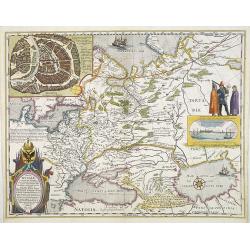
Tabula Russiae ex autographo, quod delineandum curavit Foedor filius Tzaris Boris desums... - Domino regionum Iueriae Kartalinie et Groefiniae Tzari etc: dedicata ab Heselo Gerardo M.DC.XIIII
A re-issue, by Willem Blaeu, of Hessel Gerritsz' rare and influential map of Russia. Dutch text on verso, extending west to east from Emden to Aspachan and north to south...
Place & Date: Amsterdam, 1635
De Hertochdommen Gulick Cleve Berghe en de Graefschappen...
It is one of Blaeu's early maps: It was only published between 1630 and 1635 in three editions of the "Appendix" and one of the "Theatrum". In the lef...
Place & Date: Amsterdam, 1635
Nouvelle et exacte Carte du Duche de Brabant. . .
A very rare example of a map of the duchy of Brabant. Title cartouche in the lower left-hand corner. A very rare issue of this map of Brabant. Cornelis Danckerts II. copi...
- $800 / ≈ €749
Place & Date: Amsterdam, 1635
Franconia vulgo Franckenlandt.
Fine copy centered on Bamberg, Nuremberg, Würzburg, and Nuremberg. French text on verso. Würzburg is the main city in Franconian wine country. Grapevines cover the stee...
Place & Date: Amsterdam, 1635
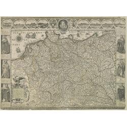
[Lot of 14 maps of Germany] Nova Totius Germaniae Descriptio.
Willem Blaeu, founder of the famous publishing firm. Originally publishing pilot-guides, he issued his first atlas, 'Atlantis Appendix', in 1630, followed by his "...
- $500 / ≈ €468
Place & Date: 1635
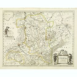
Ducatus Limburg.
A very rare issue of this map of Limburg. Cornelis Danckerts II. copied the folio map of H.Hondius.The publisher's address was placed in the lower right-hand corner. The ...
Place & Date: Amsterdam, 1636
Saltzburg Archiepiscopatus, et Carinthia Ducatus
Handsome map of the archbishopric of Salzburg and the Duchy of Carinthia.Title in banner form with two coats of arms and three cherubs decorating the map.As Willem Blaeu ...
Place & Date: Amsterdam, 1638
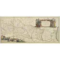
Danubius Fluvius Europae Maximus, a Fontibus ad Ostia..
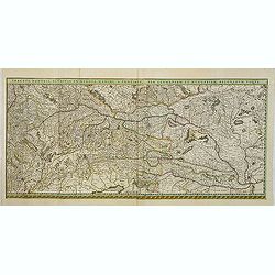
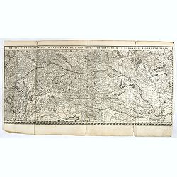
Depicts the course of the Danube River, from its sources in the Alps to the Black Sea..Because of the dimensions the map was printed from two copper plates.With two very ...
Place & Date: Amsterdam, 1638
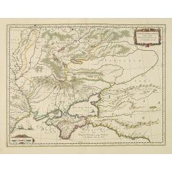
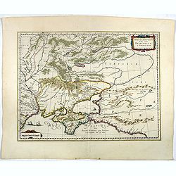
Taurica Chersonesus, Nostra aetate Przecopsca, et Gazara dicitur.
Part of Russia with in the north Smolensk and Moscow and in the south the Black Sea.As Willem Blaeu died in 1638 most of his maps are actually published by his son Joan. ...
Place & Date: Amsterdam, 1638
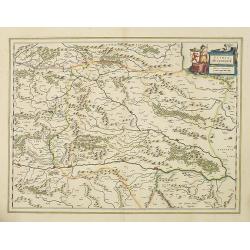
Stiria Steyermarck.
Covering the eastern part of Austria, Styria and Carinthia, centered on the town of Graz.As Willem Blaeu died in 1638 most of his maps are actually published by his son J...
Place & Date: Amsterdam, 1638
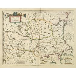
Walachia, Servia, Bulgaria, Romania.
Striking map of the region centered on the Lower Danube, Bulgaria, Romania, Serbia and Macedonia. Includes decorative cartouche, coat of arms, etc. Latin text on verso.Th...
Place & Date: Amsterdam, 1638
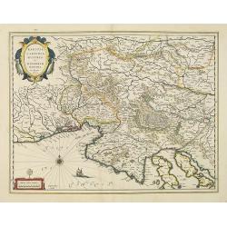
Karstia, Camiola, Histria et Windorum Marchia.
Including the Gulf of Trieste, Venice and the northern part of former Yugoslavia. Prepared by Gerard Mercator.As Willem Blaeu died in 1638 most of his maps are actually p...
Place & Date: Amsterdam, 1638
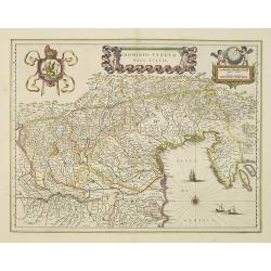
Dominio Veneto nell' Italia.
With the Gulf of Venice. Including the towns of Cremona, Brescia, Venice, etc.As Willem Blaeu died in 1638 most of his maps are actually published by his son Joan. This m...
Place & Date: Amsterdam, 1638
Mantua ducatus.
Centered at the town of Mantua.As Willem Blaeu died in 1638 most of his maps are actually published by his son Joan. This map carries his (engraved) signature and was act...
Place & Date: Amsterdam, 1638
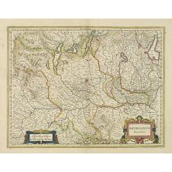
Mediolanum Ducatus.
Very fine map centered on Milan Including Lake Como, Lake Garda, Lake Majore, Parma, etc.As Willem Blaeu died in 1638 most of his maps are actually published by his son J...
Place & Date: Amsterdam, 1638
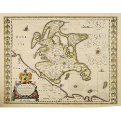
Rugia Insula ac ducatus. . .
Willem Blaeu's highly decorative map of the island of Rugen in the Baltic Sea from a map by Eihard Lubin. Embellished with a title-cartouches, and 30 coats-of-arms in the...
- $300 / ≈ €281
Place & Date: Amsterdam, 1638
Saxonia Superior, cum Lusatia et Misnia.
Finely engraved and detailed map of Saxony including Halle, Leipzig, Meissen, and Dresden. Filled with forests and tiny villages. It presents Prague close to the centre o...
Place & Date: Amsterdam, 1638
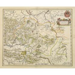
Mansfeldia Comitatus. . .
Centered on Mansfield and prepared by Telemann Stella (1527-1589) a German cartographer who made maps of Germany and the Holy Land.As Willem Blaeu died in 1638 most of hi...
Place & Date: Amsterdam, 1638
Monasteriensis Episcopatus.
A very detailed map of Germany centered on Munster and Linge. Also showing Wessel to the top of the map and Oldenburg to the right. North to the right. The map is adorned...
Place & Date: Amsterdam, 1638
Bravnswyck et Meydburg. . .
As Willem Blaeu died in 1638 most of his maps are actually published by his son Joan. This maps carries his (engraved) signature and was actually published in volume II o...
Place & Date: Amsterdam, 1638
Westphalia Ducatus.
Elegantly engraved map of Westphalia including Hamm and Lippstadt. The mountainous topography is graphically depicted and several small coats of arms dot the map. Strapwo...
Place & Date: Amsterdam, 1638
Osnabrugensis episcopatus.
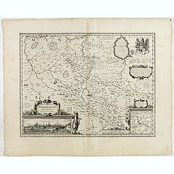
A beautiful map of Munster centered on the city of Osnabruck. Prepared by Joannes Michael Gigas (1580-1650+), a doctor, mathematician and geographer. Showing an inset wit...
Place & Date: Amsterdam, 1638
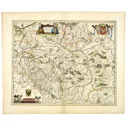
Polonia regnum et Silesia ducatus.
Very decorative map of Poland embellished with two cartouches and two coats of arms surmounted by cherubs and female figures. Showing the region from the Oder east to Pod...
Place & Date: Amsterdam, 1638
Comitatus Marchia et Ravensberg.
With an inset of Ravensberg comitatus. Decorative title cartouche with coats of arms. Scale cartouche with a surveyor.As Willem Blaeu died in 1638 most of his maps are ac...
- $80 / ≈ €75
Place & Date: Amsterdam, 1638
Paderbornensis Episscopatus Descriptio Nova.
Detailed map by Willem Blaeu., centered on Paderborn. Embellished with several coats of arms. Prepared by Joannes Michael Gigas (1580-1650+), a doctor, mathematician and ...
- $175 / ≈ €164
Place & Date: Amsterdam, 1640
Regiones Sub Polo Arctico.
One of the many cases of duplication by the firms of Blaeu and Hondius/Jansson. In this case, Blaeu has copied Janssonius's map of 1637. It depicts rhumb lines radiating ...
- $850 / ≈ €795
Place & Date: Amsterdam, 1640
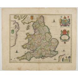
Anglia Regnum.
Janssonius' map of England and Wales was one of the new maps prepared by him in 1636. His map closely copies the similar map issued two years earlier by Willem Blaeu.. Th...
Place & Date: Amsterdam, 1642
Tabula Russiae.
A re-issue, by Willem Blaeu, of Hessel Gerritsz' rare and influential map of Russia.This fine map was compiled from manuscripts brought back from Russia, by Isaac Massa t...
- $1800 / ≈ €1684
Place & Date: Amsterdam, 1644
Taurica Chersonesus, Nostra aetate Przecopsca, et Gazara dicitur.
Part of Russia with in the north Smolensk and Moscow and in the south the Black Sea. More about Willem Blaeu. [+]
- $300 / ≈ €281
Place & Date: Amsterdam, 1644
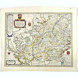
Prussia accurate descriptia a Gasparo Henneberg Erlichensi.
Prussia and the Baltic Region, with two large decorative cartouches, coat of arms, and three sailing ships. As indicated in the title cartouche, the map was prepared by t...
Place & Date: Amsterdam, 1644
Selling price: $500
Sold in 2017
Silesia Inferior. . .
Decorative map prepared by Jonas Scultetus, a Silesian cartographer (1603-1664). More about Willem Blaeu. [+]
- $300 / ≈ €281
Place & Date: Amsterdam, 1644
Ducatus Silesiae Glogani Vera Delineatio . . .
Map of Silesia showing the area of Glogow. French text on back. More about Willem Blaeu. [+]
- $350 / ≈ €328
Place & Date: Amsterdam, 1644
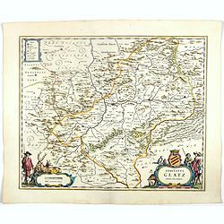
Comitatus Glatz.
Nice map by Willem Blaeu of the Silesia region with Glatz (Klodzko) at center. The forested region was renowned for its wild game and the map includes tiny illustrations ...
- $450 / ≈ €421
Place & Date: Amsterdam, 1644
Brandeburgum Marchionatus. . .
Decorative map by Willem Blaeu centered on Berlin and Brandenburg, and part of Poland and Pomerania, Mecklenburg and Rugia with excellent detail of forests, rivers, towns...
- $250 / ≈ €234
Place & Date: Amsterdam, 1644
Celeberrimi Fluvis Albis nova delineatio. . .
A decorative map from a 1640's Latin text edition of Blaeu's "Theatrum Orbis Terrarum, Sive Atlas Novis." The River Elbe is depicted in two sections from the mo...
- $80 / ≈ €75
Place & Date: Amsterdam, 1644
Picardia Regio Belgica.
Map of the northern region of Picardy. The region is well known due to the 4 major battles fought between France, Britain and Germany between 1915-18 during World War I. ...
- $400 / ≈ €374
Place & Date: Amsterdam, 1644
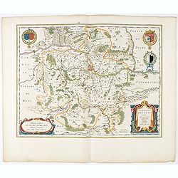
Veromanduorum.. Vermandois / Gouvernement de la Capelle.
A very decorative map with beautiful cartouches of a province of France by one of the most famous map publishers. Signed by Guilielmus Blaeu.From early on Willem Jansz. B...
- $150 / ≈ €140
Place & Date: Amsterdam, 1644
Le Gouvernement de l'Isle de France.
A very detailed map of Ile de France centered on Paris. Showing Beauvais, Compiègne, Noyon, Laon, Soisson, Vernon, Mante, Pontoise, Meaux, etc.Adorned with the royal arm...
- $300 / ≈ €281
Place & Date: Amsterdam, 1644
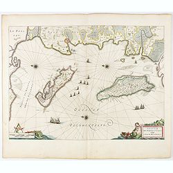
Insulae Divi Martini et Uliarus, vulgo L'Isle de Ré.. Oleron.
Map of Ré and Oléron islands. Depicting the west coast of France, showing La Rochelle. Several vessels and sailing ships dot the Atlantic ocean.Three windroses indicate...
- $950 / ≈ €889
Place & Date: Amsterdam, 1644
Britannia Ducatus. Duché de Bretaigne.
Map of Bretagne in France. From early on Willem Jansz. Blaeu aimed of publishing an atlas to compete with the Hondius-Jansson Atlas. By 1630, he had published at least 1...
- $800 / ≈ €749
Place & Date: Amsterdam, 1644
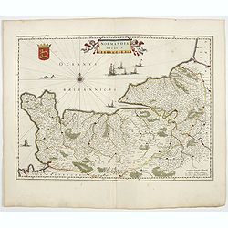
Normandia Ducatus.
Very detailed map of Normandy centered on Caen and Rouen. Also showing Cherbourg, Avranches, Bayeux, Cabourg, Honfleur, Le Havre, Etretat, Fecamp. St Malo and Mont Saint ...
- $500 / ≈ €468
Place & Date: Amsterdam, 1644
Andaluzia continens Sevillam.
Features the province of Andalucia and the city of Seville, but also depicts the Straights of Gibraltar, know in classical times as the Pillars of Hercules. Córdoba, Má...
- $550 / ≈ €515
Place & Date: Amsterdam, 1644
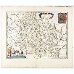
Cadurcium Vernaculé Querci.
Detailed map of a province of France by one of the most famous map publisher. Centered on Cahors.In the lower-left corner, a colored scale cartouche surmounted by a monke...
Place & Date: Amsterdam, 1644
Xaintonge et Angoumois.
This map features a portion of western coastal France, north of Bordeaux with Ile de Ré and Ile Oléron. Two large cartouches show cherubs with grapes and wheat, and tw...
- $500 / ≈ €468
Place & Date: Amsterdam, 1644
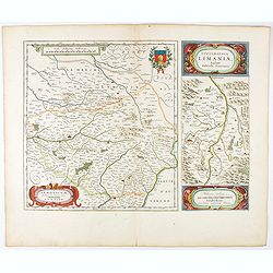
Lemovicum.. Lymosin. / Topographia Limaniae. . .
Two maps on one sheet. The author of the map of Lymosin was the French physician and cartographer Jean du Fayen. From early on Willem Jansz. Blaeu aimed of publishing an...
- $400 / ≈ €374
Place & Date: Amsterdam, 1644
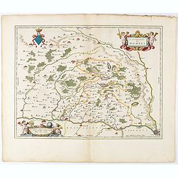
La Souverainete de Dombes.
A very decorative map with beautiful cartouches of a province of France by one of the most famous map publishers.Including Lyon in the lower right corner. From early on ...
- $400 / ≈ €374
Place & Date: Amsterdam, 1644
Territorium Metense. Auctore Ab. Fabert.. Le Pais Messin.
A very decorative map of part of Lorraine with beautiful cartouches. Orientated with West on top. Centered on Metz. From early on Willem Jansz. Blaeu aimed of publishing...
- $400 / ≈ €374
Place & Date: Amsterdam, 1644
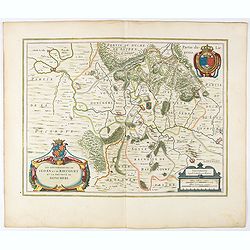
Les Souverainetez de Sedan et de Raucourt.. Doncheri.
A very decorative map with beautiful large cartouches of a province of France by one of the most famous map publishers. From early on Willem Jansz. Blaeu aimed of publis...
- $230 / ≈ €215
Place & Date: Amsterdam, 1644
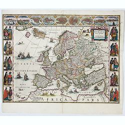
Europa recens descripta à Guilielmo Blaeuw.
On either side columns depicting the manner of dress in the major countries of Europe, surmounted by nine city views and plans.For European mapmakers their own continent ...
Place & Date: Amsterdam, 1644















![[Lot of 14 maps of Germany] Nova Totius Germaniae Descriptio.](/uploads/cache/19045-(3)-250x250.jpg)
