Browse Listings in Australia & Oceania > Oceania
Carte de la Mer comprise entre l'Australie, la Nelle. Zélande et la Nelle.
Sea chart of the Pacific Ocean between Australia, New Zealand and New Caledonia. Including the towns of Sydney, Brisbane. The northern tip of New Zealand in lower right c...
- $350 / ≈ €328
Place & Date: Paris, 1872 updated for 1888
[Australia and Polynesia].
Alexey Afinogenovich Ilyin was a lieutenant general and cartographer (1832-1889). In 1856, after graduating from the Academy of the General Staff, he was at the military ...
- $150 / ≈ €140
Place & Date: St. Petersburg, 1899
Principaux archipels d'Oceanie.
Detailed folding map of seven principal island groups in the South Pacific represented at various scales. The number and title are also on the outside front of the sheet....
- $120 / ≈ €112
Place & Date: Paris, ca. 1930
Hammond's War Map.
Drawn and published in early 1942 by C. S. Hammond & Co. in direct response to the bombing of Pearl Harbour, this is one of the most detailed USA maps of the Pacific ...
- $200 / ≈ €187
Place & Date: New York, 1943
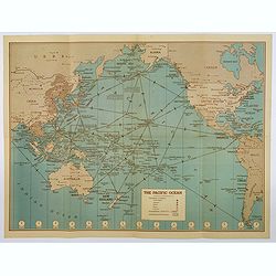
[Set of two maps of the Pacific Ocean with transportation lines, with Ottoman script]
Two post card size maps showing the Pacific Ocean with transportation lines. The maps are in Ottoman script prepared by Mehmet EŞREF in a small atlas : ...
- $200 / ≈ €187
Place & Date: Istanbul, Şirket-i Mürettibiye ve Karacoğlu Matbaas&#

![[Australia and Polynesia].](/uploads/cache/46141-250x250.jpg)


![[Set of two maps of the Pacific Ocean with transportation lines, with Ottoman script]](/uploads/cache/44327-250x250.jpg)