Browse Listings in Australia & Oceania
Nouvelle-Hollande. Oui-Re-Kine. [plate XXI]
A portrait of a female aboriginal residing in Sydney.After the original sketches by Lesueur, from Voyage de découvertes aux terres Australes by François Péron, 1824.Th...
- $100 / ≈ €94
Place & Date: Paris, 1824
Nouvelle-Hollande: Nouvelle Galles du Sud. Navigation. [plate XXIII]
Aboriginal boats, used for hunting and water transportationAfter the original sketches by Lesueur, from Voyage de découvertes aux terres Australes by François Péron, 1...
- $100 / ≈ €94
Place & Date: Paris, 1824
Phisique. [plate XL]
Some scientific instruments for measuring the sea temperature at some depth. From Voyage de découvertes aux terres Australes by François Péron, 1824.The French expedit...
- $40 / ≈ €37
Place & Date: Paris, 1824
Terre de Diemen. Habitations. [plate XV].
An aboriginal camp fire, near the ruins of an old wooden fence, and a dead tree, after the original sketches by Lesueur, from Voyage de découvertes aux terres Australes ...
- $200 / ≈ €187
Place & Date: Paris, 1824
Terre de Diemen. Tombeaux des naturels. [plate XVI]
An aboriginal campfire, near the ruins of an old wooden fence, and a dead tree, after the original sketches by Lesueur, from Voyage de découvertes aux terres Australes b...
Place & Date: Paris, 1824
Nouvelle-Hollande. Gnoung-A-Gnougn-A, Mour-Re-Mour-Ga ( Dit Collins). [plate XVII]
A portrait of a male Tasmanian Aboriginal Gnoung-A-Gnougn-A, Mour-Re-Mour-Ga ( Dit Collins) by Lesueur, from Voyage de découvertes aux terres Australes by François Pér...
Place & Date: Paris, 1824
Nouvelle-Hollande: Nelle. Galles du sud - Navigation. [plate XXIII]
An aboriginal camp fire, with a pirogue and two men navigating , after the original sketches by Lesueur, from Voyage de découvertes aux terres Australes by François Pé...
Place & Date: Paris, 1824
Nouvelle-Hollande: Terre dEndracht - Cabane des naturels de la Presqu'Ile de Péron. [plate XXIV]
An aboriginal camp fire, after the original sketches by Lesueur, from Voyage de découvertes aux terres Australes by François Péron, 1824.The French expedition under Ni...
Place & Date: Paris, 1824
Nouvelle-Hollande: Ile King. - L'Eléphant -marin ou Phoque à trompe. [plate XXXII]
Plate illustrating seals by Lesueur, from Voyage de découvertes aux terres Australes by François Péron, 1824.The French expedition under Nicolas Baudin, was commission...
Place & Date: Paris, 1824
Nouvelle-Hollande Nelle Galles du sud. Vue d'une partie de la ville de Sydney capitale des Colonies Anglaises aux Terres Australes . . . [plate XXXVII]
Important view of Sydney Cove from Dawes Point looking eastward from Voyage de découvertes aux terres Australes by François Péron, 1824. This is one of the earliest de...
Place & Date: Paris, 1824
Nouvelle-Hollande: Ile Decrès. - Détails du Casoar de la Nouvelle Hollande. [plate XLL]
Plate illustrating Casoar, by Lesueur, from Voyage de découvertes aux terres Australes by François Péron, 1824.The French expedition under Nicolas Baudin, was commissi...
- $75 / ≈ €70
Place & Date: Paris, 1824
Plan de la partie sud des Iles Furneaux [with] Carte générale de la Partie Sud-Est de la Terre de Diémen . . .
Two maps on one sheet, on top a map of the southern portion of Cape Barren Island, Clarke Island, and islets in the southern part of the Furneaux Group.With in lower part...
Place & Date: Paris, 1824
Plan de la Baie Laplace [with] Esquisse du Port Western [with] Plan des Iles Forestier [with] Esquisse du Port Champagny.
Four maps on one sheet, Laplace Bay, Western Harbour, Forestier islands and Champagny Harbour, from Voyage de découvertes aux terres Australes by François Péron, 1824....
Place & Date: Paris, 1824
[ Ippah village New Zealand ].
Aquatint depicting a view of Ippah, a village built on a rock. Engraved by G.Castellini. Plate N° 66. From Giulio Ferrario's work Le Costume Ancien et Moderne ou Histoir...
- $100 / ≈ €94
Place & Date: Milan, 1827
[Papua New Guinea Inhabitants ].
Aquatint depicts three men in a pirogue engraved by Fumagalli. Plate N° 75. From Giulio Ferrario's work Le Costume Ancien et Moderne ou Histoire du gouvernement, de la m...
- $80 / ≈ €75
Place & Date: Milan, 1827
[The Admiralty Islands and New Britain inhabitants fishing. Papua New Guinea ].
Aquatint depicting fishermen in dugouts engraved by A. Biasioli. Plate N° 14. From Giulio Ferrario's work Le Costume Ancien et Moderne ou Histoire du gouvernement, de la...
- $75 / ≈ €70
Place & Date: Milan, 1827
[ Traditional tools from New Caledonia ].
Aquatint depicting a variety of traditional tools from New Caledonia engraved by Rossi. Plate N° 72. From Giulio Ferrario's work Le Costume Ancien et Moderne ou Histoi...
Place & Date: Milan, 1827
[New Caledonians ].
Aquatint depicting New Caledonians engraved by Biasioli. Plate N° 71. From Giulio Ferrario's work Le Costume Ancien et Moderne ou Histoire du gouvernement, de la milice,...
- $50 / ≈ €47
Place & Date: Milan, 1827
[Pirogues in the bay of the voyage of the Resolution. The Marquesas Islands ].
Aquatint depicting men in pirogues in the Bay of the Resolution from the Marquesas Islands engraved by Biasioli. Plate N° 91. HMS Resolution was a sloop of the Royal Nav...
- $50 / ≈ €47
Place & Date: Milan, 1827
[Marquesas Islands headdresses and head ornaments ].
Aquatint depicting Marquesas Islanders in traditional headdresses and a variety of head ornaments engraved by Bonatti. Plate N° 90. From Giulio Ferrario's work Le Costum...
- $50 / ≈ €47
Place & Date: Milan, 1827
[Easter Island inhabitants ].
Aquatint depicting 2 portraits of Easter Island inhabitants and 2 men rowing in a pirogue. Engraved by Carlo Bottigella. Plate N° 88. From Giulio Ferrario's work Le Cost...
- $80 / ≈ €75
Place & Date: Milan, 1827
[Women dancing in a Ulietea house ].
Aquatint depicting women dancing in front of musicians and local villagers in a Ulietea house. Plate N° 87. From Giulio Ferrario's work Le Costume Ancien et Moderne ou H...
- $50 / ≈ €47
Place & Date: Milan, 1827
[Tahitian warrior dugouts ].
Aquatint depicting a view of Tahitian warrior dugouts engraved by Fumagalli. Plate N° 86. From Giulio Ferrario's work Le Costume Ancien et Moderne ou Histoire du gouvern...
- $50 / ≈ €47
Place & Date: Milan, 1827
[Tahitian tools ].
Aquatint depicting a variety of Tahitian tools engraved by Rivelanti. Plate N° 85. From Giulio Ferrario's work Le Costume Ancien et Moderne ou Histoire du gouvernement, ...
- $50 / ≈ €47
Place & Date: Milan, 1827
Mortuary scene. Tahiti Islands ].
This aquatint depicts a mortuary scene in front of a tapapow, a shed under which the dead bodies remains are exposed until they dry. Engraved by Roffi. Plate N° 83. From...
- $50 / ≈ €47
Place & Date: Milan, 1827
[Queen Obera welcoming Captain Wallis. Tahiti ].
Aquatint depicting Queen Obera welcoming Captain Wallis upon his arrival in Tahiti. Engraved by Gallina. Plate N° 82. From Giulio Ferrario's work Le Costume Ancien et Mo...
- $50 / ≈ €47
Place & Date: Milan, 1827
[The Friendly Islands ].
Aquatint depicting seashore scene of the Friendly Islands. These islands are also known as the Friendly Islands because of the friendly reception accorded to Captain Cook...
- $50 / ≈ €47
Place & Date: Milan, 1827
[Portraits. Friendly Islands ].
Aquatint depicting inhabitants of the Friendly Islands. Plate N°79. From Giulio Ferrario's work Le Costume Ancien et Moderne ou Histoire du gouvernement, de la milice, d...
- $50 / ≈ €47
Place & Date: Milan, 1827
[Scene of a meeting. The Friendly Islands ].
Aquatint depicting an indoor meeting in the Friendly Islands. Plate N°79. From Giulio Ferrario's work Le Costume Ancien et Moderne ou Histoire du gouvernement, de la mil...
- $75 / ≈ €70
Place & Date: Milan, 1827
Océanie ou Australasie et Polynesie . . .
Detailed map of Oceania, prepared by A. H. Basset, rue Saint-Jacques, no. 64, Paris and published in Atlas classique et Universel de Géographie . . . .The engraver of th...
- $150 / ≈ €140
Place & Date: Paris, A.H. Basset, 1828
Carte générale de l'océan pacifique. . .
depicting the Pacific Ocean, with nice detail of Hawaii. With a complete outline for Australia and Tasmania. Shows the south east Asian region and South America.Mapping ...
Place & Date: Paris, 1833
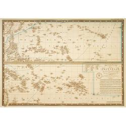
Carte particuliere de la Polynesie. . .
Prepared by A.Brué in 1826 and published by Charles Piquet. Two maps on one sheet, showing the Polynesian islands. In upper left an inset map of Formosa and the coast o...
- $150 / ≈ €140
Place & Date: Paris, 1834
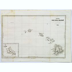
Carte des Iles Hawaii.
A lovely small map of the complete chain of Pacific islands known today as the Hawaiian islands, from Dumont d'Urville's atlas "Voyage pittoresque autour du Monde.&q...
Place & Date: Paris, 1834
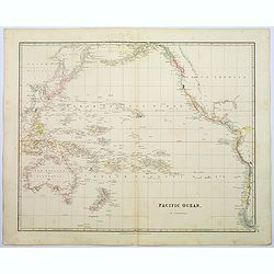
Pacific Ocean.
A wonderfully laid out map of the region, displaying the many island groups that make up this fascinating part of the world. The region is separated into parts, the South...
Place & Date: London, 1839
Oceana or Pacific Ocean.
A lovely detailed map of the Pacific, centered on Hawaii, from an early edition of Tanner's New Universal Atlas. From Russian America (AK) to Patagonia, and from New Zeal...
- $100 / ≈ €94
Place & Date: Philadelphia, ca 1840
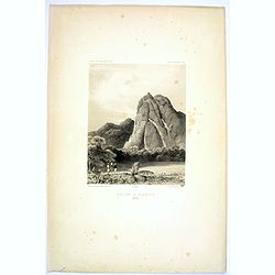
Montagne de la Manchiri.
Lithograph of the Montagne de la Manchiri in Papua New Guinea. It shows Breton, the artist on Dumont D'urville's voyage setting up a camera obscura in the foreground. Pla...
Place & Date: Paris, 1842
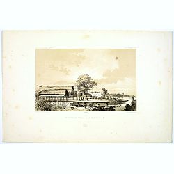
Pecheurs de Tripang a la Baie Raffles.
Fine lithograph of Javanese fishermen in the Bay of Raffles. Located at the eastern end of the Cobourg Peninsula, Raffles Bay was the site of the second abortive attempt ...
Place & Date: Paris, 1842
Entrée de la Riviere de Paiou.
A lithograph showing the entrance to the river Paiou on Vanikoro Island, a part of the Santa Cruz Group and the Solomon Islands in the Pacific. Plate 97 taken from the 'V...
- $50 / ≈ €47
Place & Date: Paris, 1842
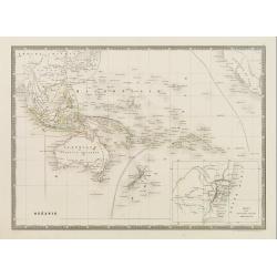
Océanie.
Detailed map of Oceania, including Indonesia and the Pacific Ocean with Hawaii, prepared by Charles V. Monin (fl.1830-1880) a French cartographer of Caen and Paris. Publi...
- $50 / ≈ €47
Place & Date: Paris, 1845
Oceanie. [Manuscript on paper]
Decorative manuscript map on paper covering South East Asia, Australia and New Zealand.
Place & Date: France ?, ca. 1850
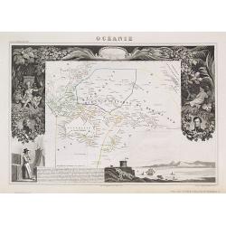
Océanie.
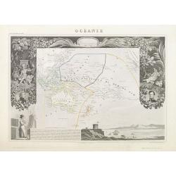
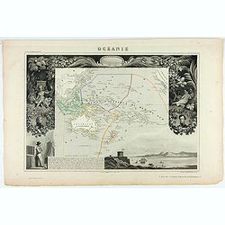
A very decorative 19th century map of the Pacific Ocean, with hand colored lines indicating the extent of Polynesia, Mirconesia, Melanesia, and Malaysia (or Southeast Asi...
Place & Date: Paris, 1850
Océanie.
A very decorative 19th century map of the Pacific Ocean, with hand colored lines indicating the extent of Polynesia, Micronesia, Melanesia, and Malaysia (or Southeast Asi...
Place & Date: Paris, 1850
Océanie.
A very decorative 19th century map of the Pacific Ocean, with hand colored lines indicating the extent of Polynesia, Micronesia, Melanesia, and Malaysia (or Southeast Asi...
- $120 / ≈ €112
Place & Date: Paris, 1850
Océanie.
A very decorative 19th century map of the Pacific Ocean, with hand colored lines indicating the extent of Polynesia, Micronesia, Melanesia, and Malaysia (or Southeast Asi...
- $200 / ≈ €187
Place & Date: Paris, 1850
Part of South Australia.
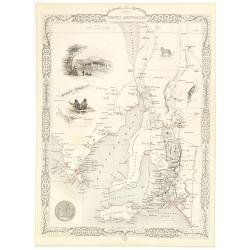
Decorative steel engraved map of part of South Australia, surrounded by illustrations of Adelaide, natives on a catamaran, an Australian dog and a nymphicus bird illustra...
Place & Date: London, ca. 1851
New South Wales.
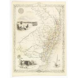
Decorative steel engraved map of New South Wales, surrounded by illustrations of Sydney Cove, native trees and the seal of New South Wales. Interlocking border design. Ta...
Place & Date: London, ca. 1851
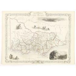
Victoria or Port Phillip.
Decorative steel engraved map of Victoria or Port Phillip, surrounded by illustrations of Melbourne, indigenous people and the Glenelg River. Interlocking border design. ...
Place & Date: London, ca. 1851
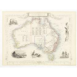
Australia.
Decorative steel engraved map of Australia, surrounded by illustrations of Sydney harbor, birds, kangaroos and local people. Interlocking border design. Taken from "...
Place & Date: London, ca. 1851
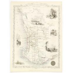
Western Australia. Swan River.
Decorative steel engraved map of part of Western Australia and Swan River, surrounded by illustrations of Perth, Aborigines and sheep shearing. With the seal of Western A...
- $300 / ≈ €281
Place & Date: London, ca. 1851
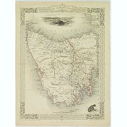
Van Diemen's Island or Tasmania.
Decorative steel engraved map of Tasmania. Taken from "The illustrated atlas and modern history of the world by John Tallis", published between 1849 and 1853. T...
- $225 / ≈ €211
Place & Date: London, 1851
Polynesia or Islands in the Pacific Ocean.
Decorative and attractive map of the Islands in the Pacific Ocean. The map extent shows parts of California, Papua New Guinea, eastern Australia, and southern Japan.The m...
- $175 / ≈ €164
Place & Date: London ,1851
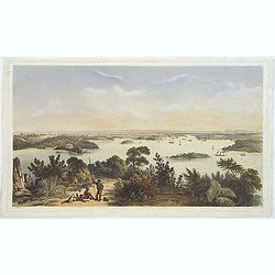
(The City And Harbour Of Sydney From Near Vaucluse.)
One of the most sought after views of the city and harbour of Sydney seen from Near Vaucluse, 1852. Magnificent hand-colored tinted lithograph and finished by gum-Arabic....
Place & Date: London, J. Hogarth, 1852
[Collection of six maps of Australia and New Zealand.]
Collection of maps including 6 engraved maps by 19th century German, French and English cartographers depicting Australia and New Zealand.This made to order atlas contain...
Place & Date: Germany, 1832-1852
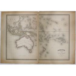
Océanie dressée par A.H. Dufour géographe.
Wall-sized map (87x117cm) in two sheets prepared by Adolphe Hippolyte Dufour, giving good detail to Australia and New Zealand, due to extensive discoveries of the French ...
- $1200 / ≈ €1123
Place & Date: Paris, 1854
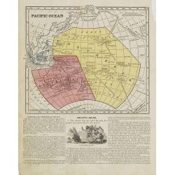
Pacific Ocean.
Map of the Pacific Ocean with its Polynesian islands, and New Zealand and Australia. From Sidney E. Morse''s: System of Geography for the use of schools , published by Ha...
- $30 / ≈ €28
Place & Date: New York, 1855
La Polinesia Francese.
Uncommon map of French Polynesia prepared by Francesco Costantino Marmocchi. Above the map "Geografia Commerciale". From "Il Globo Atlante di carte Geograf...
Place & Date: Genova, Paolo Rivara fu Giacomo, 1858
Oceania.
Uncommon map of Pacific ocean prepared by Francesco Costantino Marmocchi. Above the map "Geografia Commerciale". From "Il Globo Atlante di carte Geografich...
- $50 / ≈ €47
Place & Date: Genova, Paolo Rivara fu Giacomo, 1858
La Nuova Galles del Sud (Australia sud-est) La Diemenia e La Nuova Zelanda (Polinesia).
Uncommon map of East Coast of Australia and New Zealand prepared by Francesco Costantino Marmocchi. Above the map "Geografia Commerciale". From "Il Globo ...
Place & Date: Genova, Paolo Rivara fu Giacomo, 1858
Carta Generale dell' Oceania ossia quinta parte del mondo.
Attractive original outline color large map of the whole of Oceania covering South East Asia, the many and various groups of Pacific Islands, Australia and New Zealand pr...
- $175 / ≈ €164
Place & Date: Turin ca. 1860
Les divers archipels de L'Oceanie.
Very detailed map from Atlas Sphéroïdal & Universel de geographie , Prepared by F.A.Garnier and edited by Jules Renouard, rue de Tournon, Paris. Uncommon map with d...
- $150 / ≈ €140
Place & Date: Paris, 1861
Océanie.
Detailed map of Australia, New Zealand, Indonesia and the Pacific. With a color key indicating English, French, Dutch, Spanish and Portuguese possessions in the region. F...
- $100 / ≈ €94
Place & Date: Paris, 1865
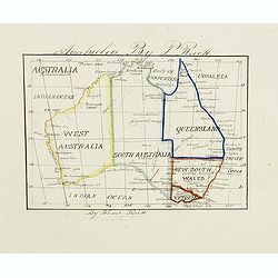
Australia by P.Rivett.
Manuscript map of Australia without Tasmania, prepared by Palmer Rivett, who was born around 1858 in Blundeston, Suffolk, England, where he spent most of his life. He was...
Place & Date: c. 1860-1870
New Zealand 1870
Manuscript map of new Zealand, signed in lower border "By Ernst Pivett. Perhaps a school exercise map.
- $200 / ≈ €187
Place & Date: London, ca. 1870
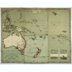
Australien, von E. van Sÿdow.
Large School wall map of Australia and New Zealand, including some islands in the Pacific, including Hawaii. Prepared by Emil von Sydow (1812 - 1873), who was a Prussian ...
- $1000 / ≈ €936
Place & Date: Gotha, H. Kiepert, 1873
New Zealand.
A detailed lithographed map of New Zealand. With in upper left corner inset-map of Western Australia and in lower right hand corner a map of Van Diemens Land. Published b...
- $100 / ≈ €94
Place & Date: Edinburg, 1874
Océanie.
In lower right hand corner a view of Nouméa. Showing the Pacific including California. Engraved by L.Smith.
- $90 / ≈ €84
Place & Date: Paris, 1874
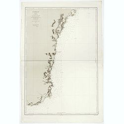
Australie (Côte Est) Feuille N°10 Partie comprise entre La Baie Jervis et le Cap Everard . . .
Large French sea chart featuring the eastern coast of Australia. Engraved by J.Millian. The chart is based on surveys by the British Captn. F.W. Sidney, Staff Comr., H.J....
- $750 / ≈ €702
Place & Date: Paris, 1874
Océanie dresée par C.V.Monin.
Fine and uncommon map including Australia, New Zealand, Indonesia, with inset maps of New Zealand, Victoria/New South Wales and Western Australia including Albany and Per...
- $150 / ≈ €140
Place & Date: Paris, 1875
Nouvelle carte de l'Océanie dressée d'après les documents les plus récents par A. Vuillemin, géographe.
Very large, highly detailed and uncommon map of the Pacific with Australia and New Zealand, with inset map of "Partie de l'Australie (Nouvelle Galles du Sud) et Vict...
Place & Date: Paris, 1876
Océanie.
Decorative map of the Pacific Ocean including Indonesia, Australia, New Zealand and California. Lower right inset map Détails de la Nouvelle Galles Méridionale , includ...
- $120 / ≈ €112
Place & Date: Paris 1880
Océanie.
Small map of Australia, New Zealand and the Pacific. The area is divided in different parts. Lithographed by C.Callewaert from Brussels.
- $80 / ≈ €75
Place & Date: Bruxelles, c. 1880
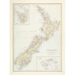
New Zealand.
Very detailed map of New Zealand, with inserts of Tasmania and Fiji Islands. The map was printed from lithographic stones taken from a hand-engraved steel plate. The cart...
- $150 / ≈ €140
Place & Date: Edinburg, ca 1881
New Zealand (with Environs of Auckland)
Striking map of New Zealand, with a large inset map of the environs of Auckland. Made by J. Bartholomew. NO. 66 in lower right corner.
- $200 / ≈ €187
Place & Date: Glasgow, London, 1882
[2 Sheets] Carte Générale de l'Océan Pacifique Dressée Par Mr. C. A. Vincendon-Dumoulin. . . Pl. 1. N° 1092. / Ocean Pacifique Feuille 2. . . Pl. 2. N° 1093.
Two sea charts depicting the Pacific Ocean, with nice detail of Hawaii. Sheet 1 shows the south east Asian region. The second North America and part of South America. Pre...
- $900 / ≈ €842
Place & Date: Paris, 1845, updated for 1884
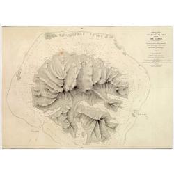
Océan Pacifique. Archipel de la Société. Iles Raiatea et Tahaa. 1ère Feuille. Ile Tahaa..
Large scale chart focused on the island Tahaa, in French Polynesia.Showing a few details of the village of Tahaa, banks, isles and soundings made in meters. Relief is sho...
- $200 / ≈ €187
Place & Date: Paris, 1885
ILE UVEA CROQUIS DES BAIES DE MUA ET DE MATA UTU.
Mata-Utu is the capital of Wallis and Futuna, an overseas collectivity of France. It is located on the island of Uvéa, in the district of Hahake, of which it is also the...
- $80 / ≈ €75
Place & Date: Paris, 1887
Carte de la Mer comprise entre l'Australie, la Nelle. Zélande et la Nelle.
Sea chart of the Pacific Ocean between Australia, New Zealand and New Caledonia. Including the towns of Sydney, Brisbane. The northern tip of New Zealand in lower right c...
- $350 / ≈ €328
Place & Date: Paris, 1872 updated for 1888
New Guinea. Map illustrating Sir. w. Macgregor's route to the Owen Stanley Range 1889.
Map illustrating Sir. w. Macgregor's route to the Owen Stanley Range 1889. With inset map of South-East New Guinea.Fine colored lithograph map lithographed by Turner &...
- $50 / ≈ €47
Place & Date: London, Edward Stanford, 1890
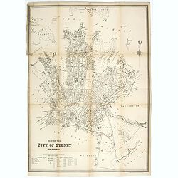
Map of the city of Sydney. New South Wales.
Early street plan of the city of Sydney, showing parishes, municipalities, buildings, public parks and recreation reserves. Lithographed and published by the dept of Land...
- $2000 / ≈ €1871
Place & Date: Sydney, 1895
![Nouvelle-Hollande. Oui-Re-Kine. [plate XXI]](/uploads/cache/40110-250x250.jpg)
![Nouvelle-Hollande: Nouvelle Galles du Sud. Navigation. [plate XXIII]](/uploads/cache/40112-250x250.jpg)
![Phisique. [plate XL]](/uploads/cache/40124-250x250.jpg)
![Terre de Diemen. Habitations. [plate XV].](/uploads/cache/46278-250x250.jpg)
![Terre de Diemen. Tombeaux des naturels. [plate XVI]](/uploads/cache/46279-250x250.jpg)
![Nouvelle-Hollande. Gnoung-A-Gnougn-A, Mour-Re-Mour-Ga ( Dit Collins). [plate XVII]](/uploads/cache/46280-250x250.jpg)
![Nouvelle-Hollande: Nelle. Galles du sud - Navigation. [plate XXIII]](/uploads/cache/46345-250x250.jpg)
![Nouvelle-Hollande: Terre dEndracht - Cabane des naturels de la Presqu'Ile de Péron. [plate XXIV]](/uploads/cache/46346-250x250.jpg)
![Nouvelle-Hollande: Ile King. - L'Eléphant -marin ou Phoque à trompe. [plate XXXII]](/uploads/cache/46354-250x250.jpg)
![Nouvelle-Hollande Nelle Galles du sud. Vue d'une partie de la ville de Sydney capitale des Colonies Anglaises aux Terres Australes . . . [plate XXXVII]](/uploads/cache/46359-250x250.jpg)
![Nouvelle-Hollande: Ile Decrès. - Détails du Casoar de la Nouvelle Hollande. [plate XLL]](/uploads/cache/46362-250x250.jpg)
![Plan de la partie sud des Iles Furneaux [with] Carte générale de la Partie Sud-Est de la Terre de Diémen . . .](/uploads/cache/46365-250x250.jpg)
![Plan de la Baie Laplace [with] Esquisse du Port Western [with] Plan des Iles Forestier [with] Esquisse du Port Champagny.](/uploads/cache/46372-250x250.jpg)
![[ Ippah village New Zealand ].](/uploads/cache/25857-250x250.jpg)
![[Papua New Guinea Inhabitants ].](/uploads/cache/26364-250x250.jpg)
![[The Admiralty Islands and New Britain inhabitants fishing. Papua New Guinea ].](/uploads/cache/26365-250x250.jpg)
![[ Traditional tools from New Caledonia ].](/uploads/cache/26366-250x250.jpg)
![[New Caledonians ].](/uploads/cache/26367-250x250.jpg)
![[Pirogues in the bay of the voyage of the Resolution. The Marquesas Islands ].](/uploads/cache/26373-250x250.jpg)
![[Marquesas Islands headdresses and head ornaments ].](/uploads/cache/26374-250x250.jpg)
![[Easter Island inhabitants ].](/uploads/cache/26375-250x250.jpg)
![[Women dancing in a Ulietea house ].](/uploads/cache/26376-250x250.jpg)
![[Tahitian warrior dugouts ].](/uploads/cache/26377-250x250.jpg)
![[Tahitian tools ].](/uploads/cache/26378-250x250.jpg)
![Mortuary scene. Tahiti Islands ].](/uploads/cache/26380-250x250.jpg)
![[Queen Obera welcoming Captain Wallis. Tahiti ].](/uploads/cache/26381-250x250.jpg)
![[The Friendly Islands ].](/uploads/cache/26384-250x250.jpg)
![[Portraits. Friendly Islands ].](/uploads/cache/26385-250x250.jpg)
![[Scene of a meeting. The Friendly Islands ].](/uploads/cache/26386-250x250.jpg)






![Oceanie. [Manuscript on paper]](/uploads/cache/01830-250x250.jpg)


![[Collection of six maps of Australia and New Zealand.]](/uploads/cache/48412-250x250.jpg)









![[2 Sheets] Carte Générale de l'Océan Pacifique Dressée Par Mr. C. A. Vincendon-Dumoulin. . . Pl. 1. N° 1092. / Ocean Pacifique Feuille 2. . . Pl. 2. N° 1093.](/uploads/cache/26731-250x250.jpg)
