Browse Listings in Asia
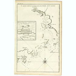
Carte particulière de l'entrée de Canton - Plan de Quang-tcheou-fou vulgo Canton .
Beautiful detailed map of the entrance to the city of Canton, showing also the cities of Macao and Quanghai, as well as the islands of the bay, including the island of Sh...
- $450 / ≈ €421
Place & Date: Paris, P.G. Le Mercier, 1735
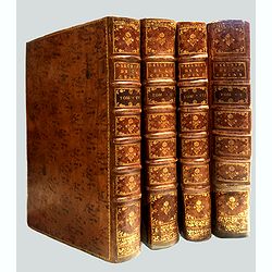
Description geographique, historique, chronologique, politique, et physique de l'empire de la Chine et de la Tartarie chinoise.
First edition of this cornerstone of any collection of books on China, which is also among the rarest and most desirable of important Americana, included in Rare American...
Place & Date: Paris, P. G. Le Mercier, 1735
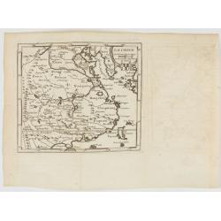
Province de Koei-Tcheou.
An important map of Koei-tcheou 贵州 [Guizhou]. With a quite elaborately pictorial cartouche featuring a rococo chinoiserie ornamentation engraved by Guélard, the map ...
- $100 / ≈ €94
Place & Date: Paris, P.G. Le Mercier, 1735
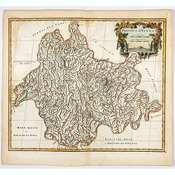
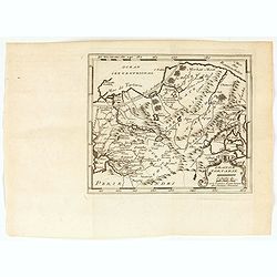
Province d'Yun-Nan.
Important map of Yun-nan 云南 [Yunnan] province. With a quite elaborately pictorial cartouche featuring a rococo chinoiserie ornamentation, engraved by Delahaye. Jean B...
- $75 / ≈ €70
Place & Date: Paris, P.G. Le Mercier, 1735
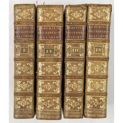
Description geographique, historique, chronologique, politique, et physique de l'empire de la Chine et de la Tartarie chinoise . . . du Thibet, & de la Coree. . .
Without the separately published atlas. Lacking 2 plates in vol.2 (Obseques at p.149 and Gin seng at p.180), one plate torn without a loss (vol.1, p.230), d4 vol.1 with a...
Place & Date: The Hague, H. Scheurleer, 1736
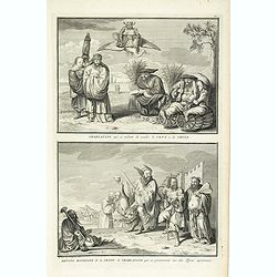
Charlatans qui se mêlent de vendre le vent de la Chine. Dévots mendiants de la Chine et charlatans qui se promènent sur des tigres apprivoisés, . . .
Two fascinating engraving on one sheet depicting Chinese charlatans. Engraved by Bernard Picart. Published in Jean Frederic Bernard's monumental "Cérémonies et cou...
- $150 / ≈ €140
Place & Date: Amsterdam, J.F. Bernard c.1736
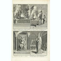
Idole que les chinois appellant, le dieu de l´immortalité, et qu´ils disent presider a leur Fortune. . .
Four fascinating engraving on one sheet depicting Chinese gods. "Idole que les chinois appellant, le dieu de l´immortalité, et qu´ils disent presider a leur Fortu...
- $150 / ≈ €140
Place & Date: Amsterdam, J.F. Bernard c.1736
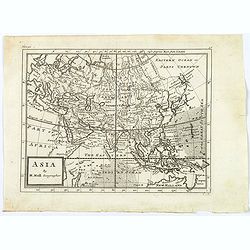
Asia By H.Moll Geographer.
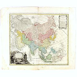
Detailed map of Asia. From his "Atlas minor: or a new and curious set of sixty-two maps. . .", which was first published in 1729 and reprinted in 1732, 1736.The...
Place & Date: London, 1736
Carte la plus generale et qui comprend la Chine, la Tartarie chinoise et le Thibet. . .
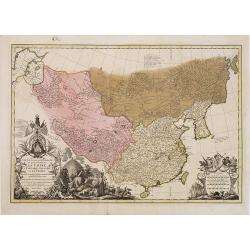
With a quite elaborately pictorial cartouche, engraved by G.Kondet. Very detailed map of China, Tibet and Korea.Jean Baptiste Bourguignon d' Anville (1697-1782), French c...
Place & Date: The Hague, 1737
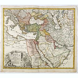
Imperium Turcicum in Europa, Asia et Africa Regiones proprias, tributarias, clientelares sicut et omnes eusdem Beglirbegatus seu Præfecturas Generales exhibens. . .
Johann Baptist Homann's well-engraved map of the Ottoman Empire. With fine decorative title cartouche. Johann Baptist Homann (1663-1724) was a German engraver and publish...
- $750 / ≈ €702
Place & Date: Nurnberg, 1737
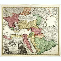
Imperium Turcicum in Europa, Asia et Africa.
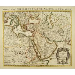
Johann Baptist Homann's well-engraved map of the Turkish Empire, showing from Tunis to Arabia, including Greece, Arabia, Turkey and Palestine. With good detail in the Ara...
- $900 / ≈ €842
Place & Date: Nurnberg, 1737
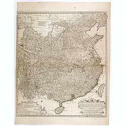
Carte générale de la Chine Dressée sur les Cartes particulières que l'Empereur Cang-hi a fait lever sur les lieux par les RR. PP. Jésuites missionaires dans cet empire / Par le Sr d'Anville.
Important and very detailed map of Southern part of China, including a detailed Taiwan. Jean Baptiste Bourguignon d' Anville (1697-1782) was a French cartographer and com...
- $1000 / ≈ €936
Place & Date: The Hague, H. Scheurleer, 1737
Royaume de Corée.
With a quite elaborately pictorial cartouche, engraved by G.Kondet. One of the earliest separate maps of Korea. Jean Baptiste Bourguignon d' Anville (1697-1782), French c...
Place & Date: The Hague, 1737
Province de Fo-Kien. [Includes West Coast of Taiwan]
Important map of Fujian Province, showing the east coast of China and the west coast of Taiwan. It shows that for the Manchu Qing, only the western half of Formosa was co...
Place & Date: The Hague, H. Scheurleer, 1737
Nouvel atlas de la Chine, de la Tartarie chinoise, et du Thibet.
First edition of "the principal cartographic authority on China during the 18th century". It was the second major atlas of China produced in Europe following th...
Place & Date: The Hague, H. Scheurleer, 1737
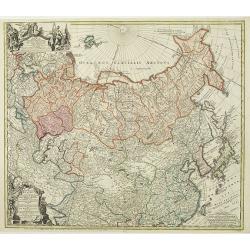
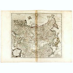
Imperii Russici et Tartariae Universae tam majoris Afiaticæ quam minoris et EuropæTabula.
The map is of interest for the use of Mere Orientale Minus Corea for the sea between Korea and Japan.Decorative map covering Russia, Tibet, China, Tartary, Korea, Taiwan ...
Place & Date: Nuremberg, 1739
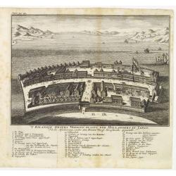
'T Eilandje Desima verblyf plaats der Hollanders in Japan.
Bird's-eye view of Dejima copied from a manuscript by Voogt, who was second-in-command on Deshima in 1713. The island is viewed from the landside, depicting the developme...
Place & Date: Amsterdam, 1739
La Chine.
A very nice map of China, including Korea and Taiwan. From Francisco Giustiniani for El Atlas abreviado o el nuevo compendio de la Geografia universal, politica, historic...
- $300 / ≈ €281
Place & Date: Leon de Francia (Lyon), Jaime Certa, 1739
Presqu'Isle de l'inde deça le Golfe du Gange/Presqu'Isle de l'Inde dela le Golfe du Gange.
Two maps on one sheet, one depicting India, Sri Lanka and the Maldives Islands (13,5 x 8 cm) and the otherone Cambodia, Thailand, Singapore and Malaysia (13,5 x 8 cm). F...
- $300 / ≈ €281
Place & Date: Leon de Francia (Lyon), Jaime Certa, 1739
Asiae.
A very nice map of Asia. From Francisco Giustiniani for El Atlas abreviado o el nuevo compendio de la Geografia universal, politica, historica, i curiosa, segun el estado...
- $300 / ≈ €281
Place & Date: Leon de Francia (Lyon), Jaime Certa, 1739
(Arabian peninsula, Turkey, Irak).
A very nice map of the Arabian peninsula, Turkey and Irak. From Francisco Giustiniani for El Atlas abreviado o el nuevo compendio de la Geografia universal, politica, his...
- $150 / ≈ €140
Place & Date: Leon de Francia (Lyon), Jaime Certa, 1739
Grande Tartarie.
A very nice map of Tartaria extending from the Caspian Sea to the Pacific Ocean. From Francisco Giustiniani for El Atlas abreviado o el nuevo compendio de la Geografia un...
- $150 / ≈ €140
Place & Date: Leon de Francia (Lyon), Jaime Certa, 1739
Mogol.
A very nice map of Northern India and Pakistan. From Francisco Giustiniani for El Atlas abreviado o el nuevo compendio de la Geografia universal, politica, historica, i c...
- $150 / ≈ €140
Place & Date: Leon de Francia (Lyon), Jaime Certa, 1739
Perse.
A very nice map of Persia. From Francisco Giustiniani for El Atlas abreviado o el nuevo compendio de la Geografia universal, politica, historica, i curiosa, segun el esta...
- $150 / ≈ €140
Place & Date: Leon de Francia (Lyon), Jaime Certa, 1739
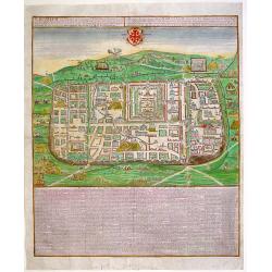
JERUSALEM, cum suburbiis..
Bird's eye perspectives town-plan of Jerusalem. Lower part of print an extensive numbered key (1-254) to principal buildings in town. Title in Latin and German. The print...
- $2250 / ≈ €2105
Place & Date: Augsburg, 1740
Carte de L'Egypte de la Nubie de L'Abissinie..
Prepared by G.de l'Isle. Uncommon issue by Hendrik de Leth. Very detailed map of northeastern Africa, the Red Sea and the Arabian peninsula shows the political divisions ...
- $500 / ≈ €468
Place & Date: Amsterdam 1740
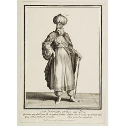
Emir Fechrredin prince des Drus.
Engraving published by Nicolas Bonnart (c.1637 - 1718), engraver in Augsburg since 1719. Before the nineteenth century portraits of rulers in the Islamic Middle East were...
Place & Date: Paris, ca. 1740
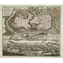
Prospectus Sanctae olim.. Hierosolymae.. Jerusalem. . .
Two bird's eye perspectives views of Jerusalem. Each with an extensive numbered key to principal buildings in town. Title in Latin and German. The print is published by M...
- $3000 / ≈ €2807
Place & Date: Augsburg, 1740
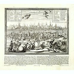
Constantinopolis Constantinopel.
Very rare and decorative panoramic view of Istanbul prepared by Friedrich Berhard Werner and published by Martin Engelbrecht. The engraving is done by Johann Georg Ringli...
- $3500 / ≈ €3275
Place & Date: Augsburg, M.Engelbrecht, ca.1730-1740
Estats de L'Empire du Grand Seigneur dit Sultan et Ottomans Empereur des Turcs. . .
The map shows the extent of the Ottoman Empire from the Balkans to Persia, including all of Arabia and North Africa (an inset map at lower left shows the continuation of ...
- $150 / ≈ €140
Place & Date: Amsterdam, 1740
Carta nuova dell'Arabia.
Detailed map of Arabia and environs. Based on a map published by Isaak Tirion in Amsterdam, but here issued by Albrizzi with a modified title.More about Mapping of Arabia...
- $900 / ≈ €842
Place & Date: Venice, 1740
Nieuwe kaart van Arabia.
An attractive map of the Arabian Peninsula here called Gelukkig Arabia or Happy Arabia . The map has a great advance on other maps of the time by showing the true extent ...
Place & Date: Amsterdam, 1740
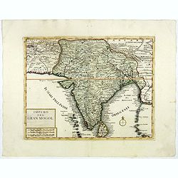
Impero del Gran Mogol.
A very fine map showing India divided into its regions with major towns and cities marked and also parts of its neighbouring kingdoms.
Place & Date: Venice, 1740
Nieuwe kaart van Arabia.
An attractive map of the Arabian Peninsula here called Gelukkig Arabia or Happy Arabia . The map has a great advance on other maps of the time by showing the true extent ...
- $1000 / ≈ €936
Place & Date: Amsterdam, 1740
Nuova carta dell Asia . . .
Attractive and detailed map of Asia showing good detail in China, Mongolia, Tibet, Kamchatka, Japan, Kuriles, Korea, Manchuria, Formosa, Philippines, Indonesia Borneo, Ne...
Place & Date: Venice, 1740
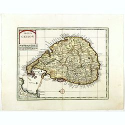
Isola Ceilon.
Attractive copper engraved map of Sri Lanka showing mountains, Towns and the Rama's Bridge (Ponte di Adamo). Included in "Atlante Novissimo che Contiene Tutte le Par...
Place & Date: Venice, 1740
Impero del Gran Mogol.
Attractive copper engraved map of India with Sri Lanka. Showing mountains, towns and the Rama's Bridge (Ponte di Adamo). Included in "Atlante Novissimo che Contiene ...
Place & Date: Venice, 1740
Nieuwe kaart van de Filippynsche, Ladrones, Moluccos of Specery Eilanden als mede Celebes etc.
Shows the western islands of the archipelago, Borneo, Java and Sumatra, up to and including New Guinea. With very good detail to Philippines.Read more Early maps of South...
Place & Date: Amsterdam, 1740
Novissima totius Terrae Sanctae sive promissionis. . .
Engraved by J.B.Homann and published by David Funck. One of the very few maps engraved by Johan Baptist Homann, signed lower right.A rare map of the Holy Land, orientated...
- $950 / ≈ €889
Place & Date: Nuremberg, 1742
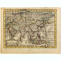
Kaartje van Asia. . .
Attractive and rare map of Asia. From Atlas Portatif . With a curious and oversized Hokkaido. The map is of interest for the use of Corease Zee for the sea between Korea ...
Place & Date: Deventer, 1742
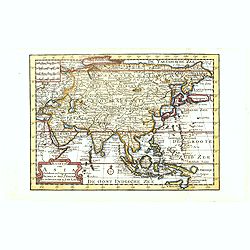
Kaartje van Asia. . .
Attractive and rare map of Asia. From Atlas Portatif . With a curious and oversized Hokkaido. The map is of interest for the use of Coreanse Zee for the sea between Korea...
Place & Date: Deventer 1742
La procession de Ganga/ La fête de Huly.
Two scenes on one page showing religious scenes, in Japan. Fine copper engraving by Bernard Picart and taken from Bernard Picart's famous Céréonies et costumes religieu...
- $30 / ≈ €28
Place & Date: Amsterdam, 1743
Judaea seu Palaestina .. Terra Sancta. . .
Johann Baptist Homann's well-engraved map has two large decorative cartouches. Upper left Moses receiving the Tables. Lower right Moses and Aaron pointing at a map showin...
- $1000 / ≈ €936
Place & Date: Nuremberg, 1744
Allerneuester geographisch- und topographischer Schau-Platz von Africa und Ost-Indien. . .
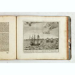
An early issue of this important book by Johann Wolfgang Heydt's describing the Dutch factories, settlements and stations at the hands of the Dutch East India Company in ...
Place & Date: Wilhermsdorf, Tetscher u. Nürnberg, Homanns Erben, 1744
ETATS DE MOSCOVIE.
A detailed map of the Russian Empire West to East from Poland, Finland to the Baring Strait and North to South from China to Spitzbergen. The Siberian coastline is based ...
Place & Date: Paris, 1744
Asia secundum legitimas projectionis stereographicae.
Highlighted area covers part of Spain, eastern coast of Ireland to western part of Papua New Guinea and the Asian continent from the Northern Polar Sea to the Indian Ocea...
Place & Date: Nurenberg, 1744
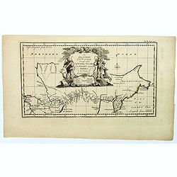
An exact chart of the countries through wich Capt. Behring travelled from Tobolsky capital of Siberia ti the country of Kamtschatka.
The earliest English language map to show Vitus Behring's Route.After retiring from a tour as Captain in the Czar's Navy, Behring, originally from Denmark, settled in Vyb...
- $200 / ≈ €187
Place & Date: London, 1744
Carte de la Turquie, de l'Arabie et de la Perse..
Large map of the Near East, based upon earlier maps by De L'Isle. Shows also most part of the Mediterranean basin as well as north-eastern Africa. Relief shown pictoriall...
Place & Date: Amsterdam c. 1745
Carte des Côtes de Malabar et de Coromandel Presentée au Roy. . .
Large and attractive map of the Indian coasts of Malabar and Coromandel, embellished with title cartouche and 2 compass roses. It shows the most northern part of Ceylon.T...
- $500 / ≈ €468
Place & Date: Amsterdam c. 1745
Plan de la Rade de Gedda situee de la Cote d'Arabie sur la Mer Rouge.
Chart of the area around city of Gedda in the Red Sea. D'Après De Mannevillette (1707-1780) was one of Franc's first hydrographers. When the first edition of his Atlas L...
- $600 / ≈ €561
Place & Date: Paris, 1745
Carte de la coste orientale de la Chine depuis Amoy, jusqu'à Chusan avec une partie de l'Isle Formose [with] Plan du port d'Amoy ou Emouy.
Important French chart of the China Sea with the coast of Northern China, including a large depiction of Formosa.Latitude and longitude scales, compass rose and system of...
Place & Date: Paris, Jean-François Robustel, 1745
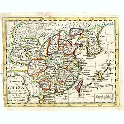
Het Keizerryk van China, volgens de Nieuwste Waarneminge opgesteld.
A scarce and uncommon miniature map of China, Korea and Taiwan. The map is of interest for the use of De Zuid Zee for the sea between Korea and Japan.
- $300 / ≈ €281
Place & Date: Amsterdam, 1745
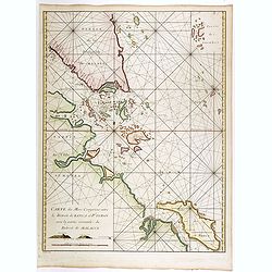
Nouvelle carte des mers comprises entre le détroit de Banca et P°. Timon avec la partie orientale du détroit de Malacca.
Important French chart of the tip of Malaysia with Singapore. Latitude and longitude scales, compass rose and system of rhumb lines, soundings near coast and in bay areas...
Place & Date: Paris, 1745
Carte réduite de l'archipel des Indes orientales avec les côtes du continent depuis le golfe de Manar jusqu'à Emoui à la Chine . . .
Important French chart of South East Asia with very good detail on Philippines. Latitude and longitude scales, compass rose and system of rhumb lines, soundings near coas...
Place & Date: Paris, 1745
Selling price: $3000
Sold in 2017
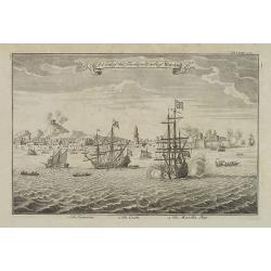
A view of the town and castle of Macao.
A nice engraving that shows the attack of the English ship "Centurion" on Macau, during which she captured a Portuguese ship that had sailed from Manila. In up...
Place & Date: London, 1746
Carte des Isles du Japon et la Presqu'Isle de Coree. . .
A fine map of the islands of Japan, including Korea, Taiwan and the coast of China till Macao.Embellished with fine baroque decorations. Bellin influenced other cartograp...
- $275 / ≈ €257
Place & Date: Paris, 1746
Das Kaiserthum China zur allgemeinen Historie der Reisen - entworfen von N. Bellin Ing. De la Mar. 1748.
Attractive and detailed map of China and Korea. The map is of interest for the use of Das Meer von Korea for the coast along the east coast of Korea. The composition is n...
- $500 / ≈ €468
Place & Date: Leipzig, Arkstee & Merkus, 1746
Karte von den Armen des Jeniséi in den Gegenden von Mangaséa Aus dem Gmélin.
Attractive and detailed map of Jenisëi River with the town of Mangasea in Siberia. The composition is nicely balanced with a large title and scale cartouche.
- $75 / ≈ €70
Place & Date: Leipzig, Arkstee & Merkus, 1746
Calmuk Tartars from Isbrant Ides [ together with] Tartars from Isbr. Ides.
Two engravings on one sheet, taken from "A New General Collection of Voyages and Travels", printed for Thomas Astley. Engraved by Thomas Kitchin and N.Parr afte...
- $40 / ≈ €37
Place & Date: London, 1746
Tartars of Koko Nor [ together with] Nothern Tartary Woman at Lafsa.
Two engravings on one sheet, taken from "A New General Collection of Voyages and Travels", printed for Thomas Astley. Engraved by Thomas Kitchin and N.Parr afte...
- $45 / ≈ €42
Place & Date: London, 1746
Uzbek Tartars [ together with] Eastern Tartars, from Nieuhof.
Two engravings on one sheet, taken from "A New General Collection of Voyages and Travels", printed for Thomas Astley. Engraved by Thomas Kitchin and N.Parr afte...
- $50 / ≈ €47
Place & Date: London, 1746
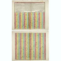
Tabula chronologica historiae Sinicae connexa cum cyclo qui vulgo Kia Tse dictur.
A set of two sheets of colored copper engravings. First published in 1729 in Rome in three sheets. Timeline of China's history with a chronological overview of the dynast...
- $1200 / ≈ €1123
Place & Date: Augsburg, 1746
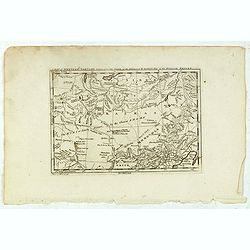
A Map of Western Tartary Drawn from the Survey of the Jesuits and Mr. Kyrillow's Map of the Russian Empire.
Uncommon map of the Gobi Desert and the eastern portion of the Silk Route region by Thomas Kitchin. Covers from Lake Baikal in the north as far south as Beijing, east to ...
- $110 / ≈ €103
Place & Date: London, 1745-1747
A Map of Little Bochara, and the Adjacent Countrys Drawn from the Survey of the Jesuits and Mr. Kyrillows Map of the Russian Empire.
An uncommon map of the Gobi Desert and Bochara region. Engraved by Thomas Kitchin - with his signature in the lower bottom.From Astley, Thomas, "A New General Collec...
- $110 / ≈ €103
Place & Date: London, 1745-1747
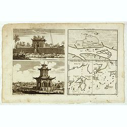
Chinese Temples. Sin-Ko-Tsyen. Canton, Sancian Isle. Ma-Kao.
An attractive print divided into four areas, two depicting Chinese temples and the other two with maps of the city of Canton, the island of Sancian and the island of Ma-K...
- $75 / ≈ €70
Place & Date: London, 1745-1747
Carte des Isles de Java, Sumatra, Borneo. . . Malaca et Banca. . . / Kaart van de Eilanden van Java. . .
Dutch edition of this map of Indonesia prepared by N. Bellin and published by Pierre d'Hondt in Amsterdam. Jaques Nicolas Bellin (1703-1772) was one of the most important...
- $400 / ≈ €374
Place & Date: Amsterdam, 1747
The Empire of Hya (including grear part of Tangul)...
Uncommon map of the Gobi Desert.Engraved by Thomas Kitchin - with his signature in lower bottom.From Astley, Thomas, "A New General Collections of Voyages and Travel...
- $100 / ≈ €94
Place & Date: London, 1745-1747
A map of Quan-Tong or Lyau-Tong province, and the kingdom of Kau-Li or Korea . . .
Detailed map of Korea, Liaodong, and the tip of Shandong Province prepared by Thomas Kitchin for Thomas Salmon's Universal Traveller, based on D'Anville's landmark map of...
- $600 / ≈ €561
Place & Date: London, 1747
Turquie Asiatique..
Small detailed map of the Near East, including Cyprus, the Black Sea and Georgie. From Atlas Portatif Universel, by Robert de Vaugondy.Page 65 outside border top right. M...
- $100 / ≈ €94
Place & Date: Paris, later than 1748
Afbeelding van all de Landen gelegen tusschen de Middellandsche, Zwarte, Caspische, Persische en Rode Zeën.
A map of the Near East, with an oversized Cyprus. From a Dutch bible published by Nicolaas Goetzee. Willem Albert Bachiene (1712-1783), Dutch geographer in Maastricht. Mo...
- $300 / ≈ €281
Place & Date: Gorichem, Nicolaas Goetzee, 1748
No title (Carte générale de l'empire de Russie).
The right hand sheet of a map of the Empire of Peter the Great.This important map is based on maps from the Bering expedition and on De L'Isle's Akademiia nauk Atlas of 1...
- $800 / ≈ €749
Place & Date: Amsterdam, ca.1748
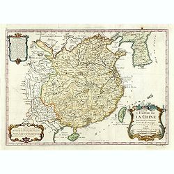
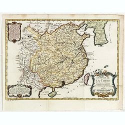
L'Empire de la Chine.
A fine map of China, Korea and Taiwan.Jacques Nicholas Bellin (1703-1772) was one of the most important and proficient French cartographers of the mid-eighteenth century....
- $450 / ≈ €421
Place & Date: Paris, 1748
L'Empire de la Chine. . .
A fine map of China, Korea and Taiwan.Jacques Nicholas Bellin (1703-1772) was one of the most important and proficient French cartographers of the mid-eighteenth century....
- $450 / ≈ €421
Place & Date: Paris, 1748
A plan of the Bay of MANILA. A plan of the harbour of Acapulco. A view of 2 of the Ladrone Islands.
The maps show two of the principal harbors of the Manila Galleon Trade, along with a profile view of the Ladrone Islands.In lower right corner "A plan of the Bay of ...
- $450 / ≈ €421
Place & Date: London, Paul Knapton, 1748
Carte de la Tartarie Occidentale.
Uncommon issue of this finely engraved map showing China's capital city of Peking inland from the Gulf of Lyau-tong. The map locates northeastern China to the border of R...
- $150 / ≈ €140
Place & Date: Amsterdam, 1749
Carte de la Tartarie Occidentale.
Uncommon issue of this finely engraved map shows China's capital city of Peking, inland from the Gulf of Lyau-tong.The map locates in northeastern China to the border of ...
- $100 / ≈ €94
Place & Date: Amsterdam, 1749
Nubie Abissinie et Cote d'Ajan.
Charming small map showing the Horn of Africa. Included are part of present-day Yemen and the coastline of Saudi Arabia along the Red Sea.From Atlas Portatif Universel, b...
- $100 / ≈ €94
Place & Date: Paris, 1749
Tartariae Sinensis mappa geographica ex Tabulis specialibus RRPP Iesuitarun nec non Relationibus R.P. Gerbillon / per Dom d'Anville, . . . primum A° 1732 nunc se Nunc secundum LL. projectionis . . . descripta per Tobiam Mayer
A very attractive map of Korea and Manchuria on the mainland and two islands of 'Ezo' and Sakhalin, prepared by Jean-Baptiste Bourguignon d'Anville (1697-1782) and Johann...
- $750 / ≈ €702
Place & Date: Nuremberg, 1749
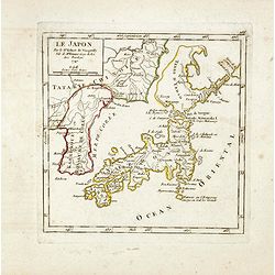
Le Japon.
The map is of interest for the use of Mer de Corée, for the sea between Korea and Japan. Small detailed map of Japan and Korea. Dated 1749. A note next to island &quo...
Place & Date: Paris, 1749
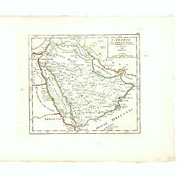
L'Arabie.
Small detailed map of the Arabian Peninsula. From Atlas Portatif Universel, by Robert de Vaugondy.Page 162 outside border top right.
Place & Date: Paris, later than 1749


![Province de Fo-Kien. [Includes West Coast of Taiwan]](/uploads/cache/43503-250x250.jpg)
















![Carte de la coste orientale de la Chine depuis Amoy, jusqu'à Chusan avec une partie de l'Isle Formose [with] Plan du port d'Amoy ou Emouy.](/uploads/cache/33583-250x250.jpg)



![Calmuk Tartars from Isbrant Ides [ together with] Tartars from Isbr. Ides.](/uploads/cache/36951-250x250.jpg)
![Tartars of Koko Nor [ together with] Nothern Tartary Woman at Lafsa.](/uploads/cache/36952-250x250.jpg)
![Uzbek Tartars [ together with] Eastern Tartars, from Nieuhof.](/uploads/cache/36953-250x250.jpg)
