Search Listings matching "sea-chart" in Asia
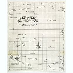
Carta prima Generale dell' Asia.
FIRST STATE of Robert Dudley's general chart of the Persian Gulf, going east through India to the southeastern coast of China showing Macau and the area of present-day Ho...
Place & Date: Florence, 1646
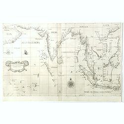
Carta terza Generale del' Asia.
Rare first state of this important chart showing part of the north coast of New Guinea and islands of the Pacific Ocean. To the north of Japan the landmass of Isola di Ie...
Place & Date: Florence, 1646
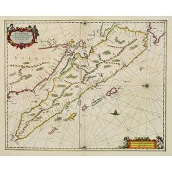
Sumatrae et insularum Locorumque nonnullorum circumiacentium. . .
Fine depicting the Island of Sumatra and the southern coasts of Malaysia from Quedo to Johore.North is orientated to the left of the page.Singapore is probably identifie...
Place & Date: Amsterdam, 1660
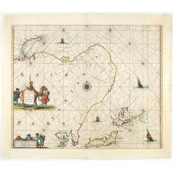
Noordoost Cust van Asia van Japan tot Nova Zembla.
Important for its early depiction of Hokkaido and the Islands to the North of Japan. Ships navigate the seas around the Siberian, Chinese and Japanese coast extending as ...
Place & Date: Amsterdam, 1666
Noordoost Cust van Asia van Japan tot Nova Zemla.
An eye-catching chart of Japan, Hokkaido and the Islands to the North of Japan. In the lower left Korea and part of northern China. Korea has three names mentioned: "...
- $2000 / ≈ €1760
Place & Date: Amsterdam, 1666
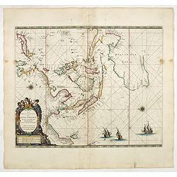
Paskaerte Zynde t'Oosterdeel Van Oost Indien, met alle de Eylanden daer ontrendt geleegen van C. Comorin tota aen Iapan.
An eye-catching chart of Pieter Goos' sea chart of Australia, Southeast Asia, China, Japan, Korea and India. The chart shows the regions from Cape Comorin (Southern India...
Place & Date: Amsterdam, 1669
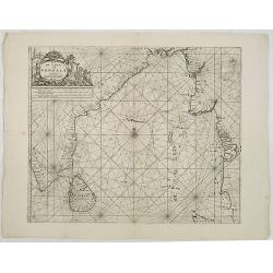
De golf van Bengalen.
Rare chart of the Indian Ocean, with nice detail on Ceylon (Sri Lanka) with compass roses and a system of rhumb lines, soundings and anchorage's. Many place names. The pl...
Place & Date: Amsterdam, after 1669-1712
Plan de la Rade de Gedda situee de la Cote d'Arabie sur la Mer Rouge.
Chart of the area around city of Gedda in the Red Sea. D'Après De Mannevillette (1707-1780) was one of Franc's first hydrographers. When the first edition of his Atlas L...
- $600 / ≈ €528
Place & Date: Paris, 1745
Carte de la coste orientale de la Chine depuis Amoy, jusqu'à Chusan avec une partie de l'Isle Formose [with] Plan du port d'Amoy ou Emouy.
Important French chart of the China Sea with the coast of Northern China, including a large depiction of Formosa.Latitude and longitude scales, compass rose and system of...
Place & Date: Paris, Jean-François Robustel, 1745
Manuscript map of the Bay of Nagasaki.
An extremely rare manuscript chart in brown ink and wash color on a printed sheet of paper with a system of rhumblines and latitude scales. This chart shows the Bay of Na...
Place & Date: Amsterdam, 1750
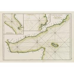
Carte de L'entrée du Golfe de la Mer Rouge.
Chart of the Gulf of Aden with the coast line of Yemen, the Island Socotra and the entrance of the Red Sea. With 2 inset charts off-shore of the town Mocha.D'Après De Ma...
- $400 / ≈ €352
Place & Date: Paris, 1753
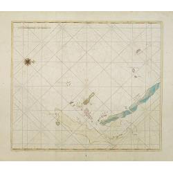
[ Hong Kong / Canton ] Nieuwe Pas=Caart strekkende van Pta Cataon tot Pta. Lamtoan, langs de kusten van Cochinchina, Tonquin, Quangsi en Quantung [?] van Macao.
A finely engraved and detailed chart of Vietnam reaching to Macao and present-day Hong Kong..Very rare: only included in the 6th volume (so-called secret atlas) of Van Ke...
Place & Date: Amsterdam, 1753
Carte de la Mer Rouge, depuis Moka jusqu's Gedda. . . .
Chart of the Red Sea. With 3 inset maps of Shake Omare, Goofs and Gedan. D'Après De Mannevillette (1707-1780) was one of France's first hydrographers. When the first edi...
Place & Date: Paris, 1753
[65] Surie.
Charming chart of the harbour of the town of St Jean d'Acre in Syria. Showing town and harbour plan, with soundings, anchorages, rocks, shoals, fortifications and lightho...
- $120 / ≈ €106
Place & Date: Marseille, 1764
Carte de l'Entrée du Golf de la Mer Rouge. / Plan de La Rade de Moka.
French sea chart of the entry of the Red Sea showing both the African and Arabian coasts. With two inset charts: Plan de La Rade de Moka. and one with the coasts south of...
- $450 / ≈ €396
Place & Date: Paris, ca 1775
Vues diverses du fort de l'Agouade pres de l'isle de Goa . . . Sumatra . . .
French sea sea chart with 9 coastal views near Goa in India and Sumatra. The titles above the main profiles reading as following : Vues diverses du fort de l'Agouade pre...
- $200 / ≈ €176
Place & Date: Paris, Brest, Demonville, 1775
Carte de la Mer Rouge, depuis Moka jusqu'a Gedda.
Chart of the Red Sea. With 3 inset maps of Shake Omare, Goofs and Gedan.D'Après De Mannevillette (1707-1780) was one of France's first hydrographers. When the first edit...
- $450 / ≈ €396
Place & Date: Paris, 1775
Carte de la Baye et du Port de Trinquemalay dans L'Isle de Ceylan.
Chart showing the bay of Trincomalee, Ceylon (Sri Lanka). Trincomalee is natural deep water port on the east coast of Sri Lanka, about 110 miles northeast of Kandy. It is...
- $250 / ≈ €220
Place & Date: Paris, 1775
Carte de la Côte de Guzerat, Du Golf de Cambaye et des Côtes de Concan et De Canara.
French sea chart of West India from Gujarat to Mangalore. With inset chart Plan de la Rivière de Surate.Prepared by Jacques-François L'Abbé Dicquemare (1733-1789). La...
Place & Date: Paris, ca 1775
A chart of the China Sea inscribed to Monsr. D'APRES de MANNEVILLETTE .. To A.Dalrymple.
Most important milestone sea chart is based upon the surveys made from navigational surveys by Alexander Dalrymple (1737-1808]. He was the first Hydrographer of the Briti...
Place & Date: Paris, ca. 1775
Carte Plate qui comprend La partie septentrionale de LA Cöte de Coromandel et les Côtes de Golconde , D' Orcha et de Bengale.
French chart of Coromandel in India. West to the top.Latitude and longitude scales, compass rose and system of rhumb lines, soundings near coast and in bay areas.D' Aprè...
- $150 / ≈ €132
Place & Date: Paris, Brest, chez Demonville, 1775
Vues des Cap d'Aden, de St. Antoine, et de Bab-El-Mandeb, sur la Côte Méridionale de l'Arabie Heureuse. Vues de l'Isle de Socotra
Coast profiles near Cape Aden in Yemen and in the lower part coastal profiles near Socotra, an island east of the Horn of Africa and 380 kilometers (240 mi) south of the ...
- $250 / ≈ €220
Place & Date: Paris, Brest, chez Demonville, 1775
Carte de la Côte Orientale du Golfe du Bengale.
French sea chart of coast northeast of India. Latitude and longitude scales, compass rose and system of rhumb lines, soundings near coast and in bay areas.D' Après de Ma...
- $150 / ≈ €132
Place & Date: Paris, ca 1775
Carte de la Baye et du Port de Trinquemalay Dans L'Isle de Ceylan.
French chart of the harbor of Trinquemalay on the island of Ceylon. Prepared after Samuel Cornish who was a vice admiral for the English East India company.Latitude and l...
- $350 / ≈ €308
Place & Date: Paris, Brest, chez Demonville, 1775
A chart of the China Sea inscribed to Monsr. D'APRES de MANNEVILLETTE .. To A.Dalrymple.
This most important milestone chart is based upon the surveys made from navigational surveys by Alexander Dalrymple (1737-1808]. He was the first hydrographer of the Brit...
Place & Date: Paris, ca 1775
Carte réduite de l'Océan Oriental, depuis Le Cap de Bonne Espérance jusqu'à l'Isle Formose.
French chart covering the seas between the Cape of Good Hope until Taiwan and the West Coast of Australia. Prepared by Jacques-François L'Abbé Dicquemare (1733-1789). L...
- $1000 / ≈ €880
Place & Date: Paris, Brest, chez Demonville, 1775
Carte Plate de la partie Septentrionale du Detroit de Malac, depuis de la rade d'Achem jusqu'a Malac.
French chart of the Island of Sumatra and the Malay Peninsula separated by the strait of Malacca in Indonesia.Latitude and longitude scales, compass rose and system of rh...
- $500 / ≈ €440
Place & Date: Paris, ca. 1775
A chart of the northern part of the Indian Ocean..
Chart of the northern part of the Indian Ocean, including part of Arabia, India and Sri Lanka prepared by D'Apré de Mannevillette and published in London by Laurie and W...
- $750 / ≈ €660
Place & Date: London 1794
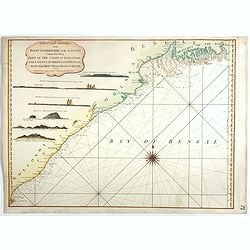
The Coast of India, from Point Gordeware to the Ganges Comprehending Part of the Coast of Golconda . . .
Detailed sea chart of the coast of India, from the mouths of the Ganges Rivers in the northeast to Point Gordeware in the south west. Includes numerous sailing channels a...
- $400 / ≈ €352
Place & Date: London, 1794
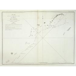
Plan de la partie des iles, ou archipel de Coree, vue au mois de Mai 1787 par les Fregates Francaises la Boussole et l'Astrolabe. . . .
Showing the track of La Perouse along the southernmost tip of Korea, with Quelpaerts Islands (nowadays called Jeju, with the volcano Halla-san (Halla Mountain) clearly no...
- $450 / ≈ €396
Place & Date: L'Imprimerie de la Republique, An V, 1797
Plan de la partie des Isles ou Archipel de Corée.
Showing the track of La Perouse along the southern most tip of Korea, with Quelpaerts Islands (now-a-days called Jeju, with the volcano Halla-san (Halla Mountain) clearly...
- $250 / ≈ €220
Place & Date: Paris, 1797
Plan de la partie des Isles ou Archipel de Coree.
Showing the track of La Perouse along the southernmost tip of Korea, with Quelpaerts Islands (nowadays called Jeju, with the vulcano Halla-san (Halla Mountain) is clearly...
- $350 / ≈ €308
Place & Date: Paris, 1797
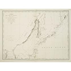
Carte des découvertes fautes en 1787 dans les Mers de Chine et de Tartarie par les Frégates Françaises la Boussole et l'Astrolabe. . . ée. Feille.
La Pérouse's important large-scale of Northern Japan, Hokkaido, the Kuriles, the tip of Kamschatka, and the northern part of Korea.Showing the track of Perouse from 27 ...
Place & Date: Paris, 1797
Plan de la partie des iles, ou archipel de Coree, vue au mois de Mai 1787 par les Fregates Francaises la Boussole et l'Astrolabe. . . .
Showing the track of La Pérouse along the southern most tip of Korea, with Quelpaerts Islands (now-a-days called Jeju, with the vulcano Halla-san (Halla Mountain) clearl...
- $400 / ≈ €352
Place & Date: L'Imprimerie de la Republique, An V, 1797
Plan of part of the islands or archipellago of Corea seen in May 1787 by the Boufsole and Astrolabe.
This is a representing the visit of the French Admiral and explorer, le Comte de La Pérouse to Korea in 1786. The tracks of La Perouse are shown.From 'Atlas du Voyage d...
Place & Date: London, 1798
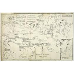
Eastern passage to China. sheet 1.
James Horsburgh early chart of the coasts of Java, Bali, Lombok, with part of Sulawesi, and Borneo. Insets of "Sketch of Bally Strait", Sketch of Lombock Strait...
- $2500 / ≈ €2200
Place & Date: London, 1824
Carte de L'Entrée de la Mer Rouge. Dressée par M.Daussy. . .
Very large and detailed chart depicting the entrance of the Red Sea, including the coastline of Yemen with inset "Carte du détroit de Bab!el-Mandeb. . ." and &...
- $750 / ≈ €660
Place & Date: Paris, ca. 1840
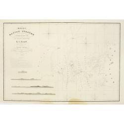
Kaart van de Gaspar Straaten volgens opnemingen van J.Stolze, D.Ross, enz.
Very large and rare chart centered on the strait between Bangka's southeastern seacoast and Belitung's western shores.Short front views of the coastal relief are shown in...
Place & Date: Amsterdam 1843
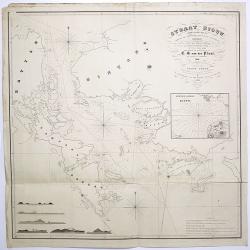
Straat Riouw onder opzicht van de commissie tot verbetering der Indische Zeekaarten..
Very large and rare so-called Blue Back centered on the strait passing between the Riau Islands. It contains an inset map with enlarged details of Riouw Harbor on Bintang...
Place & Date: Amsterdam 1843
Kaart van een gedeelte van de Noord Kust van Java en Straat Sunda van Tanjong Kaik tot den vierden hoek bij Anjer..
Very large and rare chart depicting Java's northern seacoast.Coastal profiles are present at the bottom of the map.The chart is prepared by B.H.Staring, J.A.G.Rietveld an...
Place & Date: Amsterdam 1843-1844
Straat Sunda en Westkust van Java.
Very large and rare chart depicting Java's western seacoast close to the Sunda Strait.Showing part of Sumatra on top and the West Java tip, today hosting the Ujung Kulon ...
Place & Date: Amsterdam (1841)1846
Kaart van de Reede van Batavia met de verschillende vaarwaters naar dezelve trigometrisch opgenomen op last van deb schout bijnacht E.Lucas.
Very large and rare so-called blue-black chart centered on Jakarta's harbor.The chart is prepared by B.G.Escher, I.A.C. Eschauzier, B.H.Staring and E.H.Boom during an exp...
Place & Date: Amsterdam (1841) 1847
Cyprus south east coast Cape Kiti to Cape Eloea.
An British Admiralty chart of Cyprus south east coast. A highly corrected version of Admiralty chart 971 originally published 15th February 1866 under the Superintendence...
- $100 / ≈ €88
Place & Date: London, 1852
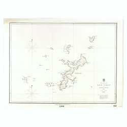
North Pacific Ocean LOO CHOO and adjacent Islands 1855.
Large scale chart of Okinawa in the Japan Sea. With scale and vignette of Typographical office. Map nr. 2416.An interesting note in lower right "The coast line of al...
- $300 / ≈ €264
Place & Date: London, 1855
China, Sheet IX, Yang-Tse-Kiang from the sea to Nanking . . .
A fine, large-scale chart. This chart depicts the last stretch of the Yangtse River before it meets the sea. It gives soundings and notes on the tides, and includes an in...
- $750 / ≈ €660
Place & Date: London, 1843-1859
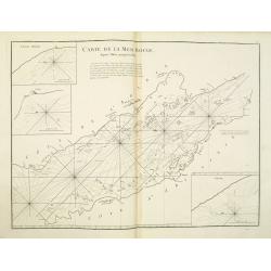
Carte de la Mer Noire. (5e Feuille). Du Cap Zefiros au Cap Kerempeh. . .
Very detailed chart of the Turkish part of the Black Sea including the towns of Sinop, Samsun, etc. Showing soundings in meters, lighthouses are marked with yellow and re...
- $200 / ≈ €176
Place & Date: Paris, 1860
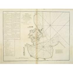
Plan de la rade de Macao (chine) Levé d'après les ordres mr. Rocquemaurel.
Very detailed chart of Macao and several of the surrounding Islands, and features numerous depth soundings throughout. Prepared by captain, Gaston de Rocquemaurel. Logo o...
Place & Date: Paris, c.1856 / 1863
(2 charts of Shri Lanka) Mer des Indes - Ile de Ceylan - Partie Nord. Détroit de Palk et Golfe de Manaar.. [with] Partrie Sud...
Two very large charts representing the northern and southern part of Sri Lanka and giving details about the Indian seacoast around the Gulf of Mannar and the Palk Strait....
- $750 / ≈ €660
Place & Date: Paris, 1866
Arabia. Gulf of Aden - North Coast. Aden and Adjacent Bays..
Large chart focused east of Aden, in Yemen. With inset plan of Aden Anchorage in the upper right corner and a set of coastal profiles in the upper left corner.With latitu...
- $900 / ≈ €792
Place & Date: London (1836) corrected to 1868
Carte générale de la mer des Indes dressée par P. Daussy et P.E. Wissocq, grave par Chassant, ecrit par J.M. Hacq.
Magnificent and detailed large-scale chartdepicting the Indian ocean, with east coast of Africa, Madagascar, Arabian Peninsula, India, China, etc .Including the West coa...
- $1000 / ≈ €880
Place & Date: Paris, 1837-1869
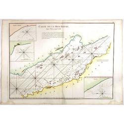
Carte de la Mer Noire. (1e Feuille). Du Bosphore à Mangalia et du Bosphore au Cap Kerempeh.
Very detailed chart of the Turkish part of the Black Sea including the towns of Constantinople (Istanbul) , Bourgas. Showing soundings in meters, lighthouses are marked w...
Place & Date: Paris, 1860, updated for 1870
Bay of Bengal, compiled chiefly from government survey.. [2 sheets]
Large scale chart in 2 sheets focused on the Bay of Bengal.It covers Sri Lanka, the whole Indian eastern coast, the seacoast of Bangladesh, Myanmar and Thailand as far as...
- $1200 / ≈ €1056
Place & Date: London (1863), corrections to 1871
Mer de Chine. Golfe du Tonkin. Entrées de Kuaï-Chin-Mun et Tsieng-Mun. . .
Large chart centred on the Gulf of Tonkin in the South China Sea. Showing banks, isles and soundings made in metres. Relief is shown by hachures.Engraved by A. Gérin aft...
Place & Date: Paris, 1887
Selling price: $300
Sold in 2008
India west coast Gulf of Cutch to Vijaydurg . . .
Chart of India's west coast map surveyed by the hydrographer Captain JF Parry. A highly corrected version of Admiralty chart 2736 originally published 1st July 1915. Date...
- $200 / ≈ €176
Place & Date: London, 1915-1980
Anamu Buru to Latakia including Iskenderun Körfezi.
A highly corrected version of Admiralty chart 2632 originally published 25 November 1955 under the Superintendence of Captain K.SB. Collins. Edition Date 1984 Detailed ch...
- $100 / ≈ €88
Place & Date: London, 1955 - 1984
China sea Gulf of Tongking (Southern sheet).
A highly corrected version of Admiralty chart 3989 originally published 11 Mai 1962 under the Superintendence of Captain EG Irving. Detailed chart including the coasts of...
- $80 / ≈ €70
Place & Date: London, 1962 - 1992
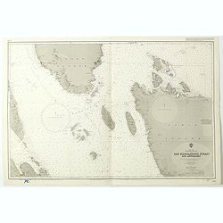
China Sea Philippine Islands - San Bernandino Strait and approaches. (3370)
A highly corrected version of Admiralty chart 3370 originally published 14th November 1924 under the Superintendence of Captain H.P. Douglas. Edition Date 1982 with furth...
- $150 / ≈ €132
Place & Date: London, 1924 / 1996
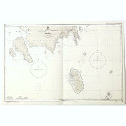
Philippine Islands - Semirara, Ilin and Ambulong 1.s with part of Mindoro. (971)
A highly corrected version of Admiralty chart 971 originally published 15th February 1866 under the Superintendence of Captain G.H. Richards. Edition Date 1991 with furth...
- $150 / ≈ €132
Place & Date: London, 1866 / 1999
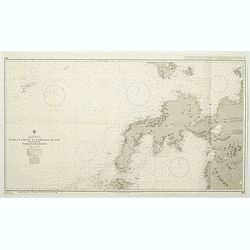
Philippine Islands - Mindanao West Coast - Basilan Strait to Camiguin Island including Tubbataha Reefs. . . (3811)
A highly corrected version of this oversized Admiralty chart 3811 originally published 26th February 1925 under the Superintendence of Captain P.H. Douglas. Edition Date ...
- $150 / ≈ €132
Place & Date: London, 1925 / 2005


![Carte de la coste orientale de la Chine depuis Amoy, jusqu'à Chusan avec une partie de l'Isle Formose [with] Plan du port d'Amoy ou Emouy.](/uploads/cache/33583-250x250.jpg)

![[ Hong Kong / Canton ] Nieuwe Pas=Caart strekkende van Pta Cataon tot Pta. Lamtoan, langs de kusten van Cochinchina, Tonquin, Quangsi en Quantung [?] van Macao.](/uploads/cache/24951-250x250.jpg)
![[65] Surie.](/uploads/cache/12837-250x250.jpg)










![(2 charts of Shri Lanka) Mer des Indes - Ile de Ceylan - Partie Nord. Détroit de Palk et Golfe de Manaar.. [with] Partrie Sud...](/uploads/cache/23493-250x250.jpg)


![Bay of Bengal, compiled chiefly from government survey.. [2 sheets]](/uploads/cache/23495-250x250.jpg)
