Browse Listings in America > South America > Venezuela
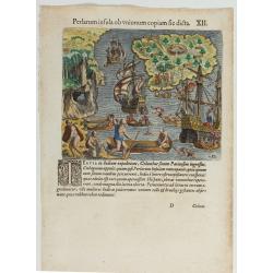
(Island of Pearls) Perlarum insula ob unionum copiam sic dicta.
A depiction of Cubagua as the Perlarum Insula (Island of Pearls), with in the foreground, two large ships send dinghies toward busy Native Americans collecting pearl oyst...
- $250 / ≈ €234
Place & Date: Frankfurt, 1594
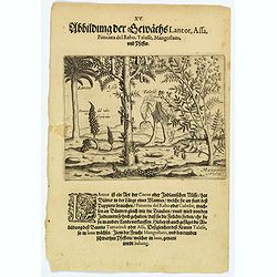
Plants Lantor, Assa, Pimenta, Mangostan and Pepper.
Lantor is a kind of coconut palm (or Indian nut) with fronds as long as a human body. These fronds are used as paper. Pimenta del Rabo (or cubebe) grows grape-like on tre...
- $80 / ≈ €75
Place & Date: Frankfurt, 1598
Descripcion del audiencia del Nuevo Reino 9.
The earliest map to include information from the previously secret manuscript maps of the Spanish cosmographer, Juan López de Velasco, showing present-day Colombia and V...
- $450 / ≈ €421
Place & Date: Amsterdam, Michel Colin, 1622
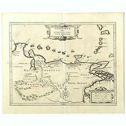
Venezuela, atque Occidentalis Pars Novæ Andalusiae.
The coastline of Venezuela with little interior development. Including Aruba, Bonaire, Curaçao, etc. This scarce map was prepared by Hessel Gerritsz (1581-1632), a forme...
- $600 / ≈ €561
Place & Date: Leiden, 1625
Venezuela, atque Occidentalis Pars Novæ Andalusiae.
Coastline of Venezuela with little interior development. Including Aruba, Bonaire, Curaçao, etc. Scarce map prepared by Hessel Gerritsz (1581-1632), former apprentice of...
- $600 / ≈ €561
Place & Date: Leiden, Elzevier, 1630
[Sir Walter Ralegh meets the King of Arromaia].
Scarce print with a German text sheet. During Ralegh’s voyage up the Orinoco in search of El Dorado, he met an old man who said he was the king of Arromaia. He claimed ...
- $125 / ≈ €117
Place & Date: Frankfurt, M.Merian, 1633
[Murder of Dominican monks in Cumana or Cubagua Island].
Murder of Dominican monks in Cumana or Cubagua Island in what is now Venezuela. Scarce print (150x177mm.) on a German text sheet taken from a first edition of Johann Ludw...
- $80 / ≈ €75
Place & Date: Frankfurt, M.Merian, 1633
[Ralegh arrives at Orocotona.]
On reaching the rapids of the Caroní, further up the Orinoco, Ralegh’s expedition was unable to proceed further by river, so they continued overland, eventually arrivi...
Place & Date: Frankfurt, M.Merian, 1633
[How natives of Paria cope with illness] / Vespucci reaches Lake Maracaibo]..
Two engravings. [421b] When the natives of those parts, they were bathed in a cold stream, then chased round a blazing fire until they had dried out. Then they were put t...
Place & Date: Frankfurt, M.Merian, 1633
Venezuela cum parte Australi Novae Andalusiae.
A finely engraved, decorative map of Venezuela. The islands of Trinidad and Tobago, Margarita, Aruba and Curaçao are shown. Local animals are depicted, sheep, birds, mon...
- $1100 / ≈ €1029
Place & Date: Amsterdam, ca. 1644
Venezuela cum parte Australi Novae Andalusiae.
Most decorative map with two large cartouches and compass-rose, large group of islands at the mouth of the Orinoco, other islands off Venezuela coast: Margarita, Aruba, C...
Place & Date: Amsterdam, 1673


![[Sir Walter Ralegh meets the King of Arromaia].](/uploads/cache/39916-250x250.jpg)
![[Murder of Dominican monks in Cumana or Cubagua Island].](/uploads/cache/40177-250x250.jpg)
![[Ralegh arrives at Orocotona.]](/uploads/cache/40468-250x250.jpg)
![[How natives of Paria cope with illness] / Vespucci reaches Lake Maracaibo]..](/uploads/cache/41095-250x250.jpg)

