Browse Listings in Africa > Central Africa > West coast / Ivory coast
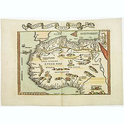
.Tabu nova partis Aphri.
This is Laurent Fries' 1535 edition of the earliest acquirable modern mapping of Africa north of the Equator.Based on Waldseemüller's map. The maps show Northern Africa ...
Place & Date: Lyons, M. Servetus, 1535
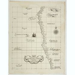
Carta particolare che comincia con il c.apo Aldea è Finisce con il capo Degortam. . .
Dudley’s magnificent chart shows the south west coast of Africa with the Tropic of Capricorn, located at about 23.5 degrees south. A first edition without the privilege...
Place & Date: Florence, 1645
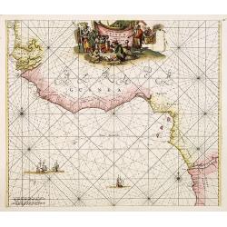
Tractus Littorales Guineae a Promontorio Verde usque ad sinum Catenbelae.
Chart of the West coast of Africa from Mauritania up to Angola. In top centre a very decorative title cartouche.
Place & Date: Amsterdam, 1675
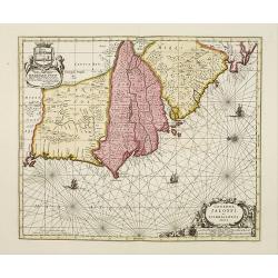
Genehoa Jaloffi et Sierraliones regna.
Decorative and detailed map of the West African Coast, from Senegal to Sierra Leone. In the center the river Gambia to the mouth in the Atlantic. Upper left a dedication ...
Place & Date: Amsterdam, 1670 / 1720