.jpg)
Browse Listings in Europe > Netherlands > Holland - South > maps
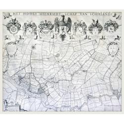
Het Hooge Heemraedtschap van Schielandt.
This beautiful wall map of "Het Hooge Heemraedtschap van Schielandt" is on nine attached leaves (each leaf 49x58,5 cm. ) engraved by J. VINGBOOMS after J.J. STA...
$2000 / ≈ €1834
Place & Date: Rotterdam, A. van Hoorn, 1684
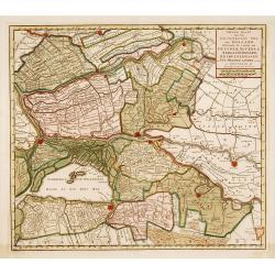
Nieuwe kaart van het oostelykste deel van Holland. . .
Detailed map covering the area of Gouda, IJsselstein, s'Hertogenbosch, Zevenbergen, Dordrecht.
$200 / ≈ €183
Place & Date: Amsterdam, 1749
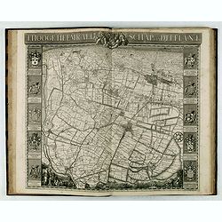
't Hooge Heemraedschap van Delfland met alle de Steden, Dorpen, Ambachten, Litmaten, Polders, (etc.).
The so-called Kruquius map is a wall-map of the Delfland water board district. The map consists of 25 engraved map sheets. Several maps flanked by fine large armorial car...
$4750 / ≈ €4357
Place & Date: Delft, 1712-1750