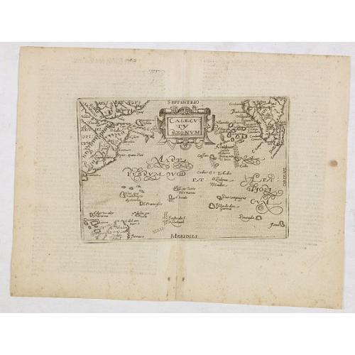
Calecuty Regnum |
||||||||||||||||||||
|
||||||||||||||||||||
|
|
||||||||||||||||||||
This item is available for immediate sale
Feel free to contact us if you have a question about this item.
Or do you like to be notified about newly added items? Add your name to our mailing list.
2000.00
|
||||||||||||||||||||
Description
The calligraphy is florid and decorative.
The engraving of the maps is attributed to Frans Hogenberg. The present work is taken by the German edition of the works of Giovanni Botero, "Theatrum oder Shawspiegel," published in 1596 by Andreas Lambert; that same year also publishes the edition with Latin text. The great rarity of the works of the school of Cologne, together with the paucity of information on these maps "secret," contributes to the charm of these important works, the cornerstone of any collection mapping.
Etching with engraving, without signature. The map belongs to the so-called atlases published by the Cartographic School of Cologne. Cologne was the most important mapmakers center in the XVI century for nearly half a century, mainly due to Dutch and Flemish refugees fleeing religious persecution.
Among the principal members of the School include Quad Matthaeus, Johannes Metellus, Giovanni Botero, and Frans Hogenberg, who was its founder. The atlases were often published anonymously or using pseudonyms precisely because of political and religious problems that characterized the era. Jan Matal or Metellus, French-born Louvaine and is active in Cologne, where he took refuge to escape persecution from the Catholic monarchs and where he died in 1597. He was one of the major cartographers of the time and, together with the Quad and Hogenberg itself as the leader of the Cologne school.
Giovanni Botero (1544 - Turin 1617) was a priest, Italian philosopher, and writer, author of universal relations, published a treatise on political geography for the first time in Rome in 1591 without cartographic illustrations. The work quickly became essential and studied throughout Europe, beginning almost to the study of demography.
Andreas Lambert (active between 1590 and 1598) was primarily a publisher, however, some of the maps in its publications are attributed to himself, albeit in doubt. From this point of view, cartographic maps are a derivation of the papers published by Abraham Ortelius in Antwerp for the first time in 1570. "
Reference: Meurer, Atlantes Colonienses Die Kolner Schule der Atlas Kartographie 1570 - 1610, pp. 74 / 78.
FAQ - Guarantee - Shipping
Buying in the BuyNow Gallery
This item is available for immediate purchase when a "Add to Cart" or "Inquire Now" button is shown.
Items are sold in the EU margin scheme
Payments are accepted in Euros or US Dollars.
Authenticity Guarantee
 We provide professional descriptions, condition report and HiBCoR rating (based on 45 years experience in the map business)
We fully guarantee the authenticity of items we sell. We provide a certificate of authenticity for each purchased item.
Condition / Coloring
We indicate the condition of each item and use our unnique HiBCoR grading system in which four key items determine a map's value: Historical Importance, Beauty, Condition/Coloring and Rarity.
We offer many maps in their original black and white condition. We do not systematically color-up maps to make them more sellable to the general public or buyer.
Copper engraved or wood block maps are always hand colored. Maps were initially colored for aesthetic reasons and to improve readability. Nowadays, it is becoming a challenge to find maps in their original colors and are therefor more valuable.
We use the following color keys in our catalog:
Original colors; mean that the colors have been applied around the time the map was issued.
Colored; If the colors are applied recently or at the end of the 20th century, then "colored", or "attractive colors" will be used.
Original o/l colors; means the map has only the borders colored at the time of publication.
Read more about coloring of maps [+]
FAQ
Please have a look for more information about buying in the BuyNow gallery.
Many answers are likely to find in the general help section.
Virtual Collection
![]()
With Virtual Collection you can collect all your favorite items in one place. It is free, and anyone can create his or her Virtual map collection.
Unless you are logged in, the item is only saved for this session. You have to be registed and logged-in if you want to save this item permanently to your Virtual Collection.
Read More [+]
Registering Here, it is and you do not need a credit card.
Add this item to
Virtual Collection
or click the following link to see my Virtual Collection.
Invoice
The invoice and certificates of authenticity are available in the client center >Invoices
| High-Resolution Digital Image Download | |
|
Paulus Swaen maintains an archive of most of our high-resolution rare maps, prints, posters and medieval manuscript scans. We make them freely available for download and study. Read more about free image download |
In accordance with the EU Consumer Rights Directive and habitually reside in the European Union you have the right to cancel the contract for the purchase of a lot, without giving any reason.
The cancellation period will expire 14 calendar days from the day after the date on which you or a third party (other than the carrier and indicated by you) acquires, physical possession of the lot. To exercise the right to cancel you must inform Paulus Swaen Europe bv, which is offering to sell the lot either as an agent for the seller or as the owner of the lot, of your decision to cancel this contract by a clear statement (e.g. a letter sent by post, or e-mail (amsterdam@swaen.com).
To meet the cancellation deadline, it is sufficient for you to send your communication concerning your exercise of the right to cancel before the cancellation period has expired.


