Browse Listings in Africa
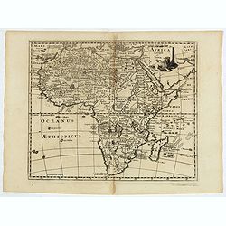
Africa Vetus.
A fine map of the ancient African continent.This edition carries the date 1690 and in brown manuscript in Aedibus Regiis .Nicolas Sanson was to bring about the rise of Fr...
Date: Paris 1690
Selling price: ????
Please login to see price!
Sold
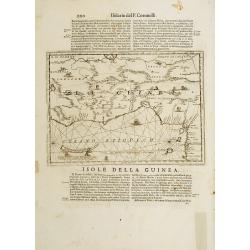
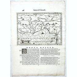
Isola della Guinea. / Isola Gore.
Fine map of Guinea, from Isolario Dell'Atlante Vento.On verso a map of the island Goeree (130x172mm).
Date: Venice 1690
Selling price: ????
Please login to see price!
Sold
Africa Vetus.
A fine map of the ancient African continent. Original outline colors retouched.Nicolas Sanson was to bring about the rise of French cartography, although the fierce compe...
Date: Paris 1690
Selling price: ????
Please login to see price!
Sold
[2 sheets] L AFRICA divisa nelle sue Parti secondo le pui moderne..
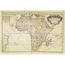
A beautiful and rare two-sheet map of Africa. The title cartouche is depicted on a drape surrounded by native animals.A most noticeable feature of the decoration on the m...
Date: Venice 1690
Selling price: ????
Please login to see price!
Sold
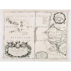
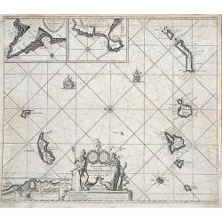
Bocche del Fiume Negro et Isole di Capo Verde..
This is a splendid map of the northwestern coast of Africa and the Cape Verde Islands.The map provides details of the various Portuguese discoveries in the region in the ...
Date: Venice 1690
Selling price: ????
Please login to see price!
Sold in 2008
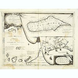
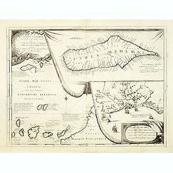
Isole Canarie..
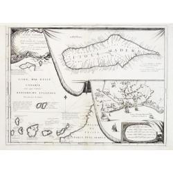
Decorative and highly detailed map of the Islands of the Canaries and Madeira, with a large inset of the port of Funchal. Includes two decorative cartouches.The remarkabl...
Date: Venice 1690
Selling price: ????
Please login to see price!
Sold
Isola di Madagascar o di S. Lorenzo Scoperta dà Portoghesi nell anno 1506..
Decorative and highly detailed map of Madagascar, including 2 decorative cartouches and other embellishments.The remarkable Vincenzo Coronelli (1650-1718), was a Francisc...
Date: Venice 1690
Selling price: ????
Please login to see price!
Sold
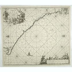
[Untitled: La Guinea].
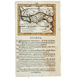
Charming small map of the west coast of Africa centered on the Gulf of Guinea covering the coast from the Ivory coast as far as Gabon.The remarkable Vincenzo Coronelli (1...
Date: Venice 1690
Selling price: ????
Please login to see price!
Sold
Abissinia, doue sono le Fonti del Nilo..
This very uncommon map concentrates of the source of the Nile in a lake called Tzana, Dembea, which Coronelli claimed to be the first to accurately depict.Extensive notat...
Date: Venice 1690
Selling price: ????
Please login to see price!
Sold
Aegyptus antiqua.
From the Hornius edition of the Ancient Atlas by Janssonius. No text on verso.
Date: Amsterdam, ca 1690
Selling price: ????
Please login to see price!
Sold in 2012
Penon de Velez.
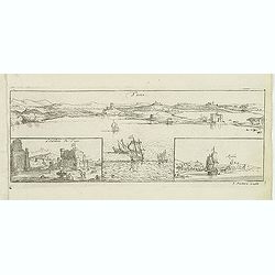
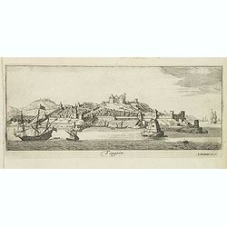
Magnificent panoramic of Penon de Velez de la Gomera, a Spanish rock in North Africa off the Moroccan coast (Plazas de soberanía). Etched by Gaspar Bouttats (1640-1695)...
Date: Antwerp, c.1690
Selling price: ????
Please login to see price!
Sold in 2017
Tuni
Magnificent bird's eye- of Tunis. Etched by Gaspar Bouttats (1640-1695).The Antwerp-based publisher Jacques Peeters published ca. 1690 a series of prints related to the H...
Date: Antwerp, c.1690
Selling price: ????
Please login to see price!
Sold in 2022
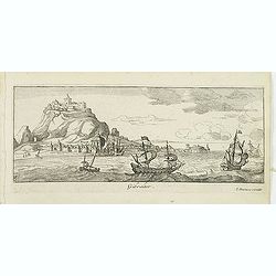
Gibraltar.
A magnificent bird's eye- of Gibraltar. Etched by Gaspar Bouttats (1640-1695).The Antwerp-based publisher Jacques Peeters published ca. 1690 a series of prints related to...
Date: Antwerp, c.1690
Selling price: ????
Please login to see price!
Sold in 2015
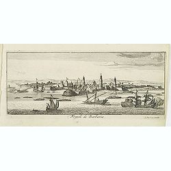
Tripoli de Barbaria.
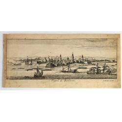
Magnificent bird's eye- of Tripoli. Etched by Gaspar Bouttats (1640-1695).The Antwerp based publisher Jacques Peeters published ca. 1690 a series of prints related to the...
Date: Antwerp, c.1690
Selling price: ????
Please login to see price!
Sold in 2013
Tangere.
Magnificent bird's eye- of Tanger. Etched by Gaspar Bouttats (1640-1695).The Antwerp based publisher Jacques Peeters published ca. 1690 a series of prints related to the ...
Date: Antwerp, c.1690
Selling price: ????
Please login to see price!
Sold in 2013
Algiers.
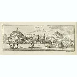
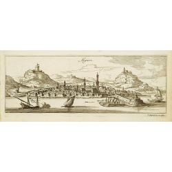
Magnificent bird's eye- of Algiers. Etched by Gaspar Bouttats (1640-1695).The Antwerp based publisher Jacques Peeters published ca. 1690 a series of prints related to the...
Date: Antwerp, c.1690
Selling price: ????
Please login to see price!
Sold in 2013
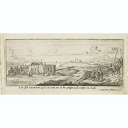
A De Stadt Zues. B Water put. C De roode Zee. D het geberghte van de wofteyne van Arabia. (Suez)
Magnificent early view of Suez. Etched by Gaspar Bouttats (1640-1695).The Antwerp based publisher Jacques Peeters published ca. 1690 a series of prints related to the Hab...
Date: Antwerp, c.1690
Selling price: ????
Please login to see price!
Sold in 2016
Isola della Guinea. / Isola Gore.
Fine map of Guinea, from Isolario Dell'Atlante Vento.On verso a map of the island Goeree (130x172mm).
Date: Venice, 1690
Selling price: ????
Please login to see price!
Sold in 2018
Novissima et perfectissima Africae descriptio
Uncommon map of Africa, based on De Wit map of 1680. Wildlife, ships and sea monsters reflects the new style of the eighteenth century. The cartouche includes Moorish tra...
Date: Amsterdam, 1690
Selling price: ????
Please login to see price!
Sold in 2013
Totius Africae . . .
The detail of the map includes the traditional depiction of Central Africa with the river Nile rising in two large central Lakes Zaire and Zaflan. The West African river ...
Date: Amsterdam, 1690
Selling price: ????
Please login to see price!
Sold in 2014
Tripoli de Barbaria.
Fine bird's eye view of the city of Tripoli, Lybia. Etched in about 1690 by Gaspar Bouttats (1640-1695).The Antwerp based publisher, Jacques Peeters, published ca. 1690 a...
Date: Antwerp, c. 1690
Selling price: ????
Please login to see price!
Sold in 2017
Isola della Guinea.
Fine map of Guinea, from Isolario Dell'Atlante Vento. The sheet dimension is 485x350mm. Information is largely confined to the coast and the Niger River, which flows in p...
Date: Venice, 1690
Selling price: ????
Please login to see price!
Sold in 2018
L'AFRICA divisa nelle sue Parti secondo le pui moderne..
A beautiful and rare two-sheet map of Africa. The title cartouche is depicted on a drape surrounded by native animals.A most noticeable feature of the decoration on the m...
Date: Venice, 1690
Selling price: ????
Please login to see price!
Sold in 2018
Abissinia, doue sono le Fonti del Nilo.
This very uncommon map concentrates of the source of the Blue Nile in a lake called Tzana, Dembea, which Coronelli claimed to be the first to accurately depict.Extensive ...
Date: Venice, 1690
Selling price: ????
Please login to see price!
Sold in 2018
Guineae Nova Descriptio.
The map shows the West African coast from Senegal to Cape Lopez on the Gulf of Guinea just below the equator. The island of St. Thomae, which today forms a Portuguese pro...
Date: Amsterdam, W. de Jonge, 1690
Selling price: ????
Please login to see price!
Sold in 2023
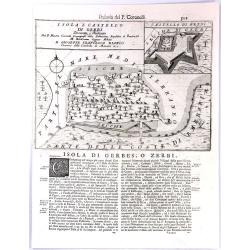
Isola e Castello di Gerbi.
A large antique sheet from Vincenzo Coronelli's well known “Isolario” or Island Book, with a map the island of Djerba (Gerbi), off the north coast of Africa (Tunisia)...
Date: Venice, 1691
Selling price: ????
Please login to see price!
Sold in 2017
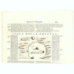
Isola della Goletta. Tunisi.
Rare plan of Tunis.Vincenzo Coronelli (August 16th, 1650 - December 9th, 1718) was a Franciscan monk, a Venetian cosmographer, cartographer, publisher, and encyclopaedist...
Date: Venice, 1691
Selling price: ????
Please login to see price!
Sold in 2020
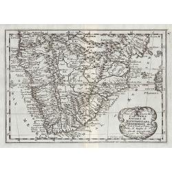
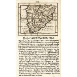
Caffraria und Monomotapa.
A miniature map of the southern part of Africa from the uncommon "Kurtzbuendige abbild-und vorstellung der gantzen weld". Johann Ulrich Müller?s (1633-1715) pu...
Date: Ulm, 1692
Selling price: ????
Please login to see price!
Sold
Alexandria d'Egiptio. (Panoramic view of Alexandria)
Rare panoramic view of Alexandria in Egypt.The print is signed in the lower right hand corner. Underneath the signature are the remains of a earlier signature slightly vi...
Date: Antwerp 1692
Selling price: ????
Please login to see price!
Sold
Algiers. (Panoramic view of Algiers)
Rare panoramic view of Algiers in Algeria.The print is signed in the lower right hand corner. Underneath the signature are the remains of a earlier signature slightly vis...
Date: Antwerp 1692
Selling price: ????
Please login to see price!
Sold
Tuni (Panoramic view of Tunis)
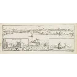
Rare panoramic of Tunis. With two smaller insets of the Caste of Tunis and the town of Argila.The print is signed in the lower right hand corner. Engraved by Lucas Voste...
Date: Antwerp, 1692
Selling price: ????
Please login to see price!
Sold in 2011
L'Afrique divisee suivant l'estendue de ses principales parties. . .
Fine map of Africa with a decorative title and scale cartouche.Alexis-Hubert Jaillot (1632-1712), was a French cartographer. He joined the Sanson heirs and redrew Nicolas...
Date: Amsterdam, 1692
Selling price: ????
Please login to see price!
Sold
GUINEA, 1692
Lovely miniature map showing the western and central African regions on the Gulf of Guinea as Cameroon, Nigeria, Benin, Togo, Ghana, Ivory Coast, Liberia, Sierra Leone. ...
Date: Frankfurt, 1692
Selling price: ????
Please login to see price!
Sold in 2020
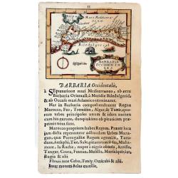
BARBARIA Occidentalis, 1692.
Lovely miniature map showing the north west Africa. Marok, Suz, Alger. Also, showing south Spain, with illustrating animals. From the "Neu aussgeffertigter kleiner A...
Date: Frankfurt, 1692
Selling price: ????
Please login to see price!
Sold in 2020
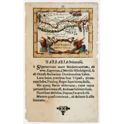
BARBARIA Orientalis, 1692
Lovely miniature map showing the north Egypt with Cairo and Numidia. Also showing Malta and Candia. From the ""Neu aussgeffertigter kleiner Atlas" one of t...
Date: Frankfurt, 1692
Selling price: ????
Please login to see price!
Sold in 2020
Bitedulgerid & Zaara. 1692 [Sahara]
Lovely miniature map showing the north west Africa depicting Nigritia, Nubia, Azara desert, etc. From the "Neu aussgeffertigter kleiner Atlas" one of the rarest...
Date: Frankfurt, 1692
Selling price: ????
Please login to see price!
Sold in 2020
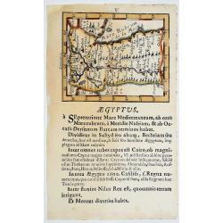
AEGYPTUS. 1692
Lovely miniature map showing Egypt. From the "Neu aussgeffertigter kleiner Atlas" one of the rarest and most interesting of all miniature atlases published in F...
Date: Frankfurt, 1692
Selling price: ????
Please login to see price!
Sold in 2020
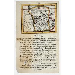
CONGO. 1692
Lovely miniature map showing Congo in the west coast of central Africa.From the "Neu aussgeffertigter kleiner Atlas" one of the rarest and most interesting of a...
Date: Frankfurt, 1692
Selling price: ????
Please login to see price!
Sold in 2020
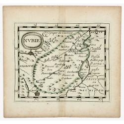
NUBIE (NUBIA)
Nubie old, outlined colored historical miniature map of Nubia along the Nile river located in what is today northern Sudan and southern Egypt. The map is copperplate engr...
Date: Nuremberg, 1694
Selling price: ????
Please login to see price!
Sold in 2020
AFRIQUE. Par. P. DuVal. Geogr du Roy.
Map of Ancient Egypt, outlined and bordered colored historical miniature map of Africa. The map is copperplate engraved with hand coloring and in very good condition and...
Date: Paris, 1694
Selling price: ????
Please login to see price!
Sold in 2020
Isole Canarie. . .
Decorative and highly detailed map of the Islands of the Canaries and Madeira, with a large inset of the port of Funchal. Includes two decorative cartouches.On verso Ital...
Date: Venice, ca.1696
Selling price: ????
Please login to see price!
Sold in 2012
Isola di Madagascar o di S. Lorenzo Scoperta dà Portoghesi nell anno 1506. . .
A beautiful and flamboyantly engraved large-scale map of Madagascar, Bourbon and part of the coast of Mozambique. On verso a smaller map Madagascar (170x123mm) The map is...
Date: Venice, ca. 1696
Selling price: ????
Please login to see price!
Sold
L' Afrique / divisee suivant l' estendue de ses principales parties.
An attractive large-format map of the African continent, embellished with a large title-cartouche.Alexis-Hubert Jaillot (1632-1712), French cartographer. He joined the Sa...
Date: Amsterdam, 1696
Selling price: ????
Please login to see price!
Sold in 2019
Bocche del Fiume Negro et Isole di Capo Verde. . .
This is a splendid map of the northwestern coast of Africa and the Cape Verde Islands.The map provides details of the various Portuguese discoveries in the region in the ...
Date: Venice, 1696
Selling price: ????
Please login to see price!
Sold in 2020
Africa antiqua et Nova.
Interesting map of Africa from Philipp Clüver's famous Introductionis in Universam geographicam, first published in Leiden in 1624. Philipp Clüver (1580–1623) was vir...
Date: Amsterdam, 1697
Selling price: ????
Please login to see price!
Sold in 2017
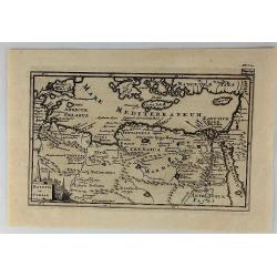
Aegyptus et Cyrene.
An attractive antique map of Egypt and Libya by Philip Cluver. It details the Mediterranean coast from the Red Sea to Libya and south to Garama. The coastal region of Lib...
Date: Paris, 1697
Selling price: ????
Please login to see price!
Sold in 2018
Africa antiqua et nova.
A fascinating map of Africa from Philipp Clüver's famous "Introductionis in Universam geographicam", which was first published in Leiden in 1624. Philipp Clüv...
Date: Amsterdam, 1697
Selling price: ????
Please login to see price!
Sold in 2018
Mauritana et Africa Proria nunc Barbaria.
A pleasantly engraved map of the north-western part of Africa with the Canary Islands.
Date: Leiden, 1697
Selling price: ????
Please login to see price!
Sold in 2019
C.D. Bona Esperance.
A couple of Bona Esperance, published in the very rare work Orbis habitabilis oppida (N° 59).
Date: Amsterdam, 1698
Selling price: ????
Please login to see price!
Sold
Isola di Madagascar, o di S. Lorenzo . . .
A beautiful and flamboyantly engraved large-scale map of Madagascar, formerly named San Lorenzo by the discoverers, the Portuguese. Shows also in detail the Comorra Islan...
Date: Venice, 1698
Selling price: ????
Please login to see price!
Sold in 2013
Isole Canarie. . .
Decorative and highly detailed map of the Islands of the Canaries and Madeira, with a large inset of the port of Funchal. Includes two decorative cartouches.On verso a vi...
Date: Venice, 1698
Selling price: ????
Please login to see price!
Sold in 2012
Appendix Tab. III. Africae, Aegyptum Inferiorem Exhibens.
Map of the Nile delta based on the Ptolemaic model. Mercator originally published this map in his 1578 edition of Ptolemy's great Geography. Although he is most renowned ...
Date: Amsterdam, 1698
Selling price: ????
Please login to see price!
Sold in 2015
Isola di Madagascar, ò di S. Lorenzo scoperta dà Portoghesi nell'Anno 1506. . .
A striking, early map of the island of Madagascar, also showing part of the Mozambique coastline, the Comoros Islands and Reunion. The remarkable Vincenzo Coronelli (1650...
Date: Venice, 1698
Selling price: ????
Please login to see price!
Sold in 2021
AFRICA
Nice map of Africa giving a wealth of information. Some names are translated in to English.
Date: London, c. 1700
Selling price: ????
Please login to see price!
Sold in 2011
L'Abissinie.
Uncommon and delightful map of Equatorial Africa, extending from the Atlantic shores as far as the Horn of Africa.It is focused on the White Nile stream which bears the n...
Date: Amsterdam 1700
Selling price: ????
Please login to see price!
Sold
Negres. Habitans de Nubie de Nigritie et de Guinée.
Decorative engraving representing people of Central Africa.
Date: Amsterdam, 1700
Selling price: ????
Please login to see price!
Sold in 2008
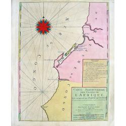
Carte Particuliere des costes de l'Afrique qui comprend une partie de Congo
Beautiful chart from Mortier's edition of Le Neptune François. Covers the region near the Congo River including Loanda, Ponta dos Palmeirinha, and Cabo Ledo. A text cart...
Date: Amsterdam, c1700
Selling price: ????
Please login to see price!
Sold in 2008
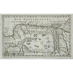
Royaume et desert de Barca, et Aegypte ...
An attractive miniature map of Egypt prepared by N.Sanson. Engraved by A.de Winter.
Date: Paris, c.1700
Selling price: ????
Please login to see price!
Sold in 2011
Carte De La Barbarie Le La Nigritie Et De La Guinee
Detailed hand colored copper engraving showing North West Africa from Mediterranean Sea to Gulf of Guinea including Canary Island.
Date: 1700
Selling price: ????
Please login to see price!
Sold in 2009
Le Zanguebar Tiree de Sanut &c. / Partie du Zanguebar ou Sont les Costes d'Ajan et d'Abix &c.
This attractive map, in two parts, covers the east coast of Africa from Mozambique to the Red Sea showing the prosperous trading ports. Each map has a decorative title ca...
Date: Amsterdam, 1700
Selling price: ????
Please login to see price!
Sold in 2008
Nieuwe en Naauwkeurige Paskaart van de Guineese, Goud, Tand en Slave Kust ? - Nouvelle carte des Cotes de Guinée, d\'Or, de Dent et des Esclaves. . .
Uncommon sea chart of Africa\'s Gold coast (Cap Verde) to Cape of Good Hope.
Date: Amsterdam, 1700
Selling price: ????
Please login to see price!
Sold in 2008
Carte Particuliere des costes de l'Afrique qui comprend une partie della Guinée et Partie de Mina...
Beautiful chart from Mortier's rare edition of 'Le Neptune François.' Covers the region from today's Sierra Leone until the Cape Coast area in Ghana. With numerous towns...
Date: Amsterdam, c1700
Selling price: ????
Please login to see price!
Sold in 2009
A New Map of Libya or old Africk. . . .
Curious map of ancient Africa, showing the entire continent and Madagascar. With two sources of the Nile. It shows the classic source in the twin lakes of Zaire and Zafla...
Date: Oxford, c1700
Selling price: ????
Please login to see price!
Sold in 2011
PATRIARCHATUS ALEXANDRINI...
Very interesting copper engraved map of Egypt and Lybia.Shows the Nile river with numerous ancient place names and some more cities along the coast are named.Mystical lar...
Date: Amsterdam, ca. 1700
Selling price: ????
Please login to see price!
Sold in 2011
Partie de la Haute Aethiopie ...
Map of the East coast of Africa. From Description de tout l'Univers, published by François Halma.
Date: Amsterdam, 1700
Selling price: ????
Please login to see price!
Sold in 2011
Afrique ou Libie Ulterieure ou sont le Saara ou Desert, ...
Map of the Ivory Coast. From Description de tout l'Univers, published by François Halma.
Date: Amsterdam, 1700
Selling price: ????
Please login to see price!
Sold in 2011
Pays, et Coste des Caffres : Empires de Monomatapa Monoemugi, &c.
Map of southern Africa. From Description de tout l'Univers, published by François Halma.
Date: Amsterdam, 1700
Selling price: ????
Please login to see price!
Sold in 2011
Egypte divisée en ses Douze Cassilifs, ...
Map of Egypt. From Description de tout l'Univers, published by François Halma.
Date: Amsterdam, 1700
Selling price: ????
Please login to see price!
Sold in 2012
Cartes des pays et des peuples du Cap de bonne Esperance nouvellemt decouverts par les Hollandois.
French manuscript map of Cape of Good Hope, as it was at about 1670. With a key (A-C) pointing to the Dutch fortress, Table Mountain and Lion's head.
Date: France, ca. 1670-1700
Selling price: ????
Please login to see price!
Sold in 2012
Nieuwe Pascaert van al de Carnarisse Eylande.
One of the most rare and sought after early maps of the Canary Islands. This large nautical map includes a latitude scale, a compass rose in the centre and a complex syst...
Date: Amsterdam, 1700
Selling price: ????
Please login to see price!
Sold in 2017
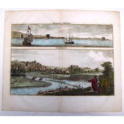
Marina di Tripoli & Tripoli.
This hand-colored, copper plate engraving shows two views of the port and city of Tripoli,Lybia. This scarce print is from: 'Voyage au Levant…” published by Henri de ...
Date: Amsterdam, 1700
Selling price: ????
Please login to see price!
Sold in 2013
Le Cap de Bonne Esperance.
Fine view of Capetown from the seaside. With numerous sailing ships in the front. Tabletop mountaion in the back. Two putti holding the title banner. A six number key exp...
Date: Leiden, c1700
Selling price: ????
Please login to see price!
Sold in 2013
Pas caerte vande Custen van Loango, Angoy als mede en gedeelte van Angola, van C. de Lopa Goncalves, tot aen R. de Zaire.
Sea-chart of the coast of Loango.Latitude scale, compass rose and system of rhumb lines, soundings, anchorage's, etc.
Date: Amsterdam, ca. 1700
Selling price: ????
Please login to see price!
Sold in 2014
Pas caert van de Custen van Angola Van Rio de Zaire tot C. Negro. alles op zyn ware coers verheyt geleyt.
Sea-chart of the coast of Angola.Latitude scale, compass rose and system of rhumb lines, soundings, anchorage's, etc. Number "8" in lower right corner.
Date: Amsterdam, ca. 1700
Selling price: ????
Please login to see price!
Sold in 2014
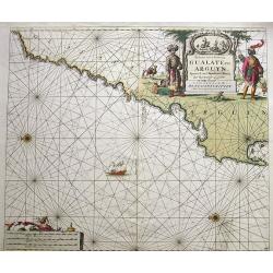
Paskaart van de Kuste van Gualate en Arguyn...
A very decorative seah-chart of the coastline of Western Sahara, between Cape Bojador and Ras Nouadhibou. Oriented to the east. With attractive hand-color, a sailing ship...
Date: Amsterdam, ca. 1680-1700
Selling price: ????
Please login to see price!
Sold in 2016
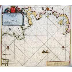
Nieuwe Pascaart voor een Gedeelte van de Zeekusten van Barbaria... Candia...
A very decorative sea-chart of the coastline of Libya, from Misurata to Crete. Curious shape of the coast with several cities shown. Oriented with south on the top. With ...
Date: Amsterdam, ca. 1680-1700
Selling price: ????
Please login to see price!
Sold in 2017
Mauritana et Africa Propria nunc Barbaria.
A nice engraved map of the north-western part of Africa with the Canary Islands by Phillip Clüver in about 1700. With one cartouche featuring an angel.Philipp Clüver (...
Date: Paris, ca 1700
Selling price: ????
Please login to see price!
Sold in 2018
L'Afrique dressée sur les observations de Mr de l'Académie Royale des Sciences. . .
Rare second state with the address : Chez l’Auteur sur le Quai de l’Horloge a la Couro. e de Diamans avec Privilege du Roy pour 20 ans, 1700". Guillaume de l'Isl...
Date: Paris, 1700
Selling price: ????
Please login to see price!
Sold in 2018
Afrique.
An interesting map of Africa. Shows the area from Brazil until Arabia, including the Canary and Cape Verde Islands, as well as Tristan da Cunha. The interior of the conti...
Date: Paris, ca 1700
Selling price: ????
Please login to see price!
Sold in 2018
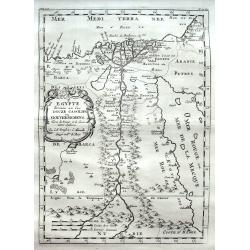
Egypte divisée en ses Douze Cassilifs. . .
A fine map of Egypt with parts of the Red Sea and Israel. Very detailed representation of the Nile River Valley, showing major cities, mountains and oases.
Date: Paris, ca 1700
Selling price: ????
Please login to see price!
Sold in 2018


![[2 sheets] L AFRICA divisa nelle sue Parti secondo le pui moderne..](/uploads/cache/23436-250x250.jpg)


![[Untitled: La Guinea].](/uploads/cache/23454-250x250.jpg)







![Bitedulgerid & Zaara. 1692 [Sahara]](/uploads/cache/82891-250x250.jpg)
