Browse Listings
Thusciae Descriptio Auctore Hieronimo Bellarmato.
Decorative and detailed map of Tuscany, from the 1574 or 1575 Latin text edition of Ortelius' Theatrum Orbis Terrarum, the first modern atlas of the world. The map is bas...
Date: Antwerp, 1574-1575
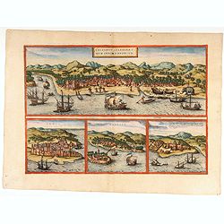
Calechut / Ormus / Canonor.
Four panoramic town-view on one sheet: the upper approximately two-thirds of this double page sheet contains a fine panoramic view of Calicut which is on the west coast o...
Date: Cologne, 1575
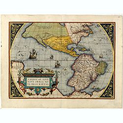
Americae Sive Novi Orbis, Nova Descriptio.
This is the second copperplate of Ortelius' map showing the western hemisphere, showing the prominent bulge in the South American coastline. An important map because of i...
Date: Antwerp, 1579
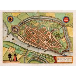
Slusa, Teutonicae Flandriae opp. . . (Sluis)
Bird'eye view of the town of Sluis.From the greatest publication in this genre!. The Civitates was compiled and written by George Braun, Canon of Cologne Cathedral. Braun...
Date: Cologne, 1580
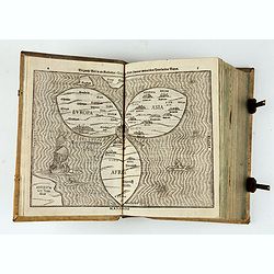
[Map of the Holy Land, including Cyprus]
Attractive full page longitudinal map of Palestine, Syria and Cyprus, cut by Hans Rudolf Manuel Deutsch. The shore line running from Southern Anatolia to the Nile Delta. ...
Date: Basle, 1550-1580
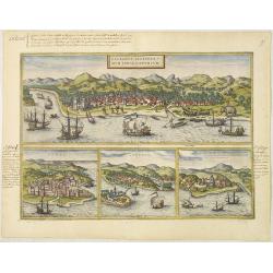
Calechut Celeberri mum Indiae Emporium/ Ormus/ Canonor, St.Georgii.
Four panoramic town-views on one sheet: The upper approximately two-thirds of this double-page sheet contains a fine panoramic view of Calicut which is on the west coast ...
Date: Cologne, 1580
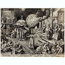
Temperance (Temperantia) from The Virtues.
Very decorative engraving by Philip Galle (Haarlem 1537–1612 Antwerp) after Pieter Bruegel the Elder (Breda (?) ca. 1525–1569 Brussels). The print was published by Hi...
Date: Antwerp, Hieronymus Cock, 1580
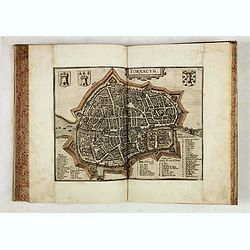
Traiectum ad Mosam. [Maastricht]
A birds-eye view of Maastricht seen from the south. Rising on Vrijthof square is the dominant complex of Sint-Servaas, in front of which - seen here in a distorted perspe...
Date: Cologne, ca. 1581
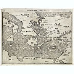
Tafel der Lender darin der Apostel Paulus geprediget hat.
Rare wood block map depicting the Mediterranean, with an over-sized Cyprus from the final Dutch edition of Heinrich Bünting's famous Itinerarium Sacrae Scripturae, a boo...
Date: Magdeburg, 1581
Descrittione di M. Lodovico Guicciardini patritio Fiorentino, di tutti i Paesi Bassi,...
Second Italian edition (variant B) and first Plantin edition (1st Silvius 1567) and the most sought-after edition of the famous description of the Low Countries, updated ...
Date: Antwerp, Plantin, 1581
Brabantia.
Map of Brabant from Guicciardini's "Description de touts les Pais-Bais" edited by Plantin in 1582. The map drawn after Ortelius' map of Brabant, and after the l...
Date: Antwerp, 1582
[Title page] De Praecipuis, Totius Universi Urbibus, Liber Secundus.
Allegorical title page, from Volume 2 of Braun & Hogenberg's Civitatus Orbis Terrarum.At the top are figures representing Religion and Politics, placed on either side...
Date: Cologne, 1582
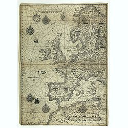
Universe Europae Maritime Eiusque Navigationis Descriptio. Generale Pascaerte van Europa . . .
This general chart of north-western Europe and the surrounding coastal waters is from the rare pilot-guide De Spiegel der Zeevaerdt , printed by Christopher Plantin in Le...
Date: Leyden, 1584
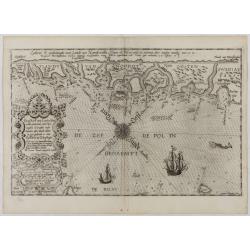
De Zee-Kuste vant Landt te Noort-oosten sorterende onder Norweghen ende eendeels onder Sweden alsoe tlandt aldaer in zijn gedaente is, van Distelberch tot Waersberghe.
A rare Latin text edition of this early and detailed chart of the coast of Norway of this landmark contribution to the science of navigation. Decorated by a large title c...
Date: Leiden, Plantijn, 1585
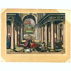
Domus mea domus orationis vocabitur. Joan 10.
A superb example of this illustration from Memorabilium Novi Testamenti in templo gestorum (Events in and around the Temple) (Events in and around the Temple). Christ exp...
Date: Antwerp, 1585
Multa bona opera ostendi vobis ex Patre meo : propter quod eorum lapidatis me. Joan 10.
A superb example of this illustration from Memorabilium Novi Testamenti in templo gestorum (Events in and around the Temple) (Events in and around the Temple). Christ in ...
Date: Antwerp, 1585
Oui ex vobis sine peccato est primus in allam Joan 8.
A superb example of this illustration from the New Testament showing Jesus and the woman taken in adultery (often called Pericope Adulterae[a] for short) is a passage (pe...
Date: Antwerp, 1585
Nititur ad vetitos iuuenem compellere amores Putephar, Gene[sis] 39,
A superb example of this illustration from the series of the Story of Joseph. Joseph Runs from Potiphar's Wife.Copper engraving published in " Thesaurus sacrarum his...
Date: Antwerp, 1585
Dum flaus in agro gaudet colligere spicas Ruth, forte affinis, venit in arua Booz. [ûRuth thanks Boaz for letting her glean his fields, from The Story of Ruth.]
A superb example of this illustration showing Ruth thanks Boaz for letting her glean his fields, from The Story of Ruth.Copper engraving published in " Thesaurus sac...
Date: Antwerp, 1585
Vincula dura Joseph pro falso crimine perfert. Sed deus a falsa hunc suspicione leuat. Gene[sis] 40
A superb example of this illustration from the series of the Story of Joseph. Joseph in Jail.Copper engraving published in " Thesaurus sacrarum historiarum veteris t...
Date: Antwerp, 1585
Imposita saxo Jacob cervice quiescens Aligeros scalas vidit imre choros. Gene[sis] 28
A superb example of this illustration showing a blind Isaac blessing Jacob. Copper engraving published in " Thesaurus sacrarum historiarum veteris testamenti, elegan...
Date: Antwerp, 1585
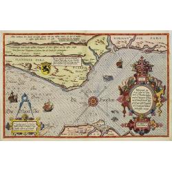
Beschrijvinge vande de zee Cuften va Vlanderen en Picardien. . .
DUTCH TEXT EDITION. A detailed chart of the coast of Flanders and Normandy decorated by a large colorful baroque title cartouche, and the coat of arms of Flanders with a ...
Date: Leiden, Plantijn, 1585
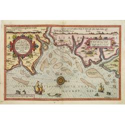
De zee cuften tufschen Dovere en Orfords nesse, daer de Teemse de Vermaerde Rivire van Lonen gelegens is. . .
A detailed chart of the English Channel coastland. Decorated by a colorful title cartouche and scale cartouche, one compass rose, several vessels and sea monsters. A very...
Date: Leiden, Plantijn, 1585
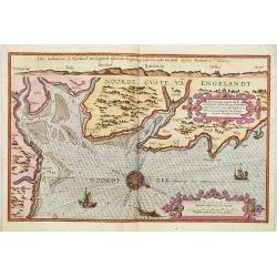
Belchrijuinghe vande zee custen van Engelandt. . .
A rare Dutch text edition of this detailed early chart of the northern coast of England. West to the top. The mileage cartouche has no Latin captures. Decorated by a colo...
Date: Leiden, Plantijn, 1585
Caerte der Noordt cufte van Engelandt, beginnende van Robinhodes baij tot Coket Eijlandt. . . .
A very early Dutch text edition of this detailed chart of the northern coast of England. The mileage cartouche has no Latin captures. West to the top.Decorated by a color...
Date: Leiden, Plantijn, 1585
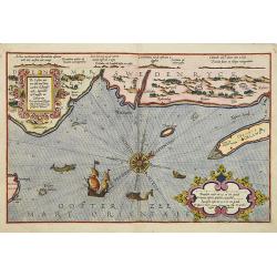
De custen van een deel van Denemarken en Swede. . .
A detailed chart of the coast Skane and Kalmar, with the island Öland. Decorated by a title and scale cartouche, a compass rose, several vessels and sea monsters, and de...
Date: Leiden, Plantijn, 1585
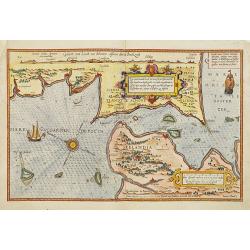
Zee caerte vande Sondt tvermaerste van Danemarcke . . .
A detailed chart of the coast of Denmark and its islands, Copenhagen in the center of the chart. West to the top. It is decorated by a title, scale and descriptive cartou...
Date: Leiden, Plantijn, 1585
Anverpia, nobile in Barbantia oppidum, parrim maritimum . . . [Antwerp]
The bird's-eye plan provides an excellent view of the citadel, city, docks and fortifications. The city was defended by a line of fortification and a moat constructed und...
Date: Cologne, 1585
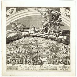
Mercurius.
Mercury holding a caduceus and riding in a chariot drawn by two birds on the clouds in the sky, an extensive landscape with a harbor with goods being loaded and unloaded ...
Date: Antwerp, 1585
Selling price: ????
Please login to see price!
Sold in 2025
Descriptio Germaniae Inferioris.
The oval map is surrounded by a strapwork frame and the title, adorned with ribbons, is held aloft by two winged cherubs.According to P. Meurer, based on de J ode's 12-sh...
Date: Antwerp, 1587
Itinerarium Sacrae Scripturae. Das ist: Ein Reisebuch...
Itinerarium Sacrae Scripturae. Das ist: Ein Reisebuch, Uber die gantze heilige Schrifft, in zwey Bücher geteilet... Zuvor gemehret mit einem Büchlein De monetis et mens...
Date: Magdeburg, 1587
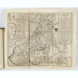
Novus de Leone Belgico eiusq topographia atq. Historica descriptione liber (…). Rerumque in Belgio maxime gestarum, inde ab anno Christi M.D.LIX. Usque ad annum M.D.LXXXVII perpetua narratione continatus.
ENLARGED EDITION, with 207 (of 208) engravings of a famous eyewitness account of the Dutch Revolt, with the famous "Leo Belgicus" map, here in its second state...
Date: Cologne, Gerardus Campensis for Frans Hogenberg, 1588
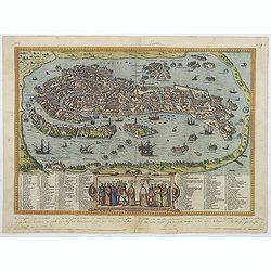
Venetia. (Venice)
Precise, beautiful bird's-eye town-view of Venice, clearly depicting the city's architectural landmark. The surrounding lagoon is animated with a great variety of sailing...
Date: Cologne, 1590
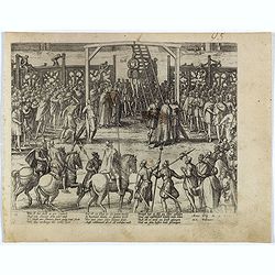
The hanging of the head of police Jean Grauwels in Brussels, 11 february 1569.
Print relating to Brussels during the first decades of the eighty year war between Spain and the Low Countries: (plate 18). This plate shows the hanging of the head of po...
Date: Cologne, ca. 1590
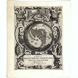
Habiti delle Donne Venetiane . . .
Title page of the book Habiti delle Donne Venetiane" (Dress of Venetian Women) which consists of twenty numbered plates of ornately dressed women. This very decorati...
Date: Venice, ca. 1591
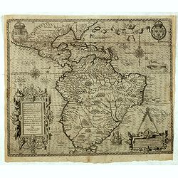
Americae Pars Magis Cognita. Chorographia nobilis & opulentae Peruanae Provinciae, atque Brasiliae, . . . MDXCII
First state. Although a map of South America it does include much of what is now the southern United States. There are two elaborate, strap-work cartouches with the one a...
Date: Frankfurt, 1592
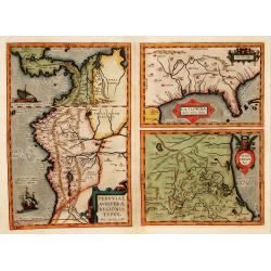
La Florida/ Peruviae Auriferae regionis Typus/ Guastecan.
The Chaves map of Florida is a prime example of an explorer's map since it records the recent discoveries of Cabeza de Vaca, De Soto, and Moscoso. The map revealed little...
Date: Antwerp, 1592
(South America) - Delineatio omnium orarum totius Australis partis Americae, dictae Peruvianae, a R. de la Plata, Brasiliam Pariam, et Castellam auream una cum omnibus…
A particularly lush example of Dutch decorative cartography boasting two intricate strapwork cartouches. Linschoten was one of the prime movers of Dutch and British expan...
Date: Amsterdam, 1593
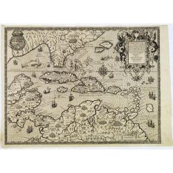
Occidentalis Americae partis.
The most beautifully engraved early map of the Caribbean, including Florida and the Southeast. The map includes representations of Columbus' ships and various notes regar...
Date: Frankfurt, 1594
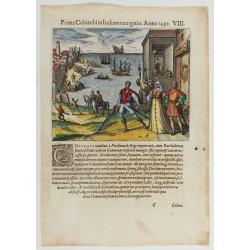
Prima Columbiin Indiam navigation Anno 1492.
Christopher Columbus and the Pinzon brothers leaving the port of Palos in Spain on August 3, 1492 for the New World. Right The King and Queen of Portugal Catholic Ferdina...
Date: Frankfurt, 1594
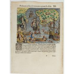
(Island of Pearls) Perlarum insula ob unionum copiam sic dicta.
A depiction of Cubagua as the Perlarum Insula (Island of Pearls), with in the foreground, two large ships send dinghies toward busy Native Americans collecting pearl oyst...
Date: Frankfurt, 1594
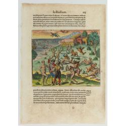
Cacodemon attacking the savages.
Cacodemon ("evil spirit") attacking the savages. Read more about "Les Grand Voyages" by Theodore De Bry [+]
Date: Frankfurt, 1594
Arcis Carolinae delineatio [Jacksonville]
Depicting Fort Caroline in Jacksonville, Florida. A French expedition, organized by Protestant leader Admiral Gaspard de Coligny and led by the French Explorer Jean Ribau...
Date: Frankfurt, 1594
[The French left in Fort Charles suffer the scarcity of provisions.]
An Indian town visited by the French of Charlesfort in search for food. After a drawing by LeMoyne. Charlesfort-Santa Elena is on what is now Parris Island, South Carolin...
Date: Frankfurt, 1594
Pisces in mari alati [flying fish attack]
Flying fish attacking a Portuguese ship in the West Indian Waters.Read more about "Les Grand Voyages" by Theodore De Bry [+]
Date: Frankfurt, 1594
[Navel battle between Portuguese and French Battle off Buttugar (Brazil).]
Navel battle between Portuguese and French in the seas off the Poti guaran Territories in Brazil.Read more about "Les Grand Voyages" by Theodore De Bry [+]
Date: Frankfurt, 1594
[Columbus is standing in the bow of his ship]
Columbus is standing in the bow of his ship, which is near the shore. He is clad in a long mantle and undercoat, while his armor lies at his feet, and his standard is flo...
Date: Frankfurt, 1594
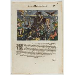
Inventio Maris Magallanici.
Allegorical scene allegorical image celebrating the circumnavigation of the earth by Ferdinand Magellan. The image shows Magellan on board of his ship, surrounded by myth...
Date: Frankfurt, 1594
Americae Retectio (Allegory of the Discovery of America)
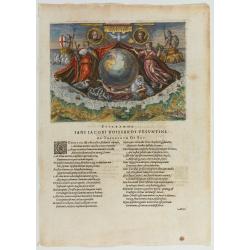
Allegorical scene commemorating the discovery of America. The main image shows Neptune, supporting a Globe, flanked by Flora-representing Florence, and Janus-representin...
Date: Frankfurt, 1594
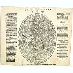
Lutetia Furens. Das ist : Die wütende Statt PARIS.
Rarissime placard dirigé contre la Ligue et le duc de Mayenne. La gravure est signée I.S. (marque inconnue). Ce placard en latin et en allemand est une reprise de l’e...
Date: France ca.. 1594
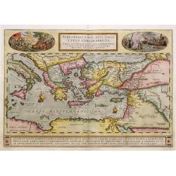
Peregrinationis Divi Pauli Typus corographicus. . .
A splendid map depicting the travels of Paulus. With two fine scenes in top. Showing the countries along the Mediterranean, including Cyprus and Italy. A first edition wi...
Date: Antwerp, 1595
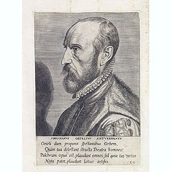
ABRAHAMUS ORTELIUS ANTVERPIANUS Orteli dum proponis spectantibus Orbem, Quam tua delectant structa Theatra homines! . . .
Portrait of Abraham Ortelius (Abraham Ortel), famous cartographer born in Antwerp and after studying Greek, Latin and mathematics set up business there with his sister, a...
Date: Antwerp, c.1595
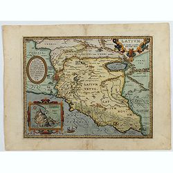
Latium.
Based on classical authors' sources, specifically Virgilius, Plinius, Varro, Halicarnasseus, Festus and Ausonius.Philip Wingius in his letter to Ortelius from 1592 mentio...
Date: Antwerp, 1595
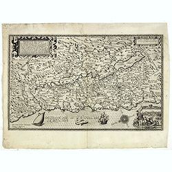
Peregrinatie Jesu Christu Een ordentliche beschrijvinge des Heijligen landts....
Very rare separately map of the Holy Land engraved by Joannes van Doetecum Jr. Oriented to the east. The shoreline runs from "Antaradus" in Syria to "Rhino...
Date: Amsterdam, ca. 1595
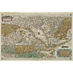
Nova et recens emendata totius Regni Ungariae una cum adiacentibus et finitimis regionisbus delineatio.
Engraved map by Jan van Deutecum, here the very rare first edition published by Cornelis Nicola in Asterdam in 1596. In very attractive original coloring.A re-issued was ...
Date: Amsterdam, Cornelius Nicol, 1596
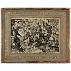
Sic inter dumos, pregrandi corpore cerus. - In pecus extrorquent dumeta per auia, acuto.
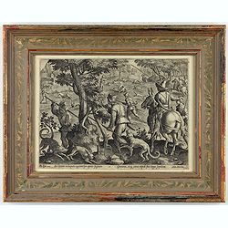
This is a plate from a series "Venationes ferarum, avium, piscium, pugnae bestiariorum & mutuae bestiarum". Published by Philippe Galle (Haarlem 1537 - 1612...
Date: Antwerp, Philips Galle, ca 1596
Sic per secta repens venator consista dumis - Torquet et undosos anates, Fusicasp palustres
This is a plate from a series "Venationes ferarum, avium, piscium, pugnae bestiariorum & mutuae bestiarum". Published by Philippe Galle (Haarlem 1537 - 1612...
Date: Antwerp, Philips Galle, ca 1596
Sic leporem in laqueos agitnat per aperta fugacem - Gramina, siq canes rapidi sua terga sequutur
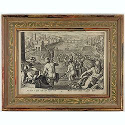
This is a plate from a series "Venationes ferarum, avium, piscium, pugnae bestiariorum & mutuae bestiarum". Published by Philippe Galle (Haarlem 1537 - 1612...
Date: Antwerp, Philips Galle, ca 1596
Piscantur tevetes sinuato in gargite pices.
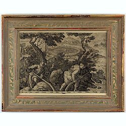
This is a plate from a series "Venationes ferarum, avium, piscium, pugnae bestiariorum & mutuae bestiarum". Published by Philippe Galle (Haarlem 1537 - 1612...
Date: Antwerp, Philips Galle, ca 1596
[Map of Corfu. View of the city of Corfu on the foreground. ]
Very rare map of Corfu with a view of the city of Corfu on the foreground. Published in the first edition of "Viaggio da Venetia, a Costantinopoli. Per Mare, e per T...
Date: Venice, Giacomo Franco, 1598
Gelriae, Cliviae, Finitimorumque Locorum Verissima..
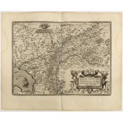
East to the top. Fine map of Geldria and Limburg, prepared by Christian s'Grooten. Very fine title cartouche lower right with painter's utensils around the cartouche. ...
Date: Antwerp, 1598
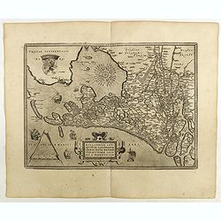
Hollandiae Antiquorum Catthorum..
This map shows Holland in great detail, including small towns, walled cities, rivers and lakes (many of which were reclaimed in the 17th century, and no longer exist). A ...
Date: Antwerp, 1598
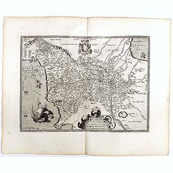
Florentini Dominii Fidelissima et nova descriptio.
The map is centered on the city of Florence and extends to Liguria, the Apennine Mountains, the Adriatic Coast, Siena and Lago di Perugia. The map is based upon Stefano B...
Date: Anvers, 1598
Larii Lacus Vulgo Comensis Descriptio . . . [and] Terretorii Romani Descrip. [and] Fori Iulii Vulgo Frivli Typus. . .
Set of 3 maps on one sheet of Lake Como, the region around Rome and the region around the Upper Adriatic, centered on Udinese from 'Theatrum Orbis Terrarum [Atlas of the ...
Date: Antwerp, 1598
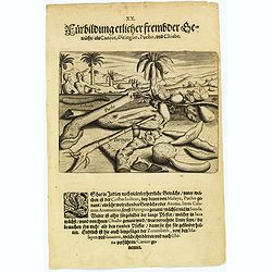
Plants, including the canior, diringuo, pucho and chiabe.
In the Indies there are many delightful plants, which include the ‘costus indicus’ (named by the Malays 'pucho') that has a wonderful aroma. Then there is the ‘cala...
Date: Frankfurt, 1598
The bird called 'Eeme' and other creatures of India.
Especially on the island of Java and in India, a strange bird called an 'Eeme' is found. It is almost as large as an ostrich with strong and sturdy legs, but it has no to...
Date: Frankfurt, 1598
Some of the animals that are found in India.
Although most elephants are found in Ethiopia, there are also many in India too. They are called 'Caffres' by the inhabitants and are slaughtered for their tusks, which t...
Date: Frankfurt, 1598
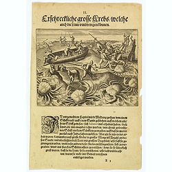
The Dutch are attacked by giant crabs.
During their return voyage, the Portuguese were wrecked on a sandbank (the Seychelles?) From the debris they began building a smaller ship in which they hoped to return t...
Date: Frankfurt, 1598
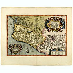
Hispaniae novae sive magnae recens et vera descriptio. 1579
This was the standard map of the area for a generation, copied by De Bry, Quad and Hondius. Even though Herrera (Spain's Royal Cosmographer) and Wytfliet worked 20 years ...
Date: Antwerp, 1598
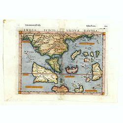
India Tercera Nuova Tavola.
The 1598 edition of this early map of South East Asia. Just to the west and south of Malacca one will notice ‘Camatra’ (Sumatra) and Java. China with Canton in the up...
Date: Venice, 1598
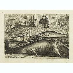
Virulus marinus. Cete (Whale and whaling scene)
Whale and whaling scene, set against a mountainous landscape in the manner of Pieter Brueghel the Elder. Plate number 1. The engraving is copied after Adrian Collaert pla...
Date: Antwerp, after 1598
Glaucus, Cantharus, Salpa, Rarus. (Piscium Vivæ Icones - Fish)
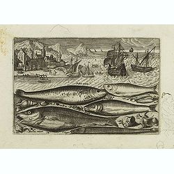
Depiction of Glaucus, Cantharus, Salpa, Rarus. Fish set against a mountainous landscape in the manner of Pieter Brueghel the Elder. Plate number 12. The engraving is copi...
Date: Antwerp, after 1598
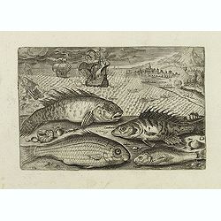
Faber piscis, Asellus minor, Conger, Alburinus. (Piscium Vivæ Icones - Fish)
Depiction of Faber piscis, Asellus minor, Conger, Alburinus. Fish set against a mountainous landscape in the manner of Pieter Brueghel the Elder. Plate number 14. The eng...
Date: Antwerp, after 1598
Venetia. [Venice ]
Scarce view of Venice published in the first edition of "Viaggio da Venetia, a Costantinopoli. Per Mare, e per Terra, & infieme quello di Terra Santa. Da Giosepp...
Date: Venice, Giacomo Franco, 1598
[ Map of the island Nexos]
Very rare map of the island Naxos published in the first edition of "Viaggio da Venetia, a Costantinopoli. Per Mare, e per Terra, & infieme quello di Terra Santa...
Date: Venice, Giacomo Franco, 1598
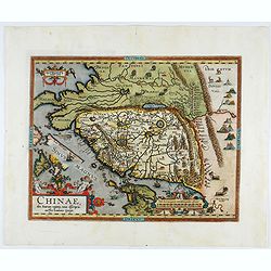
Chinae, olim Sinarum regionis. . .
The first printed map of China. It is signed by Ludovico Georgio, whose real name was Luis Jorge de Barbuda. He was a Portuguese Jesuit cartographer and besides that a sp...
Date: Antwerp, 1598
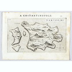
Santorini.
Very rare map of Santorini published in the first edition of "Viaggio da Venetia, a Costantinopoli. Per Mare, e per Terra, & infieme quello di Terra Santa. Da Gi...
Date: Venice, Giacomo Franco, 1598
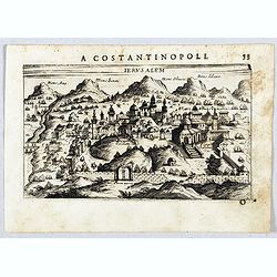
Jerusalem.
Very rare view of Jerusalem published in the first edition of "Viaggio da Venetia, a Costantinopoli. Per Mare, e per Terra, & infieme quello di Terra Santa. Da G...
Date: Venice, Giacomo Franco, 1598
Stampalia. [Map of Astypalaia]
Very rare map of the Greek island Astypalaia. The island is known in Italian as Stampalia. Published in the first edition of "Viaggio da Venetia, a Costantinopoli. P...
Date: Venice, Giacomo Franco, 1598
Rodi [View of Rhodes]
Very rare view of the City of Rhodes on the island of Rhodes. Historically, Rhodes island was very famous worldwide for the Colossus of Rhodes, one of the Seven Wonders o...
Date: Venice, Giacomo Franco, 1598

![[Map of the Holy Land, including Cyprus]](/uploads/cache/33436-250x250.jpg)
![Traiectum ad Mosam. [Maastricht]](/uploads/cache/47901-250x250.jpg)

![[Title page] De Praecipuis, Totius Universi Urbibus, Liber Secundus.](/uploads/cache/47934-250x250.jpg)


![Nititur ad vetitos iuuenem compellere amores Putephar, Gene[sis] 39,](/uploads/cache/47695-250x250.jpg)
![Dum flaus in agro gaudet colligere spicas Ruth, forte affinis, venit in arua Booz. [ûRuth thanks Boaz for letting her glean his fields, from The Story of Ruth.]](/uploads/cache/47694-250x250.jpg)
![Vincula dura Joseph pro falso crimine perfert. Sed deus a falsa hunc suspicione leuat. Gene[sis] 40](/uploads/cache/47693-250x250.jpg)
![Imposita saxo Jacob cervice quiescens Aligeros scalas vidit imre choros. Gene[sis] 28](/uploads/cache/47690-250x250.jpg)

![Anverpia, nobile in Barbantia oppidum, parrim maritimum . . . [Antwerp]](/uploads/cache/26518-250x250.jpg)


![Arcis Carolinae delineatio [Jacksonville]](/uploads/cache/48530-250x250.jpg)
![[The French left in Fort Charles suffer the scarcity of provisions.]](/uploads/cache/48529-250x250.jpg)
![Pisces in mari alati [flying fish attack]](/uploads/cache/48527-250x250.jpg)
![[Navel battle between Portuguese and French Battle off Buttugar (Brazil).]](/uploads/cache/48526-250x250.jpg)
![[Columbus is standing in the bow of his ship]](/uploads/cache/48524-250x250.jpg)
![[Map of Corfu. View of the city of Corfu on the foreground. ]](/uploads/cache/45221-250x250.jpg)
![Larii Lacus Vulgo Comensis Descriptio . . . [and] Terretorii Romani Descrip. [and] Fori Iulii Vulgo Frivli Typus. . .](/uploads/cache/41008-250x250.jpg)


![Venetia. [Venice ]](/uploads/cache/45176-250x250.jpg)
![[ Map of the island Nexos]](/uploads/cache/45289-250x250.jpg)
![Stampalia. [Map of Astypalaia]](/uploads/cache/45244-250x250.jpg)
![Rodi [View of Rhodes]](/uploads/cache/45236-250x250.jpg)