Browse Listings in Europe > Netherlands > Holland - South > maps
Zuydhollad.
An very attractive miniature map of south Holland, published by Petrus Bertius, and published in Amsterdam at the beginning of the seventeenth century. A map that is beau...
Date: Amsterdam, 1606
Selling price: ????
Please login to see price!
Sold in 2022
La Mayson de Britte.
A miniature view of a castle, including the plan and a description of few objects. The legend is in Dutch, and is translated overleaf in French. The sea is decorated with...
Date: Amsterdam/Frankfurt 1609
Selling price: ????
Please login to see price!
Sold
Civitas Bommelia Ficuti Fortis.
Very fine, detiled map of the fortification of Bommelia (Zaltbommel), Holland, during the siege. Copper engraving by Giucciardini, From Ludovico Guicciardini.'s descri...
Date: Amsterdam, 1612
Selling price: ????
Please login to see price!
Sold in 2019
[Lot of 10 maps/plans] Hollandia Comitatus.
Matthäus Merian (1593-1650). Engraver and publisher of Frankfurt. Theatrum Europaeum 1629-1718, Topographie 1642-88, Gotofred Newe Archontologica Cosmica 1638 and 1649.A...
Date: Fankfurt, c. 1625
Selling price: ????
Please login to see price!
Sold in 2022
Novissima Delflandiae, Schielandiae..
A very nice map showing the southern part of the province of Holland.Mercator was born in Rupelmonde in Flanders and studied in Louvain under Gemma Frisius, Dutch writer,...
Date: Amsterdam, 1629
Selling price: ????
Please login to see price!
Sold in 2020
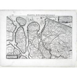
Insular Dordracencis, Alblasser, Crimper, Clundert. . .
A very nice map showing the southern part of the province of Noord Holland. The map is dated 1629. Henricus Hondius gives credit to Balthasar Florisz. van Berckenrode did...
Date: Amsterdam, 1630
Selling price: ????
Please login to see price!
Sold in 2012
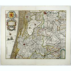
Rhinolandiae, Amstelandiae, et ..
Centered on The Hague, Leiden, Haarlem, Amsterdam, Gouda, etc. West to the top. Prepared by Balthasar Floris van Berkenrode.
Date: Amsterdam, 1630
Selling price: ????
Please login to see price!
Sold in 2008
Novissima Delflandiae, Schielandiae et circumiacentium insularum ut Voornae, Overflackeae, Goeree, Iselmonde aliarumque tabula.
A small, highly detailed map of Southern Holland published by Henricus Hondius(fl. 1624-1651) based on the survey by Floriszoon van Berckenrode. Includes the cities of Ro...
Date: Amsterdam, 1632
Selling price: ????
Please login to see price!
Sold in 2010
Novissima Tabula Insular, Dordracensis, Alblasser, Crimper, Clundert etc...
A small, highly detailed map of Southern Holland published by Henricus Hondius(fl. 1624-1651) based on the survey by Floriszoon van Berckenrode. Includes the cities of Br...
Date: Amsterdam, 1632
Selling price: ????
Please login to see price!
Sold in 2010
Novissima Tabula Insular Dordracensis. . .
The countship of Holland was subdivided into a number of bailiwicks. The most southerly bailiwick, bordering on Brabant was named Zuid-Holland. Many floods changed the ap...
Date: Amsterdam, 1639
Selling price: ????
Please login to see price!
Sold in 2021
Zuydhollandia stricte sumta.
The countship of Holland was subdivided into a number of bailiwicks. The most southerly bailiwick, bordering on Brabant was named Zuid-Holland. Many floods changed the ap...
Date: Amsterdam 1645
Selling price: ????
Please login to see price!
Sold in 2019
Rhenolandiae et Amstellandiae.
Encompasses the area between 's-Gravenhage and Gouda in the south, to Beverwijk in the north. Large expanse of the Haarlemmermeer occupies the centre of the plate. A very...
Date: Amsterdam, 1645
Selling price: ????
Please login to see price!
Sold in 2017
Zuydhollandia stricte sumta.
The count ship of Holland was subdivided into a number of bailiwicks. The most southerly bailiwick, bordering on Brabant was named Zuid-Holland. Many floods changed the a...
Date: Amsterdam, 1645
Selling price: ????
Please login to see price!
Sold in 2008
Zuydhollandia stricte sumta.
The count ship of Holland was subdivided into a number of bailiwicks. The most southerly bailiwick, bordering on Brabant was named Zuid-Holland. Many floods changed the a...
Date: Amsterdam, 1645
Selling price: ????
Please login to see price!
Sold in 2019
Delflandia, Schielandia.
This finely engraved map by Willem Blaeu shows the estuary of the River Maas and includes the area from 's-Gravenhage to Gouda to Steenbergen and Ouddorp. Includes Rotter...
Date: Amsterdam, 1645
Selling price: ????
Please login to see price!
Sold in 2021
Delflandia, Schielandia.
This finely engraved map shows the estuary of the River Maas and includes the area from 's-Gravenhage to Gouda to Steenbergen and Ouddorp. Includes Rotterdam and Delft: G...
Date: Amsterdam, 1645
Selling price: ????
Please login to see price!
Sold in 2019
Afbeeldinge Vande vermaerde Seehaven ... Duynkerken...
A striking coastal chart, extending from Dunkerque and Wynoxbergen to in the east to Waldarn and Gravelines in the west, with an inset showing the continuation of the coa...
Date: Amsterdam, 1650
Selling price: ????
Please login to see price!
Sold in 2018
Pas Caert van Texel tot aen de Hoofden.
An attractive chart of the North Sea. Hendrick Doncker was one of the leading Amstrdam-based publshers of sea-atlases and sea charts
Date: Amsterdam, 1659
Selling price: ????
Please login to see price!
Sold in 2023
Delflandia, Schielandia. . .
This detailed road map shows the estuary of the River Maas and extends.
Date: Amsterdam, ca. 1660
Selling price: ????
Please login to see price!
Sold in 2017
Delflandia, Schielandia. . .
This detailed road map shows the estuary of the River Maas and extends from 's-Gravenhage to Gouda in the north and from Ouddorp to Steenbergen in the south. Cities, such...
Date: Amsterdam, ca. 1660
Selling price: ????
Please login to see price!
Sold in 2018
Delflandia, Schielandia.
Based ultimately on the large wall map by Balthazar Florisz van Berckenrode(1620-21), this finely engraved map shows the estuary of the River Maas and includes the area f...
Date: Amsterdam 1661
Selling price: ????
Please login to see price!
Sold
Hollandiae pars Meridionalior vulgo Zuyd-Holland.
Detailed map covering the area around the Biesbos, including Breda, Dordrecht, Gorcum and Gouda.Cartouches with later color addition.
Date: Amsterdam, 1670
Selling price: ????
Please login to see price!
Sold in 2012
[Lot of 4 maps] Comitatus Hollandiae Tabula Pluribus Locus Recens Emendata a Nicolao Visscher.
The fourth state (of 5) of Claes Jansz. Visscher's attractive map of Holland, published by his grand-son Nicolaas II. Embellished with a cartouche with the coat-of-ar...
Date: Amsterdam, ca. 1670
Selling price: ????
Please login to see price!
Sold in 2022
Paskaerte van het inkoomen van de Maes.. (two sheets)
Uncommon chart of the river Maas from the entrance down to the Biesbosch. Including the towns of Dordrecht, Rotterdam, Schiedam, Willemstad, Vlaardingen, Den Briel, Helle...
Date: Amsterdam, ca.1680
Selling price: ????
Please login to see price!
Sold in 2009
Nova atque emendata descriptio Suydt Hollandiae edita a Frederico de Wit.
A detailed map of the southern part of Holland with the cities of Breda, Dordrecht and Gorinchem. The map is oriented with west at the top. Superb detail of roads, canals...
Date: Amsterdam, 1680
Selling price: ????
Please login to see price!
Sold in 2009
Novissima Delflandiae, Schielandiae et circumiacentium insularum ut Voornae, Overflackeae Goerea, Iselmondae aliarumque tabula Auctore Balthazaro Florentio a Berckenrode Amstelodami. Apud Fredericum De Witt.
A very nice map showing the southern part of the province of Holland, prepared by B.F. Van Berckenrode.Originally the plate was published by Janssonius. This is the much ...
Date: Amsterdam, 1680
Selling price: ????
Please login to see price!
Sold in 2009
Delflandia, Schielandia et circumjacentes Insulae ut Voorna, Overflackea, Goerea, Yselmonda et aliae.
Detailed map of Southern Holland, which includes the cities of The Hague (Gravenhag), Rotterdam, Willemstad, Gouda and Delft (Delet). Ships and naval battles are shown th...
Date: Amsterdam, 1690
Selling price: ????
Please login to see price!
Sold in 2010
Nova atque emendata descriptio Suydt Hollandiae edita a Frederico de Wit.
Detailed map covering the area around the Biesbos, including Breda, Willemstad, Dordrecht, Culembourg, Gorichem and Gouda.The map is oriented with west at the top. Superb...
Date: Amsterdam, 1690
Selling price: ????
Please login to see price!
Sold in 2011
Contado D'Ollanda Parte Meridionale Dedicato All'Illustrifsino Signore Auocato Benedettto Gori. . .
Detailed map of Southern Holland by Vincenzo Coronelli that shows the cities of Rotterdam, Delft and Breda. This map is the bottom half of what was published as a two par...
Date: Venice, 1692
Selling price: ????
Please login to see price!
Sold in 2010
Kaart van de Ring van Putten, bestaande uit vier delen Caerte gemaeckt op ordre vande bovengenoemde heeren opperdijckgraeff en hoog heemraden des Ringhs van Putten
Wall map consisting of four separate maps, each measuring 50 x 63 cm. The Ring van Putten concerns the region south of Rotterdam, with cities such as Spijkenisse, Geervli...
Date: 1701
Selling price: ????
Please login to see price!
Sold in 2022
't Hooge Heemraedschap van Delflant.
Beautifully engraved map, a reduced from of the wall map, of 't Hooge Heemraedschap van Delfland prepared by Nicolaas and Jacob Kruikius. Decorated with the Delfland coat...
Date: Delft, 1712
Selling price: ????
Please login to see price!
Sold
Nieuwe en Accurate Kaart van de Balluage van Amstelland.
Detailed map of the area south east of Amsterdam, including river Vecht and Muiden, Weesp, Loenen and Mijdrecht.
Date: Amsterdam 1740
Selling price: ????
Please login to see price!
Sold
VII. Carte de la Hollande ou sont les environs de Rotterdam..
Attractive small map centered on the island of Voorne-Putten with Rotterdam and Dort[recht]. From Atlas Portatif Universel, by Robert de Vaugondy.Unrecorded state with er...
Date: Paris, later than 1748
Selling price: ????
Please login to see price!
Sold
Kaart van den loop der Rivieren de RHYN, de MAAS de MERWE, en de LEK. . . [together with] Kaart van de beneden Rivier de Maas. . . [together with] Nieuwe kaart van 't Kwartier Nijmegen . . .
1./ Kaart van den loop der Rivieren de RHYN, de MAAS de MERWE, en de LEK... (352x450mm.) A detailed map of the center of the Netherlands, with the rivers Rhine, Maas, de ...
Date: Amsterdam, 1750
Selling price: ????
Please login to see price!
Sold in 2013
Nieuwe kaart der Provincie van Holland.
In upper left hand corner inset map of Kaartje van de Helder Texel Vlieland en Wieringen . Including the province of Utrecht and the Veluwe.
Date: Amsterdam 1750
Selling price: ????
Please login to see price!
Sold
Voor den Weledelen Heer Mr Cornelis Pieter Pompe van Meerdervoort, Heere van Zwijndrecht. . .
Very fine and decorative map by Jan Govertsz van Linden, who was officially admitted as surveyor with by the court of Holland in 1736.According to the title the survey wa...
Date: Zwijndrecht, 27 october, 1764
Selling price: ????
Please login to see price!
Sold in 2011
Carta Generale de Paesi Bassi Terzo Foglio. . .
This is one sheet of a six sheet map on the Low Countries, each with its own decorative cartouche and separate borders. This map encompasses the northwestern portion of B...
Date: Rome, 1795
Selling price: ????
Please login to see price!
Sold in 2020


![[Lot of 10 maps/plans] Hollandia Comitatus.](/uploads/cache/18973-(1)-250x250.jpg)


![[Lot of 4 maps] Comitatus Hollandiae Tabula Pluribus Locus Recens Emendata a Nicolao Visscher.](/uploads/cache/18172-250x250.jpg)


![Kaart van den loop der Rivieren de RHYN, de MAAS de MERWE, en de LEK. . . [together with] Kaart van de beneden Rivier de Maas. . . [together with] Nieuwe kaart van 't Kwartier Nijmegen . . .](/uploads/cache/33462-250x250.jpg)


