Browse Listings in Europe > British Isles
A Chart Shewing the Sea coast of England & Wales.
A fine map drawn by Thomas Badeslade and engraved by William Henry Toms which was published in the atlas "Chorographia Britannia". Thomas Badeslade (active 172...
Date: London, 1742
Selling price: ????
Please login to see price!
Sold in 2013
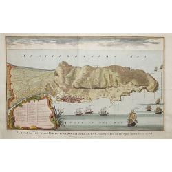
Plan of the fortifications of Gibraltar, exactly taken on the Spot in the Year 1738.
A map showing Gibraltar in Spain with decorative ships in the foreground. It is very likely that the author of this map was Nicholas Tindall: as Chaplain to an English Fl...
Date: London ca. 1742
Selling price: ????
Please login to see price!
Sold in 2018
Cambridgshire?
Rare. From the Johan and Henry Overton's edition of John Speeds "Theatre of the Empire of Great Britain". Apart from 4 editions of the Atlas, published between ...
Date: London, 1710-1743
Selling price: ????
Please login to see price!
Sold
Facciata della Chiesa Cattedrale di S. Pietro in Jorck.
Facade of the Cathedral Church of St. Peter in York. Hand colored copper engraving published by York in 1743 and engraved by Salmon.
Date: Gavirate, 1743
Selling price: ????
Please login to see price!
Sold in 2018
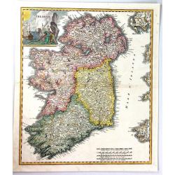
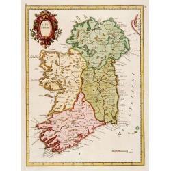
Irlanda.
A beautiful map of Ireland, finely engraved in Italy by Giambatista Albrizzi, with detailed topographical and political information.The map shows the four provinces of Ir...
Date: Venice, 1743
Selling price: ????
Please login to see price!
Sold in 2019
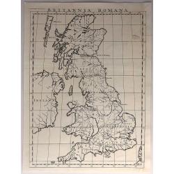
Britannia Romana.
Antique, minimalistic, copper engraved map, published in 1743 by John and Paul Knapton, London, for "The History of England" by Rapin de Thoyras.Translated by N...
Date: London, 1743
Selling price: ????
Please login to see price!
Sold in 2017
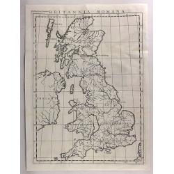
Britannia Romana.
An antique copper engraved map published in 1743 by John and Paul Knapton, London for "The History of England" by Rapin de Thoyras. Translated by Nicholas Tinda...
Date: London, 1743
Selling price: ????
Please login to see price!
Sold in 2017
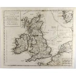
Nuova Carta dell' Isole Britanniche. . .
A rare map of the British Isles. It extends from southwestern Norway and the western coast of the Low Countries and northwestern France.
Date: Naples, 1743
Selling price: ????
Please login to see price!
Sold in 2019
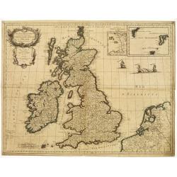
Les Isles Britanniques ou les Royaumes d'Angleterre, d'Écosse et d'Irlande. Divisées par Provinces..
Map of the British Isles with inset maps of the Channel Islands and the Faroe, Orkney and Shetland Islands.Embellished with fighting vessels and an ornamental title carto...
Date: Paris 1744
Selling price: ????
Please login to see price!
Sold
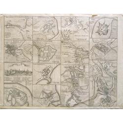
[The Plans of the Principal Towns, Forts & Harbours in Ireland]
A selection of 16 city views (Kilkenny), town plans (Dublin, Londonderry, Coleraine, Gallway, Carrickfergus, Cork, Athlone, Waterford, Belfast, Limerick), forts (Drogheda...
Date: London , 1744
Selling price: ????
Please login to see price!
Sold in 2021
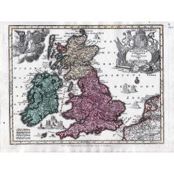
Accuratissima Angliae, Scotiae et Hiberniae tab., …
An elegant map of the British Isles. From: Atlas Minor Praecipua Orbis Terrarum Imperia, Regna et Provincias, Germania, … The maps were drawn by Georg Matheus Seutt...
Date: Augsburg, circa 1744
Selling price: ????
Please login to see price!
Sold in 2023
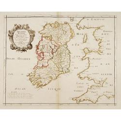
Irlande Royaume divisé en ses quatre Provinces..
SANSON'S MAP OF IRELAND IN ITS THIRD AND RAREST STATE BY GILLES ROBERT.Sanson's 1665 map of Ireland, in it THIRD AND RAREST STATE, with the 1741 imprint of Gilles Robert....
Date: Paris 1741/c.1745
Selling price: ????
Please login to see price!
Sold
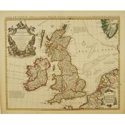
Les Isles Britanniques ou sont le Royaumes d'Angleterre.. d'Ecosse.. d'Irlande..
Beautifully engraved, decorative map of the British Isles. Detailed to show towns, roads, rivers, lakes, counties, etc. Embellished with a decorative distance scale and a...
Date: Amsterdam c. 1745
Selling price: ????
Please login to see price!
Sold
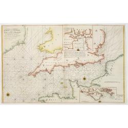
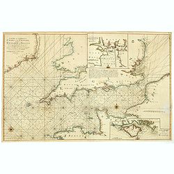
A new and correct chart of the channel between England & France..
The chart includes the South Coast of England from North of the Bristol Channel and of the Thames Estuary, there are insets for Plymouth Sound and the Isle of Wight.
Date: London 1745
Selling price: ????
Please login to see price!
Sold
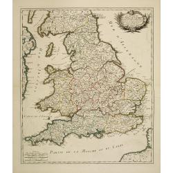
Le royaume d'Angleterre divisé en Comte et Baronies. . .
Fine map of England and Wales. As well as country details, including the main post roads. Le Rouge was active from 1740- till 1780 as a publisher, and was appointed engin...
Date: Paris, 1745
Selling price: ????
Please login to see price!
Sold in 2011
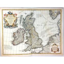
Les Isles Britanniques
A fine example of De L'Isle's map of the British Isles. It was redone by Philippe Buache and published in 1745.Includes a splendid, large, ornate decorative title cartouc...
Date: Paris, 1745
Selling price: ????
Please login to see price!
Sold in 2017
Plan of the city & Castle of Chester, Survey'd and Drawn by Alexander de Lavaux.
A rare and important plan of the city of Chester was engraved by Parr but surveyed and drawn by a Dutch engineer, Alexandre De Lavaux. Two large and imposing cartouches c...
Date: London, 1745
Selling price: ????
Please login to see price!
Sold in 2017
The Southwest Prospect of the City of Durham.
A delightful copperplate engraving of the city of Durham, published in 1745 in London by Samuel and Nathaniel Buck. It shows the ancient city perched high on a hill, over...
Date: London, 1745
Selling price: ????
Please login to see price!
Sold in 2017
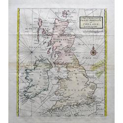
A Chart of the Sea Coast of Great Britain and Ireland.
A scarce and attractive sea chart of the British Islands. With many place names along the coats. With a compass rose and rhumb lines.
Date: London, ca. 1745
Selling price: ????
Please login to see price!
Sold in 2017
A new and correct chart of the channel between England & France..
The chart includes the South Coast of England from North of the Bristol Channel and of the Thames Estuary, there are insets for Plymouth Sound and the Isle of Wight.
Date: London, 1745
Selling price: ????
Please login to see price!
Sold in 2018
L'Irlande.
Fine map of Ireland.
Date: Paris 1746
Selling price: ????
Please login to see price!
Sold
A Map of London and the Adjacent Country 10 Miles Around - (Sheet 1 of 16).
This is a part of an exact Survey of the City of London Westminster, ye Borough of Southwark and the country near ten miles round, begun in 1741 and ended in 1745, by Joh...
Date: London, 1746
Selling price: ????
Please login to see price!
Sold in 2020
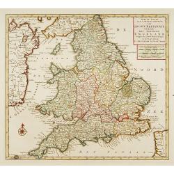
Nieuwe kaart van 'T zuider Gedeelte van Groot Brittannie. . .
Isaac Tirion was born in Utrecht ca. 1705. He came to Amsterdam ca. 1725. Tirion published a number of important books, many of which are still in demand for their intere...
Date: Amsterdam, 1747
Selling price: ????
Please login to see price!
Sold in 2023
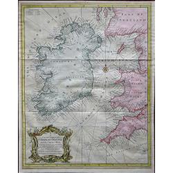
A Correct Chart of St. Georges Channel and the Irish Sea, Including all the Coast of Ireland, and ye West Coast of Great Britain from Cantire to Portland Isle: From the latest & best Observations.
A 1747 nautical chart or maritime map of Ireland and the St. Georges Channel. Engraved by R. W. Seale, the map covers the whole of Ireland as well as adjacent parts of Sc...
Date: London, 1747
Selling price: ????
Please login to see price!
Sold in 2019
A correct Chart of the English Channel - From the No. Foreland to the Lands End on the Coast of England, and from Calais to Brest on the Coast of France . . .
The English Channel, featuring insets of the Isles of Scilly, Falmouth Haven, Plymouth Sound and the Isle of Wight and ye adjacent Harbours. Alderney, Guernsey, Jersey an...
Date: London, 1747
Selling price: ????
Please login to see price!
Sold in 2020
Roy.me d'Angleterre..
Nice small map of England, dated 1748. From Atlas Portatif Universel, by Robert de Vaugondy.Page 5 outside border top left.
Date: Paris, 1748
Selling price: ????
Please login to see price!
Sold
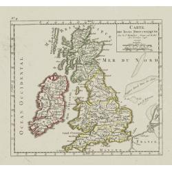
Carte des Isles Britanniques.
Nice small map of the British Isles, dated 1748. From Atlas Portatif Universel, by Robert de Vaugondy.Page 4 outside border top left.
Date: Paris, ca. 1748
Selling price: ????
Please login to see price!
Sold
Sir Richard Steele.
This ia a large finely engraved portrait of Sir Richard Steele, the private secretary to James. the 1st Duke of Ormonde. It was engraved by Houbraken from a painting by K...
Date: Amsterdam, 1748
Selling price: ????
Please login to see price!
Sold in 2016
[2 prints] The inside perspective view of the under Chappel... / A view of the west front of the Chappel...
Two quite rare attractive copper-engravings of the St. Thomas Chapel on the old London Bridge. Engraved by James Basire, drawn by George Vertue, published in the first vo...
Date: London, 1748
Selling price: ????
Please login to see price!
Sold in 2019
This plan of the cities of London and Westminster and Borough of Southwark, with the contiguous buildings..
First state of this detailed and important plan of London, engraved by Isaac Basire. With a dedication to Martin Folkes.
Date: London, 1749
Selling price: ????
Please login to see price!
Sold
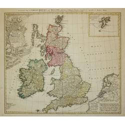
Regnorum Magnae Britanniae et Hiberniae ...
A General Map of Great Britain and Ireland with Part of Holland, Flanders and France.
Date: Nuremberg, 1749
Selling price: ????
Please login to see price!
Sold in 2011
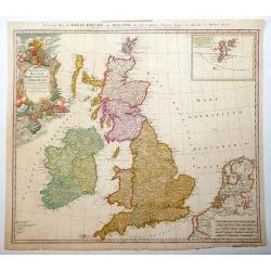
Regnorum Magnae Britanniae et Hiberniae.
Issued over a long period by the heirs of Johann Baptist Homann. This handsome map of the British Isles includes very good detail of Ireland, England, Scotland, Wales, an...
Date: Nuremberg, 1749
Selling price: ????
Please login to see price!
Sold in 2013
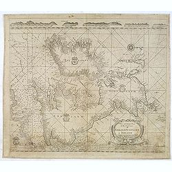
A New and Correct Chart of the Sea Coast of ENGLAND SCOTLAND & IRELAND Sold by George Grierson at the Two Bibles & Kings Arms in Essex Street Dublin
Scarce chart of England, Scotland and Ireland, engraved by James Barlow and published by George Gierson in Dublin. It is copied from Samuel Thornton's chart, 1708, for an...
Date: Dublin, 1749
Selling price: ????
Please login to see price!
Sold in 2012
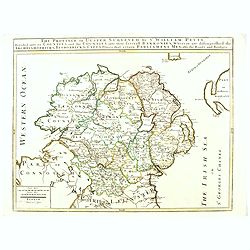
The Province of Ulster Surveyed by Sir William Petty. . .
This map of Ulster (present-day Northern Ireland), published in London by T.Jefferys is based on the Down Survey of Ireland undertaken in 1656–1658. As indicated in the...
Date: London, ca. 1749
Selling price: ????
Please login to see price!
Sold in 2016
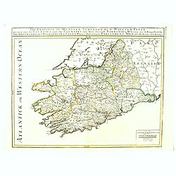
The Province of Munster Surveyed By Sr. William Petty : Divided into its Counties and the Counties into their serevall Barronies, Wherein are distinghished the . . .
This map of Ulster (present-day Northern Ireland), published in London by T.Jefferys is based on the Down Survey of Ireland undertaken in 1656–1658. As indicated in the...
Date: London, ca. 1749
Selling price: ????
Please login to see price!
Sold in 2016
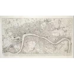
To Martin Folkes Esq[ui]r[e] President of the Royal Society: This Plan of the Cities of London with the Contiguous Buildings. . .
A plan of London, Westminster and Southwark published in London in 1749. The text below the plan states that the map was taken from Rocque’s great survey of the city, t...
Date: London, 1749
Selling price: ????
Please login to see price!
Sold in 2020
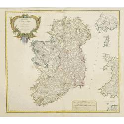
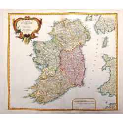
Royaume d'Irlande divisé en ses quatre Provinces
Fine map of Ireland, engraved by the master Delahaye. Fine title cartouche.
Date: Paris 1750
Selling price: ????
Please login to see price!
Sold
Royaume d'Irlande.
Nice large map of the kingdom of Ireland,divided in the 4 provinces and subdivided in counties,also showing a part of England and of Scotland, fully colored by hand. From...
Date: Paris, 1750
Selling price: ????
Please login to see price!
Sold
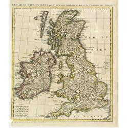
Les Isles Britanniques par Mr. De L'Isle. Geographe du Roy &c.
Uncommon map of the British Isles, after de L'Isle. In lower left bottom : cette carte doit etre placée au commencement des Tomes 2.3.4. & suivans.
Date: Paris ca 1750
Selling price: ????
Please login to see price!
Sold
Vue de la Compagnie a déjeuner dans la Rotonde qui est au milieu des Jardins de Renelagh a Londres.
An optical view of a meal held in the Rotonde in Renelagh park in London.
Date: Paris, c. 1750
Selling price: ????
Please login to see price!
Sold in 2020
Cities of Ireland (no title).
Sixteen town- plans on one sheet (not numbered): 1:Drogheda, with the battle at the Boyne 2: Londonderry 3:Kinsaile Harbour 4: Chaliamount Fort 5: The city of Dubli...
Date: ca. 1750
Selling price: ????
Please login to see price!
Sold in 2013
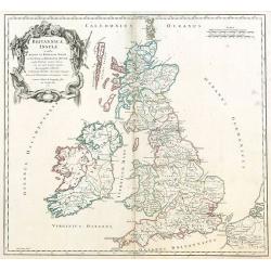
Britannicae, Insulae in quibus Albion sen Britannia Major, ...
British Isles by de Vaugondy.
Date: Paris, 1750
Selling price: ????
Please login to see price!
Sold in 2009
Vue Perspective...Ville de Londres prise de la Temise
A "vue optique" view of London on the River Thames. Major monuments are depicted, including the Tower of London, St. James and Westminster Bridge. Numerous mari...
Date: Paris, ca. 1750
Selling price: ????
Please login to see price!
Sold in 2010
A Plan of the City of Coventry Surveyed in MDCCXLVIII & IX by Samuel Bradford and Engraved by Thos. Jefferys
Rare and important plan of Coventry by T. Jefferys.A large and detailed plan of Coventry, engraved and published by Thomas Jefferys in 1750 after a survey of Samuel Bradf...
Date: London, 1750
Selling price: ????
Please login to see price!
Sold in 2010
A Plan of the City of York Survey'd By Peter Chassereau / Plan de la Ville et foubourgs de York. Capitale de le Comté du meme Nom levé par le Sr. P: Chassereau & Publié par Rocque a Charing Cross 1750
Rare plan of York by J. RocqueA large and detailed copper engraved plan of York, published by John Rocque in 1750 after a survey of Peter Chassereau. Surrounded by 10 ins...
Date: London, 1750
Selling price: ????
Please login to see price!
Sold in 2010
A Survey of the City and Suburbs of Bristol Survey'd by John Rocque Land Surveyor at Charing Cross, 1750 / Plan de la Ville et Faubourgs de Bristol Leve par Jean Rocque a Charing Cross a Londres 1750
Rare map of Bristol by J. RocqueA large and detailed copper engraved map of the city and suburbs of Bristol, draw, serveyed and published by John Rocque in 1750. Surround...
Date: London, 1750
Selling price: ????
Please login to see price!
Sold in 2010
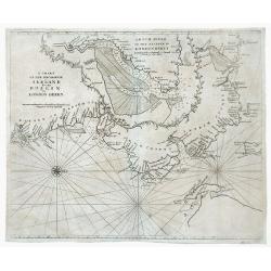
A Chart of the Seacoasts of Ireland from Dublin to London Derry.
Map showing the Irish coast from Dublin heading northeast to the city of Londonderry. The inset, partitioned with a leafy garland, details the passageway leading to Londo...
Date: London, 1750
Selling price: ????
Please login to see price!
Sold in 2010
The Southwest Coast of Ireland from Dungarvan to the River Shannon.
Map showing the southwest coast of Ireland and cities within Waterford, Cork and Kerry counties. An inset at the top of the map, divided with a leafy garland, details the...
Date: London, 1750
Selling price: ????
Please login to see price!
Sold in 2010
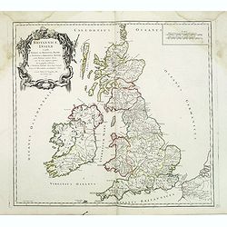
Britannicae, Insulae in quibus Albion sen Britannia Major, . . .
British Isles from his "Atlas Universel".Gilles Robert de Vaugondy (1688–1766), also known as Le Sieur or Monsieur Robert, and his son, Didier Robert de Vaugo...
Date: Paris, 1750
Selling price: ????
Please login to see price!
Sold in 2016
A View of the grand Palace of Westminster. / Vüe du Palais Episcopal de Westminster.
So-called optical print illustrating a perspective view of the old Palace of Westminster where the Lords and Commons met and the square facing it.In the eighteenth and ni...
Date: London, c.1750
Selling price: ????
Please login to see price!
Sold in 2019
A View of the Tower with the Bridge & part of the City of London from the River. Vue de la Tour du Pont et partie de la Ville de Londres prise de la Riviere.
So-called optical print illustrating part of the city of London, taken from the river Thames. With numbered key list. Engraved by Charpentier.In the eighteenth and ninete...
Date: London, c.1750
Selling price: ????
Please login to see price!
Sold in 2013
A Survey of the City and Suburbs of Bristol Survey'd by John Rocque Land Surveyor at Charing Cross, 1750 / Plan de la Ville et Faubourgs de Bristol Leve par Jean Rocque a Charing Cross a Londres 1750
Rare "carte à figures"- map of Bristol by J. Rocque.A large and detailed copper engraved map of the city and suburbs of Bristol, draw, surveyed and published b...
Date: London, 1750
Selling price: ????
Please login to see price!
Sold in 2012
Londinum Londen.
Rare view of London, in nice hand coloring.
Date: Augsburg, 1750
Selling price: ????
Please login to see price!
Sold in 2012
Royaume D'Irelande, Divisee en Ses Quatre Provinces.
A very precise and detailed map of Ireland by "Le Sieur". With large fancy title cartouche and scale table. One of the most beautiful maps of Ireland. Gilles R...
Date: Paris, 1750
Selling price: ????
Please login to see price!
Sold in 2013
View of Godston Nunnery Near Oxford.
Pleasant hand-colored print of the famous "Godston Nunnery" close to Oxford in Oxfordshire. The print was by Samuel & Nathaniel Buck who sketched the ruins ...
Date: London, c1750
Selling price: ????
Please login to see price!
Sold in 2013
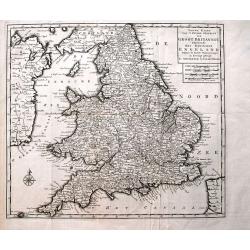
Nieuwe Kaart van 't Zuider Gedeelte van Groot Britannie behelzende Het Koningryk Engeland...
Detailed map of England and Wales, including parts of Ireland. Shows the Picts Wall (Hadrian's Wall)! With a wealth of place names, rivers, roads, areas, etc.
Date: Amsterdam, c1750
Selling price: ????
Please login to see price!
Sold in 2013
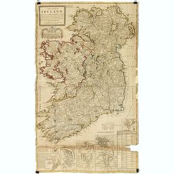
A new map of Ireland divided into its provinces, counties and baronies, wherein are distinguished the bishopricks, borroughs, barracks, bogs, passes, bridges &c. with the principal roads, and the common reputed miles
A magnificent and highly detailed late 18th century map of Ireland, with in lower right corner inset town plans of Dublin, Cork, Limerick, Waterford and Gallway, with pla...
Date: London, 1726-1750
Selling price: ????
Please login to see price!
Sold in 2015
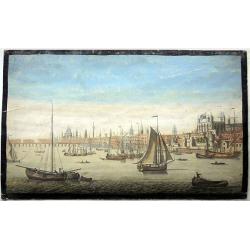
The South East prospect of London, from the Tower to London Bridge.
Optical vue of the River Thames, looking to the west from the Tower of London to London Bridge and St Paul's; animated with a number of boats on the water.
Date: Londo, circa 1750
Selling price: ????
Please login to see price!
Sold in 2022
London.
Small French map of London with a key below naming 24 important places within the city. Numerous streets are indicated. Uncommon map, probably dating to around 1700-1750.
Date: Paris, ca. 1700-1750
Selling price: ????
Please login to see price!
Sold in 2016
Vue generale de la ville de Londres
A 'bird's-eye' view of London, taken from a point several hundred feet above Tower Bridge. Note: St. Paul's church, the Monument to the fire of London, and Westminster Ab...
Date: Paris, ca 1750
Selling price: ????
Please login to see price!
Sold in 2016
Two Optical prints of London
Two optical prints "Prospect des Admiralitaets Hauses, nebst dem neuen Gebäu für die Quarde zu Pferd" and "Vue de la Maison de Northumberland à Charing ...
Date: Augsburg 1750
Selling price: ????
Please login to see price!
Sold in 2016
Vue de l Hotel du Lord Maire, qui comprend la Façade, et le Cot' Occidental de Londres.
Shows the famous Lord Mayor's coach driving through London. The Lord Mayor's coach is famous for its role in the Lord Mayor's Show, which is one of the longest establishe...
Date: Augsburg, 1750
Selling price: ????
Please login to see price!
Sold in 2016
Der Tower La Tour de Londres.
Optical view by J.B. WINCKLER after L. KNYF, German and French captions below, In the eighteenth and nineteenth centuries there were many popular speciality establishment...
Date: Augsburg, 1750
Selling price: ????
Please login to see price!
Sold in 2016
Three Optical prints of London. . .
Three optical prints of London "An Inside View of the Rotundo in London Caff. - Vue interieur de la Rotonde oú le Caffé", with "A View of the Royal Palac...
Date: London, ca. 1750
Selling price: ????
Please login to see price!
Sold in 2016
Londra, capitale dell'Inghilterra
A nice copper engraving depicting the city of London, from "Lo stato presente di tutti i paesi e popoli del mondo naturale, politico, e morale", printed in 1750...
Date: Venice, ca 1750
Selling price: ????
Please login to see price!
Sold in 2016
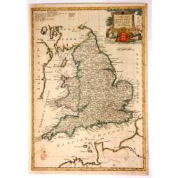
A New and Accurate Map of England.
Fine, very detailed map of England and Wales by Thomas Bowen in about 1750. It has a decorative cartouche with a cannon, a lion, a bust, a globe, and a three-lioned shiel...
Date: London, ca. 1750
Selling price: ????
Please login to see price!
Sold in 2017
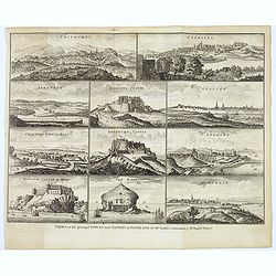
Views of the principal Towns and Castles in Scotland..
A delightful selection of 10 Scottish Towns, Castles, and of The Bass Rock. Towns include Edinburgh, Glasgow, Sterling, Aberdeen, St. Andrews, Montrose, Cannery Town in R...
Date: London, ca. 1750
Selling price: ????
Please login to see price!
Sold in 2021
[An untitled Sea Chart of South Devon.]
A large scale English Sea Chart of part of southern Devon in SW England. The chart is dominated by a very decorative dedication cartouche highlighting the landing of Will...
Date: London ca 1750
Selling price: ????
Please login to see price!
Sold in 2020
A North viewe of Westminster Bridge.
So-called optical print illustrating a North view of Westminster Bridge with vessels on the River Thames.In the eighteenth and nineteenth centuries there were many popula...
Date: London 1751
Selling price: ????
Please login to see price!
Sold
A Plan of Wolverhampton Surveyed in MDCCL By Isaac Taylor and Engraved by Thomas Jefferys Geographer to His Royal Highness the Prince of Wales
Important and rare plan of Wolverhampton by T. JefferysA large and detailed copper engraved plan of Wolverhampton, engraved and published by Thomas Jefferys in 1751 after...
Date: London, 1751
Selling price: ????
Please login to see price!
Sold in 2010
An accurate map of the county Palatine of Durham. . .
Scarce pre-atlas issue of 'The Large English Atlas' map of County Durham, published by John Hinton in 1751. Decorative cartouche around the title. Important and influenti...
Date: London, 1751
Selling price: ????
Please login to see price!
Sold in 2017
Nieuwe paskaart vande geheele canaal tufschen engeland en vranckryck.
This rare chart shows the Chanel between England et France. With explanation cartouche and ornamentally surrounded title-cartouche, fivefold miles indicator, current arro...
Date: Amsterdam, 1728 - 1751
Selling price: ????
Please login to see price!
Sold in 2016
AN ACCURATE MAP OF THE COUNTY OF KENT DIVIDED INTO ITS LATHES, and Subdivided into Hundreds. Drawn from Surveys, and most approved modern Maps, with various additional Improvements: Illustrated with Historical Extracts relative to the Air, Soil, Natural P
A first edition pre Large Atlas. A large and handsome eighteenth-century map of the county on a scale of three-eighths of an inch to the mile.Compiled by Emanuel Bowen, G...
Date: London, 1751
Selling price: ????
Please login to see price!
Sold in 2017
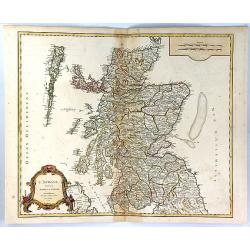
L'Ecosse Divisee en Shires ou Comtes
A decorative map of Scotland, published by Boudet in Paris in 1751. The map includes a decorative Rococo cartouche and scale of miles in the bottom left corner.The map is...
Date: Paris, 1751
Selling price: ????
Please login to see price!
Sold in 2023
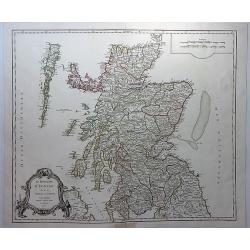
Le Royaume D'Ecosse divisee en Shires ou Comtes.
A striking and detailed map of Scotland, from Vaugondy's “Atlas Universel”. It includes towns, cities, mountains, rivers and lakes. Interestingly shaped rococo decor...
Date: Paris, 1751
Selling price: ????
Please login to see price!
Sold in 2018
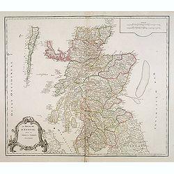
Le Royaume d'Ecosse.
Detailed map of Scotland, from a later edition of DeVaugondy's Atlas Universel. Includes towns, mountains, rivers, lakes and a host of other details. Decorative Cartouche...
Date: Paris, after 1752
Selling price: ????
Please login to see price!
Sold in 2014
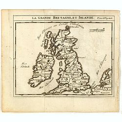
La Grande Bretagne, et Irlande.
Scarce small map of Great Britain of based on cartography of Guillaume Delisle (. Published in "Nouveau traité de geographie par M**** ", published by La veuve...
Date: Paris, 1752
Selling price: ????
Please login to see price!
Sold in 2015
Aftekening van het Margat.. / Afteekening van de Rivier Cly en Blakeny geleegen aan de Oostkust van Engeland..
Latitude scale, compass rose and system of rhumb lines, soundings, anchorage's, etc. A wealth of cities and information appear in the chart.
Date: Amsterdam 1753
Selling price: ????
Please login to see price!
Sold
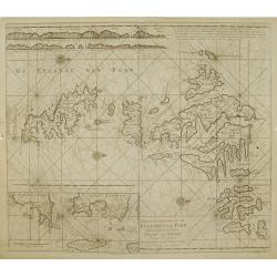
Nieuwe afteekening van de Eylanden van Fero..
Very rare: included in 6th volume, so-called secret atlas of the V.O.C. of Van Keulen. Latitude scale, compass rose and system of rhumb lines, soundings, anchorage's, etc...
Date: Amsterdam 1753
Selling price: ????
Please login to see price!
Sold
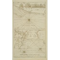
De Reede van \'t Leith van Edenburgh. / Afteekening van Nieuw en Oud Aberdeene ..
Latitude scale, compass rose and system of rhumb lines, soundings, anchorage\'s, etc. A wealth of cities and information appear in the chart. In upper right corner inset ...
Date: Amsterdam 1753
Selling price: ????
Please login to see price!
Sold



![[The Plans of the Principal Towns, Forts & Harbours in Ireland]](/uploads/cache/47406-250x250.jpg)






![[2 prints] The inside perspective view of the under Chappel... / A view of the west front of the Chappel...](/uploads/cache/82580-250x250.jpg)
![To Martin Folkes Esq[ui]r[e] President of the Royal Society: This Plan of the Cities of London with the Contiguous Buildings. . .](/uploads/cache/83535-250x250.jpg)










![[An untitled Sea Chart of South Devon.]](/uploads/cache/46633-250x250.jpg)


