Browse Listings in Europe
De zee Custe, met de England van Bretaignen, tusschenn Blauet en Picqueliers. . .
DUTCH TEXT EDITION. A detailed chart of the coast of southern part of Brittany, covering the coast from Vannes till Hilaire-de-Riez. Decorated by a colorful title cartouc...
Date: Leiden, Plantijn, 1585
Selling price: ????
Please login to see price!
Sold in 2009
Verthoninghe van zee Cuften van Bretaignen. . .
DUTCH TEXT EDITION. A detailed chart of the coast of Brittany decorated by a very colorful title cartouche and scale cartouche, one compass rose, several vessels and sea ...
Date: Leiden, Plantijn, 1585
Selling price: ????
Please login to see price!
Sold
Zee caerte van Engelants Eijndt, Alsoe hem tselfde Landt verthoont beginnende van Sorlinges tot Pleijmondt . . .
A detailed chart of the sea coast of England, from the Sorlinges islands to the Plymouth region along the English Channel decorated by a very colorful title cartouche and...
Date: Leiden, Plantijn, 1585
Selling price: ????
Please login to see price!
Sold in 2009
Befchrijvinghe der Zee, custen van Engelandt, tusschen Pleijmouth en Porthlandt. . .
A detailed chart of the sea coast of England, from Plymouth region along the English Channel to Portland decorated by a very colorful title cartouche and scale cartouche,...
Date: Leiden, Plantijn, 1585
Selling price: ????
Please login to see price!
Sold in 2009
Befchrijvinghe der Zeecusten van Engelandt tusschen Wicht ende Doveren. . .
A detailed chart of the English channel coastland, from the island of Wight to Dover. Decorated by a very colorful title cartouche and scale cartouche, one compass rose, ...
Date: Leiden, Plantijn, 1585
Selling price: ????
Please login to see price!
Sold in 2008
Zee Caerte vande Noordt custe van Engelandt, alsoe tzelffde landt aldaer. . .
A detailed chart of the northern coast of England. Decorated by a colorful title cartouche and scale cartouche, one compass rose, several vessels. A very early edition ra...
Date: Leiden, Plantijn, 1585
Selling price: ????
Please login to see price!
Sold in 2008
Beschrijvinge van een deel vann Schottlandt van Bambourg tot Aberdein. . .
A detailed chart of the coast of Scotland with Aberdeen. Decorated by a colorful title cartouche and scale cartouche, one compass rose, several vessels and sea monsters. ...
Date: Leiden, Plantijn, 1585
Selling price: ????
Please login to see price!
Sold in 2008
Die zee custe van Noorweghen tusschen der Noess en Mardou. . .
A rare Dutch text edition of this early and detailed chart of the coast of Norway. Decorated by a colorful title cartouche and scale cartouche, one compass rose, several ...
Date: Leiden, Plantijn, 1585
Selling price: ????
Please login to see price!
Sold in 2024
Zhet noterfte ofte Oosterste deel van de Oster Zee, beslooten tegens Rus landt.Lijfflandt, Oost Finlandt . . .
A detailed chart of the coast of Finland. Decorated by a title, scale and descriptive cartouche, a compass rose, several vessels and sea monsters, and depictions of mount...
Date: Leiden, Plantijn, 1585
Selling price: ????
Please login to see price!
Sold in 2008
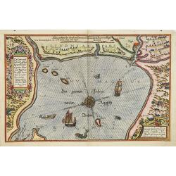
Zee caerte vande cufte va Lijfflandt begrepen Ronsomede grooten Inham. . .
A detailed chart of the Gulf of Riga and the Lithuanian coast. Decorated by a title and scale cartouche, a compass rose, several vessels and sea monsters, and depictions ...
Date: Leiden, Plantijn, 1585
Selling price: ????
Please login to see price!
Sold in 2008
De Zee kuste Rontomme Oesel eb een deel van Curlandt beginnende va Dagher oort tot Der winde . . .
A detailed chart of the entrance of the Gulf of Riga, with the island of Saaremaa. Decorated by a title, scale and descriptive cartouche, a compass rose, several vessels ...
Date: Leiden, Plantijn, 1585
Selling price: ????
Please login to see price!
Sold in 2013
De caerte ofte zee cuften van Pruijssen, met zijne haffen ofte groote Rivieren. . .
A detailed chart of part of the coastline of Poland and the city of Danzig (Gdansk). Decorated by a title, scale and descriptive cartouche, a compass rose, several vessel...
Date: Leiden, Plantijn, 1585
Selling price: ????
Please login to see price!
Sold
Caerte van de zee custe vant Landt te Pomere. . .
A detailed chart of part of the coastline of Poland and the city of Pomeren, and part of the Danish island of Bornholm. Decorated by a title and scale cartouche, a compas...
Date: Leiden, Plantijn, 1585
Selling price: ????
Please login to see price!
Sold
Caerte vande zee custe va Mekelenborch, Soe de Landen. . . Tot Femeren. . .
A rare Dutch text edition of this early detailed chart with the island of Rügen to the feft, the coastline of Mecklenburgh and Fehmarnbelt with the island of Fehmarn. No...
Date: Leiden, Plantijn, 1585
Selling price: ????
Please login to see price!
Sold in 2017
Beschrivingee der zijden op de Belt en Noortzee. . .
A rare Dutch text edition of this early detailed chart of the coast of Jutland and its towns Skagen among others. Decorated by a title and scale cartouche, two compass ro...
Date: Leiden, Plantijn, 1585
Selling price: ????
Please login to see price!
Sold in 2022
Descriptio ditionum littoralium maris Germanici, videlicet, Eijderstadij, Dithmarsiae. . .
A detailed chart of the Dithmarschen region in the North coastline of Germany. Decorated by a title, scale and a descriptive cartouche, one compass rose, several vessels ...
Date: Leiden, Plantijn, 1585
Selling price: ????
Please login to see price!
Sold in 2008
Beschrijvinghe van de zee custen van Ooft Vriesslandt. . .
A detailed chart of the Groeninger region situated at the southern tip of the Jutland Peninsula. Decorated by a title, scale and a descriptive cartouche, one compass rose...
Date: Leiden, Plantijn, 1585
Selling price: ????
Please login to see price!
Sold in 2013
De gelegentheijt van Jutlandt, mits gaders de gaeten . . Tot dat Eijlandt Silt.
A detailed chart of the Danish coastline, including Tondern and te island Silt. Decorated by a title, scale and a descriptive cartouche, one compass rose, several vessels...
Date: Leiden, Plantijn, 1585
Selling price: ????
Please login to see price!
Sold in 2022
Scotia 7.
A page of printed text in Latin with a fine general map of Scotland. Prepared by Hugo Favolius (1523-1585), who was a Dutch poet, doctor and traveler, born in Middelburg....
Date: Antwerp, Plantin, 1585
Selling price: ????
Please login to see price!
Sold in 2009
Brabantia, Gulick et Cleve.
The full coloring of the different areas with the borderlines in the same color, only slightly darker, is typical of the 16th century.
Date: Duisburg, 1585
Selling price: ????
Please login to see price!
Sold in 2017
Picardiae Belgicae Regio Nis Descriptio
A highly detailed copper engraved map of the Picardie region in Northwest France by Abraham Ortelius. This map is finely engraved with forests, cities, villages along the...
Date: Antwerp, ca. 1585
Selling price: ????
Please login to see price!
Sold in 2015
Zee Caerte vande Noordt custe van Engelandt, alsoe tzelffde landt aldaer. . .
A detailed description of the northern coast of England. Decorated by a title cartouche and scale cartouche, one compass rose, several vessels. A very early edition rare ...
Date: Leiden, Plantijn, 1585
Selling price: ????
Please login to see price!
Sold in 2016
Roma.
This large, exceptionally decorative print depicts the city of Rome as it was around 1570. Still, the structures of Ancient Rome are still much in evidence.From the famou...
Date: Cologne, 1585
Selling price: ????
Please login to see price!
Sold in 2018
ARTESIA Comit.
Mercator's early map of the northern French region of Artois. Divisions in outline colors, strap-work title cartouche and mileage scale in the upper right, and lower left...
Date: Duisbourg, 1585
Selling price: ????
Please login to see price!
Sold in 2021
Chilonium, vulgo Kyell
A rare, large, spectacular view of the German city of Kiel. From the famous 'Civitates Orbis Terrarum' of Braun & Hogenberg, with spectacular original colors and with...
Date: Cologne, 1585
Selling price: ????
Please login to see price!
Sold in 2023
Praga
Nice early view of the city of Prag from the famous "Theatrum Urbium", appeared 1585. Just a few years after the appearance of the Civitates Orbis Terrarum, Abr...
Date: Frankfurt 1585
Selling price: ????
Please login to see price!
Sold in 2020
Cimbricae Chersonese nunc Iutiae descriptio.
A very decorative, old-colored example of Ortelius' map of Jutland, depicting also Fiona, Alsen, and Langeland. The map is based on the work of Marcus Jordanus, a profess...
Date: Antwerp, 1585
Selling price: ????
Please login to see price!
Sold in 2021
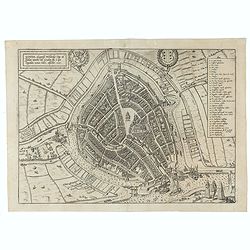
Gouda, elegantiss. Hollandiae Opp. ad Isalam amnem, ubi Goudam flu. à quo Oppidum nomen habet, absorbet. 1585.
A bird's-eye town-plan of Gouda. From the greatest publication in this genre!. The Civitates was compiled and written by George Braun, Canon of Cologne Cathedral. Braun g...
Date: Cologne, 1585
Selling price: ????
Please login to see price!
Sold in 2021
Beschrijvinghe der Zee Custen van Eiderste, Dithmers, en ee deel vant Fromges landt, ...
Sea chart by Waghenaer. Latin text on verso.
Date: Leiden, 1586
Selling price: ????
Please login to see price!
Sold in 2009
De Custen van een deel van Denemarken en Swederyck , beginnede va Uuytlte tot Calmer toe. . .
A decorative uncloured chart displaying the North Sea and the coast of Sweden and Denmark. Several vignettes of sea monsters and a ship. It was published by Dutch cartogr...
Date: Leiden, 1586
Selling price: ????
Please login to see price!
Sold in 2009
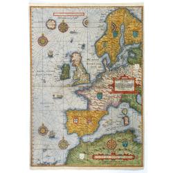
Universe Europe Maritime Eiusque Navigationis Descritio. Generale Pas chaerte van Europa. . . 1583.
The rare first plate of Waghenaer's general sea chart of Europe, dated 1583, with Latin text on verso; from the first Latin text edition, published in Leiden: Frans van R...
Date: Enkhuizen, 1586
Selling price: ????
Please login to see price!
Sold in 2017
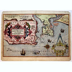
Die Zee Caerte van Portugal, tusschen Camino en Montego, alsoe dat Landt all daer in sijn Ghedaente is, met alle sijne haeven enn ondiepten ...
A fine and very rare maritime map with detailed description of part of Portugal. Decorated by a colorful title cartouche and scale cartouche, one compass rose, several ve...
Date: Leiden, Plantijn, 1584-1586
Selling price: ????
Please login to see price!
Sold in 2019
Zee Caerte van Portugal, Daer inne Begrepen de vermaerde Coopstadt van Lisbone ..
A very rare and exquisite maritime map of a part of Portugal including Lisbon. Decorated by a colorful title cartouche and scale cartouche, one compass rose, several vess...
Date: Leiden, Plantijn, 1584-1586
Selling price: ????
Please login to see price!
Sold in 2019
Zee Custen van Andaluzien ghemaeckt naet wesen en ghedaente, met zijn Rivieren en Hauenen.
A very rare and fine maritime map detailed of the eastern part of Andalusia. Decorated by a colorful title cartouche and scale cartouche, one compass rose, several vessel...
Date: Leiden, Plantijn, 1584-1586
Selling price: ????
Please login to see price!
Sold in 2019
Beschrijvinghe der Zee Custen vant Landt va Argarbe ..
A fine and rare historical maritime map of southern Portugal (Reino do Algarve). Decorated by a colorful title cartouche and scale cartouche, one compass rose, several ve...
Date: Leiden, Plantijn, 1584-1586
Selling price: ????
Please login to see price!
Sold in 2019
Die Zee Custen van Galissien, van Capo Daviles off tot Ortegal tho.
A detailed description of part of Galicia. Decorated by a colorful title cartouche and scale cartouche, one compass rose, several vessels and sea monsters. A very early e...
Date: Leiden, Plantijn, 1584-1586
Selling price: ????
Please login to see price!
Sold in 2017
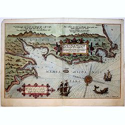
Beschrijvinge der Zee custen van Galissien beginnende van Capo de finisterre tot Camino...
A detailed description of part of Galicia. Decorated by a colorful title cartouche and scale cartouche, one compass rose, several vessels and sea monsters. A very early e...
Date: Leiden, Plantijn, 1584-1586
Selling price: ????
Please login to see price!
Sold in 2016
Caerte vande Zee Custen van Galissien, va Ortugal tot voer bij C. de Finisterre.
A fine and rare historical maritime map of detailed of part the coastline of Galicia (Northern Spain). Decorated by a colorful title cartouche and scale cartouche, one co...
Date: Leiden, Plantijn, 1584-1586
Selling price: ????
Please login to see price!
Sold in 2019
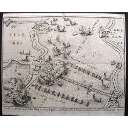
Siege on Antwerp - Ship bridge blown up.
Large anonymous engraving of a famous event on the 5th of April, 1585. On this day the ship bridge on the Schelde, build by the Duke of Parma, was blown up. However, by t...
Date: Cologne, 1586
Selling price: ????
Please login to see price!
Sold in 2021
Hispanien nach aller seiner Gelegenheit / in Bergen Stetten / Volkeren Konigreichen Wasseren und Inseln.
An early map of Spain and Portugal from the famous Munster's Cosmography, one of the most influential geographical works of the 16th Century. This map, from the 1588 edit...
Date: Basle, 1586
Selling price: ????
Please login to see price!
Sold in 2018
[Guerre des Pays-Bas] Geschichtsblätter (172 plates).
Illustrated with 170 plates dealing with Belgium, Dutch and German war sites (1567-1586) showing scenes of battles, sieges, executions, assassinations, parades, court sce...
Date: Cologne, c.1586
Selling price: ????
Please login to see price!
Sold
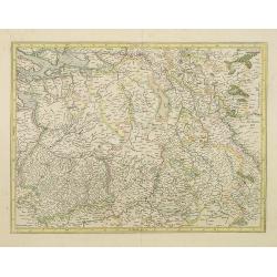
Lutzenburgensis Ducatus veriss descript.
Prepared by Jacob Surhon who made a manuscript map of Luxembourg for which he received 500 Livres from Charles V in 1551.For security reasons the map was not published. O...
Date: Antwerp 1587
Selling price: ????
Please login to see price!
Sold in 2014
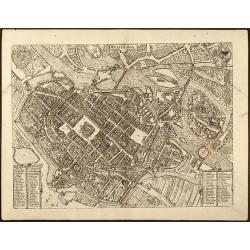
Wratislavia
Beautiful birdeye view of Wroclaw (Breslau) in Lower Silesia, Poland by Braun & Hogenberg from "Civitated Orbis Terrarum". Dated in plate 1587. ...
Date: Cologne, 1587
Selling price: ????
Please login to see price!
Sold in 2009
Moraviae, quae olim Marcomannorum Sedes, Corographia, A.D. Pavlo Fabritio Medico et Mathematico Descripta, et a Generosis Moraviae Baronibus Quibusdam corecta.
Very attractive full color map of Moravia, Slovakia prepared by Paul Fabritius in 1569. Showing fortified cities, towns, rivers, etc. With a fine Renaissance strapwork ca...
Date: Antwerp, 1587
Selling price: ????
Please login to see price!
Sold in 2013
Regni Bohemiae Descriptio.
Standard map for the Czech Republic from the famous 'Theatrum Orbis Terrarum [Atlas of the Whole World]': published in Antwerp. With two large strapwork cartouches. The ...
Date: Antwerp, 1587
Selling price: ????
Please login to see price!
Sold in 2010
Lutzenburgensis Ducatus veriss descript .
Published by Abraham Ortelius (1527-98) in Antwerp, 1587. Written in a simple cartouche lower left: Lvtzenbvrgen Sis Dvatvs Veriss Descript. Iacobo Surhonio Montano aucto...
Date: Antwerp, 1587
Selling price: ????
Please login to see price!
Sold in 2010
Eryn - Hiberniae, Britannicae Insulae, Nova Descriptio - Irelandt
A beautiful map of Ireland from Ortelius' "Theatrum Orbis Terrarum" or Atlas of the whole world. This is one of the earliest maps of Ireland to present it with ...
Date: Antwerp, 1587
Selling price: ????
Please login to see price!
Sold in 2011
Moraviae, quae olim Marcomannorum Sedes, Corographia, A.D. Pavlo Fabritio Medico et Mathematico Descripta; et a Generosis Moraviae Baronibus Quibusdam corecta.
Very attractive map of Moravia, Slovakia prepared by Paul Fabritius in 1569. Showing fortified cities, towns, rivers, etc. With a fine Renaissance strapwork cartouche, an...
Date: Antwerp, 1587
Selling price: ????
Please login to see price!
Sold in 2011
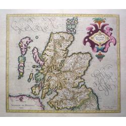
Scotia Regnum.
Printed in Duisberg 1587.
Date: Duisberg, 1587
Selling price: ????
Please login to see price!
Sold in 2014
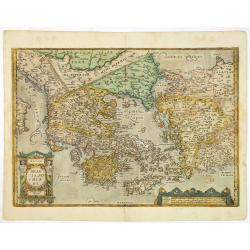
Graeciae Sophiani.
This is a beautiful depiction of ancient Greece. The map has a very attractive title cartouche in the shape of a Grecian temple in the bottom left-hand corner and a large...
Date: Antwerp, 1587
Selling price: ????
Please login to see price!
Sold in 2019
Russiae, Moscoviae et Tartariae Descriptio.
Engraved by Frans Hogenberg from an original of 1562 by Anthony Jenkinson of the English Muscovy Company. The map covers the region from the Gulf of Finland, Lithuania an...
Date: Antwerp, 1587
Selling price: ????
Please login to see price!
Sold in 2015
Angliae, scotiae, et Hiberniae, sive Britannicar insularum.
A classic, handsome and decorative map of ancient British Isles with north orientated to the east. Based on Mercator's 1564 map of the British isles and improved by Saxto...
Date: Antwerp, 1587
Selling price: ????
Please login to see price!
Sold in 2014
Russiae, Moscoviae et Tartariae Descriptio.
Engraved by Frans Hogenberg from an original of 1562 by Anthony Jenkinson of the English Muscovy Company. The map covers the region from the Gulf of Finland, Lithuania an...
Date: Antwerp, 1587
Selling price: ????
Please login to see price!
Sold in 2015
Angliae, scotiae, et Hiberniae, sive Britannicar : insularum descriptio.
A classic, handsome and decorative map of ancient British Isles with north orientated to the east. Based on Mercator's 1564 map of the British isles and improved by Saxto...
Date: Antwerp, 1587
Selling price: ????
Please login to see price!
Sold in 2017
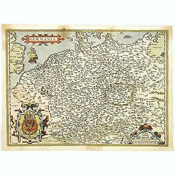
Germania.
Ortelius very decorative map of Germania, including Switzerland, Austria, Poland, The Netherlands and Belgium, from 'Theatrum Orbis Terrarum [Atlas of the Whole World]': ...
Date: Antwerp, 1587
Selling price: ????
Please login to see price!
Sold in 2019
Insularum Aliquot Maris Mediterranei Descriptio.
Insularum Aliquot Maris Mediterranei Descriptio. Cum priuilegio'Sicily, Sardegne, Corfv, Zerbi, Elba, Malta. Six early maps on one sheet. Including the islands of Sicily,...
Date: Antwerp, 1587
Selling price: ????
Please login to see price!
Sold in 2017
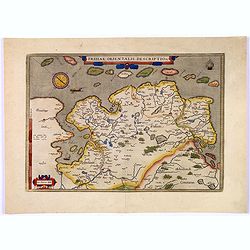
Frisiae Orientalis Descriptio.
Nice example of Ortelius' map of East Friesland, from the 1587 French edition of his Theatrum Orbis Terrarum, the first modern atlas of the world.This map includes a comp...
Date: Antwerp, 1587
Selling price: ????
Please login to see price!
Sold in 2017
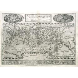
Peregrinationis Divi Pauli Typus Corographicus...
Ortelius's map of Paulus's travels from his Atlas Theatrum Orbis Terrarum. It covers the Mediterranean Sea from Italy and Sicily until the Near East and Egypt, with Cypru...
Date: Antwerp, 1587
Selling price: ????
Please login to see price!
Sold in 2019
Graecia, Sophiani.
A detailed and decorative map of Greece and parts of Turkey, including many islands. Filled with place names and topographical details. Shows Troas (Troy). From the famou...
Date: Antwerp, 1587
Selling price: ????
Please login to see price!
Sold in 2019
Germania.
An attractive map centered on Germany. The sea is decorated with a vessel and a sea monster.From a rare Spanish text edition.
Date: Antwerp, 1588
Selling price: ????
Please login to see price!
Sold in 2009
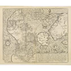
Danorum Marca, uel Cimbricum. aut Daniae Regnum..
The oldest preserved map of Denmark of Danish origin. Drawn by Marcus Jordan at the request of Duke Heinrich Rantzau, viceroy of Schleswig-Holstein. It is a new perceptio...
Date: Cologne 1588
Selling price: ????
Please login to see price!
Sold
Nobilis Hannoniae Comitatus Descrip. 1579.
Abraham Ortelius(1527-98), Dutch cartographer and publisher of the first modern atlas, ' Theatrum Orbis Terrarum' in 1570. Editions till 1612. Also an atlas of ancient ca...
Date: Antwerp, 1588
Selling price: ????
Please login to see price!
Sold in 2018
Anglia
Miniature map covering England and Wales. French text on verso. This map is oriented with north to the right. The map is beautifully engraved with stippled seas and ships...
Date: Antwerp, 1588
Selling price: ????
Please login to see price!
Sold
Scotia
Miniature map covering the northern part of England and Scotland. French text on verso. This map is oriented with north to the right. The map is beautifully engraved with...
Date: Antwerp, 1588
Selling price: ????
Please login to see price!
Sold
Daniae regni Typus
Miniature map covering Denmark including that part of Sweden that was then controlled by Denmark. The map is beautifully engraved with stippled seas and a sailing ship.
Date: Antwerp, 1588
Selling price: ????
Please login to see price!
Sold
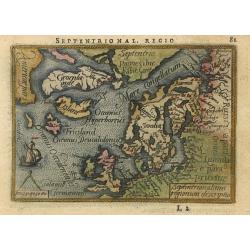
Septentrionalium regionum descriptio
Handsome miniature map based on Ortelius' important map of the Arctic regions with the mythical islands of Drogeo and Frieslant. The map is beautifully engraved with stip...
Date: Antwerp, 1588
Selling price: ????
Please login to see price!
Sold
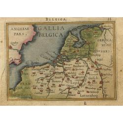
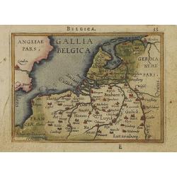
Gallia Belgica.
Miniature map covering Belgium and the Netherlands. The map is beautifully engraved with stippled seas.
Date: Antwerp, 1588
Selling price: ????
Please login to see price!
Sold
Candia olim Creta
Nice miniature map of the island that shows several place names and the mythological Labyrinth where the Minotaur was confined. The map is beautifully engraved with stipp...
Date: Antwerp, 1588
Selling price: ????
Please login to see price!
Sold
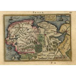
Descript. Frisiae
Charming little map of the northern part of The Netherlands, the Provinces of Friesland, Groningen and part of Drenthe. The map is beautifully engraved with stippled seas...
Date: Antwerp, 1588
Selling price: ????
Please login to see price!
Sold
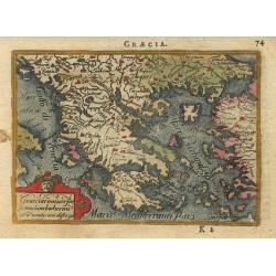
Graecia.
Delightful little map of Greece. The map is beautifully engraved with stippled seas.
Date: Antwerp, 1588
Selling price: ????
Please login to see price!
Sold
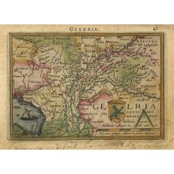
Geldria
Charming little map of a part of The Netherlands, the Province of Gelderland. The map is beautifully engraved with stippled sea and a sailing ship.
Date: Antwerp, 1588
Selling price: ????
Please login to see price!
Sold
Valentia regnum.
Nice miniature map of Valencia. Latin text on verso.
Date: Antwerp, 1588
Selling price: ????
Please login to see price!
Sold
Andaluzia.
Nice miniature map of Andalusia. Latin text on verso.
Date: Antwerp, 1588
Selling price: ????
Please login to see price!
Sold
Regni Hispaniae.
Charming miniature map fully engraved with rivers and cities, a stippled sea, strapwork title cartouche and a tiny ship. Latin text on verso.
Date: Antwerp, 1588
Selling price: ????
Please login to see price!
Sold
Pomeraniae wandalicae regnionis tipus.
Nice map features Pomerania and is based on the Peter Artopaus map published in 1550 by Sebastian Munster. With a nice title cartouche and 2 monsters in the sea. Latin te...
Date: Antwerp, 1588
Selling price: ????
Please login to see price!
Sold
Normandia.
Miniature map of the coast of France at Normandy. Latin text on verso.
Date: Antwerp, 1588
Selling price: ????
Please login to see price!
Sold
Austriae Ducatus Chorographia, Wolfgango Lazio Auctore.
A highly decorative early map of the duchy of Austria, engraved after the cartographic source by Wolfgang Lazius.Centered on the stretch of the Danube from Linz to Bratis...
Date: Antwerp, 1588
Selling price: ????
Please login to see price!
Sold
Cestria Vulgo Chester, Angliae Civitas
This desirable, highly decorative depiction presents the city of Chester on the banks of the River Dea. Based on the survey of William Smith, the bird's-eye plan shows th...
Date: Cologne, ca. 1588
Selling price: ????
Please login to see price!
Sold in 2008
Gallia Belgica.
Miniature map covering Belgium and the Netherlands. The map is beautifully engraved with stippled seas. Hard to find now-a-days in original colors.
Date: Antwerp, 1588
Selling price: ????
Please login to see price!
Sold in 2008
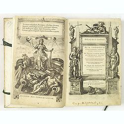
Descrittione di M. Lodovico Guicciardini, gentil- huomo fiorentino, di tutti Paesi Bassi . . .
Italian text edition of this famous description of the Low Countries. The book is illustrated with 53 double page town plans, 12 maps and 13 one page views.Ludovico Guicc...
Date: Antwerp, 1588
Selling price: ????
Please login to see price!
Sold in 2010












![[Guerre des Pays-Bas] Geschichtsblätter (172 plates).](/uploads/cache/44450-250x250.jpg)

