Browse Listings in Europe
[Sluis], Slusa, Teutonicae Flandriae opp. . .[Sluis]
A bird's eye view of the town of Sluis. The lion crest on the left is emphasised by a golden filling. From the greatest publication in this genre! The 'Civitates' was com...
Date: Cologne, 1581
Selling price: ????
Please login to see price!
Sold in 2022
HARLEMUM, Sive ut Ha: Barlan Herlemum, Urbs Hollandiae famosa . . .[HAARLEM]
A bird's-eye view plan of Haarlem, by Georg Braun and Frans Hogenberg. TRANSLATION OF CARTOUCHE TEXT: Harlemum, or, as Hadrianus Barlandus writes, Herlemum, a renowned Du...
Date: Cologne, 1581
Selling price: ????
Please login to see price!
Sold in 2020
Bergen op Zoom - Berga, ad Somam, Brabantiae Opp: a fluvi olo sic dicto,. . .
Abird's-eye view plan of Bergen-op-Zoom b y Braun and Hogenberg. TRANSLATION OF CARTOUCHE TEXT: Bergen op Zoom, Brabantine town, named after the little River Soma (Zoom),...
Date: Cologne, 1581
Selling price: ????
Please login to see price!
Sold in 2020
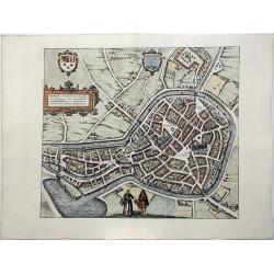
Lewardum. Occidentalis Frisiae Opp: 1580. [on sheet with:] Franicher, Nobiliu hominum, in Frisia Occidentali, ut plurimum saedes.[Leeuwarden&Franeker]
Two bird's-eye views on one sheet: Leeuwarden and Franeker, by Braun & Hogenberg. CARTOUCHE: Leeuwarden, a West Frisian town. 1580. COMMENTARY BY BRAUN: "Leeuwar...
Date: Cologne, 1581
Selling price: ????
Please login to see price!
Sold in 2020
Icon civitatis Campensis, cuius situs Isulam fluvium, eleganti venustate, decorat.[Kampen, Overijssel]
A panoramic view of Kampen by Braun and Hogenberg. TRANSLATION OF CARTOUCHE TEXT: Picture of the city of Kampen, the beautiful and charming appearance of which embellishe...
Date: Cologne, 1581
Selling price: ????
Please login to see price!
Sold in 2020
Niitidissimae Civitatis mechlineensis, in Meditulli O Brabantiae Sitae, Exactis Delineatio.[Mechelen]
A bird's-eye plan of Mechelen, costume figures at bottom right, engraved after a plan by Jacob van Deventer. TRANSLATION OF CARTOUCHE TEXT: Faithful view of the illustrio...
Date: Cologne, 1581
Selling price: ????
Please login to see price!
Sold in 2021
Charlemont [on sheet with] Landrechies [and] Avesnes [and] Beaumont.
Four bird's-eye views on one sheet: Charlemont - Beaumont - Avesnes - Landrecies. The 'Civitates Orbis Terrarum', or the "Braun & Hogenberg", is a six-volum...
Date: Cologne, 1581
Selling price: ????
Please login to see price!
Sold in 2020
Namurcum, Elegantissima ad Mosae Flume Civitas. [Namur]
A bird's-eye view plan of Namur by Braun and Hogenberg. CARTOUCHE: Namur, a very fair city on the River Meuse. COMMENTARY BY BRAUN: "The council for the whole county...
Date: Cologne, 1581
Selling price: ????
Please login to see price!
Sold in 2020
Philippopolis vulgo Philippeville munitiss. comitat Hannoniae opp. [on sheet with]: Marieburgum [on sheet with]: Cimacum, comuniter Chimay, principatus titulo, in Han prestas opp [on sheet with]: Walcourt, haud ignobile comitatus Namurcensis oppidum.
Four bird's-eye views on one sheet: Philippeville, Mariembourg, Walcourt. The 'Civitates Orbis Terrarum', or the "Braun & Hogenberg", is a six-volume town a...
Date: Cologne, 1581
Selling price: ????
Please login to see price!
Sold in 2021
Mons, Hannonia Urbs PotenS & Ampla. . .
A bird's-eye view plan of Mons, by Georg Braun and Frans Hogenberg. From: 'Civitates Orbis Terrarum'. Liber tertius. Köln, G. Kempen, 1581-88. TRANSLATION OF CARTOUCHE T...
Date: Cologne, 1581
Selling price: ????
Please login to see price!
Sold in 2020
Roterodamum Hollandiae Opp. [on sheet with:] Goude [Rotterdam, Gouda]
An old map with two bird's-eye views: Rotterdam and Gouda, by Braun and Hogenberg. The 'Civitates Orbis Terrarum', or the "Braun & Hogenberg", is a six-volu...
Date: Cologne, 1581
Selling price: ????
Please login to see price!
Sold in 2020
Halberstadium, Urbs Saxoniae [on sheet with] Quedelinburga, Antiquissimum Saxoniae Oppid. [HALBERSTADT/QUEDLINBURG]
An old map with two bird's-eye views by Braun and Hogenbergt: Halberstadt and Quedlinburg. TRANSLATION OF CARTOUCHE TEXT: Halberstadt, town in Saxony, famous for its poli...
Date: Cologne, 1581
Selling price: ????
Please login to see price!
Sold in 2020
Tiena, Brabantiae Opp: ad amnem Geta, unde casei, qui inde nomen habent, magnus proventus, Estque hic templum S. Germani, Canonicorum Collegio, ornatum (Tienen)
Decorative early view of Tienen in Flemish Brabant in Flanders, Belgium.From Braun & Hogenberg's Civitatus Orbis Terrarum, the most important book of town plans and v...
Date: Cologne, 1581
Selling price: ????
Please login to see price!
Sold in 2020
Bruxella, Urbs Aulicorum Frequentia, Fontium Copia, Magnificentia Principalis Aulae ... (Brussels)
Bird's-eye view plan of Brussels by Braun and Hogenberg, with key to locations.TRANSLATION OF CARTOUCHE TEXT: Brussels is a very well-known city due to its large number o...
Date: Cologne, 1581
Selling price: ????
Please login to see price!
Sold in 2020
Anverpia, nobile in Brabantia oppidum, ... (Antwerp)
Bird's-eye view of Antwerp by Braun and Hogenberg.TRANSLATION OF CARTOUCHE TEXT: Antwerp is a well-built and noted trade city in Brabant, which attracts many Germans, Fre...
Date: Cologne, 1581
Selling price: ????
Please login to see price!
Sold in 2020
Leodium. (Luik or Liège)
Very desirable and early town-view of Liège, which shows the city with the Meuse flowing in its favorable location amongst gentle hills, sturdy trees and fertile fields....
Date: Cologne, 1581
Selling price: ????
Please login to see price!
Sold in 2020
Namurcum, Elegantissima ad Mosae Flume Civitas. (Namur)
Bird's-eye plan of Namur by Braun and Hogenberg.CARTOUCHE: Namur, a very fair city on the River Meuse.COMMENTARY BY BRAUN: "The council for the whole county is held ...
Date: Cologne, 1581
Selling price: ????
Please login to see price!
Sold in 2020
Lympurch. - Limburgum oppidum Galliae Belgicae, vulgo Lympurch, gallice, Lembor dr. .. (Limbourg)
Bird's-eye view of Limbourg by Braun and Hogenberg, with key to locations.The Civitates Orbis Terrarum, or the "Braun & Hogenberg", is a six-volume town atl...
Date: Cologne, 1581
Selling price: ????
Please login to see price!
Sold in 2020
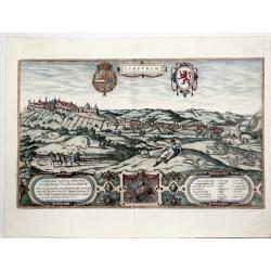
PASSAW [PASSAU].
A fine double folio page, copper engraved panoramic view of the Bavarian city of Passau. From: 'Civitates Orbis Terrarum'. Liber Tertius. Köln, G. Kempen, 1581, by Georg...
Date: Cologne, 1581
Selling price: ????
Please login to see price!
Sold in 2021
Saltzburgk Recens, et accuratissima urbis Salisburgensis delineatio.[Salzburg]
A fine copper engraved birds-eye/panoramic view of Salzburg by Braun and Hogenberg, with key to locations, with a total of five fittings cartouches, in the foreground a g...
Date: Cologne, 1581
Selling price: ????
Please login to see price!
Sold in 2021
Halberstadium, Urbs Saxoniae [on sheet with] Quedelinburga, Antiquissimum Saxoniae Oppid. [Halberstadt and Quedlinburg].
A fine copper engraving with two panoramic views by Braun and Hogenberg: Halberstadt and Quedlinburg. From: 'Civitates Orbis Terrarum. Liber tertius'. Köln, 1581. HALBE...
Date: Cologne, 1581
Selling price: ????
Please login to see price!
Sold in 2021
Landshut, Alberto D.G. Com. Pal. Rheni Utriusque Bavariae Duci. . . MDLXXVIII.
A fine copper engraved panoramic birds-eye view of the city Landshut, straddling the River Isar in Bavaria Germany, with the Trausnitz Castle. From: 'Civitates Orbis Terr...
Date: Cologne, 1581
Selling price: ????
Please login to see price!
Sold in 2021
Francenbergum, vel ut alij Francoburgum Hassiae Opp. [Frankenberg]
A fine copper-engraved panoramic bird's-eye view of Frankenberg by Braun and Hogenberg. From: 'Civitates Orbis Terrarum. Liber tertius'. Köln, 1581.CAPTION: Frankenberg ...
Date: Cologne, 1581
Selling price: ????
Please login to see price!
Sold in 2021
Soest [on sheet with] Warborch - Warburgum, elegans Westphaliae Opp.
A fine antique copper engraved sheet with two panoramic views , by Georg Braun and Frans Hogenberg: Soest and Warburg. From: 'Civitates Orbis Terrarum'. Liber tertius. K�...
Date: Cologne, 1581
Selling price: ????
Please login to see price!
Sold in 2021
Civitatis Werdenae Exactiss: Descrip: [on sheet with:] Civitatis Essensis Exactiss. Descrip.
A fine antique copper engraved sheet with two panoramic views by Braun and Hogenberg: Werden and Essen. From: 'Civitates Orbis Terrarum'. Liber tertius. Cologne,1581.WERD...
Date: Cologne, 1581
Selling price: ????
Please login to see price!
Sold in 2021
Grenoble & Romans-sur-Isère. - Gratianopolis Acusianoru Colonia, ... [on sheet with] Romans Delfinatus vulgo Daufine in Gallia Oppidu.
Fine antique copper engraved sheet with two bird's-eye views/plans by Braun and Hogenberg: Grenoble & Romans-sur-Isère from the third volume of Braun & Hogenberg...
Date: Cologne, 1581
Selling price: ????
Please login to see price!
Sold in 2021
Douai, - Duacum, Catuacorum Urbs, tam situ, quam incolis, et litterarum studijs elegantissime ornata.
A fine antique map - bird's-eye view of Douai, by Braun and Hogenberg, from the: Civitates Orbis Terrarum, ... Part 3. Köln, 1581. TRANSLATION OF CARTOUCHE TEXT: ...
Date: Cologne, 1581
Selling price: ????
Please login to see price!
Sold in 2022
Rouen, - Rhotomagus, Galliae Lugdunensis as Sequanam flu. Opp. vulgo Rouen.
A fine antique map - bird's-eye view of Rouen, by Braun and Hogenberg, from the: Civitates Orbis Terrarum, ... Part 3. Köln, 1581.With a French key to locations. Two ...
Date: Cologne, 1581
Selling price: ????
Please login to see price!
Sold in 2022
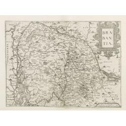
Brabantia.
Map of Brabant from Guicciardini's "Description de touts les Pais-Bais" edited by Plantin in 1582. The map drawn after Ortelius'map of Brabant, and after the...
Date: Antwerp, 1582
Selling price: ????
Please login to see price!
Sold
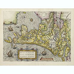
Hollandiae Cattorum regionis typus.
Guicciardini's reduced version of Jacob van Deventer's survey of the province of Holland surveyed in 1537 and published first in Antwerp in nine sheets by Bernard van der...
Date: Antwerp, 1582
Selling price: ????
Please login to see price!
Sold in 2011
Cestria vulgo Chester, Angliae Civitas.
A stunning town plan of the northern city of Chester, with heraldic shields, Royal and civic coats of arms, explanation table, dividers and Elizabethan figures in the for...
Date: Cologne, ca 1582
Selling price: ????
Please login to see price!
Sold in 2018
Dordracum Vulgo Dortt.
Early and detailed panoramic view of Dordrecht, published in the famous ‘Civitates Orbis Terrarum’, by Braun and Hogenberg. Embellished with the royal coat of arms, a...
Date: Cologne, 1582
Selling price: ????
Please login to see price!
Sold in 2019
Urbis Romae Descriptio.
First state of three. A rare view of Rome from the Lafreri-School. Below the view there is a numbered legend of 114 references to notable places and monuments, distribute...
Date: Rome, 1582
Selling price: ????
Please login to see price!
Sold in 2019
Die Fürstliche Hauptt Statt Königsbergk in Preussen / Die hauptt Statt in Lyfflantt.
A decorative print with two bird's-eye views by Georg Braun & Frans Hogenberg on one sheet: Kaliningrad and Riga.From the greatest publication in this genre!. The pla...
Date: Köln, 1582
Selling price: ????
Please login to see price!
Sold in 2020
AACHEN, Aquisgranum, vulgo Aich, ad Menapiorum fines, perantiqua Imperij Urbs, Monumento Caroli Magni. . .
A fine antique bird's-eye view plan of Aachen by Braun and Hogenberg, after Hendrick Steenwijck, from the Civitates Orbis Terrarum, ... Part 1. Köln, 1572.TRANSLATION OF...
Date: Cologne, 1582
Selling price: ????
Please login to see price!
Sold in 2020
Eigentliche Beschreibung der Schlacht zwischen den Staten und Spaniarden nitt weit von Namur gehaltten.
Representation of the battle of Gembloux, between the Spanish army under Don Juan de Austria and the Dutch troops. In the background the city of Namur. Verso with Latin t...
Date: Cologne, 1583
Selling price: ????
Please login to see price!
Sold in 2013
Die Custe va Lijfflandt, met de Eijlanden daer beneffens also hem dat landt aldaer verthoont en in zyn ghedaente is, van Ekehol.[TALLINN/REVAL,ESTONIA]
A striking full color example of Wagenhaer's map of the north coast of Estonia, Tallinn, including the Gulf of Finland. The map is reversed - showing north at the bottom....
Date: Antwerp, 1583
Selling price: ????
Please login to see price!
Sold in 2021
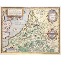
Belgii Veteris Typus..
A fine map of this historic region with many ancient place names. The map is decorated with 4 cartouches, and a compass rose in the sea. Map is dated 1594
Date: Antwerp 1584
Selling price: ????
Please login to see price!
Sold
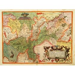
Gelriae, Cliviae, Finitimorumque locorum verissima..
East to the top. Fine map of Geldria and Limburg, prepared by Christian s'Grooten. Very fine title cartouche lower right with painters utensils around cartouche.
Date: Antwerp, 1584
Selling price: ????
Please login to see price!
Sold in 2011
Europae.
Somewhat distorted land masses: vignette of Europe being carried off by the bull (Zeus).The second plate with title AFRICAE PARS now in Italic lettering.
Date: Antwerp 1584
Selling price: ????
Please login to see price!
Sold
Verthoninghe van de Zee Custen van Bretaignen..
A very decorative chart covering the coast along the coast of Britany. South to the top. A first edition, without the previlegio. Engraved by the master engraver, Johanne...
Date: Amsterdam 1584
Selling price: ????
Please login to see price!
Sold
Poloniae, Lituaniaeq descriptio.
Fine general map of Poland, the first plate. Based on the now lost map of Waclaw Grodecki (1588). Shows the Polish kingdom near its greatest territorial limits, stretchin...
Date: Antwerp, 1584
Selling price: ????
Please login to see price!
Sold in 2013
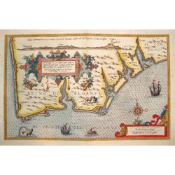
BESCHRIJUINGHE DER ZEE CUFTEN VANT LANT...ARGARBE...
A rarely seen, beautifully rendered and highly decorative sea chart of the Algarve, located in the far south of Portugal.Published in the important 1584 edition of SPIEGE...
Date: Leyden, 1584
Selling price: ????
Please login to see price!
Sold
Italiae Veteris Specimen.
Ortelius' map of Ancient Italy which appeared in his beginning in 1584. The map is based upon Gastaldi's map of Italy, supplemented with classical sources. Signed and dat...
Date: Antwerp, 1584
Selling price: ????
Please login to see price!
Sold in 2013
Schlavoniae, Croatiae, Carniale.. Bosniae..
First state. Fine and early map of former Yugoslavia after a map of Hirschvogel (1552-1565) and used by A.Ortelius in his atlas 'Theatrum Orbis Terrarum [Atlas of the Who...
Date: Antwerp 1584
Selling price: ????
Please login to see price!
Sold
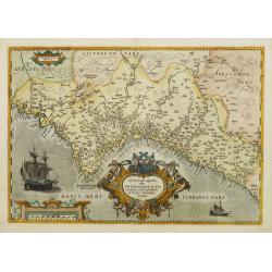
Valentiae Regni, olim contestanorum si ptolemaeo..
Rare issue of this early map of Valencia. According to v.d.Broecke in his book Ortelius Atlas Maps, only very few copies are printed, and only three found so far (1996). ...
Date: Antwerp, 1584
Selling price: ????
Please login to see price!
Sold
Venuxini Comitatus Nova Descr. Auctore Stephano Ghebellino.
Abraham Ortelius(1527-98), Dutch cartographer and publisher of the first modern atlas, ' Theatrum Orbis Terrarum' in 1570. Editions till 1612. Also an atlas of ancient ca...
Date: Antwerp, 1584
Selling price: ????
Please login to see price!
Sold
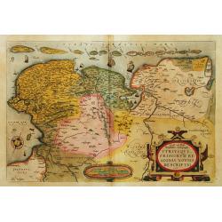
Oost ende West Vrieslandte beschryvinghe.
Prepared by Jacob van Deventer. A very decorative map of the Dutch provinces of Friesland, Groningen and Drente and of the German Province of Friesland.
Date: Antwerp, 1584
Selling price: ????
Please login to see price!
Sold in 2008
Perusini agri, exactissima ..
A first imprint. Very fine map centred on the town of Perugia. The map is based on Egnatio Danti's 1580 map of Perugia.Copper engraving with Latin text on verso. Abraham ...
Date: Antwerp, 1584
Selling price: ????
Please login to see price!
Sold in 2008
Westphaliae Totius, Finitimarumque Regionum Accurata Descriptio
Beautiful hand color copper engraved map of North Rhein-Westphalia by A. Ortelius. From the 1584 Latin edition of \"Theatrum Orbis Terrarum\".
Date: Antwerp, 1584
Selling price: ????
Please login to see price!
Sold in 2009
Europae.
Somewhat distorted land masses: vignette of Europe being carried off by the bull (Zeus).The first plate with title AFRICAE PARS in normal lettering. Fine impression.The m...
Date: Antwerp, 1584
Selling price: ????
Please login to see price!
Sold in 2013
Turingiae Noviss. Descript per Iohannem Mellinger Halens. / Misniae et Lusatiae Tabula.
A pair of maps of central Europe by Abraham Ortelius. The first map on the left is of the region of Eastern Germany, and shows the cities and towns of Erfurt (Erfurdt), ...
Date: Antwerp, 1584
Selling price: ????
Please login to see price!
Sold in 2010
Creta Iouis magni, medio iacet insula ponto.
Fantastic map of islands of the Mediterranean by Ortelius; a large map of Crete is at the bottom half of the sheet, with smaller maps of Corsica, the Greek Islands and Sa...
Date: Antwerp, 1584
Selling price: ????
Please login to see price!
Sold in 2010
Lutzenburgensis Ducatus veriss descript.
Prepared by Jacob Surhon who made a manuscript map of Luxembourg for which he received 500 Livres from Charles V in 1551. For security reasons the map was not published. ...
Date: Antwerp, 1584
Selling price: ????
Please login to see price!
Sold in 2014
Car Petani Ae Partis Descr/ Gui Pus Coae Regionis Typus / Hanc insulam Perlustrabat, et sua Manu de Pingebat Geor Gius Hoefnagli us Antuerpian. . .
Three maps on one sheet of Cadiz and other regions in Spain. Based on Georg Hoefnagel, who drew a manuscript map during his stay in Spain from 1563 to 1567 (Meurer p. 167...
Date: Antwerp, c.1584
Selling price: ????
Please login to see price!
Sold in 2012
Romanii Imperii Imago.
An attractive map of the second plate prepared (after 1592) of the Roman Empire, drawn by Ortelius and published in the 'Paregon' section. The medallion portraits are of ...
Date: Antwerp, 1584
Selling price: ????
Please login to see price!
Sold in 2012
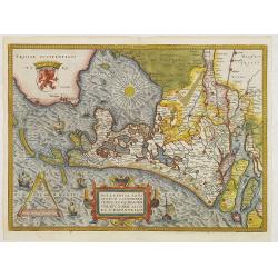
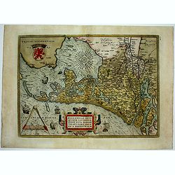
Hollandiae Antiquorum Catthorum Sedis Nova Descriptio . . .
Ortelius' atlas publication of Jacob van Deventer's survey of the province of Holland surveyed in 1537 and published first in Antwerp in nine sheets by Bernard van der Pu...
Date: Antwerp, ca.1584
Selling price: ????
Please login to see price!
Sold in 2012
Caletensium Et Bononiensium Ditionis Accurata Delineatio & Veromanduorum Eorum Que Confinium Exactissima Descriptio...
Two detailed regional maps by Ortelius. The first map shows Belgian and French Coastal region, from Etaples to Gravelines, with Calais, Boulogne-sur-Mer. The second map s...
Date: Antwerp, 1584
Selling price: ????
Please login to see price!
Sold in 2013
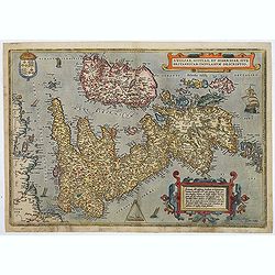
Angliae, scotiae, et Hiberniae, sive Britannicar insularum.
A state 3 of this classic, handsome and decorative map of ancient British Isles with north orientated to the east. Latin text on verso.Based on Mercator's 1564 map of the...
Date: Antwerp, after 1584
Selling price: ????
Please login to see price!
Sold in 2018
Rhetiae alpestris .. Tirolis Comitatus. & Goritiae. . .
On the left hand-side a map of Tyrol in Austria and on the right a map of the Northern part of Yugoslavia. The maps are prepared by Lazius in 1561.
Date: Antwerp, 1584
Selling price: ????
Please login to see price!
Sold in 2015
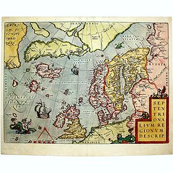
Septentrionalium Regionum Descrip.
This influential map of the Arctic, including Scandinavia, Iceland, Greenland and part of the North American continent, includes also the legendary islands of i.a. Drogeo...
Date: Antwerp, 1584
Selling price: ????
Please login to see price!
Sold in 2014
Hollandiae Antiquorum.
A mile stone map published by Ortelius on the basis of the map drawn by Jacob van Deventer in abt. 1550. Decorated with a large strapwork title cartouche, scale of miles ...
Date: Antwerp, 1584
Selling price: ????
Please login to see price!
Sold in 2015
Lutzenburgensis Ducatus Veriss Descript.
Early map of the area of Luxembourg from Ortelius great "Theatrum Orbis Terrarum" the first modern atlas. Based on the 1551 manuscript map of Jacques Surhon. Th...
Date: Antwerp, 1584
Selling price: ????
Please login to see price!
Sold in 2015
Anjou / Andegavensium Ditionis Vera et Integra Desciptio.
Very decorative map of a region in France, centered on the Loire River and Angiers. Highly detailed with hundreds of villages shown, forests, hills, etc. Includes several...
Date: Antwerp, 1584
Selling price: ????
Please login to see price!
Sold in 2015
The Best Ptolemaic Map of Germany: Europ. IIII. Tab.
An elegantly engraved map of Germany as it was known in the Roman Imperial Period from Mercator’s definitive edition of Ptolemy’s geography. It was based on geographi...
Date: Lyons, 1584
Selling price: ????
Please login to see price!
Sold in 2019
A Fine Example. Crimea/ Sea of Azov/ Russia. Asiae II Tab:
An early issue — the second — of this very attractive map of southern Russia from Mercator’s definitive edition of Ptolemy’s geography. Meeting in this map are tw...
Date: Cologne, 1584
Selling price: ????
Please login to see price!
Sold in 2019
Westphaliae Totius, Finitimarumque Regionum Accurata Descriptio.
A very beautiful hand color copper engraved map of North Rhein-Westphalia by A. Ortelius. From the 1584 Latin edition of the "Theatrum Orbis Terrarum". This is ...
Date: Antwerp, ca 1584
Selling price: ????
Please login to see price!
Sold in 2019
CARINTHIAE DUCATUS, ET GORITIAE PALATINATUS, WOLF. LAZIO -Histriae tabula a Petro Coppo defer - ZARAE, ET SEBENICI DESCRIPTION
A striking set of three maps on a single sheet, including the region around Villach on the Dravus River, the Gulf of Trieste and Quarnero and the region around Zara [Zada...
Date: Antwerp, 1584
Selling price: ????
Please login to see price!
Sold in 2019
Caroli Sigonii von Geschichten des Königreichs Italiae Fünffsehn Bücher in sich begreiffende die herrliche Historien vom Jahr Christi 57o. anbiß ins 12.oo. Jahr.
Early description of Italy, being the German translation of Carolus Sigonius' "De Regno Italia Libri XV", (Venice, 1574).This German edition published in Strasb...
Date: Bernhart, Strassburg, 1584
Selling price: ????
Please login to see price!
Sold in 2019
SOEST [on sheet with] WARBOCH - Warburgum, elegans Westphaliae Opp.
Two bird's-eye views on one sheet, by Georg Braun and Frans Hogenberg: Soest and Warburg. CARTOUCHE: Soest, among the cities of Westphalia almost the largest and richest....
Date: Cologne, 1584
Selling price: ????
Please login to see price!
Sold in 2020
Europae Tabula Secunda (Spain).
This fascinating, large, early copper engraving by Mercator appeared in 1578. It is extremely decorative with a cartouche, a sailing ship and a sea monster in the Mediter...
Date: Cologne, 1584
Selling price: ????
Please login to see price!
Sold in 2021
Europae Tabula septima (Sicily and Sardinia).
A very decorative, large, early map showing Sicily and Sardinia by Mercator. The map first appeared in 1578. Embellished with sailing ships and sea monsters. It shows als...
Date: Cologne, 1584
Selling price: ????
Please login to see price!
Sold in 2022
Circulus Sive Liga Suevia Vulgo Schwabische Kraiss.
Early map showing the region bounded by the Bodensee, the Rhein and Augsburg, centered on the Donau.
Date: Antwerp, ca. 1584
Selling price: ????
Please login to see price!
Sold in 2021
Gallipolis..
Very decorative view of Gallipolis from the greatest publication in this genre!. The "Civitates". Compiled and written by George Braun, Canon of Cologne Cathedr...
Date: Cologne 1585
Selling price: ????
Please login to see price!
Sold
Avignon.
A fine bird?s eye view of the ancient capital of Provence, Avignon, from the famous CIVITATES ORBIS TERRARUM. The work contains a 45 point legend, identifying key sights....
Date: Cologne, 1585
Selling price: ????
Please login to see price!
Sold
De Zee Custen tuschen Dovere eñ Orfordts nesse, daer de Teemse de Vermaerde Riviere vã Lõnen gelegens is, met alle sanden ondiepte, naer haren wesen eñ ghedaente / Orae maritimae inter Doverium et Ortfortnissam &tc.
Lucas Janszoon Waghenaer (1533/4-1606) published in 1583 his famous pilot-guide ' Spieghel der Zeevaerdt', the first printed pilot-guide with charts, in 1592 he published...
Date: Leiden, 1585
Selling price: ????
Please login to see price!
Sold in 2008
Poloniae Descrip.
Map of Poland from the first Latin edition and the only not issued in an oblong format of this illustrated treatise of geography, which is considered as the first modern ...
Date: Antwerp, 1585
Selling price: ????
Please login to see price!
Sold in 2009
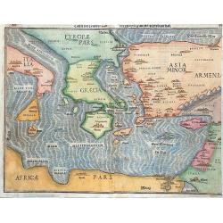
Tafel Der Lender Darin Der Apostel Paulus Geprediget Hat.
The Eastern Mediterranean, from the "Itinerarium Sacrae Scripturae", showing Italy, Sicily, Greece, Cyprus, Asia Minor, the Holy Land and North Africa, with cit...
Date: Magdeburg, 1585
Selling price: ????
Please login to see price!
Sold in 2014
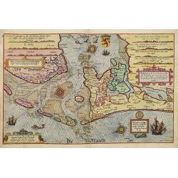
Beschrijvinge vande vermaerde stroemen, Tvlie ende Tmaersdiep: opstreckende Inde Zijder Zee voerby Enchuijsen tot Amsterdam. . .
A detailed chart of the coast of Holland decorated by several cartouches with several colorful cartouches, scale cartouches, compass roses, 5 vessels and 2 sea monster. F...
Date: Leiden, Plantijn, 1585
Selling price: ????
Please login to see price!
Sold in 2009
Chartae orarum . . . . Caerte vanden zee Custen, eensdeels Normandien, en Brittangen. . .
A detailed chart of the Normandy coast and the channel islands of Jersey, Guernsey, Alderney and Sarck decorated by a colorful title cartouche and scale cartouche, two co...
Date: Leiden, Plantijn, 1585
Selling price: ????
Please login to see price!
Sold in 2008
![[Sluis], Slusa, Teutonicae Flandriae opp. . .[Sluis]](/uploads/cache/84162-250x250.jpg)
![HARLEMUM, Sive ut Ha: Barlan Herlemum, Urbs Hollandiae famosa . . .[HAARLEM]](/uploads/cache/84172-250x250.jpg)
![Lewardum. Occidentalis Frisiae Opp: 1580. [on sheet with:] Franicher, Nobiliu hominum, in Frisia Occidentali, ut plurimum saedes.[Leeuwarden&Franeker]](/uploads/cache/84177-250x250.jpg)
![Icon civitatis Campensis, cuius situs Isulam fluvium, eleganti venustate, decorat.[Kampen, Overijssel]](/uploads/cache/84178-250x250.jpg)
![Niitidissimae Civitatis mechlineensis, in Meditulli O Brabantiae Sitae, Exactis Delineatio.[Mechelen]](/uploads/cache/84180-250x250.jpg)
![Charlemont [on sheet with] Landrechies [and] Avesnes [and] Beaumont.](/uploads/cache/84183-250x250.jpg)
![Namurcum, Elegantissima ad Mosae Flume Civitas. [Namur]](/uploads/cache/84185-250x250.jpg)
![Philippopolis vulgo Philippeville munitiss. comitat Hannoniae opp. [on sheet with]: Marieburgum [on sheet with]: Cimacum, comuniter Chimay, principatus titulo, in Han prestas opp [on sheet with]: Walcourt, haud ignobile comitatus Namurcensis oppidum.](/uploads/cache/84186-250x250.jpg)

![Roterodamum Hollandiae Opp. [on sheet with:] Goude [Rotterdam, Gouda]](/uploads/cache/84188-250x250.jpg)
![Halberstadium, Urbs Saxoniae [on sheet with] Quedelinburga, Antiquissimum Saxoniae Oppid. [HALBERSTADT/QUEDLINBURG]](/uploads/cache/84192-250x250.jpg)


![PASSAW [PASSAU].](/uploads/cache/85245-250x250.jpg)
![Saltzburgk Recens, et accuratissima urbis Salisburgensis delineatio.[Salzburg]](/uploads/cache/85253-250x250.jpg)
![Halberstadium, Urbs Saxoniae [on sheet with] Quedelinburga, Antiquissimum Saxoniae Oppid. [Halberstadt and Quedlinburg].](/uploads/cache/85261-250x250.jpg)

![Francenbergum, vel ut alij Francoburgum Hassiae Opp. [Frankenberg]](/uploads/cache/85256-250x250.jpg)
![Soest [on sheet with] Warborch - Warburgum, elegans Westphaliae Opp.](/uploads/cache/85413-250x250.jpg)
![Civitatis Werdenae Exactiss: Descrip: [on sheet with:] Civitatis Essensis Exactiss. Descrip.](/uploads/cache/85419-250x250.jpg)
![Grenoble & Romans-sur-Isère. - Gratianopolis Acusianoru Colonia, ... [on sheet with] Romans Delfinatus vulgo Daufine in Gallia Oppidu.](/uploads/cache/85902-250x250.jpg)


![Die Custe va Lijfflandt, met de Eijlanden daer beneffens also hem dat landt aldaer verthoont en in zyn ghedaente is, van Ekehol.[TALLINN/REVAL,ESTONIA]](/uploads/cache/83566-250x250.jpg)











![SOEST [on sheet with] WARBOCH - Warburgum, elegans Westphaliae Opp.](/uploads/cache/84009-250x250.jpg)


