Browse Listings in Europe
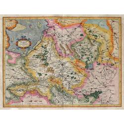
Geldria et Transysvlania Per Gerardum Mercatorem.
A fine, early map of the area of Gelderland in The Netherlands. The map shows details of all cities, towns, and villages in Gederland. North is at the top. To the nor...
Date: Amsterdam, (1585-95) 1613
Selling price: ????
Please login to see price!
Sold in 2011
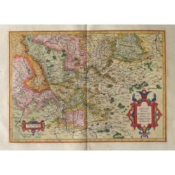
BERGHE Ducatus MARCK Comitatus et COLONIENsis Diocesis Per Gerardum Mercatorem.
The map covers a large section of the lower Rhine River and the surrounding region, including to Frankfurt and north to Duisburg.9174691746 Gerard Mercator (1512-1594) w...
Date: Amsterdam, (1585-95) 1613
Selling price: ????
Please login to see price!
Sold in 2011
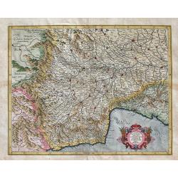
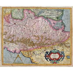
PEDEMONTANA regio cum GENVENSIUM ... Per Gerardum Mercatorem.
This is a fine, early decorative map by Gerard Mercator of the area of northwest Italy including Milano, Genoa, etc. All other major cities and towns are on the map as a...
Date: Duisburg and then Amsterdam, (1589-95) 1613
Selling price: ????
Please login to see price!
Sold in 2013
Mercator's Map of The Crimea in Russia: TAVRICA CHERSONES:VS Nostra ... Per Gerardum Mercatorem.
This is a fine, early map by Gerard Mercator of the area of southern Russia and the Crimea with the Black Sea to the south. North at the top of the map. Gerard Mercator ...
Date: Duisburg and then Amsterdam, (1595) 1613
Selling price: ????
Please login to see price!
Sold in 2012
Irlandiae Regnum.
Fine map of southern part of Ireland.Mercator was born in Rupelmonde in Flanders and studied in Louvain under Gemma Frisius, Dutch writer, astronomer and mathematician. T...
Date: Amsterdam, c. 1613
Selling price: ????
Please login to see price!
Sold in 2012
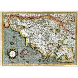
TVSCIA / Per Gerardum Mercatorem.
This is a fine, early decorative map by Gerard Mercator of the beautiful area of Tuscany in Italy. The map shows an area extending from just beyond Tuscany. At the lower ...
Date: Duisburg and then Amsterdam, (1589-95) 1613
Selling price: ????
Please login to see price!
Sold in 2012
MORAVIA Per Geradum Mercatorem cum privilegio.
This map shows the eastern part of the Czech Republic with Poland to the north. It is a finely detailed map with numerous placenames throughout. Gerard Mercator (1512-15...
Date: Duisburg and then Amsterdam, (1589-95) 1613
Selling price: ????
Please login to see price!
Sold in 2012
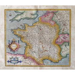
Gallia / Per Gerardum Mercatorem.
An early map of France by Gerard Mercator.Gerard Mercator (1512-1594) was one of the most famous geographers of his time. He was renowned as a scholar in his day, and hi...
Date: Druisburg and then Amsterdam, 1613
Selling price: ????
Please login to see price!
Sold in 2012
TRIER & LUTZENBURG. Per Gerardum Mercatorem Cum Privilegio.
Early map of the region of Luxembourg with Trier, etc. From a Latin edition of the Mercator Hondius atlas of 1613.
Date: Duisburg and then Amsterdam, (1585) 1613
Selling price: ????
Please login to see price!
Sold in 2012
ROMANDIOLA cum Parmensi Ducatu Per Gerardum Mercatorem.
Detailed map of Lombardy Italy, with numerous cities and villages: Florence, Pisa, Parma, to Mantuato & Ferrara in the north.
Date: Duisburg and then Amsterdam, (1589-95) 1613
Selling price: ????
Please login to see price!
Sold in 2012
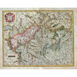
LOMBARDIAE Alpestris pars occidentalis cum VALESIA Per Gerardum Mercatorem.
This Mercator map shows much of northern Italy. Prominent on the map are Milano, Como, etc., with Lake Geneva to the left.
Date: Duisburg and then Amsterdam, (1589-95) 1613
Selling price: ????
Please login to see price!
Sold in 2012
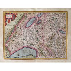
Das Wilflispurgergow / Per Gerardum Mercatore
A fine detailed early map of Central Switzerland with Lake Geneva, Bern, etc. by Gerard Mercator. Gerard Mercator (1512-1594) was one of the most famous geographers of hi...
Date: Druisburg and then Amsterdam, (1585-95) 1613
Selling price: ????
Please login to see price!
Sold in 2012
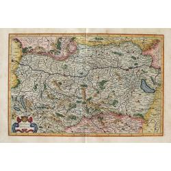
Austria archiducatus / per Gerardum Mercatorem
An early map of Austria by Gerard Mercator.Gerard Mercator (1512-1594) was one of the most famous geographers of his time. He was renowned as a scholar in his day, and hi...
Date: Duisburg and then Amsterdam, (1589-95) 1613
Selling price: ????
Please login to see price!
Sold in 2012
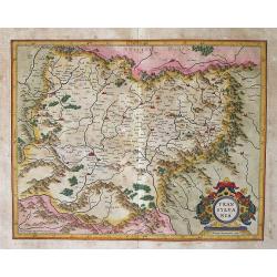
Transylvania / Per Gerardum Mercatorem.
An early, well-prepared map by Gerard Mercator of the famed region of Transylvania in southeast Europe.Gerard Mercator (1512-1594) was one of the most famous geographers ...
Date: Druisburg and then Amsterdam, (1595) 1613
Selling price: ????
Please login to see price!
Sold in 2012
WEST MORLANDIA, LANCASTRIA, CESTRIA, CAERNARVAN, DENBIGH, FLINT, MERIONIDH, MONTGOMERY, SALOPIA Cum insulis MANIA ET ANGLESEY, Per Gerardum Mercatorem.
A fine, early decorative map by Gerard Mercator of northwest England. There is great clarity in the placement and list of numerous cities and towns on the map. At the l...
Date: Duisburg and then Amsterdam, (1595-1602) 1613
Selling price: ????
Please login to see price!
Sold in 2013
LIMBURGENSIS DUCATUS NOVA DESCRIPTIO Auctore Aegido Martini Anno Domini 1603.
Decorative map of Belgium that is centered roughly on the Meuse River (Latin Mosa)and its cities of Hoy, Liege, Maastricht, etc. Finely detailed to show numerous towns an...
Date: Amsterdam, (1611) 1613
Selling price: ????
Please login to see price!
Sold in 2013
Bavaria Ducatus. Per Gerardum Mercatorem.
Map of Bavaria in Germany. Danube River across top third of the map. Numerous cities (Ingolstat, Regensburg, etc.), towns and villages on the map with various lakes incl...
Date: Amsterdam, (1585-95) 1613
Selling price: ????
Please login to see price!
Sold in 2014
Alsatia Superior cum Suntgoia & Brisgoia Per Gerardum Mercatorem.
Finely engraved map of the Alsace region of France with Germany & Switzerland. The map focuses on the course of the Rhine River from Basel to Strasbourg. North is o...
Date: Duisburg and then Amsterdam, (1585-95) 1613
Selling price: ????
Please login to see price!
Sold in 2013
Leodiensis Dioecesis Typus. Baptista Doetecomius sculp.
Detailed map of Belgium centered on Leige. Highly map with numerous cities (including Maastricht, Wyck, Namur, etc.), towns, and villages depicted. Extends to Brabant wit...
Date: Amsterdam, (1606) 1613
Selling price: ????
Please login to see price!
Sold in 2014
ALSATIA inferior Per Gerardum Mercatorem
Finely engraved and attractive map of the Alsace region of France with Germany. The map shows the course of the Rhine River around Strasbourg. North is oriented to the ri...
Date: Duisburg and then Amsterdam, (1585-95) 1613
Selling price: ????
Please login to see price!
Sold in 2013
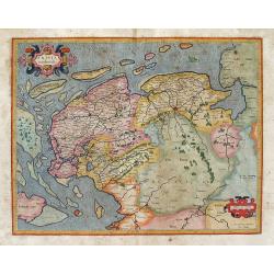
Frisia occidentalis Gerardum Mercatorem cum privilegio.
Highly detailed map of Friesland with Groningen, etc. in The Netherlands. The map was used for Mercator's Atlas Sive Cosmographicae... in 1595. One further edition of th...
Date: Duisburg and then Amsterdam, (1585-95) 1613
Selling price: ????
Please login to see price!
Sold in 2013
Emden & Olden Borch Comit Per Gerardum Mercatorem.
The highly detailed map shows northwest Germany and the northern portion of Lower Saxony. Extends from Bremen at lower right, Oldenburg (here Oldenborch) and west to the ...
Date: Duisburg and then Amsterdam, (1585-95) 1613
Selling price: ????
Please login to see price!
Sold in 2013
Wachtendonck.
A nice detailed panoramic view of Wachtendonk, a town at the meeting of the Niers and Nette rivers in the district of Kleve in North Rhine - Westphalia, Germany. It is on...
Date: Amsterdam, 1613
Selling price: ????
Please login to see price!
Sold in 2015
Temple D. virginis Mariae Vera Delineatio.
Copperplate engraved print showing the Virgin Maria Church in Antwerp. From Ludovico Guicciardini's description of the Netherlands, published by Blaeu. Lovely figural tit...
Date: Amsterdam, 1613
Selling price: ????
Please login to see price!
Sold in 2014
Ciutas Mons Geertrudan. (Geertruidenberg)
Fine hand-colored, copper engraving of the Fortification of Geertruidenberg, Netherlands. Very detailed with actual soldiers, animals, canons etc. pictured. Strong strapw...
Date: Amsterdam, 1613
Selling price: ????
Please login to see price!
Sold in 2016
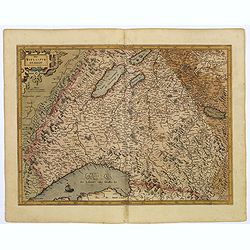
[Northern Switzerland with Basel, Zurich, etc.] per Gerardum Mercatorem.
This is Gerard Mercator's map of Northern Switzerland with Basel, Zurich, the lakes, etc. It first appeared in Duisberg in 1585. This map is from a Latin edition of 1613.
Date: Amsterdam, (1585-95) 1613
Selling price: ????
Please login to see price!
Sold in 2014
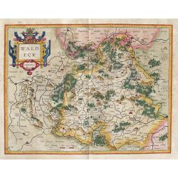
Waldeck: Waldeck Comitatus. . .
Map of Waldeck in Germany. The map first appeared in 1585 and then in Gerard Mercator’s Atlas sive Cosmographicae..., published in 1595 & 1602.In 1604, the copper...
Date: Amsterdam, (1585-95) 1613
Selling price: ????
Please login to see price!
Sold in 2014
Walcourt and Charlemont (2 prints)
Two fine city maps of Walcourt & Charlemont (Belgium) by L. Guicciardini, published by J. Janssonius in 1613. Lodovico Guicciardini (1521–1589), was an Italian wr...
Date: Amsterdam, 1613
Selling price: ????
Please login to see price!
Sold in 2016
Typus Hispaniae ab Hesselo Gerardo delineata. . .
The extremely rare FIRST STATE of this decorative "carte à figures"- map of the kingdom of Spain and Portugal by Hessel Gerritsz. This first state is only know...
Date: Amsterdam, 1613
Selling price: ????
Please login to see price!
Sold in 2016
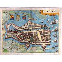
Vere
A detailed plan of Veere, (Vere) in the province of Zeeland, The Netherlands, Holland. This map originates from the 1613 edition of 'Discrittione di Tutti i Paesi Bassi',...
Date: Amsterdam, ca 1613
Selling price: ????
Please login to see price!
Sold in 2018
Islandia.
A very nice miniature map from Iceland showing a sea monster and exploding volcano. The map is a reduced version of Mercator's folio map of 1595. From an early edition of...
Date: Amsterdam, J. Janssonius, 1613
Selling price: ????
Please login to see price!
Sold in 2019
Das Wiflispurgergow.
A truly beautiful old color example of the Mercator Hondius map of Wiflispurgergow in south west Switzerland. This map was first issued in 1595, only one year after Merca...
Date: Amsterdam, 1613
Selling price: ????
Please login to see price!
Sold in 2019
Chorographica Tabula Lacus Lemmanni Locorumque Circumia Centium. . .
A highly attractive and scarce map of Lake Geneva and its environs, orientated to the south east. There is a high degree of skillful engraving within this map, embellishe...
Date: Amsterdam, 1613
Selling price: ????
Please login to see price!
Sold in 2018
West Morlandia, Lancastria, Cestria . . .
A fantastic map showing northern Wales with Anglesey, the Isle of Man, and parts of England including the cities of Liverpool, Manchester, Chester, Preston, Kendal, and m...
Date: Amsterdam, ca. 1613
Selling price: ????
Please login to see price!
Sold in 2020
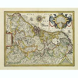
Novus XVII Inferioris Germaniae Provinciarum Typus de integro multis locis emendatus. Auct. Petro Kaerio.
Janssonius published this map when he was still working in Arnhem. One of the most decorative maps of present Netherlands, Belgium and Luxembourg.With German text on vers...
Date: Arnhem, 1614
Selling price: ????
Please login to see price!
Sold in 2011
Buckinghamshire.
An attractive map of Buckinghamshire from the "Theatre of Great Britaine" by John Speed, published by George Humbell in 1614. Inset town plans of Buckingham and...
Date: London, 1614
Selling price: ????
Please login to see price!
Sold in 2016
Tabula Russiae. . .
The rare Hessel Gerritsz' edition before the plate went to Willem Blaeu.This rare and influential map of Russia was compiled from manuscripts brought back from Russia, by...
Date: Amsterdam, 1614
Selling price: ????
Please login to see price!
Sold in 2016
Plawen der Hauptstatt Narisciae Wahre Abcontrafactur Gesamtansicht. . .
Fine 1614 woodcut by Munster featuring a birds-eye view of the city of Plauen, Germany. The print features a floral cartouche with the coat of arms within a castle. Belo...
Date: Basel, 1614
Selling price: ????
Please login to see price!
Sold in 2019
Granata.
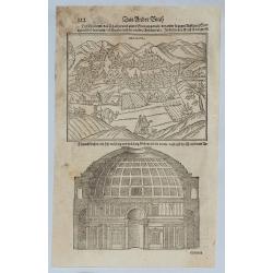
Page from the scarce 1614 German edition of the Münster's Cosmographia. Text with woodcut of a panoramic view of Grenada, Spain, with his buildings, churches, streets an...
Date: Basel, 1614
Selling price: ????
Please login to see price!
Sold in 2019
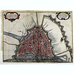
Amstelodamum.
This rare state of one of the oldest maps and views of Amsterdam depicts an early view and the further expansion of it´s windmill dykes in the beginning of the 17th cent...
Date: Amsterdam, 1614
Selling price: ????
Please login to see price!
Sold in 2019
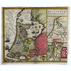
Hollandiae Chorographia
In 1611 Isaac Pontanus, published his “Rerum et urbis Amstelodamensium historia” in Amsterdam. This print comes out of the even rarer Dutch translation "Historis...
Date: Amsterdam, 1614
Selling price: ????
Please login to see price!
Sold in 2019
Amstelodamum.
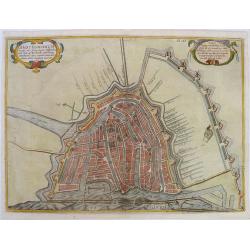
One of the oldest plans of Amsterdam from the beginning of the 17th century. An earlier but incomplete state was published in 1611, due to the desire to quickly publish t...
Date: Amsterdam, 1614
Selling price: ????
Please login to see price!
Sold in 2019
Fretum Vaygats.
The map depicts the southern part of Nova Zembla and the small passage called the Strait of Nassau, Straete van Nassau between Nova Zembla and the mainland of Russia. Dep...
Date: Amsterdam, 1614
Selling price: ????
Please login to see price!
Sold in 2022
Nova Zembla & Fretum Waygats.
A miniature map of Novaya Zemblya, here identified as Nova Zembla, in present-day Russia. It includes beautiful ships, seals, a whale, a cartouche, a fine compass rose, a...
Date: Amsterdam, 1614
Selling price: ????
Please login to see price!
Sold in 2020
Vera delineatio insulae Ordinum quatuor circiter miliaribus a freto Nassovico distantis.
A miniature map of the Strait of Nassau and Novaya Zemblya, here identified as Novae Zemblae Pars, in present-day Russia. We find the explorers attacked by a polar bear. ...
Date: Amsterdam, 1614
Selling price: ????
Please login to see price!
Sold in 2022
Isle of Wight.
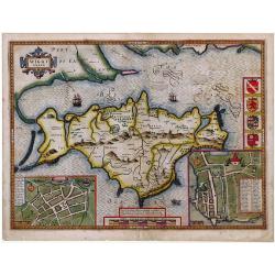
Striking map of The Isle of Wight, by John Speed, along with town plans of Newport and Southampton.
Date: London, ca. 1615
Selling price: ????
Please login to see price!
Sold in 2010
Zelandia.
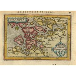
Map of the Province of Zeeland, with its many islands and peninsulas. Major cities, small villages.
Date: Amsterdam 1616
Selling price: ????
Please login to see price!
Sold
Geldria.
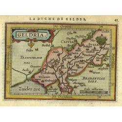
Map of the Province of Geldria, with the city Arnhem Harderwijk and many others.
Date: Amsterdam 1616
Selling price: ????
Please login to see price!
Sold
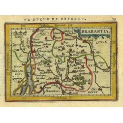
Brabantia.
Map of the Province of Brabant, with the city Breda 's Hertogenbosch and also the Belgium part of Brabant.
Date: Amsterdam 1616
Selling price: ????
Please login to see price!
Sold
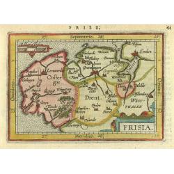
Frisia.
Map of the Province of Friesland, Groningen and Drente, with its major cities and small villages.
Date: Amsterdam 1616
Selling price: ????
Please login to see price!
Sold
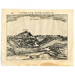
Saltzburg
Important birds-eye view of Salzburg in Austria, the birthplace of Mozart. The view shows the city with the river, castle, and many single buildings. Lovely illustrated a...
Date: Amsterdam, 1616
Selling price: ????
Please login to see price!
Sold in 2008
Comitatus Flandria.
Rare and decorative oval map in a rectangular frame, the corners decorated with ornaments. Abraham Goos figures among map publishers in Amsterdam as one of the little kno...
Date: Amsterdam, 1616
Selling price: ????
Please login to see price!
Sold in 2008
Warwicum Northapton Hunting.
Copper-engraving by P. Bertius published by J. Hondius, 1616. With small ornamental cartouche and "Miliaria Anglica" of Suffolk, Essex, Kent, East and West Suss...
Date: Amsterdam, 1616
Selling price: ????
Please login to see price!
Sold in 2012
The province of Ulster described.
A most decorative map of the County of Ulster in Northern Ireland. One of four maps in this auction of the Irish provinces included in Speed’s atlas, it contains an ins...
Date: London, 1610 - 1616
Selling price: ????
Please login to see price!
Sold in 2013
The province of Mounster.
A most decorative map of the Irish province of Munster, located in the southwest of the island. One of four maps in this auction of the Irish provinces included in Speed�...
Date: London, 1610 - 1616
Selling price: ????
Please login to see price!
Sold in 2013
The province of Connaugh with the Citie of Galwaye Described.
A most decorative map of the Irish province of Connaught. The sea is decorated with ships and sea monsters, including one being ridden by an Irish bard playing a harp. On...
Date: London, 1610 - 1616
Selling price: ????
Please login to see price!
Sold in 2013
The countie of Leinster with the Citie Dublin Described.
A most decorative map of the Irish County of Leinster, which includes this remarkable early plan of Dublin, a sea monster, sailing ship and decorative compass rose. One o...
Date: London, 1610 - 1616
Selling price: ????
Please login to see price!
Sold in 2013
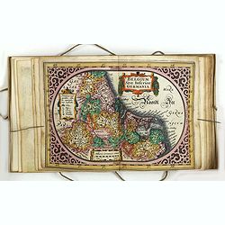
Nieuw Nederlandtsch Caertboeck. Waer in volkomentlijcker als oyt te voren vertoont werden de XVII. Nederlanden.
WITHOUT TEXT - SECOND KNOWN COPY. The rare second edition of this atlas of the provinces of the Netherlands, Belgium, and Luxemburg. Engraved title page, with : "Ged...
Date: Amsterdam, 1616
Selling price: ????
Please login to see price!
Sold in 2015
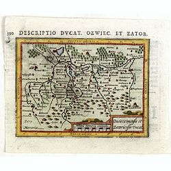
Oswieczimensis et Zatoriensis Ducat.
An original early 17th century copper engraved miniature antique map of the Oswiecim (Auschwitz) and Zator area of southern Poland by Petrus Bertius.The title is displaye...
Date: Amsterdam, J.Hondius, 1616
Selling price: ????
Please login to see price!
Sold in 2015
Antwerpia.
Scarce miniature birds-eye view of Antwerp. With numerous buildings and ships. From Willem Baudartius "Les Guerres De Nassau", published by Michel Colin Thovoyo...
Date: Amsterdam, 1616
Selling price: ????
Please login to see price!
Sold in 2015
The countie of Leinster with the Citie Dublin Described.
A most decorative map of the Irish County of Leinster, which includes this remarkable early plan of Dublin, a sea monster, sailing ship and decorative compass rose. One o...
Date: London, 1610 - 1616
Selling price: ????
Please login to see price!
Sold in 2015
The province of Connaugh with the Citie of Galwaye Described.
A most decorative map of the Irish province of Connaught. The sea is decorated with ships and sea monsters, including one being ridden by an Irish bard playing a harp. On...
Date: London, 1610 - 1616
Selling price: ????
Please login to see price!
Sold in 2015
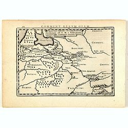
Tractus Rheni in Germania inferiore ad 4 e 5 Historiarum C. Cornelii Taciti.
Map of ancient Germany and the Low Countries, prepared by Petrus Bertius (1565-1629). From "Commentariorum Rerum Germanicarum Libri Tres : Primus est Germaniae veter...
Date: Amsterdam, J.Janssonius, 1616
Selling price: ????
Please login to see price!
Sold in 2015
Rhaetiae, Vindeliciae Norici et Pannoniarum descriptio.
Map of ancient Switzerland, part of Hungary and Croatia, prepared by Petrus Bertius (1565-1629). From "Commentariorum Rerum Germanicarum Libri Tres : Primus est Germ...
Date: Amsterdam, J.Janssonius, 1616
Selling price: ????
Please login to see price!
Sold in 2015
Germania ex descriptione Caesaris Plinij Taciti.
Map of ancient Europe, prepared by Petrus Bertius (1565-1629). From "Commentariorum Rerum Germanicarum Libri Tres : Primus est Germaniae veteris. Secundus, Germaniae...
Date: Amsterdam, J.Janssonius, 1616
Selling price: ????
Please login to see price!
Sold in 2015
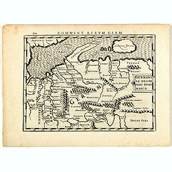
Germaniae descriptio Ptolemaica.
Map of ancient Germany, prepared by Petrus Bertius (1565-1629). From "Commentariorum Rerum Germanicarum Libri Tres : Primus est Germaniae veteris. Secundus, Germania...
Date: Amsterdam, J.Janssonius, 1616
Selling price: ????
Please login to see price!
Sold in 2015
Suevorum et Lygiorum descriptio ex Tacito de Mor. Ger.
Map of ancient Poland and Central Europe, prepared by Petrus Bertius (1565-1629). From "Commentariorum Rerum Germanicarum Libri Tres : Primus est Germaniae veteris. ...
Date: Amsterdam, J.Janssonius, 1616
Selling price: ????
Please login to see price!
Sold in 2015
Provincia Oxoniensis/ Oxford-Shire.
An very decorative map of the county from an early edition of Speed's atlas, "Theatre of Great Britaine", with inset plan of Oxford, scale bar within a pair of ...
Date: London, 1616
Selling price: ????
Please login to see price!
Sold in 2016
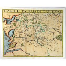
Carte Du Pais De Xaintonge.
A pleasing map of Poitiers. (Xaintonge). It was one of the earliest maps of the region. Detailed with the sea engraved with a 'moiree' effect and the forests, villages an...
Date: Paris, 1616
Selling price: ????
Please login to see price!
Sold in 2016
Caletensium et Bononiensium Ditionis Accurata Delineatio; Vermanduorum Eorumque Confinium Exactissima (2 Maps)
Two fine detailed regional maps by Ortelius. The first map shows the Belgian and French Coastal region, from Estaples to Gruerlinge. The second map shows the region Cente...
Date: Antwerp, 1616
Selling price: ????
Please login to see price!
Sold in 2016
Denbighshire.
A highly decorative map of the county of Denbighshire, located in the northwest corner of Wale from the uncommon and early Latin edition. The upper right corner inset con...
Date: London, 1616
Selling price: ????
Please login to see price!
Sold in 2018
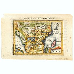
Gotia.
A charming miniature map of part of Sweden that includes Gotland. Filled with forests, lakes, small islands and place names, and decorated with title and scale cartouches...
Date: Amsterdam, 1616
Selling price: ????
Please login to see price!
Sold in 2020
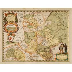
Limburgensis Ducatus.
In 1616 prepared by Aegidio Martini. Includes the towns of Maastricht as well as of Aachen. A very large title cartouche which includes a panoramic view and two citizens ...
Date: Amsterdam 1617
Selling price: ????
Please login to see price!
Sold
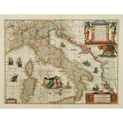
Italia Nuovamente piu perfetta che mai per inanzi posta in luce..
A marvellously engraved map filled with decorative features, notably Romulus and Remus being suckled by a wolf and Neptune with a mermaid, rising from the sea.
Date: Amsterdam 1617
Selling price: ????
Please login to see price!
Sold
Cracovia Metropolis Regni Poloniae.
Rare panoramic vioew of Cracow, only included in volume 6 of "Civitates Orbis Terrarum" , pl. 43. With Latin text. The "Civitates Orbis Terrarum" , i...
Date: Cologne, 1617
Selling price: ????
Please login to see price!
Sold
SANCTONICOLAUM vulgo S. Nicolas Oppidum in Superiore Hungaria .. [Torokszentmiklos]
Bird's-eye view of the fortified city of Törökszentmiklós by Braun and Hogenberg after G. Hoefnagel, from the rare 6th and last volume of 'Theatri praecipuarum Totius ...
Date: Cologne, 1617
Selling price: ????
Please login to see price!
Sold in 2021
Cassovia superioris Hungariae civitas primaria.
RARE only included in part VI of his town book. Panoramic of Kosice after G. Hoefnagel. With a Latin text description on verso, prepared by Braun : "Kosice is a lar...
Date: Cologne, 1617
Selling price: ????
Please login to see price!
Sold in 2011
Znaymum vulgo Znaym, Moraviae Civitas primaria..
RARE only included in part VI of his town book. Panoramic of Znaymum, with Latin text by Braun on verso, which translates to: "This is a beautiful and wealthy city i...
Date: Cologne, 1617
Selling price: ????
Please login to see price!
Sold in 2011
Brunn Vulgo Brinn Marchionatus Moraviae Civitas insignis.
RARE. Only included in part VI of his town book. Panoramic of Brno, with Latin text by Braun on verso, which translates to: "Brno (in Latin Bruna, in Bohemian Brno)...
Date: Cologne, 1617
Selling price: ????
Please login to see price!
Sold in 2011
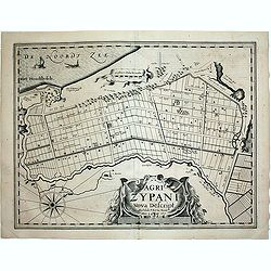
Agri Zypani Nova Descript.
Fine map, first state, of the new distribution of the Zype. From the famous first separately issued atlas of the Low Countries by Pieter van den Keere in the year 1617: P...
Date: Amsterdam, 1617
Selling price: ????
Please login to see price!
Sold in 2020








![[Northern Switzerland with Basel, Zurich, etc.] per Gerardum Mercatorem.](/uploads/cache/93430-250x250.jpg)




















![SANCTONICOLAUM vulgo S. Nicolas Oppidum in Superiore Hungaria .. [Torokszentmiklos]](/uploads/cache/85727-250x250.jpg)


