Browse Listings in Catch All
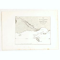
Plan du port du Roi-George, à la terre de Nuyts. . . [with] Plan de la baie du Geographe, à la terre de Leuwin. . .
Two maps of King George Sound, Nuyts Land, showing French discoveries prepared by Louis Freycinet during his voyage under Captain Thomas Baudin in 1800-1803. Plate no. 10...
Date: Paris, Langois, 1811
Selling price: ????
Please login to see price!
Sold in 2017
Plan des Iles Jerome (Terre Napoleon). . . [with] Plan des Iles Berthier (Terre Napoleon). . . [with] Plan du comte de Cumberland (Nouvelle-Galles du sud) d'apres les cartes Anglaises, mais assujetti aux observations Francaises.
Three maps showing Dorothee Island and Veteran Isles in the Investigator Group and the County of Cumberland in New South Wales, showing French discoveries prepared by Lou...
Date: Paris, Langois, 1811
Selling price: ????
Please login to see price!
Sold in 2017
Plan de l'Ile Decres (à la Terre Napoleon, Nouvelle-Hollande) par M. M. L. et H. Freycinet et Boullanger, 1802 et 1803. [with] Esquisse des Iles de l'Institut . . .
Two maps showing Kangaroo Island in South Australia and Institut Islands in Western Australia, showing French discoveries prepared by Louis Freycinet during his voyage un...
Date: Paris, Langois, 1811
Selling price: ????
Please login to see price!
Sold in 2017
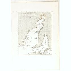
Carte generale des Golfes Bonaparte et Josephine (a la Terre Napoleon, Nouvelle-Hollande) [cartographic material] / par M. M. L. Freycinet et Boullanger, 1803.
Map showing Spencer Gulf and St. Vincent Gulf in South Australia showing French discoveries prepared by Louis Freycinet during his voyage under Captain Thomas Baudin in 1...
Date: Paris, Langois, 1811
Selling price: ????
Please login to see price!
Sold in 2017
Plan d'une partie de la Terre Napoleon (Nouvelle-Hollande) par M. M. H. Freycinet et Bernier, an 1802. [with] Plan des Iles Josephine et de la Baie Murat (a la Terre Napoleon, Nouvelle-Hollande) . . .
Two maps showing Descartes Bay and Bridgewater Bay in Victoria and Murat Bay in South Australia showing French discoveries prepared by Louis Freycinet during his voyage u...
Date: Paris, Langois, 1811
Selling price: ????
Please login to see price!
Sold in 2017
Plan des Iles Hunter par M. M. Freycinet et Boullanger, an 1802. [with] Plan de l'Ile Maria par M. Boullanger, an 1802. [with] Plan de l'Ile King par M. Faure, an 1802. [with] Plan d'une partie de l'Archipel Bonaparte (a la Nouvelle-Hollande)
Four maps showing Hunter Island in Bass Strait, Maria Island off the east coast of Tasmania, King Island in Bass Strait and Iles d'Arcole and Iles Champagny in the Bonapa...
Date: Paris, Langois, 1811
Selling price: ????
Please login to see price!
Sold in 2017
Plan de la partie sud des Iles Furneaux d'apres le Capne. Flinders, en 1798, et assujetti ... [together with] Carte d'une partie de la cote orientale de la terre de Diemen / par M. M. Boullanger et Faure en 1802.
Maps showing the southern coastline of Cape Barren Island and Clarke Island in the southern part of the Furneaux Group and the northeastern coastline of Tasmania from Por...
Date: Paris, Langois, 1811
Selling price: ????
Please login to see price!
Sold in 2017
Carte generale de la partie sud-est de la Terre de Diemen [cartographic material] / d'apres les travaux de M. M. Beautemps-Beaupre, en 1792 et 1793, L. et H. Freycinet, Boullanger et Faure en 1802.
Map of the south eastern coastline of Tasmania from Point Bailly to Recherche Bay showing French discoveries prepared by Louis Freycinet during his voyage under Captain T...
Date: Paris, Langois, 1811
Selling price: ????
Please login to see price!
Sold in 2017
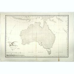
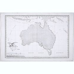
Carte Generale de la Nouvelle Hollande.
Fine map of the continent of Australia prepared by Louis Freycinet during his voyage under Captain Thomas Baudin in 1800-1803. Freycinet's map of New Holland was the firs...
Date: Paris, 1811
Selling price: ????
Please login to see price!
Sold in 2017
Carte generale de la partie sud-est de la Terre de Diemen [cartographic material] / d'apres les travaux de M. M. Beautemps-Beaupre, en 1792 et 1793, L. et H. Freycinet, Boullanger et Faure en 1802.
Map of the south eastern coastline of Tasmania from Point Bailly to Recherche Bay showing French discoveries prepared by Louis Freycinet during his voyage under Captain T...
Date: Paris, Langois, 1811
Selling price: ????
Please login to see price!
Sold in 2019
Plan de la partie sud des Iles Furneaux d'apres le Capne. Flinders, en 1798, et assujetti ... [together with] Carte d'une partie de la cote orientale de la terre de Diemen / par M. M. Boullanger et Faure en 1802.
Maps showing the southern coastline of Cape Barren Island and Clarke Island in the southern part of the Furneaux Group and the north-eastern coastline of Tasmania from Po...
Date: Paris, Langois, 1811
Selling price: ????
Please login to see price!
Sold in 2019
Plan des Iles Hunter par M. M. Freycinet et Boullanger, an 1802. [with] Plan de l'Ile Maria par M. Boullanger, an 1802. [with] Plan de l'Ile King par M. Faure, an 1802. [with] Plan d'une partie de l'Archipel Bonaparte (a la Nouvelle-Hollande)
Four maps showing Hunter Island in Bass Strait, Maria Island off the east coast of Tasmania, King Island in Bass Strait and Iles d'Arcole and Iles Champagny in the Bonapa...
Date: Paris, Langois, 1811
Selling price: ????
Please login to see price!
Sold in 2019
Plan d'une partie de la Terre Napoleon (Nouvelle-Hollande) par M. M. H. Freycinet et Bernier, an 1802. [with] Plan des Iles Josephine et de la Baie Murat (a la Terre Napoleon, Nouvelle-Hollande) . . .
Two maps showing Descartes Bay and Bridgewater Bay in Victoria and Murat Bay in South Australia showing French discoveries prepared by Louis Freycinet during his voyage u...
Date: Paris, Langois, 1811
Selling price: ????
Please login to see price!
Sold in 2019
Carte generale des Golfes Bonaparte et Josephine (a la Terre Napoleon, Nouvelle-Hollande) [cartographic material] / par M. M. L. Freycinet et Boullanger, 1803.
Map showing Spencer Gulf and St. Vincent Gulf in South Australia showing French discoveries prepared by Louis Freycinet during his voyage under Captain Thomas Baudin in 1...
Date: Paris, Langois, 1811
Selling price: ????
Please login to see price!
Sold in 2019
Plan de l'Ile Decres (à la Terre Napoleon, Nouvelle-Hollande) par M. M. L. et H. Freycinet et Boullanger, 1802 et 1803. [with] Esquisse des Iles de l'Institut . . .
Two maps showing Kangaroo Island in South Australia and Institut Islands in Western Australia, showing French discoveries prepared by Louis Freycinet during his voyage un...
Date: Paris, Langois, 1811
Selling price: ????
Please login to see price!
Sold in 2019
Plan des Iles Jerome (Terre Napoleon). . . [with] Plan des Iles Berthier (Terre Napoleon). . . [with] Plan du comte de Cumberland (Nouvelle-Galles du sud) d'apres les cartes Anglaises, mais assujetti aux observations Francaises.
Three maps showing Dorothee Island and Veteran Isles in the Investigator Group and the County of Cumberland in New South Wales, showing French discoveries prepared by Lou...
Date: Paris, Langois, 1811
Selling price: ????
Please login to see price!
Sold in 2019
Plan du port du Roi-George, à la terre de Nuyts. . . [with] Plan de la baie du Geographe, à la terre de Leuwin. . .
Two maps of King George Sound, Nuyts Land, showing French discoveries prepared by Louis Freycinet during his voyage under Captain Thomas Baudin in 1800-1803. Plate no. 10...
Date: Paris, Langois, 1811
Selling price: ????
Please login to see price!
Sold in 2019
Plan des Iles Louis-Napoleon et de la Riviere des Cygnes (Terres de Leuwin et d'Edels) [cartographic material] / par M. M. L. Freycinet et Heirisson, ans 1801 et 1803.
Map of Rottnest Island and the Swan River in Western Australia, showing French discoveries prepared by Louis Freycinet during his voyage under Captain Thomas Baudin in 18...
Date: Paris, Langois, 1811
Selling price: ????
Please login to see price!
Sold in 2019
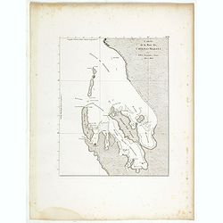
Carte de la Baie des Chiens-Marins par M. M. L. Freycinet et Faure, 1801 et 1803.
Map of Shark Bay in Western Australia, showing French discoveries prepared by Louis Freycinet during his voyage under Captain Thomas Baudin in 1800-1803. Plate no. 13 fro...
Date: Paris, Langois, 1811
Selling price: ????
Please login to see price!
Sold in 2020
Carte Generale de la Nouvelle Hollande.
Fine map of the continent of Australia prepared by Louis Freycinet during his voyage under Captain Thomas Baudin in 1800-1803. Freycinet's map of New Holland was the firs...
Date: Paris, Imprimerie Royale, 1811
Selling price: ????
Please login to see price!
Sold in 2020
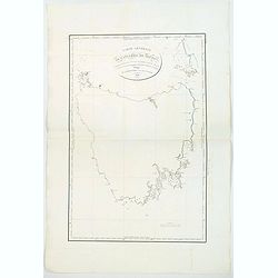
Carte Generale de la Terre de Diemen. . .
A detailed chart of the island of Tasmania and published by expedition member Louis Claude Desaulses de Freycinet, the first to show the entire island and to focus exclus...
Date: Paris 1812
Selling price: ????
Please login to see price!
Sold in 2019
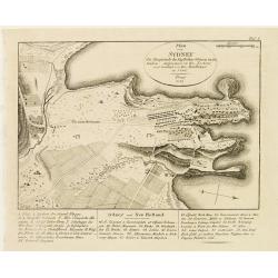
Plan von Sydney der Hauptstadt der Englischen Colonien in Australien..
Map of Sydney. Relief shown by hachures. Vegetation shown pictorially. Key to main features and buildings.German edition of the original map by Lisieur, printed in Paris ...
Date: Prague 1815
Selling price: ????
Please login to see price!
Sold
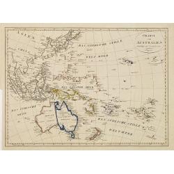
Charte von Australien berichtigt im November 1812.
Map of the Pacific Ocean. It divides Australia into two parts: the western part "Neu Holland vormals Ulimaroa" and the eastern half as "Neu Sud Wales 1770 ...
Date: Prague, 1815
Selling price: ????
Please login to see price!
Sold in 2010
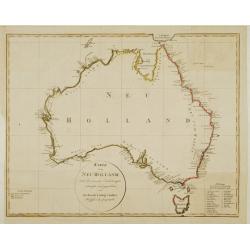
Karte von Neu Holland.
Uncommon map of Australia, by Friedrich Ludwig Lindner, hand colored in outline with plain circular title border, key to Tasmanian place names at lower-right corner.
Date: Vienna, 1816
Selling price: ????
Please login to see price!
Sold
Plan des Iles Hunter [with] Plan de l'Ile Maria [with] Plan de l'Ile King [with] Plan d'une partie de l'Archipel Bonaparte.
Four maps showing Hunter Island in Bass Strait, Maria Island off the east coast of Tasmania, King Island in Bass Strait and Iles d'Arcole and Iles Champagny in the Bonapa...
Date: Paris, 1807-1816
Selling price: ????
Please login to see price!
Sold in 2020
Carte générale des Golfes Bonaparte et Joséphine.
The first published map of South Australia. -Map showing Spencer Gulf and St. Vincent Gulf in South Australia, from Voyage de découvertes aux terres Australes by Franço...
Date: Paris, 1807-1816
Selling price: ????
Please login to see price!
Sold in 2020
Plan de l'Ile de Decrès [with] Esquisse des Iles de l'Institut.
Two maps on one sheet, showing Kangaroo Island in South Australia and Institut Islands in Western Australia. Voyage de découvertes aux terres Australes by François Pér...
Date: Paris, 1807-1816
Selling price: ????
Please login to see price!
Sold in 2020
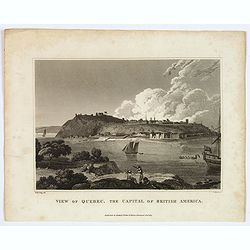
View of Quebec, the Capital of British America.
This is an uncommon view of Quebec, the capital of British America, drawn by W. M. Craig. It features a lovely view of Quebec from across the St. Lawrence. The fortifica...
Date: Liverpool, 1817
Selling price: ????
Please login to see price!
Sold in 2018
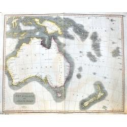
New Holland and Asiatic Isles.
A large and detailed steel engraved map from the Celebes until New Zealand. Includes Fiji, the Solomon islands, Papua New Guinea, Timor, and several small islands with da...
Date: Edinburgh, 1817
Selling price: ????
Please login to see price!
Sold in 2020
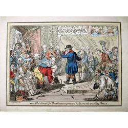
An old English gentleman pester'd by servants wanting places.
Unusual caricature etching after James Gillray. Published by John Miller, Bridge Street & W. Blackwood, Edinburgh. Hardly seen on the market, similar to Lot 45 at th...
Date: London, c1820
Selling price: ????
Please login to see price!
Sold in 2013
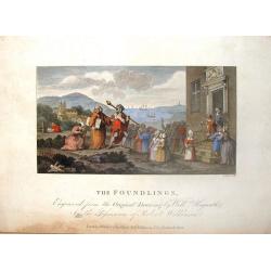
The Foundling.
Hand-colored engraving entitled "THE FOUNDLINGS" engraved by I.Stowe after a painting by William Hogarth. It was published in London by Robert Wilkinson in 1821...
Date: London, Robert Wilkinson, 1821
Selling price: ????
Please login to see price!
Sold in 2018
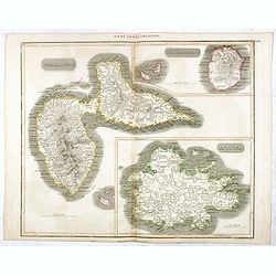
Guadaloupe / Marie Galante / Antigua.
A very finely engraved and detailed map, of both French and English islands in the West Indies. The map is mostly of Guadeloupe, with inset maps of Marie Galante and Anti...
Date: Edinburgh, 1821
Selling price: ????
Please login to see price!
Sold in 2017
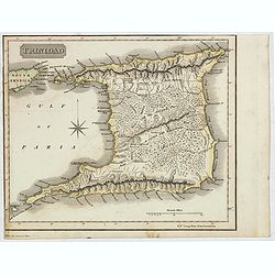
Trinidad
A delightfully detailed map the West Indian island Trinidad by John Thomson. The map displays excellent detail concerning roads, rivers, towns, bays, harbors and other in...
Date: Edenburgh, 1821
Selling price: ????
Please login to see price!
Sold in 2021
[ Boney & Talley. The Corsican carcase-butcher's reckoning day]
Aquatint by James Gillray and published by Hannah Humphrey. Showing the interior of a carcass-butcher's slaughter-house, the carcasses of animals suspended from the wall....
Date: London, 1822
Selling price: ????
Please login to see price!
Sold in 2016
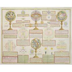
Tableau Analytique des différentes positions de la Sphère, des différens systemes, des révolutions et des distances des Planètes, &c
Containing "Globe Celeste", "Sphere de Copernic", "Globe Terrestre", "Systeme de Ptolomee" ; including diagrams of the solar syste...
Date: Paris, 1823
Selling price: ????
Please login to see price!
Sold in 2014
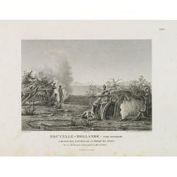
Nouvelle-Hollande : Terre d'endracht. Cabanes des naturels de la presqu'il de Péron. . .
Copper engraving from François Peron's 'Voyage de Decouvertes aux Terre d'Australes. After a design by Alexander Charles Lesueur. Engraved by Pillement.
Date: Paris, 1824
Selling price: ????
Please login to see price!
Sold in 2014
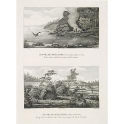
Nouvelle-Hollande : Nouvelle-Galles du sud. / Nouvelle-Hollande : Terre de Leuwin.
Two engravings on one sheet, top : "Grottes, chasse et pêche des sauvages du Port-Jackson" and that at the bottom : "Etangs saés de la Rivière Vasse, Ca...
Date: Paris, 1824
Selling price: ????
Please login to see price!
Sold in 2010
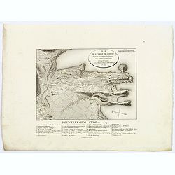
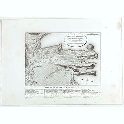
Plan de la Ville de Sydney.
Nice small plan of Sydney from Voyage de découvertes aux terres Australes by François Péron, 1824. This is one of the earliest depictions of the new English settlement...
Date: Paris, 1824
Selling price: ????
Please login to see price!
Sold in 2018
Terre de Diemen et Nouvelle-Hollande. . . [plate III]
A charming set of five coastal views from the southern tip of mainland Australia, and some of the islands in the Tasman Strait and of Tasmania, after the original sketche...
Date: Paris, 1824
Selling price: ????
Please login to see price!
Sold in 2017
Nouvelle-Hollande. . . [plate VI]
A charming set of several coastal views off the west coast of Australia, after the original sketches by Lesueur, from Voyage de découvertes aux terres Australes by Fran�...
Date: Paris, 1824
Selling price: ????
Please login to see price!
Sold in 2020
Terre de Diemen et Nouvelle-Hollande. . . [plate IV]
A charming set of four coastal views off the coast of Tasmania in Australia, after the original sketches by Lesueur, from Voyage de découvertes aux terres Australes by F...
Date: Paris, 1824
Selling price: ????
Please login to see price!
Sold in 2017
Terre de Diemen. Bara-Ourou. [plate VIII]
A portrait of the Tasmanian Aboriginal Bara-Ourou, after the original sketches by Lesueur, from Voyage de découvertes aux terres Australes by François Péron, 1824.The ...
Date: Paris, 1824
Selling price: ????
Please login to see price!
Sold in 2017
Terre de Diemen. Ourlaga. [plate IX]
A portrait of the female Tasmanian Aboriginal Ourlaga, after the original sketches by Lesueur, from Voyage de découvertes aux terres Australes by François Péron, 1824....
Date: Paris, 1824
Selling price: ????
Please login to see price!
Sold in 2017
Terre de Diemen. Grou-Agara. [plate X]
A portrait of the Tasmanian Aboriginal Grou-Agara, after the original sketches by Lesueur, from Voyage de découvertes aux terres Australes by François Péron, 1824.The ...
Date: Paris, 1824
Selling price: ????
Please login to see price!
Sold in 2017
Terre de Diemen. Paraberi. [plate XI]
A portrait of the Tasmanian Aboriginal Paraberi, after the original sketches by Lesueur, from Voyage de découvertes aux terres Australes by François Péron, 1824.The Fr...
Date: Paris, 1824
Selling price: ????
Please login to see price!
Sold in 2017
Terre de Diemen. Arra-Maida. [plate XII]]
A portrait of a female Tasmanian Aboriginal Arra-Maida, after the original sketches by Lesueur, from Voyage de découvertes aux terres Australes by François Péron, 1824...
Date: Paris, 1824
Selling price: ????
Please login to see price!
Sold in 2017
Terre de Diemen. Armes et Ornemens [plate XIII]
Set of five Aboriginal arms and ornaments, including spears, clubs, basket, necklace etc, after the original sketches by Lesueur, from Voyage de découvertes aux terres A...
Date: Paris, 1824
Selling price: ????
Please login to see price!
Sold in 2017
Terre de Diemen. Habitations. [plate XV]
An aboriginal camp fire, near the ruins of an old wooden fence, and a dead tree, after the original sketches by Lesueur, from Voyage de découvertes aux terres Australes ...
Date: Paris, 1824
Selling price: ????
Please login to see price!
Sold
Terre de Diemen: Ile Maria. Tombeaux des Naturels. [plate XVI]
A pair of Aboriginal tombs in the bush, on Maria Island, off the east coast of Tasmania. A white settler is seen lighting a fire in between them. Ships and smaller boats ...
Date: Paris, 1824
Selling price: ????
Please login to see price!
Sold in 2018
Nouvelle-Hollande. Gnoung-A-Gnoung-A, Mour-Re-Mour-Ga. [plate XVII ]
Australian aborigine given name by David Collins, Secretary to the Colony.After the original sketches by Lesueur, from Voyage de découvertes aux terres Australes by Fran...
Date: Paris, 1824
Selling price: ????
Please login to see price!
Sold in 2018
Nouvelle-Hollande. Cour-Rou-Bari-Gal. [plate XVIII ]
Aboriginal man with his hair wrapped in paperbark strips.After the original sketches by Lesueur, from Voyage de découvertes aux terres Australes by François Péron, 182...
Date: Paris, 1824
Selling price: ????
Please login to see price!
Sold in 2017
Nouvelle-Hollande. Y-Erran-Gou-La-Ga. [plate XIX ]
Portrait of an Aboriginal man from Sydney named 'Mosquito'.After the original sketches by Lesueur, from Voyage de découvertes aux terres Australes by François Péron, 1...
Date: Paris, 1824
Selling price: ????
Please login to see price!
Sold in 2017
Nouvelle-Hollande. Nouvelle Galles du Sud. Norou-Gal-Derri. [plate XX]
An interesting portrait of a warrior of the Port Jackson tribe, Norou-gal-derri, (meaning "ready for battle").After the original sketches by Lesueur, from Voyag...
Date: Paris, 1824
Selling price: ????
Please login to see price!
Sold in 2017
Nouvelle-Hollande. Vases, Armes, Peche. [plate XXII]
A set of 11 arms and implements used by the aboriginals - it includes, hooked spears, fishing axe, paddles, oars, baskets, shields etc.After the original sketches by Lesu...
Date: Paris, 1824
Selling price: ????
Please login to see price!
Sold in 2017
Nouvelle-Hollande: Ile Bernier, Kanguroo a Bandes. [plate XXVII]
Australian Kangaroos and Bandicoots, after the original sketches by Lesueur, from Voyage de découvertes aux terres Australes by François Péron, 1824.The French expedit...
Date: Paris, 1824
Selling price: ????
Please login to see price!
Sold in 2017
Mollusques et Zoophytes. [plates XIX, XXX, XXXI]
Three plates of assorted Australian Molluscs and Zoophytes, after the original sketches by Lesueur, from Voyage de découvertes aux terres Australes by François Péron, ...
Date: Paris, 1824
Selling price: ????
Please login to see price!
Sold in 2017
Nouvelle-Hollande: Nouvelle Galles du Sud. Dasyure a Longue Queue. [plate XXXIII]
A pair of small marsupial "mammal cats" easting some dead prey, after the original sketches by Lesueur, from Voyage de découvertes aux terres Australes by Fran...
Date: Paris, 1824
Selling price: ????
Please login to see price!
Sold in 2017
Nouvelle-Hollande: Nouvelle Galles du Sud. . [plate XXXIV]
A pair of black and a brown platypuses, shown either in a river, or on a riverbank, after the original sketches by Lesueur, from Voyage de découvertes aux terres Austral...
Date: Paris, 1824
Selling price: ????
Please login to see price!
Sold in 2017
Timor. Rhinolophe Crumenifere. [plate XXXV]
Timorese bats, flying or resting in trees, after the original sketches by Lesueur, from Voyage de découvertes aux terres Australes by François Péron, 1824.The French e...
Date: Paris, 1824
Selling price: ????
Please login to see price!
Sold in 2017
Nouvelle-Hollande: Ile Decres. Casoar. [plate XXXVI]
A lovely pair of Cassowary (flightless) birds, and their chicks, from King Island, off the South Australian coast, after the original sketches by Lesueur, from Voyage de ...
Date: Paris, 1824
Selling price: ????
Please login to see price!
Sold in 2017
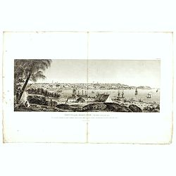
Vue d'une partie de la Ville de Sydney, capitale des Colonies Anglaises aux Terres Australes, et de l'entree du Port Jackson. . . [plate XXXVII]
A scarce view of Sydney Cove, taken from Dawes Point, looking eastwards, by Lesueur, the artist on the famous French expedition under the command of Nicholas Baudin. Gove...
Date: Paris, 1824
Selling price: ????
Please login to see price!
Sold in 2018
Nouvelle Hollande, Nouvelle Galles Du Sud, Vue De La Partie Meridion De La Ville De Sydney capitale Des Colonies Anglaise...
Early view of the southern part of the town of Sydney.After the original sketches by Lesueur, from Voyage de découvertes aux terres Australes by François Péron, 1824.T...
Date: Paris, 1824
Selling price: ????
Please login to see price!
Sold in 2017
Plan de la Ville de Sydney.
Nice small plan of Sydney from Voyage de découvertes aux terres Australes by François Péron, 1824. This is one of the earliest depictions of the new English settlement...
Date: Paris, 1824
Selling price: ????
Please login to see price!
Sold in 2020
Terre de Diemen et Nouvelle-Hollande. . . [plate III]
A charming set of five coastal views from the southern tip of mainland Australia, and some of the islands in the Tasman Strait and of Tasmania, after the original sketche...
Date: Paris, 1824
Selling price: ????
Please login to see price!
Sold in 2020
Terre de Diemen et Nouvelle-Hollande. . . [plate IV]
A charming set of four coastal views off the coast of Tasmania in Australia, after the original sketches by Lesueur, from Voyage de découvertes aux terres Australes by F...
Date: Paris, 1824
Selling price: ????
Please login to see price!
Sold in 2021
Nouvelle-Hollande. . .[plate VI]
A charming set of several coastal views off the west coast of Australia, after the original sketches by Lesueur, from Voyage de découvertes aux terres Australes by Fran�...
Date: Paris, 1824
Selling price: ????
Please login to see price!
Sold in 2020
Terre de Diemen. Armes et Ornemens [plate XIII].
Set of five Aboriginal arms and ornaments, including spears, clubs, basket, necklace etc, after the original sketches by Lesueur, from Voyage de découvertes aux terres A...
Date: Paris, 1824
Selling price: ????
Please login to see price!
Sold in 2020
Nouvelle-Hollande. Cour-Rou-Bari-Gal. [plate XVIII]
A portrait of a male Tasmanian Aboriginal Cour-Rou-Bari-Gal by Lesueur, from Voyage de découvertes aux terres Australes by François Péron, 1824.The French expedition u...
Date: Paris, 1824
Selling price: ????
Please login to see price!
Sold in 2020
Nouvelle-Hollande: Nelle Galles du sud. - Ornithorinque Brun, Ornithorinque Roux. [plate XXXIV]
Plate illustrating the platypus,), or sometimes referred to as the duck-billed platypus, which is a semiaquatic egg-laying mammal endemic to eastern Australia. Plate by L...
Date: Paris, 1824
Selling price: ????
Please login to see price!
Sold in 2020
Nouvelle-Hollande: Ile Decrès. - Casoar de la Nelle Hollande. [plate XXXVI]
Plate illustrating the extinct dwarf emus Casoar, that once roamed Kangaroo Island. They were bigger than their cousins on King Island but a bit smaller than extinct Tasm...
Date: Paris, 1824
Selling price: ????
Please login to see price!
Sold in 2020
Plan des Iles Louis-Napoléon et de la Rivière des Cygnes.
Map of Louis-Napoléon islands and Swans River, from Voyage de découvertes aux terres Australes by François Péron, 1824. The French expedition under Nicolas Baudin, wa...
Date: Paris, 1824
Selling price: ????
Please login to see price!
Sold in 2020
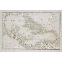
Carte du Golfe du Mexique, des Iles et des Pays Adjacens . . .
Folding map after Robert Benard's map, "Carte du Golfe de Mexique," published in William Robertson's 1778 "Histoire de l'Amerique."
Date: Paris, c.1825
Selling price: ????
Please login to see price!
Sold in 2011
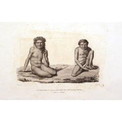
Nlle. Hollande: Port-Jackson. Sauvages des Montagnes-Bleues.
A very rare and early display of Aborigenes. Published in the important Voyage autour du monde under the command of Louis de Freycinet. Engraved by Forget. Compare to an...
Date: Paris, 1825
Selling price: ????
Please login to see price!
Sold in 2016
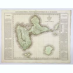
Carte Geographique, Statistique et Historique de la Guadeloupe.
A nice detailed map of the island of Guadeloupe, from Buchon's Atlas Gégraphique Statistique, historique et chronologique des deux Ameriques et des isles adjacentes trad...
Date: Paris, 1825
Selling price: ????
Please login to see price!
Sold in 2019
Nouvelle-Zélande.
Original hand colored engraving by Ambroise Tardieu taken from the rare and important book " Voyage autour du Monde, exécuté par ordre du Roi, sur la corvette de s...
Date: Paris, Arthus Bertrand, 1826
Selling price: ????
Please login to see price!
Sold in 2011
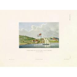
Etablissement des Missionnaires Anglais a Kidikidi (Nouvelle-Zélande)
Original hand colored engraving by Ambroise Tardieu taken from the rare and important book " Voyage autour du Monde, exécuté par ordre du Roi, sur la corvette de s...
Date: Paris, Arthus Bertrand, 1826
Selling price: ????
Please login to see price!
Sold in 2011
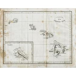
CHART of the SANDWICH ISLES
Uncommon & detailed map of the Hawaiian Islands, indicating elevation with hachure. Includes names of cities, mountains and bays, noting the death of Captain Cook in ...
Date: London, 1826
Selling price: ????
Please login to see price!
Sold in 2008
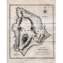
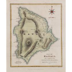
MAP OF HAWAII
Rare map of Hawaii, extremely detailed showing many towns, bays, anchor places, volcanoes and mountains, paths and roads, and missionary stations. Beautifully engraved, d...
Date: London, 1826
Selling price: ????
Please login to see price!
Sold in 2008
Map of Hawaii, the largest of the Sandwich islands. Improved from Vancouver's Survey.
One of the best early large scale maps of Hawaii island, extremely detailed showing many towns, bays, anchor places, volcanoes and mountains, paths and roads, and mission...
Date: London, 1826
Selling price: ????
Please login to see price!
Sold in 2017
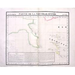
Partie de la Nouvelle Guinée. No31
Highly detailed and important map of the Louisiade Archipelago located just south east of New Guinea. With extensive descriptive text in French. With original hand-colori...
Date: Brussels, 1827
Selling price: ????
Please login to see price!
Sold in 2011
![Plan du port du Roi-George, à la terre de Nuyts. . . [with] Plan de la baie du Geographe, à la terre de Leuwin. . .](/uploads/cache/39678-250x250.jpg)
![Plan des Iles Jerome (Terre Napoleon). . . [with] Plan des Iles Berthier (Terre Napoleon). . . [with] Plan du comte de Cumberland (Nouvelle-Galles du sud) d'apres les cartes Anglaises, mais assujetti aux observations Francaises.](/uploads/cache/39679-250x250.jpg)
![Plan de l'Ile Decres (à la Terre Napoleon, Nouvelle-Hollande) par M. M. L. et H. Freycinet et Boullanger, 1802 et 1803. [with] Esquisse des Iles de l'Institut . . .](/uploads/cache/39680-250x250.jpg)
![Carte generale des Golfes Bonaparte et Josephine (a la Terre Napoleon, Nouvelle-Hollande) [cartographic material] / par M. M. L. Freycinet et Boullanger, 1803.](/uploads/cache/39681-250x250.jpg)
![Plan d'une partie de la Terre Napoleon (Nouvelle-Hollande) par M. M. H. Freycinet et Bernier, an 1802. [with] Plan des Iles Josephine et de la Baie Murat (a la Terre Napoleon, Nouvelle-Hollande) . . .](/uploads/cache/39682-250x250.jpg)
![Plan des Iles Hunter par M. M. Freycinet et Boullanger, an 1802. [with] Plan de l'Ile Maria par M. Boullanger, an 1802. [with] Plan de l'Ile King par M. Faure, an 1802. [with] Plan d'une partie de l'Archipel Bonaparte (a la Nouvelle-Hollande)](/uploads/cache/39683-250x250.jpg)
![Plan de la partie sud des Iles Furneaux d'apres le Capne. Flinders, en 1798, et assujetti ... [together with] Carte d'une partie de la cote orientale de la terre de Diemen / par M. M. Boullanger et Faure en 1802.](/uploads/cache/39684-250x250.jpg)
![Carte generale de la partie sud-est de la Terre de Diemen [cartographic material] / d'apres les travaux de M. M. Beautemps-Beaupre, en 1792 et 1793, L. et H. Freycinet, Boullanger et Faure en 1802.](/uploads/cache/39685-250x250.jpg)
![Carte generale de la partie sud-est de la Terre de Diemen [cartographic material] / d'apres les travaux de M. M. Beautemps-Beaupre, en 1792 et 1793, L. et H. Freycinet, Boullanger et Faure en 1802.](/uploads/cache/44028-250x250.jpg)
![Plan de la partie sud des Iles Furneaux d'apres le Capne. Flinders, en 1798, et assujetti ... [together with] Carte d'une partie de la cote orientale de la terre de Diemen / par M. M. Boullanger et Faure en 1802.](/uploads/cache/44029-250x250.jpg)
![Plan des Iles Hunter par M. M. Freycinet et Boullanger, an 1802. [with] Plan de l'Ile Maria par M. Boullanger, an 1802. [with] Plan de l'Ile King par M. Faure, an 1802. [with] Plan d'une partie de l'Archipel Bonaparte (a la Nouvelle-Hollande)](/uploads/cache/44030-250x250.jpg)
![Plan d'une partie de la Terre Napoleon (Nouvelle-Hollande) par M. M. H. Freycinet et Bernier, an 1802. [with] Plan des Iles Josephine et de la Baie Murat (a la Terre Napoleon, Nouvelle-Hollande) . . .](/uploads/cache/44031-250x250.jpg)
![Carte generale des Golfes Bonaparte et Josephine (a la Terre Napoleon, Nouvelle-Hollande) [cartographic material] / par M. M. L. Freycinet et Boullanger, 1803.](/uploads/cache/44032-250x250.jpg)
![Plan de l'Ile Decres (à la Terre Napoleon, Nouvelle-Hollande) par M. M. L. et H. Freycinet et Boullanger, 1802 et 1803. [with] Esquisse des Iles de l'Institut . . .](/uploads/cache/44033-250x250.jpg)
![Plan des Iles Jerome (Terre Napoleon). . . [with] Plan des Iles Berthier (Terre Napoleon). . . [with] Plan du comte de Cumberland (Nouvelle-Galles du sud) d'apres les cartes Anglaises, mais assujetti aux observations Francaises.](/uploads/cache/44034-250x250.jpg)
![Plan du port du Roi-George, à la terre de Nuyts. . . [with] Plan de la baie du Geographe, à la terre de Leuwin. . .](/uploads/cache/44035-250x250.jpg)
![Plan des Iles Louis-Napoleon et de la Riviere des Cygnes (Terres de Leuwin et d'Edels) [cartographic material] / par M. M. L. Freycinet et Heirisson, ans 1801 et 1803.](/uploads/cache/44037-250x250.jpg)
![Plan des Iles Hunter [with] Plan de l'Ile Maria [with] Plan de l'Ile King [with] Plan d'une partie de l'Archipel Bonaparte.](/uploads/cache/46366-250x250.jpg)
![Plan de l'Ile de Decrès [with] Esquisse des Iles de l'Institut.](/uploads/cache/46369-250x250.jpg)
![[ Boney & Talley. The Corsican carcase-butcher's reckoning day]](/uploads/cache/37273-250x250.jpg)
![Terre de Diemen et Nouvelle-Hollande. . . [plate III]](/uploads/cache/40093-250x250.jpg)
![Nouvelle-Hollande. . . [plate VI]](/uploads/cache/40094-250x250.jpg)
![Terre de Diemen et Nouvelle-Hollande. . . [plate IV]](/uploads/cache/40096-250x250.jpg)
![Terre de Diemen. Bara-Ourou. [plate VIII]](/uploads/cache/40097-250x250.jpg)
![Terre de Diemen. Ourlaga. [plate IX]](/uploads/cache/40098-250x250.jpg)
![Terre de Diemen. Grou-Agara. [plate X]](/uploads/cache/40099-250x250.jpg)
![Terre de Diemen. Paraberi. [plate XI]](/uploads/cache/40100-250x250.jpg)
![Terre de Diemen. Arra-Maida. [plate XII]]](/uploads/cache/40101-250x250.jpg)
![Terre de Diemen. Armes et Ornemens [plate XIII]](/uploads/cache/40102-250x250.jpg)
![Terre de Diemen. Habitations. [plate XV]](/uploads/cache/40104-250x250.jpg)
![Terre de Diemen: Ile Maria. Tombeaux des Naturels. [plate XVI]](/uploads/cache/40105-250x250.jpg)
![Nouvelle-Hollande. Gnoung-A-Gnoung-A, Mour-Re-Mour-Ga. [plate XVII ]](/uploads/cache/40106-250x250.jpg)
![Nouvelle-Hollande. Cour-Rou-Bari-Gal. [plate XVIII ]](/uploads/cache/40107-250x250.jpg)
![Nouvelle-Hollande. Y-Erran-Gou-La-Ga. [plate XIX ]](/uploads/cache/40108-250x250.jpg)
![Nouvelle-Hollande. Nouvelle Galles du Sud. Norou-Gal-Derri. [plate XX]](/uploads/cache/40109-250x250.jpg)
![Nouvelle-Hollande. Vases, Armes, Peche. [plate XXII]](/uploads/cache/40111-250x250.jpg)
![Nouvelle-Hollande: Ile Bernier, Kanguroo a Bandes. [plate XXVII]](/uploads/cache/40116-250x250.jpg)
![Mollusques et Zoophytes. [plates XIX, XXX, XXXI]](/uploads/cache/40117-250x250.jpg)
![Nouvelle-Hollande: Nouvelle Galles du Sud. Dasyure a Longue Queue. [plate XXXIII]](/uploads/cache/40119-250x250.jpg)
![Nouvelle-Hollande: Nouvelle Galles du Sud. . [plate XXXIV]](/uploads/cache/40120-250x250.jpg)
![Timor. Rhinolophe Crumenifere. [plate XXXV]](/uploads/cache/40121-250x250.jpg)
![Nouvelle-Hollande: Ile Decres. Casoar. [plate XXXVI]](/uploads/cache/40122-250x250.jpg)
![Vue d'une partie de la Ville de Sydney, capitale des Colonies Anglaises aux Terres Australes, et de l'entree du Port Jackson. . . [plate XXXVII]](/uploads/cache/40123-250x250.jpg)
![Terre de Diemen et Nouvelle-Hollande. . . [plate III]](/uploads/cache/46266-250x250.jpg)
![Terre de Diemen et Nouvelle-Hollande. . . [plate IV]](/uploads/cache/46267-250x250.jpg)
![Nouvelle-Hollande. . .[plate VI]](/uploads/cache/46269-250x250.jpg)
![Terre de Diemen. Armes et Ornemens [plate XIII].](/uploads/cache/46276-250x250.jpg)
![Nouvelle-Hollande. Cour-Rou-Bari-Gal. [plate XVIII]](/uploads/cache/46281-250x250.jpg)
![Nouvelle-Hollande: Nelle Galles du sud. - Ornithorinque Brun, Ornithorinque Roux. [plate XXXIV]](/uploads/cache/46356-250x250.jpg)
![Nouvelle-Hollande: Ile Decrès. - Casoar de la Nelle Hollande. [plate XXXVI]](/uploads/cache/46358-250x250.jpg)
