Browse Listings in Asia > China > China Provinces
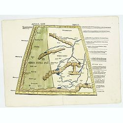
Octava Asie Tabvla.
Wood block map of Central Asia and China from Martin Waldseemüller's 1513 edition of Ptolemy, who was a landmark work that contributed to major advances in both Renaissa...
Date: Strasbourg, J. Schott, 1513
Selling price: ????
Please login to see price!
Sold in 2018
Tabula octava Asiae continet.
Woodblock map illustrating the Ptolemaic concept of the region of ancient Schytia Extra in a trapezoidal projection. Title is on verso.Central Asia and China with the cou...
Date: Vienne, 1541
Selling price: ????
Please login to see price!
Sold in 2009
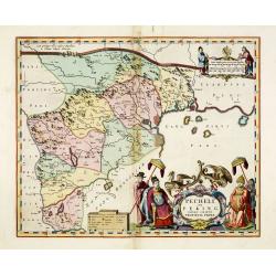
Pecheli sive Peking imperii sinarum provincia prima.
The map of the province of Peking from Joan Blaeu's Novus Atlas Sinensis , the first atlas of china with maps by the hand of the Italian Jesuit Martino Martini. A beautif...
Date: Amsterdam, 1640
Selling price: ????
Please login to see price!
Sold
Pecheli sive Peking imperii sinarum provincia prima.
The map of the province of Peking from Joan Blaeu's Novus Atlas Sinensis , the first atlas of china with maps by the hand of the Italian Jesuit Martino Martini. A beautif...
Date: Amsterdam, 1640
Selling price: ????
Please login to see price!
Sold in 2013
Pecheli sive Peking imperii sinarum provincia prima.
The map of the province of Peking from Joan Blaeu's Novus Atlas Sinensis , the first atlas of china with maps by the hand of the Italian Jesuit Martino Martini. A beautif...
Date: Amsterdam, 1640
Selling price: ????
Please login to see price!
Sold in 2015
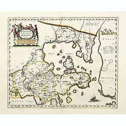
Xantung, sinarum imperii provincia quarta.
Map of the province of Shandong.From the Blaeu\'s \"Novus Atlas Sinensis\". Ornated with the typical high decorative ornated title cartouche together with an mi...
Date: Amsterdam, 1655
Selling price: ????
Please login to see price!
Sold in 2008
Quangsi, Sinarum Imperii Provinciae Decimatertia.
A map of a part of China published by J. Blaeu, in the second landmark in the European mapping of China "the Atlas Sinensis" in 1655.
Date: Amsterdam, 1655
Selling price: ????
Please login to see price!
Sold in 2009
Xensi Imperii Sinarum provincia tertia.
Based on the remarkably accurate compilations of the Jesuit Father Martino Martini during his travels between 1643 and 1650, this map of the Xensi (Shaanxi) province feat...
Date: Amsterdam, 1655
Selling price: ????
Please login to see price!
Sold in 2015
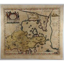
Xantung Sinarum Imperii Provincia Quarta.
A map of the province of Shandong, China. Many larger cities are named including Tungchang, Cinan, Yencheu. Laicheu and Leaochang. At the upper right side is an engrave...
Date: Amsterdam, 1655
Selling price: ????
Please login to see price!
Sold in 2018
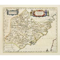
Fokien, Imperii Sinarum Provincia Undecima.
A map of the Chinese province of Fokien, by Joan Blaeu. Title in a cartouche with Chinese figures at top centre. At top left a cartouche with putti containing mileage sca...
Date: Amsterdam, 1655
Selling price: ????
Please login to see price!
Sold in 2020
Pecheli, Xansi, Xantung, Honan, Nanking, In plaga Regni Sinensis..
A map of the northern provinces of China after the Jesuit Martino Martini, Beijing, Shandong, Hanan and Jiangsu.Shows the Great Wall and covers northeastern China includi...
Date: Amsterdam ca 1660
Selling price: ????
Please login to see price!
Sold
Fokien Imperii Sinarum Provincia undecima.
The province of Fokien lies opposite Taiwan and south of the region described in the above map. The coast is shown from Wen-zhou in the north to Fu-zhou and as far south ...
Date: Amsterdam, 1660
Selling price: ????
Please login to see price!
Sold in 2011
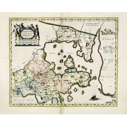
Xantung, sinarum imperii provincia quatra.
A map of the northern province ‘Xantung’ of China after the Jesuit Martino Martini.Shows the Great Wall and is centered on the Bohai Sea, and the Shandong and Liaonin...
Date: Amsterdam, ca 1660
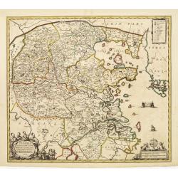
Nanking, sive Kiangnan, Imperii Sinarum Provincia Nona.
A map of Nanking, or Kiangnan, province (roughly corresponding to today's Jiangsu Province and Shanghai Municipality, after the Jesuit Martino Martini.Good detail of Yang...
Date: Amsterdam, ca 1660
Selling price: ????
Please login to see price!
Sold in 2013
Pecheli, Xansi, Xantung, Honan, Nanking, In plaga Regni Sinensis..
A map of the northern provinces of China after the Jesuit Martino Martini, Beijing, Shandong, Hanan and Jiangsu.Shows the Great Wall and covers northeastern China includi...
Date: Amsterdam, ca 1660
Selling price: ????
Please login to see price!
Sold in 2014
Nanking, sive Kiangnan, Imperii Sinarum Provincia Nona.
A map of Nanking, or Kiangnan, province (roughly corresponding to today's Jiangsu Province and Shanghai Municipality, after the Jesuit Martino Martini.Good detail of Yang...
Date: Amsterdam, ca 1660
Selling price: ????
Please login to see price!
Sold in 2015
Kiangsi Imperii Sinarum provincia octava. (Kiangsi)
Prepared 1655 by Martino Martini and published by Joan Blaeu in his Atlas Maior. A fine map of Jiangxi (Kiangsi) Province in China. The map depicts the region from the Ya...
Date: Amsterdam, 1661
Selling price: ????
Please login to see price!
Sold in 2020
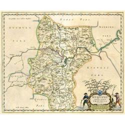
Huquang Imperii Sinarum Provincia Septima.
Decorative map of the seventh Chinese province 'Huquang', ornated with the typical high decorative ornated title cartouche together with an ornated mileage scale. The map...
Date: Amsterdam, 1662
Selling price: ????
Please login to see price!
Sold in 2010
Suchuen Imperii Sinarum Provincia Sexta.
Province map of China from the Atlas Sinensis. Decorative map of the sixth Chinese province 'Suchuen', ornated with the typical high decorative ornated title cartouche to...
Date: Amsterdam, 1662
Selling price: ????
Please login to see price!
Sold in 2010
Suchuen et Xensi, Provinciae seu Praefecturae Regni Sinensis. . .
Map of the central China provinces of Sichuan and Shaanxi with two cartouches. North orientated to the right.
Date: Amsterdam, c. 1680
Selling price: ????
Please login to see price!
Sold in 2011
Suchuen et Xensi, Provinciae seu Praefecturae Regni Sinensis. . .
Map of the central China provinces of Sichuan and Shaanxi with two cartouches. North orientated to the right.
Date: Amsterdam, c. 1680
Selling price: ????
Please login to see price!
Sold in 2014
Iunnan, Queicheu, Quangsi, et Quantung. . .
A beautifully engraved map of Southern China covering Hainan and the Pearl River Delta with Macao and the islands around present-day Hong Kong.
Date: Amsterdam, c. 1680
Selling price: ????
Please login to see price!
Sold in 2014
Xansi, e Xensi, Provincie della Cina..
A beautiful map depicting part of China and showing a stretch of the Great Wall of China. With decorative title cartouche, scale cartouche and a cartouche containing some...
Date: Venice 1690
Selling price: ????
Please login to see price!
Sold
Hunouang, e Sucuhen, Provincie della Cina..
A beautiful map depicting part of China with decorative title cartouche and scale cartouche. Information about the area at the top of the map.The remarkable Vincenzo Coro...
Date: Venice 1690
Selling price: ????
Please login to see price!
Sold
Chekiang, e Kiangsi, Provincie della Cina..
A beautiful map depicting part of China with decorative scale cartouche as well as some information about the area in the lower right corner, surmounted by an impressive ...
Date: Venice 1690
Selling price: ????
Please login to see price!
Sold
Iunan, Queichev, e Quangsi Provincie della Cina..
A beautiful map depicting part of China with decorative title cartouche and scale cartouche. Information about the area at the top of the map.The remarkable Vincenzo Coro...
Date: Venice 1690
Selling price: ????
Please login to see price!
Sold
Nanking, et Honan Provincie della China..
A beautiful map depicting part of China with Nanking (Jiangsu) and Honan (Henan), with decorative title cartouche and scale cartouche. Information about the area in the u...
Date: Venice 1690
Selling price: ????
Please login to see price!
Sold
Hunouang, e Sucuhen, Provincie della Cina. . .
A beautiful map depicting part of China with decorative title cartouche and scale cartouche. Information about the area at the top of the map.The remarkable Vincenzo Coro...
Date: Venice, 1690
Selling price: ????
Please login to see price!
Sold in 2012
Xantung, e Peking Provincie della China, divise sue Regioni . . .
A beautiful map depicting the area of Beijing with decorative title cartouche and scale cartouche. Information about the area at the top of the map.To the right the west ...
Date: Venice, 1690
Selling price: ????
Please login to see price!
Sold in 2012
Iunan, Queichev, e Quangsi Provincie della Cina. . .
A beautiful map depicting the area of Beijing with decorative title cartouche and scale cartouche. Information about the area at the top of the map.The remarkable Vincenz...
Date: Venice, 1690
Nanking, et Honan Provincie della China. . .
A beautiful map depicting part of China with Nanking (Jiangsu) and Honan (Henan), with decorative title cartouche and scale cartouche. Information about the area in the u...
Date: Venice, 1690
Selling price: ????
Please login to see price!
Sold in 2012
Xansi, e Xensi Provincie della China . . .
A beautiful map depicting part of China and showing a stretch of the Great Wall and the Deserto de Xamo. With decorative title cartouche, scale cartouche and a cartouche ...
Date: Venice, 1690
Selling price: ????
Please login to see price!
Sold in 2012
Chekiang, e Kiangsi, Provincie della Cina. . .
Impressive map of Zhejiang and Jiangxi from Coronelli's set of six maps showing thirteen Chinese provinces, is modeled on the earlier maps by Joan Blaeu and the Jesuit Ma...
Date: Venice, 1690
Selling price: ????
Please login to see price!
Sold in 2012
Iunan, Queicheu, e Quangsi Provincie della China...
Large early map of the Chinese provinces of Yunan, Guizhou, Guangxi, from Coronellis "Corso Geografico Universalle".The map includes many place names and topogr...
Date: Venice, c1690
Selling price: ????
Please login to see price!
Sold in 2015
Parte orientale della China..
The map depicts the eastern part of China with Korea -correctly- as a peninsula. A lettered index (A=G) at mid-right, in the sea., Decorative cartouche with scientific in...
Date: Venice, 1694
Selling price: ????
Please login to see price!
Sold in 2018
Xantun, e Peking..
An attractive map of this northern province. Curiously, although Peking had been thus named since the 15th century (after a spell as Kublai Khan's Cambaluc ), it is here ...
Date: Venice, 1695
Selling price: ????
Please login to see price!
Sold
Nanking, et Honan provincie della China..
An attractive map of this north eastern province of China. Including the town of Kiangning, in contemp. manuscript ou Nankin. The remarkable Vincenzo Coronelli (1650-1718...
Date: Venice, 1695
Selling price: ????
Please login to see price!
Sold
Xantun, e Peking..
An attractive map of this northern province. Curiously, although Peking had been thus named since the 15th century (after a spell as Kublai Khan's Cambaluc ), it is here ...
Date: Venice 1695
Selling price: ????
Please login to see price!
Sold
Parte orientale della China.. / Parte occidentale della China (2 sheets)
The map depicts the eastern part of China with Korea -correctly- as a peninsula. Formosa is included as well. Japan is partly visible i.e. the area of Yamaguchi, strait K...
Date: Venice, 1695
Selling price: ????
Please login to see price!
Sold in 2022
Xansi, e Xensi, provincie della China . . .
A beautiful and flamboyantly engraved large-scale map of Province of Xansi (Shanxi) and Xensi (Shaanxi) including a depiction of the Great Wall and the Deserto de Xamo. T...
Date: Venice, 1698
Selling price: ????
Please login to see price!
Sold in 2012
Xantung, e Peking provincie della china. . .
A beautiful map depicting the area of Beijing with decorative title cartouche and scale cartouche. Information about the area at the top of the map.To the right the west ...
Date: Venice, 1698
Selling price: ????
Please login to see price!
Sold in 2012
Description d' un des plus Fameux Temples des Chinois, avec leurs Principales Idoles telles que la Figure. . .
An interesting folio sheet with three engravings illustrating Chinese religion. The central engraving is of a pagoda in the Province of Fokien, which is flanked by two dr...
Date: Amsterdam 1719
Selling price: ????
Please login to see price!
Sold in 2020
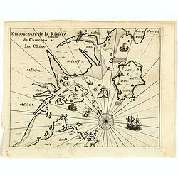
Embouchure de la rivière de Chincheo à la Chine.
This map is a view of Quanzhou Bay. Quanzhou was established in 718 during the Tang Dynasty (618–907). In those days, Guangzhou was China's greatest seaport, but this s...
Date: Amsterdam, F. Bernard, 1725
Selling price: ????
Please login to see price!
Sold in 2014
[10 Maps] Carte generale du Thibet ou Bout-Tan et des Pays de Kashgar et Hami Dress'ee sur les Cartes et Memoires des RR PP Jesuites de la Chine . . .
A general map of Tibet together with 9 regional maps. The first accurate cartographic depiction of Tibet that is available in the western world. Jean Baptiste Bourguignon...
Date: Paris, Le Mercier, 1735
Selling price: ????
Please login to see price!
Sold in 2012
[11 Maps] . . . Feuille particuliere de la Tartarie Chinoise. . .
A group of 11 maps, together forming a large map of Tartary. The first accurate cartographic depiction of Tartary available in the western world. Jean Baptiste Bourguigno...
Date: Paris, Le Mercier, 1735
Selling price: ????
Please login to see price!
Sold in 2010
Land-Taffel der Insel Sanciano. Grab-Statt des Heiligen Franc. Xaverii auf der Insel Sanciano
A map (21,5:21 cm) of the southern coast of China with Macau, the Xiachuan Island and the Shangchuan Island, where Francis Xavier was buried. With the ground plan of Xavi...
Date: Augsburg, 1735
Selling price: ????
Please login to see price!
Sold in 2011
Province de Quang-Si. [Quang-si 广西 [Guangxi] province]
Important map of Quang-si 广西 [Guangxi] province. With a quite elaborately pictorial cartouche featuring a rococo chinoiserie ornamentation, engraved...
Date: Paris, P.G. Le Mercier, 1735
Selling price: ????
Please login to see price!
Sold in 2020
Province d'Yun-Nan. [Yun-nan 云南 [Yunnan] province.]
Important map of Yun-nan 云南 [Yunnan] province. With a quite elaborately pictorial cartouche featuring a rococo chinoiserie ornamentation, engraved b...
Date: Paris, P.G. Le Mercier, 1735
Selling price: ????
Please login to see price!
Sold
Province de Kiang-Nan. [Kiang-nan 江南 [Jiangnan] province.]
Important map of Kiang-nan 江南 [Jiangnan] province. With a quite elaborately pictorial cartouche featuring a rococo chinoiserie ornamentation, engrav...
Date: Paris, P.G. Le Mercier, 1735
Selling price: ????
Please login to see price!
Sold in 2017
Province de Chen-Si. [Chen-si 陕西 [Shaanxi] province.]
Important map of Chen-si 陕西 [Shaanxi] province. With a quite elaborately pictorial cartouche, engraved by Guélard, the map by Delahaye, featuring a...
Date: Paris, P.G. Le Mercier, 1735
Selling price: ????
Please login to see price!
Sold in 2017
Dedication page to the King of France.
Text page showing an engraving (130x210mm.) of the young King followed by a letter addressed to him. Jean Baptiste Bourguignon d' Anville (1697-1782), French cartographer...
Date: Paris, P.G. Le Mercier, 1735
Selling price: ????
Please login to see price!
Sold in 2018
Description geographique, historique, chronologique, politique et physique de l'Empire de chine et de la Tartarie / De la Religion des Chinois.
Text page with a copper engraving (90x175mm.) showing an interior with Chinese persons. Jean Baptiste Bourguignon d' Anville (1697-1782), French cartographer. Compiled ov...
Date: Paris, P.G. Le Mercier, 1735
Selling price: ????
Please login to see price!
Sold in 2018
Au vrai principe de toutes choses.
Text page with an engraving. Jean Baptiste Bourguignon d' Anville (1697-1782), French cartographer. Compiled over 200 maps. This map is from his most important work Nou...
Date: Paris, P.G. Le Mercier, 1735
Selling price: ????
Please login to see price!
Sold in 2017
Carte generale de la Chine. . . [together with 11 maps of Chinese provinces]
Very detailed map of Southern part of China, including a detailed Taiwan. Together with 11 maps of Chinese provinces, in different sizes and each with a fine title cartou...
Date: The Hague, 1737
Selling price: ????
Please login to see price!
Sold in 2010
Province de Chen-Si.
With a quite elaborately pictorial cartouche, engraved by Guélard, the map by Delahaye. Jean Baptiste Bourguignon d' Anville (1697-1782), French cartographer. Compiled o...
Date: The Hague, 1737
Selling price: ????
Please login to see price!
Sold in 2014
Province de Koei-Tcheou.
Appeared in d'Anville's Nouvel atlas de la Chine in 1737. This is a delightful map of the province of Guizhou, or Kweichow, the smallest province in southwestern China. T...
Date: 1737
Selling price: ????
Please login to see price!
Sold in 2017
Province d'Yunnan.
Based on Jesuit sources, D'Anville's maps remained the definitive European rendering of China's provinces until the end of the 19th century. This beautiful and detailed D...
Date: 1737
Selling price: ????
Please login to see price!
Sold in 2017
Carte plate qui comprend les Costes de Tsiompa, de la Cochinchine, le golfe de Tunquin, une partie des costes de la Chine avec une partie de l'Archipel des Isles Philippines. . .
Important French of the China Sea with the coast of Southern China, including Hong Kong and the southern tip of Taiwan. Great detail on the Philippines.Engraved by Guill...
Date: Paris, Jean-François Robustel, 1745
Selling price: ????
Please login to see price!
Sold
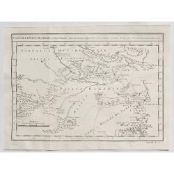
Carte de la Petite Bukharie et Pays Voisins.
Fine copper engraved map covering entire Sinkiang, the Tarim Basin, Djungariet and Turfan and the Pamirs in the west to the Chinese Wall beginning in the East. Engraved b...
Date: Paris, 1749
Selling price: ????
Please login to see price!
Sold in 2016
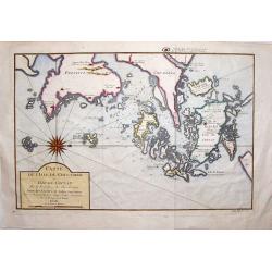
Carte de L'isle de Cheu-Chan.
Striking map of the area of China, east of Ningbo in Chekiang Province across from Shanghai. The map was by Bellin in 1749. Interestingly, the large, detailed compass ...
Date: Paris, 1749
Selling price: ????
Please login to see price!
Sold in 2019
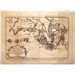
l'Isle de Cheu-chan ou Isle de Chusan.
A striking map of of Cheu-Chan in the province of Che-Kiang and surrounding islands in China. It was published in "HISTOIRE GENERALE DES VOYAGES" by Prevost in ...
Date: Paris, 1749
Selling price: ????
Please login to see price!
Sold in 2019
Carte de la Petite Bukarde et Pays Voisins. . .
Antique map of Central Asia (Turpan) of China. Petit Bukaharie or Xinjiang, known for the more two thousand years old Silk road. By Bellin in 1749.Jacques Nicolas Bellin ...
Date: Paris, 1749
Selling price: ????
Please login to see price!
Sold in 2020
[SET OF 7 MAPS OF CHINA, ca. 1750]
Interesting set of seven regional copper-engraved maps and plans of China by or after Bellin, dating to around 1750. List of the maps: 1: Carte des isles qui sont a l'en...
Date: Paris, 1750
Selling price: ????
Please login to see price!
Sold in 2011
Nieuwe Pas=Caart strekkende van Pta Cataon tot Pta. Lamtoan, langs de kusten van Cochinchina, Tonquin, Quangsi en Quantung [?] van Macao.
A finely engraved and detailed chart of Vietnam reaching till Macao and present-day Hong Kong..Very rare: only included in 6th volume (so-called secret atlas) of Van Keul...
Date: Amsterdam 1753
Selling price: ????
Please login to see price!
Sold
PROVINCE OF FOKYEN A chart of the Bay of Chin-Chew or Chang-Chew in China.
A small but very early and interesting map, engraved by G.Child for \'The Universal Traveller\', by Thomas Salmon.Covers that part of the coastline from Pu-tay Point, dow...
Date: London, Th. Salmon, 1729-1753
Selling price: ????
Please login to see price!
Sold in 2008
Carte de la Baye de Chin-Chew ...
A detailed small chart of the estuary of the Chiu-lung River at present-day Hsia-men, on the mainland coast, adjacent to Taiwan, showing the location of a few village set...
Date: Paris, 1754
Selling price: ????
Please login to see price!
Sold in 2011
Carte de la Tartarie Occidentale Pour Servir a L'Histoire Generale des Voyages Tiree des Auteurs Anglois.
A map of Western Tartary, covering present-day Northern China and Mongolia. The site of Genghis Khan's ancient Mongol capital of Karakum (Karakorum) is centrally marked o...
Date: Paris, 1758
Selling price: ????
Please login to see price!
Sold in 2019
Carte de la Baye de Chin-Chew. Avec les Isles de Emowi et de Quemowi.
Jaques Nicolas Bellin (1702-720) was the most important French hydrographer of the 18th century. Sea-atlas 'Hydrographique Français' , 1756-65, atlas to accompany Prévo...
Date: Amsterdam, 1759
Selling price: ????
Please login to see price!
Sold
Carte de la Baye d?Hocsieu.
Jaques Nicolas Bellin (1702-720) was the most important French hydrographer of the 18th century. Sea-atlas 'Hydrographique Français' , 1756-65, atlas to accompany Prévo...
Date: Amsterdam, 1759
Selling price: ????
Please login to see price!
Sold
Carte des Isles... de la Rivière de Canton.
Jaques Nicolas Bellin (1702-720) was the most important French hydrographer of the 18th century. Sea-atlas 'Hydrographique Français' , 1756-65, atlas to accompany Prévo...
Date: Amsterdam, 1759
Selling price: ????
Please login to see price!
Sold
Kaart der Baai van Chin-Chew, of Chang-Chew.
This map features the Bay of Changchow in the Fukien province. The map features a floral title cartouche. The Dutch title is at the bottom.
Date: Paris, 1759
Selling price: ????
Please login to see price!
Sold in 2018
Plan de la Ville de Su-Tcheou-Fou / Plan de L'Enceinte de la Ville de Nan-King.
Two plans on one page. One is a plan of Nanking while the other is of the town of Su-Chew-Fu. Published in Paris by Jacques Nicolas Bellin in 1760.
Date: Paris, 1760
Selling price: ????
Please login to see price!
Sold in 2016
Carte de la Baye d'Hocsieu. . .
An interesting map showing the mouth and estuary of the Chiang River in southwest China, opposite Taiwan (Formosa) by Prevost, after Bellin. It shows the modern day Chine...
Date: Paris, ca 1760
Selling price: ????
Please login to see price!
Sold in 2020
Kaart van't Eiland Cheu-chan of Chusan. . .
A detailed map of Zhoushan Island & Zhajiang China (The coastal area east of Ningbo in the Chinese province of Chekiang, located across the bay from Shanghai). The or...
Date: Paris, 1763
Selling price: ????
Please login to see price!
Sold in 2021
Carte Hydro-geo-graphique des Indes Orientales.. (Set of Four Maps)
A detailed map with a large, and very decorative title cartouche, showing the coast of southern China, Taiwan and the northern Philippines region with particular detail i...
Date: Paris 1771
Selling price: ????
Please login to see price!
Sold in 2014
A chart of the China Sea inscribed to Monsr. D'APRES de MANNEVILLETTE .. To A.Dalrymple.
Most important milestone based upon the surveys made from navigational surveys by Alexander Dalrymple (1737-1808]. He was the first Hydrographer of the British Admiralty...
Date: Paris, ca. 1775
Selling price: ????
Please login to see price!
Sold
Carte de la Baye de Chin-Chew ou Chang-Chew avec les Isles d'Emowi et de Quemowi ...
A small but very early and interesting map of the coastline from Pu-tay Point, down to the Chin Chew river, with Ko-long-fu, Lakkateyn, Tano-fita, Roo Point, Womends Isle...
Date: Paris, 1738-1775
Selling price: ????
Please login to see price!
Sold in 2013
Carte de l'Entrée de la riviere de Canton Dressee sur les Observations les plus recentes.
A small but very early and interesting map of the mouth of the Canton River with the island of Macao and the future site of Hong Kong (Sinn-gan-hien). The fortified city ...
Date: Paris, 1738-1775
Selling price: ????
Please login to see price!
Sold in 2022
A chart of the China Sea inscribed to Monsr. D\'APRES de MANNEVILLETTE . . . To A.Dalrymple.
Most important milestone based upon the surveys made from navigational surveys by Alexander Dalrymple (1737-1808]. He was the first Hydrographer of the British Admiralty...
Date: Paris, ca. 1775
Selling price: ????
Please login to see price!
Sold in 2015














![[10 Maps] Carte generale du Thibet ou Bout-Tan et des Pays de Kashgar et Hami Dress'ee sur les Cartes et Memoires des RR PP Jesuites de la Chine . . .](/uploads/cache/29978-250x250.jpg)
![[11 Maps] . . . Feuille particuliere de la Tartarie Chinoise. . .](/uploads/cache/29979-250x250.jpg)

![Province de Quang-Si. [Quang-si 广西 [Guangxi] province]](/uploads/cache/39686-250x250.jpg)
![Province d'Yun-Nan. [Yun-nan 云南 [Yunnan] province.]](/uploads/cache/39687-250x250.jpg)
![Province de Kiang-Nan. [Kiang-nan 江南 [Jiangnan] province.]](/uploads/cache/39690-250x250.jpg)
![Province de Chen-Si. [Chen-si 陕西 [Shaanxi] province.]](/uploads/cache/39698-250x250.jpg)


![Carte generale de la Chine. . . [together with 11 maps of Chinese provinces]](/uploads/cache/29994-250x250.jpg)


![[SET OF 7 MAPS OF CHINA, ca. 1750]](/uploads/cache/91735-250x250.jpg)
![Nieuwe Pas=Caart strekkende van Pta Cataon tot Pta. Lamtoan, langs de kusten van Cochinchina, Tonquin, Quangsi en Quantung [?] van Macao.](/uploads/cache/23818-250x250.jpg)


