Browse Listings in Asia
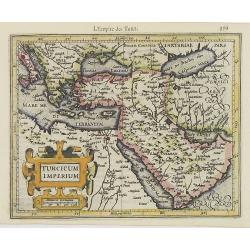
Turcicum Imperium.
Early map of Turkey, the Arabian peninsula and eastern part of the Mediterranean.From the first French-text edition of Jodocus Hondius'' Atlas Minor.Shortly after the pub...
Date: Amsterdam, 1608
Selling price: ????
Please login to see price!
Sold in 2008
Ceilan insula.
Charming small map of the island of Sri Lanka with great detail of the villages, kingdoms, mines and spice plantations.Decorated with a strap work title and distance scal...
Date: Amsterdam, 1608
Selling price: ????
Please login to see price!
Sold in 2017
Tabula Cananae ae prout tempore Christi et Apostolorum divisa fuit.
Early map of the Holy Land, from the first French-text edition of Jodocus Hondius' Atlas Minor.Shortly after the publication of the big folio-atlases, the need was appare...
Date: Amsterdam, 1608
Selling price: ????
Please login to see price!
Sold in 2010
Natolia.
Early map of Turkey, including Cyprus, from the first French-text edition of Jodocus Hondius' Atlas Minor.Shortly after the publication of the big folio-atlases the need ...
Date: Amsterdam, 1608
Selling price: ????
Please login to see price!
Sold in 2011
Cyprus, Rhodus. . .
Early map of Cyprus with inset maps of Rhodes, Cerigo, Negroponte, Mytilene, Kéos and Stalimene at the bottom.From the first French-text edition of Jodocus Hondius' Atla...
Date: Amsterdam, 1608
Selling price: ????
Please login to see price!
Sold in 2008
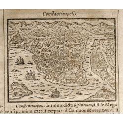
Constantinopolis
Rare woodcut view of Istanbul (Constantinople). From "Parvum Theatrum Urbium sive Urbium Praecipuarum totius orbis Brevis & Methodica Descriptio" by Adrianu...
Date: Frankfurt, 1608
Selling price: ????
Please login to see price!
Sold in 2009
[Babylon]
Rare woodcut view of the Tower of Babel, Babylon. From "Parvum Theatrum Urbium sive Urbium Praecipuarum totius orbis Brevis & Methodica Descriptio" by Adria...
Date: Frankfurt, 1608
Selling price: ????
Please login to see price!
Sold in 2009
Alexandri Magni Expeditio.
Early map of travels of Alexander the Great. Including the Near East and a small inset of Eastern part of Turkey.From the first French-text edition of Jodocus Hondius' At...
Date: Amsterdam, 1608
Selling price: ????
Please login to see price!
Sold in 2010
Peregrinatio Israelitaru In Deserto.
A nice small map depicting the Exodus and the wandering of the Children of Israel. Inset of the encampment enclosed in a strapwork border.From the first French-text editi...
Date: Amsterdam, 1608
Selling price: ????
Please login to see price!
Sold in 2017
Insulae Indiae Orientalis.
Charming map of the East Indies, including the Philippines, and the Malay Peninsula, from the first French-text edition of Jodocus Hondius' Atlas Minor.Covering the coast...
Date: Amsterdam, 1608
Selling price: ????
Please login to see price!
Sold in 2017
China.
Charming small map of the eastern part of China, oriented with west on top. It includes part of Japan and Korea represented as an island.From the first French-text editio...
Date: Amsterdam, 1608
Selling price: ????
Please login to see price!
Sold in 2009
Paradisus.
Attractive map showing the Syrian desert, Lebanon, and the mouth of the Tigris in the Persian Gulf. Including Babylon, Tripoli, etc.Showing the site of Paradise between t...
Date: Amsterdam, 1608
Selling price: ????
Please login to see price!
Sold in 2012
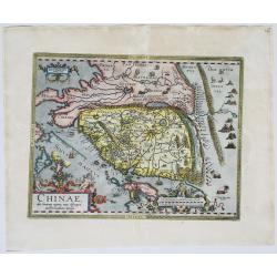
Chinae Olim Sinarum Regionis Nova Descriptio auctore Ludovico Georgio.
The first map of China to appear in a western atlas by Abraham Ortelius, based on the work of Jorge de Barbuda, a Portuguese Jesuit also known as Ludovicus Georgius. The...
Date: Antwerp, 1587/1608
Selling price: ????
Please login to see price!
Sold in 2020
China, regio Asiae.
Miniature map of China, the map is oriented with north to the right and extends into parts of Indo-China, the Philippines and part of Japan. The Great Wall is prominently...
Date: Antwerp 1609
Selling price: ????
Please login to see price!
Sold
Iterra Sancta.
Miniature map of Israel and a part of Egypt, with major cities named. The sea is stipple engraved. Strapwork title cartouche at right. Latin text on verso.
Date: Antwerp, 1609
Selling price: ????
Please login to see price!
Sold
China.
A miniature map of China, including the islands of Mindanao, Philippines, Borneo, Japan, etc. Title cartouche in the upper left corner.First published in 1598 in his Caer...
Date: Amsterdam/Frankfurt 1609
Selling price: ????
Please login to see price!
Sold
Moluccae Insulae [Molucca].
A miniature map of Moluccas, centered on Celebes Islands. Title cartouche on the upper right corner.First published in 1598 in his Caert-Thresoor, the plates were execute...
Date: Amsterdam / Frankfurt, 1609
Selling price: ????
Please login to see price!
Sold in 2016
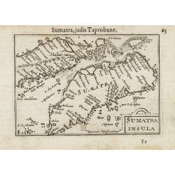
Sumatra.
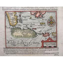
A miniature map of Sumatra containing detailed geography and nomenclature around the entire island. The neighboring coast of the Malay Peninsula is shown, including Singa...
Date: Amsterdam / Frankfurt, 1609
Selling price: ????
Please login to see price!
Sold in 2014
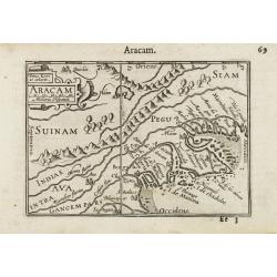
Aracam.
A miniature map of Burma, orientated with north to the left, with Pegu. Title cartouche on the upper left corner.First published in 1598 in his Caert-Thresoor, the plates...
Date: Amsterdam / Frankfurt, 1609
Selling price: ????
Please login to see price!
Sold in 2012
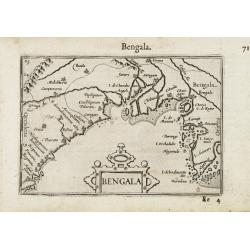
Bengala.
Very fine early miniature map of Bangladesh, River Ganges and Calcutta named Calecota . Title cartouche centered on the lower part.First published in 1598 in his Caert-Th...
Date: Amsterdam/Frankfurt 1609
Selling price: ????
Please login to see price!
Sold
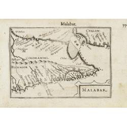
Malabar.
Very fine early miniature map of southern part of India and a part of Ceylon island. Title cartouche on the lower right corner.First published in 1598 in his Caert-Threso...
Date: Amsterdam/Frankfurt 1609
Selling price: ????
Please login to see price!
Sold
Narsinga and Ceylon.
Very fine early miniature map of Ceylon and the southern tip of India. Title cartouche on the upper right corner.First published in 1598 in his Caert-Thresoor, the plates...
Date: Amsterdam/Frankfurt 1609
Selling price: ????
Please login to see price!
Sold
Cambaia.
Very fine early miniature map of North India. Title cartouche on the lower left corner. First published in 1598 in his Caert-Thresoor, the plates were executed by the mos...
Date: Amsterdam/Frankfurt 1609
Selling price: ????
Please login to see price!
Sold
Terrae Chanaan Inter XII Tribuus Israel Distributae Orthographia.
The land Canaan distributed among the 12 Tribes. A map from Augustino Torniello's ' Anales Sacri et Profani.' Rare. Ref.: Laor, Holy Land, entry Anonymus 913.
Date: Frankfurt, Jacobus Fischerus, 1609
Selling price: ????
Please login to see price!
Sold
Sinai Desert (no title).
A small map illustrating the crossing of the Red Sea by the Children Israels.
Date: Frankfurt, Jacobus Fischerus, 1609
Selling price: ????
Please login to see price!
Sold
Hierosolymae, Cura Neemiaeducis Instauratae Descriptio.
Two plans of Jerusalem, left according to Brocardus, right after Villalpando. Geographically there is no difference between the two plans, however, the plan after Brocard...
Date: Frankfurt, Jacobus Fischerus, 1609
Selling price: ????
Please login to see price!
Sold
Tabula XXXXII Mansinum Populi Israelitici in Deserto.
The perigrinations of the Children Israel. A map from Augustino Torniello\'s \' Anales Sacri et Profani\'. Rare.
Date: Frankfurt, Jacobus Fischerus, 1609
Selling price: ????
Please login to see price!
Sold
Terrae Chanaan Inter XII Tribuus Israel Distributae Orthographia.
The land Canaan distributed among the 12 Tribes. A rare and elegantly simple Holy Land map from Torniello's Annales Sacri & Profani, featuring only the 12 tribal divi...
Date: Frankfurt, Jacobus Fischeru, 1609
Selling price: ????
Please login to see price!
Sold in 2021
Palestinae sive totius Terrae Promissionis.
Map of Holy Land from the rare Spanish edition of Abraham Ortelius' "Theatrum Orbis Terrarum", published by Vrientius.Abraham Ortelius(1527-1598), Dutch cartogr...
Date: Antwerp, Robert Bruneau, 1609
Selling price: ????
Please login to see price!
Sold in 2021
Hollandi a Caesare Calecutense.
Dutch mission arriving in Calicut, India.Theodore de Bry, a German engraver and book dealer, began a compilation of early voyages in 1590 and had published six parts at t...
Date: Frankfurt, 1609
Selling price: ????
Please login to see price!
Sold in 2016
IX. Tabula Cosmographica, Regionis Sive.
Early map of Ceylon (Sri-Lanka). Theodore de Bry, a German engraver and book dealer, began a compilation of early voyages in 1590 and had published six parts at the time ...
Date: Frankfurt, 1609
Selling price: ????
Please login to see price!
Sold in 2010
Asiae Nova Descriptio.
Ortelius' important map of Asia based on his wall map of 1567, which was based on the work of Gastaldi.The cordiform projection shows Asia extended too far to the east, a...
Date: Antwerp, 1609
Selling price: ????
Please login to see price!
Sold in 2011
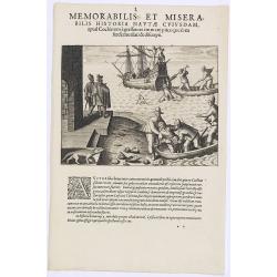
Memorabilis et Miserabilis Historia Nautae Cuiusdam.
Scene in Indochina of the first part of the voyage of van de Neck and Wybrandt van Warwijk to the East Indies.Theodore de Bry, a German engraver and book dealer, began a ...
Date: Frankfurt, 1609
Selling price: ????
Please login to see price!
Sold in 2013
XXXIV. Quomodo Reges Insulae Baly curru Vehantur. 28. (The King of Bali)
Theodore de Bry, a German engraver and book dealer, began a compilation of early voyages in 1590 and had published six parts at the time of his death in 1598. His widow, ...
Date: Frankfurt, 1609
Selling price: ????
Please login to see price!
Sold in 2014
Pars undecima orientalis. IX. Aliarum ferarum certamina, item nobilis.
A scene with animals of Mongolia.Theodore de Bry, a German engraver and book dealer, began a compilation of early voyages in 1590 and had published six parts at the time ...
Date: Frankfurt, 1609
Selling price: ????
Please login to see price!
Sold in 2016
Navis Quaed am Praetoria. (A Portuguese ship is wrecked on its way to Goa in India)
In 1595 a Portuguese ship called St. Iago, with the admiral and about five hundred people aboard, set sail for the East Indies. Having carefully negotiated the Cape of Go...
Date: Frankfurt, 1609
Selling price: ????
Please login to see price!
Sold in 2016
Rex Balius Preciosissimo Curru.
How the people of Bali transport their King. According to deBry: there are many horses on the island of Bali but they are small and only the simple folk ride them. Those ...
Date: Frankfurt, 1609
Selling price: ????
Please login to see price!
Sold in 2023
XVIII. Repraesentatio Mulierum varie exornatarum, et Quomodo matrimonium contrahant. (The natives' clothing and how they adorn themselves: 1603-1604)
A: This shows a chief’s wife (called ‘aeneodifie’) wearing feast-day attire as she walks out. She has beads or corral around her neck, her hair being decoratively b...
Date: Frankfurt, 1609
Selling price: ????
Please login to see price!
Sold in 2016
Vicerex Classem Ex Goa. ( An encounter with pirates on the Malabar coast.)
An encounter with pirates on the Malabar coast. The pirates along the west coast of India were notorious for bad deeds, both on land and sea. The Portuguese viceroy at Go...
Date: Frankfurt, 1609
Selling price: ????
Please login to see price!
Sold in 2019
Delineatio Regis in Matecalo Hollandos. (Arrival of Sebald de Weert in Matecalo/Batticaloa).
Arrival of Sebald de Weert in Matecalo/Batticaloa, Ceylon (Sri Lanka).Theodore de Bry, a German engraver and book dealer, began a compilation of early voyages in 1590 and...
Date: Frankfurt, 1609
Selling price: ????
Please login to see price!
Sold in 2016
Ins. Ceilan que incolis Tenarisin dictur.
In 1606 J. Hondius introduced in the Mercator Atlas a separate map of Ceylon. Prepared by Petrus Plancius who was at the time the official map maker of the V.O.C.Early ma...
Date: Amsterdam, 1609
Selling price: ????
Please login to see price!
Sold in 2016
Tartaria.
A delightful, well engraved miniature map of Tartary (northeastern Asia) with Japan, Korea, and a lovely rustic depiction of the Great Wall of China. Latin text on verso....
Date: Antwerp, ca. 1609
Selling price: ????
Please login to see price!
Sold in 2016
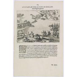
Lusitani ad Malaccam ab Hollan.
Dutchmen in Malacca Harbor repairing ships. Engraving by Theodore de Bry, a German engraver and book dealer, began a compilation of early voyages in 1590 and had publishe...
Date: Frankfurt, 1609
Selling price: ????
Please login to see price!
Sold in 2019
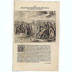
III. Delineatio Punientium Adulteria in Insula Patane. (Death of Sebald de Weerdt.)
Showing the death of Sebald de Weert (1567 – 1603) was a Dutch captain and vice-admiral of the Dutch East India Company (VOC). He is most widely remembered for accurate...
Date: Frankfurt, 1609
Selling price: ????
Please login to see price!
Sold
IV. Delineatio Processionis Reginae Pataniensis. (Procession of the Queen of Patani.)
Copper engraving on a text sheet showing a procession of the Queen of Patani. More than a century of female rule in Patani (1584-1688) involved four successive queens Pro...
Date: Frankfurt, 1609
Selling price: ????
Please login to see price!
Sold
Delineatio Annabonae ab Holandis Expugnatae. (The Dutch attack on the Portuguese at Ambon Island)
The Dutch attack on the Portuguese at Ambon Island.Theodore de Bry, a German engraver and book dealer, began a compilation of early voyages in 1590 and had published six ...
Date: Frankfurt, 1609
Selling price: ????
Please login to see price!
Sold in 2017
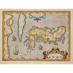
Iaponiae Insulae Descriptio; Ludoico Teisera Auctore.
This landmark map was the first map of Japan published in a European atlas. Ortelius received the map from Ludovico Teixeira, a Portuguese Jesuit cartographer and mathema...
Date: Antwerp, Robert Bruneau, 1609
Selling price: ????
Please login to see price!
Sold in 2019
Nefaria Obtruncatio Quorundam in Navi Hollandia.
A finely engraved scene of a Javanese murderous attack on a Dutch ship. The text underneath explains : "after trading with the people of Bantam, we sailed on to anot...
Date: Frankfurt, 1609
Selling price: ????
Please login to see price!
Sold
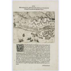
Delineatio Adventus Hollandorum. (Ternate Island)
Arrival of the Dutch at Ternate Island.Theodore de Bry, a German engraver and book dealer, began a compilation of early voyages in 1590 and had published six parts at the...
Date: Frankfurt, 1609
Selling price: ????
Please login to see price!
Sold in 2017
XXIV. Delineatio Castelli et Propugnaculi Lusitanorum, La Mina, &c. (Elmina Castle)
View of Elmina Castle, which was erected by the Portuguese in 1482 as São Jorge da Mina (St. George of the Mine) Castle, also known simply as Mina or Feitoria da Mina) i...
Date: Frankfurt, 1609
Selling price: ????
Please login to see price!
Sold in 2019
[How the genteel folk of Bali are transported]
Text engraving with explanation how the royalty and high-ranking citizens of Bali are transported about on light decorative chairs, with a shelter above to protect them f...
Date: Amsterdam, Cornille Nicolas, 1609
Selling price: ????
Please login to see price!
Sold in 2025
[Creatures of Java].
Two text engravings from "Premier livre de l'histoire de la navigation aux Indes Orientales, par les hollandois, et des choses a eux advenues . . . ", being the...
Date: Amsterdam, Cornille Nicolas, 1609
Selling price: ????
Please login to see price!
Sold in 2017
Delineatio Venationis, Qua Elephantes Patane Capiuntur. (Capturing elephants)
A fine early illustration of capturing elephants in Pegu Kingdom.Theodore de Bry, a German engraver and book dealer, began a compilation of early voyages in 1590 and had ...
Date: Frankfurt, 1609
Selling price: ????
Please login to see price!
Sold
[Java].
Wood block engraved coastal profiles set in text from "Premier livre de l'histoire de la navigation aux Indes Orientales, par les hollandois, et des choses a eux adv...
Date: Amsterdam, Cornille Nicolas, 1609
Selling price: ????
Please login to see price!
Sold in 2025
Iaponia Insula.
A very nice miniature map of Japan, with major cities named, title cartouche at the bottom and the sea is stipple engraved. The map was engraved by the brothers Ambrose a...
Date: Antwerp, 1609
Selling price: ????
Please login to see price!
Sold in 2018
Cum Hollandi Achiensem aliquando Regem.
Scene during the second voyage of Jacob van Neck to the East Indies, from 1600-1604, during which he visited the islands of Ternate and Macao, and the city of Patane, in ...
Date: Frankfurt, 1609
Selling price: ????
Please login to see price!
Sold
Delineatio Adventus Hollandorum in terram Patane.
Scene during the second voyage of Jacob van Neck to the East Indies, from 1600-1604, during which he visited the islands of Ternate and Macao, and the city of Patane, in ...
Date: Frankfurt, 1609
Selling price: ????
Please login to see price!
Sold in 2019
Japonia.
The first map of Japan published in a European atlas. Ortelius received the map from Ludovico Teixeira, a Portuguese Jesuit cartographer and mathematician. While Teixeira...
Date: Antwerp, Robert Bruneau, 1609
Selling price: ????
Please login to see price!
Sold in 2020
Natoliae Sive Asia Minor. [with Cyprus]
Decorative map of present day Turkey with Cyprus prominently shown. The sea is boldly engraved in a wave pattern. There is a large sea monster in the Mediterranean and an...
Date: Amsterdam, 1610
Selling price: ????
Please login to see price!
Sold in 2013
Natoliae Sive Asia Minor.
Map of Turkey, also depicting Cyprus.
Date: Amsterdam, 1610
Selling price: ????
Please login to see price!
Sold
Mesopotamia Syrie.
This scarce map of the Eastern Mediterranean region extends throughout the Middle East and Egypt. Cyprus and the Levantine coasts are clearly detailed with particular att...
Date: Hannover 1611
Selling price: ????
Please login to see price!
Sold
Asiae Nova Descriptio Auctore Jodoco Hondio.
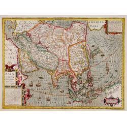
Hondius Asia map in full colors.
Date: Amsterdam, 1611
Selling price: ????
Please login to see price!
Sold in 2009
Iaponia.
A close derivative of the Teixeira map introduced by Ortelius in 1595. Hondius, however, makes note of Korea by including an inscription stating that it is not known whet...
Date: Amsterdam, 1611
Selling price: ????
Please login to see price!
Sold in 2010
Baly and Java.
Map of Bali in present-day Indonesia. Includes inset of temple and temple grounds. Even though this map is much smaller than an atlas map from Blaeu, Hondius or Ortelius,...
Date: Amsterdam, 1611
Selling price: ????
Please login to see price!
Sold in 2014
The town of Madura on the island Madura: Madurensium
An early, rare view of the town of Madura on the island Madura with the 4 ships of Houtman's fleet. On verso the inhabitants are showing the Houtman’s crew their skills...
Date: Amsterdam, 1611
Selling price: ????
Please login to see price!
Sold in 2014
Banda isles - Banda, Poelepetacke and Groene Ape
Two early maps on one sheet. Amboina and the Banda Isles: Banda, Pulau Run and Gunung Api on the verso of the sheet. From the description by Pontanus of the second expedi...
Date: Amsterdam, 1611
Selling price: ????
Please login to see price!
Sold in 2014
View of the town of Gammelamme, situated on Ternate.
View of the town of Gammelamme [Gamalama] on Ternate, where the Dutch established a trading post. Includes Dutch ships, native boats or proas, indication of the reef, nat...
Date: Amsterdam, 1611
Selling price: ????
Please login to see price!
Sold in 2020
Siege of Malacca.
Siege of Malacca by admiral Cornelis Matelief. Malacca is in the background. The Dutch go ashore with boats and march on the city. Even though this map is much smaller th...
Date: Amsterdam, 1611
Selling price: ????
Please login to see price!
Sold in 2014
Java, Borneo and Southern Sumatra.
An early, rare and beautiful map of Java and the southern part of Sumatra and Borneo. Includes Bali and Cambava (present-day Mataram?). Also includes shoals. Fine calligr...
Date: Amsterdam, 1611
Selling price: ????
Please login to see price!
Sold in 2014
Goa
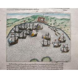
Very early view of Goa, India. An entire leaf from the book by Pontanus ‘Rerum et urbis Amstelodamensium Historia’ (1611). On verso a naval engagement.
Date: Amsterdam, 1611
Selling price: ????
Please login to see price!
Sold in 2023
't Steenachtige, Woest, en Gelukkig Arabien.
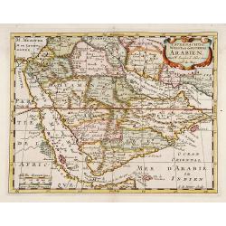
An attractive map of the Arabian Peninsula from a Dutch text edition. Engraved by A.de Winter.
Date: F.HALMA, Amsterdam/Utrecht, 1700
Selling price: ????
Please login to see price!
Sold
Japoniae insulae descriptio.
The first printed map of Japan to appear in an atlas. It was drawn by the Portuguese Jesuit Luiz Teixeira and depicts Korea as an island. Japan was probably identified wi...
Date: Antwerp 1595-1612
Selling price: ????
Please login to see price!
Sold
Turcici Imperii Descriptio.
This is the best known of all the sixteenth-century maps of the Middle East, extending from Greece to Arabia and covering the Cradle of Civilisation region. Large and dec...
Date: Antwerp 1579-1612
Selling price: ????
Please login to see price!
Sold
Abrahami Patriarchae Peregrinatio et Vita.
"The Holy Land map itself occupies the centre and is surrounded by vignettes of the life of the Patriarch Abraham. Extremely decorative map made by Ortelius, based o...
Date: Antwerp 1612
Selling price: ????
Please login to see price!
Sold
Abrahami Patriarchae Peregrinatio et Vita.
The Holy Land map itself occupies the centre and is surrounded by vignettes of the life of the Patriarch Abraham. Extremely decorative map made by Ortelius, based on Ptol...
Date: Antwerp 1601-1612
Selling price: ????
Please login to see price!
Sold
Typus chorographicus, celebrium locoum in regno Judae et..
Drawn by Tilemannus Stella Sigenensi, this map delineates the most important places in the kingdom of Judah and Israel. The shorelines run from Berytus (Beirut) to Rhinoc...
Date: Antwerp 1601-1612
Selling price: ????
Please login to see price!
Sold
Asiae Nova Descriptio.
Several sources appear to have been used in the compilation of this map, including the Portuguese Jesuits Luis Teixeira (1595) for Japan, and Luis Jorgede Barbuda (1584) ...
Date: Amsterdam 1611-1612
Selling price: ????
Please login to see price!
Sold
Japoniae insulae descriptio.
The first printed map of Japan to appear in an atlas. It was drawn by the Portuguese Jesuit Luiz Teixeira and depicts Korea as an island. Japan was probably identified wi...
Date: Antwerp 1595-1612
Selling price: ????
Please login to see price!
Sold
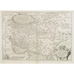
Persici sive Sophorum Regni Typus.
The map includes Iran, Afghanistan, Pakistan, the Caspian Sea and the north eastern tip of the Arabian Peninsula including United Arab Emirates and Oman.Milestone map of ...
Date: Antwerp, 1570/1612
Selling price: ????
Please login to see price!
Sold
Daphne.
Stunning town view of the Paradise Daphne, a pleasant suburb of Antioch in Syria, representing a mixture of myth and history.Prepared by Ortelius on basis of ancient sour...
Date: Antwerp, 1612
Selling price: ????
Please login to see price!
Sold


![[Babylon]](/uploads/cache/90737-250x250.jpg)




![Moluccae Insulae [Molucca].](/uploads/cache/13293-250x250.jpg)








![[How the genteel folk of Bali are transported]](/uploads/cache/37935-250x250.jpg)
![[Creatures of Java].](/uploads/cache/37950-250x250.jpg)

![[Java].](/uploads/cache/37965-250x250.jpg)


![Natoliae Sive Asia Minor. [with Cyprus]](/uploads/cache/02938-250x250.jpg)


