Browse Listings in Asia
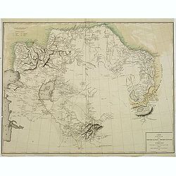
Carte du pays occupé par les Kirghiz-Kazaks ou Kirghiz-Kaïssaks. . .
Map representing Kazakhstan, Uzbekistan, Turkmenistan, northern part of Afghanistan, with the Caspian Sea in the west.
Date: Paris, 1840
Selling price: ????
Please login to see price!
Sold in 2011
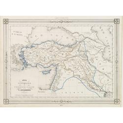
Asie Mineure..
Uncommon map of Turkey, Cyprus and Palestine. Lithography in very delicate hand colors with ,Route de Xenophon, marked in red.
Date: Paris, 1840
Selling price: ????
Please login to see price!
Sold
Asie.
Finely engraved map of Asia prepared by A.H.Dufour and engraved by Giraldon-Bovinet. The map is of interest for the use of East Sea, the sea between Korea and Japan, here...
Date: Paris, Jules Renouard, ca.1840
Selling price: ????
Please login to see price!
Sold in 2012
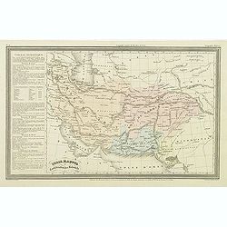
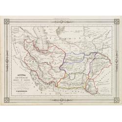
Perse, Kaboul et confédération des Beloutchi.
Finely engraved map of Persia, Iran, Iraq, etc. prepared by A.H.Dufour and engraved by Giraldon-Bovinet. Published by Jules Renouard in his uncommon atlas "Le globe ...
Date: Paris, Jules Renouard, ca.1840
Selling price: ????
Please login to see price!
Sold in 2023
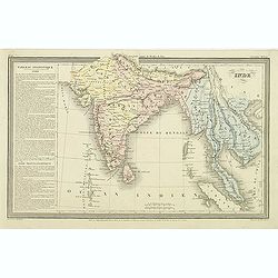
Inde.
Finely engraved map of India, Thailand, Malaysia, including Singapore prepared by A.H.Dufour and engraved by Giraldon-Bovinet. Published by Jules Renouard in his uncommon...
Date: Paris, Jules Renouard, ca.1840
Selling price: ????
Please login to see price!
Sold in 2015
Chine et Japon.
Finely engraved map of China, Korea, Formosa and Tibet, prepared by A.H.Dufour and engraved by Giraldon-Bovinet. Published by Jules Renouard in his uncommon atlas "L...
Date: Paris, Jules Renouard, ca.1840
Selling price: ????
Please login to see price!
Sold in 2015
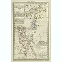
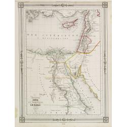
Egypte ancienne et Palestine.
Finely engraved map of Egypt and Palestine with Cyprus, prepared by A.H.Dufour and engraved by Giraldon-Bovinet. Published by Jules Renouard in his uncommon atlas "L...
Date: Paris, Jules Renouard, ca.1840
Selling price: ????
Please login to see price!
Sold in 2013
(Manuscript) Plan du port de Bombay.
French manuscript map of Bombay harbor complete with anchorage point at Bombay. The map is likely based on Jean B.N.D. D'Apres de Mannevillette: "Plan du Port de Bom...
Date: France or India, c. 1840
Selling price: ????
Please login to see price!
Sold in 2015
Plan de la Ville de Nazareth
A fine map of the city of Nazareth by P. Bellier in Paris in about 1840.Taken from his "GEOGRAPHIC ATLAS & ICONOGRAPHIC FULL COURSE OF SCRIPTURE". There is ...
Date: Paris, ca. 1840
Selling price: ????
Please login to see price!
Sold in 2016
Entrance of the Hoang-ho, or Yellow River.
Superb view of the mouth of the Yellow River or Huáng Hé in the Bohai Sea (a gulf of the Yellow Sea). With numerous very detailed boats and ships shown. Engraved by Adl...
Date: London, ca. 1840
Selling price: ????
Please login to see price!
Sold in 2016
Bridge of Chains in China.
An interesting scene with a rope bridge over waterfalls. In the front several people are seen, including one angling.With nice hand color.
Date: London, ca 1840
Selling price: ????
Please login to see price!
Sold in 2017
L'Asia . . .
A rare and detailed double-page map of Asia. According to the title cartouche, prepared by A de La Sage for l'Atlante Storico, Letterario, Biografico, Archeologico. . . ...
Date: Venice, 1840
Selling price: ????
Please login to see price!
Sold in 2017
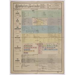
Histoire Sainte, 1840, Cours encyclopédiques - 28e Année - Méthode de Mr Colart . . .
Fine genealogic sheet for educational purpose, about Jewish history. From Adam to Cyrus. In top a map of "Palestine ou Terre Promise en 12 Tribes" 135 x 70mm.
Date: Paris, 1840
Selling price: ????
Please login to see price!
Sold in 2017
East India Isles.
Somewhat later but very finely engraved and detailed map of south-east Asia, including modern day Myanmar (Burma), Thailand, Cambodia, Vietnam, Singapore, Malaysia, Indon...
Date: 1840
Selling price: ????
Please login to see price!
Sold in 2018
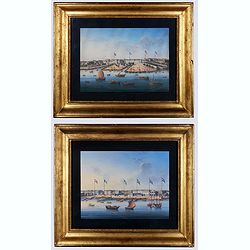
Canton. (Two gouaches).
Two so-called export paintings of the Thirteen Factories at Canton (Guangzhou). The flags of Denmark, France, the U.S., Sweden, Britain, and the Netherland are visible on...
Date: China, ca. 1840
Selling price: ????
Please login to see price!
Sold in 2020
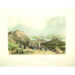
Macao from the Forts of Heang shan.
A finely engraved view of the city of Macao, as seen from the Heang-shan forts. In the foreground is a group that is gathered for a worship or blessing of some kind. Two ...
Date: London and/or Paris, ca. 1841
Selling price: ????
Please login to see price!
Sold
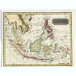
East India Islands.
Uncommon map of Indonesia, including North coast of Australia and nice detail on Philippines, published by Thomas Kelly, 17 Paternoster Row, London.Engraved by Alexander ...
Date: London, 1841
Selling price: ????
Please login to see price!
Sold in 2017
East India Islands.
Uncommon map of Indonesia, with nice detail on Philippines, published by Thomas Kelly, 17 Paternoster Row, London.The map appeared in 'Kelly's New System of Universal Geo...
Date: London, 1841
Selling price: ????
Please login to see price!
Sold in 2018
Carte encyprotype de l'Asie dédiée & présentée au Roi par H. Brué, Géographe de S.M. Nouvelle édition.
A very detailed, wall map size, map of Asia. Published in Paris by Ch. Picquet, Géographe du Roi et de M.gr le duc d'Orléans, propriétaire des cartes et atlas de Brué...
Date: Paris, Ch. Picquet, 1841
Selling price: ????
Please login to see price!
Sold in 2020
China WOOSUNG RIVER surveyed by Capt. H.Kellett C.B. & R.Collinson C.B.
Important Anglo-Chinese War ("Opium war") of 1838 - 1842 map.Detailed drawing of the Woosung river, as fair south as Shanghai. Prepared by the British commander...
Date: China 1842
Selling price: ????
Please login to see price!
Sold
Algemeene Kaart van Nederlandsch Oostindie, met hoogstdezelfs toestemming opgedragen aan Zijne Majesteit den Koning der Nederlanden. . .
First and only edition. 8 Engraved maps and 1 general engraved map in contemp. outline colors, each sheet cut into 6 and laid on canvas. Preserved in cloth box. Each map ...
Date: s-Gravenhage / Jakarta, 1842
Selling price: ????
Please login to see price!
Sold in 2008
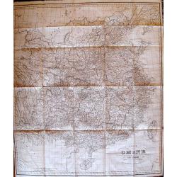
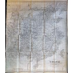
Carte de la Chine.
Rare, incredibly detailed map of China prepared by the renowned German historian, linguist, orientalist, and explorer Julius Klaproth. Originally intended to accompany Kl...
Date: Paris, 1842
Selling price: ????
Please login to see price!
Sold
A map to illustrate the war in China...
Scarce map of China during the Opium Wars, extending from Peking to Kanton (Guangzhou), Macau, and Hong Kong . North oriented to the right. Very detailed map including s...
Date: London, 1842
Selling price: ????
Please login to see price!
Sold in 2013
Palestine according to its ancient divisions.
Unusual Adam and Charles Black map of Ancient Palestine, Israel or the Holy Land. It covers the region as it existed in Biblical times with divisions for each of the Twel...
Date: Edinburgh, 1842
Selling price: ????
Please login to see price!
Sold in 2015
Mosquee de Ternate.
A handsome lithograph of the mosque on the eastern Indonesian Island of Ternate. Plate 107 taken from the 'Voyage au Pole et dans L'Oceanie…'br >Departing in late 18...
Date: Paris, 1842
Selling price: ????
Please login to see price!
Sold in 2016
Mouillage dans la Baie de Rajah Bassa.
A tranquil lithograph of the anchorage in the Bay of Rajah Bassa on the Indonesian island of Sumatra. Plate 151 taken from the 'Voyage au Pole et dans L'Oceanie…' Depar...
Date: Paris, 1842
Selling price: ????
Please login to see price!
Sold in 2016
Carte de la Chine.
Rare, incredibly detailed map of China prepared by the renowned German historian, linguist, orientalist, and explorer Julius Klaproth. Originally intended to accompany Kl...
Date: Paris, 1842
Selling price: ????
Please login to see price!
Sold in 2017
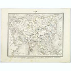
Asie.
This is a detailed map of Asia by French cartographer and engraver, Ambroise Tardieu. It covers from the Arabian Peninsula and Turkey in the west, eastward as far as Kamc...
Date: Paris, ca 1842
Selling price: ????
Please login to see price!
Sold in 2019
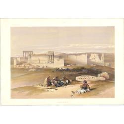
Ruins of Baalbec. May 5th, 1839.
Roberts was the first independent, professional British artist to travel so extensively in the Near East. His tour in 1838-9 produced 272 sketches, a panorama of Cairo an...
Date: London: F.G. Moon. 1842
Selling price: ????
Please login to see price!
Sold in 2023
Baalbec [The Sanctuary, 4th-5th May, 1839].
Baalbek is a town in the Beqaa Valley of Lebanon situated east of the Litani River. After Alexander the Great conquered the Near East in 334 BC, the existing settlement w...
Date: London: F.G. Moon. 1842
Selling price: ????
Please login to see price!
Sold in 2023
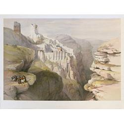
Convent of St. Saba April 4th 1839. / Engedi.
Dramatic view overlooking the Greek Orthodox Convent or Monastery of St. Saba near Bethlehem. Roberts was the first independent, professional British artist to travel ...
Date: London: F.G. Moon. 1842-9 1842
Selling price: ????
Please login to see price!
Sold in 2023
Kaart van Nederlands Oostindische bezittingen.
Detailed lithographed map of Indonesia published by ''Maatschappij tot nut van 't algemeen''. Lithographed and published by Daniel Veelwaard.
Date: Amsterdam 1843
Selling price: ????
Please login to see price!
Sold
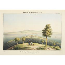
Presqu'ile de Malacca.. - Vue de George Town, prise de la Moutagne des siguaux. Ile du Prince de Galles (Pulo-Pinang).
Lithography representing a view of George Town on Pinang island. Plate N° 10.From Souvenirs d'un voyage dans l'Inde, exécuté de 1834 à 1839, by A. Delessert.Adolphe D...
Date: Paris, 1843
Selling price: ????
Please login to see price!
Sold in 2008
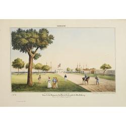
Pondichery - Vue de la Maison du Port et de la rade de Pondichery. . .
Lithography representing a view of Pondicherry. Plate 9. From Souvenirs d'un voyage dans l'Inde, execute de 1834 à 1839, after a design by A. Delessert. Adolphe Delesser...
Date: Paris, 1843
Selling price: ????
Please login to see price!
Sold
Madras. - Scottch - Church.
Lithography representing a view of a Scottish church in Madras. Plate N 13. From Souvenirs d'un voyage dans l'Inde, execute de 1834 a 1839, by A. Delessert.Adolphe Deless...
Date: Paris, 1843
Selling price: ????
Please login to see price!
Sold
Map of the Burman Empire including also Siam, Cochin-China,Ton-King and Malaya from Calcutta to Hong Kong.
Superb map showing South East Asia, from Calcutta to Hong Kong. Includes many regions and place names such as the Burman Empire, Siam (Thailand), Cochin China and Tonking...
Date: London, c1843
Selling price: ????
Please login to see price!
Sold in 2012
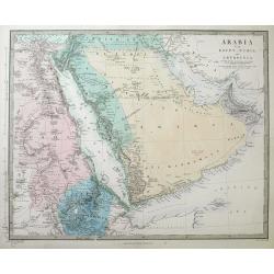
Arabia with Egypt, Nubia and Abyssinia...
A detailed steel-engraved map of the area from Egypt and Nile - West to the Persian Gulf and Gulf of Oman in the East.Several towns, cities, rivers, tribes, routes, and d...
Date: London, 1843
Selling price: ????
Please login to see price!
Sold in 2016
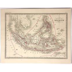
Carte de la Malaisie.
Fine lithographed map of South East Asia by A Vuillemin. Includes Malaysia, the Philippines, Indonesia, Singapore and Java. It is from the atlas "GEOGRAPHIE MODERNE&...
Date: Paris , 1843
Selling price: ????
Please login to see price!
Sold in 2017
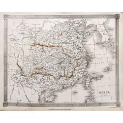
China.
A highly detailed map of China, extending from Tibet until South Korea. Names many towns, areas, rivers, islands,... Includes a tip of Japan and the Philippines.
Date: London, ca. 1843
Selling price: ????
Please login to see price!
Sold in 2017
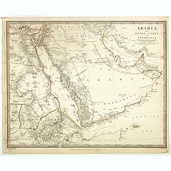
Arabia with Egypt, Nubia and Abyssinia . . .
Engraved map of Arabia peninsula. Detailed map of the area from Egypt and Nile West to the Persian Gulf and Gulf of Oman in the East and the Somali Coast in the south. Se...
Date: London, ca. 1843
Selling price: ????
Please login to see price!
Sold
Jerusalem from the road leading to Bethany.
A fine example from David Roberts' monumental works on the Middle East: The Holy Land and Egypt & Nubia, considered the greatest lithographically illustrated works is...
Date: London 1841-1844
Selling price: ????
Please login to see price!
Sold
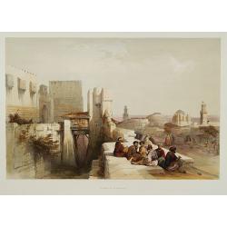
Citadel of Jerusalem.
A fine example from the deluxe issue of David Roberts' monumental works on the Middle East: The Holy Land and Egypt & Nubia, considered the greatest lithographically ...
Date: London, 1841-1844
Selling price: ????
Please login to see price!
Sold
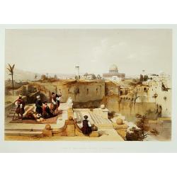
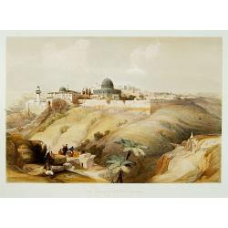
Mosque of Omar showing the site of the Temple.
A fine example of David Roberts' monumental works on the Middle East: The Holy Land and Egypt & Nubia, considered the greatest lithographically illustrated works issu...
Date: London 1841-1844
Selling price: ????
Please login to see price!
Sold
The Church of the Purification.
A fine example from David Roberts' monumental works on the Middle East: The Holy Land and Egypt & Nubia, considered the greatest lithographically illustrated works is...
Date: London 1841-1844
Selling price: ????
Please login to see price!
Sold
Jerusalem from the mount of Olives.
A fine example from David Roberts' monumental works on the Middle East: The Holy Land and Egypt & Nubia, considered the greatest lithographically illustrated works is...
Date: London 1841-1844
Selling price: ????
Please login to see price!
Sold
A Chart Of The Indian Ocean Drawn From The Best Authorities.
This detailed sea chart by John William Norie features the Western Indian Ocean and east coast of Africa, from Cape Delgado in the south to Persian Gulf in the north. T...
Date: London, 1844
Selling price: ????
Please login to see price!
Sold in 2015
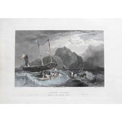
Tiger Island. Entrance of the Canton River.
A superb view of the mouth of the Pearl River, near Guangzhou and Hong Kong. With three very detailed boats and ships shown.Engraved by Goodall, drawn by Standfield, sket...
Date: London, 1844
Selling price: ????
Please login to see price!
Sold in 2017
S.E. Peninsula and Malaysia.
Very detailed map of South-east Asia with Philippines, Malaysia, Formosa (Taiwan) by A.K. Johnston's.Inset maps of "Island and Strait of Singapore. Properly Singhapu...
Date: London, Edward Stanford, ca. 1844
Selling price: ????
Please login to see price!
Sold in 2020
HONG KONG surveyed by Captn. Sir Edward Belcher, in H.M.S. Sulphur 1841. Corrected to 1845.
Nautical chart of Hong Kong. Engraved by J. & C. Walker, it is based on the observations of Sir Edward Belcher, a British naval officer and explorer.Belcher entered t...
Date: London 1841 - 1845
Selling price: ????
Please login to see price!
Sold
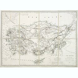
Asie mineure ou Natolie selon l'état actuel des connaissances. . .
Map of Turkey, including Cyprus prepared by Louis Vivien de Saint-Martin (1802-1897), who was French geographer born in Saint-Martin-de-Fontenay and died in Paris. He wro...
Date: Paris, 1845
Selling price: ????
Please login to see price!
Sold in 2021
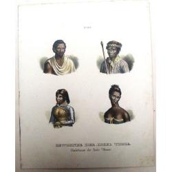
Bewohner der Insel Timor, Habitans de L'Isle Timor.
Four hand colored pictures on one print of inhabitants of the Island of Timor. From "NATIVE PEOPLE OF THE WORLD" by Heinrich Rudolf Schinz in Zurich, Switzerlan...
Date: Zürich, 1845
Selling price: ????
Please login to see price!
Sold in 2017
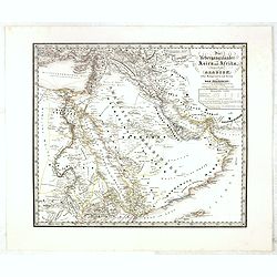
Die übergangsländer von Asien und Afrika begreifend : Arabien nebst Mesopotamien und Syrien und das Nilgebiet. . .
This extremely rare separately-issued map of the Middle East was made as a private commission by a group of Münich grandees led by Gotthilf Heinrich von Schubert (1780 -...
Date: Munich, 1845
Selling price: ????
Please login to see price!
Sold
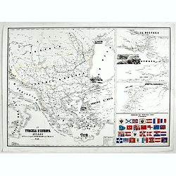
La Turchia d'Europa Milano dall'Editore Lithografo Antonio Vallardi. . .
Three maps on one sheet: to the left map of present Greece, with European part of Turkey, Marmara Sea and the west coast of Turkey. In the Black Sea a small panoramic vie...
Date: Milan, ca. 1845
Selling price: ????
Please login to see price!
Sold in 2017
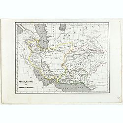
Perse, Kaboul et Beloutchistan.
Detailed map of Persia, Kabul and Baluchistan, prepared by Charles V. Monin (fl.1830-1880) a French cartographer of Caen and Paris. Published in Atlas Universel de Géogr...
Date: Paris, 1845
Selling price: ????
Please login to see price!
Sold in 2024
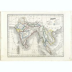
Indes.
Detailed map of India, Malaysia, Cambodia, Tibet and Thailand, prepared by Charles V. Monin (fl.1830-1880) a French cartographer of Caen and Paris. Published in Atlas Uni...
Date: Paris, 1845
Selling price: ????
Please login to see price!
Sold in 2024
Eastern Islands Birmah &c.
A detailed early-Victorian map of south east Asia, from 'Black's General Atlas.' The map covers parts of modern day Burma (Myanmar) Thailand, Malaysia, Cambodia, Vietnam,...
Date: London, 1845
Selling price: ????
Please login to see price!
Sold in 2020
Égypte Palestine et Phénicie.
Detailed map of Egypt, Cyprus and the Holy Land, prepared by Auguste Henri Dufour (1798-1865). Published by Basset, rue de Seine 33, Paris. The engraver of the map was Ch...
Date: Paris 1846
Selling price: ????
Please login to see price!
Sold
Empire d'Alexandre.
Decorative map showing the empire of Alexander the Great. Prepared by A.H.Dufour, published by Basset, rue de Seine 33, Paris. The engraver of the map was Ch.Smith. Inclu...
Date: Paris 1846
Selling price: ????
Please login to see price!
Sold in 2010
Carte des Détroits Singapore, Durain..
Large scale map of Singapore, the Sunda Islands with Linga and part of the east coast of Sumatra. Prepared after maps by d'Horsburgh and other Dutch charts (M.M.Dittlof T...
Date: Paris 1846
Selling price: ????
Please login to see price!
Sold
Asie Ottomane ou Turquie d'Asie..
Decorative map of Turkey and Cyprus, prepared by J.G.Barbié du Bocage.Engraved by Ch.Smith, published by Basset who was established in Paris, rue de Seine 33. From atlas...
Date: Paris, 1846
Selling price: ????
Please login to see price!
Sold in 2009
Royaumes de Perse Heart & Kaboul..
Decorative map of Persia, prepared by J.G.Barbié du Bocage.Engraved by Ch.Smith, published by Basset who was established in Paris, rue de Seine 33. From atlas Illustré ...
Date: Paris, 1846
Selling price: ????
Please login to see price!
Sold in 2009
Asie..
Decorative map of Asia, prepared by J.G.Barbié du Bocage.Engraved by Ch.Smith, published by Basset who was established in Paris, rue de Seine 33. From atlas Illustré de...
Date: Paris, 1846
Selling price: ????
Please login to see price!
Sold in 2009
Carte du détroit de la Sonde. . .
Fantastic large-scale sea-chart of the Sunda Strait with parts of Sumatra and Java. Includes Batavia (Jakarta), Telukbetung, and many small islands in great detail (Tabua...
Date: Paris, 1846
Selling price: ????
Please login to see price!
Sold in 2014
KAISEI NIHON YOCHI ROTEI ZENZU. [A Revised Route Map of Japan showing the fiefs and distances]
A multi-sheet woodcut map, showing Japan orientated north west to south east, compass roses, with various text blocks giving information on roads, crops of each Daimyo, t...
Date: Edo, Chojiya Heibei et al.1846
Selling price: ????
Please login to see price!
Sold in 2014
Idolatrie du veau d'or des Israelites dans le desert. Exod. XXXII.1.8.
Print showing the Adoration of the golden calf by the Israelites in the desert. From "Atlas géographique et iconographique du Cours complet d'Écriture sainte... gr...
Date: Paris, M. L. Migne, 1844-1846
Selling price: ????
Please login to see price!
Sold in 2016
Estrade, ou Tribune d'Airin de Salomon, suivant les dimensions données 2.Paralip. chap6. v13
Print showing a platform with the Throne Airin Solomon. From "Atlas géographique et iconographique du Cours complet d'Écriture sainte... gravé... sous la directio...
Date: Paris, M. L. Migne, 1844-1846
Selling price: ????
Please login to see price!
Sold in 2015
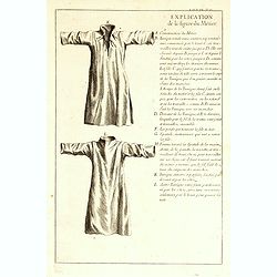
Explication de la figure du métier.
Explanation how to sew garments. From "Atlas géographique et iconographique du Cours complet d'Écriture sainte... gravé... sous la direction de Théophile Blancha...
Date: Paris, M. L. Migne, 1844-1846
Selling price: ????
Please login to see price!
Sold in 2016
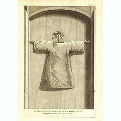
Représenation exacte de la robe de N.S gardée précieusement dans l'églisede Tréves.
Print showing the Holy Tunic venerated in the Cathedral of Trier, worn by Jesus Christ at Calvary. From "Atlas géographique et iconographique du Cours complet d'Éc...
Date: Paris, M. L. Migne, 1844-1846
Selling price: ????
Please login to see price!
Sold in 2017
Tombeau de Zacharie.
Print showing the Tomb of Zechariah. The monument is a monolith - it is completely carved out of the solid rock and does not contain a burial chamber. The lowest part of ...
Date: Paris, M. L. Migne, 1844-1846
Selling price: ????
Please login to see price!
Sold in 2016
Un des dix bassins d'Airain du temps de Salomon qui servaient à laver les victimes, les vases.
Print showing one of the ten wheeled movable basin used in the courtyard of the temple of Solomon. From "Atlas géographique et iconographique du Cours complet d'Éc...
Date: Paris, M. L. Migne, 1844-1846
Selling price: ????
Please login to see price!
Sold in 2014
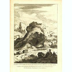
Caverne d'engaddi, où David se cacha, étant poursuivi par Saul.
Print showing the cave of Engedi, where David hide himself when being pursued by Saul. From "Atlas géographique et iconographique du Cours complet d'Écriture saint...
Date: Paris, M. L. Migne, 1844-1846
Selling price: ????
Please login to see price!
Sold in 2015
Plan souterrain des tombeaux des rois d'Israël.
Print showing the underground plan of tombs of the Kings of Israel. From "Atlas géographique et iconographique du Cours complet d'Écriture sainte... gravé... sous...
Date: Paris, M. L. Migne, 1844-1846
Selling price: ????
Please login to see price!
Sold in 2016
Veuë, et élévation du tombeau des rois d'Israël.
Print showing the Tomb of the Kings of Israel. From "Atlas géographique et iconographique du Cours complet d'Écriture sainte... gravé... sous la direction de Thé...
Date: Paris, M. L. Migne, 1844-1846
Selling price: ????
Please login to see price!
Sold in 2016
Arbre généalogique des descendants d'Adam et d'Eve, jusqu'au déluge.
Print showing the genealogy tree of the descendants of Adam and Eve. From "Atlas géographique et iconographique du Cours complet d'Écriture sainte... gravé... sou...
Date: Paris, M. L. Migne, 1844-1846
Selling price: ????
Please login to see price!
Sold in 2016
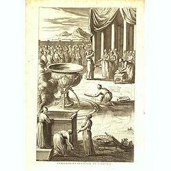
Cérémonies des eaux de Jalousie.
Print showing a water ceremony. From "Atlas géographique et iconographique du Cours complet d'Écriture sainte... gravé... sous la direction de Théophile Blanchar...
Date: Paris, M. L. Migne, 1844-1846
Selling price: ????
Please login to see price!
Sold in 2016
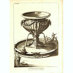
Lavoir, ou bassin d'Airin qui étoit dans le parvis du Tabernacle.
Print showing a basin. From "Atlas géographique et iconographique du Cours complet d'Écriture sainte... gravé... sous la direction de Théophile Blanchard et Barr...
Date: Paris, M. L. Migne, 1844-1846
Selling price: ????
Please login to see price!
Sold in 2016
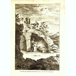
Veuë de la caverne de Betheléem où le sauveur nâquit.
Print showing the view of the cave of Bethelem where Jesus was born . From "Atlas géographique et iconographique du Cours complet d'Écriture sainte... gravé... so...
Date: Paris, M. L. Migne, 1844-1846
Selling price: ????
Please login to see price!
Sold in 2020
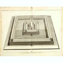
Veuë, et évélation du temple de Salomon.
Print showing a bird's-eye view of Solomon's Temple. From "Atlas géographique et iconographique du Cours complet d'Écriture sainte... gravé... sous la direction d...
Date: Paris, M. L. Migne, 1844-1846
Selling price: ????
Please login to see price!
Sold in 2015
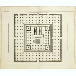
Plan du temple rebati par herodes le grand.
Print showing the plan of the temple rebuilt by the great Herodes. From "Atlas géographique et iconographique du Cours complet d'Écriture sainte... gravé... sous ...
Date: Paris, M. L. Migne, 1844-1846
Selling price: ????
Please login to see price!
Sold in 2015
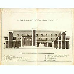
Coupe, et profil du temple de Jérusalem par Hérodes le grand.
Print showing the profile and the Temple of Jerusalem by Herod the Great. From "Atlas géographique et iconographique du Cours complet d'Écriture sainte... gravé.....
Date: Paris, M. L. Migne, 1844-1846
Selling price: ????
Please login to see price!
Sold in 2015











![Baalbec [The Sanctuary, 4th-5th May, 1839].](/uploads/cache/1126552-250x250.jpg)













![KAISEI NIHON YOCHI ROTEI ZENZU. [A Revised Route Map of Japan showing the fiefs and distances]](/uploads/cache/93941-250x250.jpg)


