Browse Listings in Asia
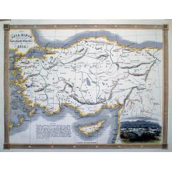
Asia-Minor Shewing the Seven Apocalyptic Churches of Asia.
Interesting map of Turkey and Cyprus, with ancient place names. Locates the Seven Churches and other places mentioned in the New Testament.With a vignette view of Tarsus.
Date: London, c1830
Selling price: ????
Please login to see price!
Sold in 2012
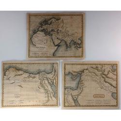
The World as Known to the Ancients, Egypt with Libya & The East (3 Maps)
Three fine Holy Land maps by Sidney Hall. Sidney Hall (1788–1831) was a British engraver and cartographer well known and popular for his early nineteenth century atlase...
Date: London, ca. 1830
Selling price: ????
Please login to see price!
Sold in 2018
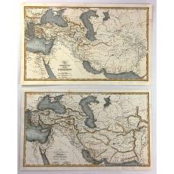
(2 Maps) - The Expedition of Alexander & Map To Illustrate the History of the Assyrians, Babylonians, Medes and Persians
Two interesting historical maps of North Africa and the Middle East at different times in history. “The Expedition of Alexander” covers the time from 334BC through t...
Date: London, c1830
Selling price: ????
Please login to see price!
Sold in 2016
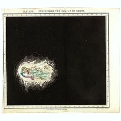
B.C. 529. Exhibiting the Empire of Cyprus.
Plate from An historical atlas: in a series of maps of the world as known at different periods constructed upon an uniform scale and colored according to the political ch...
Date: London, 1830
Selling price: ????
Please login to see price!
Sold in 2024
JAPAN, ca 1830.
Woodcut, colored map of Japan, with Japanese text.
Date: c 1830
Selling price: ????
Please login to see price!
Sold in 2019
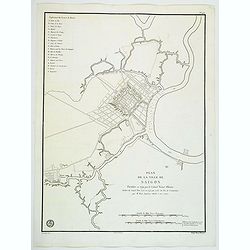
Plan de la Ville de Saigon. . .
An impressive large plan of the Vietnamese city of Saigon, produced and published by the Depot General de la Marine in Paris. Plan of the City of Saigon, fortified in 179...
Date: Paris, ca 1830
Selling price: ????
Please login to see price!
Sold in 2020
[Manuscript map without title] Map of the east Indian coast with Sri Lanka showing The Cousins Voyage 1831.
Manuscript map of the Indian coast with Ceylon (Sri Lanka) with the track of the vessel "Le Cousin" from Calcutta to Pondicherry and the retour voyage from Madr...
Date: Perhaps India, ca. 1831
Selling price: ????
Please login to see price!
Sold in 2014
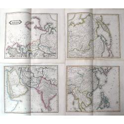
Asia
Lizar's fantastic 4-sheet map of Asia. From Turkey until the Philippines. Shows caravan routes through the Arabian desert, tremendous detail in Siberia, and small islands...
Date: Edinburgh, ca. 1831
Selling price: ????
Please login to see price!
Sold in 2019
[Set of 9 maps of India]
A set of 9 steel engraved maps of India published under the superintendence of the Society for the Diffusion of Useful Knowledge (SDUK), most sheets are early editions da...
Date: London, ca. 1831
Selling price: ????
Please login to see price!
Sold in 2023
Asia.
A distinctive woodblock engraved map of Asia where the printing is reversed - white on black. The map was published in London in 1832 in William Pinnock's "The Guide...
Date: London, 1832
Selling price: ????
Please login to see price!
Sold in 2012
Birman Empire with Anam, Siam & Cochin China.
Charming map of Thailand, Cambodia, Malaysian peninsular with Singapore named. Very detailed with a numbered key (1-10) to States and Territories. Published for the propr...
Date: London 1832
Selling price: ????
Please login to see price!
Sold in 2016
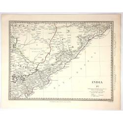
India IV.
Original map engraved by J&C Walker in London and Published by Chapman & Hall in 1832. Published under the Superintendence of the Society for the Diffusion of Use...
Date: London, 1832
Selling price: ????
Please login to see price!
Sold in 2018
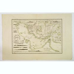
Reduzirte Karte von Persischen Golf.
A superb marine chart of the Persian Gulf. It shows the top of the Gulf from Basra all the way down to Muscat, depicting Kuwait, Bahrain, Qatar, Dubai, Shiraz and Bandar ...
Date: [Gotha], ca 1832
Selling price: ????
Please login to see price!
Sold in 2019
Das Himálaja Gebirg in Bissahir, Gherwal..
Very detailed map of Himalaya, plateaus of Tibet and the lowlands of Hindostan, prepared by J.L.Grim and Carl Ritter. In upper high land corner key to travels by Raper 18...
Date: Berlin 1833
Selling price: ????
Please login to see price!
Sold
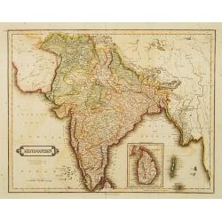
Hindostan.
Uncommon detailed steel engraved map of India, with inset map of Shri Lanka. Published in Edinburgh by D. Lizars.
Date: Edinburgh, 1833
Selling price: ????
Please login to see price!
Sold in 2012
Carte de la Palestine ou Terre Sainte..
Detailed map of Holy Land. Prepared by Alexandre Emile Lapie, a Colonel de l'Etat Major and first geographer to the King. From his Atlas Universal (1829-37). In lower par...
Date: Paris, 1833
Selling price: ????
Please login to see price!
Sold in 2008
EAST INDIA ISLANDS.
A detailed miniature map.
Date: London, 1833
Selling price: ????
Please login to see price!
Sold in 2016
Asia.
Map of Asia. The map has great detail with many rivers named, from the Ob, the Yenisei and the Lena in the north to the Ganges or the Irrawaddy in the south and the Yangt...
Date: London, 1832-1834
Selling price: ????
Please login to see price!
Sold in 2017
The Bernar Pagoda. Benares.
A fine and detailed view with decorative coloring. Varanasi, also known as Benares, Banaras or Kashi, is a city on the banks of the Ganges in the Uttar Pradesh state of N...
Date: London, 1834
Selling price: ????
Please login to see price!
Sold in 2017
Shuwallah Gaut, Benares.
A fine and detailed view of Shivala Ghat at Benares (Varanasi), a city on the banks of the Ganges in the Uttar Pradesh state of North India. Drawn by William Daniell, and...
Date: London, ca. 1834
Selling price: ????
Please login to see price!
Sold in 2017
Vorder-Indien oder dasIndo-Britische Reich.
This is a nice example of Stieler's 1834 map of the Indian subcontinent. It covers from the Tibet and the Himalayas in the north as far south as Ceylon (Sri Lanka), and f...
Date: Gotha, 1834
Selling price: ????
Please login to see price!
Sold in 2020
Tombeau d'une Bramine brulée sur le bucher de son mari.
Depiction of an Indian temple after Barthelemy Lauvergne (1805-1875) and engraved in aquatint technique by Sigismond Himely (1801-1872). Published as plate 13 in Voyage a...
Date: Paris, Finot, 1835
Selling price: ????
Please login to see price!
Sold in 2014
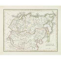
Siberia & central Asia.
This map covers the eastern section of Russia as well as China, Japan, Korea, India and Tibet. The map is of interest for the use of East Sea, the sea between Korea and J...
Date: Boston, 1835
Selling price: ????
Please login to see price!
Sold in 2010
[Lot with two maps] Map of the Three Kingdoms / Map of the Great Ming Dynasty.
Two beautifully colored Japanese woodblock maps of China, one of China during the Three Kingdoms period and a second of Ming China, 1368-1644.
Date: Japan, ca.1835
Selling price: ????
Please login to see price!
Sold in 2012
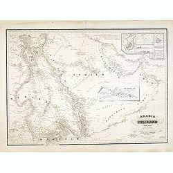
Arabia und das Nil-Land den manen Karsten Niebuhr's hochverdienten forschern. . .
Rare map of the Arabian Peninsula and the east coast of Africa with the River Nile. Inset plans include Jeddah, Mecca and Medina, and a trompe-l'oeil of the caravan route...
Date: Gotha, Justus Perthes, 1835
Selling price: ????
Please login to see price!
Sold in 2013
Carte d'une partie de la Côte de Cochinchine (deuxième feuille)...
A scarce large-scale sea-chart of a portion of the Vietnamese coast, with the tracks of the Corvette Favorite in January and February 1831. With an exact representation o...
Date: Paris, 1833-1835
Selling price: ????
Please login to see price!
Sold in 2016
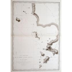
Carte Particulière De La Partie S. O. Des Natunas Et Du Canal Laplace: Découvert en Mars 1831,...
A fantastic sea-chart of a part of the Natuna Islands archipelago, which is part of the Indonesian Riau Islands Province, located in the South China Sea between Malaysia ...
Date: Paris, 1833-1835
Selling price: ????
Please login to see price!
Sold in 2016
Plan de la Baie de Tourane...
An extremely detailed sea-chart of the Bay and area of Đà Nẵng or Danang in Vietnam.With numerous depth soundings, and the anchoring place of the ship...
Date: Paris, 1833-1835
Selling price: ????
Please login to see price!
Sold in 2016
Croquis du Mouillage du Cap Boung-Quioua (Côte du Tonkin)...
A hardly obtainable sea-chart of an are in the 'Gulf of Tonkin' in northern Vietnam. It shows a bay with a village, and three smaller islands, including numerous depth so...
Date: Paris, 1833-1835
Selling price: ????
Please login to see price!
Sold in 2016
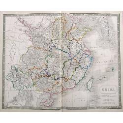
China.
A very detailed map of China and Korea, filled with place names. Includes Hainan and Taiwan, and a small inset map of Macao.
Date: London, ca. 1835
Selling price: ????
Please login to see price!
Sold in 2018
East India Islands.
An excellent map of Southeast Asia, from south Myanmar (Pegu) to a small part of northern Australia. Includes Singapore, Borneo, the Philippines, Indonesia, and a part of...
Date: London, ca. 1835
Selling price: ????
Please login to see price!
Sold in 2017
Ostindien [and] Carte de L'Inde. [2 maps]
First map is 'Ostindien' by Radefeld, from Meyer's Atlas, countries and regional boundaries shown in differing colors, with plenty of map detail, relief shown in hachures...
Date: Hildeburghausen, Paris ca. 1835
Selling price: ????
Please login to see price!
Sold in 2017
Carte de la Malaisie ou Grand archipel d'Asie.
Nice map of Indonesia, Philippines, Malacca with Singapore and tip of Northern Australia. Engraved by Thierry. Countries and regions in delicate out line color. Includes ...
Date: Paris, 1835
Selling price: ????
Please login to see price!
Sold in 2018
East India Islands.
A detailed miniature map with a full-page table of place names and geographical coordinates. Shows the area from Yangon to New Guinea, including Hainan, Singapore, the Ph...
Date: London, ca. 1835
Selling price: ????
Please login to see price!
Sold in 2018
Map of India..
Very detailed map of India. In the Indian Ocean and the Bay of Bengalen numerous information: Native states not under British protection, Native states under British prot...
Date: London 1836
Selling price: ????
Please login to see price!
Sold
Eastern Islands or Malay Archipelago
Detailed map of Indonesia by the SDUK. The SDUK was known to produce some of the most up-to-date and accurate maps in the early 19th century. The map includes many placen...
Date: London 1836
Selling price: ????
Please login to see price!
Sold
Carte de L'Asie.
An interesting hand-colored, lithograph map of Asia from the Brussels edition of Malte-Brun's "Atlas Complet". The lithographer was Thomas LeJeune. The printing...
Date: Brusselles, 1836
Selling price: ????
Please login to see price!
Sold in 2015
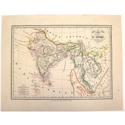
Carte de L'Inde.
An interesting lithographed map of India and Indo China from the Brussels edition of Malte-Brun's "Atlas Complet". The different provinces are nicely differenti...
Date: Brusselles, 1836
Selling price: ????
Please login to see price!
Sold in 2015
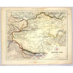
CENTRAL ASIA (MIDDLE DIVISION)
Striking lithographed map of Central Asia published for the Proprietors by H.C. Collins. Engraved by J. Archer. Features the Chinese Empire, Mongolia & Tibet.
Date: London, 1836
Selling price: ????
Please login to see price!
Sold in 2014
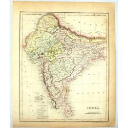
India.
colorful map of India engraved by J. Dower in 1836. Published by Orr & company in London.
Date: London, 1836
Selling price: ????
Please login to see price!
Sold in 2014
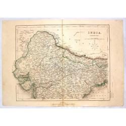
India (Northern Part).
Detailed colored map of Northern India by J. Archer. Published in London by H.G. Collins in 1836.
Date: London, 1836
Selling price: ????
Please login to see price!
Sold in 2014
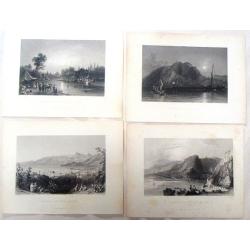
Four Bartlett steel engravings of the Middle East.
Four fine steel engraving prints by William Barlett. Included are: - A TURKISH DEVAN - DEMASCUS - HOUSE OF GIRIUS ADEEB, AT ANTIOCH - THE PASS OF BEILAN -- MOUNT ANANUS...
Date: London, 1836
Selling price: ????
Please login to see price!
Sold in 2016
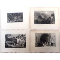
(Four fine Bartlett steel engravings with Middle East Prints.)
Four fine steel engraving prints by William Bartlett. Included are: - THE MOUTH OF THE NAHR-EL-KELB - BEIROUT AND MOUNT LEBANON - MOUNT CASIUS FROM THE SEA - THE RIVE...
Date: London, 1836
Selling price: ????
Please login to see price!
Sold in 2017
Eastern Islands or Malay Archipelago.
This map provides good detail throughout the East Indies, Malaysia, Thailand, Laos, Cambodia, and the Philippines. Names Ache in northern Sumatra. There is little to no d...
Date: London 1836
Selling price: ????
Please login to see price!
Sold in 2015
NINGTHEE RIVER, FROM MULPHOO TO SUNAYACHIL.
Finely executed pen drawing in brown ink with river in blue color of The Eastern Frontier Of India. Scale is in English miles. Underneath the title an explanation.From th...
Date: ca, 1836
Selling price: ????
Please login to see price!
Sold in 2017
Central Asia comprising Bokhara, Cabool, Persia, The river Indus, & countries eastward of it.
An important detailed map of Central Asia shows the routes of Lieut. Alexander Burnes. It also shows both the western and eastern coasts of the Persian Gulf in much detai...
Date: London, 1834-1836
Selling price: ????
Please login to see price!
Sold
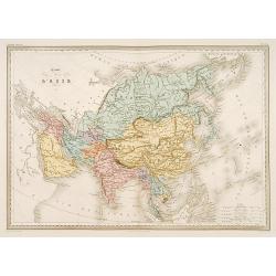
Carte de L'Asie.
Detailed map of Asia.From Malte-Brun's Atlas Géographie Universelle.."., revised by Jean Jacques Nicolas Huot.This very fine executed map has been printed...
Date: Paris 1837
Selling price: ????
Please login to see price!
Sold
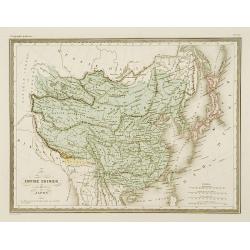
Empire Chinois et Japon.
Detailed map of China, Korea, Taiwan and Japan.From Malte-Brun's Atlas Géographie Universelle.., revised by Jean Jacques Nicolas Huot.This very fine executed map has bee...
Date: Paris 1837
Selling price: ????
Please login to see price!
Sold
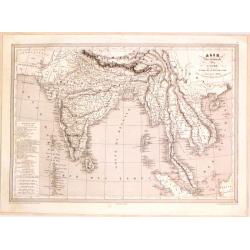
Hindoustan et Indo-Chine.
Detailed map of India, Pakistan, Thailand, Malaysia, Vietnam, etc.From Malte-Brun's Atlas Géographie Universelle..., revised by Jean Jacques Nicolas Huot.This very fine ...
Date: Paris 1837
Selling price: ????
Please login to see price!
Sold
Sibérie ou Russie d'asie.
Fine map of the Siberia and Northern part of China.From Malte-Brun's Atlas Géographie Universelle.. ., revised by Jean Jacques Nicolas Huot.This very fine executed map h...
Date: Paris 1837
Selling price: ????
Please login to see price!
Sold
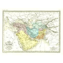
Carte de la Turquie d'asie, de la Perse. . .
Fine map of the Turkish Empire.From Malte-Brun's Atlas Géographie Universelle.., revised by Jean Jacques Nicolas Huot.This very fine executed map has been printed by Fos...
Date: Paris, 1837
Selling price: ????
Please login to see price!
Sold in 2016
Palestine .. Romains/ .. David et Salomon./ Douze tribes
3 Maps on one sheet of Holy Land during Roman times, during David and Salomon and one divided into 12 tribes.From Malte-Brun's Atlas Géographie Universelle.., revised by...
Date: Paris, 1837
Selling price: ????
Please login to see price!
Sold
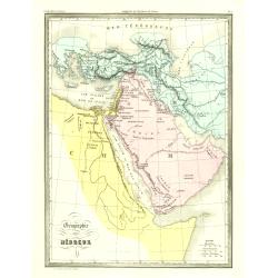
Géographie des Hébreux.
Fine map of the Arabian Peninsula, Egypt and the Near East.From Malte-Brun's Atlas Géographie Universelle.. ., revised by Jean Jacques Nicolas Huot.This very f...
Date: Paris, 1837
Selling price: ????
Please login to see price!
Sold in 2009
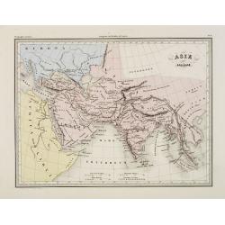
Asie ancienne.
Fine map of ancient Asia.From Malte-Brun's Atlas Géographie Universelle.., revised by Jean Jacques Nicolas Huot.This very fine executed map has been printed by...
Date: Paris, 1837
Selling price: ????
Please login to see price!
Sold in 2009
Asie mineure Ancienne.
Fine map of ancient Turkey with Cyprus.From Malte-Brun's Atlas Géographie Universelle.., revised by Jean Jacques Nicolas Huot.This very fine executed map has been printe...
Date: Paris, 1837
Selling price: ????
Please login to see price!
Sold
Carte de la Mer de Chine.. [Together with] Carte des Cotes orientales de Chine.. [Together with] Carte générale de la Mer des Indes..
A set of 3 printed charts of the China Sea added in manuscripts the tracks of the French frigate "Cleopatre" under command of Adm. Cecille in the years 1846 - 1...
Date: Paris, 1838, 1842, 1837
Selling price: ????
Please login to see price!
Sold in 2009
[untitled plan of Osaka]
Rare Japanese colored woodcut printed map of Osaka. Very large size and scale, with excellent detail. Dated from the Tenpo era which was from 1830-44!It indicates the Osa...
Date: Japan, c. 1837
Selling price: ????
Please login to see price!
Sold in 2009
Carte Generale de la Mer des Indes Dressée par M.M.P.Daussy . . . P.E.Wissocq. . .
A detailed chart including east coast of Africa, Madagascar, Arabian Peninsula, India, China, and the west coast of Australia.This chart was actually a working document a...
Date: Paris, 1837
Selling price: ????
Please login to see price!
Sold in 2018
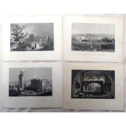
Four Bartlett steel engravings from the Middle East.
Four fine steel engraving prints by William Bartlett. Included are: - SEPULCHRE AT SELEUCIA - RUINS OF BALBEC - GENERAL VIEW OF BALBEC AND ANTI-LIBANUS - ENCAMPMENT A...
Date: London, 1837
Selling price: ????
Please login to see price!
Sold in 2016
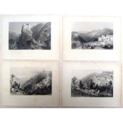
Four Middle East Bartlett steel engravings.
Four fine steel engraving prints by William Bartlett. Included are: - SELUCIA - BETHDDEIN - PLACE OF THE PRINCE OF THE DRUSES - GOTHIC CASTLE IN A VALLEY NEAR BATROU...
Date: London, 1837
Selling price: ????
Please login to see price!
Sold in 2016
Asie Meridionale Comprenant L'Inde en deca et au Dela du Gange.
Detailed map of Asia including India. Published by Aubree Armand in Paris in 1837. Engraved by I. Grenier and printed by Mangeon.
Date: Paris, 1837
Selling price: ????
Please login to see price!
Sold in 2015
Die Ostindischen Inseln nach dem neuesten Berivchtigungen dargesteltt.
Map of Indonesia with Philippines. Engraved by Heinrich Leutemann (1814 - 1850). Included in Christian Gottfried Daniel Stein (1772-1839) "Neuer Atlas der ganzen Erd...
Date: Leipzig, Hinrichs, 1837
Selling price: ????
Please login to see price!
Sold in 2016
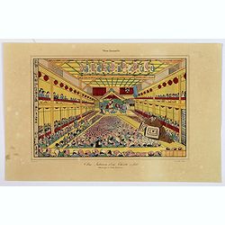
Vue Interieure d'un Theatre a Jedo.
A typical theatre scene in Tokyo, as seen during the first half of the nineteenth century. It shows a packed theatre, looking at events being reenacted on stage, and else...
Date: Paris, ca 1837
Selling price: ????
Please login to see price!
Sold in 2018
Siberia and Chinese Tartary.
Steel engraved map of Mongolia, Manchuria, Siberia, Korea, Sakhalin and part of Japan.Published by the Society for the Diffusion of Useful Knowledge, 59 Lincolns Inn Fiel...
Date: London, SDUK, 1838
Selling price: ????
Please login to see price!
Sold in 2014
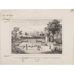
Vue d'un grand étang Indien, au moment des ablutions Carnate. (Inde)
After a drawing by Charles Bélanger. Charles Bélanger (1805-1881), French naturalist and explorer in Asia and the East Indies. Lithography taken most probably from 7 vo...
Date: Paris, ca 1834-1838
Selling price: ????
Please login to see price!
Sold in 2013
Vue de la Pagode de Shoe Dagon. Prise des environs de Rangoun (Pégou.).
View different pagodas after a drawing by Paquet and Charles Bélanger. Charles Bélanger (1805-1881), French naturalist and explorer in Asia and the East Indies. Lithogr...
Date: Paris, ca 1834-1838
Selling price: ????
Please login to see price!
Sold in 2009
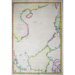
Carte de la mer de Chine...
Highly decorative and scarce large-scale seachart of the South China Sea. Extending from China to Borneo with the Philippines and surroundings countries and islands! Ext...
Date: Paris, 1838
Selling price: ????
Please login to see price!
Sold in 2011
Carte generale de L'Asia.
Detailed steel engraving of Dufour's map of Asia dated 1838. Adolphe Hippolyte Dufour (1798 - 1865), also known as Auguste-Henri Dufour, was a Paris based map and atlas...
Date: Paris, 1838
Selling price: ????
Please login to see price!
Sold in 2013
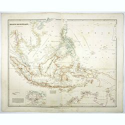
Asiatic Archipelago.
Map of the Asiatic Archipelago with very good detail on the Philippines. In the lower-left corner inset of Singapore Island. This map by the nephew of Aaron Arrowsmith fi...
Date: London, 1838
Selling price: ????
Please login to see price!
Sold in 2017
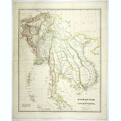
Burmah, Siam, and Cochin China.
Large-scale map of Burma, Siam and Cochin China with the current political divisions in the region. This map by the nephew of Aaron Arrowsmith first appeared in 1832 and ...
Date: London, 1838
Selling price: ????
Please login to see price!
Sold in 2018
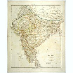
India.
Detailed map of India and Ceylon. This map by the nephew of Aaron Arrowsmith first appeared in 1832 and was reissued several times. The present issue appeared in Arrowsmi...
Date: London, 1838
Selling price: ????
Please login to see price!
Sold
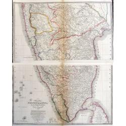
Map of the Peninsula of India, from the 19th Degree of North Latitude to Cape Comorin.
Large and detailed map of Southern India from Bomba/Mumbai and Aurangabad, until a part of of Sri Lanka/Ceylon. Original outline color indicated the British Possessions, ...
Date: London, 1838
Selling price: ????
Please login to see price!
Sold in 2017
Carte Generale de L'Asie.
A nice general map of the continent of Asia by Brue, from his Atlas Universel.Lots of map detail, a set of ten mileage scales, and a color key as to which countries belon...
Date: Paris, ca. 1838
Selling price: ????
Please login to see price!
Sold in 2017
[Manuscript] Asie - Janvier 1839.
Fine manuscript map of Asia with relief shown pictorially. The Oceans in wash color and the borders in different colors. Dated 1839 and signed by the author in the lower ...
Date: France, 1839
Selling price: ????
Please login to see price!
Sold in 2009
Asia.
Uncommon map of Asia and Australia, published in Boston for "Mitchill's School Atlas". Relief shown by hachure's.The map is of interest for the use of Gulf of C...
Date: Boston, Cummings & Hilliard, 1839
Selling price: ????
Please login to see price!
Sold in 2016
Northern Asia, from the Himalaya Mountains to the Arctic Ocean.
A lovely looking steel engraved map of Northern Asia, taking in Mongolia, Tibet, Bhutan, Tartary, Siberia and Manchuria. Part of Japan engraved also. Many place names and...
Date: London, 1839
Selling price: ????
Please login to see price!
Sold in 2018
Carte du Golfe du bengale dressée par Mr daussy, ingénieur hydrographe en chef, d'après les travaux les plus récents. . .
Large sea chart showing the Gulf of Bengal with India, Ceylon and Thailand with the Gulf of Siam to the right. The chart was engraved by E. Collin and Chassant for the D�...
Date: Paris, 1839
Selling price: ????
Please login to see price!
Sold in 2020
Macao from the Forts of Heang-shan.
A finely delineated view of the city of Macao as seen from one of its fortification areas. The foreground contains a group of religious worshipers. Engraved by S. Fisher....
Date: London, ca. 1840
Selling price: ????
Please login to see price!
Sold in 2011
L\'Asia . . .
A rare and detailed double-page map of Asia. According to the title cartouche, prepared by A de La Sage for l\'Atlante Storico, Letterario, Biografico, Archeologico. . . ...
Date: Venice, 1840
Selling price: ????
Please login to see price!
Sold in 2009
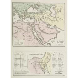
Divisione della Terra . . . / Viaggio . . .
Two rare maps on one sheet. Top map of the Arabian peninsula, Turkey, Europe and part of Africa (200 x 240mm.), and the other of the Holy Land and Egypt (113 x 230mm.)Fro...
Date: Venice, 1840
Selling price: ????
Please login to see price!
Sold in 2009

![[Manuscript map without title] Map of the east Indian coast with Sri Lanka showing The Cousins Voyage 1831.](/uploads/cache/34583-250x250.jpg)
![[Set of 9 maps of India]](/uploads/cache/20230514_144931-250x250.jpg)





![[Lot with two maps] Map of the Three Kingdoms / Map of the Great Ming Dynasty.](/uploads/cache/92041-250x250.jpg)




![Ostindien [and] Carte de L'Inde. [2 maps]](/uploads/cache/40043-250x250.jpg)








![Carte de la Mer de Chine.. [Together with] Carte des Cotes orientales de Chine.. [Together with] Carte générale de la Mer des Indes..](/uploads/cache/24291-250x250.jpg)
![[untitled plan of Osaka]](/uploads/cache/99163-250x250.jpg)






![[Manuscript] Asie - Janvier 1839.](/uploads/cache/23276-250x250.jpg)


