Browse Listings in Asia
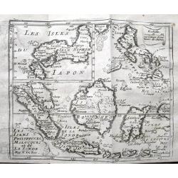
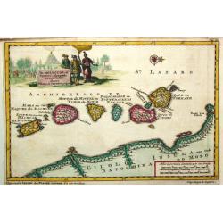
The Principal Islands of the East Indies.
A detailed copper engraved map of Indonesia and the Philippines, that Includes a small tip of New Holland (Australia) and names the Singapore Strait. With interesting tex...
Date: London, ca 1705
Selling price: ????
Please login to see price!
Sold in 2019
Plan de Batavia.
An excellent example of de Fer's town plan of Batavia (Jakarta) produced early in the 18th century, when the city and region was under the direct control and influence of...
Date: Paris, 1705
Selling price: ????
Please login to see price!
Sold in 2021
Carte de Tartarie..
Detailed map covering north east Asia, Tibet, Korea and part of Terre d' Eso . Nova Zembla joined with the mainland.
Date: Paris 1706
Selling price: ????
Please login to see price!
Sold
Carte de Tartarie. . .
Uncommon Amsterdam edition covering north east Asia, Tibet, Korea and part of Terre d'Eso . Nova Zembla joined with the mainland.
Date: Amsterdam, 1706
Selling price: ????
Please login to see price!
Sold in 2017
Les Isles Philippines et celles Des Larrons oude Marianes, Les Isles Moluques et de la Sonde, avec la Presqu'isle de L'Inde de la le Gange ou Orientale?
A map of the Malaysia, Indonesian and Philippines islands, by Nicolas De Fer, Royal French Geographer. The island of Taiwan is labeled "I.Formosa ou Bel Isle".
Date: Paris, 1706
Selling price: ????
Please login to see price!
Sold in 2015
Les Isles Philippines et celles Des Larrons oude Marianes, Les Isles Moluques et de la Sonde, avec la Presqu\'isle de L\'Inde de la le Gange ou Orientale.
A map of the Malaysia, Indonesian and Philippines islands, by Nicolas De Fer, Royal French Geographer. The island of Taiwan is labeled "I.Formosa ou Bel Isle".
Date: Paris, 1706
Selling price: ????
Please login to see price!
Sold in 2010
La Ville de Palimbang dans L'Ile de Sumatra.
A very decorative, impressive old-colored engraving of Palembang in Sumatra. Two views on one sheet. In the upper part the overall view with a sea battle in the foregroun...
Date: Leiden, 1706
Selling price: ????
Please login to see price!
Sold in 2014
Les Isles Philippines et celles Des Larrons ou de Marianes, Les Isles Moluques et de la Sonde, avec la Presqu'isle de L'Inde de la le Gange ou Orientale...
A scarce map of the Malaysia, Indonesian and Philippines islands, by Nicolas De Fer, Royal French Geographer. The island of Taiwan is labeled "I.Formosa ou Bel Isle&...
Date: Paris, 1706
Selling price: ????
Please login to see price!
Sold in 2016
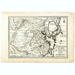
La partie orientale de l'Asie où se trouvent Le Grand Empire des Tartares Chinois et celuidu Iapon.
A map of China, Korea, Japan, Taiwan and northern India, by Nicolas De Fer, Royal French Geographer. The island of Taiwan is labeled "I.Formosa ou Bel Isle" and...
Date: Paris, 1706
Selling price: ????
Please login to see price!
Sold in 2018
Perse (Persia)
A rare map of the Middle east region, Afghanistan and Persian Empire by a little known map maker - Medrano. Shows Kandahar, Kabu, Hormuz, Kurdistan and Isfahan in Iran.
Date: 1706
Selling price: ????
Please login to see price!
Sold in 2016
Carte de Tartarie. . .
Covering north east Asia, Tibet, Korea and part of "Terre d'Eso". Nova Zembla joined with the mainland.With good detail in Korea, several cities a labeled: Chau...
Date: Paris, 1706
Selling price: ????
Please login to see price!
Sold
Carte de Tartarie . . .
Uncommon edition with the address : A Paris Chez l’Auteur sur le Quai de l’Horloge a l’Aigle d’Or avec Privilege, 1706". In early 1708 Delisle changed the si...
Date: Paris, 1706
Selling price: ????
Please login to see price!
Sold in 2018
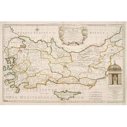
[Lot of 4] TURKEY
Pieter van der Aa (1659-1733) was a Dutch mapmaker and publisher who printed pirated editions of foreign bestsellers and illustrated books, but is best known for his vol...
Date: 1706
Selling price: ????
Please login to see price!
Sold in 2023
Kaart van Tartaryen.
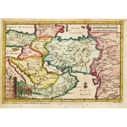
A fine detailed map of Ukraine, the Crimea and the north-eastern part of the Caspian Sea. With charming pictorial title piece on the lower right-hand corner.Although not ...
Date: Leiden 1707
Selling price: ????
Please login to see price!
Sold
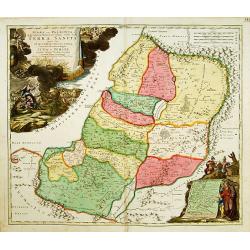
IUDAEA seu PALAESTINA... TERRA SANCTA... IUDA et ISRAEL
Map of Palestine divided among the Tribes, drawn by Homann after Guillaume Sanson. The shoreline runs from Sidon as far as Rinocorura. The Kishon River is shown as connec...
Date: Nuremberg 1707
Selling price: ????
Please login to see price!
Sold
Naaukeurige kaart van Tartaryen.
A fine detailed map of Ukraine, the Crimea and the north-eastern part of the Caspian Sea. With charming pictorial title piece on the upper left-hand corner.Although not r...
Date: Leiden 1707
Selling price: ????
Please login to see price!
Sold
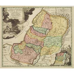
Iudæa seu Palæstina ob sacratißima Redemtoris vestigia hodie dicta Terra Sancta prout olim In Duodecim Tribus Divisa separatis ab invicem Regnis Iuda Et ...
Map of Palestine divided among the Tribes, drawn by Homann after Guillaume Sanson. The shoreline runs from Sidon as far as Rinocorura. The Kishon River is shown as connec...
Date: Nuremberg 1707
Selling price: ????
Please login to see price!
Sold in 2009
Reys-togt door Thomas Coryat van Jerusalem te Land gedaan na Asmere de Ho-Stadt des Grooten Mogols in Oostindien.
Pieter van der Aa was a prolific publisher. He published a.o. ' Naaukeurige versameling der gedenkwaardigste zee- en land-reysen', a series of accounts of voyages (1706-0...
Date: Leiden, 1707
Selling price: ????
Please login to see price!
Sold
Scheep-Togt door Don Henrique de Menezes...
This is a desirable first state example of the Indian Ocean / India and Sri Lanka regions, from Van der Aa's NAAUKEURIGE VERSAMELING DER GENDENK-WAARDIGSTE ZEE EN LAND-RE...
Date: Leiden, ca. 1707
Selling price: ????
Please login to see price!
Sold in 2008
M. Heberers Ongelukige Voyagie gedaan in Verscheyde gedeeltens van Asia en Africa.
Pieter van der Aa was a prolific publisher. He published a.o. ' Naaukeurige versameling der gedenkwaardigste zee- en land-reysen', a series of accounts of voyages (1706-0...
Date: Leiden, 1707
Selling price: ????
Please login to see price!
Sold
De Moluccos, of Speceri-dragende Eilanden Tussen Cilolo en Celebes gelegen.
Pieter van der Aa was a prolific publisher. He published a.o. ' Naaukeurige versameling der gedenkwaardigste zee- en land-reysen', a series of accounts of voyages (1706-0...
Date: Leiden, 1707
Selling price: ????
Please login to see price!
Sold
'T Koninkryk Sunda met dat van Java
Pieter van der Aa was a prolific publisher. He published a.o. ' Naaukeurige versameling der gedenkwaardigste zee- en land-reysen', a series of accounts of voyages (1706-0...
Date: Leiden, 1707
Selling price: ????
Please login to see price!
Sold
Het Koninkrijk van Bengalen en de Vloeden die zig inde Ganges ontlasten.
Pieter van der Aa was a prolific publisher. He published a.o. ' Naaukeurige versameling der gedenkwaardigste zee- en land-reysen', a series of accounts of voyages (1706-0...
Date: Leiden, 1707
Selling price: ????
Please login to see price!
Sold
De Eilanden Maldives.
Pieter van der Aa was a prolific publisher. He published a.o. ' Naauwkeurge versameling der gedenkwaardigste zee- en land-reysen', a series of accounts of voyages (1706-0...
Date: Leiden, 1707
Selling price: ????
Please login to see price!
Sold
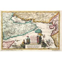
De Persiaanze Zee met d' Eylanden in deselve Tussen de Kusten van Arabier en Persie Gelegen tot aan den Indus Vloed. De Voorkusten van Guzaratte en Malabaar Tot aan Kaap Komeryn.
Pieter van der Aa was a prolific publisher. He published a.o. ' Naauwkeurge versameling der gedenkwaardigste zee- en land-reysen', a series of accounts of voyages (1706-0...
Date: Leiden, 1707
Selling price: ????
Please login to see price!
Sold in 2008
d'' Oostindize Voyagien door Johan Davis tweemaal gedaan.
Pieter van der Aa was a prolific publisher. He published a.o. '' Naaukeurige versameling der gedenkwaardigste zee- en land-reysen'', a series of accounts of voyages (1706...
Date: Leiden, 1707
Selling price: ????
Please login to see price!
Sold in 2008
Zee-Togt van Alfonso d' Albuquerque na de Roode Zee, d' Arabize en Persize Kusten, met die van Ormus, Guzaratte, Goa, Malacca en Verder Indien tot aan't Eiland Java.
Pieter van der Aa was a prolific publisher. He published a.o. ' Naaukeurige versameling der gedenkwaardigste zee- en land-reysen', a series of accounts of voyages (1706-0...
Date: Leiden, 1707
Selling price: ????
Please login to see price!
Sold
Het eiland Sumatra hoe ten aansien van Malacca . . .
Map of Sumatra, lower part of Malacca with Singapore (Singapura) and western part of Borneo. In lower left a fine title cartouche showing locals.Although not renowned for...
Date: Leiden, 1707
Selling price: ????
Please login to see price!
Sold in 2009
Het eiland Sumatra hoe ten aansien van Malacca . . .
Map of Sumatra, lower part of Malacca with Singapore (Singapura) and western part of Borneo. In lower left a fine title cartouche showing locals.Although not renowned for...
Date: Leiden, 1707
Selling price: ????
Please login to see price!
Sold in 2012
Oostindize Voyagien door Johan Davis tweemaal gedaan.
Pieter van der Aa was a prolific publisher. He published a.o. ' Naaukeurige versameling der gedenkwaardigste zee- en land-reysen', a series of accounts of voyages (1706-0...
Date: Leiden, 1707
Selling price: ????
Please login to see price!
Sold in 2019
Indien onder den Heer Lopo Vaz Sampayo, als Gouverneur Generaal tot aan Nieuw-Spanje in America en kusten van Peru en Chili bevaaren.
Pieter van der Aa was a prolific publisher. He published a.o. ' Naaukeurige versameling der gedenkwaardigste zee- en land-reysen', a series of accounts of voyages (1706-0...
Date: Leiden, 1707
Selling price: ????
Please login to see price!
Sold in 2015
d'Uytrusting der Engelze Maatshappye onder den Genernal James Lancaster Voor d'Eerst maal over Zee na d' Oost-Indien gedaan.
Detailed map of the region from India to Australia and Japan, illustrating the voyage of James Lancaster in the region.James Lancaster was prominent trader and privateer....
Date: Leiden, 1707
Selling price: ????
Please login to see price!
Sold in 2015
William Adams Reystogt na Oost-Indien.. JAPAN. . .
Map of Japan and Korea. In lower right a fine title cartouche showing William Adams during an audience with the shogun, who sits under a baldachin on a fancifully portray...
Date: Leiden, 1707
Selling price: ????
Please login to see price!
Sold
IUDAEA seu PALAESTINA... TERRA SANCTA... IUDA et ISRAEL
Map of Palestine divided among the Tribes, drawn by Homann after Guillaume Sanson. The shoreline runs from Sidon as far as Rinocorura. The Kishon River is shown as connec...
Date: Nuremberg, 1707
Selling price: ????
Please login to see price!
Sold in 2016
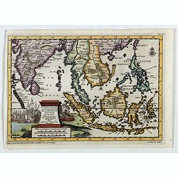
D'Indize Kusten van Bengale, Pegu, Malacca en Siam tot in China, met d'Eylanden Sumatra, Iava, Borneo, Moluccos en andere.
A map of Indonesia extending from the Gulf of Bengal to Taiwan (Formosa) and south to Timor. Including southern China, the Philippines, Sumatra, Borneo, Vietnam and Cambo...
Date: Leiden, 1707
Selling price: ????
Please login to see price!
Sold in 2017
D'Indiaanze Landschappen, Zeen en Eylanden, van Couchin Af, tot in de Moluccos, En na by Gelegen Eylanden, Door Antionio Galvaon Besyevend.
Map of Southeast Asia with India, Malacca, Philippines, Indonesia, Formosa, etc. Lower left a fine title cartouche showing a naval battle and a siege of a town.The map wa...
Date: Leiden? 1707
Selling price: ????
Please login to see price!
Sold in 2016
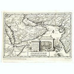
De kusten van Arabie het Roode Meer en Persize Zee..
Map of the Arabian Peninsula till West Coast of India, southern Persia and the 'Horn of Africa'.
Date: Leiden, 1707
Selling price: ????
Please login to see price!
Sold in 2016
D'Indiaanze Landschappen, Zeen en Eylanden, van Couchin Af, tot in de Moluccos, En na by Gelegen Eylanden, Door Antionio Galvaon Besyevend.
Map of Southeast Asia with India, Malacca, Philippines, Indonesia, Formosa, etc. Lower left a fine title cartouche showing a naval battle and a siege of a town.The map wa...
Date: Leiden, 1707
Selling price: ????
Please login to see price!
Sold in 2023
Tabula Geographica Terrae Sanctae Auctore J. Bonfrerio Societa Jesu.
An uncommon map of Israel by the Flemish theologian Jacques Bonfrere. The map is oriented with north at top left and divided into the twelve tribes with a key at bottom. ...
Date: Amsterdam, 1707
Selling price: ????
Please login to see price!
Sold in 2021
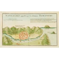
Nangasaki appellé par les Chinois Tchangki.
Attractive bird's-eye view of Nagasaki by Jean de Fontaney from a French collection of Jesuit letters, volume 17. With reference key to principal points of interest. (A-H...
Date: Paris 1708
Selling price: ????
Please login to see price!
Sold
Paskaart van 't Oosterste deel vande Middellantsche Zee Vervattende de Zee-kusten van Caramania Cyprus Soria en Aegiptia.
This sea chart represents Cyprus as well as the eastern coasts of the Mediterranean Sea.From van Keulen's "De Nieuwe Groote Lichtende Zee-Fackel, part III.3.3. The a...
Date: Amsterdam, 1708
Selling price: ????
Please login to see price!
Sold
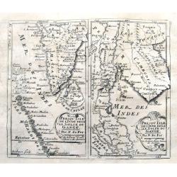
Prequ Isle de L'Inde deca Le Golfe du Gange and Prequ Isle de l
A very rare double map of India, Sri Lanka and the Maldives islands, together with a separate map of Cambodia, Thailand, Malaysia and North Sumatra.
Date: 1708
Selling price: ????
Please login to see price!
Sold in 2016
Vera Hierosolymae Veteris Imago
Delicately engraved imaginary plan of ancient Jerusalem based on Villalpando's foundation map of the city. The plan shows only the major religious sites, uncluttered by h...
Date: Amsterdam, 1709
Selling price: ????
Please login to see price!
Sold
[Kawachi - Osaka Prefecture ]
Rare Japanese colored woodcut map of Kawachi (Osaka Prefecture). Very large size and scale, with excellent detail. Additional Japanese text to sides. These large maps are...
Date: Osaka, Hoei 6, so 1709
Selling price: ????
Please login to see price!
Sold in 2008
Vera Hierosolymae Veteris Imago
Delicately engraved imaginary plan of ancient Jerusalem based on Villalpando's foundation map of the city. The plan shows only the major religious sites, uncluttered by h...
Date: Amsterdam, 1709
Selling price: ????
Please login to see price!
Sold in 2009
Descriptio Paradisi..
Nice map of the Middle East from the Mediterranean Sea to the Persian Gulf. The Garden of Eden is located in present-day Iraq, near the city of Babylon. Abraham's journey...
Date: Utrecht, 1709
Selling price: ????
Please login to see price!
Sold in 2009
Tabula Geographica Terrae Sanctae Auctore J. Bonfrerio Societa Jesu.
This uncommon map of Israel is by the Flemish theologian, Jacques Bonfrere. Oriented with north at top left, it is divided into the Twelve Tribes with a key at bottom. Th...
Date: Utrecht, 1709
Selling price: ????
Please login to see price!
Sold in 2009
Vera Hierosolymae Veteris Imago.
Delicately engraved imaginary town-plan of ancient Jerusalem based on Villalpando's foundation map of the city. The plan shows only the major religious sites, uncluttered...
Date: Amsterdam, 1709
Selling price: ????
Please login to see price!
Sold in 2009
Descriptio Paradisi..
Nice map of the Middle East from the Mediterranean Sea to the Persian Gulf. The Garden of Eden is located in present-day Iraq, near the city of Babylon. Abraham's journey...
Date: Utrecht 1709
Selling price: ????
Please login to see price!
Sold in 2009
Untitled
A rare map of the Middle East region by Medrano. Engraved by Debruslins. Sheet size: 26.9cm x 19.5cm. Map size: 14.9cm x 13cm.
Date: 1709
Selling price: ????
Please login to see price!
Sold in 2016
Vera HIEROSOLYMAE Veteris Imago.
A delicately engraved imaginary plan of ancient Jerusalem based on Villalpando's foundation map of the city. The plan shows only the major religious sites, uncluttered by...
Date: Amsterdam, 1709
Selling price: ????
Please login to see price!
Sold in 2020
Asia Minor..
Rare map of Turkey and Cyprus, published by Pierre Moullart-Sanson, who was the grandson of Nicolas the elder.The two title cartouches are printed from different copperpl...
Date: Paris 1710
Selling price: ????
Please login to see price!
Sold
Patriarchatus Hierosolymitani Geographica descriptio.
An ecclesiastical map showing the extent of Patriarchate of Jerusalem in Roman times. Divided into Palestine prima, secunda, salvtatis. The shore line runs from Sicaminum...
Date: Amsterdam 1699-1710
Selling price: ????
Please login to see price!
Sold
No title.
A fine and rare panoramic view of a town in the Near East. With extensive shipping on the foreground. From the Voyage de M. le Chevalier Chardin en Perse, et autres lieux...
Date: Paris,1710
Selling price: ????
Please login to see price!
Sold in 2012
[Ruines d'un palais perse]
From the Voyage de M. le Chevalier Chardin en Perse, et autres lieux de l'Orient.
Date: Paris, 1710
Selling price: ????
Please login to see price!
Sold in 2014
No title.
From the Voyage de M. le Chevalier Chardin en Perse, et autres lieux de l'Orient.Panoramic view of a city in the Near East.
Date: Paris, 1710
Selling price: ????
Please login to see price!
Sold in 2012
Pergrinatie ofte Veertich-iarige Reyse
Dutch Bible map of the Holy Land depicting the Exodus from Egypt and the wanderings of the Children of Israel. The lower part of the map is elaborately engraved with a sc...
Date: Amsterdam, 1710
Selling price: ????
Please login to see price!
Sold
De Stadt Jerusalem.
A stunning "carte à figures" plan of ancient Jerusalem from a Dutch bible after Villalpando. Lower left the Temple as a Renaissance palace and lower right a pa...
Date: Amsterdam, 1710
Selling price: ????
Please login to see price!
Sold in 2008
Totius Asiae continens cum praecipuis insulis eidem annexis
On this map Hokkaido is connected with Honshu and even bigger depicted than Honshu. In lower left cartouche a scale and a monstrance with the sign of the Society of Jesus...
Date: Munich, 1710
Selling price: ????
Please login to see price!
Sold in 2008
Le Royaume de Siam avec Les Royaumes Qui Luy sont Tributaries & c. / La Royaume de Siam avec les royaumes qui luy sont Tributaires, et les Isles de Sumatra, Andemaon, etc. . . [two sheet map]
Influential map of Southeast Asia and the East Indies including modern day Thailand, southern Vietnam, Cambodia, Malaysia, Singapore, Borneo, Sumatra and Java. Ottens inc...
Date: Amsterdam, 1710
Selling price: ????
Please login to see price!
Sold in 2009
Carte Geographique de l'Asie Mineure ...
Detailed map of the Mediterranean Region, from Chatelain's monumental Atlas Historique.
Date: Paris, 1710
Selling price: ????
Please login to see price!
Sold in 2011
Carte marine de la mer Caspienne avec toutes ses Bayes Rivieres et Havres, dressée sur les observations des plus habiles Navigateurs,. . .
Strikingly engraved and attractive map of the region south of the Caspian Sea, showing major towns, ports, etc. Large compass rose in Arabia.
Date: Leiden, 1710
Selling price: ????
Please login to see price!
Sold in 2010
Le Royaume de Siam avec Les Royaumes Qui Luy sont Tributaries & c. / La Royaume de Siam avec les royaumes qui luy sont Tributaires, et les Isles de Sumatra, Andemaon, etc. . . [two sheet map]
Influential map of Southeast Asia and the East Indies including modern day Thailand, southern Vietnam, Cambodia, Malaysia, Singapore, Borneo, Sumatra and Java. Ottens inc...
Date: Amsterdam, 1710
Selling price: ????
Please login to see price!
Sold in 2013
Repraesentatio totius Asiae...
Rare map of Asia by Scherer from Munich who was a cartographer, a Jesuit, and also a professor of mathematics. In this map the areas where Jesuit missions were present ar...
Date: Munich, ca 1710
Selling price: ????
Please login to see price!
Sold in 2015
Asiae in Tabula Geographica Delineatio, ex officina Petri Schenkii.
Very fine, and very scarce of map of Asia. Beautifully, contemporary colored engraved map. The map is decorated with a wonderful, large and colored cartouche featuring Ar...
Date: Amsterdam, 1710
Selling price: ????
Please login to see price!
Sold in 2016
Insulae Indicae Cum Terris Circumvicinis.
Highly sought-after map of Southeast Asia. Includes today's Malaysia, Thailand, Vietnam, Singapore, Indonesia, Ceylon,< etc. Nova Hollandia (Australia) is depicted at ...
Date: Munich, c1710
Selling price: ????
Please login to see price!
Sold in 2016
Asia Corrected from the Observations Communicated to the Royal Society at London and the Royal Academy at Paris...
Nice example of this scarce large format map of Asia by Senex. The map is most remarkable for its detail in South east Asia, the Philippines, Larrones Isles, New Guinea a...
Date: London, 1710
Selling price: ????
Please login to see price!
Sold in 2017
Les Isles Philippines, Molucques et de la Sonde.
Detailed map of the Philippines, Borneo and Indonesia. With an inset map of Japan. Names Singapore (Sincapura) and extends until Timor. The equator line is shown.
Date: Paris, ca. 1710
Selling price: ????
Please login to see price!
Sold in 2019
Presqu'isle de l'Inde decale Golfe du Gange. & Presqu'isle de l'Inde dela le Golfe du Gange.
Two early maps on one sheet, one showing souther India, the Maledives and Sri Lanka. The other shows former Pegu and Siam, todays Myanmar, Thailand, Malaysia, Cambodia, L...
Date: Paris, ca. 1710
Selling price: ????
Please login to see price!
Sold in 2019
Asie.
A small map of Asia with curiously shaped coast lines. Korea is shown as being thin and long, whilst Japan is misshaped, as is India. Includes the Philippines, Borneo and...
Date: Paris, ca 1710
Selling price: ????
Please login to see price!
Sold in 2019
Les Deserts D'Egypte de Thebaide D'Arabie, De Sirie &c.
Full title and impressum in a cartouche top left: 'Les Deserts D'Egypte de Thebaide D'Arabie, De Sirie, &c. ou Sont Exactement Marques Les Lieux Habitez Par Les Sainc...
Date: Amsterdam, 1710
Selling price: ????
Please login to see price!
Sold in 2021
Hierosolyma. - Jerusalem
A rare and beautifully engraved and richly detailed panoramic view of Jerusalem. With in lower part description of Jerusalem in German and Latin. Published by Joseph Frie...
Date: Augsburg 1711
Selling price: ????
Please login to see price!
Sold
La China.
Map of China from Laso’s extremely rare atlas “El Atlas Abreviado”. The plates for the atlas were based on those for Don Francisco De Afferden’s earlier atlas pub...
Date: Madrid, 1711
Selling price: ????
Please login to see price!
Sold in 2012
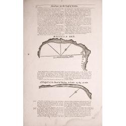
Directions between Amoye and Chusan.
Text page with woodblock plofiles by Samuel Thornton showing the approaching coast lines of The Island of Quesan, Sampanna, Lamjett and Island of Hightan on the verso dir...
Date: London 1711
Selling price: ????
Please login to see price!
Sold in 2014
Two double sided pages No's 25 & 26 ‘Directions for the coast of Arabia.' 27 & 28 Directions for the Coast of Persia & ‘Directions for the coast of Arabia
Four woodblock chart’s on two double sided sheets by Samuel Thornton showing the approaching coast lines Arabia by John How and Samuel Thornton. Pages numbered 25,26,27...
Date: London, 1711
Selling price: ????
Please login to see price!
Sold in 2015
Three double sided pages No's 65 & 66 ‘Directions from the River Siam to the River of Cambodia.' Directions between Pulo Timoan and Amoye in China. 67 & 68 Directions between Pulo Timoan and Amoye in China. 69 & 70,
Six woodblock chart’s on three double sided sheets by Samuel Thornton showing the approaching coast lines China by John How and Samuel Thornton.Published in "The E...
Date: London, 1711
Selling price: ????
Please login to see price!
Sold in 2014
Two double sided pages No's 57 & 58 A Description of the West Coast of Sumatra & The West coast of Sumatra 59 & 60 The West coast of Sumatra & Instructions for Sailing through the Streights of Diron
Four woodblock chart’s on two double sided sheets by Samuel Thornton showing the approaching coast lines of Sumatra. Published in "The English Pilot, the Third Boo...
Date: London 1711
Selling price: ????
Please login to see price!
Sold in 2014
Two double sided pages No's 61 & 62 Directions for the Streights of Singapore. 63 & 64 Directions for the Old Streights of Singapore & Instructions for Sailing from Pulo Tingay to Siam.
Four woodblock chart’s on two double sided sheets by Samuel Thornton showing the approaching coast lines of Singapore & Thailand.Published in "The English Pilo...
Date: London, 1711
Selling price: ????
Please login to see price!
Sold in 2014
Asia According to ye Newest Observations. . .
Fine map of Asia covering from Asia Minor in the west to New Guinea in the east. It includes South East Asia and New Guinea, but not Australia. From Moll's "Atlas Ge...
Date: London, 1711
Selling price: ????
Please login to see price!
Sold in 2016




![[Lot of 4] TURKEY](/uploads/cache/410004-250x250.jpg)












![[Kawachi - Osaka Prefecture ]](/uploads/cache/90638-250x250.jpg)



![[Ruines d'un palais perse]](/uploads/cache/16328-250x250.jpg)


![Le Royaume de Siam avec Les Royaumes Qui Luy sont Tributaries & c. / La Royaume de Siam avec les royaumes qui luy sont Tributaires, et les Isles de Sumatra, Andemaon, etc. . . [two sheet map]](/uploads/cache/27847-250x250.jpg)

![Le Royaume de Siam avec Les Royaumes Qui Luy sont Tributaries & c. / La Royaume de Siam avec les royaumes qui luy sont Tributaires, et les Isles de Sumatra, Andemaon, etc. . . [two sheet map]](/uploads/cache/33564-250x250.jpg)


