Browse Listings in Asia
L'Asie suivant Mr. de Lisle de L'Academie royale des sciences.
RARE miniature map of Asia after de L'Isle. The map is of interest for the use of East Sea, the sea between Korea and Japan, here called "Mer Orientale".With Co...
Date: Paris, ca. 1700
Selling price: ????
Please login to see price!
Sold in 2014
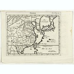
Chine.
RARE miniature map of China, Korea, Japan and Taiwan. The map is of interest for the use of East Sea, the sea between Korea and Japan, here called "Mer Orientale&quo...
Date: Paris, ca. 1700
Selling price: ????
Please login to see price!
Sold in 2014
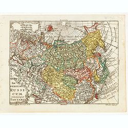
Imperium Russicum omnisque Tartaria.
Very finely engraved miniature map of Asian part of Russia with Korea and Japan. The map is of interest for the use of East Sea, the sea between Korea and Japan, here cal...
Date: Paris, ca. 1700
Selling price: ????
Please login to see price!
Sold in 2023
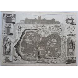
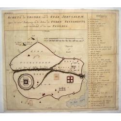
Schets des Gronds van de Stad Jerusalem.
Uncommon plan of ancient Jerusalem.
Date: ca. 1700
Selling price: ????
Please login to see price!
Sold in 2014
Ancient Asia.
Map of ancient Asia engraved by Michael Burghers of Oxford University. Dedicated to the Duke of Gloucester.With several interesting legends, a legend in the vicinity of t...
Date: Oxford, 1700
Selling price: ????
Please login to see price!
Sold in 2015
De Beschryving van de Reysen Pauli, en van de Andere Apostelen...
A beautiful map by Jan Van Den Avelen of the Eastern Mediterranean region, detailing the travels of the Apostle Paul. Richly decorated with scenes from St. Paul's travels...
Date: Amsterdam, 1700
Selling price: ????
Please login to see price!
Sold in 2016
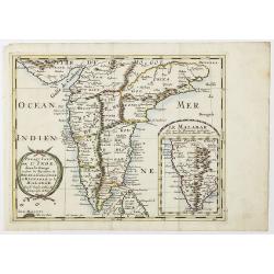
The Penisula on this side Ganges.
This map appeared in Modern's rare 'Atlas Terestris', first published in 1687. This map is the uncommon English text map of India, Ceylon, the Maldives and the Malaya Pen...
Date: London, 1700
Selling price: ????
Please login to see price!
Sold in 2016
A New Map Shewing the Travels of the Patriarchs.
A fine engraved map of the land of Canaan (Current day Ethiopia and Arabia). At the bottom is a separate map of of "The Great Sea" (Mediterranean". The tit...
Date: London, 1700
Selling price: ????
Please login to see price!
Sold in 2018
Insulae Indicae cum terris circumvicinis..
An attractive map of South-East Asia published in the uncommon Atlas Novus by the German Jesuit scholar, Heinrich Scherer. The map extends from Ceylon to the north coast ...
Date: Munich, 1700
Selling price: ????
Please login to see price!
Sold in 2017
A New Map of Great Tartary and China with the adjoining parts of Asia...
Two insets showing the land to the north-east of China according to the Jesuits. Map stretches from northern Russia and Nova Zemlya in the north-west to Formosa in the so...
Date: Oxford, 1700
Selling price: ????
Please login to see price!
Sold in 2018
Chine.
The rare second state of this early map of China, Korea, and Japan. From "Nouvelle Geographie. . . Par Mr. D. Martineau Du Plessis... A Amsterdazm, Chez George Galle...
Date: Amsterdam, 1700
Selling price: ????
Please login to see price!
Sold in 2017
Carte particuliere d'une Partie d'Asie ou sont le Isles d'Andemaon, Ceylan, Les Maldives. . .
Intriguing map of India, Ceylon, Maldives and East Coast of Sumatra, and Malaysia. Sumatra peeks out of the eastern border, with the southwest peninsula showing the Kingd...
Date: Amsterdam, 1700
Selling price: ????
Please login to see price!
Sold in 2020
L'ASIE Dressée sur les Observations de l'Académie Royale des Sciences et quelques autres, et sur les mémoires les plus recens. . .
This is important and rare map of Asia, issued by Guillaume Delisle and with 3 nice decorative cartouches, engraved by N. Guerard. It includes the East Indies and the tip...
Date: Paris, 1700
Selling price: ????
Please login to see price!
Sold in 2019
Alexandri Magni Macedonis Expeditio.
An interesting historical map showing the region covered during the expeditions of Alexander the Great. With many details in Turkey, Near East, Middle East and Persia. Se...
Date: Amsterdam, 1652-1700
Selling price: ????
Please login to see price!
Sold in 2018
Presqu Isle de L'Inde. deca la Gange.. .
Two maps together on one sheet.
Date: Amsterdam, 1700
Selling price: ????
Please login to see price!
Sold in 2018
Chine.
RARE miniature map of China, Korea, Japan and Taiwan. The map is of interest for the use of East Sea, the sea between Korea and Japan, here called "Mer Orientale&quo...
Date: Paris, ca. 1700
Selling price: ????
Please login to see price!
Sold in 2023
Nova Tabula Indiae Orientalis.
Covers an area from the Cape of Good Hope to Japan, including the East Indies, and Australia as discovered by Tasman lettered Nova Hollandia, Terradel Zur . An unchanged ...
Date: Amsterdam, 1700
Selling price: ????
Please login to see price!
Sold in 2023
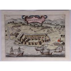
Presa di Namur.
A detailed, attractive, panoramic battle view of the siege of the Karaman fortification in Anatolia, Turkey, fought between the Naval Army of the Gand Duke of Tuscany, Co...
Date: Florence, 1701
Selling price: ????
Please login to see price!
Sold in 2023
India or the Mogul's Empire.
A detailed map showing India, Sri Lanka, Tibet, Siam, Cambodia, etc. Names towns, rivers, and islands. With text below the map and on verso.
Date: London, ca 1701
Selling price: ????
Please login to see price!
Sold in 2020
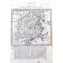
China.
A detailed copper engraved map of China including Taiwan and South Korea. Shows the Great Wall. With good details of towns, rivers, and islands. With interesting text abo...
Date: London, 1701
Selling price: ????
Please login to see price!
Sold in 2021
Der Hollaendisch-Ostindianischen Compagnie Weltberühmte Haupt-Handels und Niederlags-Stadt Batavia.
A truly beautiful map of Batavia, with a map of the city, two views of the city, a magnificent view of the harbor and a fine representation of the most important build...
Date: Neurenberg, 1701
Selling price: ????
Please login to see price!
Sold in 2021
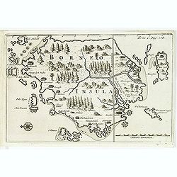
Borneo.
From a travel book deScribing the early Dutch voyages by René Augustin Constantin de Renneville Recueil des voiages qui ont servi à l'établissement & aux progrès ...
Date: Amsterdam, E. Rogers, 1702
Selling price: ????
Please login to see price!
Sold in 2012
Asia Multis in locis dei matrem colit..
A map from the series of maps by the Jesuit mathematician. A general map of Asia, produced by Scherer to show the spread of Catholicism in the continent. This decorative ...
Date: Munich c.1702
Selling price: ????
Please login to see price!
Sold
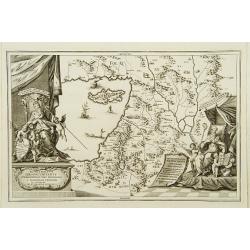
Terra Sancta Christi et Deiparae patria ..
A map from the series of maps by the Jesuit mathematician. A general map of eastern part of Medeteranean with Holy Land and Cyprus, produced by Scherer to show the spread...
Date: Munich c.1702
Selling price: ????
Please login to see price!
Sold
Patriarchatus Ierosolymitanus comprehendebat tres provincias..
A map from the series of maps by the Jesuit mathematician. A general map of the Holy Land and Cyprus (only listing town of Constantia, produced by Scherer to show the spr...
Date: Munich c.1702
Selling price: ????
Please login to see price!
Sold
De Gelegentheyt van t' Paradys en t' Landt Canaan, mitsgaders d' eerst bewoonde Landen der Patriarchen.
Dutch so-called ' Staten' bibles, published between 1637 and c. 1760, contained five maps: The World, ' Paradise', The Perigrinations, The Promised Land Canaan, The Trave...
Date: Amsterdam, H.,J.,P. Keur, M. Doornick en P. Rotterdam, 1702
Selling price: ????
Please login to see price!
Sold
Bandel, de Reede van de vermaerde Koopstadt Arrakan. [Chittagong]
From Schenk's Hecatompolis sive Totius Terrarum Oppida Nobiliora Centrum.. , a collection of 100 views, dedicated to the 14-year old Prussian crown prince, the later king...
Date: Amsterdam, 1702
Selling price: ????
Please login to see price!
Sold in 2011
Het Beloofde Landt Canaan door wandelt van onsen Salichmaecker Iesu Christo, neffens syne Apostelen.
Dutch so-called ' Staten' bibles, published between 1637 and c. 1760, contained five maps: The World, ' Paradise', The Perigrinations, The Promised Land Canaan, The Trave...
Date: Amsterdam, H.,J.,P. Keur, M. Doornick en P. Rotterdam, 1702
Selling price: ????
Please login to see price!
Sold in 2011
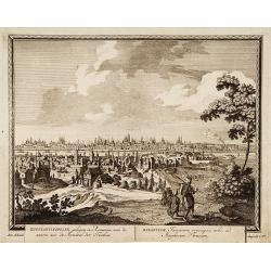
Konstantinopolien, gelegen../ Byzantium Turcarum..
From Schenk's Hecatompolis sive Totius Terrarum Oppida Nobiliora Centrum.. , a collection of 100 views, dedicated to the 14-year old Prussian crown prince, the later king...
Date: Amsterdam, 1702
Selling price: ????
Please login to see price!
Sold in 2009
Batavia, gelegen op het eiland Java een beroemde volkplanting der Batavieren.
Town-view of Batavia (now-a-days Jakarta) seen from the harbor. On the foreground many large Dutch V.O.C. vessels.From Schenk's "Hecatompolis sive Totius Terrarum Op...
Date: Amsterdam, 1702
Selling price: ????
Please login to see price!
Sold in 2009
Fort de l'Isle de Banda.
Decorative print of the Dutch fortress on the island Banda.From a travel book deScribing the early Dutch voyages by René Augustin Constantin de Renneville Recueil des vo...
Date: Amsterdam, E. Rogers, 1702
Selling price: ????
Please login to see price!
Sold in 2013
Batavia, L'an 1629.
Uncommon of Batavia (Jakarta) in 1629.From a travel book describing the early Dutch voyages by René Augustin Constantin de Renneville Recueil des voiages qui ont servi ...
Date: Amsterdam, E. Rogers, 1702
Selling price: ????
Please login to see price!
Sold in 2013
(Bird's eye view of the Bay of Bantam.)
Bird's eye view of the Bay of Bantam after Willem Lodewijcksz.From the French reissue of the account of early Dutch voyages first published in 1608 by Commelin. The Frenc...
Date: Amsterdam, E. Roger, 1702
Selling price: ????
Please login to see price!
Sold in 2014
Iava Maior.
Nice early map of Java. From the French reissue of the account of early Dutch voyages first published in 1608 by Commelin. The French translation was carried out by René...
Date: Amsterdam, E. Roger, 1702
Selling price: ????
Please login to see price!
Sold in 2013
( Detroit de Baly / Detroit de Ballabuan. )
Nice early map of Bali. From the French reissue of the account of early Dutch voyages first published in 1608 by Commelin. The French translation was carried out by René...
Date: Amsterdam, E. Roger, 1702
Selling price: ????
Please login to see price!
Sold in 2013
(Gunanappi / Wayer / Nera / Pulorin / Puloway .)
Uncommon map of islands in the Banda Sea. Several islands and villages are named, Wayer, Nera, Pulorin, Puloway, Lontoor, Ortattan and Combeer.From the French reissue of ...
Date: Amsterdam, E. Roger, 1702
Selling price: ????
Please login to see price!
Sold in 2012
[map of South East Asia ]
The map is an expanded version of De Bry's "Mar di India", with the inclusion of an inset map of Buton (Botton I. 140x105mm.). The Straits of Buton, highlighted...
Date: Amsterdam, E. Rogers, 1702
Selling price: ????
Please login to see price!
Sold in 2012
Bandel, de Reede van de vermaerde Koopstadt Arrakan. [Chittagong]
View of Chittagong. From Schenk's Hecatompolis sive Totius Terrarum Oppida Nobiliora Centrum.. , a collection of 100 views, dedicated to the 14-year old Prussian crown pr...
Date: Amsterdam, 1702
Selling price: ????
Please login to see price!
Sold in 2014
Perigrinatie ofte Veertich-jarige Reyse der Kinderen Israels.
Dutch so-called ' Staten' bibles, published between 1637 and c. 1760, contained five maps: The World, ' Paradise', The Perigrinations, The Promised Land Canaan, The Trave...
Date: Amsterdam, H.,J.,P. Keur, M. Doornick en P. Rotterdam, 1702
Selling price: ????
Please login to see price!
Sold in 2020
Nova Et Vera Exhibitio Gerographica Insularum Marianarum . . .
Attractive map of the Philippines, Japan, Korea and Indonesia with an inset of the island Guam, by the Jesuit Heinrich Scherer, printed in for Scherer's 'Atlas Novus'. Se...
Date: Munich, c.1702
Selling price: ????
Please login to see price!
Sold in 2016
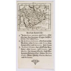
Arabia.
A lovely miniature map of the Arabian peninsular, showing the Red Sea, parts of Persia, Bagdad, parts of north eastern Africa, to the Horn of Africa. For such a small map...
Date: Ulm, 1702
Selling price: ????
Please login to see price!
Sold in 2020
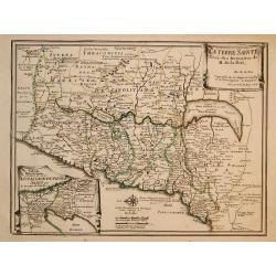
" La Terre Sainte Tirée des Memoires de M. de la. Ruë, par N.de Fer."
"Uncommon map of the Holy Land. In lower left inset map;""Tabula Mansionum ad caput 33. Numer le-passage-du-peuple Saint par les deserts de l'Arabie."...
Date: Paris 1703
Selling price: ????
Please login to see price!
Sold
La Terre Sainte Tirée des Memoires de M. de la Ruë, ...
Uncommon map of the Holy Land. In lower left inset map Tabula Mansionum ad caput 33. Numer le-passage-du-peuple Saint par les deserts de l'Arabie. Engraved by Van Loon.Un...
Date: Paris, 1703
Selling price: ????
Please login to see price!
Sold in 2011
Baye la Baye.
Early map of Albay Bay on the Southeast Coast of Luzon, with the northern tip of Samar in the lower right. The mountains rising in the upper left lead to Mayon Volcano.Fr...
Date: Amsterdam, E. Rogers, 1703
Selling price: ????
Please login to see price!
Sold in 2015
Baye de Matecalo Dans l'Isle de Ceyon / Partie du Golfe de Bengale.
Uncommon map of the Bay of Matecalo on Ceylon in the Gulf of Bengal. From the French reissue of the account of early Dutch voyages first published in 1608 by Commelin. Th...
Date: Amsterdam, E. Roger, 1703
Selling price: ????
Please login to see price!
Sold in 2016
Isle de Zeilan ou Ceilon.
Uncommon map of Sri Lanka (Ceylon). From the French reissue of the account of early Dutch voyages first published in 1608 by Commelin. The French translation was carried ...
Date: Amsterdam, E. Roger, 1703
Selling price: ????
Please login to see price!
Sold in 2012
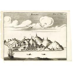
Macao.
Uncommon fanciful view of Macao, with a Dutch vessel in the foreground. From the French reissue of the account of early Dutch voyages first published in 1608 by Commelin....
Date: Amsterdam, E. Roger, 1703
Selling price: ????
Please login to see price!
Sold in 2013
Asia Minor.
A fascinating and detailed map of Asia Minor, from an English edition of Cellarius' Geographia Antiqua. Cyprus prominent, as are many of the Greek Islands
Date: Germany, 1703
Selling price: ????
Please login to see price!
Sold in 2015
A New Map of the East Indies taken form Mr. de Fer's Map of Asia.
Striking scarce regional map of India and the East Indies, extending from Southeast Asia, the Philippines, China and Tibet in the East to India and the Maldives in the We...
Date: London, 1703
Selling price: ????
Please login to see price!
Sold in 2015
Asia.
A detailed map of Asia from his Heylyn's "Cosmographie". The map includes good detail through South East Asia and the islands in the Indian Ocean. It is embelli...
Date: London, 1703
Selling price: ????
Please login to see price!
Sold in 2019
Het Beloofde Landt Canaan..
Title of the map: Het Beloofde Landt Canaan door wandelt van onsen Salichmaecker Iesu Christo, neffens syne Apostelen.Fine map of Israel with north oriented to right. Lar...
Date: Amsterdam, 1704
Selling price: ????
Please login to see price!
Sold
Presqu'Isle De L'Inde De Ca Le Golfe Du Gange/Presqu'Isle De L'Inde De La Le Golfe Du Gange.
Pair of maps, one of the Indian peninsula and Sri Lanka, and another of Southeast Asia, including Singapore.
Date: Paris, c.1704
Selling price: ????
Please login to see price!
Sold in 2012
Mogol.
Detailed map of the Mughal Empire, which controlled much of South Asia by the early 18th century.
Date: Paris, c.1704
Selling price: ????
Please login to see price!
Sold in 2013
Grande Tartarie.
Map of Tartary covering present-day Asian Russia.
Date: Paris, c.1704
Selling price: ????
Please login to see price!
Sold in 2010
An account of the shipwreck of a Dutch vessel on the coast of the Isle of Quelpaert, together with the description of the kingdom of Corea. Translated out of French.
FIRST ENGLISH EDITION. A 26 page description extracted from the first edition of Churchill's "A Collection of Voyages and Travels: Some Now First Printed from Origin...
Date: London, 1704
Selling price: ????
Please login to see price!
Sold in 2011
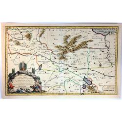
Galatia Cujus Populi Tolistobogi, Tectosages, Trocmi Mox Provincia sub Romani
This striking map by Nicolas Sanson is of northern Turkey, and is centreed on Ancyra (Ankara). It illustrates the provinces inhabited by the three Celtic tribes that migr...
Date: Amsterdam, 1704
Selling price: ????
Please login to see price!
Sold in 2016
Grande Tartarie.
A lovely small map of Greater Tartary in Russia, and on into Asia, including Tibet, Usbec, China and Korea. Each region depicted is with a different outline color. A smal...
Date: Madrid, ca. 1696-1704
Selling price: ????
Please login to see price!
Sold in 2017
Complete set of five Bible maps.
The Dutch so-called "Staten-Bijbels" were published from 1637 onwards. The printed bibles were allowed to embody outside the official Bible text but inside the ...
Date: Dordrecht, 1704
Selling price: ????
Please login to see price!
Sold in 2023
Turkyen in Asia.
Attractive general map of the Middle East, including Turkey, Cyprus, Palestine, etc.
Date: Amsterdam 1705
Selling price: ????
Please login to see price!
Sold
Terra promissa in sortes seu tribus XII?
The promised Land divided among the 12 Tribes according to the Book of Joshua. Shows Palestine on both sides of the Jordan, the shoreline running from Sidon as far as Rhi...
Date: Amsterdam 1705
Selling price: ????
Please login to see price!
Sold
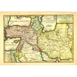
La Perse La Georgie, et la Turquie d'Asie..
Uncommon map of Turkey, Persia, Palestine and the northern tip of Arabia.
Date: Paris, 1705
Selling price: ????
Please login to see price!
Sold in 2009
Theatrum Historicum.. Tu Imperii Romani.. Pars Orientalis..
Showing the Eastern part of the Roman Empire, extending from Greece and Cyprus to India and centered on Armenia and the Black and Caspian Seas. Prepared by G. de l'Isle, ...
Date: Paris, 1705
Selling price: ????
Please login to see price!
Sold in 2009
Plan de Pondichery la côte of Coromandel occupé pair la Compagnie Royale DES Indes cartographic Orientales..
Detailed plan of the town of Pondichery, by Nicolas De Fer, who was a royal French geographer.
Date: Paris 1705
Selling price: ????
Please login to see price!
Sold
La Perse La Georgie, et la Turquie d'Asie ...
Uncommon map of Turkey, Persia, Palestine and the northern tip of Arabia.
Date: Paris, 1705
Selling price: ????
Please login to see price!
Sold in 2011
Anatolien. (with Cyprus)
A Dutch edition of Sanson Jr.'s map of Turkey. In the lower right corner is an oversized Cyprus. Engraved by Anthony d'Winter.
Date: Amsterdam, 1705
Selling price: ????
Please login to see price!
Sold in 2022
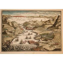
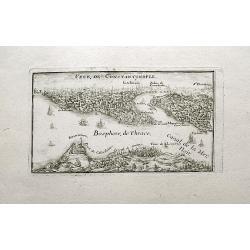
Veue des dardanelle s de Constantinople
Interesting miniature bird's-eye view shows the strategic strait between the Aegean Sea to the Sea of Marmara with Constantinople in the background. Nicolas de Fer held t...
Date: Paris, 1705
Selling price: ????
Please login to see price!
Sold in 2009
La Terre Sainte..
Decorative and detailed map of the region covering present-day Israel and Jordan and in the inset at left under a part of Egypt. The map shows the Holy Land divided among...
Date: Paris, 1705
Selling price: ????
Please login to see price!
Sold in 2009
Les Vrays Indes dits Grands Indes ou Indes Orientales
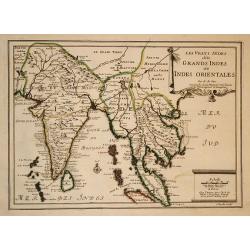
Striking map of India and the Malaysian Peninsula, showing excellent detail throughout. From De Fer's Atlas Curieux. Nice wide margins and decorative cartouche.
Date: Paris, 1705
Selling price: ????
Please login to see price!
Sold in 2009
Les Isles Philippines
Striking map of the East Indies. From De Fer's Atlas Curieux. Nice wide margins and decorative cartouche.
Date: Paris, 1705
Selling price: ????
Please login to see price!
Sold in 2009
La partie orientale de L'Asie ou se trouvent le Grand Empire des Tartares chinois ...
The map includes China, an elonged Korea and the islands of Taiwan and Japan. Hokkaido is curiously shown as an Asian peninsula. Taiwan labeled: Isle Formosa ou Bel-Isle ...
Date: Paris, 1705
Selling price: ????
Please login to see price!
Sold in 2009
Tartaria, sive magni Chami Imperium ex credendis amplissimi viri Nicolai Witsen. . .
This map is particularly significant for depicting Russia, Siberia, and parts of Chinese Tartary, taken from the great six-sheet map by Nicolas Witsen, 1687. The importan...
Date: Amsterdam, 1705
Selling price: ????
Please login to see price!
Sold in 2010
Veue des Dardanelles de Constantinople.
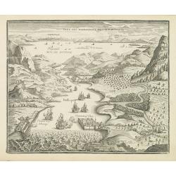
Attractive birds eye view of Hellespont in Dardanelles Strait, fortifications and the city of Istanbul in the background. From "L'atlas curieux, ou Le monde réprés...
Date: Paris, 1705
Selling price: ????
Please login to see price!
Sold in 2011
Veue de la ville et du port de Constantinople.
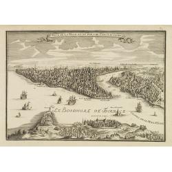
Uncommon bird's-eye view of Istanbul (Constantinople) with Scutari in the foreground, identifying numerous landmarks and a number of ships in the Bosporus.
Date: Paris, 1705
Selling price: ????
Please login to see price!
Sold
Les isles Philippines, Molucques../Les isles du Iapon.
A map of the Indonesian and Philippines islands with an insert showing the three main Japanese islands, by Nicolas De Fer, Royal French Geographer.
Date: Paris, 1705
Selling price: ????
Please login to see price!
Sold in 2015
Voyage des Enfans d'Israel dans le Desert Depuis Leux Partie d'Egypte par la Mer Rouge.
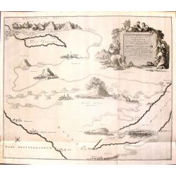
This interesting copper engraving map focuses on the Exodus of the children of Israel from Egypt to the Promised Land. Numerous place names and biblical references fill t...
Date: Amsterdam, Covens and Mortier, 1705
Selling price: ????
Please login to see price!
Sold in 2016
Fort de Zeelande ou de Taiovang.
A rare view of Fort Zeelandia, which was a fortress built over ten years from 1624–1634 by the Dutch East India Company, in the town of Anping (Tainan) on the island of...
Date: ca, 1705
Selling price: ????
Please login to see price!
Sold in 2016
Description de l'île Formosa en Asie, du gouvernement, des loix, des mœurs & de la religion des habitans. . .
First French edition of one of the most famous fictitious travel books ever published. It offered a complete and detailed description of the island Formosa and the life a...
Date: Amsterdam, d'Estienne Roger, 1705
Selling price: ????
Please login to see price!
Sold
Veue de Constantinople.
A small and charming view of Istanbul and the Bosphorus. With numerous buildings and several sailing ships.
Date: Paris, 1705
Selling price: ????
Please login to see price!
Sold in 2018
Carte des Indes et de la Chine . . .
Scarce state of "Carte des Indes et de la Chine. A Paris Chez l’Auteur, Rue des Canettes prez de St. Sulpice. Avec Privilège pour 20 ans, 1705. This early state w...
Date: Paris, 1705
Selling price: ????
Please login to see price!
Sold in 2018
Plan de Pondichery la côte of Coromandel occupé par la Compagnie Royale des Indes cartographic Orientales..
Detailed plan of the town of Pondicherry, founded in 1674 as the capital of French India. A masterpiece of European Enlightenment Era urban planning, it was predicated on...
Date: Paris, 1705
Selling price: ????
Please login to see price!
Sold in 2020










![Bandel, de Reede van de vermaerde Koopstadt Arrakan. [Chittagong]](/uploads/cache/24998-250x250.jpg)



![[map of South East Asia ]](/uploads/cache/31872-250x250.jpg)
![Bandel, de Reede van de vermaerde Koopstadt Arrakan. [Chittagong]](/uploads/cache/32894-250x250.jpg)


