Browse Listings in America > South America
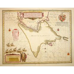
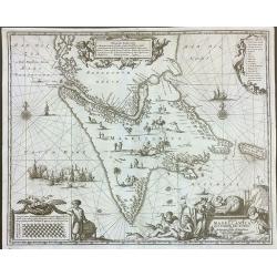
Tabula Magellanica.
A map with Willem Blaeu\'s signature, but published by his son Joan, of South America\'s extremity. A dedication to Constantijn Huygens.
Date: Amsterdam, 1660
Selling price: ????
Please login to see price!
Sold in 2009
S. SALVADOR.
Charming view of Salvador de Bahia, in Brazil, seen from the ocean. In lower left inset map of Baia de todos os Sanctos.
Date: Frankfurt, 1660
Selling price: ????
Please login to see price!
Sold in 2008
Tabula Magellanica.
A map with Willem Blaeu's signature, but published by his son Joan, of South America's extremity. A dedication to Constantijn Huygens.
Date: Amsterdam, 1660
Selling price: ????
Please login to see price!
Sold in 2017
Accuratissima Brasiliae tabula.
A decorative map with a title cartouche of two natives, in the interior is an inset of Baya de Todos os Sanctos (Salvador), indigenous wild life and cannibal scenes.
Date: Amsterdam, 1660
Selling price: ????
Please login to see price!
Sold in 2009
Praefecturae Paranambucae pars Borealis, una cum praefectura de Itamaraca.
This map is one the first maps of Brazil based on Dutch rather than Portuguese interest. The Dutch West India Company, appointed Count Johan Maurits Governor-General of D...
Date: Amsterdam, 1660
Selling price: ????
Please login to see price!
Sold in 2009
Tabula Magellanica.
A map with Willem Blaeu's signature, but published by his son Joan, of South America's extremity with the Strait of Magellan and Le Maire Strait.The coastlines are depict...
Date: Amsterdam, 1660
Selling price: ????
Please login to see price!
Sold in 2022
Tabula Magellanica, qua Tierra del fuego. . .
A map with Willem Blaeu's signature, but published by his son Joan, of South America's extremity with the Strait of Magellan and Le Maire Strait.The coastlines are depict...
Date: Amsterdam, 1660
Selling price: ????
Please login to see price!
Sold in 2014
Tabula Magellanica, qua Tierra del fuego. . .
A map with Willem Blaeu's signature, but published by his son Joan, of South America's extremity with the Strait of Magellan and Le Maire Strait.The coastlines are depict...
Date: Amsterdam, 1660
Selling price: ????
Please login to see price!
Sold in 2016
S. SALVADOR.
Charming view of Salvador de Bahia, in Brazil, seen from the ocean. In lower left inset map of Baia de todos os Sanctos.
Date: Frankfurt, 1660
Selling price: ????
Please login to see price!
Sold in 2020
Olinda
This is a reduced version of the famous view of Olinda (Pernabuco, north east of Brazil) derived by the famous work of Barlaeus entitled "Rerum per octennium in Bras...
Date: Amsterdam, ca 1660
Selling price: ????
Please login to see price!
Sold in 2022
Boa Vista
This is a reduced version of the famous view of Boa Vista derived by the famous work of Barlaeus entitled "Rerum per octennium in Brasilia et alibi gestarum..."...
Date: Amsterdam, ca 1660
Selling price: ????
Please login to see price!
Sold in 2022
Parayba
This is a reduced version of the famous view of Parayba derived by the famous work of Barlaeus entitled "Rerum per octennium in Brasilia et alibi gestarum...", ...
Date: Amsterdam, ca 1660
Selling price: ????
Please login to see price!
Sold in 2022
Acapitania de Paranambuca
This is a reduced version of the famous view of the Captaincy of Pernambuco or New Lusitania, derived by the famous work of Barlaeus entitled "Rerum per octennium in...
Date: Amsterdam, ca 1660
Selling price: ????
Please login to see price!
Sold in 2022
Carta Particolare dell? Rio d?Amazone con la costa sin al fiume Maranhan
Dudley?s magnificent map shows the mouth of the Amazon River. One of the smaller scale, more specific (?Carta Particolare?) maps and include sailing ships, notes on preva...
Date: Florence 1661
Selling price: ????
Please login to see price!
Sold
(The coast of Argentina from Cape S. Andreas to Golfo San Jorge.)
A chart from Robert Dudley's sea-atlas Arcano del Mare. It depicts the coast of Argentina from Cape S. Andreas in lattitude 39 o S. to Golfo San Jorge.Robert Dudley (1574...
Date: Florence, 1661
Selling price: ????
Please login to see price!
Sold in 2019
Carta particolare d'Argentina che comincia con il capo S. Andrea e¨ finisce con il capo Matas d'America.
Robert Dudley (1574-1649). English cartographer. The Arcano del Mare (Mystery of the Sea) is "ONE OF THE GREATEST ATLASES OF THE WORLD": it is the first sea-atl...
Date: Florence, 1661
Selling price: ????
Please login to see price!
Sold in 2019
Chili.
Willem Blaeu's very decorative map of Chili with two large and beautiful cartouches, a compass and ships.First edition of the last part of the Latin "Atlas maior&quo...
Date: Amsterdam, 1662
Selling price: ????
Please login to see price!
Sold in 2010
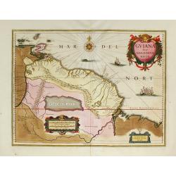
Guiana sive Amazonum Regio.
First edition of the last part of the Latin "Atlas maior" dedicated to America.Nice map extending from the Isla Margarita in the northwest to the coast of north...
Date: Amsterdam, 1662
Selling price: ????
Please login to see price!
Sold in 2009
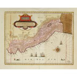
Peru.
First edition of the last part of the Latin "Atlas maior" dedicated to America.Decorated with ships and monsters on the sea. Orientated with east at the top. A ...
Date: Amsterdam, 1662
Selling price: ????
Please login to see price!
Sold in 2009
Nova et Accurata Brasiliae totius tabula.
First edition of the last part of the Latin "Atlas maior" dedicated to America. Original color.
Date: Amsterdam, 1662
Selling price: ????
Please login to see price!
Sold in 2010
Sinus Omnium Sanctory.
Shows the area of Bahia de Todos Sanctos in north-east Brazil with an inset plan of San Salvador.First edition of the last part of the Latin "Atlas maior" dedic...
Date: Amsterdam, 1662
Selling price: ????
Please login to see price!
Sold in 2009
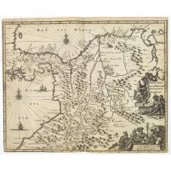
Terra Firma et Novum Regnum Granatense et Popayan.
Fine copy with wide margins of this handsome map of modern-day Panama and Colombia.First edition of the last part of the Latin "Atlas maior" dedicated to Americ...
Date: Amsterdam, 1662
Selling price: ????
Please login to see price!
Sold in 2009
Tabula Magellanica.
A map of South America's extremity with the Strait of Magellan and Le Maire Strait.The coastlines are depicted as very mountainous, while the interior is completely witho...
Date: Amsterdam, 1662
Selling price: ????
Please login to see price!
Sold in 2009
Paraquaria vulgo Paraguay.
Detailed map of Uruguay, Paraguay, Northern part of Argentina and northern part of Chilli. Engraved by Gerard Coeck. Two Dutch ships in the Atlantic Ocean.First edition o...
Date: Amsterdam, 1662
Selling price: ????
Please login to see price!
Sold in 2009
Praefecturae Paranambucae Pars Borealis. . . / Praefecturae Paranambucae Pars Meridionalis... / Praefectura de Ciriii ... / Praefecturae de Paraiba ...
Matching set of four maps covering the Brazilian Capitanias. Latin text on verso. First edition of the last part of the Latin "Atlas maior" dedicated to America...
Date: Amsterdam, 1662
Selling price: ????
Please login to see price!
Sold in 2009
Venezuela, cum parte Australi novae Andalusiae.
From the first edition of the last part of the Latin "Atlas maior" dedicated to America.A finely engraved, decorative map. The islands Trinidad, Margarita, Arub...
Date: Amsterdam, 1662
Selling price: ????
Please login to see price!
Sold in 2010
Freti Magellanici ac novi Freti vulgo Le Maire..
A fine map of Tierra del Fuego. With a Dutch translation of the explanatory text of the passage by Barent Jansz. Potgieter who accompanied captain Sebald de Weert to the ...
Date: Amsterdam, ca. 1662
Selling price: ????
Please login to see price!
Sold in 2016
Praefecturae Paranambucae Pars Meridionalis
Original map of the coast of Pernambuco, Brazil, from the Rio de S. Francisco to Paripueira.Title in a cartouche at top right, below is a nice scene with fishermen pullin...
Date: Amsterdam, 1662
Selling price: ????
Please login to see price!
Sold in 2022
Praefectura de Ciriji.
Full title: 'Praefecture de Ciriji vel Seregippe Del Rey cium Itapuama'. Showing a large part of the river de S. Francisco and further south to Aracaju, province of Sergi...
Date: Amsterdam, 1662
Selling price: ????
Please login to see price!
Sold in 2022
Sinus Omnium Sanctoru. Bahia de Todos os Sanctos.
First Atlas Major issue: originally issued by Blaeu in Casper van Baarle's 'Rerum per Octennium in Brasilia' (1647) dedicated to the former Governor of the Dutch colony, ...
Date: Amsterdam, 1664
Selling price: ????
Please login to see price!
Sold in 2012
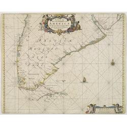
Paskaarte van Het Zuydelijckste van America..
A good copy of this scarce of the Southern tip of South America. The map also depicts a sailing ship at sea and a compass rose.
Date: Amsterdam, 1666
Selling price: ????
Please login to see price!
Sold in 2012
Chili.
Johannes Janssonius' very decorative map of Chili with two large and beautiful cartouches, a compass and ships. The modern cities of Santiago (identified on the map as &q...
Date: Amsterdam, 1666
Selling price: ????
Please login to see price!
Sold in 2012
Chili.
Johannes Janssonius' very decorative map of Chili with two large and beautiful cartouches, a compass and ships. The modern cities of Santiago (identified on the map as &q...
Date: Amsterdam, 1666
Selling price: ????
Please login to see price!
Sold in 2015
Destroit de Magellan, Terre et Isles Magellanicques . . .
Map of the Teierra del Fuego, Magellan Detroit prepared by N.Sanson and published by Pierre Mariette.Published in an early edition of the small Sanson atlas L'Europe Dedi...
Date: Paris, P. Mariette, 1667
Selling price: ????
Please login to see price!
Sold in 2008
Le Paraguay . . .
Map of Paraguay prepared by N.Sanson and published by Pierre Mariette.Published in an early edition of the small Sanson atlas L'Europe Dediée a Monseigneur . . . Le Tell...
Date: Paris, P. Mariette, 1667
Selling price: ????
Please login to see price!
Sold in 2011
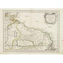
Guiane divisee en Guiane, et Caribane. . .
Map of Guinea prepared by N.Sanson and published by Pierre Mariette. This is a reduced derivative of the famous Sanson map of 1650.Published in an early edition of the sm...
Date: Paris, P. Mariette, 1667
Selling price: ????
Please login to see price!
Sold in 2008
Le Perou et le cours de la Riviere Amazone. . .
Standard map of Peru and the River Amazon prepared by N.Sanson and published by Pierre Mariette.Published in an early edition of the small Sanson atlas L'Europe Dediée a...
Date: Paris, P. Mariette, 1667
Selling price: ????
Please login to see price!
Sold in 2009
Le Bresil don't la coste est. . .
Map of Brazil. Published in an early edition of the small Sanson atlas L'Europe Dediée a Monseigneur . . . Le Tellier Secret. D'Estat &c."The ...
Date: Paris, P. Mariette, 1667
Selling price: ????
Please login to see price!
Sold in 2009
AMERIQUE MERIDIONALE.
A map of South America as prepared by N.Sanson and published by Pierre Mariette. Published in an early edition of the small Sanson atlas 'L'Europe Dediée a Monseigneur ....
Date: Paris, 1667
Selling price: ????
Please login to see price!
Sold in 2020
Le Paraguay Tire des Relations les Plus Recentes.
A boldly engraved, rare map of the region of present day Paraguay, Uruguay, northern Argentina, and parts of Chile and Brazil. The Rio de la Plata is the main feature of ...
Date: Paris, 1668
Selling price: ????
Please login to see price!
Sold in 2022
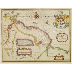
GUIANA sive Amazonum Regio.
Extremely rare map published by J.P. Thelott, extending from the Isla Margarita in the northwest to the coast of northern Brazil near Sao Luis east of the Amazon delta. T...
Date: Franckfurt 1669
Selling price: ????
Please login to see price!
Sold
Olinda de Phernambuco.
View of the town of Olinda, north of present-day Recife in Pernambuco with extensive shipping in the foreground.This plate is taken from Ogilby's An Accurate Description ...
Date: London, 1671
Selling price: ????
Please login to see price!
Sold in 2009
Obsidio et Expugnatio Portus Calvi.
Copper engraving of the Dutch fort at Porto Calvo (Alagoas). The foreground is filled with people, carts, and farmers. Title in banner style cartouche.This print is taken...
Date: London 1671
Selling price: ????
Please login to see price!
Sold
Fluvius Grandis.
A finely engraved view of a heavily armed fort along the Amazon delta. In the foreground soldiers and natives can be seen unloading goods from small boats that have come ...
Date: London 1671
Selling price: ????
Please login to see price!
Sold
I. Tamaraca.
A superb view of the Dutch Forte Oranje on the Brazilian island of Itamaracá, with small-craft shipping and local products being hauled along the waterfront. A small let...
Date: London, 1671
Selling price: ????
Please login to see price!
Sold in 2008
Urbs Salvador.
Fine copper engraving of the walled city of San Salvador, with numbered key at the top. Ships and boats fill the harbor in the foreground.This map is taken from Ogilby's ...
Date: London 1671
Selling price: ????
Please login to see price!
Sold
Arx Principis Guiljelmi.
Uncommon folio sheet 17th-century engraved view of the Dutch Fort William with its central church and strong palisades.Olinda is located on a hill in the background. A de...
Date: London 1671
Selling price: ????
Please login to see price!
Sold
Sinus Omnium Sanctoru.
Fine impression of Ogilby?s dramatic view of the Bay of All Saints in Brazil. Known as Sao Salvador, or Bahia, the town was first founded by the Portuguese in 1549 and wa...
Date: London 1671
Selling price: ????
Please login to see price!
Sold
I. Tamaraca.
A superb view of the Dutch Forte Oranje on the Brazilian island of Itamaracá, with small-craft shipping and local products being hauled along the waterfront.A small lett...
Date: Amsterdam, 1671
Selling price: ????
Please login to see price!
Sold in 2008
Urbs Salvador.
Fine copper engraving of the walled city of San Salvador, with numbered key at the top.Ships and boats fill the harbor in the foreground.
Date: Amsterdam, 1671
Selling price: ????
Please login to see price!
Sold
Obsidio et Expugnatio Portus Calvi.
Copper engraving of the Dutch fort at Porto Calvo (Alagoas), with numbered key in the upper right corner.The foreground is filled with people, carts, and farmers. Title i...
Date: Amsterdam, 1671
Selling price: ????
Please login to see price!
Sold
Alagoa ad Austrum.
Superb view of Alagoa (Maceio) with native fishermen in the foreground and a religious procession in the background. A small letter key at the bottom left identifies majo...
Date: Amsterdam, 1671
Selling price: ????
Please login to see price!
Sold
Ostium Flumines Paraybae.
Fine copper engraving illustrating the entrance to the Paraiba River in Brazil. With small letter key in the upper left corner.In the left background is a large fort (Cas...
Date: Amsterdam, 1671
Selling price: ????
Please login to see price!
Sold in 2008
Castrum Mauritij ad Ripam Fluminis S. Francisci.
Impressing copper engraving depicting Fort Maurice, which controlled the ferry on the Rio Francisco.With small letter key at the bottom.
Date: Amsterdam, 1671
Selling price: ????
Please login to see price!
Sold
Olinda de Phernambuco.
View of the town of Olinda, north of present-day Recife in Pernambuco with extensive shipping in the foreground.With small letter key in the upper left corner.
Date: Amsterdam, 1671
Selling price: ????
Please login to see price!
Sold
Serinhaim.
Fine view of a fort in Serinhaim, Brazil. With numbered key in the upper left corner and title enclosed in large ribbon banner style cartouche.A procession of Portuguese ...
Date: Amsterdam, 1671
Selling price: ????
Please login to see price!
Sold
Cartagena.
Attractive view of the treasure port of Cartagena in what is now Colombia.A variety of boats and ships dominate the foreground with the town and its surroundings depicted...
Date: Amsterdam, 1671
Selling price: ????
Please login to see price!
Sold
Venezuela cum parte Australi Novae Andalusiae.
Most decorative map with two large cartouches and compass-rose, large group of islands at the mouth of the Orinoco, other islands off Venezuela coast: Margarita, Aruba, C...
Date: Amsterdam, 1671
Selling price: ????
Please login to see price!
Sold
Brasila.
Map of Brazil extending from C. Nasou and Parime Lago to the Mouth of the Rio de la Plata.Oriented with West on top.The cartography of the region is quite primitive. The ...
Date: Amsterdam 1671
Selling price: ????
Please login to see price!
Sold
Tabula Magellanica qua tierrae del Fuego..
One of the most decorative maps of the extremity of South America, with Patagonia, the Straight of Magellan, Terra del Fuego and the discoveries made by LeMaire and Schou...
Date: Amsterdam, 1671
Selling price: ????
Please login to see price!
Sold
Peru.
Map of Peru from De Nieuwe en onbekende Weereld.. published by Arnold Montanus, which was used by John Ogilby as the basis of his Complete History of America.The map exte...
Date: Amsterdam, 1671
Selling price: ????
Please login to see price!
Sold
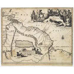
Guiana sive Amazonum Regio.
From : De Nieuwe en Onbekende Weereld published by Jacob van Meurs. Beautiful map of the Guyanas and Brazil, showing the course of the Amazon river and indicates the myth...
Date: Amsterdam, 1671
Selling price: ????
Please login to see price!
Sold in 2008
POTOSI
Decorative and highly detailed view of the City of Potosi, now the largest city in the Department of Potosi in Bolivia.Remarkable for its silver mines and the cathedral o...
Date: London, 1671
Selling price: ????
Please login to see price!
Sold in 2011
ARX NASSOVII
Early copper engraved view of the Fort Nassau, in Pernambuco, Brazil.Very decorative, with detailed sailing ships in the front, one firing its canons. The fort and villag...
Date: London, 1671
Selling price: ????
Please login to see price!
Sold in 2011
Castrum Mauritij ad Ripam Fluminis S. Francisci.
Impressing copper engraving depicting Fort Maurice, which controlled the ferry on the Rio Francisco.With small letter key at the bottom.
Date: Amsterdam, 1671
Selling price: ????
Please login to see price!
Sold in 2015
Tabula Magellanica qua tierrae del Fuego. . .
One of the most decorative maps of the extremity of South America, with Patagonia, the Straight of Magellan, Terra del Fuego and the discoveries made by LeMaire and Schou...
Date: Amsterdam, 1671
Selling price: ????
Please login to see price!
Sold in 2016
Tabula Magellanica, qua Tierrae del Fuego, cum Celeberrimis Fretis a F. Magellano et I. Le Maire Detectis Noviss et Accuratissim Descript. Exhibetur
One of the most elaborately decorated maps focusing on the tip of South America with the Strait of Magellan and Le Maire Strait. Several strange creatures are shown in th...
Date: 1671
Selling price: ????
Please login to see price!
Sold in 2020
Urbs Salvador.
A handsome copper engraving of the walled city of San Salvador, with a lettered key at the top left corner.Ships and boats fill the harbor in the foreground. From Arnoldu...
Date: Amsterdam, 1671
Selling price: ????
Please login to see price!
Sold in 2017
S. Salvador.
A very attractive copperplate engraving of the Brazilian city of San Salvador (Sao Salvador de Bahia de Todos os Santos / The Holy Saviour of the Bay of All Saints), in t...
Date: London, ca 1671
Selling price: ????
Please login to see price!
Sold in 2022
Cartagena.
A richly colored view of what was at the time one of the most important and largest cities in Spanish America. As a result, Cartagena was heavily defended, as is evidence...
Date: London, ca 1671
Selling price: ????
Please login to see price!
Sold in 2022
Tabula Magellanica qua tierrae del Fuego. . .
One of the most decorative maps of the extremity of South America, with Patagonia, the Straight of Magellan, Terra del Fuego and the discoveries made by LeMaire and Schou...
Date: Amsterdam, 1673
Selling price: ????
Please login to see price!
Sold in 2013
Guiana sive Amazonum Regio.
Map of Guiana and Amazon extending westwards to Trinidad and Margarita Island, dominated by a huge inland sea north of the Amazon.Embellished with decorative title and sc...
Date: Amsterdam, 1673
Selling price: ????
Please login to see price!
Sold in 2025
Venezuela cum parte Australi Novae Andalusiae.
Most decorative map with two large cartouches and compass-rose, large group of islands at the mouth of the Orinoco, other islands off Venezuela coast: Margarita, Aruba, C...
Date: Amsterdam, 1673
Selling price: ????
Please login to see price!
Sold in 2025
Terra Firma et Novum Regnum Granatense et Popayan.
Detailed map of Panama and northwestern South America derived from the Blaeu/Jansson map of the regionFeaturing ships at sea, two compass roses, and two cartouches depict...
Date: Amsterdam, 1673
Selling price: ????
Please login to see price!
Sold in 2025
Paraquaria vulgo Paraguay cum adjacentibus.
Detailed map extending from Rio de Janeiro to the Rio de la Plata basin in what is today Argentina.The title cartouche of this highly decorative map features Indians and ...
Date: Amsterdam, 1673
Selling price: ????
Please login to see price!
Sold in 2022
Brasila.
Map of Brazil extending from C. Nasou and Parime Lago to the Mouth of the Rio de la Plata. Oriented with West on top.The cartography of the region is quite primitive. The...
Date: Amsterdam, 1673
Selling price: ????
Please login to see price!
Sold in 2014
Amérique Méridionale divisée en ses principales Parties.
A very impressive large-scale map. The large decorative title cartouche is balanced by an equally large cartouche around the scale bars, surrounded by Indian figures and ...
Date: Paris, 1674
Selling price: ????
Please login to see price!
Sold in 2009
Paskaart van BRASIL van Rio de los Amazones, tot Rio de la Plata.
An eye-catching chart of Brazil. Including 2 compass roses along with a title cartouche.Pieter Goos (ca. 1616-1675) was one of the most important cartographer, engraver, ...
Date: Amsterdam 1675
Selling price: ????
Please login to see price!
Sold
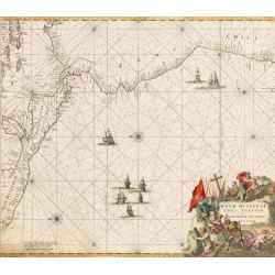
Nova Hispaniae, Chili, Peruviae, et Guatimalae Littorae...
An early edition of this superb chart of the Pacific Ocean, oriented with north to the left of the sheet, showing the coasts of Peru, Chili, Ecuador, Colombia, Honduras, ...
Date: Amsterdam, 1675
Selling price: ????
Please login to see price!
Sold in 2022
Littoria Brasiliae / Pascaert van Brasil.
A truly superb Dutch sea chart of Brazil, with north orientated to the left, published by Frederik de Wit, a man who was rightly famous for his accurate, detailed and hig...
Date: Amsterdam, ca 1675
Selling price: ????
Please login to see price!
Sold in 2022


