Browse Listings in America > North America
Memorial Hall - International Exhibition Fairmount Park
Very fine depiction of Memorial Hal at the 1876 International World exhibition in Philadelphia. The building was 365 feet wide and used 1.5 acres. The centennial exhibiti...
Date: Philadelphia 1876
Selling price: ????
Please login to see price!
Sold in 2008
Horticultural Hall-International Exhibition Fairmount Park
Very fine depiction of Horticultural Hal at the 1876 International World exhibition in Philadelphia. The building was 360 feet wide and used 1.5 acres. The centennial exh...
Date: Philadelphia 1876
Selling price: ????
Please login to see price!
Sold in 2008
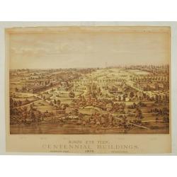
Bird's eye view, Centennial buildings.
Overview of the grounds of the 1876 International Exhibition Worldexpo in Philadelphia. The centennial exhibition took place to celibrate the 100 year eccistance of the R...
Date: Philadelphia 1876
Selling price: ????
Please login to see price!
Sold
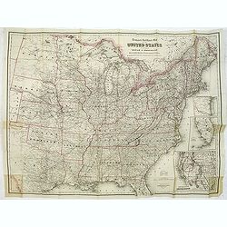
Travelers' Rail Road Map of the United States to Accompany ‘Boston to Washington' Riverside Series Centennial Guides. . .
Lithographed folding map with excellent original outline hand color for state boundaries. 28 1/4 x 38" at neat line. Sheet size: 30 x 39 1/4". Three inset maps ...
Date: New York, G. W. & C. B. Colton & Co., 1876
Selling price: ????
Please login to see price!
Sold in 2014
New York from Bergen Hill - Hoboken.
A large and detailed view of New York City issued in the year of America's centennial as an "extra supplement" to the Illustrated London News (Aug. 19, 1876).Fr...
Date: London, 1876
Selling price: ????
Please login to see price!
Sold in 2017
Carte Ecclésiastique des Etats Unis d'Amérique.
Uncommon map of the United States divided up in 11 missionary regions, including on the right side a list of the total population, Catholics, priests and the number of ch...
Date: Lyon/ Paris 1877
Selling price: ????
Please login to see price!
Sold
[The City of San Francisco.]
A very decorative bird's-eye view of San Francisco. The city is seen from above the harbor, which teems with sailing and steam vessels.Published by Currier & Ives 125...
Date: New York, 1877
Selling price: ????
Please login to see price!
Sold in 2014
Battle plan of York.
A battle plan of York, from a Dutch translation of 'The life of George Washington'.
Date: Haarlem, 1877
Selling price: ????
Please login to see price!
Sold in 2019
Carte générale du Golfe du Mexique d'après les traveaux Américans, Anglais et Français les plus récents. Publiée par ordre de L'Empereur..
Important chart of Texas, Florida and the Gulf Coast, heavenly leaning on the landmark map Carta Esferica. The original map was commissioned by the governor of Spanish Lo...
Date: Paris (1865) corrected for 1878
Selling price: ????
Please login to see price!
Sold
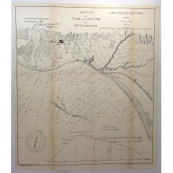
Sketch of Plan and Section of a Breakwater, San Buenaventura Cal. 1870
A scarce early map of Ventura, extending from the San Buenaventura River and the City of Ventura southward and showing the town, mountains several rivers and extensive so...
Date: Washington, 1878
Selling price: ????
Please login to see price!
Sold in 2018
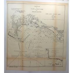
Sketch of Plan and Sections of a Breakwater, San Luis Obispo Bay, Cal. 1876.
A scarce early map of the San Luis Obispo area of California. It is one of the earliest obtainable plans of San Luis Obispo. Showing the town, mountains several rivers an...
Date: Washington, 1878
Selling price: ????
Please login to see price!
Sold in 2018
Sketch of Plan and Section of a Breakwater, San Buenaventura, Cal. 1870.
A scarce early map of Ventura, extending from the San Buenaventura River and the City of Ventura southward. Showing the town, mountains several rivers and extensive sound...
Date: Washington, 1878
Selling price: ????
Please login to see price!
Sold in 2018
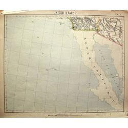
United States No. 19.
Unusual map, showing Baja California, and the area to San Diego, Santa Catalina Island, Yuma, Phoenix. Attractive map, with decorative coloring.
Date: London, c1880
Selling price: ????
Please login to see price!
Sold in 2011
Map Issued by H.C. Frick & Co., Manufacturers Connellsville Coke.
Scarce large-scale map of the Connellsville coal vein by the H.C. Frick Coke Company. Locates ovens, towns, railroads, roads, creeks, etc. We could not locate a copy of ...
Date: Pittsburgh, 1880
Selling price: ????
Please login to see price!
Sold in 2013
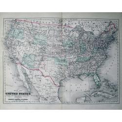
Map of the United States Drawn and Engraved on Copper-Plate Expressly for Johnson's Universal Cyclopaedia.
Fine map of the United States. Oklahoma is Indian Territory and only "one" Dakota. With many place names, railroads, etc.
Date: New York, c1880
Selling price: ????
Please login to see price!
Sold in 2013
City of New Orleans.
A very decorative bird's-eye view of New Orleans with the Mississippi River in the foreground. Lake Pontchartrain is visible in the distance. Keyed below image : Lake Pon...
Date: New York, ca. 1880
Selling price: ????
Please login to see price!
Sold in 2014
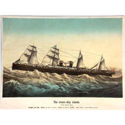
The Steam-Ship Alaska.
A fine Currier & Ives chromolithographic print featuring the steam-ship Alaska of the Guion Line. Its nickname was "THE GREYHOUND OF THE ATLANTIC." This pri...
Date: New York, ca. 1880
Selling price: ????
Please login to see price!
Sold in 2016
Long Beach, Long Island. 1. Long Beach Hotel. 2. Bathing Pavilion. 3. Map Showing the route to Long Beach.
3 views on one sheet. Map depicts the city map of New York and the city with its surroundings.
Date: London, ca. 1880
Selling price: ????
Please login to see price!
Sold in 2018
The Great East River Suspension Bridge. Pont de Brooklyn. Connecting the cities of New York and Brooklyn.
A very decorative print of the Brooklyn Bridge. The bridge enters the print at center left, the New York end of the bridge is at right, with lower Manhattan. Featured wit...
Date: New York, 1881
Selling price: ????
Please login to see price!
Sold in 2014
Boston.
A highly detailed late -19th century plan of the city of Boston. It depicts the entire city in remarkable detail, noting individual streets, important public buildings, r...
Date: London, 1881
Selling price: ????
Please login to see price!
Sold in 2020
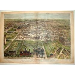
OUR NATIONAL CAPITAL VIEWED FROM THE SOUTH
A handsome, hard to find, double page bird's-eye panorama of Washington D.C. as seen in the early 1880's. This finely engraved wood-cut provides excellent detail of the c...
Date: New York, 1882
Selling price: ????
Please login to see price!
Sold
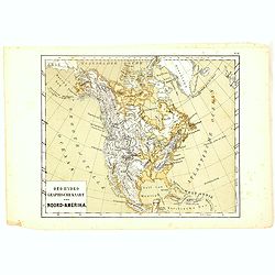
Oro-Hydrographische Kaart van Noord-Amerika.
One of the earliest thematic maps of North America published in the Netherlands from "Atlas der natuurkundige aardrijkskunde. . .". prepared by Nicolaas Wilhelm...
Date: Amsterdam, C.L. Brinkman, 1883
Selling price: ????
Please login to see price!
Sold in 2018
Parts of Western Wyoming, Southeastern Idaho and Northeastern Utah.
A fine, detailed economic map of portions of the mid-western states of Wyoming, Idaho and Utah, published in 1883 in Hayden's 12th Annual Report. It is a spectacular, ear...
Date: Washington, 1883
Selling price: ????
Please login to see price!
Sold in 2018
PANORAMIC VIEW OF NEW ORLEANS - THE FEDERAL FLEET AT ANCHOR IN THE RIVER, APRIL 25TH, 1862
A superb bird's-eye panoramic view of the city of New Orleans in April, 1862. From a special 1884 publication titled: "The Soldier in our Civil War an Illustrated H...
Date: New York, 1884
Selling price: ????
Please login to see price!
Sold
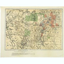
Map showing private land claims, patented or unpatented or cinfirmed in New Mexico, Colorado and Arizona.
Rare map showing private land claims, patented or unpatented or confirmed in New Mexico, Colorado and Arizona to accompany Thomas Donaldson "The Public Domain, Its H...
Date: Washington, 1884
Selling price: ????
Please login to see price!
Sold in 2012
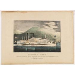
Steamer Drew. Vapeur de l'Hudson.
A very decorative print of the steamboat "Drew" sailing on the Hudson River.Published by Currier & Ives 125 Nassau Street, New York."Currier & Ives...
Date: New York, ca. 1885
Selling price: ????
Please login to see price!
Sold in 2014
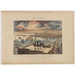
The Harbor of New York. Pont de Brooklyn.
A very decorative print of New York Harbor and Brooklyn Bridge. Five men stand or sit on the Brooklyn Bridge tower in the foreground. The harbor extends to the horizon at...
Date: New York, ca. 1885
Selling price: ????
Please login to see price!
Sold in 2014
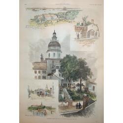
Annapolis, Maryland
A beautiful woodcut grouping incorporating five views of / in Annapolis, the capital of Maryland. The central view is of the old capitol building. The original U.S. Naval...
Date: New York, 1886
Selling price: ????
Please login to see price!
Sold
Les Etats Unis de l' Amerique Septentrionale, Partie Occidentale.
Rigobert Bonne (1727-1795), French cartographer. His maps are found in a.o. Atlas Moderne (1762), Raynal's Histoire Philos. du Commerce des Indes (1774) and Atlas Encyclo...
Date: Paris, 1787-1888
Selling price: ????
Please login to see price!
Sold
Murphy Bolanz. Official Map of the City of Dallas and East Dallas, Texas, 1887.
Engraved map with to the right and lower margin. Very small inset map of northeast Texas at top, along with an illustration of the firm's offices. Size of the map 375x252...
Date: Dallas, June, 1888
Selling price: ????
Please login to see price!
Sold in 2014
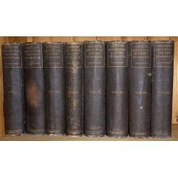
Eight volumes, ' Narrative and Critical History of America ' by Justin Winsor, complete, published by Houghton, Mifflin & Co. Boston at the Riverside Press 1889
In addition to the set in volume, I is a handwritten letter dated July 7th, 1893, signed Edward Channing, an American historian, and author of a monumental "History ...
Date: Boston, 1889
Selling price: ????
Please login to see price!
Sold in 2017
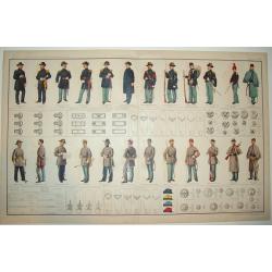
ATLAS TO ACCOMPANY THE OFFICIAL RECORDS OF THE UNION AND CONFEDERATE ARMIES 1861 - 1865
A highly desirable, rarely found double page lithograph of official Union and Confederate army uniforms, along with chevrons, buttons, badges, caps and more. A fascinatin...
Date: New York, c. 1890
Selling price: ????
Please login to see price!
Sold
[Untitled Turkish map of Central America, from California until Honduras]
An unusual Turkish map of Central America, from California until Honduras, including parts of today's Arizona, New Mexico, Texas and Louisiana. A highly collectible Ottom...
Date: Turkey, ca. 1890
Selling price: ????
Please login to see price!
Sold in 2018
Canada Creek Falls . . [title in French, English, German & Latin] N°32. Pl. 4.
A view of the Canada Creek Falls.From 8e Livraison Amérique Septentrionale - Etat de New York. After Jacques Milbert and lithographed by Dupressoir and figures by V. Ada...
Date: Paris, Bove dirigée par Nöel ainé & Cie, 1892
Albany-Capital of the State of New York. . . [title in French, English, German & Latin] N°13. Pl. 1.
A town-view coastal of Albany-Capital of the State of New York..From 4e Livraison Amérique Septentrionale - Etat de New York. After Jacques Milbert and lithographed by D...
Date: Paris, Bove dirigée par Nöel ainé & Cie, 1892
Selling price: ????
Please login to see price!
Sold in 2010
Foundery on Jone's Creek near Baltimore. . [title in French, English, German & Latin] N°52. Pl. 4.
A view of Jone's Creek foundery near Baltimore.From 13e Livraison Amérique Septentrionale - Etat de New York. After Jacques Milbert and lithographed by Bichebois and fig...
Date: Paris, Bove dirigée par Nöel ainé & Cie, 1892
Selling price: ????
Please login to see price!
Sold in 2009
Commencement of Passaic falls. . [title in French, English, German & Latin] N°47. Pl. 3.
A view of the Passaic Falls.From 12e Livraison Amérique Septentrionale - Etat de New York. Drawn after nature by J.R.Smith and lithographed by Dupressoir and the figures...
Date: Paris, Bove dirigée par Nöel ainé & Cie, 1892
Selling price: ????
Please login to see price!
Sold in 2009
View of the natural bridge. [title in French, English, German & Latin] N°53. Pl. 5.
A view of a natural bridge.From 13e Livraison Amérique Septentrionale - Etat de New York. After Jacques Milbert and lithographed by Bichebois and figures by V. Adam. Pri...
Date: Paris, Bove dirigée par Nöel ainé & Cie, 1892
Selling price: ????
Please login to see price!
Sold in 2009
Saw-Mill at the village of Glenns. . . N°23. Pl.3.
A view of the saw mill at the village of Gleens.From 6e Livraison Amérique Septentrionale - Etat de New York. After Jacques Milbert and lithographed by Villeneuve. Print...
Date: Paris, Bove dirigée par Nöel ainé & Cie, 1892
Selling price: ????
Please login to see price!
Sold in 2010
Grand Birds-Eye View of the Grounds and Buildings of the Great Columbian Exposition at Chicago, Illinois, 1892-3.
Lithography after a watercolor by C. Graham created as part of a portfolio for the World's Columbian Exposition (also known as the Chicago World's Fair) was a world's fai...
Date: New York, 1892
Selling price: ????
Please login to see price!
Sold in 2023
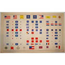
ATLAS TO ACCOMPANY THE OFFICIAL RECORDS OF THE UNION AND CONFEDERATE ARMIES, 1861-1865
An impressive and rarely seen double-page lithographic print of official U.S. Civil War-era national and military standards, badges, and icons. More than 100 items are de...
Date: New York, ca. 1894
Selling price: ????
Please login to see price!
Sold
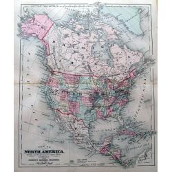
Map of North America.
Attractive map of North America during the late 19th century. With the Indian Territory north of Texas. Indicates coal fields, and shows railways.
Date: New York, 1894
Selling price: ????
Please login to see price!
Sold in 2015
Map of New York City showing portions of Brooklyn, Jersey City, and Westchester Co.
Map of the routes of the train system around New York. With inset plan of lower Manhattan. On verso Guide map of New York City, with lovely illustration of Broadway Centr...
Date: Chicago & New York, 1895
Selling price: ????
Please login to see price!
Sold
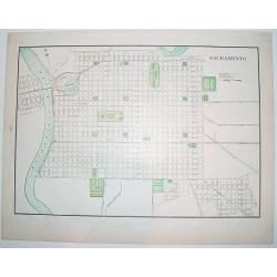
Sacramento.
A nice, late 19th century plan of the City of Sacramento, capital of California. The map shows the city's existing railway as well as the "proposed railway". On...
Date: New York, ca. 1895
Selling price: ????
Please login to see price!
Sold
Bird's Eye View of the Tourists' Ideal Route from Niagara to the Sea.
A terrific "bird's eye view" of the Tourists' Ideal Route from Niagara to the Sea - ca. 1895. The maker is unknown, map shows from Nova Scotia to St Louis, and ...
Date: Buffalo, ca. 1895
Selling price: ????
Please login to see price!
Sold in 2018
Port de Boston d'après la carte de l'United Coast Survey.
A fine French Service Hydrograhique de la Marine chart no. 4821, showing Boston Harbour, after maps of the United Coast Survey. A past-on (7 x 10 cm) has been pasted on t...
Date: Paris, 1895
Selling price: ????
Please login to see price!
Sold in 2019
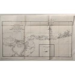
Sketch Showing Progress of Surveys on the Gulf Coast Lake Pontchartrain, Mobile and Pensacola Bays.
This is the Survey Report of 1896 by the U.S. Coast and Geodetic Department. It includes an insert of Tortugas Harbor.
Date: Washington, 1896
Selling price: ????
Please login to see price!
Sold in 2020
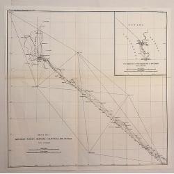
Boundary Survey Between California and Nevada.
An antique lithographic map published in 1896, Washington for "U.S. Coast and Geodetic Survey" . Includes an insert “SUB SKETCH OF SOUTHERN END OF BOUNDARY�...
Date: Washington, 1896
Selling price: ????
Please login to see price!
Sold in 2020
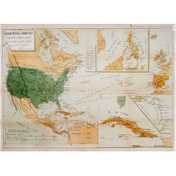
Guerre Hispano-Américaine.. Carte de Cuba, des petites Antilles et des Iles Philippines.
Interesting map of North and Central America. In upper right corner: 2e édition Revue et Completée. Text on verso relating to the history of Cuba Histoire de Cuba depui...
Date: Gent , 1898
Selling price: ????
Please login to see price!
Sold
Sound et delta du Mississippi / de la baie de Mobile à la Nouvelle Orléans d'après les Cartes de l'United Coast Survey...
A fine French Service Hydrograhique de la Marine chart no.4710, showing the Mississippi Delta from Mobile Bay to New Orleans, after maps of the United Coast Survey. With ...
Date: Paris, 1894 / 1898
Selling price: ????
Please login to see price!
Sold in 2019
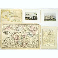
Group of 5 maps and prints of North American interest.
Group of five prints and maps. - Map of the West Indies by W.Darton.- View of New York from Weehawken by W.H.Bartlett (120x180mm.)- Principal front of the capitol Washing...
Date: c. 1850-1900
Selling price: ????
Please login to see price!
Sold in 2014
New Mexico.
A large, detailed map of New Mexico, possibly published at the turn of the last century. Each county is color coded, parcels of land and property are recorded, together w...
Date: Unknown, ca 1900
Selling price: ????
Please login to see price!
Sold in 2019
Nieuw Amsterdam op t Eylant Manhattans.
The rare and earliest obtainable view of Manhattan of ca. 1650 by J. Blaeu. The view is based on a prototype drawing, dated by J.M. de Koning to the year 1648, discovered...
Date: Amsterdam, 1652 but likely ca. 1900
Selling price: ????
Please login to see price!
Sold in 2020
Delaware River from Cohansey to Philadelphia. From the United States Coast Survey, 1882. Inner sheet 2.
A fine Hydrographic Office chart no. 2564 figuring the Delaware River from Cohansey to Philadelphia based on a United States Coast Survey from 1882. Inner sheet 2. Engrav...
Date: London, 1882 / 1900
Selling price: ????
Please login to see price!
Sold in 2019
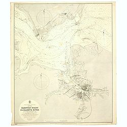
Hampton road and Elizabeth River. . .
A fine Hydrographic Office chart no. 2818, figuring Hampton Road, the James and Elizabeth Rivers and the cities of Norfolk and Portsmouth. Engraved by J. and C. Walker. L...
Date: London, 1892 / 1900
Selling price: ????
Please login to see price!
Sold in 2020
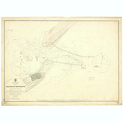
East Coast, Gulf of Mexico, Texas - Galveston Entrance from the latest United States Government Chart.
A fine Hydrographic Office chart no. 192 (1714) showing Galveston entrance. Engraved by Davies & Company. London : Published at the Admiralty, 6th Nov.r 1897 under th...
Date: London, 1897/ 1900
Selling price: ????
Please login to see price!
Sold in 2019
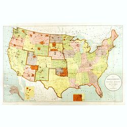
Map Showing Indian Reservations Within The Limits of the United States Compiled Under The Direction of the Hon. T. J. Morgan Commissioner of Indian Affairs 1901.
Fine example of the Indian Affairs Commissioner's Map of the United States. The present map locates all the lands reserved to Native American Tribes as of 1901.Inset maps...
Date: Washington D.C, 1901
Selling price: ????
Please login to see price!
Sold in 2017
War Department Map of Exploration of North Western Alaska...
Unusual survey map of the Arctic Ocean and Northwestern Alaska.
Date: 1902
Selling price: ????
Please login to see price!
Sold in 2010
Sabine Pass and Lake / Louisiana and Texas (Polyconic proJection) / Scale 1/40 000.
A fine Hydrographic Office chart no. 517 showing Sabine Pass and Lake with Port Arthur in Louisiana and Texas.Published at Washington D.C. April, 1901, by the U. S. Coast...
Date: Washington D.C, 1901-1902
Selling price: ????
Please login to see price!
Sold in 2019
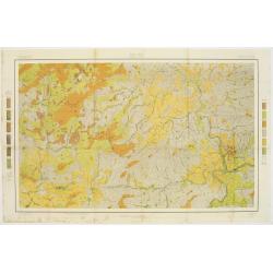
Soil map - Alabama, Mobile sheet.
Early color lithographed soil map by Julius Bien & Co. in New York for the Department of Agriculture. Legends at the side give details on soil type, etc. They also in...
Date: New York, 1903
Selling price: ????
Please login to see price!
Sold in 2017
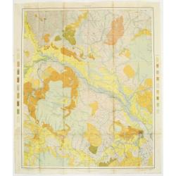
Soil map - North Carolina, Asheville sheet.
Soil map printed by Julius Bien & Co in New York for Department of Agriculture. The map is giving great detail of the area including and west of Asheville, North Caro...
Date: New York, 1903
Selling price: ????
Please login to see price!
Sold in 2017
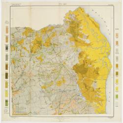
Soil map - North Carolina, Craven sheet
Early color lithographed soil map by Julius Bien & Co. in New York for Department of Agriculture. Legends at side give detail on soil type, etc. They also include int...
Date: New York, 1903
Selling price: ????
Please login to see price!
Sold
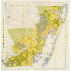
Soil map - Maryland, Worcester County sheet
Early color lithographed soil map by Julius Bien & Co. in New York for Department of Agriculture. Legends at side give detail on soil type, etc. They also include int...
Date: New York, 1903
Selling price: ????
Please login to see price!
Sold in 2009
Soil map - Delaware, Dover sheet.
Early color lithographed soil map by Julius Bien & Co. in New York for Department of Agriculture. Legends at side give detail on soil type, etc. They also include int...
Date: New York, 1903
Selling price: ????
Please login to see price!
Sold in 2018
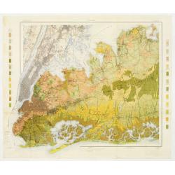
Soil map - New York, Hempstead sheet
Early color lithographed geological or soil map by Julius Bien & Co. in New York for the Department of Agriculture. Legends at the side give details on soil type, etc...
Date: New York 1903
Selling price: ????
Please login to see price!
Sold
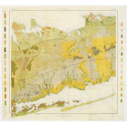
Soil map - New York, Babylon sheet.
Early color lithographed soil map by Julius Bien & Co. in New York for Department of Agriculture. Legends at side give detail on soil type, etc. They also include int...
Date: New York, 1903
Selling price: ????
Please login to see price!
Sold in 2011
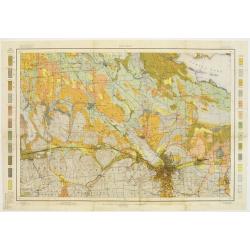
Soil map - New York, Syracuse sheet
Early color lithographed geological or soil map by Julius Bien & Co. in New York for the Department of Agriculture. Legends at the side give details on soil type, etc...
Date: New York 1903
Selling price: ????
Please login to see price!
Sold
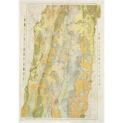
Soil map - Connecticut. - Massachusetts, (Hartford) Springfield sheet.
Early color lithographed soil map by Julius Bien & Co. in New York for Department of Agriculture. Legends at side give detail on soil type, etc. They also include int...
Date: New York, 1903
Selling price: ????
Please login to see price!
Sold in 2008
Soil map - Massachusetts, Amherst sheet
Early color lithographed soil map by Julius Bien & Co. in New York for Department of Agriculture. Legends at side give detail on soil type, etc. They also include int...
Date: New York, 1903
Selling price: ????
Please login to see price!
Sold in 2009
Soil map - Alabama, Fort Payne sheet.
Early color lithographed geological or soil map by Julius Bien & Co. in New York for the Department of Agriculture. Legends at the side give details on soil type, etc...
Date: New York, 1903
Selling price: ????
Please login to see price!
Sold in 2011
Soil map - Alabama, Huntsville sheet
Early color lithographed soil map by Julius Bien & Co. in New York for the Department of Agriculture. Legends at the side give details on soil type, etc. They also in...
Date: New York 1903
Selling price: ????
Please login to see price!
Sold
Louisiana, New Orleans sheet.
soil map printed by Julius Bien & Co in New York for Department of Agriculture. The map is giving great detail of the area in the east of New Orleans, Louisiana, in t...
Date: New York, 1903
Selling price: ????
Please login to see price!
Sold in 2013
Soil map - Louisiana, Acadia Parish sheet.
Early color lithographed soil map by Julius Bien & Co. in New York for Department of Agriculture. Legends at side give detail on soil type, etc. They also include int...
Date: New York, 1903
Selling price: ????
Please login to see price!
Sold in 2009
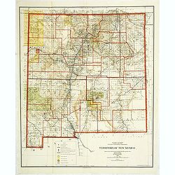
Department of the interior . . . Territory of New Mexico Compiled from the official Records. . .
Photolithography by Andrew B. Graham Washington, DC. Revised and drawn by Charles J. Helm.Detailed sepia tone topographic plat map with Indian Reservations in yellow, for...
Date: Washington, 1903
Selling price: ????
Please login to see price!
Sold in 2014
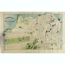
The commercial, pictorial and tourist map of San Francisco, in colors and illustrated with litho-engraved pictures of all public buildings, parks, monuments, and recommended business houses, etc. . . .
Important and rare pre-earth-quake San Francisco town plan. Covering from the "Sunset District" and the Blue Mountain, up to the Golden Gate and the northern sh...
Date: San Francisco, 1904
Selling price: ????
Please login to see price!
Sold in 2015
Boston Bay approaches from the latest United States Government Charts.
A fine Hydrographic Office chart no. 1227 figuring Boston Bay approaches from the latest United States Government Charts. Engraved by Davies and Company. London : Publish...
Date: London, 1904
Selling price: ????
Please login to see price!
Sold in 2020
Map of Alaska, YukonTerritory and British Columbia showing connections of The White Pass & Yukon Route.
Railway map of Alaska, YukonTerritory and British Columbia showing connections of The White Pass & Yukon Route. On the back informations about the trip.
Date: Chicago, 1904
Selling price: ????
Please login to see price!
Sold in 2021
[Official US Government Document.]
An official US government printed document, completed in manuscript and signed by President Theodore Roosevelt, appointing John G. Chandler Brigadier-General on the retir...
Date: Washington D.C., 1904
Selling price: ????
Please login to see price!
Sold in 2022
[North America]
A more than 100 year old Russian map of North America printed in lithography. Published by one of the most successful publishers of St. Petersburg A.Iljin. With a color k...
Date: St. Petersburg, c.1905
Selling price: ????
Please login to see price!
Sold in 2013
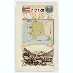
Alaska / Costume del S. Salvador.
An unusual item. It is a nice colored chromolithograph map of Alaska, with a few place names, a coat of arms and the American flag, together with a small view of Sitca be...
Date: Milano, 1905
Selling price: ????
Please login to see price!
Sold in 2019



![[The City of San Francisco.]](/uploads/cache/27529-250x250.jpg)










![[Untitled Turkish map of Central America, from California until Honduras]](/uploads/cache/81325-250x250.jpg)
![Canada Creek Falls . . [title in French, English, German & Latin] N°32. Pl. 4.](/uploads/cache/26800-250x250.jpg)
![Albany-Capital of the State of New York. . . [title in French, English, German & Latin] N°13. Pl. 1.](/uploads/cache/26654-250x250.jpg)
![Foundery on Jone's Creek near Baltimore. . [title in French, English, German & Latin] N°52. Pl. 4.](/uploads/cache/26804-250x250.jpg)
![Commencement of Passaic falls. . [title in French, English, German & Latin] N°47. Pl. 3.](/uploads/cache/26818-250x250.jpg)
![View of the natural bridge. [title in French, English, German & Latin] N°53. Pl. 5.](/uploads/cache/26819-250x250.jpg)














![[Official US Government Document.]](/uploads/cache/48155-250x250.jpg)
![[North America]](/uploads/cache/25596-250x250.jpg)
