Browse Listings in America
Virginiae Partis australis, et Floridae Partis Orientalis, interjacentiumq, regionum Nova Descripti
Attractive map of the east coast of Virginia and Florida. Second state with small tail at left water-cherub. "One of the many elegantly engraved maps of the Eastern ...
Date: Amsterdam, 1643
Selling price: ????
Please login to see price!
Sold in 2009
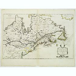
Description de la Nouvelle France ou sont remarquees les diverse habitations des Francois, depuis la premiere descouvert jusques a present, recueillie et dressee sur diverses relations modernes
VERY RARE FIRST STATE, a second state was issued circa 1664. In superb condition. Important GREAT LAKES map first issued in 1643. According to Burden it is actually the f...
Date: Paris, 1643
Selling price: ????
Please login to see price!
Sold in 2012
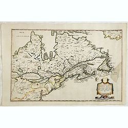
Description de la Nouvelle France. . .
Jean Boisseau's edition of Samuel De Champlain's 1632 map, first published in Paris in 1643.Boisseau’s map was the first map derived from Champlain and pre-dates Du Val...
Date: Paris, 1643
Selling price: ????
Please login to see price!
Sold in 2014
Poli Arctici et Circumiacentium Terrarum Descriptio.
A circular map showing north of Europe and United States. The map is surrounded by scenes of fishing whales.
Date: Amsterdam 1639-1644
Selling price: ????
Please login to see price!
Sold
Poli Arctici et Circumiacentium Terrarum Descriptio.
A circular map showing north of Europe and United States. The map is surrounded by scenes of fishing whales. Cartographically the map incorporates much of the knowledge g...
Date: Amsterdam, 1639-1644
Selling price: ????
Please login to see price!
Sold in 2012
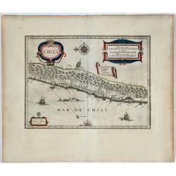
Chili.
Very decorative map of Chili with two large and beautiful cartouches, a compass and ships.
Date: Amsterdam, 1639-1644
Selling price: ????
Please login to see price!
Sold in 2014
Insulae Americanae in oceano septentrionali.
Showing the Gulf of Mexico and the West Indian Islands, and the adjacent North and South American coastlines. The map is based on the map by Gerritsz., except for the add...
Date: Amsterdam, 1639-1644
Selling price: ????
Please login to see price!
Sold in 2014
America noviter delineata.
Very rare map of America separately published. This derivative map by Nicolas Picart is based upon the second state of Janssonius' map of 1623, after the lower border had...
Date: Paris, 1644
Selling price: ????
Please login to see price!
Sold in 2023
Americae Nova Tabula.
The delineation of the coast and the nomenclature on both the Pacific and Atlantic coasts are basically Spanish in origin and follow the maps of Ortelius and Wytfliet. To...
Date: Amsterdam 1645
Selling price: ????
Please login to see price!
Sold
Americae Nova Tabula.
One of the best known and sought after seventeenth century maps of America. Blaeu?s famous ?carte a figures? map of America is regarded as a high point in Dutch cartograp...
Date: Amsterdam 1645
Selling price: ????
Please login to see price!
Sold
Americae Nova Tabula.
One of the best known and sought after seventeenth century maps of America. Blaeu's famous carte à figure map of America is regarded as a high point in Dutch cartography...
Date: Amsterdam 1645
Selling price: ????
Please login to see price!
Sold
Americae Nova Tabula.
One of the best known and sought after seventeenth century maps of America. Blaeu's famous carte a figures map of America is regarded as a high point in Dutch cartography...
Date: Amsterdam 1645
Selling price: ????
Please login to see price!
Sold
Americae Nova Tabula.
One of the best known and sought after seventeenth century maps of America. Blaeu's famous carte a figure map of America is regarded as a high point in Dutch cartography....
Date: Amsterdam, 1645
Selling price: ????
Please login to see price!
Sold
Áfbeeldinge vande Cabo St. Augustin Met haer forten.
The taking of the Portuguese settlement at Cape St. Augustin by a Dutch fleet. From I. Commelin's work on the history of the Dutch in Brasil.
Date: Amsterdam, c. 1645
Selling price: ????
Please login to see price!
Sold
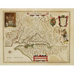
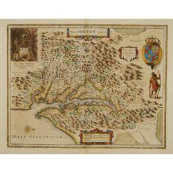
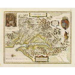
Nova Virginiae Tabula.
The map is based on the first state of Smith's map, 1612, and is slightly larger and more expertly engraved. In 1629 the Hondius plate was purchased by Blaeu who deleted ...
Date: Amsterdam 1645
Selling price: ????
Please login to see price!
Sold
t' Neemen van de Suyker Prysen in de Bay de Tode los Santos Anno 1627.
Nice copper engraving of the Dutch fleet under command of Piet Heyn capturing the fort at the entrance to the Baia de Todos os Santos, in northeastern Brazil. Large inset...
Date: Amsterdam, c. 1645
Selling price: ????
Please login to see price!
Sold
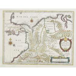
Terra Firma et Novum regnum Granatense et Propayan.
Fine copy, with wide margins of this handsome map of the Isthmus of Panama and northwestern South America including most of present day Columbia and part of Venezuela. Te...
Date: Amsterdam, 1645
Selling price: ????
Please login to see price!
Sold in 2008
Americae Nova Tabula.
Blaeu's America, with extensive gold highlights. Blaeu's famous map of America is flanked by panels on three sides. People of Virginia, Florida, California, and South Am...
Date: Amsterdam, ca. 1645
Selling price: ????
Please login to see price!
Sold in 2008
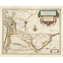
Paraguay, o Prov. de Rio de la Plata cum regionibus adiacentibus Tucuman et S.ta Cruz de la Sierra
Attractive map of Paraguay. With 2 cartouche and a sea monster.
Date: Amsterdam, 1645
Selling price: ????
Please login to see price!
Sold in 2009
Peru.
Decorative map of Peru, featuring large decorative cartouche, compass rose, four sailing ships and three sea monsters. East to the top. Nearly 100 place names shown.
Date: Amsterdam, c. 1645
Selling price: ????
Please login to see price!
Sold in 2012
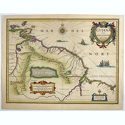
Guiana sive Amazonum Regio.
Important map extending from the Isla Margarita in the northwest to the coast of northern Brazil near Sao Luis east of the Amazon delta. The map locates at its center a l...
Date: Amsterdam, ca.1645
Selling price: ????
Please login to see price!
Sold in 2018
Peru.
French text edition. A map of Peru, orientated with north to the left, also showing most of Equador and Northern Chile, also includes Potosi, the famous mountain of silve...
Date: Amsterdam, 1645
Selling price: ????
Please login to see price!
Sold in 2018
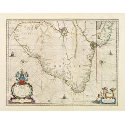
Brasilia.
An important map of Brazil by the famous Dutch publishing house of Blaeu.
Date: Amsterdam, 1645
Selling price: ????
Please login to see price!
Sold in 2019
Tabula Magellanica Qua Tierrae del Fuego.
A magnificent map of Patagonia & Magellanica, in contemporary color. By far the most decorative map of the region. This map reveals many images of indigenous peoples,...
Date: Amsterdam, 1645
Selling price: ????
Please login to see price!
Sold in 2019
Chili.
Willem Blaeu's very decorative map of Chile with two large and beautiful cartouches, a compass and ships.
Date: Amsterdam 1646
Selling price: ????
Please login to see price!
Sold
Chili.
Very decorative map of Chilli with two large and beautiful cartouches, a compass and ships.
Date: Amsterdam 1646
Selling price: ????
Please login to see price!
Sold
Chili. 

Willem Blaeu's very decorative map of Chile with two large and beautiful cartouches, a compass and ships.
Date: Amsterdam, 1646
Selling price: ????
Please login to see price!
Sold in 2019
Paraguayo prov. de Rio de La Plata cum regionibus..
A beautiful map of Paraguay, Uruguay and northern Argentina.
Date: Amsterdam, 1647
Selling price: ????
Please login to see price!
Sold in 2013
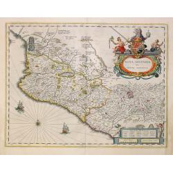
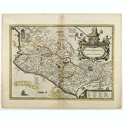
Nova Hispania et Nova Galicia.
Based on Ortelius's map of 1579 which became the basis for many of the seventeenth century maps of the area. Despite the implications in the title, the map does not cover...
Date: Amsterdam, 1647
Selling price: ????
Please login to see price!
Sold in 2011
America Septentrionalis.
Showing California as an island, and above, the north west of the continent left blank except for two legends explaining the discoveries to that date. The Hudson Bay is c...
Date: Amsterdam 1647
Selling price: ????
Please login to see price!
Sold
Insulae Americanae in Oceanus Septentrionali cum Terris..
General map of the West Indies extending from Virginia to the mouth of the Orinoco, and destined to be copied in various shapes by many other publishers. Title cartouche ...
Date: Amsterdam 1647
Selling price: ????
Please login to see price!
Sold
Nova Hispania et Nova Galicia.
Map of old Mexico based on Ortelius's map of 1579 which became the basis for many of the seventeenth century maps of the area. A lovely copy of this decorative map.
Date: Amsterdam, 1647
Selling price: ????
Please login to see price!
Sold in 2022
Nova Virginiae Tabula.
The map is based on the first state of Smith's map, 1612, and is slightly larger and more expertly engraved.The map is, in part, famous for its depiction, upper left, of ...
Date: Amsterdam 1647
Selling price: ????
Please login to see price!
Sold
America Septentrionalis.
Showing California as an island, and above, the north west of the continent left blank except for two legends explaining the discoveries to that date. The Hudson Bay is c...
Date: Amsterdam 1647
Selling price: ????
Please login to see price!
Sold
Terra Firma et Novum regnum Granatense et Propayan.
Fine copy, with wide margins of this handsome map of the Isthmus of Panama and northwestern South America including most of present day Columbia and part of Venezuela. Te...
Date: Amsterdam, 1647
Selling price: ????
Please login to see price!
Sold in 2008
Brasilia.
Fine copy of this map by Krystof Arciszewski, a Polish general who worked for the Dutch West Indian Company. The map perpetuates various myths including the Parime Lago ,...
Date: Amsterdam 1647
Selling price: ????
Please login to see price!
Sold
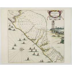
Praefecturae Paranambucae pars Meridionalis.
EXTREMELY RARE issue, printed for C.Barlaeus, and before included in the Blaeu Atlas Major. Extends from the Rio San Francisco to the Rio Gujaraigacu.This map is one the ...
Date: Amsterdam, 1647
Selling price: ????
Please login to see price!
Sold in 2008
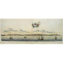
Boa vista.
EXTREMELY RARE issue, printed for C.Barlaeus.This plate is one the first views of Brazil based on Dutch rather than Portuguese interest. The drawing was made by Frans Pos...
Date: Amsterdam, 1647
Selling price: ????
Please login to see price!
Sold in 2008
America Septentrionalis.
Showing California as an island, and above, the north west of the continent left blank except for two legends explaining the discoveries to that date. The Hudson Bay is c...
Date: Amsterdam, 1647
Selling price: ????
Please login to see price!
Sold in 2008
Loanda S.Pauli.
Attractive coastal view of the island of Luanda (Angola). The name means "flat land" as the island has no mountains and is comprised only of sand deposited by t...
Date: Amsterdam, 1647
Selling price: ????
Please login to see price!
Sold in 2008
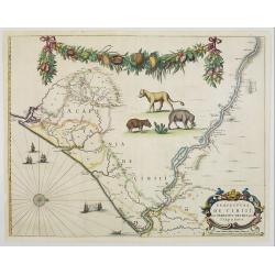
Praefecturae de ciriii vel seregippe delrey cum Itapuama.
EXTREMELY RARE issue, printed for C.Barlaeus, and before included in the atlas. This map is one the first maps of Brazil based on Dutch rather than Portuguese interest. T...
Date: Amsterdam, 1647
Selling price: ????
Please login to see price!
Sold in 2008
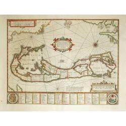
Mappa Aestivarum Insularum, alias Barmudas Dictarum.
A striking map based on the famous survey by Richard Norwood of the Bermuda Company, also known as the Somers Isles Company in 1618. The map shows the division into the o...
Date: Amsterdam, ca.1647
Selling price: ????
Please login to see price!
Sold in 2014
Insulae Americanae in Oceanus Septentrionali, ...
General map of the West Indies extending from Virginia to the mouth of the Orinoco, and destined to be copied in various shapes by many other publishers.
Date: Amsterdam, 1647
Selling price: ????
Please login to see price!
Sold in 2014
Insulae Americanae in Oceanus Septentrionali cum Terris..
General map of the West Indies extending from Virginia to the mouth of the Orinoco, and destined to be copied in various shapes by many other publishers.Title cartouche t...
Date: Amsterdam, 1647
Selling price: ????
Please login to see price!
Sold in 2015
Regiones Sub Polo Arctico.
A fine Blaeu version of the Janssonius map of 1637. It depicts rhumb lines radiating from the North Pole. A large title cartouche, with two figures and numerous wind head...
Date: Amsterdam, 1647
Selling price: ????
Please login to see price!
Sold in 2017
Nova Hispania et Nova Galicia.
Based on Ortelius's map of 1579 which became the basis for many of the seventeenth century maps of the area. A lovely copy of this decorative map.
Date: Amsterdam, 1647
Selling price: ????
Please login to see price!
Sold in 2018
[Lot of a portrait of Johan Maurits Count of Nassau-Siegen and title page both from Rerum per octennium in Brasilia. ]
Title page and portrait taken from the rare work about Brasil "Rerum per octennium in Brasilia et alibi nuper gestarum, sub præfectura illustrissimi comitis J. Maur...
Date: Amsterdam, 1647
Selling price: ????
Please login to see price!
Sold in 2022
Virginia.
Detailed miniature map of Virginia, from a German text edition of his Atlas Minor. Engraved by Petrus Kaerius.
Date: Amsterdam (1628) 1648
Selling price: ????
Please login to see price!
Sold
Septentrionalium Terrarum Descript.
Detailed miniature map of the North Pole, from a German text edition of his Atlas Minor. Engraved by Petrus Kaerius.
Date: Amsterdam (1628) 1648
Selling price: ????
Please login to see price!
Sold
Nova Virginiae Tabula..
Detailed miniature map of Virginia, from a German text edition of his Atlas Minor. Engraved by Petrus Kaerius.
Date: Amsterdam (1628) 1648
Selling price: ????
Please login to see price!
Sold
America Meridionalis.
Detailed miniature map of South America, from a German text edition of his Atlas Minor. Engraved by Petrus Kaerius.
Date: Amsterdam (1628) 1648
Selling price: ????
Please login to see price!
Sold
Americae Descriptio.
Detailed miniature map of the Americas, from a German text edition of his Atlas Minor. Engraved by A. Goos.
Date: Amsterdam (1628) 1648
Selling price: ????
Please login to see price!
Sold
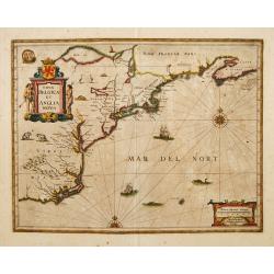
Nova Belgica et Anglia Nova.
A second state. Derived from De Laet's map of 1630, which was important as the first appearance on a printed map of 'Manhattes' (Manhattan), 'N.Amsterdam' (New York, foun...
Date: Amsterdam 1649
Selling price: ????
Please login to see price!
Sold
Nova Belgica et Anglia Nova.
A second state. Derived from De Laet's map of 1630, which was important as the first appearance on a printed map of 'Manhattes' (Manhattan), 'N.Amsterdam' (New York, foun...
Date: Amsterdam 1649
Selling price: ????
Please login to see price!
Sold
Nova Virginiae Tabula.
The map is based on the first state of Smith's map, 1612, and is slightly larger and more expertly engraved. In 1629 the Hondius plate was purchased by Blaeu who deleted ...
Date: Amsterdam 1638-1649
Selling price: ????
Please login to see price!
Sold
Civitas Loandae S. Pauli.
Map of the city of Luanda. Taken from Archontologia Cosmica... Primo opera & studio Jo. Ludovici Gotofredi, ex gallico per nobiliss. D.T.V.Y.... nunc continuati a G.C...
Date: Frankfurt, 1649
Selling price: ????
Please login to see price!
Sold in 2008
[Untitled Map of Mexico City].
Map of the city of Mexico. Taken from Archontologia Cosmica... Primo opera & studio Jo. Ludovici Gotofredi, ex gallico per nobiliss. D.T.V.Y.... nunc continuati a G.C...
Date: Frankfurt, 1649
Selling price: ????
Please login to see price!
Sold in 2008
America noviter delineata.
This map was originally one map of a separate-issued set of world and continents with decorative borders first published in 1618. After the death of the elder son of Jodo...
Date: Amsterdam, 1649
Selling price: ????
Please login to see price!
Sold in 2014
Americae pars meridionalis.
Decorated with several ships and sea monsters, and a cartouche flanked by engravings of six Indians, netted hammocks and South American fauna.
Date: Amsterdam 1650
Selling price: ????
Please login to see price!
Sold
Mexicum in hac forma in lucem edebat IOANNES BAPTISTA NICOLOSIVS S.T.D.
The first state of Nicolosi's rare and important map of south-western North America. Although the Spanish settlements in New Mexico were already more than half a century ...
Date: Rome 1650
Selling price: ????
Please login to see price!
Sold
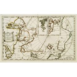
Pais qui dependent de la Norvege suivant les derniers relations.
Rare map of the North Pole. With inset maps of Faeroe and Shetland Islands.
Date: Paris 1650
Selling price: ????
Please login to see price!
Sold
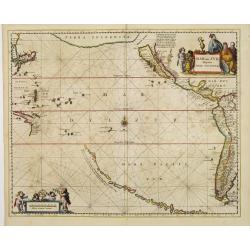
Mar del Zur, Hispanis Mare Pacificum.
Jansson's fine map of the Pacific including the west coast of America with California shown as an island, Japan and a small Australian coastline. This is one of the earli...
Date: Amsterdam 1650
Selling price: ????
Please login to see price!
Sold
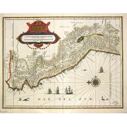
Peru.
Johan Blaeu succeeded his father Willem when the latter died in 1638. Johan led the Blaeu firm to its greatest achievement the ' Atlas Maior' in 12 parts, the greatest an...
Date: Amsterdam, c. 1650
Selling price: ????
Please login to see price!
Sold in 2020
Capitaniarum de Phernambuca, Itamaraca, Paraiba..
Rare map of part of the coast of Brazil. Much information is derived from maps drawn for the Dutch West Indian Company.Published by the famous Amsterdam publisher Johanne...
Date: Amsterdam 1650
Selling price: ????
Please login to see price!
Sold
Insula S.Iuan de Puertorico caribes vel Canibasun insulae.
Interesting map of the Lesser Antilles, from Porto Rico as far as Trinidad & Tobago and the South American coast. North is orientated to the left of the page.With a s...
Date: Amsterdam 1650
Selling price: ????
Please login to see price!
Sold
Americae Pars Meridionalis.
Finely engraved map of South America. Decorated with several ships and sea monsters, and a cartouche flanked by engravings of six Indians, netted hammocks and South Ameri...
Date: Amsterdam 1650
Selling price: ????
Please login to see price!
Sold
Polus Antarcticus.
Circular map with decorative illustrations in the four corners of the South Pole. From the German text edition of his Atlas of 1650.Third state with important changes: Th...
Date: Amsterdam, 1650
Selling price: ????
Please login to see price!
Sold in 2013
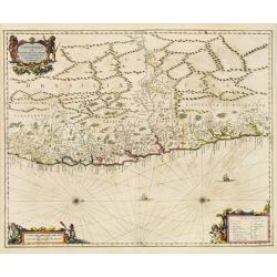
Venezuela cum parte Australi Novae Andalusiae.
A finely engraved, decorative map with Latin text on the reverse. The islands Trinidad, Margarita, Aruba, Bonaire and Curaçao are shown as well.
Date: Amsterdam, 1650
Selling price: ????
Please login to see price!
Sold
Terra Firma et Novum regnum Granatense et Propayan.
Fine copy, with wide margins of this handsome map of the Isthmus of Panama and northwestern South America including most of present day Columbia and part of Venezuela. Te...
Date: Amsterdam, 1650
Selling price: ????
Please login to see price!
Sold
Peru.
Decorated with ships and monsters in the sea. Orientated with east at the top. With the signature of G. Blaeuw lower right corner. Shows the Pacific coast of South Americ...
Date: Amsterdam, 1650
Selling price: ????
Please login to see price!
Sold in 2013
Capitaniae de cirii et Parnambuco.
Rare map of part of the coast of Brazil. From Janssonius' 'Atlas Novus'. Rare. Title in a decorated frame at top right, flanked by allegorical figures, and scale bars in ...
Date: Amsterdam, 1650
Selling price: ????
Please login to see price!
Sold in 2009
Americae Pars Meridionalis.
Finely engraved map of South America. Decorated with several ships and sea monsters, and a cartouche flanked by engravings of six Indians, netted hammocks and South Ameri...
Date: Amsterdam, 1650
Selling price: ????
Please login to see price!
Sold in 2013
Capitaniae de cirii et Parnambuco.
Rare map of part of the coast of Brazil. From Janssonius' 'Atlas Novus'. Rare. Title in a decorated frame at top right, flanked by allegorical figures, and scale bars in ...
Date: Amsterdam, 1650
Selling price: ????
Please login to see price!
Sold in 2013
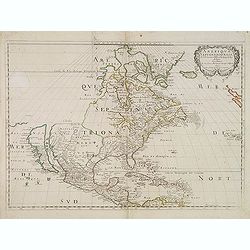
Amerique Septentrionale par N. Sanson.
Decorative and important map of the Americas with a CALIFORNIA AS AN ISLAND. Engraved by Abraham Peyrounim (c.1620 - c.1666).Sanson's map of North America is the first to...
Date: Paris, after 1650
Selling price: ????
Please login to see price!
Sold in 2014
America Meridionalis.
Gerard Mercator's stunning map of South America with Latin text on the verso. The Strait of Magellan is show but Tierra Del Fuego is part of the large southern continent....
Date: Amsterdam, c 1650
Selling price: ????
Please login to see price!
Sold in 2013
Afbeeldinge in Wat Manier de Silver Vloot Vanden Generael Pieter Pietersen Heyn Veroovert is Anno 1628.
Decorative view showing the Dutch capture of the Spanish silver fleet in the Bay of Matanzas (Cuba) in 1628. With the portrait of Admiral Hein, who captured over eleven m...
Date: Amsterdam, c1650
Selling price: ????
Please login to see price!
Sold in 2015
America Septentrionalis.
A wonderful map showing California as an island, and above, the north west of the continent left blank except for two paragraphs explaining the discoveries to date. Inter...
Date: Amsterdam, ca 1650
Selling price: ????
Please login to see price!
Sold in 2019
Americae Pars Meridionalis.
A finely engraved map of South America. One of the earliest separate maps of South America, and one of the first decorative maps of South America to appear in a Dutch Atl...
Date: Amsterdam, 1650
Selling price: ????
Please login to see price!
Sold in 2019
Insulae Flandricae, olim Asores dictae.
A scarce colored sea chart of part of the Atlantic Ocean: the Azores islands ((Faial, Pico, Graciosa, Terceira, Sao Jorge, Formigas, São Miguel), published by Johannes J...
Date: Amsterda, 1650
Selling price: ????
Please login to see price!
Sold in 2020
Tabula Magellanica quatierrae del Fuego.
One of the most decorative maps made by Johannes Janssonius. Depicts the extremity of South America, with Patagonia, the Straight of Magellan, Terra del Fuego and the dis...
Date: Amsterdam, 1650
Selling price: ????
Please login to see price!
Sold in 2022















![[Lot of a portrait of Johan Maurits Count of Nassau-Siegen and title page both from Rerum per octennium in Brasilia. ]](/uploads/cache/48309-250x250.jpg)




![[Untitled Map of Mexico City].](/uploads/cache/26432-250x250.jpg)


