Browse Listings in America
America./ Americae Descriptio.
Map of America from 'Atlas Minor Gerardi Mercatoris', engraved by Abraham Goos. Joannes Jansson created a completely new set of small formatted maps to be included in the...
Date: Amsterdam, 1628
Selling price: ????
Please login to see price!
Sold in 2016
Septentrionalium Terrarum decsript.
A good example of Mercator-Jansson's small map of the North Polar regions.The map is extended to 60 degrees, to show the recent explorations in search of the North West a...
Date: Amsterdam, ca. 1628
Selling price: ????
Please login to see price!
Sold in 2017
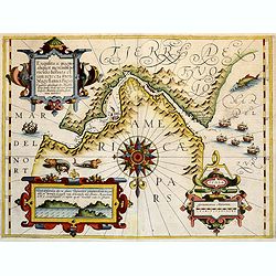
Exquisita & magno aliquot.. Freti Magellanici..
Map of the extremities of South America. North at 180 degrees. Borders graduated for latitude. Single compass rose with radiates. Scale in German miles. Soundings and sho...
Date: Amsterdam, 1628
Selling price: ????
Please login to see price!
Sold in 2018
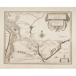
Paraguayo prov. de Rio de La Plata cum regionibus..
Extremely rare edition of this beautiful map of Paraguay, Uruguay and northern Argentina.Jodocus Hondius Jr. planned to produce a new modern atlas less dependent on the M...
Date: Amsterdam, 1629
Selling price: ????
Please login to see price!
Sold in 2017
Peru.
Rare first state. Decorated with ships and monsters on the sea. Orientated with east at the top. A most decorative item. One of the most dramatic events in the early hist...
Date: Amsterdam 1629
Selling price: ????
Please login to see price!
Sold
Freti Magellanici ac novi Freti vulgo Le Maire..
The very rare first state with the address of J.Hondius. After the acquisition of the copper plate by Willem Blaeu, the name of J.Hondius has been erased and substituted ...
Date: Amsterdam 1629
Selling price: ????
Please login to see price!
Sold
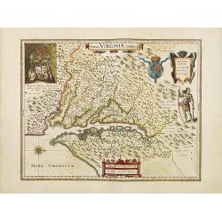
Nova Virginiae Tabula.
The map is based on the first state of Smith's map, 1612, and is slightly larger and more expertly engraved. In 1629 the Hondius plate was purchased by Blaeu who deleted ...
Date: Amsterdam 1618-1629
Selling price: ????
Please login to see price!
Sold
Freti Magellanici ac novi Freti vulgo Le Maire. . .
The very rare according v.d. Krogt first state with the address of J.Hondius. After the acquisition of the copper plate by Willem Blaeu, the name of J.Hondius has been er...
Date: Amsterdam, 1629
Selling price: ????
Please login to see price!
Sold in 2012
Verovering vande Silver-Vloot inde Bay Matanca. Anno 1628.
A scarce and important depiction of the taking of the Spanish silver fleet by the Dutch naval force in Matanzas Bay, Cuba. It includes the portraits of the Dutch commande...
Date: Amsterdam, 1629
Selling price: ????
Please login to see price!
Sold in 2015
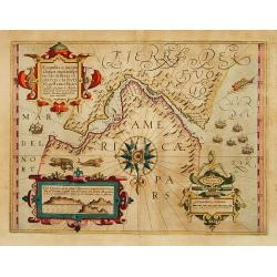
Provinciae sitae ad Fretum Magallanis itemque Fretum Le..
Detailed map of the southern tip of South America, prepared by Hessel Gerritsz, the official map maker for the Dutch West India Company. Gerritsz enjoys a very high reput...
Date: Leiden 1630
Selling price: ????
Please login to see price!
Sold in 2011
Maiores minores que Insulae Hispaniola, Cuba Lucaia..
Detailed map of the Caribbean, prepared by Hessel Gerritsz, the official map maker for the Dutch West India Company. Gerritsz enjoys a very high reputation for his critic...
Date: Leiden 1630
Selling price: ????
Please login to see price!
Sold
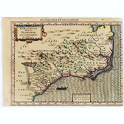
Virginiae item et Floridae.
Cummings describes it as one of the most beautifully executed maps ever made of the Southeast. In detail and in general conception it surpasses all earlier maps of the re...
Date: Amsterdam, 1630
Selling price: ????
Please login to see price!
Sold in 2013
Virginiae item et Floridae.
"Cummings describes it as ""one of the most beautifully executed maps ever made of the Southeast. In detail and in general conception it surpasses all earl...
Date: Amsterdam 1630
Selling price: ????
Please login to see price!
Sold
America sive India Nova.
The map's geography is based on the appropriate portions of Rumold Mercator's 1569 world map. The central hemisphere, which is a general map of the two continents, is sur...
Date: Amsterdam 1630
Selling price: ????
Please login to see price!
Sold
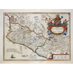
Nova Hispania et Nova Galicia.
Willem Blaeu, father of Johan and Cornelis Blaeu, was the founder of the famous publishing firm. Originally publishing pilot-guides, he issued his first atlas, 'Atlantis ...
Date: Amsterdam, c. 1630
Selling price: ????
Please login to see price!
Sold in 2011
Hispaniae Novae Nova Descriptio.
Hendrick Hondius (1597-1651). In association with Johannes Janssonius, Hendrick continued to publish the Mercator-Hondius Atlas, which was improved and enlarged, the by t...
Date: Amsterdam, c. 1630
Selling price: ????
Please login to see price!
Sold in 2019
Nova Hispania et Nova Galicia.
In association with Johannes Janssonius, Hendrick continued to publish the Mercator-Hondius Atlas, which was improved and enlarged, the by then obsolute Mercator maps wer...
Date: Amsterdam, c. 1630
Selling price: ????
Please login to see price!
Sold
De Groote ende Kleyne Eylanden van West-Indien
This map covers all of the West Indies and the Bahamas and shows the coastline of Florida, Central and South America. The title is contained in a decorative title cartouc...
Date: Amsterdam, 1630
Selling price: ????
Please login to see price!
Sold in 2008
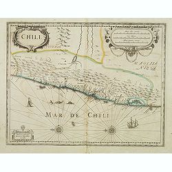
Chili
This beautiful map covers Chili, from Puente de Vetes in the North to Cap de Diego Gallego in the south. North is to the left of the map. Beautiful title cartouche, scale...
Date: Amsterdam, 1630
Selling price: ????
Please login to see price!
Sold in 2009
Septentrionalium Terrarum descriptio.
The classic map of the Arctic region, representing the late Medieval concept of four islands surrounding a centralized whirlpool. This polar depiction was an expansion of...
Date: Amsterdam, 1630
Selling price: ????
Please login to see price!
Sold in 2009
America sive India Nova.
The map's geography is based on the appropriate portions of Rumold Mercator's 1569 world map. The central hemisphere, which is a general map of the two continents, is sur...
Date: Amsterdam, 1610 -1630
Selling price: ????
Please login to see price!
Sold in 2010
America.
A very nice map from America. The inset shows native Brazilians brewing beer.Mercator was born in Rupelmonde in Flanders and studied in Louvain under Gamma Friskies, Dutc...
Date: Amsterdam, 1630
Selling price: ????
Please login to see price!
Sold in 2009
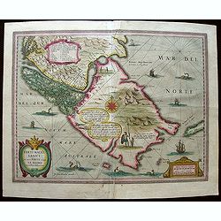
Exquilita.. Freti Magellanici Facies.
The turbulent strait of Magellan winds between Tierra del Fuego and Patagonia (here, simply 'Part of America') to link the Atlantic and the Pacific. In1606, nearly a cent...
Date: Amsterdam, 1630
Selling price: ????
Please login to see price!
Sold in 2013
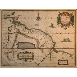
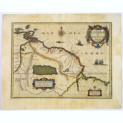
Guiana sive Amazonum Regio
Beautiful map extending from the Isla Margarita in the northwest to the coast of northern Brazil near Sao Luis east of the Amazon delta. At center lies a large inland sea...
Date: Amsterdam 1630
Selling price: ????
Please login to see price!
Sold in 2009
AMERICA
A spectacular map of the Americas at the beginning of European settlement in North America. This map provides considerable, interesting detail on European knowledge and ...
Date: Amsterdam, (1606) 1630
Selling price: ????
Please login to see price!
Sold
Chili.
Decorative map of Chile from Copiapo to Isla de Chiloé. With the mountains of the Andes, with the main river valleys, provinces and volcanoes of southern Chili, with two...
Date: Amsterdam, after 1630
Selling price: ????
Please login to see price!
Sold in 2012
Virginiae item et Floridae..
Cummings describes it as one of the most beautifully executed maps ever made of the Southeast. In detail and in general conception it surpasses all earlier maps of the re...
Date: Amsterdam, 1630
Selling price: ????
Please login to see price!
Sold in 2016
Nova Francia et Regiones Adiacentes.
This map is one of the foundation maps of Canada. It is the first printed map to include an accurate Prince Edward Island, and the earliest depiction of a north-south ori...
Date: Leiden, 1630
Selling price: ????
Please login to see price!
Sold in 2013
Virginiae item et Floridae..
Cummings describes it as one of the most beautifully executed maps ever made of the Southeast. In detail and in general conception it surpasses all earlier maps of the re...
Date: Amsterdam, 1630
Selling price: ????
Please login to see price!
Sold in 2014
Cuba Insula, Hispaniola Insula, Ins. Jamaica..
One of the earliest maps depicting five of the major West Indian islands. An inset top right shows Havana. The map is exceptionally attractive and beautifully engraved.
Date: Amsterdam, 1630
Selling price: ????
Please login to see price!
Sold in 2014
Nova Francia et Regiones Adiacentes.
An important early map of the Maritime Provinces. Considered one of the foundation maps of Canada (Burden), this is the first printed map to show an accurate Prince Edwar...
Date: Amsterdam, c. 1630
Selling price: ????
Please login to see price!
Sold in 2018
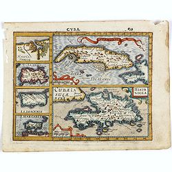
Cuba Insula. Hispaniola.
Decorative engraved map of Cuba above Hispaniola with smaller insets of Havana, Jamaica, Puerto Rico and Margarita.
Date: Amsterdam, ca. 1630
Selling price: ????
Please login to see price!
Sold in 2015
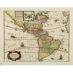
America noviter delineata. Auct: Judoco Hondio.
Fine map of the American continent with insets of the South and North Pole on the left hand side.Panels on the left, right and top borders, as in the Blaeu Americas. Note...
Date: Amsterdam, 1630
Selling price: ????
Please login to see price!
Sold in 2016
Cuba Insula. Hispaniola.
Decorative engraved map of Cuba above Hispaniola with smaller insets of Havana, Jamaica, Puerto Rico and Margarita.From the first French-text edition of Jodocus Hondius' ...
Date: Amsterdam, ca. 1630
Selling price: ????
Please login to see price!
Sold in 2016
Nova Virginiae Tabula.
The map is based on the first state of Smith's map, 1612, and is slightly larger and more expertly engraved.The map is, in part, famous for its depiction, upper left, of ...
Date: Amsterdam, 1630
Selling price: ????
Please login to see price!
Sold in 2016
America Meridionalis.
The eastern part of Brazil is depicted as an island: a huge Rio de la Plata extends from the Atlantic in the south to a large lake, Eupana Lacus. From this lake the Rio G...
Date: Amsterdam, 1630
Selling price: ????
Please login to see price!
Sold in 2019
AMERICA TRUE INDIA NOVA ad magna Gerardi Mercatoris aui Vniversalis imitationem in compendi. Um redacta.
A copperplate full hand colored map of American continent. The map's geography is based on the appropriate portions of Rumold Mercator's 1569 world map.The central hemisp...
Date: Amsterdam, 1610-1630
Selling price: ????
Please login to see price!
Sold in 2017
Virginiae item et Floridae.
From the rare French text edition of Mercator's Atlas Minor. From the first of the so-called Cloppenburg edition with new engraved maps in a larger format. The map extend...
Date: Amsterdam, 1630
Selling price: ????
Please login to see price!
Sold in 2017
America noviter delineata.
America map from the rare Cloppenburg edition slightly larger format and more scarce edition of the Mercator/Hondius "Atlas Minor". Engraved by Pieter Van Den K...
Date: Amsterdam, 1630
Selling price: ????
Please login to see price!
Sold in 2018
America meridionalis.
Map of South America the rare Cloppenburg edition "Atlas Sive Cosmographicae Meditationes De Fabrica Mundi Et Fabricati Figura", slightly larger format and more...
Date: Amsterdam, 1630
Selling price: ????
Please login to see price!
Sold in 2019
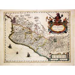
Hispaniae Novae Nova Descriptio.
Map of Mexico from the rare Cloppenburg edition "Atlas Sive Cosmographicae Meditationes De Fabrica Mundi Et Fabricati Figura", slightly larger format and more s...
Date: Amsterdam, 1630
Selling price: ????
Please login to see price!
Sold in 2022
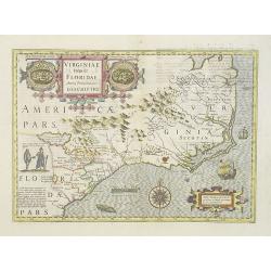
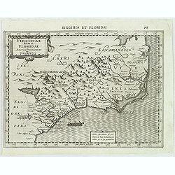
Virginiae item et Floridae Americae Provinciarum nova Descriptio.
Map of the Carolinas and parts of Virginia and Georgia. The map extends from St. Augustine in the south to just north of Chesepioock Sinus in the north and to the Allegha...
Date: Amsterdam, 1630
Selling price: ????
Please login to see price!
Sold in 2022
Description des Isles de l'Indie Occidentale.
Map of the Caribbean from the rare Cloppenburg edition slightly larger format and more scarce edition of the Mercator/Hondius "Atlas Minor". Engraved by Pieter ...
Date: Amsterdam, 1630
Selling price: ????
Please login to see price!
Sold in 2019
America sive India Nova.
A great example of one of the most famous maps of the Americas. The only known printed map by Gerard Mercator's grandson Michael! Richly decorated by a beautifully engrav...
Date: Amsterdam, ca. 1613-1630
Selling price: ????
Please login to see price!
Sold in 2020
Americae sive Indiae Occidentalis.
Hessel Gerritsz. the author and probable engraver of the map had seen maps of California as an island, but he relies on the more trustworthy accounts, such as Herrera, in...
Date: Leiden, Elzevier, 1630
Selling price: ????
Please login to see price!
Sold in 2019
Provincia Sitæ Ad Fretum Magallanis itemque Fretum Le Maire.
Detailed map of the southern tip of South America, with coastline and Strait of Magellan from Tierra del Fuego to southern Argentina.Scarce map prepared by Hessel Gerrits...
Date: Leiden, Elzevier, 1630
Selling price: ????
Please login to see price!
Sold in 2019
Nova Hispania et Nova Galicia.
Willem Blaeu’s beautiful map of Mexico is decorated with a very large title-cartouche with the coat-of-arms of the king of Spain, another cartouche and two ships and a ...
Date: Amsterdam, ca 1630
Selling price: ????
Please login to see price!
Sold in 2020
Septentrionalium Terrarum descriptio.
Artic pole map from the rare Cloppenburg edition slightly larger format and more scarce edition of the Mercator/Hondius "Atlas Minor". The classic map of the Ar...
Date: Amsterdam, 1630
Selling price: ????
Please login to see price!
Sold in 2020
Cuba Insula / Hispaniola insula, insets: Havanna portus, celeberrimus totius indiae Occidentalis; Insula Iamaica; Ins. S. Ioannis; Ins. Margareta Cum Confinijis.
A most decorative map of the main Carabean islands from the Mercator / Hondius Atlas. Embellished with seven strapwork cartouches. Ref.: Koeman, Atlantes Neerlandici,...
Date: Amsterdam, c. 1630
Selling price: ????
Please login to see price!
Sold in 2022
America.
A very nice map of America. The inset shows native Brazilians brewing beer. Mercator was born in Rupelmonde in Flanders and studied in Louvain under Gamma Friskies, Dutch...
Date: Amsterdam, 1630
Selling price: ????
Please login to see price!
Sold in 2022
America noviter delineata.
With inset details of the North and South Poles, and several ships and sea-monsters. Hondius shows the imaginary island of Frisland, Southeast of Iceland, and gives Picar...
Date: Amsterdam 1631
Selling price: ????
Please login to see price!
Sold
America noviter delineata.
A stunning impression of this uncommon version of Jodocus Hondius influential map of 1617, but lacking the decorative borders. With inset details of the North and South P...
Date: Frankfurt 1631
Selling price: ????
Please login to see price!
Sold
Nova Virginiae Tabula.
Janssonius' derivative of John Smith's landmark map of the Chesapeake of which only three other copies have been recorded (Verner). The map is the only regional map of Am...
Date: Amsterdam 1628-1631
Selling price: ????
Please login to see price!
Sold
America noviter delineata.
This is the uncommon, larger version of Marian's map of the Americas. Marian's bold engraving style copies the cartography of Jodocus Hondius' map of 1631.North America i...
Date: Amsterdam 1631
Selling price: ????
Please login to see price!
Sold
Nova Virginiae Tabula
NO TEXT ON VERSO: From the rare Atlantis Appendix of 1630 and 1631.One of the most important maps of the Chesapeake Bay region, credited with disseminating knowledge of t...
Date: Amsterdam ca. 1630-1631
Selling price: ????
Please login to see price!
Sold
America noviter delineata.
This map was originally one map of a separate-issue set of world and continents with decorative borders first published in 1618. After the death of the elder son of Jodoc...
Date: Amsterdam, 1631
Selling price: ????
Please login to see price!
Sold in 2008
America noviter delineata.
With inset details of the North and South Poles and gives Picart's version of Tierra del Fuego and several ships and sea monsters. The map is derived from that by Jodocus...
Date: Frankfurt, 1631
Selling price: ????
Please login to see price!
Sold in 2008
America noviter delineata.
This map was originally one map of a separate-issue set of world and continents with decorative borders first published in 1618. After the death of the elder son of Jodoc...
Date: Amsterdam, 1631
Selling price: ????
Please login to see price!
Sold in 2013
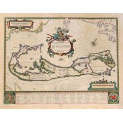
Mappa Aestivarum Insularum, Alias Barmudas. . .
Map is based on the survey by John Norwood of the Bermuda Company in 1618 and it shows the division into the original eight tribes and shows the various landowners, with ...
Date: Amsterdam, 1631
Selling price: ????
Please login to see price!
Sold in 2011
Description de nouveau pasage vers le zud.... together with an untitled map of Port Desire (today's Puerto Deseado, Argentina)
On verso a map of Tierra del Fuogo (167 x 201mm.) and on recto a scarce print (145x210mm.) on a German text sheet showing a map of Port Desire (today’s Puerto Deseado, ...
Date: Frankfurt, M.Merian, 1631
Selling price: ????
Please login to see price!
Sold in 2023
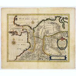
Terra Firma et Novum regnum Granatense et Propayan.
Good copy, with wide margins of this handsome map of the Isthmus of Panama and northwestern South America, including most of present day Columbia and part of Venezuela.Te...
Date: Amsterdam, ca. 1631
Selling price: ????
Please login to see price!
Sold in 2017
Guiana sive Amazonum Regio.
An important map extending from the Isla Margarita in the northwest, to the coast of northern Brazil near Sao Luis east of the Amazon delta. The map locates at its center...
Date: Amsterdam, ca. 1631
Selling price: ????
Please login to see price!
Sold in 2017
America noviter delineata.
With inset details of the North and South Poles, and several ships and sea-monsters. Hondius shows the imaginary island of Frisland, Southeast of Iceland, and gives Picar...
Date: Amsterdam, 1632
Selling price: ????
Please login to see price!
Sold in 2008
America noviter delineata. Auct. Judoco Hondio. / Ioannes Janssonius Excudit.
Third state of this very rare "carte à figures" - map. It is most easily distinguished by the chipped top right hand corner of the plate that appears in virtua...
Date: Amsterdam, 1632
Selling price: ????
Please login to see price!
Sold in 2011
America noviter delineata.
An attractive, detailed and early map of the Americas from the rare Cloppenburg edition slightly larger format and more scarce edition of the Mercator/Hondius "Atlas...
Date: Amsterdam, 1632
Selling price: ????
Please login to see price!
Sold in 2013
Virginiae Item et Floridae Americae Provinciarum.nova Descriptio.
An attractive, detailed and early map of the Southeast from the rare Cloppenburg edition slightly larger format and more scarce edition of the Mercator/Hondius "Atla...
Date: Amsterdam, 1632
Selling price: ????
Please login to see price!
Sold in 2012
Nova Virginiae Tabula. . .
An attractive, detailed and early map of the Chesapeake region from the rare Cloppenburg edition slightly larger format and more scarce edition of the Mercator/Hondius &q...
Date: Amsterdam, 1632
Selling price: ????
Please login to see price!
Sold in 2012
America noviter delineata. Auct: Judoco Hondio.
Very rare "carte à figures"- map of America first issued by Jan Janssonius in 1623. The American continent with insets of the South and North Pole on the left ...
Date: Amsterdam, 1632
Selling price: ????
Please login to see price!
Sold in 2012
[Incas lay siege to Cusco.]
Atahualpa’s brother, Manco, organized a long and bloody siege to reoccupy the Inca capital, which eventually spread to open rebellion throughout the land. Pizarro, who ...
Date: Frankfurt, M.Merian, 1633
Selling price: ????
Please login to see price!
Sold in 2025
Americae Nova Tabula.
Very rare variant. of the map of the figured borders Western hemisphere by Blaeu. Remains of the figured borders are still visible. During the printing process the figure...
Date: Amsterdam 1633
Selling price: ????
Please login to see price!
Sold
Americae Nova Tabula.
The delineation of the coast and the nomenclature on both the Pacific and Atlantic coasts are basically Spanish in origin and follow the maps of Ortelius and Wytfliet. To...
Date: Amsterdam 1633
Selling price: ????
Please login to see price!
Sold
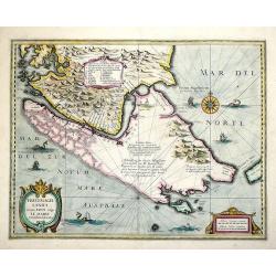
Freti Magellanici ac novi Freti vulgo Le Maire exactissima delinatio..
Early impression of this fine map of Tierra del Fuego. With a Dutch translation of the explanatory text of the passage by Barent Jansz. Potgieter who accompanied captain ...
Date: Amsterdam, 1633
Selling price: ????
Please login to see price!
Sold in 2020
Freti Magellanici ac novi Freti vulgo Le Maire exactissima delinatio...
Decorative map of the Straits of Magellan, Le Mair Strait, Fire Lands, and the southern tip of Patagonia. The coastlines of Tierra del Fuego are incomplete. Fully engrave...
Date: Amsterdam, 1633
Selling price: ????
Please login to see price!
Sold in 2013
[Discovery of the Magellan Strait.]
Scarce print with a German text sheet shows the great Portuguese explorer, Ferdinand Magellan, navigating the dangerous waters of the channel that bears his name. On 21st...
Date: Frankfurt, M.Merian, 1633
Selling price: ????
Please login to see price!
Sold in 2017
[Dutch fight with the local Indians in the Magellan Strait.]
Scarce print with a German text sheet shows Noort’s fleet in the Magellan Straits, the Dutch visited an island near Cape Nassau. It was inhabited by Fuegian Indians who...
Date: Frankfurt, M.Merian, 1633
Selling price: ????
Please login to see price!
Sold in 2020
[Dutch become stranded in the Magallen Strait.]
Scarce print with a German text sheet. While the Dutch were killing the birds on Penguin Island, there was a great storm and the waves damaged their boat so badly that it...
Date: Frankfurt, M.Merian, 1633
Selling price: ????
Please login to see price!
Sold in 2023
[Cavendish reaches Deseado.]
Scarce print with a German text sheet. In December, 1586, during his round-the-world voyage, Cavendish’s fleet landed on the Atlantic coast of Patagonia, near some isla...
Date: Frankfurt, M.Merian, 1633
Selling price: ????
Please login to see price!
Sold in 2017
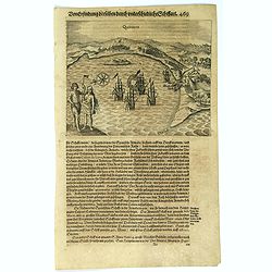
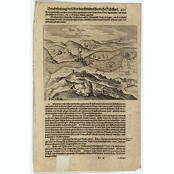
Quintero.
Scarce print with a German text sheet. On 13th June, 1615, Spilbergen’s fleet entered the beautiful Bay of Quintero (A), and anchored there (C). Again the Dutch went as...
Date: Frankfurt, M.Merian, 1633
Selling price: ????
Please login to see price!
Sold in 2017
Val Parysa.
Scarce print with a German text sheet. In the June of 1615, the Dutch fleet reached the town of Valparaíso. The natives were dressed as shown (I). The fleet (D) anchored...
Date: Frankfurt, M.Merian, 1633
Selling price: ????
Please login to see price!
Sold in 2017
























![[Incas lay siege to Cusco.]](/uploads/cache/40353-250x250.jpg)



![[Discovery of the Magellan Strait.]](/uploads/cache/39903-250x250.jpg)
![[Dutch fight with the local Indians in the Magellan Strait.]](/uploads/cache/39904-250x250.jpg)
![[Dutch become stranded in the Magallen Strait.]](/uploads/cache/39905-250x250.jpg)
![[Cavendish reaches Deseado.]](/uploads/cache/39906-250x250.jpg)
